Strategize a Smooth Tenant-to-tenant Migration and Copilot Takeoff
Acoustic imaging of the sea floor
1. Acoustic Imaging Of the Sea Floor
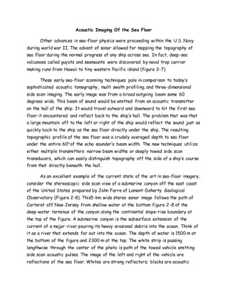
Other advances in sea-floor physics were proceeding within the U.S. Navy
during world war II. The advent of sonar allowed for mapping the topography of
sea floor during the normal progress of any ship across sea. In fact, deep-sea
volcanoes called guyots and seamounts were discovered by naval trop carrier
making runs from Hawaii to tiny western Pacific island (figure 2-7)
Those early sea-floor scanning techniques pale in comparison to today’s
sophisticated acoustic tomography, multi swath profiling, and three-dimensional
side scan imaging. The early image was from a broad outgoing beam some 60
degrees wide. This beam of sound would be emitted from an acoustic transmitter
on the hull of the ship. It would travel outward and downward to hit the first sea
floor it encountered and reflect back to the ship’s hull. The problem that was that
a large mountain off to the left or right of the ship would reflect the sound just as
quickly back to the ship as the sea floor directly under the ship. The resulting
topographic profile of the sea floor was a crudely averaged depth to sea floor
under the entire 60o
of the echo sounder’s beam width. The new techniques utilize
either multiple transmitters narrow beam widths or deeply towed side scan
transducers, which can easily distinguish topography off the side of a ship’s course
from that directly beneath the hull.
As an excellent example of the current state of the art in sea-floor imagery,
consider the stereoscopic side scan view of a submarine canyon off the east coast
of the United States prepared by John Farre of Lamont-Doherty Geological
Observatory (Figure 2-8). This5-km wide stereo sonar image follows the path of
Carteret off New Jersey from shallow water at the bottom figure 2-8 of the
deep-water terminus of the canyon along the continental slope-rise boundary at
the top of the figure. A submarine canyon is the subsurface extension of the
current of a major river pouring its heavy erosional debris into the ocean. Think of
it as a river that extends far out into the ocean. The depth of water is 1500 m at
the bottom of the figure and 2300 m at the top. The white strip is passing
lengthwise through the center of the photo is path of the towed vehicle emitting
side scan acoustic pulses. The image of the left and right of the vehicle are
reflections of the sea floor. Whites are strong reflectors; blacks are acoustic
2. shadow. The horizontal white gaps are missed interval caused by the need to the
change magnetic tape for recording of the digital images.
The three-dimensional image is displayed at a ten-to-one vertical
exaggeration to blow up topography changes on the sea floor. The separation of
each data point in the left versus right-hand images is offset to produce the
appropriate perception of depth for unaided stereo viewing. Un focus the eyes as
if viewing a far object and the two images merge and become stereoscopic. Better
results are achieved using a mirror-style stereo viewer, especially one with
magnification.
The images shows that Carteret Canyon is not a simple v- or – shaped valley,
but that along its lower reaches a very narrow canyon crosses a step cliff forming
an “ underwaterfall.” It then is almost stranded on the flat plain beneath the falls
where it feeds into one of several flat-floored, steep-walled erosional chutes.
These grooved chutes terminate abruptly at the slope-rise boundary. This is the
site of an oblong depression that drains toward the left. In the upper left-hand
corner of the image is a strongly reflective, angular object-perhaps a sunken ship.
Submarine detection methods
Attempts at submarine detections led not only to the development of sonar
but the measurement of the earth’s magnetic field at sea as well. Submarine could
be found by scanning the magnetic field of the Earth and identifying the large
positive perturbations that are caused by the magnetic body of submarine. Depth
charges provided the first energy sources to bounce sound waves through the
outer skin of the ocean floor and record the reflected waveforms (seismology)
beneath the sea floor itself.
Meanwhile, the transatlantic cable industry reappeared on the horizon to
rekindle scientific curiosity about the geology of the sea floor. After the war, the
Lamont-Doherty Geological Observatory was founded as a part of Columbia
University on the Palisades Cliffs across the Hudson River from New York City.
The continual loss off shore