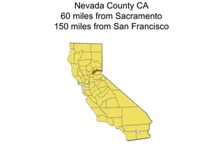
Nevada County is located in northern California, 60 miles from Sacramento and 150 miles from San Francisco. This document discusses the use of performance measures in transportation planning, particularly for rural counties. It analyzes pavement condition data from rural counties, finding their average pavement condition index is 58 compared to the statewide average of 66. It also finds that with existing funding, the average pavement condition will drop to 42 by 2034, with $6.7-8.1 billion in deferred maintenance. The funding shortfall to achieve a target pavement condition of 68 is $4.2 billion. It recommends developing standardized performance measures tailored for small and rural areas.
13. History & Future of Performance
Measures
• The Past: Safety, LOS, Community input &
Common Sense.
• The Present: Federal/State regulatory
requirements: MAP 21, SB 375, State
Transportation Improvement Program
Guidelines.
• The Future: Cost effective expenditure of
public funding on infrastructure that achieves
State, Regional, & Community goals
14. Definitions & Applications
Performance measures are tools that help
us to determine existing conditions across
the transportation system and to evaluate
the effectiveness of proposed investments
by using a "measure" to evaluate anticipated
and/or actual progress toward achieving a
specific benchmark or "target" that is tied to
an overarching goal.
Amador County Transportation Commission,
2014 RTP Update
15. • Performance measures can be either
quantitative (data: e.g. LOS) or qualitative
(values: (e.g. historic character).
• A State-level quantitative performance
measure may be very different than one
that is based on regional data and goals.
• Performance measures are used
differently at plan-level, program-level, and
project level.
16. • Plan-level – selecting a plan alternative
• Program-level – establishing project
priorities in a Capital Improvement Program
(CIP)
• Project-level – screening project alternatives
and measuring refined design features.
• The level of analysis needed & data
available are not the same at each step.
17. In California, rural agencies are concerned
that performance measures developed by,
and for, urban areas of the state will skew
the prioritization of funding toward those
urban areas.
18. Rural Counties Task Force
Local Roads Needs Assessment
Draft Report
RCTF Committee
November 21, 2014
19. Project Objectives
Compare revenues vs. pavement needs
Perform three funding scenarios
– Existing Funding (preventive maintenance first)
– Existing Funding (worst first)
– $$ to reach specific PCI goals
Review other performance measures
20. Performance Measures
Must be:
– Meaningful
– Repeatable & reproducible
– Economical
Pavement distress (PCI)
– Widespread use nationally and in California
– Well known, historical data available
Roughness (IRI)
– Not common on local roads
– Not appropriate for rural roads e.g. chip seals
25. How Bad is 58?
100
70
PCI 58
50
25
0
Time (years)
$3.85/sy
$17.50/sy
$27.50/sy
$57/sy
26. Needs Per Capita Comparisons
10 Year Needs 10 Year Needs Per Capita
27. Funding Shortfall
Pavement
Needs*
($ million)
Funding
Available
($ million)
Shortfall
($ million)
Local Roads $ 7,275 $3,080 $ 4,195
State Highways $ 732**
Unknown
* Target PCI di ffers by county. Average i s 68.
** State highways are 10 year needs
34. Conclusions
Average PCI for rural roads = 58
20 year analysis to reach target PCI
– Impacts of existing funding ($3.08 billion)
• Average PCI drops to 42
• Deferred maintenance = $6.7 to $8.1 billion
– Funding to reach target (PCI = 68) is $7.3 billion
– Shortfall = $4.2 billion
State highways = $732 million (10 years)
35. Performance Monitoring Indicators for
Transportation Planning
Purpose:
–Standardized, common set of transportation
indicators
–California MPOs and State Agencies
Completed: June 2013
36. 200 + Indicators
Most Commonly Used by MPOs and State
Agencies
Methods and Data Sources
Input from MPOs
Input from State Agencies
Set of 10 Indicators
38. Proposed Performance Monitoring Indicators
1. Vehicle Miles Traveled 5. Fatalities/Serious Injuries
2. Mode Share – travel to work 6. Transit accessibility
3. State of good repair 7. Travel time to jobs
a. Highways 8. Change in agricultural
b. Local streets land
c. Bridges 9. CO2 Emissions reductions
d. Transit Assets
4. Freeway/Highway Travel Time
Reliability (Buffer Index)
39. Next Steps for Rural California
Complete “Performance Monitoring Indicators for
Small Urban and Rural Transportation Planning”
Review and analyze the applicability of the nine
performance monitoring indicators identified in the
SANDAG study for implementation in small urban and
rural areas.
40. The results of this study will be provided to
CALTRANS to inform participation in the MAP 21
process, to the California Transportatiion Commission
for inclusion in the 2016 STIP Guidelines and will give
guidance to small urban and rural agencies RTP and
RTIP processes.
Notas del editor
Nevada County is northeast of Sacramento, stretching from the eastern edge of the Sacramento Valley across the Sierra Nevada to the Nevada state border.
The world's first long-distance telephone call was made from Nevada City, California to Washington, California.
The Pelton wheel, designed to power gold mines, still drives hydro-electric generators today.
Nevada City and Grass Valley were among the first California towns with electric lights.
Lyman Gilmore, a contemporary of the Wright Brothers, developed early powered aircraft and operated the world's first commercial air field in Grass Valley. There is also evidence he may have flown before the Wright brothers.
Charles Litton Sr., a resident and entrepreneur of Nevada County, assisted Raytheon in the development of the magnetron tube.
Atari developed its first home computer video games in Nevada County.
The Nevada County Narrow Gauge Railroad was built in 1876, and was the only railroad in the West that was never robbed, even though its primary freight was gold. (Builder-owner John Flint Kidder's reputation made it clear that he would personally hunt down and kill anyone who tried.) The rail line closed in 1942 and was torn up for scrap.
The Olympics, NASA, and virtually every television station around the country utilizes video/broadcasting equipment designed and manufactured by Grass Valley Group, founded in Grass Valley.
Electronic medical dosing equipment was first developed and manufactured in Nevada County.
The first commercially viable picture-phone was developed in Nevada City.
Over 50 high tech and applied tech companies, and more than 1,000 hardware and software design and development professionals call Nevada County home. The county is sometimes referred to as the "Silicon Valley of the Sierras".
The western portion of the County in the Sierra foothills including the cities of Grass Valley (pop. 12,958 ), Nevada City (pop. 3,079). The largest municipality is the Town of Truckee (pop. 16,000), lies just east of the Sierra crest and a few miles from the Nevada border. The population in the unincorporated area of the County is approximately (pop. 67,000) . As of the 2010 census, the population was 98,764. The county has a total area of 974 square miles
Town of Truckee: Summer vs Winter
Looking east from the Sierra crest at Donner Lake, with the Town of Truckee in the distance.
Donner Summit
The natural beauty and historic character of the area causes many residents to express concern over the type and amount development occurring.
Broad St. (Downtown) Nevada City
Mill St. (Historic Downtown area) Grass Valley Ca
Twenty years ago, system monitoring and Maintenance and some operational improvements were left to Public Works and State DOTs. Smart Land Use strategies were funded by mitigation impact fees and local sales tax initiatives, System completion and expansion were the purview of funding controlled by RTPAs. The shrinking transportation revenues have forced agencies to work together without regard to color of $. This is one of the basic premises of performance based planning. If the system is in decay, it doesn’t make sense to add capacity that can’t be maintained. “New lanes on old roads”.
After a year of inserting myself into every discussion that I could find on Performance Based Planning, I think everyone is at the same place: We are just getting started.
As of 2013, all 26 rural RTPAs have included performance measures in their RTP documents. However, in nearly all cases these are related to attainment of RTP goals and not to project prioritization. Our next step is to help our decision-makers understand the performance based planning concept.
The California Rural Counties Task Force identified system preservation as an issue that we all share and a utilized state planning grant to establish pavement condition as a performance measure that can be included in our RTPs. This report is a “next step” for many RTPAs.
We understand that IRI is being considered for use as a performance measure in MAP 21 implementation. One of our goals for this study is to inform the MAP 21 discussions that PCI is more appropriate for Rural situations.
Lane miles = 45,553 lane miles
Statewide = 320,669
Mariposa-Water St, PCI=58
Unit costs are 7 to 27% lower than statewide, but…..
($million Needs per 1000 people) even with lower unit costs, per capita needs are generally higher than our urban neighbors.
Bottom line is that we need an adequate revenue source to maintain our rural state/regional road system.
A review of rural California RTPs in 2013, showed that 26 of 26 included Mobility/Reliability/Accessibilty as performance outcome areas, but none listed “congestion reduction”.
VMT: Mode shift is a leading strategy in reducing VMT, however, it isn’t a strategy that fits rural application.
Mode Share: Again, alternative modes are not economically competitive in rural areas.
State of Good Repair: 24 of 26 Rural RTPs included System Preservation as a performance outcome area.
Freeway/Highway Travel Time: In general not a good rural performance metric. Geographic distance cannot be reduced
Fatalities/Serious injuries: FHWA states that rural roads experience approximately 54 percent of the nation’s fatalities each year while approximately 20 percent of the population lives in rural areas (http://ruraltransportation.org/safety-webinar-on-1120/)
Transit accessibility
Travel time to jobs: in urban areas, this is a function of congestion, in rural areas it is more a function of distance.
Change in agricultural land:
CO2 emission reductions: While many look at mode shift and congestion reduction to achieve this goal, changing the fuel source may achieve the goal more effectively.
Nevada County Transportation Commission is embarking on the development of a performance-based RTP. The Performance Monitoring Indicators for Small Urban and Rural Transportation Planning study will provide us and the other rural RTPAs with Performance Measures that fit the rural context.