SlideShare una empresa de Scribd logo
1 de 17
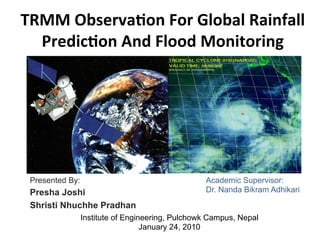
TRMM	
  Observa,on	
  For	
  Global	
  Rainfall	
  
Predic,on	
  And	
  Flood	
  Monitoring	
  
Presented By:
Presha Joshi
Shristi Nhuchhe Pradhan
Academic Supervisor:
Dr. Nanda Bikram Adhikari
Institute of Engineering, Pulchowk Campus, Nepal
January 24, 2010
INTRODUCTION	
  
•  Tropical	
  Rainfall	
  Measuring	
  Mission	
  (TRMM)	
  
•  Before	
  TRMM	
  global	
  distribu8on	
  of	
  rainfall	
  at	
  the	
  
Earth's	
  surface	
  had	
  uncertain8es	
  of	
  the	
  order	
  of	
  50%	
  	
  
•  Measures	
  the	
  ver8cal	
  distribu8on	
  of	
  precipita8on	
  
over	
  the	
  tropics	
  in	
  a	
  band	
  between	
  35	
  degrees	
  north	
  
and	
  south	
  la8tudes	
  
•  Improves	
  modelling	
  of	
  tropical	
  rainfall	
  processes	
  and	
  
their	
  influence	
  on	
  global	
  circula8on	
  
INSTRUMENTS	
  IN	
  TRMM	
  
§  Precipita8on	
  Radar	
  (PR)	
  
Ø  Horizontal	
  resolu8on:	
  3.1	
  miles	
  (5	
  km)	
  
Ø  Swath	
  width:	
  154	
  miles	
  (247	
  km)	
  
Ø  Ver8cal	
  profiles:	
  about	
  12	
  miles	
  (20	
  
km).	
  
Ø  Radar	
  frequency	
  :	
  3	
  8mes	
  greater	
  
than	
  a	
  ground	
  radar	


§  TRMM	
  microwave	
  imager	
  (TMI)	
  
Ø  Passive	
  microwave	
  sensor	
  
Ø  Provide	
  quan8ta8ve	
  rainfall	
  
informa8on	
  over	
  a	
  wide	
  swath	
  under	
  
the	
  TRMM	
  satellite.	
  
Ø  Quan8fy	
  the	
  water	
  vapour,	
  the	
  cloud	
  
water,	
  and	
  the	
  rainfall	
  intensity	
  in	
  the	
  
atmosphere	
  
http://trmm.gsfc.nasa.gov
INSTRUMENTS	
  IN	
  TRMM	
  (contd...)	
  
§  Visible	
  and	
  InfraRed	
  Scanner	
  (VIRS)	
  
Ø  Senses	
  radia8on	
  coming	
  up	
  from	
  the	
  
Earth	
  in	
  five	
  spectral	
  regions,	
  ranging	
  
from	
  visible	
  to	
  infrared	
  
Ø  Can	
  be	
  used	
  to	
  determine	
  the	
  brightness	
  
(visible	
  and	
  near	
  infrared)	
  or	
  temperature	
  
(infrared)	
  of	
  the	
  source.	


§  Cloud	
  and	
  Earth	
  Radiant	
  	
  Energy	
  
Sensors	
  (CERES)	
  
Ø  Study	
  the	
  energy	
  exchanged	
  between	
  the	
  
Sun;	
  the	
  Earth’s	
  atmosphere,	
  surface	
  and	
  
clouds;	
  and	
  space.	
  	
  
Ø  Es8mate	
  energy	
  levels	
  within	
  the	
  
atmosphere	
  and	
  at	
  the	
  Earth’s	
  surface.	


§  Lightning	
  Imaging	
  Sensor	
  (LIS)	
  
Ø  Detects	
  and	
  locates	
  lightning	
  over	
  the	
  
tropical	
  region	
  of	
  the	
  globe.	


TRMM	
  ORBITS	
  
http://trmm.gsfc.nasa.gov
AVERAGE	
  RAINFALL	
  OF	
  PAST	
  3	
  DAYS	
  
http://precip.gsfc.nasa.gov
Rain	
  informa8on	
  from	
  Real-­‐Time	
  TRMM	
  Mul8-­‐Satellite	
  Precipita8on	
  Analysis	
  	
  
ASIA	
  Disaster	
  Watch	
  
Early	
  May	
  2008	
  Cyclone	
  Nargis	
  at	
  Burma	
  
• 	
  Worst	
  natural	
  disaster	
  in	
  the	
  
history	
  of	
  Burma	
  
• 	
  Deadliest	
  named	
  cyclone	
  in	
  the	
  
North	
  Indian	
  Ocean	
  Basin	
  
• 	
  Category	
  4	
  cyclone(very	
  severe)	


• 	
  Landfall	
  on	
  May	
  2,	
  2008	


• 	
  Wind	
  speed:	
  132	
  mph	


Rainfall	
   analysis	
   derived	
   from	
   TRMM's	
  
Precipita,on	
   Radar	
   (PR)	
   and	
   TRMM	
  
Microwave	
   Imager	
   instruments	
   (TMI)	
  
overlaid	
  on	
  infrared	
  and	
  visible	
  images	
  
from	
   TRMM's	
   Visible	
   and	
   Infrared	
  
Scanner	
  (VIRS).	
  	
  
Flood	
  inunda,on	
  maps	
  of	
  Burma	
  as	
  
tropical	
   cyclone	
   NARGIS	
   moved	
   in	
  
from	
  Bay	
  of	
  Bengal	
  from	
  April	
  25	
  to	
  
May	
  5,	
  2008	
  
Cyclone	
  NARGIS	
  track	
  
• 	
  >1,38,000	
  death	
  
• 	
  >1	
  million	
  homeless	
  
• 	
  Damage:	
  $10	
  billion	


http://earthobservatory.nasa.gov
• 	
  Flooding	
  and	
  landslides	
  due	
  to	
  heavy	
  rainfall	
  
• 	
  The	
  TRMM-­‐based,	
  near-­‐real	
  ,me	
  Mul,-­‐satellite	
  Precipita,on	
  Analysis	
  (MPA)	
  at	
  the	
  NASA	


Goddard	
  Space	
  Flight	
  Center	
  monitors	
  rainfall	
  over	
  the	
  global	
  Tropics.	
  	
  
• 	
  Rainfall	
  amounts	
  upwards	
  of	
  400	
  mm	
  (15.7	
  Inches)	
  are	
  shown	
  in	
  red	
  over	
  southern	
  Burma.	
  	
  
The	
   most	
   populous	
  
division	
   and	
   most	
  
affected	
   division	
   of	
  
Burma,	
  Ayeyarwady	
  
Near	
  landfall	
  on	
  Burma	
  
Seen	
  from	
  MODIS	
  on	
  the	
  Terra	
  
Satellite,	
  May2	
  
The	
   low	
   lying	
   Irrawady	
   Delta	
   was	
  
the	
  hardest	
  hit	
  region.	
  
Eleva,on	
   data	
   is	
   based	
   on	
   NASA	
  
Shu_le	
   Radar	
   Topography	
   Mission	
  
(SRTM)	
  
http://www.nasa.govhttp://en.wikipedia.org
Homes	
  destroyed	
  in	
  the	
  city	
  of	
  Yangon,	
  Burma	
  
An	
  aerial	
  view	
  of	
  destruc,on	
  caused	
  by	
  Nargis	
  
People	
  devastated	
  
Satellite	
  photography:	
  Before	
  and	
  Aaer	
  Nargis	
  
http://earthobservatory.nasa.gov
OBSERVATION	
  ON	
  May	
  5,	
  2008	
  
•  	
   Image	
   by	
   Moderate	
   Resolu,on	
  
Imaging	
   Spectroradiometer	
   (MODIS)	
  
sensors	
   on	
   NASA’s	
   Terra	
   and	
   Aqua	
  
satellites.	


• 	
   Cloud-­‐free	
   observa,ons	
   to	
   get	
   the	
  
clearest	
  possible	
  picture	
  	
  
• 	
   Flooded	
   areas	
   are	
   blue,	
   ci,es	
   are	
  
red,	
  and	
  tree	
  cover	
  appears	
  in	
  shades	
  
of	
   green	
   (dense	
   tree	
   cover)	
   to	
   pale	
  
yellow	
  (sparse	
  tree	
  cover)	
  	
  
• 	
  Flooding	
  appears	
  to	
  be	
  more	
  intense	
  
in	
  areas	
  with	
  fewer	
  trees	


• 	
  Cyclone	
  Nargis	
  flooded	
  about	
  14,402	
  
square	
   kilometers	
   in	
   the	
   Irrawaddy	
  
River	
  Delta	
  in	
  Burma	
  	
  
CONCLUSION	
  
•  TRMM	
  observa8ons	
  helped	
  in	
  the	
  modeling	
  of	
  tropical	
  rainfall	
  
processes	
  and	
  their	
  influence	
  on	
  global	
  circula8on	
  leading	
  to	
  
beber	
  predic8ons	
  of	
  rainfall	
  and	
  its	
  variability	
  at	
  various	
  8me	
  
scales.	
  	
  
•  Remote	
  sensing	
  techniques	
  are	
  used	
  to	
  measure	
  and	
  monitor	
  
the	
  extent	
  of	
  flooded	
  areas	
  and	
  es8mate	
  the	
  amount	
  of	
  land	
  
and	
  infrastructure	
  affected.	


THANK	
  YOU	
  !	
  
QUESTIONS ?

Más contenido relacionado

La actualidad más candente

Fire Risk Zonation Through Geospatial Modeling.pptx
Fire Risk Zonation Through Geospatial Modeling.pptxFire Risk Zonation Through Geospatial Modeling.pptx
Fire Risk Zonation Through Geospatial Modeling.pptxsahl_2fast
 
Gis and remote sensing tools to analyze landslides
Gis and remote sensing tools to analyze landslidesGis and remote sensing tools to analyze landslides
Gis and remote sensing tools to analyze landslideslkant1983
 
Meteorology and air pollution
Meteorology and air pollutionMeteorology and air pollution
Meteorology and air pollutionGARRE RAVI KUMAR
 
Environmental Segments and Natural/Biogeochemical cycles
Environmental Segments and Natural/Biogeochemical cyclesEnvironmental Segments and Natural/Biogeochemical cycles
Environmental Segments and Natural/Biogeochemical cyclesPRANSHU KUMAR GUPTA
 
Air Pollution Modeling – An Overview
Air Pollution Modeling – An OverviewAir Pollution Modeling – An Overview
Air Pollution Modeling – An Overviewzubeditufail
 
Criteria of setting ambient air
Criteria of setting ambient airCriteria of setting ambient air
Criteria of setting ambient airECRD IN
 
Waste Stabilisation and Solidification (Guide for Regulators & Operators in t...
Waste Stabilisation and Solidification (Guide for Regulators & Operators in t...Waste Stabilisation and Solidification (Guide for Regulators & Operators in t...
Waste Stabilisation and Solidification (Guide for Regulators & Operators in t...Abbyoo Environmental Consulting
 
11 air pollution dispersion
11 air pollution dispersion11 air pollution dispersion
11 air pollution dispersionGaurav Pahuja
 
Air Pollution Sampling and Analysis
Air Pollution Sampling and AnalysisAir Pollution Sampling and Analysis
Air Pollution Sampling and AnalysisRakshith Jain
 
SAMPLING IN AIR POLLUTION
SAMPLING IN AIR POLLUTIONSAMPLING IN AIR POLLUTION
SAMPLING IN AIR POLLUTIONKUMARCIVIL
 
Air pollution and meteorology
Air pollution and meteorologyAir pollution and meteorology
Air pollution and meteorologyECRD2015
 
Water pollution lecture
Water pollution lectureWater pollution lecture
Water pollution lectureArun kumar
 
Applications of remote sensing and gis
Applications of remote sensing and gisApplications of remote sensing and gis
Applications of remote sensing and gisMuralikrishnan143
 

La actualidad más candente (20)

Fire Risk Zonation Through Geospatial Modeling.pptx
Fire Risk Zonation Through Geospatial Modeling.pptxFire Risk Zonation Through Geospatial Modeling.pptx
Fire Risk Zonation Through Geospatial Modeling.pptx
 
Gis and remote sensing tools to analyze landslides
Gis and remote sensing tools to analyze landslidesGis and remote sensing tools to analyze landslides
Gis and remote sensing tools to analyze landslides
 
POZA RICA
POZA RICAPOZA RICA
POZA RICA
 
Meteorology and air pollution
Meteorology and air pollutionMeteorology and air pollution
Meteorology and air pollution
 
Smog ppt
Smog pptSmog ppt
Smog ppt
 
Environmental Segments and Natural/Biogeochemical cycles
Environmental Segments and Natural/Biogeochemical cyclesEnvironmental Segments and Natural/Biogeochemical cycles
Environmental Segments and Natural/Biogeochemical cycles
 
AIR POLLUTION CONTROL L 14
AIR POLLUTION CONTROL L 14AIR POLLUTION CONTROL L 14
AIR POLLUTION CONTROL L 14
 
Air Pollution Modeling – An Overview
Air Pollution Modeling – An OverviewAir Pollution Modeling – An Overview
Air Pollution Modeling – An Overview
 
Criteria of setting ambient air
Criteria of setting ambient airCriteria of setting ambient air
Criteria of setting ambient air
 
Waste Stabilisation and Solidification (Guide for Regulators & Operators in t...
Waste Stabilisation and Solidification (Guide for Regulators & Operators in t...Waste Stabilisation and Solidification (Guide for Regulators & Operators in t...
Waste Stabilisation and Solidification (Guide for Regulators & Operators in t...
 
Air sampling
Air samplingAir sampling
Air sampling
 
11 air pollution dispersion
11 air pollution dispersion11 air pollution dispersion
11 air pollution dispersion
 
Air Pollution Sampling and Analysis
Air Pollution Sampling and AnalysisAir Pollution Sampling and Analysis
Air Pollution Sampling and Analysis
 
AIR POLLUTION CONTROL L 15
AIR POLLUTION CONTROL L 15AIR POLLUTION CONTROL L 15
AIR POLLUTION CONTROL L 15
 
Sox ppt
Sox pptSox ppt
Sox ppt
 
SAMPLING IN AIR POLLUTION
SAMPLING IN AIR POLLUTIONSAMPLING IN AIR POLLUTION
SAMPLING IN AIR POLLUTION
 
Drought Monitoring and Early Warning Indicators by Lucka Bogataj, University ...
Drought Monitoring and Early Warning Indicators by Lucka Bogataj, University ...Drought Monitoring and Early Warning Indicators by Lucka Bogataj, University ...
Drought Monitoring and Early Warning Indicators by Lucka Bogataj, University ...
 
Air pollution and meteorology
Air pollution and meteorologyAir pollution and meteorology
Air pollution and meteorology
 
Water pollution lecture
Water pollution lectureWater pollution lecture
Water pollution lecture
 
Applications of remote sensing and gis
Applications of remote sensing and gisApplications of remote sensing and gis
Applications of remote sensing and gis
 

Similar a TRMM observation for global rainfall prediction and flood monitoring study

ArdhiArbain-LightningGPM20140114
ArdhiArbain-LightningGPM20140114ArdhiArbain-LightningGPM20140114
ArdhiArbain-LightningGPM20140114Ardhi Adhary Arbain
 
Systematic Variation of Rain Rate and Radar Reflectivity Relations for Micro ...
Systematic Variation of Rain Rate and Radar Reflectivity Relations for Micro ...Systematic Variation of Rain Rate and Radar Reflectivity Relations for Micro ...
Systematic Variation of Rain Rate and Radar Reflectivity Relations for Micro ...iosrjce
 
Flood risk mapping using GIS and remote sensing and SAR
Flood risk mapping using GIS and remote sensing and SARFlood risk mapping using GIS and remote sensing and SAR
Flood risk mapping using GIS and remote sensing and SARRohan Tuteja
 
CAAC_Downbursts_Fog_KP
CAAC_Downbursts_Fog_KPCAAC_Downbursts_Fog_KP
CAAC_Downbursts_Fog_KPKen Pryor
 
DSD-INT 2021 Development of an operational tide and storm surge forecasting -...
DSD-INT 2021 Development of an operational tide and storm surge forecasting -...DSD-INT 2021 Development of an operational tide and storm surge forecasting -...
DSD-INT 2021 Development of an operational tide and storm surge forecasting -...Deltares
 
Lake sediment thickness estimation using ground penetrating radar
Lake sediment thickness estimation using ground penetrating radarLake sediment thickness estimation using ground penetrating radar
Lake sediment thickness estimation using ground penetrating radareSAT Publishing House
 
Remote sensing in Disaster management
Remote sensing in Disaster managementRemote sensing in Disaster management
Remote sensing in Disaster managementDebasis Ray
 
INTRODUCTION TO REMOTE SENSING
INTRODUCTION TO REMOTE SENSINGINTRODUCTION TO REMOTE SENSING
INTRODUCTION TO REMOTE SENSINGmusadoto
 
Tr 102 adamson_1981_southern_african_storm_rainfall_nodata
Tr 102 adamson_1981_southern_african_storm_rainfall_nodataTr 102 adamson_1981_southern_african_storm_rainfall_nodata
Tr 102 adamson_1981_southern_african_storm_rainfall_nodataPieterSteenkamp10
 
Meteorological Satellites
Meteorological SatellitesMeteorological Satellites
Meteorological SatellitesManoj Barman
 
Modelling the Typhoon Haiyan Storm Surge on Eastern Philippines Using Weather...
Modelling the Typhoon Haiyan Storm Surge on Eastern Philippines Using Weather...Modelling the Typhoon Haiyan Storm Surge on Eastern Philippines Using Weather...
Modelling the Typhoon Haiyan Storm Surge on Eastern Philippines Using Weather...Nathan Hipolito
 
Landslide Early Warning - Czech Republic 2009
Landslide Early Warning - Czech Republic 2009Landslide Early Warning - Czech Republic 2009
Landslide Early Warning - Czech Republic 2009Vladimir Gutierrez, PhD
 
First Observation of the Earth’s Permanent FreeOscillation s on Ocean Bottom ...
First Observation of the Earth’s Permanent FreeOscillation s on Ocean Bottom ...First Observation of the Earth’s Permanent FreeOscillation s on Ocean Bottom ...
First Observation of the Earth’s Permanent FreeOscillation s on Ocean Bottom ...Sérgio Sacani
 
Final Project Presentation
Final Project PresentationFinal Project Presentation
Final Project PresentationMichael Stavely
 

Similar a TRMM observation for global rainfall prediction and flood monitoring study (20)

Ll3519561960
Ll3519561960Ll3519561960
Ll3519561960
 
ArdhiArbain-LightningGPM20140114
ArdhiArbain-LightningGPM20140114ArdhiArbain-LightningGPM20140114
ArdhiArbain-LightningGPM20140114
 
space technology
space technologyspace technology
space technology
 
#5
#5#5
#5
 
Systematic Variation of Rain Rate and Radar Reflectivity Relations for Micro ...
Systematic Variation of Rain Rate and Radar Reflectivity Relations for Micro ...Systematic Variation of Rain Rate and Radar Reflectivity Relations for Micro ...
Systematic Variation of Rain Rate and Radar Reflectivity Relations for Micro ...
 
Flood risk mapping using GIS and remote sensing and SAR
Flood risk mapping using GIS and remote sensing and SARFlood risk mapping using GIS and remote sensing and SAR
Flood risk mapping using GIS and remote sensing and SAR
 
CAAC_Downbursts_Fog_KP
CAAC_Downbursts_Fog_KPCAAC_Downbursts_Fog_KP
CAAC_Downbursts_Fog_KP
 
DSD-INT 2021 Development of an operational tide and storm surge forecasting -...
DSD-INT 2021 Development of an operational tide and storm surge forecasting -...DSD-INT 2021 Development of an operational tide and storm surge forecasting -...
DSD-INT 2021 Development of an operational tide and storm surge forecasting -...
 
Lake sediment thickness estimation using ground penetrating radar
Lake sediment thickness estimation using ground penetrating radarLake sediment thickness estimation using ground penetrating radar
Lake sediment thickness estimation using ground penetrating radar
 
Remote sensing in Disaster management
Remote sensing in Disaster managementRemote sensing in Disaster management
Remote sensing in Disaster management
 
INTRODUCTION TO REMOTE SENSING
INTRODUCTION TO REMOTE SENSINGINTRODUCTION TO REMOTE SENSING
INTRODUCTION TO REMOTE SENSING
 
Seminar
Seminar Seminar
Seminar
 
Tr 102 adamson_1981_southern_african_storm_rainfall_nodata
Tr 102 adamson_1981_southern_african_storm_rainfall_nodataTr 102 adamson_1981_southern_african_storm_rainfall_nodata
Tr 102 adamson_1981_southern_african_storm_rainfall_nodata
 
Meteorological Satellites
Meteorological SatellitesMeteorological Satellites
Meteorological Satellites
 
Modelling the Typhoon Haiyan Storm Surge on Eastern Philippines Using Weather...
Modelling the Typhoon Haiyan Storm Surge on Eastern Philippines Using Weather...Modelling the Typhoon Haiyan Storm Surge on Eastern Philippines Using Weather...
Modelling the Typhoon Haiyan Storm Surge on Eastern Philippines Using Weather...
 
Landslide Early Warning - Czech Republic 2009
Landslide Early Warning - Czech Republic 2009Landslide Early Warning - Czech Republic 2009
Landslide Early Warning - Czech Republic 2009
 
First Observation of the Earth’s Permanent FreeOscillation s on Ocean Bottom ...
First Observation of the Earth’s Permanent FreeOscillation s on Ocean Bottom ...First Observation of the Earth’s Permanent FreeOscillation s on Ocean Bottom ...
First Observation of the Earth’s Permanent FreeOscillation s on Ocean Bottom ...
 
defesaEvandro
defesaEvandrodefesaEvandro
defesaEvandro
 
Final Project Presentation
Final Project PresentationFinal Project Presentation
Final Project Presentation
 
HURRICANES
HURRICANESHURRICANES
HURRICANES
 

Más de Shristi Pradhan

Food Preservation for Farming Communities in Nepal: A Low Cost Engineering So...
Food Preservation for Farming Communities in Nepal: A Low Cost Engineering So...Food Preservation for Farming Communities in Nepal: A Low Cost Engineering So...
Food Preservation for Farming Communities in Nepal: A Low Cost Engineering So...Shristi Pradhan
 
Multiuser MIMO Gaussian Channels: Capacity Region and Duality
Multiuser MIMO Gaussian Channels: Capacity Region and DualityMultiuser MIMO Gaussian Channels: Capacity Region and Duality
Multiuser MIMO Gaussian Channels: Capacity Region and DualityShristi Pradhan
 
Traffic Offloading Solutions: Femto, WiFi and Integrated Femto-WiFi
Traffic Offloading Solutions: Femto, WiFi and Integrated Femto-WiFiTraffic Offloading Solutions: Femto, WiFi and Integrated Femto-WiFi
Traffic Offloading Solutions: Femto, WiFi and Integrated Femto-WiFiShristi Pradhan
 
MIMO Capacity and Duality Between MAC and BC
MIMO Capacity and Duality Between MAC and BCMIMO Capacity and Duality Between MAC and BC
MIMO Capacity and Duality Between MAC and BCShristi Pradhan
 
FPGA Based Acoustic Source Localization Project
FPGA Based Acoustic Source Localization ProjectFPGA Based Acoustic Source Localization Project
FPGA Based Acoustic Source Localization ProjectShristi Pradhan
 
ZERONE 2010 - Annual Technical Journal, IOE, Nepal
ZERONE 2010 - Annual Technical Journal, IOE, NepalZERONE 2010 - Annual Technical Journal, IOE, Nepal
ZERONE 2010 - Annual Technical Journal, IOE, NepalShristi Pradhan
 
Establishment of Remote Sensing Data Centre in NAST
Establishment of Remote Sensing Data Centre in NASTEstablishment of Remote Sensing Data Centre in NAST
Establishment of Remote Sensing Data Centre in NASTShristi Pradhan
 
Shristi Pradhan 3MT ECE UBC
Shristi Pradhan 3MT ECE UBCShristi Pradhan 3MT ECE UBC
Shristi Pradhan 3MT ECE UBCShristi Pradhan
 

Más de Shristi Pradhan (8)

Food Preservation for Farming Communities in Nepal: A Low Cost Engineering So...
Food Preservation for Farming Communities in Nepal: A Low Cost Engineering So...Food Preservation for Farming Communities in Nepal: A Low Cost Engineering So...
Food Preservation for Farming Communities in Nepal: A Low Cost Engineering So...
 
Multiuser MIMO Gaussian Channels: Capacity Region and Duality
Multiuser MIMO Gaussian Channels: Capacity Region and DualityMultiuser MIMO Gaussian Channels: Capacity Region and Duality
Multiuser MIMO Gaussian Channels: Capacity Region and Duality
 
Traffic Offloading Solutions: Femto, WiFi and Integrated Femto-WiFi
Traffic Offloading Solutions: Femto, WiFi and Integrated Femto-WiFiTraffic Offloading Solutions: Femto, WiFi and Integrated Femto-WiFi
Traffic Offloading Solutions: Femto, WiFi and Integrated Femto-WiFi
 
MIMO Capacity and Duality Between MAC and BC
MIMO Capacity and Duality Between MAC and BCMIMO Capacity and Duality Between MAC and BC
MIMO Capacity and Duality Between MAC and BC
 
FPGA Based Acoustic Source Localization Project
FPGA Based Acoustic Source Localization ProjectFPGA Based Acoustic Source Localization Project
FPGA Based Acoustic Source Localization Project
 
ZERONE 2010 - Annual Technical Journal, IOE, Nepal
ZERONE 2010 - Annual Technical Journal, IOE, NepalZERONE 2010 - Annual Technical Journal, IOE, Nepal
ZERONE 2010 - Annual Technical Journal, IOE, Nepal
 
Establishment of Remote Sensing Data Centre in NAST
Establishment of Remote Sensing Data Centre in NASTEstablishment of Remote Sensing Data Centre in NAST
Establishment of Remote Sensing Data Centre in NAST
 
Shristi Pradhan 3MT ECE UBC
Shristi Pradhan 3MT ECE UBCShristi Pradhan 3MT ECE UBC
Shristi Pradhan 3MT ECE UBC
 

Último

AXA XL - Insurer Innovation Award Americas 2024
AXA XL - Insurer Innovation Award Americas 2024AXA XL - Insurer Innovation Award Americas 2024
AXA XL - Insurer Innovation Award Americas 2024The Digital Insurer
 
Strategies for Landing an Oracle DBA Job as a Fresher
Strategies for Landing an Oracle DBA Job as a FresherStrategies for Landing an Oracle DBA Job as a Fresher
Strategies for Landing an Oracle DBA Job as a FresherRemote DBA Services
 
How to Troubleshoot Apps for the Modern Connected Worker
How to Troubleshoot Apps for the Modern Connected WorkerHow to Troubleshoot Apps for the Modern Connected Worker
How to Troubleshoot Apps for the Modern Connected WorkerThousandEyes
 
Emergent Methods: Multi-lingual narrative tracking in the news - real-time ex...
Emergent Methods: Multi-lingual narrative tracking in the news - real-time ex...Emergent Methods: Multi-lingual narrative tracking in the news - real-time ex...
Emergent Methods: Multi-lingual narrative tracking in the news - real-time ex...Zilliz
 
[BuildWithAI] Introduction to Gemini.pdf
[BuildWithAI] Introduction to Gemini.pdf[BuildWithAI] Introduction to Gemini.pdf
[BuildWithAI] Introduction to Gemini.pdfSandro Moreira
 
Navigating the Deluge_ Dubai Floods and the Resilience of Dubai International...
Navigating the Deluge_ Dubai Floods and the Resilience of Dubai International...Navigating the Deluge_ Dubai Floods and the Resilience of Dubai International...
Navigating the Deluge_ Dubai Floods and the Resilience of Dubai International...Orbitshub
 
Apidays New York 2024 - Accelerating FinTech Innovation by Vasa Krishnan, Fin...
Apidays New York 2024 - Accelerating FinTech Innovation by Vasa Krishnan, Fin...Apidays New York 2024 - Accelerating FinTech Innovation by Vasa Krishnan, Fin...
Apidays New York 2024 - Accelerating FinTech Innovation by Vasa Krishnan, Fin...apidays
 
ProductAnonymous-April2024-WinProductDiscovery-MelissaKlemke
ProductAnonymous-April2024-WinProductDiscovery-MelissaKlemkeProductAnonymous-April2024-WinProductDiscovery-MelissaKlemke
ProductAnonymous-April2024-WinProductDiscovery-MelissaKlemkeProduct Anonymous
 
Ransomware_Q4_2023. The report. [EN].pdf
Ransomware_Q4_2023. The report. [EN].pdfRansomware_Q4_2023. The report. [EN].pdf
Ransomware_Q4_2023. The report. [EN].pdfOverkill Security
 
Biography Of Angeliki Cooney | Senior Vice President Life Sciences | Albany, ...
Biography Of Angeliki Cooney | Senior Vice President Life Sciences | Albany, ...Biography Of Angeliki Cooney | Senior Vice President Life Sciences | Albany, ...
Biography Of Angeliki Cooney | Senior Vice President Life Sciences | Albany, ...Angeliki Cooney
 
TrustArc Webinar - Unlock the Power of AI-Driven Data Discovery
TrustArc Webinar - Unlock the Power of AI-Driven Data DiscoveryTrustArc Webinar - Unlock the Power of AI-Driven Data Discovery
TrustArc Webinar - Unlock the Power of AI-Driven Data DiscoveryTrustArc
 
Connector Corner: Accelerate revenue generation using UiPath API-centric busi...
Connector Corner: Accelerate revenue generation using UiPath API-centric busi...Connector Corner: Accelerate revenue generation using UiPath API-centric busi...
Connector Corner: Accelerate revenue generation using UiPath API-centric busi...DianaGray10
 
Apidays New York 2024 - Passkeys: Developing APIs to enable passwordless auth...
Apidays New York 2024 - Passkeys: Developing APIs to enable passwordless auth...Apidays New York 2024 - Passkeys: Developing APIs to enable passwordless auth...
Apidays New York 2024 - Passkeys: Developing APIs to enable passwordless auth...apidays
 
Repurposing LNG terminals for Hydrogen Ammonia: Feasibility and Cost Saving
Repurposing LNG terminals for Hydrogen Ammonia: Feasibility and Cost SavingRepurposing LNG terminals for Hydrogen Ammonia: Feasibility and Cost Saving
Repurposing LNG terminals for Hydrogen Ammonia: Feasibility and Cost SavingEdi Saputra
 
Exploring Multimodal Embeddings with Milvus
Exploring Multimodal Embeddings with MilvusExploring Multimodal Embeddings with Milvus
Exploring Multimodal Embeddings with MilvusZilliz
 
presentation ICT roal in 21st century education
presentation ICT roal in 21st century educationpresentation ICT roal in 21st century education
presentation ICT roal in 21st century educationjfdjdjcjdnsjd
 
Architecting Cloud Native Applications
Architecting Cloud Native ApplicationsArchitecting Cloud Native Applications
Architecting Cloud Native ApplicationsWSO2
 
MS Copilot expands with MS Graph connectors
MS Copilot expands with MS Graph connectorsMS Copilot expands with MS Graph connectors
MS Copilot expands with MS Graph connectorsNanddeep Nachan
 
Manulife - Insurer Transformation Award 2024
Manulife - Insurer Transformation Award 2024Manulife - Insurer Transformation Award 2024
Manulife - Insurer Transformation Award 2024The Digital Insurer
 
Apidays New York 2024 - The Good, the Bad and the Governed by David O'Neill, ...
Apidays New York 2024 - The Good, the Bad and the Governed by David O'Neill, ...Apidays New York 2024 - The Good, the Bad and the Governed by David O'Neill, ...
Apidays New York 2024 - The Good, the Bad and the Governed by David O'Neill, ...apidays
 

Último (20)

AXA XL - Insurer Innovation Award Americas 2024
AXA XL - Insurer Innovation Award Americas 2024AXA XL - Insurer Innovation Award Americas 2024
AXA XL - Insurer Innovation Award Americas 2024
 
Strategies for Landing an Oracle DBA Job as a Fresher
Strategies for Landing an Oracle DBA Job as a FresherStrategies for Landing an Oracle DBA Job as a Fresher
Strategies for Landing an Oracle DBA Job as a Fresher
 
How to Troubleshoot Apps for the Modern Connected Worker
How to Troubleshoot Apps for the Modern Connected WorkerHow to Troubleshoot Apps for the Modern Connected Worker
How to Troubleshoot Apps for the Modern Connected Worker
 
Emergent Methods: Multi-lingual narrative tracking in the news - real-time ex...
Emergent Methods: Multi-lingual narrative tracking in the news - real-time ex...Emergent Methods: Multi-lingual narrative tracking in the news - real-time ex...
Emergent Methods: Multi-lingual narrative tracking in the news - real-time ex...
 
[BuildWithAI] Introduction to Gemini.pdf
[BuildWithAI] Introduction to Gemini.pdf[BuildWithAI] Introduction to Gemini.pdf
[BuildWithAI] Introduction to Gemini.pdf
 
Navigating the Deluge_ Dubai Floods and the Resilience of Dubai International...
Navigating the Deluge_ Dubai Floods and the Resilience of Dubai International...Navigating the Deluge_ Dubai Floods and the Resilience of Dubai International...
Navigating the Deluge_ Dubai Floods and the Resilience of Dubai International...
 
Apidays New York 2024 - Accelerating FinTech Innovation by Vasa Krishnan, Fin...
Apidays New York 2024 - Accelerating FinTech Innovation by Vasa Krishnan, Fin...Apidays New York 2024 - Accelerating FinTech Innovation by Vasa Krishnan, Fin...
Apidays New York 2024 - Accelerating FinTech Innovation by Vasa Krishnan, Fin...
 
ProductAnonymous-April2024-WinProductDiscovery-MelissaKlemke
ProductAnonymous-April2024-WinProductDiscovery-MelissaKlemkeProductAnonymous-April2024-WinProductDiscovery-MelissaKlemke
ProductAnonymous-April2024-WinProductDiscovery-MelissaKlemke
 
Ransomware_Q4_2023. The report. [EN].pdf
Ransomware_Q4_2023. The report. [EN].pdfRansomware_Q4_2023. The report. [EN].pdf
Ransomware_Q4_2023. The report. [EN].pdf
 
Biography Of Angeliki Cooney | Senior Vice President Life Sciences | Albany, ...
Biography Of Angeliki Cooney | Senior Vice President Life Sciences | Albany, ...Biography Of Angeliki Cooney | Senior Vice President Life Sciences | Albany, ...
Biography Of Angeliki Cooney | Senior Vice President Life Sciences | Albany, ...
 
TrustArc Webinar - Unlock the Power of AI-Driven Data Discovery
TrustArc Webinar - Unlock the Power of AI-Driven Data DiscoveryTrustArc Webinar - Unlock the Power of AI-Driven Data Discovery
TrustArc Webinar - Unlock the Power of AI-Driven Data Discovery
 
Connector Corner: Accelerate revenue generation using UiPath API-centric busi...
Connector Corner: Accelerate revenue generation using UiPath API-centric busi...Connector Corner: Accelerate revenue generation using UiPath API-centric busi...
Connector Corner: Accelerate revenue generation using UiPath API-centric busi...
 
Apidays New York 2024 - Passkeys: Developing APIs to enable passwordless auth...
Apidays New York 2024 - Passkeys: Developing APIs to enable passwordless auth...Apidays New York 2024 - Passkeys: Developing APIs to enable passwordless auth...
Apidays New York 2024 - Passkeys: Developing APIs to enable passwordless auth...
 
Repurposing LNG terminals for Hydrogen Ammonia: Feasibility and Cost Saving
Repurposing LNG terminals for Hydrogen Ammonia: Feasibility and Cost SavingRepurposing LNG terminals for Hydrogen Ammonia: Feasibility and Cost Saving
Repurposing LNG terminals for Hydrogen Ammonia: Feasibility and Cost Saving
 
Exploring Multimodal Embeddings with Milvus
Exploring Multimodal Embeddings with MilvusExploring Multimodal Embeddings with Milvus
Exploring Multimodal Embeddings with Milvus
 
presentation ICT roal in 21st century education
presentation ICT roal in 21st century educationpresentation ICT roal in 21st century education
presentation ICT roal in 21st century education
 
Architecting Cloud Native Applications
Architecting Cloud Native ApplicationsArchitecting Cloud Native Applications
Architecting Cloud Native Applications
 
MS Copilot expands with MS Graph connectors
MS Copilot expands with MS Graph connectorsMS Copilot expands with MS Graph connectors
MS Copilot expands with MS Graph connectors
 
Manulife - Insurer Transformation Award 2024
Manulife - Insurer Transformation Award 2024Manulife - Insurer Transformation Award 2024
Manulife - Insurer Transformation Award 2024
 
Apidays New York 2024 - The Good, the Bad and the Governed by David O'Neill, ...
Apidays New York 2024 - The Good, the Bad and the Governed by David O'Neill, ...Apidays New York 2024 - The Good, the Bad and the Governed by David O'Neill, ...
Apidays New York 2024 - The Good, the Bad and the Governed by David O'Neill, ...
 

TRMM observation for global rainfall prediction and flood monitoring study

  • 1. TRMM  Observa,on  For  Global  Rainfall   Predic,on  And  Flood  Monitoring   Presented By: Presha Joshi Shristi Nhuchhe Pradhan Academic Supervisor: Dr. Nanda Bikram Adhikari Institute of Engineering, Pulchowk Campus, Nepal January 24, 2010
  • 2. INTRODUCTION   •  Tropical  Rainfall  Measuring  Mission  (TRMM)   •  Before  TRMM  global  distribu8on  of  rainfall  at  the   Earth's  surface  had  uncertain8es  of  the  order  of  50%     •  Measures  the  ver8cal  distribu8on  of  precipita8on   over  the  tropics  in  a  band  between  35  degrees  north   and  south  la8tudes   •  Improves  modelling  of  tropical  rainfall  processes  and   their  influence  on  global  circula8on  
  • 3. INSTRUMENTS  IN  TRMM   §  Precipita8on  Radar  (PR)   Ø  Horizontal  resolu8on:  3.1  miles  (5  km)   Ø  Swath  width:  154  miles  (247  km)   Ø  Ver8cal  profiles:  about  12  miles  (20   km).   Ø  Radar  frequency  :  3  8mes  greater   than  a  ground  radar     §  TRMM  microwave  imager  (TMI)   Ø  Passive  microwave  sensor   Ø  Provide  quan8ta8ve  rainfall   informa8on  over  a  wide  swath  under   the  TRMM  satellite.   Ø  Quan8fy  the  water  vapour,  the  cloud   water,  and  the  rainfall  intensity  in  the   atmosphere   http://trmm.gsfc.nasa.gov
  • 4. INSTRUMENTS  IN  TRMM  (contd...)   §  Visible  and  InfraRed  Scanner  (VIRS)   Ø  Senses  radia8on  coming  up  from  the   Earth  in  five  spectral  regions,  ranging   from  visible  to  infrared   Ø  Can  be  used  to  determine  the  brightness   (visible  and  near  infrared)  or  temperature   (infrared)  of  the  source.     §  Cloud  and  Earth  Radiant    Energy   Sensors  (CERES)   Ø  Study  the  energy  exchanged  between  the   Sun;  the  Earth’s  atmosphere,  surface  and   clouds;  and  space.     Ø  Es8mate  energy  levels  within  the   atmosphere  and  at  the  Earth’s  surface.       §  Lightning  Imaging  Sensor  (LIS)   Ø  Detects  and  locates  lightning  over  the   tropical  region  of  the  globe.    
  • 6. AVERAGE  RAINFALL  OF  PAST  3  DAYS   http://precip.gsfc.nasa.gov
  • 7. Rain  informa8on  from  Real-­‐Time  TRMM  Mul8-­‐Satellite  Precipita8on  Analysis    
  • 8.
  • 9. ASIA  Disaster  Watch   Early  May  2008  Cyclone  Nargis  at  Burma   •   Worst  natural  disaster  in  the   history  of  Burma   •   Deadliest  named  cyclone  in  the   North  Indian  Ocean  Basin   •   Category  4  cyclone(very  severe)     •   Landfall  on  May  2,  2008     •   Wind  speed:  132  mph     Rainfall   analysis   derived   from   TRMM's   Precipita,on   Radar   (PR)   and   TRMM   Microwave   Imager   instruments   (TMI)   overlaid  on  infrared  and  visible  images   from   TRMM's   Visible   and   Infrared   Scanner  (VIRS).    
  • 10. Flood  inunda,on  maps  of  Burma  as   tropical   cyclone   NARGIS   moved   in   from  Bay  of  Bengal  from  April  25  to   May  5,  2008   Cyclone  NARGIS  track   •   >1,38,000  death   •   >1  million  homeless   •   Damage:  $10  billion     http://earthobservatory.nasa.gov
  • 11. •   Flooding  and  landslides  due  to  heavy  rainfall   •   The  TRMM-­‐based,  near-­‐real  ,me  Mul,-­‐satellite  Precipita,on  Analysis  (MPA)  at  the  NASA           Goddard  Space  Flight  Center  monitors  rainfall  over  the  global  Tropics.     •   Rainfall  amounts  upwards  of  400  mm  (15.7  Inches)  are  shown  in  red  over  southern  Burma.    
  • 12. The   most   populous   division   and   most   affected   division   of   Burma,  Ayeyarwady   Near  landfall  on  Burma   Seen  from  MODIS  on  the  Terra   Satellite,  May2   The   low   lying   Irrawady   Delta   was   the  hardest  hit  region.   Eleva,on   data   is   based   on   NASA   Shu_le   Radar   Topography   Mission   (SRTM)   http://www.nasa.govhttp://en.wikipedia.org
  • 13. Homes  destroyed  in  the  city  of  Yangon,  Burma   An  aerial  view  of  destruc,on  caused  by  Nargis   People  devastated   Satellite  photography:  Before  and  Aaer  Nargis   http://earthobservatory.nasa.gov
  • 14. OBSERVATION  ON  May  5,  2008   •    Image   by   Moderate   Resolu,on   Imaging   Spectroradiometer   (MODIS)   sensors   on   NASA’s   Terra   and   Aqua   satellites.       •    Cloud-­‐free   observa,ons   to   get   the   clearest  possible  picture     •    Flooded   areas   are   blue,   ci,es   are   red,  and  tree  cover  appears  in  shades   of   green   (dense   tree   cover)   to   pale   yellow  (sparse  tree  cover)     •   Flooding  appears  to  be  more  intense   in  areas  with  fewer  trees       •   Cyclone  Nargis  flooded  about  14,402   square   kilometers   in   the   Irrawaddy   River  Delta  in  Burma    
  • 15. CONCLUSION   •  TRMM  observa8ons  helped  in  the  modeling  of  tropical  rainfall   processes  and  their  influence  on  global  circula8on  leading  to   beber  predic8ons  of  rainfall  and  its  variability  at  various  8me   scales.     •  Remote  sensing  techniques  are  used  to  measure  and  monitor   the  extent  of  flooded  areas  and  es8mate  the  amount  of  land   and  infrastructure  affected.