
Recomendados
Más contenido relacionado
La actualidad más candente
La actualidad más candente (20)
Similar a Final Lecture Enav211
Similar a Final Lecture Enav211 (20)
Final Lecture Enav211
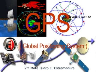
- 1. GPS ( Global Positioning System ) 2nd Mate Isidro E. Estremadura
- 2. GPS GPS employs 24 spacecraft in 20,200 km circular orbits inclined at 55 degrees. These spacecraft are placed in 6 orbit planes with four operational satellites in each plane. All launches have been successful except for one launch failure in 1981. The full 24-satellite constellation was completed on March 9, 1994.
- 3. The Global Positioning System Baseline 24 satellite constellation in medium earth orbit Global coverage, 24 hours a day, all weather conditions Satellites broadcast precise time and orbit information on L-band radio frequencies Two types of service: • Standard (free of direct user fees) • Precise (U.S. and Allied military) Three segments: • Space • Ground control • User equipment 4
- 4. GPS Services GPS satellites provide service to civilian and military users. The civilian service is freely available to all users on a continuous, worldwide basis. The military service is available to U.S. and allied armed forces as well as approved Government agencies.
- 5. Standard Positioning Service The Standard Positioning Service (SPS) is defined in the standard specified level of positioning and timing accuracy that is available, without restrictions, to any user on a continuous worldwide basis. The accuracy of this service will be established by the DOD and DOT based on U. S. security interests. SPS provides a predictable positioning accuracy of 100 meters (95 percent) horizontally and 156 meters (95 percent) vertically and time transfer accuracy to UTC within 340 nanoseconds (95 percent).
- 6. Precise Positioning Service Precise Positioning Service (PPS) as the most accurate direct positioning, velocity, and timing information continuously available, worldwide, from the basic GPS. This service is limited to users specifically authorized by the U.S. P(Y)-code capable military user equipment provides a predictable positioning accuracy of at least 22 meters (95 percent) horizontally and 27.7 meters (95 percent) vertically and time transfer accuracy to UTC within 200 nanoseconds (95 percent) (DoD and DoT 1995, A-36).
- 7. GPS Constellation GPS satellites circle the earth twice a day in a very precise orbit and transmit signal information to earth.
- 10. Triangulation GPS receivers take this information and use triangulation to calculate the user's exact location.
- 11. Time Essentially, the GPS receiver compares the time a signal was transmitted by a satellite with the time it was received.
- 14. The time difference tells the GPS receiver how far away the satellite is.
- 15. • Now, with distance measurements from a few more satellites, the receiver can determine the user's position and display it on the receiver.
- 16. • With four or more satellites in view, the receiver can determine the user's 3D position (latitude, longitude and altitude).
- 18. The Space Segment The space segment consists of a nominal constellation of 24 operating satellites that transmit one- way signals that give the current GPS satellite position and time.
- 19. The User Segment The user segment consists of the GPS receiver equipment, which receives the signals from the GPS satellites and uses the transmitted information to calculate the user’s three-dimensional position and time.
- 20. Control Segment The control segment consists of worldwide monitor and control stations that maintain the satellites in their proper orbits through occasional command maneuvers, and adjust the satellite clocks. It tracks the GPS satellites, uploads updated navigational data, and maintains health and status of the satellite constellation.
- 21. Control Segment
- 23. A full size model of the Earth observation satellite ERS 2
- 24. Satellite frequencies L1 (1575.42 MHz): Mix of Navigation Message, coarse-acquisition (C/A) code and encrypted precision P(Y) code, plus the new L1C on future Block III satellites. L2 (1227.60 MHz): P(Y) code, plus the new L2C code on the Block IIR-M and newer satellites. L3 (1381.05 MHz): Used by the Nuclear Detonation (NUDET) Detection System Payload (NDS) to signal detection of nuclear detonations and other high-energy infrared events. Used to enforce nuclear test ban treaties.
- 25. Cont’d Satellite frequencies L4 (1379.913 MHz): Being studied for additional ionospheric correction. L5 (1176.45 MHz): Proposed for use as a civilian safety-of-life (SoL) signal . This frequency falls into an internationally protected range for aeronautical navigation, promising little or no interference under all circumstances. The first Block IIF satellite that would provide this signal is set to be launched in 2009.
- 26. Other Satellite System Galileo – a GNSS developed and constructed by the European Union and other partner countries, and planned to be operational by 2014. Beidou – People's Republic of China's experimental regional system. COMPASS – A proposed global satellite positioning system by the People's Republic of China. GLONASS – Russia's GNSS which is being completed in partnership with India. IRNSS – India's regional navigation system covering Asia and the Indian Ocean only (distinct from India's participation in GLONASS). QZSS – Japanese proposed regional system covering Japan only.
- 27. Facts about the GPS satellites (also called NAVSTAR ) The first GPS satellite was launched in 1978. A full constellation of 24 satellites was achieved in 1994. Each satellite is built to last about 10 years. Replacements are constantly being built and launched into orbit. A GPS satellite weighs approximately 2,000 pounds and is about 17 feet across with the solar panels extended. Transmitter power is only 50 watts or less.
- 28. GPS Satellite GPS satellite launches began in 1978, and a second-generation set of satellites ("Block II") was launched beginning in 1989. Today's GPS constellation consists of at least 24 Block II satellites. The system became fully operational in 1995.
- 29. Determining Position A GPS receiver "knows" the location of the satellites, because that information is included in satellite transmissions. By estimating how far away a satellite is, the receiver also "knows" it is located somewhere on the surface of an imaginary sphere centered at the satellite. It then determines the sizes of several spheres, one for each satellite. The receiver is located where these spheres intersect.
- 31. Sources of GPS signal errors 1. Signal Multipath 2. Ionospheric and Tropospheric Delay 3. Receiver Clock error 4. Orbital Error
- 32. Signal multipath This occurs when the GPS signal is reflected off objects such as tall buildings or large rock surfaces before it reaches the receiver.
- 33. Ionosphere and troposphere delays The satellite signal slows as it passes through the atmosphere.
- 34. Receiver clock error A receiver's built-in clock is not as accurate as the atomic clocks onboard the GPS satellites.
- 35. Orbital error Also known as ephemeris errors, these are inaccuracies of the satellite's reported location.
- 36. General Characteristics Primary Function: Positioning, navigation, timing and velocity information worldwide Primary Contractors: Block II/IIA, Rockwell International (Boeing North American); Block IIR, Lockheed Martin; Block IIR-M, Lockheed Martin; Block IIF, Boeing North American Power Plant: Solar panels generating 800 watts; Block IIF panels generate 2450 watts Weight: Block IIA, 3,670 pounds (1,816 kilograms); Block IIR/M, 4,480 pounds (2,217 kilograms); Block IIF, 3,758 pounds (1,705 kilograms)
- 37. Height: Block IIA, 136 inches (3.4 meters); Block IIR, 70 inches (1.7 meters); Block IIF, 98 inches (2.4 meters) Width (includes wingspan): Block IIA, 208.6 inches (5.3 meters); Block IIR, 449 inches (11.4 meters); Block IIF, approximately 116 feet (35.5 meters) Design life: Block II/IIA, 7.5 years; Block IIR, 10 years; Block IIR-M (modernized) 8.57 years; Block IIF, 11 years Date of First Launch: 1978 Launch vehicle: Delta II; EELV for Block IIF Date Constellation Operational: April 1995 (at full operational capacity)
- 38. GPS Accuracy by Land The accuracy of a position determined with GPS depends on the type of receiver. Most hand-held GPS units have about 10- 20 meter accuracy. Other types of receivers use a method called Differential GPS (DGPS) to obtain much higher accuracy. DGPS requires an additional receiver fixed at a known location nearby. Observations made by the stationary receiver are used to correct positions recorded by the roving units, producing an accuracy greater than 1 meter.
- 40. Global Maritime Distress and Safety System
- 41. GMDSS
- 42. What is GMDSS? The Global Maritime Distress and Safety System (GMDSS) is the international radio safety system mandated by the International Maritime Organization (IMO) for ships at sea. The GMDSS was implemented on February 1, 1999 through amendments to the Safety of Life At Sea (SOLAS) Convention. The primary purpose of GMDSS is to automate and improve emergency communications for the world's shipping industry.
- 43. Why GMDSS? GMDSS was developed to SAVE LIVES by modernizing and enhancing the current radio communications system. By utilizing satellite and digital selective calling technology, GMDSS provides a more effective distress alerting system. It improves the current system by: 1. increasing the probability that an alert will be sent when a vessel is in distress; 2. increasing the likelihood that the alert will be received; 3. increasing the ability to locate survivors; 4. improving rescue communications and coordination; and 5. providing mariners with vital maritime safety information.
- 44. Functional requirements 1. transmitting ship-to-shore Distress Alerts; 2. receiving shore-to-ship Distress Alerts; 3. transmitting and receiving ship-to-ship Distress Alerts; 4. transmitting and receiving search and rescue co- ordinating communications; 5. transmitting and receiving on-scene communications; 6. transmitting and receiving locating signals; 7. receiving maritime safety information; 8. transmitting and receiving general radiocommunications; 9. transmitting and receiving bridge-to-bridge communications.
- 45. Application The GMDSS applies to vessels subject to the SOLAS Convention - that is: Commercial vessels of 300 Gross Registered Tons (GRT) and above, engaged on international voyages. The GMDSS became mandatory for such vessels as of February 1, 1999.
- 46. Minimum requirements GMDSS ships are required to carry the following minimum equipment: A VHF radio installation capable of transmitting DSC on channel 70, and radiotelephony on channels 16, 13 and 6. One SART if under 500 GRT, 2 SARTs if over 500 GRT. Two portable VHF transceivers for use in survival craft if under 500 GRT, three if over 500 GRT. A NAVTEX receiver, if the ship is engaged on voyages in any area where a NAVTEX service is provided. An Inmarsat EGC receiver, if the ship is engaged on voyages in any area of Inmarsat coverage where MSI services are not provided by NAVTEX or HF NBDP. A 406 MHz or 1.6 GHz EPIRB
- 47. GMDSS Equipment Digital Selective Calling (DSC) Satellite Communications Emergency Position Indicating Radio beacon (EPIRB) Search And Rescue Transponder (SART) Maritime Safety Information (MSI) GMDSS Sea Areas - International
- 48. Digital Selective Calling (DSC) The traditional marine radio (VHF/MF/HF) has been enhanced with the addition of a feature known as DSC. This feature enables vessels to automatically maintain the required watch on distress and calling channels instead of the current aural listening watch. A DSC receiver will only respond to the vessel’s unique Maritime Mobile Service Identity number (MMSI#), similar to a telephone number, or to an "All Ships" DSC call within range. Once contact has been made by DSC, follow-up communications take place by voice on another frequency.
- 49. VHF with DSC VHF channel 70 (156.525 MHz) is dedicated to DSC operation. Radio telephone calls are prohibited on Channel 70.
- 50. MF/HF with DSC An MF radio installation capable of transmitting and receiving on the frequencies MF 2187.5 kHz using DSC and 2182 kHz using radiotelephony;
- 51. MF/HF DSC DISTRESS AND SAFETY CHANNELS MF - 2187.5 kHz HF - 4207.5 6312.0 8414.5 12577.0 16804.5 (kHz)
- 52. EPIRB GMDSS makes use of the COSPAS- SARSAT Satellite System which provides global detection of 406 Megahertz (MHz) EPIRB
- 53. Cospas/Sarsat Cospas-Sarsat is a satellite system designed to provide distress alert and location data to assist search and rescue (SAR) operations, using spacecraft and ground facilities to detect and locate the signals of distress beacons operating on 406 Megahertz (MHz).
- 54. In Times of Distress
- 55. Navtex NAVTEX receivers are fully automatic and receive safety maritime information (MSI) broadcasts in coastal regions up to 300 nautical miles offshore.
- 56. Navtex Frequencies Reception only 518 kHz – MSI broadcast in English language 490 kHz – MSI broadcast in in local languages (non English)
- 57. Survival Craft Radio Equipment Although SARTs are primarily designed to be used in lifeboats or liferafts, they can be deployed on board a ship, or even in the water. SARTs are powered by integral batteries which are designed to provide up to 96 hours of operation.
- 58. INMARSAT-C Inmarsat-C terminals receive Enhanced Group Call - SafetyNET (EGC) broadcasts for areas outside NAVTEX coverage.
- 59. MF/HF Radio Equipment HF Narrow Band Direct Printing (NBDP) receivers can be used where service is available as an alternate to EGC.
- 60. Search And Rescue Transponder (SART) SARTs operate in the 9 GHz marine radar band, and when interrogated by a searching ship's radar, respond with a signal which is displayed as a series of dots on a radar screen.
- 61. HOW Does SART Work?
- 62. Portable VHF transceivers These units are designed to allow communications between searching vessels and survivors in liferafts. They operate on the VHF marine band in voice mode. DSC capability is not fitted.
- 64. What is ECDIS? The Electronic Chart Display and Information systems (ECDIS) are extremely efficient mean of navigation, which significantly reduce the workload of the officers on watch, thus allowing them to devote more time to the observation of the surroundings and to the navigation of the ship.
- 65. ECDIS An Electronic Chart Display and Information System (ECDIS) is a computer-based navigation information system that complies with International Maritime Organization (IMO) regulations and can be used as an alternative to paper navigational chart. IMO refers to similar systems not meeting the regulations as Electric Chart Systems (ECS).
- 66. Timeline of ECDIS Mandatory for large international traveling ships. The new standard was adopted in June 2009 during the 86th session of International Maritime Safety Committee. Expected entry into force will be on January 1, 2011.
- 67. Regulation ECDIS (as defined by IHO Special Publications S-52 and S-57) is an approved marine navigational chart and information system, which is accepted as complying with the conventional paper charts required by Regulation V/20 of the 1974 IMO SOLAS Convention.
- 68. Application of ECDIS ECDIS provides continuous position and navigational safety information. The system generates audible and/or visual alarms when the vessel is in proximity to navigational hazards.
- 69. Electronic chart data Vector charts Vector charts are the chart databases for ECDIS, with standardized content, structure and format, issued for use with ECDIS on the authority of government authorized hydrographic offices.
- 70. Example of a Vector Chart
- 71. Raster charts Raster navigational charts are raster charts that conform to IHO specifications and are produced by converting paper charts to digital image by scanner. The image is similar to digital camera pictures, which could be zoomed in for more detailed information as it does in ENC. IHO Special Publication S-61 provides guidelines for the production of raster data. IMO Resolution MSC.86(70) permits ECDIS equipment to operate in a Raster Chart Display System (RCDS) mode in the absence of ENC.
- 72. Example of a Raster Chart
- 73. Application ECDIS provides continuous position and navigational safety information. The system generates audible and/or visual alarms when the vessel is in proximity to navigational hazards.
- 75. What is AIS? Automatic identification system (AIS) are designed to be capable of providing information about the ship to other ships and to coastal authorities automatically. The Automatic Identification System (AIS) is a short range coastal tracking system used on ships and by Vessel Traffic Service (VTS) for identifying and locating vessels by electronically exchanging data with other nearby ships and VTS stations.
- 76. How AIS Works
- 77. Application AIS main objectives are: - to improve maritime safety - to protect the maritime environment AIS operates in the VHF frequency band.
- 78. Regulations for carriage of AIS Regulation 19 of SOLAS Chapter V - Carriage requirements for shipborne navigational systems and equipment - sets out navigational equipment to be carried on board ships, according to ship type. In 2000, IMO adopted a new requirement (as part of a revised new chapter V) for all ships to carry automatic identification system (AIS) capable of providing information about the ship to other ships and to coastal authorities automatically.
- 79. The regulation requires AIS to be fitted aboard all ships of 300 gross tonnage and upwards engaged on international voyages, cargo ships of 500 gross tonnage and upwards not engaged on international voyages and all passenger ships irrespective of size. The requirement became effective for all ships by 31 December 2004.
- 80. The regulation requires that AIS shall: provide information - including the ship's identity, type, position, course, speed, navigational status and other safety- related information - automatically to appropriately equipped shore stations, other ships and aircraft; receive automatically such information from similarly fitted ships; · monitor and track ships; exchange data with shore-based facilities.
- 81. The regulation applies to ships built on or after 1 July 2002 and to ships engaged on international voyages constructed before 1 July 2002, according to the following timetable: passenger ships, not later than 1 July 2003; tankers, not later than the first survey for safety equipment on or after 1 July 2003; ships, other than passenger ships and tankers, of 50,000 gross tonnage and upwards, not later than 1 July 2004.