SlideShare una empresa de Scribd logo
1 de 24
Descargar para leer sin conexión
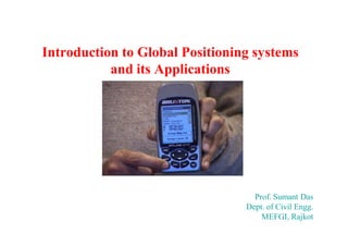
Introduction to Global Positioning systems
and its Applications

Prof. Sumant Das
Dept. of Civil Engg.
MEFGI, Rajkot
Global Positioning System (GPS)


In 1973 the U.S. Department of Defense
decided to establish, develop, test, acquire,
and deploy a spaceborne Global Positioning
System (GPS). The result of this decision is the
present NAVSTAR GPS (Navigation Satellite
Timing And Ranging Global Positioning
System).
Definition of GPS:
The Global Positioning System
(GPS) is a worldwide satellitebased radio navigation system
formed from a constellation of
24 satellites and their ground
stations. It’s used to determine
accurate geodetic position &
altitude on the earth surface.
GPS General Characteristics




Developed by the US
Department of Defense
Provides


Accurate Navigation










10 - 20 m

Worldwide Coverage
24 hour access
Common Coordinate System
20,200 Km above the Earth

Designed to replace existing
navigation systems
Accessible by Civil and Military
Basic Principles of GPS:
 The GPS System Consists of 24 Satellite
that broadcast Signals containing
information about their position and time.
 A GPS receiver processes signal from at
least 4 Satellites.
The GPS system and receiver is the
constancy of the speed of light.
GPS – How it works








All satellites have clocks set to exactly the same time.
All satellites know their exact position in space from
data sent to them from the systems controllers.
Each satellite transmits its position and a time signal.
The signals travel to the receiver delayed only by
distance traveled.
The receiver calculates the distance to each satellite
and trilaterates its own position.
Types:



Single frequency- Static mode GPS surveying
Dual frequency- requires post processing only.
GPS Segments
Space Segment
Space Segment
24 Satellites
4 satellites in 6 Orbital Planes
inclined at 55 Degrees
20200 Km above the Earth
12 Hourly orbits
In view for 4-5 hours
Designed to last 7.5 years
Different Classifications
Block 1, 2, 2A, 2R & 2 F

Control Segment

User Segment

Control Segment
1Master Control Station
Responsible for collecting tracking data from the
monitoring stations and calculating satellite
orbits and clock parameters
2.5 Monitoring Stations
Responsible for measuring
pseudorange data. This orbital
tracking network is used to
determine the broadcast
ephemeris and satellite clock
modeling
Ground Control Stations
Responsible for upload of information to the
satellites

User Segment
1.The most visible segment
2 GPS receivers are found in
many locations and applications
Three Segments of the GPS
Space Segment

User Segment
Control Segment
Ground
Antennas
Master Station

Monitor Stations
Space Segment


4 satellites in 6 Orbital
Planes inclined at 55
Degrees





• 12 Hourly orbits

24 Satellites

20200 Km above the Earth

Orbits

Equator

4

55

3
2

1
Satellites

– In view for 4-5 hours

• Designed to last 7.5 years
• Different Classifications
– Block 1, 2, 2A, 2R & 2 F
Control Segment
Monitor and Control

Colorado
Springs

Hawaii

Master Control Station
Monitor Station
Ground Antenna

Kwajalein

Ascension
Islands
Diego
Garcia
Control Segment


Master Control Station




Responsible for collecting tracking data from the monitoring
stations and calculating satellite orbits and clock parameters

5 Monitoring Stations


Responsible for measuring pseudorange data. This orbital
tracking network is used to determine the broadcast
ephemeris and satellite clock modeling



Ground Control Stations



Responsible for upload of information to the satellites
User Segment



The most visible segment
GPS receivers are found in many
locations and applications
GPS Segments
Space Segment

Satellite Constellation

User Segment

Ground
Antennas
Monitor
Stations

Master Control Station

AFSCN

FAIRBANKS

Control Segment

ENGLAND

COLORADO SPRINGS
SOUTH
KOREA

USNO WASH D.C.
VANDENBERG, AFB
CAPE CANAVERAL

Master Control Station (MCS)
Ground Antenna (GA)

Advanced Ground Antenna
Monitor Station (MS)

BAHRAIN

HAWAII Master Control Station

KWAJALEIN

ASCENSION
ECUADOR

National Geospatial-Intelligence Agency (NGA) Tracking Station
GeospatialAlternate Master Control Station (AMCS)

ARGENTINA

DIEGO
GARCIA

TAHITI

SOUTH
AFRICA
NEW ZEALAND
Who Uses It?








Everyone!
Merchant, Navy, Coast Guard vessels
Commercial Airliners, Civil Pilots
Surveyors
Commercial Truckers
Cars now being equipped
Communications and Imaging Satellites




Space-to-Space Navigation

Any system requiring accurate timing
Application of GPS

Power Grid
Interfaces

Precision farming

Personal Navigation
Trucking &
Shipping

Surveying &
Mapping

Aviation
Railroads

Recreation

Off shore
Drilling

Communications

Fishing &
Boating
Applications


Civilian Purpose











Locations
Mapping
Monitoring
Construction Control
Emergency services
Boundaries









Agriculture - Slope Staking
Tracking of people,
vehicles
Sports (boating, hiking,…)
Archeology
Public Transport
Town Planning
Hydrographic Surveying
Topographical Mapping
Cadastral Surveying
GIS Application
Defense Application





Navigation (night & bad weather)
Call in target coordinates
Guidance system for missiles
Ships used them for minesweeping,
rendezvous, and aircraft operations
GPS Basics: How it Works and Its Applications

Más contenido relacionado

La actualidad más candente

La actualidad más candente (20)

Gps
GpsGps
Gps
 
Satellite Navigation
Satellite Navigation Satellite Navigation
Satellite Navigation
 
Introduction-of-GNSS-2
Introduction-of-GNSS-2Introduction-of-GNSS-2
Introduction-of-GNSS-2
 
Global Positioning System
Global Positioning System Global Positioning System
Global Positioning System
 
Gps
GpsGps
Gps
 
Global Positioning System
Global Positioning SystemGlobal Positioning System
Global Positioning System
 
GPS
GPSGPS
GPS
 
Gps
GpsGps
Gps
 
Introduction to GPS
Introduction to GPSIntroduction to GPS
Introduction to GPS
 
gps technology
gps technologygps technology
gps technology
 
Global Positioning System (GPS)
Global Positioning System (GPS) Global Positioning System (GPS)
Global Positioning System (GPS)
 
Global positioning system (gps)
Global positioning  system (gps)Global positioning  system (gps)
Global positioning system (gps)
 
Global positioning system
Global positioning systemGlobal positioning system
Global positioning system
 
Global positioning system ppt
Global positioning system pptGlobal positioning system ppt
Global positioning system ppt
 
GPS(Global Positioning system
GPS(Global Positioning systemGPS(Global Positioning system
GPS(Global Positioning system
 
Introduction to global position system
Introduction to global position systemIntroduction to global position system
Introduction to global position system
 
GPS-errors-1
GPS-errors-1GPS-errors-1
GPS-errors-1
 
Gps
GpsGps
Gps
 
Global positioning system (gps)
Global positioning system (gps)Global positioning system (gps)
Global positioning system (gps)
 
Introduction of gps global navigation satellite systems
Introduction of gps   global navigation satellite systems Introduction of gps   global navigation satellite systems
Introduction of gps global navigation satellite systems
 

Similar a GPS Basics: How it Works and Its Applications

Global Positioning system GPS - Dr. S. Balamurugan
Global Positioning system GPS - Dr. S. BalamuruganGlobal Positioning system GPS - Dr. S. Balamurugan
Global Positioning system GPS - Dr. S. BalamuruganPrakash Kumar Sekar
 
Global positioning system
Global positioning systemGlobal positioning system
Global positioning systemNirant Patel
 
Project on GPS (Global Positioning System)
Project on GPS (Global Positioning System)Project on GPS (Global Positioning System)
Project on GPS (Global Positioning System)Jyotismat Raul
 
The global positioning system an overview
The global positioning system an overviewThe global positioning system an overview
The global positioning system an overviewGurubasavaraj M
 
Gps and remote sensing
Gps and remote sensingGps and remote sensing
Gps and remote sensingSanila Khalid
 
Gps principle and working
Gps principle and workingGps principle and working
Gps principle and workingArnishprajapati
 
GPSS ,DEFENITION,TYPE,WORKING,PRINCIPLES
GPSS ,DEFENITION,TYPE,WORKING,PRINCIPLESGPSS ,DEFENITION,TYPE,WORKING,PRINCIPLES
GPSS ,DEFENITION,TYPE,WORKING,PRINCIPLESSALIAALIAS
 
Electronic Navigations: GPS,GPS terms, GPS use and using Waypoints
Electronic Navigations: GPS,GPS terms, GPS use and using WaypointsElectronic Navigations: GPS,GPS terms, GPS use and using Waypoints
Electronic Navigations: GPS,GPS terms, GPS use and using WaypointsAzad Uddin (Sojib Ahmed)
 
GPS DOCUMENT
GPS DOCUMENTGPS DOCUMENT
GPS DOCUMENTTuhin_Das
 
GPS (Global Positioning System)
GPS (Global Positioning System)GPS (Global Positioning System)
GPS (Global Positioning System)TANMAY SHARMA
 

Similar a GPS Basics: How it Works and Its Applications (20)

Global Positioning system GPS - Dr. S. Balamurugan
Global Positioning system GPS - Dr. S. BalamuruganGlobal Positioning system GPS - Dr. S. Balamurugan
Global Positioning system GPS - Dr. S. Balamurugan
 
Global positioning system
Global positioning systemGlobal positioning system
Global positioning system
 
Global positioning system
Global positioning systemGlobal positioning system
Global positioning system
 
Project on GPS (Global Positioning System)
Project on GPS (Global Positioning System)Project on GPS (Global Positioning System)
Project on GPS (Global Positioning System)
 
The global positioning system an overview
The global positioning system an overviewThe global positioning system an overview
The global positioning system an overview
 
GPS Surveying
GPS SurveyingGPS Surveying
GPS Surveying
 
Global Positioning system (Gps)
Global Positioning system (Gps)Global Positioning system (Gps)
Global Positioning system (Gps)
 
Gps and remote sensing
Gps and remote sensingGps and remote sensing
Gps and remote sensing
 
Final Lecture Enav211
Final Lecture Enav211Final Lecture Enav211
Final Lecture Enav211
 
Gps principle and working
Gps principle and workingGps principle and working
Gps principle and working
 
Gps final main
Gps final mainGps final main
Gps final main
 
An introduction of GPS
An introduction of GPS An introduction of GPS
An introduction of GPS
 
Gps
GpsGps
Gps
 
GPSS ,DEFENITION,TYPE,WORKING,PRINCIPLES
GPSS ,DEFENITION,TYPE,WORKING,PRINCIPLESGPSS ,DEFENITION,TYPE,WORKING,PRINCIPLES
GPSS ,DEFENITION,TYPE,WORKING,PRINCIPLES
 
Electronic Navigations: GPS,GPS terms, GPS use and using Waypoints
Electronic Navigations: GPS,GPS terms, GPS use and using WaypointsElectronic Navigations: GPS,GPS terms, GPS use and using Waypoints
Electronic Navigations: GPS,GPS terms, GPS use and using Waypoints
 
Gps sy stem
Gps sy stemGps sy stem
Gps sy stem
 
GPS.pptx
GPS.pptxGPS.pptx
GPS.pptx
 
GPS DOCUMENT
GPS DOCUMENTGPS DOCUMENT
GPS DOCUMENT
 
GPS (Global Positioning System)
GPS (Global Positioning System)GPS (Global Positioning System)
GPS (Global Positioning System)
 
GPS-1 (1).ppt
GPS-1 (1).pptGPS-1 (1).ppt
GPS-1 (1).ppt
 

Último

BASLIQ CURRENT LOOKBOOK LOOKBOOK(1) (1).pdf
BASLIQ CURRENT LOOKBOOK  LOOKBOOK(1) (1).pdfBASLIQ CURRENT LOOKBOOK  LOOKBOOK(1) (1).pdf
BASLIQ CURRENT LOOKBOOK LOOKBOOK(1) (1).pdfSoniaTolstoy
 
JAPAN: ORGANISATION OF PMDA, PHARMACEUTICAL LAWS & REGULATIONS, TYPES OF REGI...
JAPAN: ORGANISATION OF PMDA, PHARMACEUTICAL LAWS & REGULATIONS, TYPES OF REGI...JAPAN: ORGANISATION OF PMDA, PHARMACEUTICAL LAWS & REGULATIONS, TYPES OF REGI...
JAPAN: ORGANISATION OF PMDA, PHARMACEUTICAL LAWS & REGULATIONS, TYPES OF REGI...anjaliyadav012327
 
Beyond the EU: DORA and NIS 2 Directive's Global Impact
Beyond the EU: DORA and NIS 2 Directive's Global ImpactBeyond the EU: DORA and NIS 2 Directive's Global Impact
Beyond the EU: DORA and NIS 2 Directive's Global ImpactPECB
 
The byproduct of sericulture in different industries.pptx
The byproduct of sericulture in different industries.pptxThe byproduct of sericulture in different industries.pptx
The byproduct of sericulture in different industries.pptxShobhayan Kirtania
 
Software Engineering Methodologies (overview)
Software Engineering Methodologies (overview)Software Engineering Methodologies (overview)
Software Engineering Methodologies (overview)eniolaolutunde
 
social pharmacy d-pharm 1st year by Pragati K. Mahajan
social pharmacy d-pharm 1st year by Pragati K. Mahajansocial pharmacy d-pharm 1st year by Pragati K. Mahajan
social pharmacy d-pharm 1st year by Pragati K. Mahajanpragatimahajan3
 
Z Score,T Score, Percential Rank and Box Plot Graph
Z Score,T Score, Percential Rank and Box Plot GraphZ Score,T Score, Percential Rank and Box Plot Graph
Z Score,T Score, Percential Rank and Box Plot GraphThiyagu K
 
microwave assisted reaction. General introduction
microwave assisted reaction. General introductionmicrowave assisted reaction. General introduction
microwave assisted reaction. General introductionMaksud Ahmed
 
A Critique of the Proposed National Education Policy Reform
A Critique of the Proposed National Education Policy ReformA Critique of the Proposed National Education Policy Reform
A Critique of the Proposed National Education Policy ReformChameera Dedduwage
 
POINT- BIOCHEMISTRY SEM 2 ENZYMES UNIT 5.pptx
POINT- BIOCHEMISTRY SEM 2 ENZYMES UNIT 5.pptxPOINT- BIOCHEMISTRY SEM 2 ENZYMES UNIT 5.pptx
POINT- BIOCHEMISTRY SEM 2 ENZYMES UNIT 5.pptxSayali Powar
 
Disha NEET Physics Guide for classes 11 and 12.pdf
Disha NEET Physics Guide for classes 11 and 12.pdfDisha NEET Physics Guide for classes 11 and 12.pdf
Disha NEET Physics Guide for classes 11 and 12.pdfchloefrazer622
 
1029-Danh muc Sach Giao Khoa khoi 6.pdf
1029-Danh muc Sach Giao Khoa khoi  6.pdf1029-Danh muc Sach Giao Khoa khoi  6.pdf
1029-Danh muc Sach Giao Khoa khoi 6.pdfQucHHunhnh
 
mini mental status format.docx
mini    mental       status     format.docxmini    mental       status     format.docx
mini mental status format.docxPoojaSen20
 
Activity 01 - Artificial Culture (1).pdf
Activity 01 - Artificial Culture (1).pdfActivity 01 - Artificial Culture (1).pdf
Activity 01 - Artificial Culture (1).pdfciinovamais
 
Sanyam Choudhary Chemistry practical.pdf
Sanyam Choudhary Chemistry practical.pdfSanyam Choudhary Chemistry practical.pdf
Sanyam Choudhary Chemistry practical.pdfsanyamsingh5019
 
CARE OF CHILD IN INCUBATOR..........pptx
CARE OF CHILD IN INCUBATOR..........pptxCARE OF CHILD IN INCUBATOR..........pptx
CARE OF CHILD IN INCUBATOR..........pptxGaneshChakor2
 
SOCIAL AND HISTORICAL CONTEXT - LFTVD.pptx
SOCIAL AND HISTORICAL CONTEXT - LFTVD.pptxSOCIAL AND HISTORICAL CONTEXT - LFTVD.pptx
SOCIAL AND HISTORICAL CONTEXT - LFTVD.pptxiammrhaywood
 

Último (20)

BASLIQ CURRENT LOOKBOOK LOOKBOOK(1) (1).pdf
BASLIQ CURRENT LOOKBOOK  LOOKBOOK(1) (1).pdfBASLIQ CURRENT LOOKBOOK  LOOKBOOK(1) (1).pdf
BASLIQ CURRENT LOOKBOOK LOOKBOOK(1) (1).pdf
 
JAPAN: ORGANISATION OF PMDA, PHARMACEUTICAL LAWS & REGULATIONS, TYPES OF REGI...
JAPAN: ORGANISATION OF PMDA, PHARMACEUTICAL LAWS & REGULATIONS, TYPES OF REGI...JAPAN: ORGANISATION OF PMDA, PHARMACEUTICAL LAWS & REGULATIONS, TYPES OF REGI...
JAPAN: ORGANISATION OF PMDA, PHARMACEUTICAL LAWS & REGULATIONS, TYPES OF REGI...
 
Mattingly "AI & Prompt Design: The Basics of Prompt Design"
Mattingly "AI & Prompt Design: The Basics of Prompt Design"Mattingly "AI & Prompt Design: The Basics of Prompt Design"
Mattingly "AI & Prompt Design: The Basics of Prompt Design"
 
Beyond the EU: DORA and NIS 2 Directive's Global Impact
Beyond the EU: DORA and NIS 2 Directive's Global ImpactBeyond the EU: DORA and NIS 2 Directive's Global Impact
Beyond the EU: DORA and NIS 2 Directive's Global Impact
 
The byproduct of sericulture in different industries.pptx
The byproduct of sericulture in different industries.pptxThe byproduct of sericulture in different industries.pptx
The byproduct of sericulture in different industries.pptx
 
Software Engineering Methodologies (overview)
Software Engineering Methodologies (overview)Software Engineering Methodologies (overview)
Software Engineering Methodologies (overview)
 
social pharmacy d-pharm 1st year by Pragati K. Mahajan
social pharmacy d-pharm 1st year by Pragati K. Mahajansocial pharmacy d-pharm 1st year by Pragati K. Mahajan
social pharmacy d-pharm 1st year by Pragati K. Mahajan
 
Z Score,T Score, Percential Rank and Box Plot Graph
Z Score,T Score, Percential Rank and Box Plot GraphZ Score,T Score, Percential Rank and Box Plot Graph
Z Score,T Score, Percential Rank and Box Plot Graph
 
microwave assisted reaction. General introduction
microwave assisted reaction. General introductionmicrowave assisted reaction. General introduction
microwave assisted reaction. General introduction
 
Mattingly "AI & Prompt Design: Structured Data, Assistants, & RAG"
Mattingly "AI & Prompt Design: Structured Data, Assistants, & RAG"Mattingly "AI & Prompt Design: Structured Data, Assistants, & RAG"
Mattingly "AI & Prompt Design: Structured Data, Assistants, & RAG"
 
A Critique of the Proposed National Education Policy Reform
A Critique of the Proposed National Education Policy ReformA Critique of the Proposed National Education Policy Reform
A Critique of the Proposed National Education Policy Reform
 
POINT- BIOCHEMISTRY SEM 2 ENZYMES UNIT 5.pptx
POINT- BIOCHEMISTRY SEM 2 ENZYMES UNIT 5.pptxPOINT- BIOCHEMISTRY SEM 2 ENZYMES UNIT 5.pptx
POINT- BIOCHEMISTRY SEM 2 ENZYMES UNIT 5.pptx
 
Disha NEET Physics Guide for classes 11 and 12.pdf
Disha NEET Physics Guide for classes 11 and 12.pdfDisha NEET Physics Guide for classes 11 and 12.pdf
Disha NEET Physics Guide for classes 11 and 12.pdf
 
1029-Danh muc Sach Giao Khoa khoi 6.pdf
1029-Danh muc Sach Giao Khoa khoi  6.pdf1029-Danh muc Sach Giao Khoa khoi  6.pdf
1029-Danh muc Sach Giao Khoa khoi 6.pdf
 
INDIA QUIZ 2024 RLAC DELHI UNIVERSITY.pptx
INDIA QUIZ 2024 RLAC DELHI UNIVERSITY.pptxINDIA QUIZ 2024 RLAC DELHI UNIVERSITY.pptx
INDIA QUIZ 2024 RLAC DELHI UNIVERSITY.pptx
 
mini mental status format.docx
mini    mental       status     format.docxmini    mental       status     format.docx
mini mental status format.docx
 
Activity 01 - Artificial Culture (1).pdf
Activity 01 - Artificial Culture (1).pdfActivity 01 - Artificial Culture (1).pdf
Activity 01 - Artificial Culture (1).pdf
 
Sanyam Choudhary Chemistry practical.pdf
Sanyam Choudhary Chemistry practical.pdfSanyam Choudhary Chemistry practical.pdf
Sanyam Choudhary Chemistry practical.pdf
 
CARE OF CHILD IN INCUBATOR..........pptx
CARE OF CHILD IN INCUBATOR..........pptxCARE OF CHILD IN INCUBATOR..........pptx
CARE OF CHILD IN INCUBATOR..........pptx
 
SOCIAL AND HISTORICAL CONTEXT - LFTVD.pptx
SOCIAL AND HISTORICAL CONTEXT - LFTVD.pptxSOCIAL AND HISTORICAL CONTEXT - LFTVD.pptx
SOCIAL AND HISTORICAL CONTEXT - LFTVD.pptx
 

GPS Basics: How it Works and Its Applications

  • 1. Introduction to Global Positioning systems and its Applications Prof. Sumant Das Dept. of Civil Engg. MEFGI, Rajkot
  • 3. Global Positioning System (GPS)  In 1973 the U.S. Department of Defense decided to establish, develop, test, acquire, and deploy a spaceborne Global Positioning System (GPS). The result of this decision is the present NAVSTAR GPS (Navigation Satellite Timing And Ranging Global Positioning System).
  • 4. Definition of GPS: The Global Positioning System (GPS) is a worldwide satellitebased radio navigation system formed from a constellation of 24 satellites and their ground stations. It’s used to determine accurate geodetic position & altitude on the earth surface.
  • 5. GPS General Characteristics   Developed by the US Department of Defense Provides  Accurate Navigation        10 - 20 m Worldwide Coverage 24 hour access Common Coordinate System 20,200 Km above the Earth Designed to replace existing navigation systems Accessible by Civil and Military
  • 6. Basic Principles of GPS:  The GPS System Consists of 24 Satellite that broadcast Signals containing information about their position and time.  A GPS receiver processes signal from at least 4 Satellites. The GPS system and receiver is the constancy of the speed of light.
  • 7. GPS – How it works       All satellites have clocks set to exactly the same time. All satellites know their exact position in space from data sent to them from the systems controllers. Each satellite transmits its position and a time signal. The signals travel to the receiver delayed only by distance traveled. The receiver calculates the distance to each satellite and trilaterates its own position.
  • 8.
  • 9.
  • 10.
  • 11.
  • 12. Types:   Single frequency- Static mode GPS surveying Dual frequency- requires post processing only.
  • 13. GPS Segments Space Segment Space Segment 24 Satellites 4 satellites in 6 Orbital Planes inclined at 55 Degrees 20200 Km above the Earth 12 Hourly orbits In view for 4-5 hours Designed to last 7.5 years Different Classifications Block 1, 2, 2A, 2R & 2 F Control Segment User Segment Control Segment 1Master Control Station Responsible for collecting tracking data from the monitoring stations and calculating satellite orbits and clock parameters 2.5 Monitoring Stations Responsible for measuring pseudorange data. This orbital tracking network is used to determine the broadcast ephemeris and satellite clock modeling Ground Control Stations Responsible for upload of information to the satellites User Segment 1.The most visible segment 2 GPS receivers are found in many locations and applications
  • 14. Three Segments of the GPS Space Segment User Segment Control Segment Ground Antennas Master Station Monitor Stations
  • 15. Space Segment  4 satellites in 6 Orbital Planes inclined at 55 Degrees   • 12 Hourly orbits 24 Satellites 20200 Km above the Earth Orbits Equator 4 55 3 2 1 Satellites – In view for 4-5 hours • Designed to last 7.5 years • Different Classifications – Block 1, 2, 2A, 2R & 2 F
  • 16. Control Segment Monitor and Control Colorado Springs Hawaii Master Control Station Monitor Station Ground Antenna Kwajalein Ascension Islands Diego Garcia
  • 17. Control Segment  Master Control Station   Responsible for collecting tracking data from the monitoring stations and calculating satellite orbits and clock parameters 5 Monitoring Stations  Responsible for measuring pseudorange data. This orbital tracking network is used to determine the broadcast ephemeris and satellite clock modeling  Ground Control Stations  Responsible for upload of information to the satellites
  • 18. User Segment   The most visible segment GPS receivers are found in many locations and applications
  • 19. GPS Segments Space Segment Satellite Constellation User Segment Ground Antennas Monitor Stations Master Control Station AFSCN FAIRBANKS Control Segment ENGLAND COLORADO SPRINGS SOUTH KOREA USNO WASH D.C. VANDENBERG, AFB CAPE CANAVERAL Master Control Station (MCS) Ground Antenna (GA) Advanced Ground Antenna Monitor Station (MS) BAHRAIN HAWAII Master Control Station KWAJALEIN ASCENSION ECUADOR National Geospatial-Intelligence Agency (NGA) Tracking Station GeospatialAlternate Master Control Station (AMCS) ARGENTINA DIEGO GARCIA TAHITI SOUTH AFRICA NEW ZEALAND
  • 20. Who Uses It?        Everyone! Merchant, Navy, Coast Guard vessels Commercial Airliners, Civil Pilots Surveyors Commercial Truckers Cars now being equipped Communications and Imaging Satellites   Space-to-Space Navigation Any system requiring accurate timing
  • 21. Application of GPS Power Grid Interfaces Precision farming Personal Navigation Trucking & Shipping Surveying & Mapping Aviation Railroads Recreation Off shore Drilling Communications Fishing & Boating
  • 22. Applications  Civilian Purpose         Locations Mapping Monitoring Construction Control Emergency services Boundaries        Agriculture - Slope Staking Tracking of people, vehicles Sports (boating, hiking,…) Archeology Public Transport Town Planning Hydrographic Surveying Topographical Mapping Cadastral Surveying GIS Application
  • 23. Defense Application     Navigation (night & bad weather) Call in target coordinates Guidance system for missiles Ships used them for minesweeping, rendezvous, and aircraft operations