SlideShare una empresa de Scribd logo
1 de 70
Descargar para leer sin conexión
submitted by:

                                                 Ekistics Planning and Design
                                                 1 Starr Lane,
                                                 Dartmouth, NS

S t r at f o r d C o r e a r e a v i s i o n :   B2Y 4V7


FINA L R e p o r t                               in association with:

                                                 P. Wood Associate
                                                 Cantwell & Company
March 2008
                                                 Land Design Engineering
                                                 Form:Media
                                                 Atlantic Road & Traffic Management
C h a p t e r 1 : I n t r o d u c t i o n 						          1    C h a p t e r 2 : w a t e r f r o n t c o r e a r e a 				                           15
1.	 Background										                                  1    1.	 Vision 										                                                                15
2.	 The Core Area Imperative								                      1    2.	 The Concept										                                                            17
3.	 History of the Town									                          2    Urban Design Elements 								                                                       17
4.	 Planning Context									                             2    Streetscapes 										                                                              17
5.	 Stratford Core Area Vision 								                   3    Gateways											                                                                  18
table 1: 1991-2001 Charlottetown region growth 				       4    Open Spaces 										                                                               18
Chart 2: Stratford 2001 population 						                 4    The North and South WCA							                                                       19
Chart 3: Stratford 2001 population 						                 4    The South Waterfront Core Area								                                               19
Chart 4: Stratford 2001 population 						                 4    New Streets										                                                                19
6.	 Demographic Profile of Stratford							               4    Residential Blocks										                                                         19
Age Distribution									                                 4    Waterfront Greenway Promenade								                                                21
Household Income									                                 4    Waterfront Plaza										                                                           21
Stratford Economy								                                 5    Marina											                                                                    22
Labour Force Participation							                         5    Waterfront Drive										                                                           23
Population Projection								                             6    Community Park										                                                             24
Implications of Growth on the Demand for Housing			       6    The North Waterfront Core Area						                                                 24
Future Housing Trends. 								                           7    3.	 Challenges to 	 mplementation								
                                                                                 I                                                                  24
7.	 Road Network									                                 8    Road and TCH Intersection(s)							                                                  24
Traffic Volumes 									                                 8    River Infilling and Dredging							                                                  25
Context Sensitive Solutions						                     	   10   Sewage Treatment lagoon							                                                       25
8.	 Sustainable Development								                       10   Sewage Treatment Options							                                                      26
Building Level									                                   11   Option 1 - Cover the existing lagoons:								                                       26
Site Level										                                      11   Option 2 – Employ a decentralized sewage management approach for new development		   26
Planning Level									                                   11   Option 3 - Replace the Lagoons with a Sequencing Batch Reactor (SBR) process			      26
9.	 Sustainability Principles								                     11   Option 4 – Temporary Upgrade to the Existing Lagoons						                           27
Ecological Protection								                             11   Option 5 - Upgrade the Existing Lagoons							                                       27
Stewardship										                                     11   I.	 Option 6 - Pump effluent to Charlottetown							                                 27
Density										                                         12   Conclusion										                                                                 27
Diversity										                                       12   4.	 Branding										                                                               27
Resource Efficiency								                               12   5.	Phasing and 	 Implementation								                                              28
Sustainable Transport								                             12   Phase 1 (estimated completion time - 2-3 years					                                  28
Affordable and Green Housing							                       13   Phase 1 Next Steps:									                                                         28
Pollution Reduction:								                              13   Phase 2 (estimated completion time - 5 years 					                                   29
Distinctiveness:									                                 13   Phase 2 Next Steps:									                                                         29
Sufficiency:										                                    13   Phase 3 (estimated completion time - 3-5 years					                                  29
Sewage & Stormwater								                               13   Phase 3 Next Steps:									                                                         29
10. Organization of this Report								                   13   Phase 4 (estimated completion time - 10 years					                                   30
                                                               Phase 4 Next Steps:									                                                         30
                                                               6.	 Design Guidelines for the Waterfront Core Area					                              30
                                                               Commercial Mixed Use Area							                                                     30
                                                               Residential Buildings								                                                        31
                                                               Signage										                                                                    31
C h a p t e r 3 : t o w n c e n t r e c o r e a r e a 				   33      C h a p t e r 4 : m a s o n r o a d c o r e a r e a 				   45
1.	 Town Centre Core Vision								                          34      1.	 Mason Road Core Vision								                         45
2.	   Town Centre TCH Intersection							                    34      2.	 Mason Road Intersection Options							                 45
3.	 The North Town Centre Core								                       35			   Dale Drive Extension								                               45
The Civic Core									                                      35      Opportunities										                                    45
Additional Institutional Infill									                     35      Mason Road Extension								                               46
Town Square										                                        35      Mason Road Realignment 								                            46
Clustered parking										                                  35      3.	 The Mason Road Core Vision								                     46
Active Recreation Facilities									                        36      Mason Road Intersection 							                            46
Connected Greenspace								                                 37      Stopping Sight Distance									                           47
Residential Land Surrounding The Civic Core				              37      Conclusions										                                      47
The new intersection – north gateway corridor				            37      Commercial Block 1								                                 48
The Shakespeare Residential Corridor						                   38      Commercial Block 2								                                 48
Town Core Commercial Cluster							                          38      Commercial Block 3								                                 48
4. 	 South Town Centre Core Area							                      39      commercial block 5								                                 50
Town Centre Commercial								                               39      plant list A										                                     50
Mixed Use Zone									                                      40      Commercial Block 5								                                 50
Drainage Corridor									                                   40      4.	 Challenges to Implementation							                    50
Highway Corridor Enhancement Project					                    40      Highway Intersection								                               50
5. 	 Challenges to Implementation							                     40      Servicing										                                        51
Highway Intersection								                                 40      Stormwater Management								                              51
Servicing										                                          40      Pedestrian Accessibility								                           51
Stormwater Management								                                40      Residential Buffering								                              51
Residential Buffering								                                40      Environmentally Sensitive Areas						                      52
6. 	 Phasing and Implementation								                      41      TCH Corridor Improvements							                           52
7. 	 Design Guidelines 									                             42      5.	 Phasing & Implementation								                       52
Architectural Design Guidelines (single family)				          42      6.	 Design Guidelines									                             52
Architectural Design Guidelines (Multi-Unit)				             42      Architectural Design Guidelines (Multi-Unit)				           52
Commercial Design Guidelines							                          42      Architectural Design Guidelines (Mixed Use)					           52
Roof Lines 										                                        42      Commercial Design Guidelines							                        52
Detail Features 									                                    42      Roof Lines 										                                      52
Commercial Loading & Storage Areas						                     42      Detail Features 										                                 52
Pedestrian Amenities									                                43      Commercial Loading & Storage Areas								                 53
Signage Guidelines										                                 43      Pedestrian Amenities									                              53
Architectural Design Guidelines 						                       43      Signage Guidelines										                               53
Landscape Guidelines								                                 43      Lighting											                                        53
                                                                     Landscape Guidelines								                               53
C h a p t e r 5 : s i g n a g e 							                 55	
1. 	 Introduction										                             55
Stratford / Southport Logo 							                      55
Exterior street Banners: Stratford Example					         56
Directional Information Signage: Street Blades				      56
Community Kiosk:									                               57
Directional Information Signage: Area Prompts				       57
Directional Information Signage: Pictogram Concept			   57
civic building signage								                          58
Park signage	58
2.	 Signing the Town									                           59


C h a p t e r 6 : CONC L USION 						                   55
Servicing										                                     61
Chapter 1: Introduction
1.	 Background                                               This report was prepared by Ekistics Planning Design (in       As one of Atlantic Canada’s most progressive communities,         hidden costs which include: “traffic congestion; loss of
                                                             association with P Wood & Associates, Cantwell Company,        Stratford recognizes the growing importance of sustainable        trees, open space and farmland; displaced locally-owned
Stratford’s Core Area represents the first point of
                                                             Atlantic Road & Traffic Management, and LandDesign             development in achieving long-term balance for the                small businesses; substitution of jobs that support families
contact for visitors, a place of commerce and pride for
                                                             Engineering) between February 2006 and February 2007           community. For this reason, the Vision outlines a variety of      with low-paying jobs that do not; air and water pollution;
Stratford residents, and the embodiment the Town’s
                                                             for the Town of Stratford. The report is the second phase of   sustainability principles which will form the foundation of       dying downtowns with vacant buildings; abandoned shop-
civic character. The highway which bisects the Town
                                                             the Core Area Vision prepared by the Town in 2005. The         future development practices in the Town. The sustainability      ping centres and the creation of more retail space than the
is both an opportunity and a challenge for Stratford. It
                                                             scope includes the creation of two separate documents; an      principles also provide an over-riding rationale for macro        local economy can support; a degraded sense of communi-
brings thousands of visitors and residents a day through
                                                             Open Space Plan for the entire Town and a Core Area Vision     and micro scale land use decisions and policies to guide          ty; placing large burdens on public infrastructure, such as
the community (for many, this will be their first and only
                                                             for the area from the Hillsborough River Bridge to the Mason   future growth. It is the intention of the planning team to see    sewers and road maintenance; discouraging new business
impression), but it also creates a barrier to the north
                                                             Road Intersection. The Core Area can be divided into several   these principles eventually integrated into the official plan     development; and sprawl.”
and south side of the community. Left unplanned, the
                                                             ‘nodes’ along the corridor. These include the Waterfront       and to become directly reflected in the land use bylaw and
Core Area would undoubtedly transition into a long                                                                                                                                            As PEI’s fastest growing community, Stratford is at a
                                                             Core on both sides of the highway, the Town Core, and the      administrative decision making structure of the Town.
commercial strip corridor of unbroken parking lots,                                                                                                                                           critical juncture. It can proactively shape the form, mass
                                                             Mason Road Core. There is an intentional gap between
placeless, homogeneous architecture, competing pylon
                                                             the Waterfront Core Area and the Town Centre Core Area
                                                                                                                            2.	 The Core Area Imperative                                      and mix of its Core Area, or like most communities, it
signs, and stagnant, engineered highway infrastructure,                                                                     Since the end of the Second World War, North America              can wait until developers shape it for them. For staff and
                                                             on both sides of the TCH. To the south of the TCH this
devoid of trees, people or personality. This has become                                                                     has seen a significant rise in suburban sprawl. Traditional       Council, the latter scenario is not acceptable; and nor
                                                             area is largely developed and the development character is
the reality for most communities in North America who                                                                       neighborhoods used to be characterized as “mixed use,             should it be for any progressive community.
                                                             well established. The limited available opportunities for
lack foresight and vision. As the fastest growing com-                                                                      pedestrian friendly communities of varied population, either      This Vision outlines the Town’s desires for shaping
                                                             infilling should conform to the character of the surrounding
munity on PEI, the fate of the Core Area would be rapid                                                                     standing free as villages or grouped into towns and cities.”
                                                             development rather than the new Core Area standards. To                                                                          its core areas, ranging from a traditional downtown
and decisive.                                                                                                               As suburban developments spread further from the urban
                                                             the north of the TCH a high standard of development has                                                                          waterfront core, to a mixed use Town Hall core to a more
The Core Area Vision represents an opportunity to            already been established in the PURD area and adjacent         core, developers built large retail developments, which have      typical big box core. The general message is that there is
direct high quality growth, to connect both halves of the    lands with developments such as the Andrews’ Senior’s          evolved into today’s “big box” stores . Following WW II,          room for a wide range of commercial core area types in
community across the highway corridor and to create          Complex. The balance of these lands should develop in a        North America experienced a boom that shifted the economy         Stratford, assuming that high quality development can be
commercial and residential areas which are unique,           compatible manner pursuant to the provisions of the current    from a ‘central city-based manufacturing’ economy to a            assured and provided that they occur in areas where they
desirable and contribute to the character of one of PEI’s    development bylaw. Where these two areas abut the new          ‘suburban-based service and information’ economy. The             are best suited. Individual developments must contribute
most desirable communities. This report is a testament to    Core Area, a transitional mechanism should be considered to    result of this shift was the rise of the suburbs which helped     to the greater whole of the Core Area in Stratford, and
the foresight of the community and its leaders.              assist in integrating new Core Area development standards      set the stage for the success of big box retailers by providing   they must participate in ‘place making’ at the highest
                                                             with the existing development character, building styles and   new markets in outlying areas. While big box stores boast         level. A proactive Core Area Vision is a real imperative for
                                                             land uses.                                                     convenient, one-stop shopping, they are criticized for their      Stratford. This document is a response to that imperative.


                                                                                                                                                                                                                                                             1
                                                                                                                                                                       FINA L R e p o r t • MARCH 2 0 0 7
4.	 Planning Context
                                                                                                                                                                                            The Town of Stratford is located immediately to the
                                                                                                                                                                                            southeast of the City of Charlottetown, the provincial
                                                                                                                                                                                            capital and largest municipality in Prince Edward
                                                                                                                                                                                            Island. The Town is situated on a peninsula, bounded
                                                                                                                                                                                            by the Hillsborough River, Charlottetown Harbour,
                                                                                                                                                                                            Hillsborough Bay and Fullerton’s Marsh. To the south
                                                                                                                                                                                            are the communities of Alexandra and Pownal and to the
                                                                                                                                                                                            east is the community of Mt. Herbert.
                                                                                                                                                                                            While the Town represents a somewhat natural
                                                                                                                                                                                            geographic region, the one obvious anomaly is the area
                                                                                                                                                                                            often referred to as “Bunbury District”, essentially
                                                                                                                                                                                            the area between the former community of Bunbury
                                                                                                                                                                                            and Fullerton’s Marsh. During the discussions on
                                                                                                                                                                                            municipal amalgamation the Town recommended
                                                                                                                                                                                            the incorporation of this area into the new Town
                                                                                                                                                                                            boundaries, but this did not occur. Today, this area
                                                                                                                                                                                            remains an unincorporated region surrounded by
                                                                                                                                                                                            the Town on two sides, and the natural boundary of
                                                                                                                                                                                            Fullerton’s Marsh and the Hillsborough River on the
                                                                                                                                                                                            other.

                                                                       Image 1: Stratford aerial photo, 1967                                        Image 2: Stratford aerial photo, 1991   The Town of Stratford is contained within a
                                                                                                                                                                                            geographical area that includes 5,230 acres. The Trans
    3.	 History of the Town                                                                                                                                                                 Canada Highway, connecting the eastern end of the
                                                                                                                                                                                            Province to the capital via the Hillsborough Bridge,
    Several Acadian families originally settled the Stratford     Hillsborough Bridge in 1961, the process of municipal       Hillsborough River and a western municipality to the          bisects the Town from east to west.
    area in the 1750s. The local economy has traditionally        incorporation began as the new bridge vastly improved       west of the North River causeway. With this goal in mind      The topography and drainage within the Town is
    been based on agriculture. Other early industries             the connection to Charlottetown and spawned the             the four communities, through the Waterview Municipal         quite diverse. In the northern part of the Town, the
    include shipbuilding at Fullerton’s Marsh, a shingle          rapid growth of suburban development. As Bunbury,           Co-operation Committee, made a joint submission to            landscape is gently rolling with a poorly differentiated
    mill, a pasteurizing plant and brick kilns in Keppoch and     Southport, Cross Roads and Keppoch-Kinlock                  the Commission on Municipal Reform.                           drainage system. The land falls generally from a high
    Southport.                                                    incorporated, co-operation and joint initiatives, such as   The technical arguments and the level of co-operation         point on Mason Road north toward Fullerton’s Marsh,
                                                                  the Glen Stewart School, provided a solid foundation for    displayed by the Committee were sufficient to be              west toward the Hillsborough River and south toward
    Several important institutions in Stratford’s history
                                                                  the eventual amalgamation.                                  adopted in the Commission’s final report, which was           Stewarts Cove. There are no prominent streams in this
    include the Marine Hospital where all ships entering
                                                                                                                              eventually accepted by the Provincial Government.             area.
    the Charlottetown Harbour were required to have               In 1993, the Provincial Government issued a
    passengers examined for smallpox. The first church            White Paper on Municipal Reform in the greater              On April 1, 1995, the new Charlottetown Area                  The southern part of the Town has much more diverse
    was the Cross Roads Christian Church built in 1839            Charlottetown and Summerside Areas. The reform              Municipalities Act came into effect and created the           topography and a well articulated drainage system with
    that is still in use and remains one of the Island’s oldest   model called for the creation of one large municipality     enlarged City of Charlottetown, the Town of Cornwall          a number of streams and several prominent ravines.
    churches.                                                     in the Charlottetown area. Given the long standing          and the Town of Stratford.                                    The most significant stream system is the Hatchery
                                                                  history of co-operation between the four municipalities                                                                   Pond system feeding into Stewarts Cove. Several other
    Ferry Point was the first non-agricultural town                                                                           The name Stratford was not determined by the Province
                                                                  on the Stratford peninsula and the natural geographic                                                                     streams are evident in the Keppoch-Kinlock and Cross
    development as it was point where the ferry crossed                                                                       but was selected by area residents shortly after the new
                                                                  boundaries of this area, Southport, Bunbury, Cross                                                                        Roads areas feeding into Hillsborough Bay.
    to Charlottetown. With the construction of the                                                                            incorporation was announced. Stratford, which means
                                                                  Roads and Keppoch-Kinlock felt the logical approach                                                                       The highest point of land in the town is Cable Heights,
    Hillsborough Bridge in 1905, this transportation link                                                                     “road over water”, now constitutes the land area of five
                                                                  would see three municipalities formed. The new                                                                            located in Cross Roads. A significant escarpment
    and associated commercial focus diminished.                                                                               previous communities of Bunbury, Southport, Cross
                                                                  communities would include an expanded City of                                                                             begins in the Keppoch-Kinlock area and runs for
                                                                                                                              Roads, Keppoch-Kinlock and Battery Point.
    As a result of the construction of the current                Charlottetown, a southern municipality south of the


2
                                  FINA L R e p o r t • MARCH 2 0 0 7
several miles to the east through Alexandra and Pownal.     5.	 Stratford Core Area Vision
This prominent land feature affords dramatic views
to the south overlooking Hillsborough Bay and the           In the winter of 2005, Stratford initiated the Core Area
Northumberland Strait, and has become a popular             Vision process, designed to provide a vision framework
location for estate type housing.                           to inform this more detailed implementation plan.
The shoreline of the Town is marked by prominent cliffs     Urban Strategies Inc. of Toronto was retained by the
in the Keppoch area, which become less pronounced           Town to prepare the vision. The framework for the
to the north and east. A number of beaches are located      vision was prepared over a week-long public symposium
along the shoreline, mostly at the mouths of streams and    in March 2005.
in coves.                                                   The long term vision for Stratford includes a “Lake
Soils in the region are primarily of the Charlottetown      District” that forms the setting for a new office and
series and tend to be somewhat heavy. High clay content     commercial district to the south of the current municipal
in certain areas creates low percolation rates and          building. The backbone of the Lake District is a mixed-
poses problems for septic tile fields. While soil depth     use main street (i.e. a new street south from City Hall
is generally good, there are pockets of shallow soils,      to the TCH) that is the focus for commercial and civic
primarily along the escarpment. A number of shale pits      activities and creates a defined arrival to the Town Hall
are located in this area. Ground water is of high quality   and civic district. An attractive pedestrian oriented
and is in generally good supply.                            main street creates opportunities for social, cultural
                                                            and economic exchange and a place for new more
                                                            compact housing forms, small shops, retail and offices.
                                                            This district can accommodate a future junior high
                                                            school, sports fields, a multi use recreational facility,
                                                            and a place of worship. These institutions would create
                                                            a focus for neighbourhood development which would
                                                            include detached homes, townhouses and apartments.
                                                            An attractive public realm, comprised of walkable
                                                            streets, parks, civic and main street gathering places
                                                                                                                                                                                                                   Urban Strategies’ Core Area Vision Model
                                                            and trail linkages, provides a clear structure for a mix of
                                                            uses within the town centre. A radial pattern of streets,
                                                                                                                          celebrations. The marina break wall, boardwalk and            While the 2005 Vision report developed a physical model
                                                            trail, hedgerow and open space connections will be
                                                                                                                          floating waterfront pier will connect people to the water     to illustrate the principles of the vision, the vision plan did
                                                            constructed to connect the new neighbourhoods south
                                                                                                                          and water-based activities. A new park can provide a          not account for some of the detailed realities that required
                                                            of the city Hall district.
                                                                                                                          setting for a public building that would house cultural,      significantly more investigation as part of this study. This
                                                            A new system of green linkages would preserve                 educational or arts uses. Adjacent to a new waterfront        explains why there are differences between the 2005
                                                            existing natural features and link the Town Centre and        park the new neighbourhood along the shore is arranged        vision and this more detailed implementation concept.
                                                            neighbourhoods to Cotton Park and the waterfront.             around an extension of the Town street system.
                                                            A comprehensive open space system along the shore                                                                           1 Andres Duany, Elizabeth Plater-Zyberk, and Jeff Speck, “SUBURBAN
                                                                                                                          Buildings are arranged around small courts and open           NATION: THE RISE OF SPRAWL AND THE DECLINE OF THE AMERI-
                                                            will strengthen Stratford as a waterfront community
                                                                                                                          spaces to create a village like setting at the waterfront.    CAN DREAM” (2000)
                                                            and create a new sense of arrival at the Hillsborough
                                                                                                                          A plaza at the waterfront would make a great setting to
                                                            Bridge. Trail linkages along the bridge will connect                                                                        2 ”Big Box” development refers to stores that range from 90,000 to 250,000
                                                                                                                          view the activities along the river, fireworks, cruise ship
                                                            the important public places along the waterfront.                                                                           square feet, which are typically 20 to 50 times the size of typical downtown
                                                                                                                          movements and the view of Charlottetown. The plaza            retailers. Leslie Tucker, Retail Caps for Retail Glut: Smart Growth Tools for
                                                            The waterfront should be developed to create a
                                                                                                                          is directly connected to the piers and boardwalk. The         Main Street, NATIONAL TRUST FOR HISTORICAL PRESERVATION 1
                                                            waterfront park, public marina, floating pier, residential                                                                  (2002)
                                                                                                                          waterfront connects to the south along Glen Stewart and
                                                            development and commercial activities to support
                                                                                                                          St. John Avenue to the Glen Stewart School and then to        3 Constance E. Beaumont & Leslie Tucker, Big-Box Sprawl; (And How to
                                                            year round use, water-based recreation and civic
                                                                                                                          the town centre and lake district.                            Control It), MUNICIPAL LAWYER, 7
                                                                                                                                                                                        (Mar./Apr. 2002).


                                                                                                                                                                                                                                                                        3
                                                                                                                                                                      FINA L R e p o r t • MARCH 2 0 0 7
6.	 Demographic Profile of 		                                Chart 2: Stratford 2001 population                              Chart 3: Stratford 2001 population                             Chart 4: Stratford 2001 population

      	 Stratford
      Stratford’s population started to grow rapidly after the
      construction of the new Hillsborough Bridge in 1965.
      The first large suburban subdivisions were established
      in the late 1960s and early 1970s. By 1976, there were in
      excess of 1,000 housing units in the Stratford Area with
      an estimated population of over 3,400 people. Young
      families with young children occupied the majority
      of these new housing units, thereby creating strong
      demand for new school facilities. In response to this
      demand, the Glen Stewart School was constructed in
      1975, however the continued growth of families in the
      area rapidly outpaced this new capacity.
      During the mid 1980s, the pace of growth in the entire
      Charlottetown region slowed down, but moderate
      growth rates returned in the late 1980s and continue
      today. Table 1 provides information on the growth of the    This data indicates that the population growth of the            The age distribution chart for Charlottetown illustrates      Household Income
      population of the Charlottetown Region from 1991 until      province is slowing down, and that a good portion of the         several interesting facts. The City contains a large          Chart 5 summarizes the 2001 Median Household
      2001.                                                       growth occurring in the Charlottetown area is the result         percentage of youth (aged 20-24) likely attending             Income for Stratford, Charlottetown, Cornwall and
                                                                  of intraprovincial in-migration to Queens County from            university in Charlottetown, and a large percentage of        Prince Edward Island.
    table 1: 1991-2001 Charlottetown region growth                Kings and Prince counties. Within Greater Charlottetown,         elderly residents, who are predominantly women.
                                                                  Stratford is the fastest growing community, while Cornwall       By contrast, the Town of Cornwall has far fewer elderly       Overall, median income levels in Stratford and Cornwall
                                                                  also shows positive population growth.                           residents than Charlottetown, and even less than              are significantly higher than the provincial average,
                                                                                                                                   Stratford. Cornwall is similar to Stratford in that it does   while those in the Charlottetown are lower. This is
                                                                  Age Distribution                                                 not have a large number of university-aged residents,         logical, given that both Stratford and Cornwall are
                                                                                                                                   but it does have a large percentage of young families         bedroom communities for Charlottetown and house a
                                                                  Charts 2, 3, and 4 illustrate the age distribution (from 2001
                                                                                                                                   with children.                                                large proportion of the people employed in the capital.
                                                                  census data) of the populations of Stratford, Charlottetown,
                                                                                                                                                                                                 Conversely, Charlottetown houses a larger proportion
                                                                  and Cornwall respectively.                                       Not taking into account the natural growth rates (births      of less mobile, lower income workers and students, as
                                                                  The chart above illustrates the distribution by age of the       and deaths) and in-migration that will occur during           the social services and affordable housing they need are
                                                                  2001 population of the Town of Stratford. When compared          the next decade, if this same data is projected forward       in ready supply.
      From 1991 to 2001 the population of Prince Edward
                                                                  to the Province as a whole, or the City of Charlottetown,        fifteen years to 2016, the 55 and above cohort (especially
      Island increased from 129,765 to 135,294; an increase                                                                                                                                      4 Adapted from Urban Strategies Inc. core area vision for the Town of
                                                                  several observations can be made. First, Stratford has a large   55–69, the active, retired population) will increase
      of 5,529 people, or a 0.43 % population growth rate per                                                                                                                                    Stratford - A Place at the Centre of Town
                                                                  percentage of its population in the 35-54 age cohort. This       dramatically in Stratford; while the 35-44 the age cohort
      year. During this same period of time, the population of
                                                                  clearly indicates a preference by mature adults and families     (currently the largest groups) will decline sharply.
      the Town of Stratford increased by 887 people, a 1.63%
                                                                  with children to live in Stratford. It should also be noted      This increase in the active mature adult and active
      average annual growth rate, making Stratford the fastest
                                                                  how small the 20-29 age cohort is. This is the age group         elderly will require new housing forms that provide
      growing municipality in the Province. The population
                                                                  that is either in university, or working and probably has just   increased accessibility, and amenities and recreational
      of the City of Charlottetown increased by 704 people,
                                                                  leased their first apartment. Not surprisingly, Charlottetown    facilities to meet the needs of these age groups (e.g.,
      although all of this growth occurred during the 1991-
                                                                  sees a much higher percentage of this age group than             walking trails, community centres, etc). The continued
      1996 period, while the population actually decreased
                                                                  does the surrounding communities, as Charlottetown has           increase in the very aged over the next several decades
      by 286 people during the second five-year period
                                                                  the university, a large employment base, and many urban          also means that many more assisted and long-term care
      (from 1996 until 2001). The population of the Town
                                                                  amenities that appeal to youth. Stratford also has very          facilities will be required. This would be a good fit for
      of Cornwall increased by 359 people from 1991-2001,
                                                                  few residents over 75 years of age, perhaps reflecting the       the new Stratford Waterfront development project.
      about half the rate of the Town of Stratford.
                                                                  availability of hospitals and nursing homes in Charlottetown.


4
                                   FINA L R e p o r t • MARCH 2 0 0 7
Chart 6: 2001 occupation by industry sector


Chart 5: 2001 Median household income by income type


                                                                                                                                                                                      Chart 7: 2001 stratford labour force characteristics
 Stratford Economy                                            As would be expected, the sectors employing most of           Labour Force Participation
 The Stratford economy is inextricably tied to that of the    the Stratford’s population are public administration,         Chart 7 presents labour force characteristics for
 City of Charlottetown, the provincial capital and major      health care, retail trade and educational services. Most      Stratford, Charlottetown, Cornwall and Prince Edward
 employment centre. According to the Statistics Canada        of these jobs are located in the Charlottetown area; thus,    Island based on the 2001 Census.
 Labour Force Survey, the Charlottetown Labour                the local population is employed significantly more           Unemployment rates in Stratford are almost 50%
 Market created 5,175 new jobs from 1995 to 2005, with        than the provincial population in public administration       lower than those for the Province, while at the same
 3,708 of these occurring in the five-year period from        and educational services, and less in the traditional         time having a higher than average labour participation
 2001 to 2005. Much of this growth is occurring in the        Island employment sectors of agriculture, fishing, and        rate. Again, the Town benefits from its proximity to
 service sector, however jobs are also being created in       manufacturing.                                                Charlottetown, which provides a stable, diversified and
 manufacturing and agriculture.                               Future development of Stratford’s core area is expected       year-round employment base.
 Chart 6 provides a breakdown of occupations for              to contain a mix of commercial, office, retail and
 Stratford, Charlottetown, Cornwall and Prince Edward         higher density residential uses. Current distribution of
 Island by employment sector.                                 employment across the sectors would be expected to
                                                              continue, although job locations would change.
                                                              The new CGI call centre being built on the Southport
                                                              lands (Stratford Waterfront) is the first example of an IT
                                                              sector crossing the river to Stratford, and presents a real
                                                              growth opportunity for the community to increase, and
                                                              diversify, its own employment base.


                                                                                                                                                                                                                                             5
                                                                                                                                                                     FINA L R e p o r t • MARCH 2 0 0 7
Chart 8: 1995-2016 stratford population projection             Conversely, if a husband or wife dies, the population of      Implications of Growth on
                                                                                           a town decreases, but the surviving spouse will still need    the Demand for Housing
                                                                                           a place to live and may chose to continue living in the
                                                                                                                                                         Before discussing what future types of housing are
                                                                                           same home. Other factors that can influence the growth
                                                                                                                                                         likely to be built in Stratford in the coming decade, it
                                                                                           or decline of households include: divorce (creates
                                                                                                                                                         is instructive to review actual data on housing that was
                                                                                           more households); marriage (can reduce the number of
                                                                                                                                                         built in the last decade. Chart 9 provides information on
                                                                                           households as both partners now live together); and the
                                                                                                                                                         housing starts in the Charlottetown area during the past
                                                                                           general state of the economy (i.e., if the economy is not
                                                                                                                                                         eight years.
                                                                                           producing high paying jobs, young adults may chose to
                                                                                           come back home and live with their parents).
                                                                                                                                                        Chart 9: 1999-2006 charlottetown housing starts
                                                                                           This process of household formation and contraction
                                                                                           can best be expressed by looking at the average
                                                                                           household size of a community. As shown on Chart 8,
                                                                                           the average household size for the Town of Stratford
                                                                                           decreased from 2.87 persons per household in 1996 to
                                                                                           2.39 persons per household in 2006 – a drop of 16%
                                                                                           in just a decade. The effect of this demographic shift is
                                                                                           that even if the population of the region was flat and did
                                                                                           not change during this period, the propensity towards
                                                                                           smaller households would have created demand for
                                                                                                                                                         During the past eight years, the total number of single
                                                                                           more housing.
                                                                                                                                                         family homes built per year in the Charlottetown area
                                                                                           For the next decade (2007-2016) the average household         has increased from just over 300 per year in 1999 and
                             Population Projection                                         size for the Town of Stratford is projected to continue to    2000, to a peak of 490 homes in 2004. This increase
                                                                                           contract, from 2.35 to 2.02, thus continuing to generate      in the production of housing has been caused by the
                             Chart 8 provides a population projection for the Town                                                                       combination of increased household formation and low
                                                                                           demand for new homes and apartments, even if the
                             of Stratford that was prepared for the Eastern School                                                                       interest rates. It is unlikely that this level of housing
                                                                                           population of the Town does not change. However, the
                             District by the Town of Stratford.                                                                                          demand will be repeated in the coming decade.
                                                                                           projection indicates that the number of households in
                             Chart 8 indicates that the population of the Town of          the Town will grow by just over 1,100 people during
                                                                                                                                                         It should also be noted that the majority of new housing
                             Stratford is projected to increase by 1,239 people during     the 10 year period from 2007-2016. This household
                                                                                                                                                         built in the Charlottetown market is single family
                             the ten-year period from 2007 to 2016 to a total of 8,213     growth will likely occur due to the wide availability of
                                                                                                                                                         housing, with an average of about 300 homes built per
                             people. During this same period, there are projected          good quality land in Stratford that is in close proximity
                                                                                                                                                         year in 2002-2005. Semi-detached are the second most
                             to be a total of 1,156 new households formed, thus            to the City of Charlottetown (i.e., jobs, social and
                                                                                                                                                         popular housing type with 50 to 90 units built per year.
                             increasing the number of apartments and homes in the          cultural amenities), and the potential of the Southport
                                                                                                                                                         Row or townhouses are becoming more popular, but
                             Town of Stratford from 2,915 to 4,071.                        waterfront lands that will provide a high quality
                                                                                                                                                         still only account for 20 to 60 housing starts per year,
                                                                                           waterfront environment that is considered desirable by
                             When planning for housing, the important indicator                                                                          while the market for multi-family housing (apartments
                                                                                           many residents.
                             is not population growth per se, but rather household                                                                       and condominiums) has historically ranged from 15 to
                             formation (or headship rates as they are known in the                                                                       80 units per year.
                             housing industry). For example, if the child of a married                                                                   Chart 10 provides some detailed information on the
                             couple reaches the age of maturity (i.e., 18 years old) and                                                                 types of housing built in Stratford during the past seven
                             decides to get his/her own apartment, this creates a new                                                                    years. It is important to note that construction activity
                             household (and hence demand for an apartment) without                                                                       of the past seven years is not a fool proof predictor of
                             a corresponding change in the population of a town.                                                                         future activity. For example, if serviced land was not
                                                                                                                                                         readily available in Stratford for certain housing types
                                                                                                                                                         during this period (e.g., apartment construction),
                                                                                                                                                         builders and hence homebuyers likely went elsewhere.


6
    FINA L R e p o r t • MARCH 2 0 0 7
Chart 10: 1999-2005 stratford housing by type                   Future Housing Trends.
                                                                Stratford is widely seen as one of the more affluent
                                                                housing markets in Charlottetown, with average
                                                                Multiple Listing Service (MLS) price exceeding those of
                                                                nearby Charlottetown or Cornwall. In 2005, the average
                                                                MLS price for Stratford was $153,718, 2% higher than
                                                                the West Royalty area of Charlottetown and 10%
                                                                higher than Cornwall ($139,437) and 17% higher than
                                                                Sherwood East Royalty ($130,138). This affluent market
 An average of 100 units of housing per year was built in       has been an excellent fit for aging baby boomers looking
 Stratford in 2003-2005. Approximately two thirds of this       for move up housing or dream homes, often on large lots
 housing was single family housing and another 20% was          with mature vegetation and views of the river.
 semi-detached housing; both are low density housing            However, during the next decade, there will be a slight
 options. Row houses are relatively rare, although 19           shift towards housing that is easier to maintain (i.e.,
 were built in 2004 and 2005. Apartment construction is         condominiums, apartments and townhouses) which
 sporadic, although this may have more to do with the lack      are typically located in serviced urban areas close to
 of serviced land that is zoned for this type of development    shopping, personal services and health care facilities.
 activity, than the actual demand. As well, until Stratford     The two core areas available for development within the
 develops its own “urban downtown”, apartment                   Town of Stratford are both well positioned to capture
 construction will continue to occur predominantly in           this future demand. Although land is not in short supply
 downtown Charlottetown.                                        in the Charlottetown area, there is a limited amount
 Chart 11 indicates the market position of Stratford relative   of urban waterfront land, and for this reason, the
 to other communities in the greater Charlottetown area.        Southport Motel site should attract a large portion of
 For example, the first column indicates that Stratford         baby boomers looking to downsize.
 captures 15% to 20% of the market for single family            An increased demand for lower maintenance housing
 housing in the Charlottetown area; this amount increased       will increase demand slightly for apartments,
 steadily from 15% in 1999 to 20% in 2005.                      condominiums and town homes when compared to
                                                                historical housing production. Housing affordability
Chart 11: 1999-2005 stratford market position
                                                                will also become more of an issue, and municipalities
                                                                will be forced to ensure that servicing costs do not
                                                                get out of hand in order to be competitive relative to
                                                                their neighbouring communities. One way to achieve
                                                                these two goals is to increase the amount of medium
                                                                density housing options provided (i.e., town homes
                                                                                                                                                    Existing apartments in the Town Core Area in Stratford
                                                                and apartments/condominiums are cost effective and
                                                                provide low maintenance). Demand for traditional
                                                                single family homes will still be strong, but will decline
 Stratford has a large portion of the market for semi-          slightly. The shift is demographics will require more
 detached housing, with new units in town comprising            walking trails and community centres where retired
 20% to 50% of al units being built in the local market         and/or single elderly residents can socialize. The
 place. Both row housing and apartments appear to be            Town’s Official Plan should take these trends into
 sporadic, and can fluctuate from zero to 25% and 50% of        account and prepare accordingly.
 the market on a given year.
 Overall, the Town of Stratford has been capturing a large
 share of the local housing market and should continue to
 do so in the near future.


                                                                                                                                                                                                             7
                                                                                                                             FINA L R e p o r t • MARCH 2 0 0 7
Hourly volumes for west and east count locations for
                                                                                                                                                                                                seven days between July 5 and 11, 2006, are tabulated
                                                                                                                                                                                                in Tables A-3A and A-3B, respectively, and average
                                                                                                                                                                                                weekday hourly volumes are shown graphically in
                                                                                                                                                                                                Figure A-3. During that week, the average weekday
                                                                                                                                                                                                volume varied from about 38,500 vpd on the Bridge
                                                                                                                                                                                                to about 12,600 vpd east of Georgetown Road.
                                                                                                                                                                                                Bridge average hourly volumes varied from 2500 vph
                                                                                                                                                                                                during the AM peak hour, to 3300 vph during the
                                                                                                                                                                                                PM peak hour, with an average volume of about 2300
                                                                                                                                                                                                vph between the peak hours. Route 1 average hourly
                                                                                                                                                                                                volumes east of Georgetown Road varied from 900 vph
                                                                                                                                                                                                during the AM peak hour, to 1100 vph during the PM
                                                                                                                                                                                                peak hour, with an average volume of about 700 vph
                                                                                                                                                                                                between the peak hours.


    7.	 Road Network                                           The Core Area encompasses about three kilometres                Traffic Volumes
                                                               of TCH Route 1 from the east end of the Hillsborough            The Core Area section of TCH Route 1 experiences
    Trans Canada Highway Route 1 bisects the Town of
                                                               River Bridge to the Mason Road intersection. The                among the highest traffic volumes in the Province. The
    Stratford east-to-west. This section of TCH Route 1 is
                                                               highway section, with a posted speed limit of 70 km/h,          Department of Transportation has obtained traffic counts
    part of the National Highway System and is considered
                                                               includes four significant intersections:                        on the Hillsborough River Bridge annually since 1978.
    to be of strategic importance to the Province of Prince
    Edward Island, as well as Government of Canada. This       1.	   Bunbury Road – partial intersection for movements to      Estimated Annual Average Daily Traffic (AADT) volumes
    highway places Stratford in an advantageous position             and from the Hillsborough River Bridge; direct merge      are tabulated in Table A-1 and are shown graphically in
    with immediate access to the Hillsborough River Bridge           lane for westbound traffic; left turn lane on TCH Route   Figure A-1 represent a seasonally adjusted average daily
    and Charlottetown to the west and the southeast part             1 for eastbound traffic.                                  volume. Regression analysis indicates that AADT volumes
                                                               2.	   Stratford Road / Hopeton Road – traffic signal control;   have been increasing by about 750 vehicles per day per year.
    of the Province and Wood Islands Ferry to the east.
                                                                     concrete median on TCH Route 1; left and right turn       This represents an annual growth rate of about 2.3% based
    However, there are disadvantages in that the highway
                                                                     lanes; protected left turn phases.                        on the estimated 2006 AADT volume of 32,000 vpd. If this
    divides residents, Stratford Town Hall and the Stratford
                                                               3.	   Kinlock Road / Jubilee Road - traffic signal control;
    Business Park on the north from other residents,                                                                           growth rate continues, as it is expected to do considering the
                                                                     concrete median on TCH Route 1; left and right turn
    schools, and principal business areas to the south side                                                                    proposed Core Area Vision, AADT volumes are projected to
                                                                     lanes; protected left turn phases.
    of the highway. Collector roads serving the Core Area      4.	   Mason Road – T-Intersection with STOP sign control;
                                                                                                                               increase to 47,000 vehicles per day over the next 20 years.
    in the north side of Town include Mason Road, Jubilee            left turn lane on TCH Route 1.                            The Department of Transportation has also obtained several
    Road / Shakespeare Drive, Hopeton Road and Bunbury                                                                         traffic counts on TCH Route 1 on the eastern approach to
                                                               There are also two minor intersections at Clinton
    Road. Core Area south side collector roads include                                                                         the Core Area, just east of the Georgetown Road / Stratford
                                                               Avenue and Dale Drive, between the Kinlock Road /
    Stratford Road, Keppoch Road, Georgetown Road and                                                                          Road intersection. Weekday hourly traffic volumes for
                                                               Jubilee Road and Mason Road intersections.
    Kinlock Road                                                                                                               four different seasons in 2005 are tabulated in Table A-2
                                                                                                                               and shown graphically in Figure A-2. Weekday volumes
                                                                                                                               varied from about 10,500 vpd in May and November to
                                                                                                                               almost 13,000 vpd during July. If volumes at this location
                                                                                                                               are assumed to increase at the same rate as volumes on the
                                                                                                                               Hillsborough River Bridge, ‘off-season’ weekday volumes
                                                                                                                               are projected to increase to about 15,000 vpd, with ‘peak’
                                                                                                                               season volumes of about 19,000 vpd, over the next 20 years.


8
                                FINA L R e p o r t • MARCH 2 0 0 7
figure a-2: hourly volumes - route at east georgetown road intersection
                                                 hourly volumes on route1 for four seasons in 2005
                                                                                                                                                  figure a-3: route 1 volumes - july 5-11, 2006 - average weekday hourly volumes


table a-3a - route 1 - hillsborough river bridge - july 5-11, 2006                                   table a-3b - route 1 - east of georgetown road - july 5-11, 2006
                    days of the week july 5-11, 2006                                                                       days of the week july 5-11, 2006
 Hour                                                                                                  Hour


                                                                                                                                                                                                                                   9
                                                                                                                                                                                            FINA L R e p o r t • MARCH 2 0 0 7
Context Sensitive Solutions                                  The CSS process is based on the following tenets:                           8.	 Sustainable Development                                                   Sustainability is the root principle for all components
     Highway design engineers, with the objective of                                                                                                                                                                        in both the Vision and the Open Space Plan, whether
                                                                  •	    Balance safety, mobility, community and environmental                 Sustainable development is defined as “meeting
     building and maintaining a road network that provides                                                                                                                                                                  it concerns broad-based elements such as the entire
                                                                        goals in all projects;                                                the needs of the present without compromising
     safe, convenient, economic and efficient movement of         •	    Involve the public and stakeholders early and                                                                                                       waterfront development or minor details such as
                                                                                                                                              the ability of future generations to meet their own
     persons and goods using motor vehicles, have utilized              continuously throughout the planning and project                                                                                                    the type of lighting suggested for Town streets. The
                                                                                                                                              needs.” (Brundtland Commission, 1987). Sustainable
     traditional highway corridor design for the section of             development process;                                                                                                                                fundamental concept is to create a Core Area Vision
                                                                                                                                              development has many objectives including deliberate
     TCH Route 1 which passes through the Core Area.              •	    Use an interdisciplinary team tailored to project needs;                                                                                            that aims to achieve a sustainable vision for the Town of
                                                                                                                                              consideration of how to maintain the quality of the
     While these objectives are extremely important, in           •	    Address all modes of travel;                                                                                                                        Stratford for the long-term. Too often, municipal plans
                                                                                                                                              environment, human well being, and economic security.
     recent years it has been recognized that there is a need     •	    Apply flexibility inherent in design standards; and                                                                                                 focus on short-term priorities and neglect to consider
                                                                                                                                              While some of the larger consequences, such as sea
     to balance them with walkability, community values,          •	    Incorporate aesthetics as an integral part of good design.                                                                                          important environmental, energy, and development
                                                                                                                                              level rise, species extinction and the thinning ozone,
     sense of place, and quality of life.                         While the Hillsborough River Bridge has the highest                                                                                                       issues that threaten the long-term health and welfare of
                                                                                                                                              seem beyond the capacity of local governments to effect
                                                                  volume of any road in the Province, and TCH Route 1 in                                                                                                    residents, the natural environment, and essential natural
     Context Sensitive Solutions (CSS) is a different                                                                                         change, it is at the local level (specifically the municipal
                                                                  the Core Area is part of the National Highway System,                                                                                                     resources.
     approach to the roadway planning and design process.                                                                                     level) that change can be most pronounced.
     It is a process of balancing the needs of all stakeholders   the road section is actually an arterial street through the                                                                                               As noted in the Cardinal Group’s New Urban Agenda ,
                                                                                                                                              The sustainability principles described in this section
     and starts in the earliest stages of project development.    Town. Comparison of volumes on TCH Route 1 east                                                                                                           “Policies may reflect outdated assumptions about urban
                                                                                                                                              provide a framework for guiding the implementation of
     It is also flexible in the application of design controls,   of the Core Area with those to the west (Table A3 and                                                                                                     and ecological systems. Urban subsystems based on
                                                                                                                                              Stratford’s Core Area Vision and Open Space Plan. It
     guidelines and standards to design a facility that is safe   Figure A3) reveals that a large percentage of the high                                                                                                    linear processes (in food supply, waste management,
                                                                                                                                              also provides a framework for land use decision making
     for pedestrians and bicyclists as well as for motorized      volume on the Hillsborough River Bridge originates                                                                                                        transportation, sewerage and water infrastructure)
                                                                                                                                              which should be implemented at every scale of planning
     vehicles.                                                    within the Town. Since the Town is a major stakeholder,                                                                                                   assume the cheap availability of energy and materials,
                                                                                                                                              and design in the town.
                                                                  future planning and design of improvements to TCH                                                                                                         rich public treasuries, and the infinite capacity of the
     A definition for the CSS process used by the Federal         Route 1 in the Core Area must adopt the Content                                                                                                           ecological sinks that must handle our pollution”. The
     Highway Administration (FHWA) in the United States                                                                                       Transportation Research Board. 2004. “Context Sensitive Design Around
                                                                  Sensitive Solutions process.                                                                                                                              aim of this Core Area Vision is to focus on sustainable
                                                                                                                                              the Country, Some Examples.” Transportation Research Circular Number
     indicates that “ Context sensitive solutions (CSS) is a                                                                                                                                                                practices that will make Stratford a vibrant, healthy, and
                                                                                                                                              E-CO67 - July. Washington, DC: TRB.
     collaborative, interdisciplinary approach that involves      5 American Association of State Highway and Transportation Officials.
                                                                  2004c. A Guide for Achieving Flexibility in Highway Design. Washington,     Oregon Department of Transportation. 1999. Main Street ... When a             viable community for the long-term at the building level,
     all stakeholders to develop a transportation facility        DC: AASHTO.                                                                 highway runs through it: A Handbook for Oregon Communities.                   site level and community level.
     that fits its physical setting and preserves scenic,
     aesthetic, historic and environmental resources, while       American Association of State Highway and Transportation Officials. 1997.   6 http://www.greenroofs.ca/nua/nua.html . New Urban Agenda is a
                                                                  Highway Safety Design and Operations Guide. Washington, DC: AASHTO.         new electronic journal that provides analyses of urban problems and
     maintaining safety and mobility. CSS is an approach that
                                                                                                                                              highlights success stories about innovative projects that help to implement
     considers the total context within which a transportation    Transportation Research Board. 2002. NCHRP Report 480: A Guide to Best      the United Nation’s Local Agenda 21, a blueprint for urban sustainable
     improvement project will exist.”                             Practices for Achieving Context Sensitive Solutions. Washington, DC: TRB.   development


10
                                  FINA L R e p o r t • MARCH 2 0 0 7
Stratford's Core Area_Plan

Más contenido relacionado

Similar a Stratford's Core Area_Plan

Waterfront Development Principles - TU Delft Thesis 2011
Waterfront Development Principles - TU Delft Thesis 2011Waterfront Development Principles - TU Delft Thesis 2011
Waterfront Development Principles - TU Delft Thesis 2011Nicholas Socrates
 
Loganlea Neighbourhood Plan Planning Report October 2011 Final Excluding Appe...
Loganlea Neighbourhood Plan Planning Report October 2011 Final Excluding Appe...Loganlea Neighbourhood Plan Planning Report October 2011 Final Excluding Appe...
Loganlea Neighbourhood Plan Planning Report October 2011 Final Excluding Appe...LJ Gilland Real Estate Pty Ltd
 
Waterfront Development Principles
Waterfront Development PrinciplesWaterfront Development Principles
Waterfront Development PrinciplesNicholas Socrates
 
Urban Envelope Implementation
Urban Envelope Implementation Urban Envelope Implementation
Urban Envelope Implementation Amman Institute
 
Tim Lindholm Metro
Tim Lindholm MetroTim Lindholm Metro
Tim Lindholm MetroMike Flynn
 
Eacc ethiopia
Eacc ethiopiaEacc ethiopia
Eacc ethiopiawiriana
 
Leed 2009 checklist
Leed 2009 checklistLeed 2009 checklist
Leed 2009 checklistJ C
 
NYC Projects 2006-09
NYC Projects 2006-09NYC Projects 2006-09
NYC Projects 2006-09smetts
 
Challenges and Opportunities for King County to Successfully Complete the Sta...
Challenges and Opportunities for King County to Successfully Complete the Sta...Challenges and Opportunities for King County to Successfully Complete the Sta...
Challenges and Opportunities for King County to Successfully Complete the Sta...marcus evans Network
 
Project Proposal On Improving River Water Quality In Tegucigalpa, Honduras
Project Proposal On Improving River Water Quality In Tegucigalpa, HondurasProject Proposal On Improving River Water Quality In Tegucigalpa, Honduras
Project Proposal On Improving River Water Quality In Tegucigalpa, HondurasVolkan Emre
 
Comprehensive Wastewater Planning in Your Town
Comprehensive Wastewater Planning in Your TownComprehensive Wastewater Planning in Your Town
Comprehensive Wastewater Planning in Your TownBuzzards Bay Coalition
 
Nepal rural infrastructure project managment under do lidar for nec enginners
Nepal rural infrastructure project managment under do lidar for nec enginnersNepal rural infrastructure project managment under do lidar for nec enginners
Nepal rural infrastructure project managment under do lidar for nec enginnersBhim Upadhyaya
 
Insight Issue 5 Sept 2012
Insight Issue 5 Sept 2012Insight Issue 5 Sept 2012
Insight Issue 5 Sept 2012Ahmad Azaizeh
 
Eacc samoa
Eacc samoaEacc samoa
Eacc samoawiriana
 
Westport Neighborhood Annapolis Road Enhancement Study
Westport Neighborhood Annapolis Road Enhancement StudyWestport Neighborhood Annapolis Road Enhancement Study
Westport Neighborhood Annapolis Road Enhancement StudyMegan Maffeo
 

Similar a Stratford's Core Area_Plan (20)

Waterfront Development Principles - TU Delft Thesis 2011
Waterfront Development Principles - TU Delft Thesis 2011Waterfront Development Principles - TU Delft Thesis 2011
Waterfront Development Principles - TU Delft Thesis 2011
 
Loganlea Neighbourhood Plan Planning Report October 2011 Final Excluding Appe...
Loganlea Neighbourhood Plan Planning Report October 2011 Final Excluding Appe...Loganlea Neighbourhood Plan Planning Report October 2011 Final Excluding Appe...
Loganlea Neighbourhood Plan Planning Report October 2011 Final Excluding Appe...
 
London Plan 2008 (Full)
London Plan 2008 (Full)London Plan 2008 (Full)
London Plan 2008 (Full)
 
Waterfront Development Principles
Waterfront Development PrinciplesWaterfront Development Principles
Waterfront Development Principles
 
Urban Envelope Implementation
Urban Envelope Implementation Urban Envelope Implementation
Urban Envelope Implementation
 
Civic masterplan sector1-small
Civic masterplan sector1-smallCivic masterplan sector1-small
Civic masterplan sector1-small
 
Civic masterplan sector1-preface
Civic masterplan sector1-prefaceCivic masterplan sector1-preface
Civic masterplan sector1-preface
 
Tim Lindholm Metro
Tim Lindholm MetroTim Lindholm Metro
Tim Lindholm Metro
 
Eacc ethiopia
Eacc ethiopiaEacc ethiopia
Eacc ethiopia
 
Leed 2009 checklist
Leed 2009 checklistLeed 2009 checklist
Leed 2009 checklist
 
NYC Projects 2006-09
NYC Projects 2006-09NYC Projects 2006-09
NYC Projects 2006-09
 
Challenges and Opportunities for King County to Successfully Complete the Sta...
Challenges and Opportunities for King County to Successfully Complete the Sta...Challenges and Opportunities for King County to Successfully Complete the Sta...
Challenges and Opportunities for King County to Successfully Complete the Sta...
 
Project Proposal On Improving River Water Quality In Tegucigalpa, Honduras
Project Proposal On Improving River Water Quality In Tegucigalpa, HondurasProject Proposal On Improving River Water Quality In Tegucigalpa, Honduras
Project Proposal On Improving River Water Quality In Tegucigalpa, Honduras
 
Comprehensive Wastewater Planning in Your Town
Comprehensive Wastewater Planning in Your TownComprehensive Wastewater Planning in Your Town
Comprehensive Wastewater Planning in Your Town
 
Nepal rural infrastructure project managment under do lidar for nec enginners
Nepal rural infrastructure project managment under do lidar for nec enginnersNepal rural infrastructure project managment under do lidar for nec enginners
Nepal rural infrastructure project managment under do lidar for nec enginners
 
Insight Issue 5 Sept 2012
Insight Issue 5 Sept 2012Insight Issue 5 Sept 2012
Insight Issue 5 Sept 2012
 
Rolling Climate Change, Transportation & Land Use Planning into One Innovativ...
Rolling Climate Change, Transportation & Land Use Planning into One Innovativ...Rolling Climate Change, Transportation & Land Use Planning into One Innovativ...
Rolling Climate Change, Transportation & Land Use Planning into One Innovativ...
 
Eacc samoa
Eacc samoaEacc samoa
Eacc samoa
 
SOTC_2016_RMJ_SurveyingChallenges
SOTC_2016_RMJ_SurveyingChallengesSOTC_2016_RMJ_SurveyingChallenges
SOTC_2016_RMJ_SurveyingChallenges
 
Westport Neighborhood Annapolis Road Enhancement Study
Westport Neighborhood Annapolis Road Enhancement StudyWestport Neighborhood Annapolis Road Enhancement Study
Westport Neighborhood Annapolis Road Enhancement Study
 

Más de Town of Stratford, PEI

Stratford Area Watershed Improvement Plan
Stratford Area Watershed Improvement PlanStratford Area Watershed Improvement Plan
Stratford Area Watershed Improvement PlanTown of Stratford, PEI
 
Stratford and comparable jurisdictions
Stratford and comparable jurisdictionsStratford and comparable jurisdictions
Stratford and comparable jurisdictionsTown of Stratford, PEI
 
BUILDING DIVERSE AND INCLUSIVE COMMUNITIES
BUILDING DIVERSE AND  INCLUSIVE COMMUNITIESBUILDING DIVERSE AND  INCLUSIVE COMMUNITIES
BUILDING DIVERSE AND INCLUSIVE COMMUNITIESTown of Stratford, PEI
 
Diversity and inclusion_a_small_town_perspective_stratford_pei_en
Diversity and inclusion_a_small_town_perspective_stratford_pei_enDiversity and inclusion_a_small_town_perspective_stratford_pei_en
Diversity and inclusion_a_small_town_perspective_stratford_pei_enTown of Stratford, PEI
 

Más de Town of Stratford, PEI (8)

Stratford Area Watershed Improvement Plan
Stratford Area Watershed Improvement PlanStratford Area Watershed Improvement Plan
Stratford Area Watershed Improvement Plan
 
Stratford in Action
Stratford in ActionStratford in Action
Stratford in Action
 
Stratford and comparable jurisdictions
Stratford and comparable jurisdictionsStratford and comparable jurisdictions
Stratford and comparable jurisdictions
 
BUILDING DIVERSE AND INCLUSIVE COMMUNITIES
BUILDING DIVERSE AND  INCLUSIVE COMMUNITIESBUILDING DIVERSE AND  INCLUSIVE COMMUNITIES
BUILDING DIVERSE AND INCLUSIVE COMMUNITIES
 
Diversity and Inclusion in Stratford
Diversity and Inclusion in StratfordDiversity and Inclusion in Stratford
Diversity and Inclusion in Stratford
 
Diversity and inclusion_a_small_town_perspective_stratford_pei_en
Diversity and inclusion_a_small_town_perspective_stratford_pei_enDiversity and inclusion_a_small_town_perspective_stratford_pei_en
Diversity and inclusion_a_small_town_perspective_stratford_pei_en
 
Pre Budget Meeting December 5, 2012
Pre Budget Meeting December 5, 2012 Pre Budget Meeting December 5, 2012
Pre Budget Meeting December 5, 2012
 
Pre budget meeting website slides
Pre budget meeting  website slidesPre budget meeting  website slides
Pre budget meeting website slides
 

Stratford's Core Area_Plan

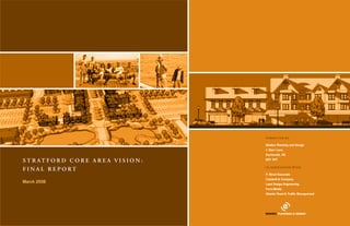
  • 1. submitted by: Ekistics Planning and Design 1 Starr Lane, Dartmouth, NS S t r at f o r d C o r e a r e a v i s i o n : B2Y 4V7 FINA L R e p o r t in association with: P. Wood Associate Cantwell & Company March 2008 Land Design Engineering Form:Media Atlantic Road & Traffic Management
  • 2.
  • 3. C h a p t e r 1 : I n t r o d u c t i o n 1 C h a p t e r 2 : w a t e r f r o n t c o r e a r e a 15 1. Background 1 1. Vision 15 2. The Core Area Imperative 1 2. The Concept 17 3. History of the Town 2 Urban Design Elements 17 4. Planning Context 2 Streetscapes 17 5. Stratford Core Area Vision 3 Gateways 18 table 1: 1991-2001 Charlottetown region growth 4 Open Spaces 18 Chart 2: Stratford 2001 population 4 The North and South WCA 19 Chart 3: Stratford 2001 population 4 The South Waterfront Core Area 19 Chart 4: Stratford 2001 population 4 New Streets 19 6. Demographic Profile of Stratford 4 Residential Blocks 19 Age Distribution 4 Waterfront Greenway Promenade 21 Household Income 4 Waterfront Plaza 21 Stratford Economy 5 Marina 22 Labour Force Participation 5 Waterfront Drive 23 Population Projection 6 Community Park 24 Implications of Growth on the Demand for Housing 6 The North Waterfront Core Area 24 Future Housing Trends. 7 3. Challenges to mplementation I 24 7. Road Network 8 Road and TCH Intersection(s) 24 Traffic Volumes 8 River Infilling and Dredging 25 Context Sensitive Solutions 10 Sewage Treatment lagoon 25 8. Sustainable Development 10 Sewage Treatment Options 26 Building Level 11 Option 1 - Cover the existing lagoons: 26 Site Level 11 Option 2 – Employ a decentralized sewage management approach for new development 26 Planning Level 11 Option 3 - Replace the Lagoons with a Sequencing Batch Reactor (SBR) process 26 9. Sustainability Principles 11 Option 4 – Temporary Upgrade to the Existing Lagoons 27 Ecological Protection 11 Option 5 - Upgrade the Existing Lagoons 27 Stewardship 11 I. Option 6 - Pump effluent to Charlottetown 27 Density 12 Conclusion 27 Diversity 12 4. Branding 27 Resource Efficiency 12 5. Phasing and Implementation 28 Sustainable Transport 12 Phase 1 (estimated completion time - 2-3 years 28 Affordable and Green Housing 13 Phase 1 Next Steps: 28 Pollution Reduction: 13 Phase 2 (estimated completion time - 5 years 29 Distinctiveness: 13 Phase 2 Next Steps: 29 Sufficiency: 13 Phase 3 (estimated completion time - 3-5 years 29 Sewage & Stormwater 13 Phase 3 Next Steps: 29 10. Organization of this Report 13 Phase 4 (estimated completion time - 10 years 30 Phase 4 Next Steps: 30 6. Design Guidelines for the Waterfront Core Area 30 Commercial Mixed Use Area 30 Residential Buildings 31 Signage 31
  • 4. C h a p t e r 3 : t o w n c e n t r e c o r e a r e a 33 C h a p t e r 4 : m a s o n r o a d c o r e a r e a 45 1. Town Centre Core Vision 34 1. Mason Road Core Vision 45 2. Town Centre TCH Intersection 34 2. Mason Road Intersection Options 45 3. The North Town Centre Core 35 Dale Drive Extension 45 The Civic Core 35 Opportunities 45 Additional Institutional Infill 35 Mason Road Extension 46 Town Square 35 Mason Road Realignment 46 Clustered parking 35 3. The Mason Road Core Vision 46 Active Recreation Facilities 36 Mason Road Intersection 46 Connected Greenspace 37 Stopping Sight Distance 47 Residential Land Surrounding The Civic Core 37 Conclusions 47 The new intersection – north gateway corridor 37 Commercial Block 1 48 The Shakespeare Residential Corridor 38 Commercial Block 2 48 Town Core Commercial Cluster 38 Commercial Block 3 48 4. South Town Centre Core Area 39 commercial block 5 50 Town Centre Commercial 39 plant list A 50 Mixed Use Zone 40 Commercial Block 5 50 Drainage Corridor 40 4. Challenges to Implementation 50 Highway Corridor Enhancement Project 40 Highway Intersection 50 5. Challenges to Implementation 40 Servicing 51 Highway Intersection 40 Stormwater Management 51 Servicing 40 Pedestrian Accessibility 51 Stormwater Management 40 Residential Buffering 51 Residential Buffering 40 Environmentally Sensitive Areas 52 6. Phasing and Implementation 41 TCH Corridor Improvements 52 7. Design Guidelines 42 5. Phasing & Implementation 52 Architectural Design Guidelines (single family) 42 6. Design Guidelines 52 Architectural Design Guidelines (Multi-Unit) 42 Architectural Design Guidelines (Multi-Unit) 52 Commercial Design Guidelines 42 Architectural Design Guidelines (Mixed Use) 52 Roof Lines 42 Commercial Design Guidelines 52 Detail Features 42 Roof Lines 52 Commercial Loading & Storage Areas 42 Detail Features 52 Pedestrian Amenities 43 Commercial Loading & Storage Areas 53 Signage Guidelines 43 Pedestrian Amenities 53 Architectural Design Guidelines 43 Signage Guidelines 53 Landscape Guidelines 43 Lighting 53 Landscape Guidelines 53
  • 5. C h a p t e r 5 : s i g n a g e 55 1. Introduction 55 Stratford / Southport Logo 55 Exterior street Banners: Stratford Example 56 Directional Information Signage: Street Blades 56 Community Kiosk: 57 Directional Information Signage: Area Prompts 57 Directional Information Signage: Pictogram Concept 57 civic building signage 58 Park signage 58 2. Signing the Town 59 C h a p t e r 6 : CONC L USION 55 Servicing 61
  • 6.
  • 7. Chapter 1: Introduction 1. Background This report was prepared by Ekistics Planning Design (in As one of Atlantic Canada’s most progressive communities, hidden costs which include: “traffic congestion; loss of association with P Wood & Associates, Cantwell Company, Stratford recognizes the growing importance of sustainable trees, open space and farmland; displaced locally-owned Stratford’s Core Area represents the first point of Atlantic Road & Traffic Management, and LandDesign development in achieving long-term balance for the small businesses; substitution of jobs that support families contact for visitors, a place of commerce and pride for Engineering) between February 2006 and February 2007 community. For this reason, the Vision outlines a variety of with low-paying jobs that do not; air and water pollution; Stratford residents, and the embodiment the Town’s for the Town of Stratford. The report is the second phase of sustainability principles which will form the foundation of dying downtowns with vacant buildings; abandoned shop- civic character. The highway which bisects the Town the Core Area Vision prepared by the Town in 2005. The future development practices in the Town. The sustainability ping centres and the creation of more retail space than the is both an opportunity and a challenge for Stratford. It scope includes the creation of two separate documents; an principles also provide an over-riding rationale for macro local economy can support; a degraded sense of communi- brings thousands of visitors and residents a day through Open Space Plan for the entire Town and a Core Area Vision and micro scale land use decisions and policies to guide ty; placing large burdens on public infrastructure, such as the community (for many, this will be their first and only for the area from the Hillsborough River Bridge to the Mason future growth. It is the intention of the planning team to see sewers and road maintenance; discouraging new business impression), but it also creates a barrier to the north Road Intersection. The Core Area can be divided into several these principles eventually integrated into the official plan development; and sprawl.” and south side of the community. Left unplanned, the ‘nodes’ along the corridor. These include the Waterfront and to become directly reflected in the land use bylaw and Core Area would undoubtedly transition into a long As PEI’s fastest growing community, Stratford is at a Core on both sides of the highway, the Town Core, and the administrative decision making structure of the Town. commercial strip corridor of unbroken parking lots, critical juncture. It can proactively shape the form, mass Mason Road Core. There is an intentional gap between placeless, homogeneous architecture, competing pylon the Waterfront Core Area and the Town Centre Core Area 2. The Core Area Imperative and mix of its Core Area, or like most communities, it signs, and stagnant, engineered highway infrastructure, Since the end of the Second World War, North America can wait until developers shape it for them. For staff and on both sides of the TCH. To the south of the TCH this devoid of trees, people or personality. This has become has seen a significant rise in suburban sprawl. Traditional Council, the latter scenario is not acceptable; and nor area is largely developed and the development character is the reality for most communities in North America who neighborhoods used to be characterized as “mixed use, should it be for any progressive community. well established. The limited available opportunities for lack foresight and vision. As the fastest growing com- pedestrian friendly communities of varied population, either This Vision outlines the Town’s desires for shaping infilling should conform to the character of the surrounding munity on PEI, the fate of the Core Area would be rapid standing free as villages or grouped into towns and cities.” development rather than the new Core Area standards. To its core areas, ranging from a traditional downtown and decisive. As suburban developments spread further from the urban the north of the TCH a high standard of development has waterfront core, to a mixed use Town Hall core to a more The Core Area Vision represents an opportunity to already been established in the PURD area and adjacent core, developers built large retail developments, which have typical big box core. The general message is that there is direct high quality growth, to connect both halves of the lands with developments such as the Andrews’ Senior’s evolved into today’s “big box” stores . Following WW II, room for a wide range of commercial core area types in community across the highway corridor and to create Complex. The balance of these lands should develop in a North America experienced a boom that shifted the economy Stratford, assuming that high quality development can be commercial and residential areas which are unique, compatible manner pursuant to the provisions of the current from a ‘central city-based manufacturing’ economy to a assured and provided that they occur in areas where they desirable and contribute to the character of one of PEI’s development bylaw. Where these two areas abut the new ‘suburban-based service and information’ economy. The are best suited. Individual developments must contribute most desirable communities. This report is a testament to Core Area, a transitional mechanism should be considered to result of this shift was the rise of the suburbs which helped to the greater whole of the Core Area in Stratford, and the foresight of the community and its leaders. assist in integrating new Core Area development standards set the stage for the success of big box retailers by providing they must participate in ‘place making’ at the highest with the existing development character, building styles and new markets in outlying areas. While big box stores boast level. A proactive Core Area Vision is a real imperative for land uses. convenient, one-stop shopping, they are criticized for their Stratford. This document is a response to that imperative. 1 FINA L R e p o r t • MARCH 2 0 0 7
  • 8. 4. Planning Context The Town of Stratford is located immediately to the southeast of the City of Charlottetown, the provincial capital and largest municipality in Prince Edward Island. The Town is situated on a peninsula, bounded by the Hillsborough River, Charlottetown Harbour, Hillsborough Bay and Fullerton’s Marsh. To the south are the communities of Alexandra and Pownal and to the east is the community of Mt. Herbert. While the Town represents a somewhat natural geographic region, the one obvious anomaly is the area often referred to as “Bunbury District”, essentially the area between the former community of Bunbury and Fullerton’s Marsh. During the discussions on municipal amalgamation the Town recommended the incorporation of this area into the new Town boundaries, but this did not occur. Today, this area remains an unincorporated region surrounded by the Town on two sides, and the natural boundary of Fullerton’s Marsh and the Hillsborough River on the other. Image 1: Stratford aerial photo, 1967 Image 2: Stratford aerial photo, 1991 The Town of Stratford is contained within a geographical area that includes 5,230 acres. The Trans 3. History of the Town Canada Highway, connecting the eastern end of the Province to the capital via the Hillsborough Bridge, Several Acadian families originally settled the Stratford Hillsborough Bridge in 1961, the process of municipal Hillsborough River and a western municipality to the bisects the Town from east to west. area in the 1750s. The local economy has traditionally incorporation began as the new bridge vastly improved west of the North River causeway. With this goal in mind The topography and drainage within the Town is been based on agriculture. Other early industries the connection to Charlottetown and spawned the the four communities, through the Waterview Municipal quite diverse. In the northern part of the Town, the include shipbuilding at Fullerton’s Marsh, a shingle rapid growth of suburban development. As Bunbury, Co-operation Committee, made a joint submission to landscape is gently rolling with a poorly differentiated mill, a pasteurizing plant and brick kilns in Keppoch and Southport, Cross Roads and Keppoch-Kinlock the Commission on Municipal Reform. drainage system. The land falls generally from a high Southport. incorporated, co-operation and joint initiatives, such as The technical arguments and the level of co-operation point on Mason Road north toward Fullerton’s Marsh, the Glen Stewart School, provided a solid foundation for displayed by the Committee were sufficient to be west toward the Hillsborough River and south toward Several important institutions in Stratford’s history the eventual amalgamation. adopted in the Commission’s final report, which was Stewarts Cove. There are no prominent streams in this include the Marine Hospital where all ships entering eventually accepted by the Provincial Government. area. the Charlottetown Harbour were required to have In 1993, the Provincial Government issued a passengers examined for smallpox. The first church White Paper on Municipal Reform in the greater On April 1, 1995, the new Charlottetown Area The southern part of the Town has much more diverse was the Cross Roads Christian Church built in 1839 Charlottetown and Summerside Areas. The reform Municipalities Act came into effect and created the topography and a well articulated drainage system with that is still in use and remains one of the Island’s oldest model called for the creation of one large municipality enlarged City of Charlottetown, the Town of Cornwall a number of streams and several prominent ravines. churches. in the Charlottetown area. Given the long standing and the Town of Stratford. The most significant stream system is the Hatchery history of co-operation between the four municipalities Pond system feeding into Stewarts Cove. Several other Ferry Point was the first non-agricultural town The name Stratford was not determined by the Province on the Stratford peninsula and the natural geographic streams are evident in the Keppoch-Kinlock and Cross development as it was point where the ferry crossed but was selected by area residents shortly after the new boundaries of this area, Southport, Bunbury, Cross Roads areas feeding into Hillsborough Bay. to Charlottetown. With the construction of the incorporation was announced. Stratford, which means Roads and Keppoch-Kinlock felt the logical approach The highest point of land in the town is Cable Heights, Hillsborough Bridge in 1905, this transportation link “road over water”, now constitutes the land area of five would see three municipalities formed. The new located in Cross Roads. A significant escarpment and associated commercial focus diminished. previous communities of Bunbury, Southport, Cross communities would include an expanded City of begins in the Keppoch-Kinlock area and runs for Roads, Keppoch-Kinlock and Battery Point. As a result of the construction of the current Charlottetown, a southern municipality south of the 2 FINA L R e p o r t • MARCH 2 0 0 7
  • 9. several miles to the east through Alexandra and Pownal. 5. Stratford Core Area Vision This prominent land feature affords dramatic views to the south overlooking Hillsborough Bay and the In the winter of 2005, Stratford initiated the Core Area Northumberland Strait, and has become a popular Vision process, designed to provide a vision framework location for estate type housing. to inform this more detailed implementation plan. The shoreline of the Town is marked by prominent cliffs Urban Strategies Inc. of Toronto was retained by the in the Keppoch area, which become less pronounced Town to prepare the vision. The framework for the to the north and east. A number of beaches are located vision was prepared over a week-long public symposium along the shoreline, mostly at the mouths of streams and in March 2005. in coves. The long term vision for Stratford includes a “Lake Soils in the region are primarily of the Charlottetown District” that forms the setting for a new office and series and tend to be somewhat heavy. High clay content commercial district to the south of the current municipal in certain areas creates low percolation rates and building. The backbone of the Lake District is a mixed- poses problems for septic tile fields. While soil depth use main street (i.e. a new street south from City Hall is generally good, there are pockets of shallow soils, to the TCH) that is the focus for commercial and civic primarily along the escarpment. A number of shale pits activities and creates a defined arrival to the Town Hall are located in this area. Ground water is of high quality and civic district. An attractive pedestrian oriented and is in generally good supply. main street creates opportunities for social, cultural and economic exchange and a place for new more compact housing forms, small shops, retail and offices. This district can accommodate a future junior high school, sports fields, a multi use recreational facility, and a place of worship. These institutions would create a focus for neighbourhood development which would include detached homes, townhouses and apartments. An attractive public realm, comprised of walkable streets, parks, civic and main street gathering places Urban Strategies’ Core Area Vision Model and trail linkages, provides a clear structure for a mix of uses within the town centre. A radial pattern of streets, celebrations. The marina break wall, boardwalk and While the 2005 Vision report developed a physical model trail, hedgerow and open space connections will be floating waterfront pier will connect people to the water to illustrate the principles of the vision, the vision plan did constructed to connect the new neighbourhoods south and water-based activities. A new park can provide a not account for some of the detailed realities that required of the city Hall district. setting for a public building that would house cultural, significantly more investigation as part of this study. This A new system of green linkages would preserve educational or arts uses. Adjacent to a new waterfront explains why there are differences between the 2005 existing natural features and link the Town Centre and park the new neighbourhood along the shore is arranged vision and this more detailed implementation concept. neighbourhoods to Cotton Park and the waterfront. around an extension of the Town street system. A comprehensive open space system along the shore 1 Andres Duany, Elizabeth Plater-Zyberk, and Jeff Speck, “SUBURBAN Buildings are arranged around small courts and open NATION: THE RISE OF SPRAWL AND THE DECLINE OF THE AMERI- will strengthen Stratford as a waterfront community spaces to create a village like setting at the waterfront. CAN DREAM” (2000) and create a new sense of arrival at the Hillsborough A plaza at the waterfront would make a great setting to Bridge. Trail linkages along the bridge will connect 2 ”Big Box” development refers to stores that range from 90,000 to 250,000 view the activities along the river, fireworks, cruise ship the important public places along the waterfront. square feet, which are typically 20 to 50 times the size of typical downtown movements and the view of Charlottetown. The plaza retailers. Leslie Tucker, Retail Caps for Retail Glut: Smart Growth Tools for The waterfront should be developed to create a is directly connected to the piers and boardwalk. The Main Street, NATIONAL TRUST FOR HISTORICAL PRESERVATION 1 waterfront park, public marina, floating pier, residential (2002) waterfront connects to the south along Glen Stewart and development and commercial activities to support St. John Avenue to the Glen Stewart School and then to 3 Constance E. Beaumont & Leslie Tucker, Big-Box Sprawl; (And How to year round use, water-based recreation and civic the town centre and lake district. Control It), MUNICIPAL LAWYER, 7 (Mar./Apr. 2002). 3 FINA L R e p o r t • MARCH 2 0 0 7
  • 10. 6. Demographic Profile of Chart 2: Stratford 2001 population Chart 3: Stratford 2001 population Chart 4: Stratford 2001 population Stratford Stratford’s population started to grow rapidly after the construction of the new Hillsborough Bridge in 1965. The first large suburban subdivisions were established in the late 1960s and early 1970s. By 1976, there were in excess of 1,000 housing units in the Stratford Area with an estimated population of over 3,400 people. Young families with young children occupied the majority of these new housing units, thereby creating strong demand for new school facilities. In response to this demand, the Glen Stewart School was constructed in 1975, however the continued growth of families in the area rapidly outpaced this new capacity. During the mid 1980s, the pace of growth in the entire Charlottetown region slowed down, but moderate growth rates returned in the late 1980s and continue today. Table 1 provides information on the growth of the This data indicates that the population growth of the The age distribution chart for Charlottetown illustrates Household Income population of the Charlottetown Region from 1991 until province is slowing down, and that a good portion of the several interesting facts. The City contains a large Chart 5 summarizes the 2001 Median Household 2001. growth occurring in the Charlottetown area is the result percentage of youth (aged 20-24) likely attending Income for Stratford, Charlottetown, Cornwall and of intraprovincial in-migration to Queens County from university in Charlottetown, and a large percentage of Prince Edward Island. table 1: 1991-2001 Charlottetown region growth Kings and Prince counties. Within Greater Charlottetown, elderly residents, who are predominantly women. Stratford is the fastest growing community, while Cornwall By contrast, the Town of Cornwall has far fewer elderly Overall, median income levels in Stratford and Cornwall also shows positive population growth. residents than Charlottetown, and even less than are significantly higher than the provincial average, Stratford. Cornwall is similar to Stratford in that it does while those in the Charlottetown are lower. This is Age Distribution not have a large number of university-aged residents, logical, given that both Stratford and Cornwall are but it does have a large percentage of young families bedroom communities for Charlottetown and house a Charts 2, 3, and 4 illustrate the age distribution (from 2001 with children. large proportion of the people employed in the capital. census data) of the populations of Stratford, Charlottetown, Conversely, Charlottetown houses a larger proportion and Cornwall respectively. Not taking into account the natural growth rates (births of less mobile, lower income workers and students, as The chart above illustrates the distribution by age of the and deaths) and in-migration that will occur during the social services and affordable housing they need are 2001 population of the Town of Stratford. When compared the next decade, if this same data is projected forward in ready supply. From 1991 to 2001 the population of Prince Edward to the Province as a whole, or the City of Charlottetown, fifteen years to 2016, the 55 and above cohort (especially Island increased from 129,765 to 135,294; an increase 4 Adapted from Urban Strategies Inc. core area vision for the Town of several observations can be made. First, Stratford has a large 55–69, the active, retired population) will increase of 5,529 people, or a 0.43 % population growth rate per Stratford - A Place at the Centre of Town percentage of its population in the 35-54 age cohort. This dramatically in Stratford; while the 35-44 the age cohort year. During this same period of time, the population of clearly indicates a preference by mature adults and families (currently the largest groups) will decline sharply. the Town of Stratford increased by 887 people, a 1.63% with children to live in Stratford. It should also be noted This increase in the active mature adult and active average annual growth rate, making Stratford the fastest how small the 20-29 age cohort is. This is the age group elderly will require new housing forms that provide growing municipality in the Province. The population that is either in university, or working and probably has just increased accessibility, and amenities and recreational of the City of Charlottetown increased by 704 people, leased their first apartment. Not surprisingly, Charlottetown facilities to meet the needs of these age groups (e.g., although all of this growth occurred during the 1991- sees a much higher percentage of this age group than walking trails, community centres, etc). The continued 1996 period, while the population actually decreased does the surrounding communities, as Charlottetown has increase in the very aged over the next several decades by 286 people during the second five-year period the university, a large employment base, and many urban also means that many more assisted and long-term care (from 1996 until 2001). The population of the Town amenities that appeal to youth. Stratford also has very facilities will be required. This would be a good fit for of Cornwall increased by 359 people from 1991-2001, few residents over 75 years of age, perhaps reflecting the the new Stratford Waterfront development project. about half the rate of the Town of Stratford. availability of hospitals and nursing homes in Charlottetown. 4 FINA L R e p o r t • MARCH 2 0 0 7
  • 11. Chart 6: 2001 occupation by industry sector Chart 5: 2001 Median household income by income type Chart 7: 2001 stratford labour force characteristics Stratford Economy As would be expected, the sectors employing most of Labour Force Participation The Stratford economy is inextricably tied to that of the the Stratford’s population are public administration, Chart 7 presents labour force characteristics for City of Charlottetown, the provincial capital and major health care, retail trade and educational services. Most Stratford, Charlottetown, Cornwall and Prince Edward employment centre. According to the Statistics Canada of these jobs are located in the Charlottetown area; thus, Island based on the 2001 Census. Labour Force Survey, the Charlottetown Labour the local population is employed significantly more Unemployment rates in Stratford are almost 50% Market created 5,175 new jobs from 1995 to 2005, with than the provincial population in public administration lower than those for the Province, while at the same 3,708 of these occurring in the five-year period from and educational services, and less in the traditional time having a higher than average labour participation 2001 to 2005. Much of this growth is occurring in the Island employment sectors of agriculture, fishing, and rate. Again, the Town benefits from its proximity to service sector, however jobs are also being created in manufacturing. Charlottetown, which provides a stable, diversified and manufacturing and agriculture. Future development of Stratford’s core area is expected year-round employment base. Chart 6 provides a breakdown of occupations for to contain a mix of commercial, office, retail and Stratford, Charlottetown, Cornwall and Prince Edward higher density residential uses. Current distribution of Island by employment sector. employment across the sectors would be expected to continue, although job locations would change. The new CGI call centre being built on the Southport lands (Stratford Waterfront) is the first example of an IT sector crossing the river to Stratford, and presents a real growth opportunity for the community to increase, and diversify, its own employment base. 5 FINA L R e p o r t • MARCH 2 0 0 7
  • 12. Chart 8: 1995-2016 stratford population projection Conversely, if a husband or wife dies, the population of Implications of Growth on a town decreases, but the surviving spouse will still need the Demand for Housing a place to live and may chose to continue living in the Before discussing what future types of housing are same home. Other factors that can influence the growth likely to be built in Stratford in the coming decade, it or decline of households include: divorce (creates is instructive to review actual data on housing that was more households); marriage (can reduce the number of built in the last decade. Chart 9 provides information on households as both partners now live together); and the housing starts in the Charlottetown area during the past general state of the economy (i.e., if the economy is not eight years. producing high paying jobs, young adults may chose to come back home and live with their parents). Chart 9: 1999-2006 charlottetown housing starts This process of household formation and contraction can best be expressed by looking at the average household size of a community. As shown on Chart 8, the average household size for the Town of Stratford decreased from 2.87 persons per household in 1996 to 2.39 persons per household in 2006 – a drop of 16% in just a decade. The effect of this demographic shift is that even if the population of the region was flat and did not change during this period, the propensity towards smaller households would have created demand for During the past eight years, the total number of single more housing. family homes built per year in the Charlottetown area For the next decade (2007-2016) the average household has increased from just over 300 per year in 1999 and Population Projection size for the Town of Stratford is projected to continue to 2000, to a peak of 490 homes in 2004. This increase contract, from 2.35 to 2.02, thus continuing to generate in the production of housing has been caused by the Chart 8 provides a population projection for the Town combination of increased household formation and low demand for new homes and apartments, even if the of Stratford that was prepared for the Eastern School interest rates. It is unlikely that this level of housing population of the Town does not change. However, the District by the Town of Stratford. demand will be repeated in the coming decade. projection indicates that the number of households in Chart 8 indicates that the population of the Town of the Town will grow by just over 1,100 people during It should also be noted that the majority of new housing Stratford is projected to increase by 1,239 people during the 10 year period from 2007-2016. This household built in the Charlottetown market is single family the ten-year period from 2007 to 2016 to a total of 8,213 growth will likely occur due to the wide availability of housing, with an average of about 300 homes built per people. During this same period, there are projected good quality land in Stratford that is in close proximity year in 2002-2005. Semi-detached are the second most to be a total of 1,156 new households formed, thus to the City of Charlottetown (i.e., jobs, social and popular housing type with 50 to 90 units built per year. increasing the number of apartments and homes in the cultural amenities), and the potential of the Southport Row or townhouses are becoming more popular, but Town of Stratford from 2,915 to 4,071. waterfront lands that will provide a high quality still only account for 20 to 60 housing starts per year, waterfront environment that is considered desirable by When planning for housing, the important indicator while the market for multi-family housing (apartments many residents. is not population growth per se, but rather household and condominiums) has historically ranged from 15 to formation (or headship rates as they are known in the 80 units per year. housing industry). For example, if the child of a married Chart 10 provides some detailed information on the couple reaches the age of maturity (i.e., 18 years old) and types of housing built in Stratford during the past seven decides to get his/her own apartment, this creates a new years. It is important to note that construction activity household (and hence demand for an apartment) without of the past seven years is not a fool proof predictor of a corresponding change in the population of a town. future activity. For example, if serviced land was not readily available in Stratford for certain housing types during this period (e.g., apartment construction), builders and hence homebuyers likely went elsewhere. 6 FINA L R e p o r t • MARCH 2 0 0 7
  • 13. Chart 10: 1999-2005 stratford housing by type Future Housing Trends. Stratford is widely seen as one of the more affluent housing markets in Charlottetown, with average Multiple Listing Service (MLS) price exceeding those of nearby Charlottetown or Cornwall. In 2005, the average MLS price for Stratford was $153,718, 2% higher than the West Royalty area of Charlottetown and 10% higher than Cornwall ($139,437) and 17% higher than Sherwood East Royalty ($130,138). This affluent market An average of 100 units of housing per year was built in has been an excellent fit for aging baby boomers looking Stratford in 2003-2005. Approximately two thirds of this for move up housing or dream homes, often on large lots housing was single family housing and another 20% was with mature vegetation and views of the river. semi-detached housing; both are low density housing However, during the next decade, there will be a slight options. Row houses are relatively rare, although 19 shift towards housing that is easier to maintain (i.e., were built in 2004 and 2005. Apartment construction is condominiums, apartments and townhouses) which sporadic, although this may have more to do with the lack are typically located in serviced urban areas close to of serviced land that is zoned for this type of development shopping, personal services and health care facilities. activity, than the actual demand. As well, until Stratford The two core areas available for development within the develops its own “urban downtown”, apartment Town of Stratford are both well positioned to capture construction will continue to occur predominantly in this future demand. Although land is not in short supply downtown Charlottetown. in the Charlottetown area, there is a limited amount Chart 11 indicates the market position of Stratford relative of urban waterfront land, and for this reason, the to other communities in the greater Charlottetown area. Southport Motel site should attract a large portion of For example, the first column indicates that Stratford baby boomers looking to downsize. captures 15% to 20% of the market for single family An increased demand for lower maintenance housing housing in the Charlottetown area; this amount increased will increase demand slightly for apartments, steadily from 15% in 1999 to 20% in 2005. condominiums and town homes when compared to historical housing production. Housing affordability Chart 11: 1999-2005 stratford market position will also become more of an issue, and municipalities will be forced to ensure that servicing costs do not get out of hand in order to be competitive relative to their neighbouring communities. One way to achieve these two goals is to increase the amount of medium density housing options provided (i.e., town homes Existing apartments in the Town Core Area in Stratford and apartments/condominiums are cost effective and provide low maintenance). Demand for traditional single family homes will still be strong, but will decline Stratford has a large portion of the market for semi- slightly. The shift is demographics will require more detached housing, with new units in town comprising walking trails and community centres where retired 20% to 50% of al units being built in the local market and/or single elderly residents can socialize. The place. Both row housing and apartments appear to be Town’s Official Plan should take these trends into sporadic, and can fluctuate from zero to 25% and 50% of account and prepare accordingly. the market on a given year. Overall, the Town of Stratford has been capturing a large share of the local housing market and should continue to do so in the near future. 7 FINA L R e p o r t • MARCH 2 0 0 7
  • 14. Hourly volumes for west and east count locations for seven days between July 5 and 11, 2006, are tabulated in Tables A-3A and A-3B, respectively, and average weekday hourly volumes are shown graphically in Figure A-3. During that week, the average weekday volume varied from about 38,500 vpd on the Bridge to about 12,600 vpd east of Georgetown Road. Bridge average hourly volumes varied from 2500 vph during the AM peak hour, to 3300 vph during the PM peak hour, with an average volume of about 2300 vph between the peak hours. Route 1 average hourly volumes east of Georgetown Road varied from 900 vph during the AM peak hour, to 1100 vph during the PM peak hour, with an average volume of about 700 vph between the peak hours. 7. Road Network The Core Area encompasses about three kilometres Traffic Volumes of TCH Route 1 from the east end of the Hillsborough The Core Area section of TCH Route 1 experiences Trans Canada Highway Route 1 bisects the Town of River Bridge to the Mason Road intersection. The among the highest traffic volumes in the Province. The Stratford east-to-west. This section of TCH Route 1 is highway section, with a posted speed limit of 70 km/h, Department of Transportation has obtained traffic counts part of the National Highway System and is considered includes four significant intersections: on the Hillsborough River Bridge annually since 1978. to be of strategic importance to the Province of Prince Edward Island, as well as Government of Canada. This 1. Bunbury Road – partial intersection for movements to Estimated Annual Average Daily Traffic (AADT) volumes highway places Stratford in an advantageous position and from the Hillsborough River Bridge; direct merge are tabulated in Table A-1 and are shown graphically in with immediate access to the Hillsborough River Bridge lane for westbound traffic; left turn lane on TCH Route Figure A-1 represent a seasonally adjusted average daily and Charlottetown to the west and the southeast part 1 for eastbound traffic. volume. Regression analysis indicates that AADT volumes 2. Stratford Road / Hopeton Road – traffic signal control; have been increasing by about 750 vehicles per day per year. of the Province and Wood Islands Ferry to the east. concrete median on TCH Route 1; left and right turn This represents an annual growth rate of about 2.3% based However, there are disadvantages in that the highway lanes; protected left turn phases. on the estimated 2006 AADT volume of 32,000 vpd. If this divides residents, Stratford Town Hall and the Stratford 3. Kinlock Road / Jubilee Road - traffic signal control; Business Park on the north from other residents, growth rate continues, as it is expected to do considering the concrete median on TCH Route 1; left and right turn schools, and principal business areas to the south side proposed Core Area Vision, AADT volumes are projected to lanes; protected left turn phases. of the highway. Collector roads serving the Core Area 4. Mason Road – T-Intersection with STOP sign control; increase to 47,000 vehicles per day over the next 20 years. in the north side of Town include Mason Road, Jubilee left turn lane on TCH Route 1. The Department of Transportation has also obtained several Road / Shakespeare Drive, Hopeton Road and Bunbury traffic counts on TCH Route 1 on the eastern approach to There are also two minor intersections at Clinton Road. Core Area south side collector roads include the Core Area, just east of the Georgetown Road / Stratford Avenue and Dale Drive, between the Kinlock Road / Stratford Road, Keppoch Road, Georgetown Road and Road intersection. Weekday hourly traffic volumes for Jubilee Road and Mason Road intersections. Kinlock Road four different seasons in 2005 are tabulated in Table A-2 and shown graphically in Figure A-2. Weekday volumes varied from about 10,500 vpd in May and November to almost 13,000 vpd during July. If volumes at this location are assumed to increase at the same rate as volumes on the Hillsborough River Bridge, ‘off-season’ weekday volumes are projected to increase to about 15,000 vpd, with ‘peak’ season volumes of about 19,000 vpd, over the next 20 years. 8 FINA L R e p o r t • MARCH 2 0 0 7
  • 15. figure a-2: hourly volumes - route at east georgetown road intersection hourly volumes on route1 for four seasons in 2005 figure a-3: route 1 volumes - july 5-11, 2006 - average weekday hourly volumes table a-3a - route 1 - hillsborough river bridge - july 5-11, 2006 table a-3b - route 1 - east of georgetown road - july 5-11, 2006 days of the week july 5-11, 2006 days of the week july 5-11, 2006 Hour Hour 9 FINA L R e p o r t • MARCH 2 0 0 7
  • 16. Context Sensitive Solutions The CSS process is based on the following tenets: 8. Sustainable Development Sustainability is the root principle for all components Highway design engineers, with the objective of in both the Vision and the Open Space Plan, whether • Balance safety, mobility, community and environmental Sustainable development is defined as “meeting building and maintaining a road network that provides it concerns broad-based elements such as the entire goals in all projects; the needs of the present without compromising safe, convenient, economic and efficient movement of • Involve the public and stakeholders early and waterfront development or minor details such as the ability of future generations to meet their own persons and goods using motor vehicles, have utilized continuously throughout the planning and project the type of lighting suggested for Town streets. The needs.” (Brundtland Commission, 1987). Sustainable traditional highway corridor design for the section of development process; fundamental concept is to create a Core Area Vision development has many objectives including deliberate TCH Route 1 which passes through the Core Area. • Use an interdisciplinary team tailored to project needs; that aims to achieve a sustainable vision for the Town of consideration of how to maintain the quality of the While these objectives are extremely important, in • Address all modes of travel; Stratford for the long-term. Too often, municipal plans environment, human well being, and economic security. recent years it has been recognized that there is a need • Apply flexibility inherent in design standards; and focus on short-term priorities and neglect to consider While some of the larger consequences, such as sea to balance them with walkability, community values, • Incorporate aesthetics as an integral part of good design. important environmental, energy, and development level rise, species extinction and the thinning ozone, sense of place, and quality of life. While the Hillsborough River Bridge has the highest issues that threaten the long-term health and welfare of seem beyond the capacity of local governments to effect volume of any road in the Province, and TCH Route 1 in residents, the natural environment, and essential natural Context Sensitive Solutions (CSS) is a different change, it is at the local level (specifically the municipal the Core Area is part of the National Highway System, resources. approach to the roadway planning and design process. level) that change can be most pronounced. It is a process of balancing the needs of all stakeholders the road section is actually an arterial street through the As noted in the Cardinal Group’s New Urban Agenda , The sustainability principles described in this section and starts in the earliest stages of project development. Town. Comparison of volumes on TCH Route 1 east “Policies may reflect outdated assumptions about urban provide a framework for guiding the implementation of It is also flexible in the application of design controls, of the Core Area with those to the west (Table A3 and and ecological systems. Urban subsystems based on Stratford’s Core Area Vision and Open Space Plan. It guidelines and standards to design a facility that is safe Figure A3) reveals that a large percentage of the high linear processes (in food supply, waste management, also provides a framework for land use decision making for pedestrians and bicyclists as well as for motorized volume on the Hillsborough River Bridge originates transportation, sewerage and water infrastructure) which should be implemented at every scale of planning vehicles. within the Town. Since the Town is a major stakeholder, assume the cheap availability of energy and materials, and design in the town. future planning and design of improvements to TCH rich public treasuries, and the infinite capacity of the A definition for the CSS process used by the Federal Route 1 in the Core Area must adopt the Content ecological sinks that must handle our pollution”. The Highway Administration (FHWA) in the United States Transportation Research Board. 2004. “Context Sensitive Design Around Sensitive Solutions process. aim of this Core Area Vision is to focus on sustainable the Country, Some Examples.” Transportation Research Circular Number indicates that “ Context sensitive solutions (CSS) is a practices that will make Stratford a vibrant, healthy, and E-CO67 - July. Washington, DC: TRB. collaborative, interdisciplinary approach that involves 5 American Association of State Highway and Transportation Officials. 2004c. A Guide for Achieving Flexibility in Highway Design. Washington, Oregon Department of Transportation. 1999. Main Street ... When a viable community for the long-term at the building level, all stakeholders to develop a transportation facility DC: AASHTO. highway runs through it: A Handbook for Oregon Communities. site level and community level. that fits its physical setting and preserves scenic, aesthetic, historic and environmental resources, while American Association of State Highway and Transportation Officials. 1997. 6 http://www.greenroofs.ca/nua/nua.html . New Urban Agenda is a Highway Safety Design and Operations Guide. Washington, DC: AASHTO. new electronic journal that provides analyses of urban problems and maintaining safety and mobility. CSS is an approach that highlights success stories about innovative projects that help to implement considers the total context within which a transportation Transportation Research Board. 2002. NCHRP Report 480: A Guide to Best the United Nation’s Local Agenda 21, a blueprint for urban sustainable improvement project will exist.” Practices for Achieving Context Sensitive Solutions. Washington, DC: TRB. development 10 FINA L R e p o r t • MARCH 2 0 0 7