KIRIBATI- Gone in 60 years
•
3 likes•974 views

- The document discusses the Pacific island nation of Kiribati, which consists of 33 coral atolls and reef islands spread across an area of the central Pacific Ocean straddling the equator. - Kiribati has a population of over 100,000 people and gained independence from the UK in 1979. - However, studies show that surrounding sea levels are rising which threatens the long-term habitability of Kiribati, as the low-lying islands could become uninhabitable within 30-60 years due to inundation and contamination of fresh water supplies from climate change.

Recommended
Recommended
More Related Content
More from vinhbinh2010
More from vinhbinh2010 (20)
Recently uploaded
Recently uploaded (20)
KIRIBATI- Gone in 60 years
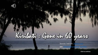
- 1. Kiribati_ Gone in 60 years Sources: Internet , Reuters.com pps: chieuquetoi,vinhbinh, bachkien Click to continue
- 4. American marines assault a Japanese bunker during the Battle of Tarawa, November 1943. Click to continue
- 5. The U.S Marines fought the Japanese on the small island nation of Kiribati in the Pacific Click to continue
- 8. Battle of Tarawa Click to continue
- 10. Kiribati (phát âm /ˈkɪrɨbæs/ ( listen) KIRR-i-bas;[1] Gilbertese: [ˈkiɾibas]), tên chính thức là Cộng hòa Kiribati, là một quốc đảo có khí hậu nhiệt đới nằm ở vùng trung tâm Thái Bình Dương. Nước này có tổng cộng 32 đảo san hô vòng và một đảo san hô cao, chiếm tổng cộng một diện tích khoảng 3.5 triệu kilomet vuông, (1.351.000 dặm vuông) gần rải rác quanh đường xích đạo, và giáp với Đường đổi ngày Quốc tế về phía đông. Cái tên Kiribati là phát âm địa phương của từ "Gilberts", xuất phát từ đảo chính của nước này là Quần đảo Gilbert. Kiribati giành được độc lập từ Anh Quốc vào năm 1979. Nước này là một thành viên thuộc Khối Thịnh vượng chung Anh, Quỹ Tiền tệ Quốc tế và Ngân hàng Thế giới, và trở thành thành viên đầy đủ của Liên hiệp Quốc vào năm 1999. Nguồn : vi.wikipedia.org Kiribati ([kɪribas] kirr-i-bas[4] or ˈkɪrəˈbɑdi;[5] Gilbertese: [ˈkiɾibas]), officially the Republic of Kiribati, is an island nation in the central tropical Pacific Ocean. The permanent population is just over 100,000 (2011),[6] and the nation is composed of 32 atolls and one raised coral island, dispersed over 3.5 million square kilometres, (1,351,000 square miles) straddling the equator, and bordering the International Date Line at its easternmost point. The name Kiribati is the local pronunciation of "Gilberts", derived from the main island chain, the Gilbert Islands, which in turn were named after the British explorer Thomas Gilbert, who discovered them.[7] The capital, South Tarawa, consists of a number of islets connected through a series of causeways, located in the Tarawa archipelago. Kiribati became independent from the United Kingdom in 1979. It is a member of the Commonwealth of Nations, the IMF and the World Bank, and became a full member of the United Nations in 1999. Source: en.wikipedia.org Ribaberiki Kiribati
- 13. Kiribati Presidential_Residence Kiribati Parliament House Kiribati supermarket Bonriki_International_Airport welcome
- 15. • Photographer David Gray spent time documenting life in the Pacific Island nation of Kiribati, a chain of 33 islands that stand just a few feet above sea level, spread over a huge expanse of otherwise empty ocean. Studies show surrounding sea levels are rising, and Kiribati President Anote Tong has predicted his country will likely become uninhabitable in 30-60 years because of inundation and contamination of its fresh water supplies. Nevertheless, while climate change poses a serious longer-term threat, many people now recognise that breakneck population growth is a more immediate problem, particularly for those crowded onto Kiribati's main island of South Tarawa. Read David's personal account here. 35 PHOTOS • Source : www.reuters.com
- 16. North and South Tarawa are seen from the air in the central Pacific island nation of Kiribati May 23, 2013. REUTERS/David Gray
- 17. The wreckage of a ship lies in water near Bikeman Islet, located off South Tarawa in the central Pacific island nation of Kiribati May 25, 2013. REUTERS/David Gray
- 18. A boat being repaired sits on the reef-mud flats of the lagoon located at South Tarawa in the central Pacific island nation of Kiribati May 23, 2013. REUTERS/David Gray
- 19. Young boys cover each other in reef-mud near the village of Ambo located on South Tarawa in the central Pacific island nation of Kiribati May 25, 2013. REUTERS/David Gray
- 20. A woman uses a fork to dig for shellfish on the reef-mud flats of the lagoon located at South Tarawa in the central Pacific island nation of Kiribati May 23, 2013.REUTERS/David Gray
- 21. A dog seeks shade from one mangrove tree as a woman uses a fork to dig for shellfish on the reef-mud flats of the lagoon located at South Tarawa in the central Pacific island nation of Kiribati May 24, 2013. REUTERS/David Gray
- 22. A young boy covered in reef-mud reacts as he stands with other boys in the village of Ambo located on South Tarawa in the central Pacific island nation of Kiribati May 25, 2013. REUTERS/David Gra
- 23. An abandoned house that has been effected by sea-water during high-tides can be seen next to a small lagoon located near the village of Tangintebu on South Tarawa in the central Pacific island nation of Kiribati May 25, 2013. REUTERS/David Gray
- 24. Young children run through the village of Betio on South Tarawa in the central Pacific island nation of Kiribati May 23, 2013. REUTERS/David Gray
- 25. A woman prepares to feed a patient lieing on a bed placed outside due to lack of space at the Nawerewere Hospital on South Tarawa in the central Pacific island nation of Kiribati May 25, 2013. REUTERS/David Gray
- 26. A baby lies on a bed in the maternity ward of the Nawerewere Hospital on South Tarawa in the central Pacific island nation of Kiribati May 25, 2013. Kiribati has the highest infant- mortality rate in the western Pacific, more than five times that of Australia. REUTERS/David Gray
- 27. Members of the congregation stand outside the church on South Tarawa in the central Pacific island nation of Kiribati May 26, 2013. REUTERS/David Gray
- 28. A woman sits atop a grave in a graveyard located near the town of Bairiki on South Tarawa in the central Pacific island nation of Kiribati May 25, 2013. REUTERS/David Gray
- 29. A man sleeps in a hammock above graves in the village of Betio on South Tarawa in the central Pacific island nation of Kiribati May 23, 2013. REUTERS/David Gray
- 30. A girl sits on a log located near her home and next to the roots of a tree that have been exposed as a result of high-tides near the village of Teaorereke on South Tarawa in the central Pacific island nation of Kiribati May 25, 2013. REUTERS/David Gray
- 31. A young girl stands on an old World War II Japanese bunker, that is being used as a pig sty, located next to her home in the village of Betio on South Tarawa in the central Pacific island nation of Kiribati May 23, 2013. REUTERS/David Gray
- 32. A toy bear sits next to a battery storing solar power in the home of Binata Pinata on Bikeman Islet, located off South Tarawa in the central Pacific island nation of Kiribati May 25, 2013. REUTERS/David Gray
- 33. A boy washes himself with water from a well outside his home in the village of Antebuka located on South Tarawa in the central Pacific island nation of Kiribati May 25, 2013. REUTERS/David Gray
- 34. A man lowers a tin into a well to collect water in the village of Betio on South Tarawa in the central Pacific island nation of Kiribati May 23, 2013. REUTERS/David Gray
- 35. Binata Pinata checks the roof of her home as a storm approaches Bikeman Islet, located off South Tarawa in the central Pacific island nation of Kiribati May 25, 2013.REUTERS/David Gray
- 36. Rubbish lies in a dumping ground on South Tarawa in the central Pacific island nation of Kiribati May 26, 2013. REUTERS/David Gray
- 37. A man swims next to a man-made wall built to stop the rising tides located near the village of Eita on South Tarawa in the central Pacific island nation of Kiribati May 26, 2013. REUTERS/David Gray
- 38. A fisherman walks in shallow water near the shoreline near the village of Tangintebu on South Tarawa in the central Pacific island nation of Kiribati May 25, 2013.REUTERS/David Gray
- 39. Newly-made sandbags sit atop the 'Nippon' causeway, so-named after it was financed by Japan, that connects the town of Bairiki and Betio on South Tarawa in the central Pacific island nation of Kiribati May 25, 2013. REUTERS/David Gray
- 40. A local villager wades through a small lagoon that at high-tide laps at the base of homes near the village of Tangintebu on South Tarawa in the central Pacific island nation of Kiribati May 25, 2013. REUTERS/David Gray
- 41. A full moon rises behind a young boy as he stands in the doorway of a store called the 'Sunrise Store' located in the village of Ambo located on South Tarawa in the central Pacific island nation of Kiribati May 25, 2013. REUTERS/David Gray
- 42. A sign misspelling the word Chinese hangs above a restaurant in the village of Ambo located on South Tarawa in the central Pacific island nation of Kiribati May 26, 2013.REUTERS/David Gray
- 43. A boy stands atop an old World War II gun used by the Japanese located near the village of Betio on South Tarawa in the central Pacific island nation of Kiribati May 26, 2013. REUTERS/David Gray
- 44. The huts built by Binata Pinata and her husband Kaibakia can be seen above the tidal mark on Bikeman Islet, located off South Tarawa in the central Pacific island nation of Kiribati May 25, 2013. REUTERS/David Gray
- 45. A boat floats on the lagoon near Bikeman Islet, located off South Tarawa in the central Pacific island nation of Kiribati May 25, 2013. REUTERS/David Gray
- 46. Storm clouds can be seen above the small huts and tower on Bikeman Islet, located off South Tarawa in the central Pacific island nation of Kiribati May 25, 2013.REUTERS/David Gray
- 47. Shifting sands can be seen as Kaibakia Pinata walks from his huts to cast his fishing nets on Bikeman Islet, located off South Tarawa in the central Pacific island nation of Kiribati May 25, 2013. REUTERS/David Gray
- 48. Binata Pinata scales a fish her husband Kaibakia just caught as she sits just off Bikeman Islet, located off South Tarawa in the central Pacific island nation of Kiribati May 25, 2013. REUTERS/David Gray
- 49. Binata Pinata stands atop a rock holding a fish her husband Kaibakia just caught below her on Bikeman Islet, located off South Tarawa in the central Pacific island nation of Kiribati May 25, 2013. REUTERS/David Gray
- 50. A storm approaches as Binata Pinata and her husband Kaibakia walk back to their huts after fishing on Bikeman Islet, located off South Tarawa in the central Pacific island nation of Kiribati May 25, 2013. REUTERS/David Gray
- 51. Abaiang_top_view
- 52. An island country (33 islands) of the west-central Pacific Ocean
- 53. Blue-water fishing with Kim Anderson, Dive Kiribati, Christmas Island, Kiribati
- 54. Fairy Basslet Fish Dart among Blooms of Lettuce Coral near the Phoenix Islands, Kiribati, Micronesia. Paul Nicklen-National Geographic
- 55. Fanning Island , they don't have there phones, electricity, gas,…
- 56. Fanning Island
- 57. Fanning Island
- 58. Kiribati-Island
- 59. Millennium Island, Republic of Kiribati, South Pacific Ocean
- 60. Kiribati-Island Sources: Internet , Reuters.com pps: chieuquetoi,vinhbinh, bachkien