
Recommended
More Related Content
Recently uploaded
Recently uploaded (20)
Featured
Featured (20)
Web quest cyprus
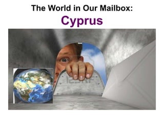
- 1. The World in Our Mailbox: Cyprus
- 2. Your Name _______________________________ Start Date ______________________________ Date Finished _____________________________ Congratulations, Junior Traveler! You are headed to the island of Cyprus.
- 3. Cyprus is an island Do you know what an island is? An island is land that is completely surrounded by water!
- 4. OK! Here we go… These are the things you will do on your journey:
- 5. Challenge #1 Locate the island of Cyprus on a globe (hint: look at the picture on the front of this WebQuest. There is a large country near Cyprus that will help you locate tiny Cyprus on the globe). After you have located it, have your teacher sign your paper copy of this WebQuest.
- 6. Challenge #2 You will go to a website about Cyprus and identify the Cyprus national flag. Then you will draw and color a picture of it.
- 7. Challenge #3 For your third challenge, you will go to a different web page and look carefully at the map found there. You will then identify two countries that are CLOSE to the island of Cyprus.
- 8. Challenge #4 There are many oceans and seas in the world. For this challenge, you will head back to the classroom globe and discover which sea the island of Cyprus sits in. You will even be given a hint to help you on your mission.
- 9. Your journey begins here… So pack your suitcase, grab a camera, and let’s get started!!
- 10. Challenge #1 When you have found the island of Cyprus on the globe, show your teacher and have him or her sign your passport here… ______________________________ Signature
- 11. Great job, Junior Traveler!! You are ready for challenge #2. This challenge will require some internet research. Any good traveler knows that it is a smart idea to find out all you can about your destination before leaving for your trip. So let’s learn some fun stuff about the island of Cyprus!
- 12. Challenge #2 There are two pictures on the Click this link… website. One is a map and the other is the flag of Cyprus. Which • http://travel.nationalgeogr picture do you think is the flag? aphic.com/travel/countries Draw a picture of the flag on your paper copy and color it using your /cyprus-facts/# best effort. Draw your flag here…
- 13. Challenge #3 Click on this link… http://www.worldmapsinfo.com/map-of turkey-europe.html List two countries that are close to the island of Cyprus: 1.____________________________________ 2.___________________________________ Were the two countries that you listed islands like Cyprus? Remember, an island is land that is completely surrounded by water.
- 14. You are almost finished with your journey and ready to head home. There is only one challenge left before you can return to America.
- 15. Here you go… your last challenge! Are you ready?
- 16. Challenge #4 • Go back to the classroom globe. • Now write down the name of the sea that the island of Cyprus is located in (hint: it begins with an upper case M and has a lot of letters in it!). What is it? M ___________________________________
- 17. Now just for fun, go to this web page and look at some great photos of this beautiful island. Do you think you might like to go there for real some day? http://www.visitcyprus.com/wps/portal/multimedia_experience/!ut/p/c5/04_SB8K8xLLM9MSSzPy 8xBz9CP0os3hXN0fHYE8TIwN3A2MDAyNXI2cPE48gA29HQ6B8JG75YCMCusNB9pnFG- AAjgYQeXzmo8hbGHpZAOW9Tb28jEyMDC2M9P088nNT9QtyIwwyA9IVAXSj0hM!/dl3/d3/L2dBISEvZ 0FBIS9nQSEh/
- 18. Conclusion That’s it, Junior Traveler. You did it! You completed all of your challenges, saw some great sights, and now it is time to pack your suitcase and get back on that airplane (or ship) that will take you home.
- 19. During your journey you faced four challenges: • You found the island of Cyprus on the globe and had your teacher sign your passport. • You identified and drew a picture of the flag of Cyprus. • You found two countries on a map that are close to the island of Cyprus. • And lastly, you discovered which sea the island of Cyprus is located in.
- 20. I hope you have enjoyed your journey and learned a thing or two about the island of Cyprus. Until your next WebQuest adventure… Bon Voyage and Happy Learning!!
- 21. This is How Your Work Will Be Evaluated The island of Awesome!! You Almost Got It Keep Working Cyprus 3 2 1 Challenge #1: Nice job using your Junior You got pretty close, but No, you did not find it Locate Cyprus on a globe Traveler skills! You nailed didn’t find the exact and did not keep trying it!! location. until you did find it. Challenge #2: Yep! That is most It SORT OF looks like the You either did not Identify the flag of certainly the flag of flag of Cyprus, but it correctly identify the flag Cyprus and draw a Cyprus. Nice job drawing looks like you hurried of Cyprus or did not take picture of it and coloring it. I can tell through and did not give your time to carefully you took your time and it your best effort draw and color it. Try cared how it looked when giving it more effort next you were finished. time! You correctly identified ONE Challenge #3: You correctly identified Sorry, you did not find country that is close to the Identify two countries TWO countries that are island of Cyprus. two countries that are that are close to Cyprus close to the island of close to the island of Cyprus. Cyprus. Challenge #4 FOUND IT! You wrote You were close… Not even close. Sorry!! Locate the name of the down the correct sea. sea that the island of Great job! Cyprus sits in
- 22. Teacher Talk Intended Grade Level: 1st Grade Is adult supervision required? Yes Inquiry process skills emphasized: * Using both maps and a globe to locate geographical locations. • Learn to use a hyperlink to access information from the Internet. • Learn that each country has its own flag representative of its most notable features.
- 23. • National Curriculum Standards for Social Studies to which this webquest is most closely related: • • How to Use Maps and Other Geographic Representations, Tools, and Technologies to Acquire, Process, and Report Information From a Spatial Perspective. • How to Use Maps and Other Geographic Representations, Tools, and Technologies to Acquire, Process, and Report Information From a Spatial Perspective. • • North Dakota Content Standards and Benchmarks (First Grade): • • 1.5.1. Identify Earth’s geographical landforms (e.g., islands, mountains, • plains, hills, bodies of water). •