SlideShare una empresa de Scribd logo
1 de 32
INTRODUCTION TO PHOTOGRAMMETRY AND
AIR SURVEY
INTRODUCTION TO
PHOTOGRAMMETRY AND AIR
SURVEY
BY
ASSISTANT PROFESSOR NASRUL HAQ.
DEFINITION
• Photogrammetry is defined as the science of
obtaining reliable measurements, by the use
of photographs, in order to determine
characteristics such as size, shape and position
of photographed objects
TECHNIQUES
a. Arial
using photographs taken from the air or from
space with the camera usually pointing
vertically downwards
TECHNIQUES
b. Terrestrial
using photographs taken on the ground with
the camera usually pointing in a horizontal
direction
TECHNIQUES
c. Industrial & Scientific
an adaptation of terrestrial techniques to
small distances, the camera set at any suitable
angle
AIR SURVEY
The term air survey is used to describe survey
techniques using photographs taken from the
air or from the space
A STEREO PAIR OF AERIL
PHOTOGRAPHS
A STRIP OF AERIL PHOTORAPHS
THE BASIC CONCEPT OF
STEREO PLOTTER
THE BASIC CONCEPT OF
STEREO PLOTTER
STEREO PLOTTER
STEREO PLOTTER
STEREO PLOTTER
STEREO PLOTTER
STEREO PLOTTER
STEREO PLOTTER
STEREO PLOTTER
PHOTOGRAPHIC INTERPRETATION
Photographic interpretation is concerned with
the examination of photographs in order to
identify objects, and is an essential part of air
survey
SURVEY APPLICATIONS OF
PHOTOGRAMMETRY
a. Topographical Mapping
– The plotting of map detail and contours is normally
carried out using aerial photogrammetric methods
– These methods are used for both original survey and
revision, and replace classical ground methods
except where the task is so small that flying is
uneconomical
– The technique needs a certain amount of ground
surveyed control, but this requirement is being
continually reduced with the improvement of aerial
triangulation techniques to provide supplementary
control.
– A final Field check is necessary
SURVEY APPLICATIONS OF
PHOTOGRAMMETRY
b. Large Scale Plans
– Large scale surveys can be produced accurately and
quickly by air survey methods, but require more field
checking in addition to the provision of ground
control
– For large tasks, such as road building and major
constructions, air survey methods are quicker and
cheaper than ground methods
– Profiles for determination of earthwork quantities
and other data useful to Civil Engineer may be
simply obtained from the same photographs
SURVEY APPLICATIONS OF
PHOTOGRAMMETRY
c. Cadastral Plans
– Similar advantages may be gained by an air survey for
cadastral purpose as are provided in the production
of large scale plans.
– As the accuracy of the cadastral plan is related to the
value of land, the traditional ground method trends to
be slower, costly but very accurate
– In most cases, the accuracy of a well planned air
survey is sufficient for cadastral purposes, and this
method is used in many countries
– Where boundaries are related to described features,
or land is very valuable, the additional accuracy of
ground survey may be necessary
SURVEY APPLICATIONS OF
PHOTOGRAMMETRY
d. Land use maps
– Air survey techniques may be used not only to
define the extent of an area, but also to identify
its use and measure the yield of a crop
– Forestry is a typical application where, by plotting
the limits of timber and measuring tree heights,
an accurate estimate of yield may be given.
– The use of special films, such as color and infra-
red will provide additional information about the
quality of the crop
SURVEY APPLICATIONS OF
PHOTOGRAMMETRY
e. Hydrographic Maps and Charts
– Air survey techniques are particularly valuable in
the accurate plotting of coastlines, sandbanks and
small islands where the changing tide is a problem
for ground methods
– The use of special film will again add more
information, either by clearly delineating water
limits or by extra penetration in shallow water
SURVEY APPLICATIONS OF
PHOTOGRAMMETRY
f. Exploration and Reconnaissance
– Information may be gained about areas to which
access is restricted by employing air survey
techniques
– In the case of military reconnaissance, a high flying or
unmanned aircraft can obtain photograph that will
provide data for an accurate survey
– For explorers, and area can be mapped before the
first entry, either from photographs obtained by
aircraft as in the case of Moon or Mars, or by specially
equiped satellites
SURVEY APPLICATIONS OF
PHOTOGRAMMETRY
g. Terrestrial, Industrial and Scientific Uses
– Photogrammetry has provided rapid, accurate and
in some cases unique solutions to many non
topographical problems.
– The following are of particular interest
1.Detailed Survey of Historic Buildings
– Precise plans of building facades and architectural
detail may be obtained without direct
measurement by terrestrial photogrammetric
techniques
TERRESTRIAL, INDUSTRIAL AND
SCIENTIFIC USES
2. Traffic Accidents
– Terrestrial methods are also used to record details
of accidents in some countries
– This allows obstructions to be cleared without
delay, the scene being plotted at a later stage
3. Medical Applications
– Short range photogrammetry is in use by doctors
and dentists to define conditions requiring
treatment and also to study the results of
treatment
TERRESTRIAL, INDUSTRIAL AND
SCIENTIFIC USES
4. Analysis of movement
– Tidal and Particle movement may be analyzed by
photogrammetric methods by taking photographs
of the moving surface with a fixed camera
– The stereo model obtained shows vertical “relief”
proportional to the amount of movement
“contours” may be plotted

Más contenido relacionado

La actualidad más candente

Aerial Photogrammetry
Aerial Photogrammetry Aerial Photogrammetry
Aerial Photogrammetry Mujeeb Muji
 
Principle of photogrammetry
Principle of photogrammetryPrinciple of photogrammetry
Principle of photogrammetrySumant Diwakar
 
Lecture 6 vertical photographs
Lecture 6  vertical photographsLecture 6  vertical photographs
Lecture 6 vertical photographsSarhat Adam
 
Topic stereoscopy, Parallax, Relief displacement
Topic  stereoscopy, Parallax, Relief displacementTopic  stereoscopy, Parallax, Relief displacement
Topic stereoscopy, Parallax, Relief displacementsrinivas2036
 
Aerial photogrammetry ppt 2
Aerial photogrammetry ppt 2Aerial photogrammetry ppt 2
Aerial photogrammetry ppt 2Mr Amol Ghogare
 
Elements of Analytical Photogrammetry
Elements of Analytical PhotogrammetryElements of Analytical Photogrammetry
Elements of Analytical PhotogrammetryNadia Aziz
 
Distortions and displacement on aerial photograph
Distortions and displacement on aerial photographDistortions and displacement on aerial photograph
Distortions and displacement on aerial photographchandan00781
 
Introduction to aerial photography and photogrammetry.ppt
Introduction to aerial photography and photogrammetry.pptIntroduction to aerial photography and photogrammetry.ppt
Introduction to aerial photography and photogrammetry.pptsrinivas2036
 
Photogrammetry -Types of Photographs
Photogrammetry -Types of Photographs Photogrammetry -Types of Photographs
Photogrammetry -Types of Photographs prasenjit bhowmick
 
Aerial photogrammetry ppt 1
Aerial photogrammetry ppt 1Aerial photogrammetry ppt 1
Aerial photogrammetry ppt 1Mr Amol Ghogare
 
Height measurement of aerial photograph
Height measurement of aerial photographHeight measurement of aerial photograph
Height measurement of aerial photographvidyasagar university
 
Lecture 1-aerial photogrammetry
Lecture 1-aerial photogrammetryLecture 1-aerial photogrammetry
Lecture 1-aerial photogrammetryVidhi Khokhani
 
Photogrammetry Surveying, its Benefits & Drawbacks
Photogrammetry Surveying, its Benefits & DrawbacksPhotogrammetry Surveying, its Benefits & Drawbacks
Photogrammetry Surveying, its Benefits & DrawbacksNI BT
 

La actualidad más candente (20)

Photogrammetry
PhotogrammetryPhotogrammetry
Photogrammetry
 
Aerial Photogrammetry
Aerial Photogrammetry Aerial Photogrammetry
Aerial Photogrammetry
 
Principle of photogrammetry
Principle of photogrammetryPrinciple of photogrammetry
Principle of photogrammetry
 
Lecture 6 vertical photographs
Lecture 6  vertical photographsLecture 6  vertical photographs
Lecture 6 vertical photographs
 
Photogrammetry 1.
Photogrammetry 1.Photogrammetry 1.
Photogrammetry 1.
 
Topic stereoscopy, Parallax, Relief displacement
Topic  stereoscopy, Parallax, Relief displacementTopic  stereoscopy, Parallax, Relief displacement
Topic stereoscopy, Parallax, Relief displacement
 
Digital photogrammetry
Digital photogrammetryDigital photogrammetry
Digital photogrammetry
 
Historical Development of Photogrammetry
Historical Development of PhotogrammetryHistorical Development of Photogrammetry
Historical Development of Photogrammetry
 
Aerial photogrammetry ppt 2
Aerial photogrammetry ppt 2Aerial photogrammetry ppt 2
Aerial photogrammetry ppt 2
 
Elements of Analytical Photogrammetry
Elements of Analytical PhotogrammetryElements of Analytical Photogrammetry
Elements of Analytical Photogrammetry
 
Stereoscopic Parallax
Stereoscopic ParallaxStereoscopic Parallax
Stereoscopic Parallax
 
Stereoscopic vision
Stereoscopic visionStereoscopic vision
Stereoscopic vision
 
Distortions and displacement on aerial photograph
Distortions and displacement on aerial photographDistortions and displacement on aerial photograph
Distortions and displacement on aerial photograph
 
Introduction to aerial photography and photogrammetry.ppt
Introduction to aerial photography and photogrammetry.pptIntroduction to aerial photography and photogrammetry.ppt
Introduction to aerial photography and photogrammetry.ppt
 
Photogrammetry -Types of Photographs
Photogrammetry -Types of Photographs Photogrammetry -Types of Photographs
Photogrammetry -Types of Photographs
 
Aerial photogrammetry ppt 1
Aerial photogrammetry ppt 1Aerial photogrammetry ppt 1
Aerial photogrammetry ppt 1
 
Height measurement of aerial photograph
Height measurement of aerial photographHeight measurement of aerial photograph
Height measurement of aerial photograph
 
Lecture 1-aerial photogrammetry
Lecture 1-aerial photogrammetryLecture 1-aerial photogrammetry
Lecture 1-aerial photogrammetry
 
Photogrammetry
PhotogrammetryPhotogrammetry
Photogrammetry
 
Photogrammetry Surveying, its Benefits & Drawbacks
Photogrammetry Surveying, its Benefits & DrawbacksPhotogrammetry Surveying, its Benefits & Drawbacks
Photogrammetry Surveying, its Benefits & Drawbacks
 

Similar a Lecture on photogrammetry

chapter19. Terrestrial and Close-Range Photogrammetry.pdf
chapter19. Terrestrial and Close-Range Photogrammetry.pdfchapter19. Terrestrial and Close-Range Photogrammetry.pdf
chapter19. Terrestrial and Close-Range Photogrammetry.pdfssuser3f7a17
 
REMOTE SENSING_TOPIC_II_2023.pptx
REMOTE SENSING_TOPIC_II_2023.pptxREMOTE SENSING_TOPIC_II_2023.pptx
REMOTE SENSING_TOPIC_II_2023.pptxarmanisingh31
 
PHOTOGRAMMETIC SURVEYING
PHOTOGRAMMETIC SURVEYING PHOTOGRAMMETIC SURVEYING
PHOTOGRAMMETIC SURVEYING ADCET, Ashta
 
AERIAL PHOTOGRAMMETRY.pptx
AERIAL PHOTOGRAMMETRY.pptxAERIAL PHOTOGRAMMETRY.pptx
AERIAL PHOTOGRAMMETRY.pptxDayamoySantra
 
UAVmapping_11111.ppt
UAVmapping_11111.pptUAVmapping_11111.ppt
UAVmapping_11111.pptBismaJZ
 
Photogrammetry_nec.pdf
Photogrammetry_nec.pdfPhotogrammetry_nec.pdf
Photogrammetry_nec.pdfUjjwalSubedi8
 
GST - First Class Intro, Unit 1 and Unit 2 Part.pptx
GST - First Class Intro, Unit 1 and Unit 2 Part.pptxGST - First Class Intro, Unit 1 and Unit 2 Part.pptx
GST - First Class Intro, Unit 1 and Unit 2 Part.pptxpoola2015
 
Drone Survey Mapping | Aerial Photography Survey - EpitomeGs
Drone Survey Mapping  | Aerial Photography Survey - EpitomeGsDrone Survey Mapping  | Aerial Photography Survey - EpitomeGs
Drone Survey Mapping | Aerial Photography Survey - EpitomeGsNeerajMudgil1
 
Drone Survey Mapping | Aerial Photography Survey Mapping - Eptiome
Drone Survey Mapping | Aerial Photography Survey Mapping - EptiomeDrone Survey Mapping | Aerial Photography Survey Mapping - Eptiome
Drone Survey Mapping | Aerial Photography Survey Mapping - EptiomeNeerajMudgil1
 
Photographic surveying
Photographic surveyingPhotographic surveying
Photographic surveyingHUSSAINGHAZI1
 
Photogrammetry.pdf
Photogrammetry.pdfPhotogrammetry.pdf
Photogrammetry.pdfBSuresh26
 
L10-AarialPhotography.ppsx
L10-AarialPhotography.ppsxL10-AarialPhotography.ppsx
L10-AarialPhotography.ppsxzulham18
 

Similar a Lecture on photogrammetry (20)

Photogrammetry amir
Photogrammetry amirPhotogrammetry amir
Photogrammetry amir
 
chapter19. Terrestrial and Close-Range Photogrammetry.pdf
chapter19. Terrestrial and Close-Range Photogrammetry.pdfchapter19. Terrestrial and Close-Range Photogrammetry.pdf
chapter19. Terrestrial and Close-Range Photogrammetry.pdf
 
Photographic survey
Photographic survey Photographic survey
Photographic survey
 
PHOTOGRAMMETRY.pptx
PHOTOGRAMMETRY.pptxPHOTOGRAMMETRY.pptx
PHOTOGRAMMETRY.pptx
 
REMOTE SENSING_TOPIC_II_2023.pptx
REMOTE SENSING_TOPIC_II_2023.pptxREMOTE SENSING_TOPIC_II_2023.pptx
REMOTE SENSING_TOPIC_II_2023.pptx
 
PHOTOGRAMMETIC SURVEYING
PHOTOGRAMMETIC SURVEYING PHOTOGRAMMETIC SURVEYING
PHOTOGRAMMETIC SURVEYING
 
photogrammetry.ppt
photogrammetry.pptphotogrammetry.ppt
photogrammetry.ppt
 
AERIAL PHOTOGRAMMETRY.pptx
AERIAL PHOTOGRAMMETRY.pptxAERIAL PHOTOGRAMMETRY.pptx
AERIAL PHOTOGRAMMETRY.pptx
 
UAVmapping_11111.ppt
UAVmapping_11111.pptUAVmapping_11111.ppt
UAVmapping_11111.ppt
 
Photogrammetry_nec.pdf
Photogrammetry_nec.pdfPhotogrammetry_nec.pdf
Photogrammetry_nec.pdf
 
GST - First Class Intro, Unit 1 and Unit 2 Part.pptx
GST - First Class Intro, Unit 1 and Unit 2 Part.pptxGST - First Class Intro, Unit 1 and Unit 2 Part.pptx
GST - First Class Intro, Unit 1 and Unit 2 Part.pptx
 
PHOTOGRAMETRY SURVEY
PHOTOGRAMETRY SURVEYPHOTOGRAMETRY SURVEY
PHOTOGRAMETRY SURVEY
 
3A1_Lecture_1-1-.pdf
3A1_Lecture_1-1-.pdf3A1_Lecture_1-1-.pdf
3A1_Lecture_1-1-.pdf
 
Drone Survey Mapping | Aerial Photography Survey - EpitomeGs
Drone Survey Mapping  | Aerial Photography Survey - EpitomeGsDrone Survey Mapping  | Aerial Photography Survey - EpitomeGs
Drone Survey Mapping | Aerial Photography Survey - EpitomeGs
 
Drone Survey Mapping | Aerial Photography Survey Mapping - Eptiome
Drone Survey Mapping | Aerial Photography Survey Mapping - EptiomeDrone Survey Mapping | Aerial Photography Survey Mapping - Eptiome
Drone Survey Mapping | Aerial Photography Survey Mapping - Eptiome
 
ppt viva.pptx
ppt viva.pptxppt viva.pptx
ppt viva.pptx
 
Photographic surveying
Photographic surveyingPhotographic surveying
Photographic surveying
 
Photogrammetry.pdf
Photogrammetry.pdfPhotogrammetry.pdf
Photogrammetry.pdf
 
Drones.pptx
Drones.pptxDrones.pptx
Drones.pptx
 
L10-AarialPhotography.ppsx
L10-AarialPhotography.ppsxL10-AarialPhotography.ppsx
L10-AarialPhotography.ppsx
 

Más de Waleed Liaqat

The Three Step Writing Process (Technical & Business Writing)
The Three Step Writing Process (Technical & Business Writing)The Three Step Writing Process (Technical & Business Writing)
The Three Step Writing Process (Technical & Business Writing)Waleed Liaqat
 
Nietzsche's Philosophies
Nietzsche's Philosophies Nietzsche's Philosophies
Nietzsche's Philosophies Waleed Liaqat
 
Selected verses from the quran
Selected verses from the quranSelected verses from the quran
Selected verses from the quranWaleed Liaqat
 
Brief Introduction to Architecture
Brief Introduction to ArchitectureBrief Introduction to Architecture
Brief Introduction to ArchitectureWaleed Liaqat
 
Urban Planning Types, Processes and History
Urban Planning Types, Processes and HistoryUrban Planning Types, Processes and History
Urban Planning Types, Processes and HistoryWaleed Liaqat
 
Construction machinery - Associated costs and basic concepts
Construction machinery - Associated costs and basic conceptsConstruction machinery - Associated costs and basic concepts
Construction machinery - Associated costs and basic conceptsWaleed Liaqat
 
Fundamentals of Effective Business Communication
Fundamentals of Effective Business CommunicationFundamentals of Effective Business Communication
Fundamentals of Effective Business CommunicationWaleed Liaqat
 
Introduction to town and Urban planning
Introduction to town and Urban planningIntroduction to town and Urban planning
Introduction to town and Urban planningWaleed Liaqat
 
Brief Introduction to Project Life Cycle And Organizational Structures
Brief Introduction to Project Life Cycle And Organizational StructuresBrief Introduction to Project Life Cycle And Organizational Structures
Brief Introduction to Project Life Cycle And Organizational StructuresWaleed Liaqat
 
Brief Introduction to Project Management
Brief Introduction to Project ManagementBrief Introduction to Project Management
Brief Introduction to Project ManagementWaleed Liaqat
 
Resource Levelling - PMBOK - Example
Resource Levelling - PMBOK - ExampleResource Levelling - PMBOK - Example
Resource Levelling - PMBOK - ExampleWaleed Liaqat
 
Public Health Engineering - Concepts Regarding Water
Public Health Engineering - Concepts Regarding WaterPublic Health Engineering - Concepts Regarding Water
Public Health Engineering - Concepts Regarding WaterWaleed Liaqat
 
Youth and Education in Pakistan
Youth and Education in PakistanYouth and Education in Pakistan
Youth and Education in PakistanWaleed Liaqat
 
LEED 2009 applied to a mixed - use building
LEED 2009 applied to a mixed - use buildingLEED 2009 applied to a mixed - use building
LEED 2009 applied to a mixed - use buildingWaleed Liaqat
 
An Overview of the History of Pakistan: 1947 - 1973
An Overview of the History of Pakistan: 1947 - 1973 An Overview of the History of Pakistan: 1947 - 1973
An Overview of the History of Pakistan: 1947 - 1973 Waleed Liaqat
 
Richter scale and mercalli scale
Richter scale and mercalli scaleRichter scale and mercalli scale
Richter scale and mercalli scaleWaleed Liaqat
 
Key Components of Cost Estimation in construction
Key Components of Cost Estimation in constructionKey Components of Cost Estimation in construction
Key Components of Cost Estimation in constructionWaleed Liaqat
 
Plain Concrete - General concepts
Plain Concrete - General conceptsPlain Concrete - General concepts
Plain Concrete - General conceptsWaleed Liaqat
 
S-curve analysis for development of hydrographs
S-curve analysis for development of hydrographsS-curve analysis for development of hydrographs
S-curve analysis for development of hydrographsWaleed Liaqat
 
Activity on Arrow Diagram
Activity on Arrow DiagramActivity on Arrow Diagram
Activity on Arrow DiagramWaleed Liaqat
 

Más de Waleed Liaqat (20)

The Three Step Writing Process (Technical & Business Writing)
The Three Step Writing Process (Technical & Business Writing)The Three Step Writing Process (Technical & Business Writing)
The Three Step Writing Process (Technical & Business Writing)
 
Nietzsche's Philosophies
Nietzsche's Philosophies Nietzsche's Philosophies
Nietzsche's Philosophies
 
Selected verses from the quran
Selected verses from the quranSelected verses from the quran
Selected verses from the quran
 
Brief Introduction to Architecture
Brief Introduction to ArchitectureBrief Introduction to Architecture
Brief Introduction to Architecture
 
Urban Planning Types, Processes and History
Urban Planning Types, Processes and HistoryUrban Planning Types, Processes and History
Urban Planning Types, Processes and History
 
Construction machinery - Associated costs and basic concepts
Construction machinery - Associated costs and basic conceptsConstruction machinery - Associated costs and basic concepts
Construction machinery - Associated costs and basic concepts
 
Fundamentals of Effective Business Communication
Fundamentals of Effective Business CommunicationFundamentals of Effective Business Communication
Fundamentals of Effective Business Communication
 
Introduction to town and Urban planning
Introduction to town and Urban planningIntroduction to town and Urban planning
Introduction to town and Urban planning
 
Brief Introduction to Project Life Cycle And Organizational Structures
Brief Introduction to Project Life Cycle And Organizational StructuresBrief Introduction to Project Life Cycle And Organizational Structures
Brief Introduction to Project Life Cycle And Organizational Structures
 
Brief Introduction to Project Management
Brief Introduction to Project ManagementBrief Introduction to Project Management
Brief Introduction to Project Management
 
Resource Levelling - PMBOK - Example
Resource Levelling - PMBOK - ExampleResource Levelling - PMBOK - Example
Resource Levelling - PMBOK - Example
 
Public Health Engineering - Concepts Regarding Water
Public Health Engineering - Concepts Regarding WaterPublic Health Engineering - Concepts Regarding Water
Public Health Engineering - Concepts Regarding Water
 
Youth and Education in Pakistan
Youth and Education in PakistanYouth and Education in Pakistan
Youth and Education in Pakistan
 
LEED 2009 applied to a mixed - use building
LEED 2009 applied to a mixed - use buildingLEED 2009 applied to a mixed - use building
LEED 2009 applied to a mixed - use building
 
An Overview of the History of Pakistan: 1947 - 1973
An Overview of the History of Pakistan: 1947 - 1973 An Overview of the History of Pakistan: 1947 - 1973
An Overview of the History of Pakistan: 1947 - 1973
 
Richter scale and mercalli scale
Richter scale and mercalli scaleRichter scale and mercalli scale
Richter scale and mercalli scale
 
Key Components of Cost Estimation in construction
Key Components of Cost Estimation in constructionKey Components of Cost Estimation in construction
Key Components of Cost Estimation in construction
 
Plain Concrete - General concepts
Plain Concrete - General conceptsPlain Concrete - General concepts
Plain Concrete - General concepts
 
S-curve analysis for development of hydrographs
S-curve analysis for development of hydrographsS-curve analysis for development of hydrographs
S-curve analysis for development of hydrographs
 
Activity on Arrow Diagram
Activity on Arrow DiagramActivity on Arrow Diagram
Activity on Arrow Diagram
 

Último

🐬 The future of MySQL is Postgres 🐘
🐬  The future of MySQL is Postgres   🐘🐬  The future of MySQL is Postgres   🐘
🐬 The future of MySQL is Postgres 🐘RTylerCroy
 
The Role of Taxonomy and Ontology in Semantic Layers - Heather Hedden.pdf
The Role of Taxonomy and Ontology in Semantic Layers - Heather Hedden.pdfThe Role of Taxonomy and Ontology in Semantic Layers - Heather Hedden.pdf
The Role of Taxonomy and Ontology in Semantic Layers - Heather Hedden.pdfEnterprise Knowledge
 
Strategies for Unlocking Knowledge Management in Microsoft 365 in the Copilot...
Strategies for Unlocking Knowledge Management in Microsoft 365 in the Copilot...Strategies for Unlocking Knowledge Management in Microsoft 365 in the Copilot...
Strategies for Unlocking Knowledge Management in Microsoft 365 in the Copilot...Drew Madelung
 
How to Troubleshoot Apps for the Modern Connected Worker
How to Troubleshoot Apps for the Modern Connected WorkerHow to Troubleshoot Apps for the Modern Connected Worker
How to Troubleshoot Apps for the Modern Connected WorkerThousandEyes
 
IAC 2024 - IA Fast Track to Search Focused AI Solutions
IAC 2024 - IA Fast Track to Search Focused AI SolutionsIAC 2024 - IA Fast Track to Search Focused AI Solutions
IAC 2024 - IA Fast Track to Search Focused AI SolutionsEnterprise Knowledge
 
How to convert PDF to text with Nanonets
How to convert PDF to text with NanonetsHow to convert PDF to text with Nanonets
How to convert PDF to text with Nanonetsnaman860154
 
The Codex of Business Writing Software for Real-World Solutions 2.pptx
The Codex of Business Writing Software for Real-World Solutions 2.pptxThe Codex of Business Writing Software for Real-World Solutions 2.pptx
The Codex of Business Writing Software for Real-World Solutions 2.pptxMalak Abu Hammad
 
A Call to Action for Generative AI in 2024
A Call to Action for Generative AI in 2024A Call to Action for Generative AI in 2024
A Call to Action for Generative AI in 2024Results
 
Developing An App To Navigate The Roads of Brazil
Developing An App To Navigate The Roads of BrazilDeveloping An App To Navigate The Roads of Brazil
Developing An App To Navigate The Roads of BrazilV3cube
 
The 7 Things I Know About Cyber Security After 25 Years | April 2024
The 7 Things I Know About Cyber Security After 25 Years | April 2024The 7 Things I Know About Cyber Security After 25 Years | April 2024
The 7 Things I Know About Cyber Security After 25 Years | April 2024Rafal Los
 
Boost PC performance: How more available memory can improve productivity
Boost PC performance: How more available memory can improve productivityBoost PC performance: How more available memory can improve productivity
Boost PC performance: How more available memory can improve productivityPrincipled Technologies
 
04-2024-HHUG-Sales-and-Marketing-Alignment.pptx
04-2024-HHUG-Sales-and-Marketing-Alignment.pptx04-2024-HHUG-Sales-and-Marketing-Alignment.pptx
04-2024-HHUG-Sales-and-Marketing-Alignment.pptxHampshireHUG
 
2024: Domino Containers - The Next Step. News from the Domino Container commu...
2024: Domino Containers - The Next Step. News from the Domino Container commu...2024: Domino Containers - The Next Step. News from the Domino Container commu...
2024: Domino Containers - The Next Step. News from the Domino Container commu...Martijn de Jong
 
Data Cloud, More than a CDP by Matt Robison
Data Cloud, More than a CDP by Matt RobisonData Cloud, More than a CDP by Matt Robison
Data Cloud, More than a CDP by Matt RobisonAnna Loughnan Colquhoun
 
CNv6 Instructor Chapter 6 Quality of Service
CNv6 Instructor Chapter 6 Quality of ServiceCNv6 Instructor Chapter 6 Quality of Service
CNv6 Instructor Chapter 6 Quality of Servicegiselly40
 
Raspberry Pi 5: Challenges and Solutions in Bringing up an OpenGL/Vulkan Driv...
Raspberry Pi 5: Challenges and Solutions in Bringing up an OpenGL/Vulkan Driv...Raspberry Pi 5: Challenges and Solutions in Bringing up an OpenGL/Vulkan Driv...
Raspberry Pi 5: Challenges and Solutions in Bringing up an OpenGL/Vulkan Driv...Igalia
 
Kalyanpur ) Call Girls in Lucknow Finest Escorts Service 🍸 8923113531 🎰 Avail...
Kalyanpur ) Call Girls in Lucknow Finest Escorts Service 🍸 8923113531 🎰 Avail...Kalyanpur ) Call Girls in Lucknow Finest Escorts Service 🍸 8923113531 🎰 Avail...
Kalyanpur ) Call Girls in Lucknow Finest Escorts Service 🍸 8923113531 🎰 Avail...gurkirankumar98700
 
Scaling API-first – The story of a global engineering organization
Scaling API-first – The story of a global engineering organizationScaling API-first – The story of a global engineering organization
Scaling API-first – The story of a global engineering organizationRadu Cotescu
 
Neo4j - How KGs are shaping the future of Generative AI at AWS Summit London ...
Neo4j - How KGs are shaping the future of Generative AI at AWS Summit London ...Neo4j - How KGs are shaping the future of Generative AI at AWS Summit London ...
Neo4j - How KGs are shaping the future of Generative AI at AWS Summit London ...Neo4j
 
Driving Behavioral Change for Information Management through Data-Driven Gree...
Driving Behavioral Change for Information Management through Data-Driven Gree...Driving Behavioral Change for Information Management through Data-Driven Gree...
Driving Behavioral Change for Information Management through Data-Driven Gree...Enterprise Knowledge
 

Último (20)

🐬 The future of MySQL is Postgres 🐘
🐬  The future of MySQL is Postgres   🐘🐬  The future of MySQL is Postgres   🐘
🐬 The future of MySQL is Postgres 🐘
 
The Role of Taxonomy and Ontology in Semantic Layers - Heather Hedden.pdf
The Role of Taxonomy and Ontology in Semantic Layers - Heather Hedden.pdfThe Role of Taxonomy and Ontology in Semantic Layers - Heather Hedden.pdf
The Role of Taxonomy and Ontology in Semantic Layers - Heather Hedden.pdf
 
Strategies for Unlocking Knowledge Management in Microsoft 365 in the Copilot...
Strategies for Unlocking Knowledge Management in Microsoft 365 in the Copilot...Strategies for Unlocking Knowledge Management in Microsoft 365 in the Copilot...
Strategies for Unlocking Knowledge Management in Microsoft 365 in the Copilot...
 
How to Troubleshoot Apps for the Modern Connected Worker
How to Troubleshoot Apps for the Modern Connected WorkerHow to Troubleshoot Apps for the Modern Connected Worker
How to Troubleshoot Apps for the Modern Connected Worker
 
IAC 2024 - IA Fast Track to Search Focused AI Solutions
IAC 2024 - IA Fast Track to Search Focused AI SolutionsIAC 2024 - IA Fast Track to Search Focused AI Solutions
IAC 2024 - IA Fast Track to Search Focused AI Solutions
 
How to convert PDF to text with Nanonets
How to convert PDF to text with NanonetsHow to convert PDF to text with Nanonets
How to convert PDF to text with Nanonets
 
The Codex of Business Writing Software for Real-World Solutions 2.pptx
The Codex of Business Writing Software for Real-World Solutions 2.pptxThe Codex of Business Writing Software for Real-World Solutions 2.pptx
The Codex of Business Writing Software for Real-World Solutions 2.pptx
 
A Call to Action for Generative AI in 2024
A Call to Action for Generative AI in 2024A Call to Action for Generative AI in 2024
A Call to Action for Generative AI in 2024
 
Developing An App To Navigate The Roads of Brazil
Developing An App To Navigate The Roads of BrazilDeveloping An App To Navigate The Roads of Brazil
Developing An App To Navigate The Roads of Brazil
 
The 7 Things I Know About Cyber Security After 25 Years | April 2024
The 7 Things I Know About Cyber Security After 25 Years | April 2024The 7 Things I Know About Cyber Security After 25 Years | April 2024
The 7 Things I Know About Cyber Security After 25 Years | April 2024
 
Boost PC performance: How more available memory can improve productivity
Boost PC performance: How more available memory can improve productivityBoost PC performance: How more available memory can improve productivity
Boost PC performance: How more available memory can improve productivity
 
04-2024-HHUG-Sales-and-Marketing-Alignment.pptx
04-2024-HHUG-Sales-and-Marketing-Alignment.pptx04-2024-HHUG-Sales-and-Marketing-Alignment.pptx
04-2024-HHUG-Sales-and-Marketing-Alignment.pptx
 
2024: Domino Containers - The Next Step. News from the Domino Container commu...
2024: Domino Containers - The Next Step. News from the Domino Container commu...2024: Domino Containers - The Next Step. News from the Domino Container commu...
2024: Domino Containers - The Next Step. News from the Domino Container commu...
 
Data Cloud, More than a CDP by Matt Robison
Data Cloud, More than a CDP by Matt RobisonData Cloud, More than a CDP by Matt Robison
Data Cloud, More than a CDP by Matt Robison
 
CNv6 Instructor Chapter 6 Quality of Service
CNv6 Instructor Chapter 6 Quality of ServiceCNv6 Instructor Chapter 6 Quality of Service
CNv6 Instructor Chapter 6 Quality of Service
 
Raspberry Pi 5: Challenges and Solutions in Bringing up an OpenGL/Vulkan Driv...
Raspberry Pi 5: Challenges and Solutions in Bringing up an OpenGL/Vulkan Driv...Raspberry Pi 5: Challenges and Solutions in Bringing up an OpenGL/Vulkan Driv...
Raspberry Pi 5: Challenges and Solutions in Bringing up an OpenGL/Vulkan Driv...
 
Kalyanpur ) Call Girls in Lucknow Finest Escorts Service 🍸 8923113531 🎰 Avail...
Kalyanpur ) Call Girls in Lucknow Finest Escorts Service 🍸 8923113531 🎰 Avail...Kalyanpur ) Call Girls in Lucknow Finest Escorts Service 🍸 8923113531 🎰 Avail...
Kalyanpur ) Call Girls in Lucknow Finest Escorts Service 🍸 8923113531 🎰 Avail...
 
Scaling API-first – The story of a global engineering organization
Scaling API-first – The story of a global engineering organizationScaling API-first – The story of a global engineering organization
Scaling API-first – The story of a global engineering organization
 
Neo4j - How KGs are shaping the future of Generative AI at AWS Summit London ...
Neo4j - How KGs are shaping the future of Generative AI at AWS Summit London ...Neo4j - How KGs are shaping the future of Generative AI at AWS Summit London ...
Neo4j - How KGs are shaping the future of Generative AI at AWS Summit London ...
 
Driving Behavioral Change for Information Management through Data-Driven Gree...
Driving Behavioral Change for Information Management through Data-Driven Gree...Driving Behavioral Change for Information Management through Data-Driven Gree...
Driving Behavioral Change for Information Management through Data-Driven Gree...
 

Lecture on photogrammetry

  • 2. INTRODUCTION TO PHOTOGRAMMETRY AND AIR SURVEY BY ASSISTANT PROFESSOR NASRUL HAQ.
  • 3. DEFINITION • Photogrammetry is defined as the science of obtaining reliable measurements, by the use of photographs, in order to determine characteristics such as size, shape and position of photographed objects
  • 4. TECHNIQUES a. Arial using photographs taken from the air or from space with the camera usually pointing vertically downwards
  • 5. TECHNIQUES b. Terrestrial using photographs taken on the ground with the camera usually pointing in a horizontal direction
  • 6. TECHNIQUES c. Industrial & Scientific an adaptation of terrestrial techniques to small distances, the camera set at any suitable angle
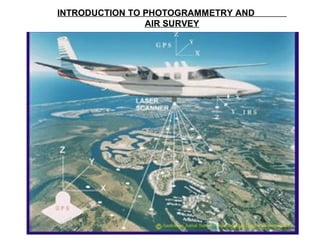
  • 7. AIR SURVEY The term air survey is used to describe survey techniques using photographs taken from the air or from the space
  • 8.
  • 9.
  • 10.
  • 11. A STEREO PAIR OF AERIL PHOTOGRAPHS
  • 12. A STRIP OF AERIL PHOTORAPHS
  • 13. THE BASIC CONCEPT OF STEREO PLOTTER
  • 14. THE BASIC CONCEPT OF STEREO PLOTTER
  • 15.
  • 23. PHOTOGRAPHIC INTERPRETATION Photographic interpretation is concerned with the examination of photographs in order to identify objects, and is an essential part of air survey
  • 24. SURVEY APPLICATIONS OF PHOTOGRAMMETRY a. Topographical Mapping – The plotting of map detail and contours is normally carried out using aerial photogrammetric methods – These methods are used for both original survey and revision, and replace classical ground methods except where the task is so small that flying is uneconomical – The technique needs a certain amount of ground surveyed control, but this requirement is being continually reduced with the improvement of aerial triangulation techniques to provide supplementary control. – A final Field check is necessary
  • 25. SURVEY APPLICATIONS OF PHOTOGRAMMETRY b. Large Scale Plans – Large scale surveys can be produced accurately and quickly by air survey methods, but require more field checking in addition to the provision of ground control – For large tasks, such as road building and major constructions, air survey methods are quicker and cheaper than ground methods – Profiles for determination of earthwork quantities and other data useful to Civil Engineer may be simply obtained from the same photographs
  • 26. SURVEY APPLICATIONS OF PHOTOGRAMMETRY c. Cadastral Plans – Similar advantages may be gained by an air survey for cadastral purpose as are provided in the production of large scale plans. – As the accuracy of the cadastral plan is related to the value of land, the traditional ground method trends to be slower, costly but very accurate – In most cases, the accuracy of a well planned air survey is sufficient for cadastral purposes, and this method is used in many countries – Where boundaries are related to described features, or land is very valuable, the additional accuracy of ground survey may be necessary
  • 27. SURVEY APPLICATIONS OF PHOTOGRAMMETRY d. Land use maps – Air survey techniques may be used not only to define the extent of an area, but also to identify its use and measure the yield of a crop – Forestry is a typical application where, by plotting the limits of timber and measuring tree heights, an accurate estimate of yield may be given. – The use of special films, such as color and infra- red will provide additional information about the quality of the crop
  • 28. SURVEY APPLICATIONS OF PHOTOGRAMMETRY e. Hydrographic Maps and Charts – Air survey techniques are particularly valuable in the accurate plotting of coastlines, sandbanks and small islands where the changing tide is a problem for ground methods – The use of special film will again add more information, either by clearly delineating water limits or by extra penetration in shallow water
  • 29. SURVEY APPLICATIONS OF PHOTOGRAMMETRY f. Exploration and Reconnaissance – Information may be gained about areas to which access is restricted by employing air survey techniques – In the case of military reconnaissance, a high flying or unmanned aircraft can obtain photograph that will provide data for an accurate survey – For explorers, and area can be mapped before the first entry, either from photographs obtained by aircraft as in the case of Moon or Mars, or by specially equiped satellites
  • 30. SURVEY APPLICATIONS OF PHOTOGRAMMETRY g. Terrestrial, Industrial and Scientific Uses – Photogrammetry has provided rapid, accurate and in some cases unique solutions to many non topographical problems. – The following are of particular interest 1.Detailed Survey of Historic Buildings – Precise plans of building facades and architectural detail may be obtained without direct measurement by terrestrial photogrammetric techniques
  • 31. TERRESTRIAL, INDUSTRIAL AND SCIENTIFIC USES 2. Traffic Accidents – Terrestrial methods are also used to record details of accidents in some countries – This allows obstructions to be cleared without delay, the scene being plotted at a later stage 3. Medical Applications – Short range photogrammetry is in use by doctors and dentists to define conditions requiring treatment and also to study the results of treatment
  • 32. TERRESTRIAL, INDUSTRIAL AND SCIENTIFIC USES 4. Analysis of movement – Tidal and Particle movement may be analyzed by photogrammetric methods by taking photographs of the moving surface with a fixed camera – The stereo model obtained shows vertical “relief” proportional to the amount of movement “contours” may be plotted