Wisconsin Land Survey Network
•Descargar como PPTX, PDF•
2 recomendaciones•313 vistas

This document summarizes the Wisconsin Land Survey Network project. It describes the Public Land Survey System used in Wisconsin since the 1830s to divide land into townships, sections, and smaller subdivisions. It outlines the goals of creating an improved statewide dataset of PLSS data by integrating local county data and the existing DNR Landnet dataset where local data is unavailable. The project will follow standards for coordinate system, data model, and deliverables to create a replicable and updatable statewide PLSS dataset.

Recomendados
Recomendados
Más contenido relacionado
Similar a Wisconsin Land Survey Network
Similar a Wisconsin Land Survey Network (20)
Más de Wisconsin Land Information Association
Más de Wisconsin Land Information Association (20)
Último
Último (20)
Wisconsin Land Survey Network
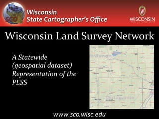
- 1. Wisconsin Land Survey Network A Statewide (geospatial dataset) Representation of the PLSS www.sco.wisc.edu
- 2. Public Land Survey System (PLSS) Rectangular grid system of land description used in Wisconsin: original survey commenced – 1830’s Land is described by location from a principal meridian and baseline. Further division of land into townships, sections, quarter sections, quarter- quarter sections.
- 3. DNR Landnet WDNR, 1990s Derived from USGS 24K topos Statewide inventory of PLSS features Framework for representing WDNR-managed lands Linkage to survey-level data
- 4. County PLSS data is available!
- 5. Coordinate Accuracy Section Corner Comparison: Landnet vs. Outagamie County
- 6. Coordinate Accuracy 740 points used in accuracy analysis Mean distance between Landnet and county corner points: 8.93 m Maximum distance: 84.90 m Minimum distance: 0.19 m
- 10. SCO Project Goals & Objectives Create an improved dataset of statewide PLSS data Improved coordinates in participating counties Integration of Landnet where local data unavailable Replicable data model for statewide data integration Broad access to data Simple update and maintenance process
- 11. SCO Project Requirements NAD83 (1991) Store multiple coordinate values per corner point Select one corner point for map display Preserve Landnet coordinates and IDs (backwards compatibility to Landnet) Accommodate third-level PLSS subdivision (quarter-quarter)
- 12. Requirements (cont.) Persistent point contact information Multiple URL storage per point Topological consistency Storage of external metadata Highly portable deliverables Forward compatibility to national standard
- 13. SCO Project Expectations Phase I: Pilot study using 9 counties Solicit partners and support Finalize data model and data integration procedures Geodatabase of study counties PLSS data Phase II: Statewide coverage (non-PLSS areas – long lots, metes & bounds, etc.) Distribution network (web-mapping application, download)
- 14. Pilot Project Study Area Varied status of remonumentation Abundance of diverse meander features Non-PLSS data Data availability
- 15. What’s in it for you? Updated dataset of PLSS points and polygons in Wisconsin PLSS points with greater accuracy where county data available Robust metadata from county sources Multiple delivery methods (geodatabase, shapefiles, GPS, KML, web-mapping application) Regular update cycle
- 16. Why Are We Here? Your chance to provide comments, critiques, suggestions How would this dataset benefit you? Brief online survey
- 17. PLSSFinder Timothy Kennedy Program Specialist 608-890-3793 ttkennedy@wisc.edu WHAIFinder Brenda Hemstead Data Services Professional 608-263-4371 hemstead@wisc.edu ControlFinder www.sco.wisc.edu
Notas del editor
- Red counties includes county data displayed on PLSS finder and county date we have acquired and are still processing.This initiative was developed to utilize more accurate data that is available to provide a more accurate dataset. 3. To demonstrate why let’s take a look at an accuracy analysis the SCO recently completed where we compared Landnet data to County data.
- 1. A small test was done comparing Landnet section corner locations to Outagamie county corners. 2. Landnet coordinates were from a variety of sources but for the most part these were cartographic sources – maps and data.NOT from survey coordinates.
- Map shows distances < 5 m in orange, > 5 m in red.Points with no Outagamie county point within 100 m are black stars.
- Closeup. Note some position discrepancies.
- 1. Next I would like to discuss the SCO’s internal project goals and objectives
- In defining our goals and objectives we designated several internal project requirements that we wanted to achieve and maintain