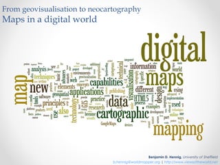
From geovisualisation to neocartography: Maps in a digital world
•
5 likes•3,913 views

Presentation by Benjamin D. Hennig at the first Neocartography Commission session is set to start directly after the Society of Cartographers conference, and will be held from 3-45pm to 7-15pm at University College London on Wednesday 5th September. More at http://www.viewsoftheworld.net/?p=2566

Recommended
Recommended
More Related Content
What's hot
What's hot (20)
Similar to From geovisualisation to neocartography: Maps in a digital world
Similar to From geovisualisation to neocartography: Maps in a digital world (20)
More from Benjamin Hennig
More from Benjamin Hennig (20)
Recently uploaded
Recently uploaded (20)
From geovisualisation to neocartography: Maps in a digital world
- 1. From geovisualisation to neocartography Maps in a digital world Benjamin D. Hennig, University of Sheffield b.hennig@worldmapper.org | http://www.viewsoftheworld.net
- 2. From geovisualisation to neocartography Maps in a digital world I. Geovisualisation II. Mapmakers III. Mapmaking IV. Neocartography?
- 3. Geovisualisation Maps in a digital world
- 4. Geovisualisation Cartography is dead! Location, location, location! ? Cartography as a discipline investigates the methods and understanding of visualising spatial knowledge. Geovisualisation, in contrast, is more widely understood in a far more technical way. I. Geovisualisation II. Mapmakers III. Mapmaking VI. Neocartography? Benjamin D. Hennig Maps in a digital world 1st Session of the ICA Commission on Neocartography. London, 5. September 2012
- 5. GIS, GIScience, Geovisualisation, Geoweb,… I. Geovisualisation II. Mapmakers III. Mapmaking VI. Neocartography? Benjamin D. Hennig Maps in a digital world 1st Session of the ICA Commission on Neocartography. London, 5. September 2012
- 6. Mapmakers Maps in a digital world
- 7. What is a cartographer anyway? I. Geovisualisation II. Mapmakers III. Mapmaking VI. Neocartography? Benjamin D. Hennig Maps in a digital world 1st Session of the ICA Commission on Neocartography. London, 5. September 2012
- 8. What is a cartographer anyway? http://www.cartographymaster.eu I. Geovisualisation II. Mapmakers III. Mapmaking VI. Neocartography? Benjamin D. Hennig Maps in a digital world 1st Session of the ICA Commission on Neocartography. London, 5. September 2012
- 9. Open Data and Data Visualisation US government initiative Data.gov (top left), repository Visualizing.org (top right), individuals’ projects Floatingsheep.org (bottom left) and Flowingdata.com (bottom right) (screenshots taken from Bly 2011, US Government 2011, Yau 2011, Zook et al. 2011) I. Geovisualisation II. Mapmakers III. Mapmaking VI. Neocartography? Benjamin D. Hennig Maps in a digital world 1st Session of the ICA Commission on Neocartography. London, 5. September 2012
- 10. Mapmaking Maps in a digital world
- 11. Evolution of Maps I. Geovisualisation II. Mapmakers III. Mapmaking VI. Neocartography? Benjamin D. Hennig Maps in a digital world 1st Session of the ICA Commission on Neocartography. London, 5. September 2012
- 12. The impact of the Internet Britt, M. & WC (Wikimedia Commons). 2006. Partial map of the internet. http://en.wikipedia.org/wiki/File:Internet_map_1024.jpg I. Geovisualisation II. Mapmakers III. Mapmaking VI. Neocartography? Benjamin D. Hennig Maps in a digital world 1st Session of the ICA Commission on Neocartography. London, 5. September 2012
- 13. Digital Cartography A: Natural Earth geodata repository, B: Colorbrewer map colour guide, C: Typebrewer map typography guide, D: Indiemapper online cartography application (screenshots taken from Kelso & Patterson 2011, Brewer & Harrower 2011, Sheesley 2006, Axis Maps LLC. 2010) I. Geovisualisation II. Mapmakers III. Mapmaking VI. Neocartography? Benjamin D. Hennig Maps in a digital world 1st Session of the ICA Commission on Neocartography. London, 5. September 2012
- 14. Neocartography? Maps in a digital world
- 15. Neogeography “Neogeography combines the complex techniques of cartography and GIS and places them within reach of users and developers.” I. Geovisualisation II. Mapmakers III. Mapmaking VI. Neocartography? Benjamin D. Hennig Maps in a digital world 1st Session of the ICA Commission on Neocartography. London, 5. September 2012
- 16. Neocartography “First there was neogeography, a convenient label for the practice of geography outside of the formally accepted geographical disciplines. A convenient label, but one which caused some controversy and mud slinging with the aforementioned formally accepted disciplines being labelled paleogeography and with a strong emphasis on the pejorative. So it seems almost inevitable that we now have a proposal […] form a commission on neocartography, looking into the practise of making maps outside of the formally accepted cartography profession.” (Gary Gale, http://www.vicchi.org/2011/03/07/after-neogeography-here-comes-neocartography/) I. Geovisualisation II. Mapmakers III. Mapmaking VI. Neocartography? Benjamin D. Hennig Maps in a digital world 1st Session of the ICA Commission on Neocartography. London, 5. September 2012
- 17. Neocartography “Thankfully there’s been no mention of paleocartography yet; it’s to be hoped that with neocartography we look beyond the label to what is trying to be achieved rather than fixating on convenient labels and pigeon-holing concepts.” (Gary Gale, http://www.vicchi.org/2011/03/07/after-neogeography-here-comes-neocartography/) I. Geovisualisation II. Mapmakers III. Mapmaking VI. Neocartography? Benjamin D. Hennig Maps in a digital world 1st Session of the ICA Commission on Neocartography. London, 5. September 2012
- 18. Neocartography “Many examples of new and innovative mapping are being produced outside the normal orbit of existing cartographers or map producers. The term neocartographers is being used to describe map makers who may not have come from traditional mapping backgrounds, and are frequently using open data and open source mapping tools. Another difference is in the blurring of boundaries between map producers and map consumers. The availability of data and tools allows neocartographers to make their own maps, show what they want, and often be the intended audience as well – that is to say they may make the maps for themselves, just because they can. There is a real need for a discipline to be established to study this essentially undisciplined field of neocartography. This new commission tries to stimulate and bring together research in this area.” (http://neocartography.icaci.org/mission-and-aims/) I. Geovisualisation II. Mapmakers III. Mapmaking VI. Neocartography? Benjamin D. Hennig Maps in a digital world 1st Session of the ICA Commission on Neocartography. London, 5. September 2012
- 19. Neocartography…and Geography In a new approach to cartography we should abandon these barriers between the technical side of cartography (which some see as the science of geographical information, or GIScience, with geovisualisation being a part of it), and the aesthetic as well as more conceptual side that many 'traditional' cartographers defend. Contemporary cartography needs to be redefined according to today’s challenges. This is a chance to revive cartography as the main contributor to a new understanding of our world. As early cartographers explained the world centuries ago by discovering previously unknown physical spaces, it is now a necessity to tell the stories of the spaces of humanity. One new role of cartography is to contribute to an understanding of those spaces that we still do not fully understand, and to analyse how these can be visualised. I. Geovisualisation II. Mapmakers III. Mapmaking VI. Neocartography? Benjamin D. Hennig Maps in a digital world 1st Session of the ICA Commission on Neocartography. London, 5. September 2012
- 20. Principles of Digital Mapping I. Geovisualisation II. Mapmakers III. Mapmaking VI. Neocartography? Benjamin D. Hennig Maps in a digital world 1st Session of the ICA Commission on Neocartography. London, 5. September 2012
- 21. Neocartography…and Geography “A lot of cartographers buried their heads in the sand in the 90s, but now we recognise we need to find a better solution to make maps work on screen. The essence of cartography is communication.” (UK Ordnance Survey's head of cartography, Bob Lilley, in an interview with Moss 2007) I. Geovisualisation II. Mapmakers III. Mapmaking VI. Neocartography? Benjamin D. Hennig Maps in a digital world 1st Session of the ICA Commission on Neocartography. London, 5. September 2012
- 22. Thanks for your attention!