
Recomendados
Más contenido relacionado
La actualidad más candente
La actualidad más candente (20)
Similar a Navi mumbai
Similar a Navi mumbai (20)
Último
Último (20)
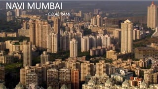
Navi mumbai
- 2. • Formerly Bombay, is the commercial and financial centre of India, with a population of about twelve million at 2010. • Mumbai is built on what was once a set of seven islands: Bombay Island, parel, Mazagaon, mahim, colaba, w orli, and Old Woman's Island(also known as Little Colaba). • The seven islands coalesced into a single landmass by the Hornby Vellard project via large scale land reclamation(1845). • The huge city is growing by many thousand hopeful immigrants from predominantly rural areas each day. • Mumbai‘s particular topography – it is a long, narrow peninsula – meant that the constantly needed extension of the city limits was possible in one direction only, northwards. HISTORY AND NEED FOR NEW CITY
- 3. • Britain‘s efforts as a colonial power 200 years ago were directed at citifying something that was essentially a withdrawn little town because of its outstanding location as a harbor and trading center. • But Bombay did not flourish until 50 years later, when the turmoil of the Civil War cut off American cotton export. So the world focused its interest on Indian cotton, and Bombay became the center for the shipment of goods. • Ultra-fast growth began, the port became the largest in India, and rapid urban expansion created the problem of a housing shortage and a proliferation of emergency accommodation. • The center of Mumbai, now and then, is at the southern end of the peninsula, where commercial life developed and population density and land prices are highest. • The extreme expansion of the urban area to one side of a fixed commercial center created Mumbai‘s major problems of long transport routes. Journeys lasting several hours on express trains had to be accepted if people were to get to work, a state of affairs that eventually reached its natural limits. • Bombay’s population jumped from 1.5 million in the years leading up to the Second World War to 4.5 million in 1964, and was predicted to double by 1984.
- 4. • As early as 1964, Bombay municipality published the draft plan to deal with population growth for next two decades and invited the public comments and suggestions from the public. • Charles Correa with his colleagues Pravina Mehta and Shiresh Patel proposed to the Mumbai city authorities that they should not expand any further northwards, but use an eastern site cut off by a sea bay for urban expansion, with the aim of establishing New Mumbai. • The government did not finally accept this plan until 1970, when it started to buy land east of Mumbai old town. • Large bridges then made it possible to create a direct link with the old centre, so that there was now nothing else in the way of the actual goal of a new commercial centre with a new urban structure. • The City and Industrial Development Corporation (CIDCO) was founded, and Charles Correa headed it as chief architect from 1970 to 1974. • Their aim was to settle at least four million people in New Mumbai, thus containing the spread of further emergency accommodation and creating enough new jobs.
- 5. NAVI MUMBAI - INTRODUCTION • The prominent authors of the twin city concept were Charles Correa (architect and urban designer) , Pravina Mehta(structural engineer) and Shirish Patel(engineer and planner) who presented to the government a proposal in 1964 for constructing new growth centers across Bombay harbor on the mainland. • Navi Mumbai covers an area of 344 sq. km. • The site that was finally chosen was across the harbor from Bombay island. It is a narrow piece of land bounded by the Western Ghat mountain ranges on the north, south and east, and the Arabian Sea on the west. • There were two key aspects to be dealt with: • creating living space and • setting up mass transport systems.
- 6. NAVI MUMBAI – CONCEPT • The success of Navi Mumbai lies in the approach adopted while it’s planning. Considering the massive scale of Navi Mumbai project and to avoid a Mumbai like situation of activity concentration caused by a mono-centric development model, the planners adopted polycentric nodal pattern of development. • The polycentric approach based on principle of decentralization. • It avoids concentration of population, and activities in a particular area rather it works like ‘bunch of grapes’ and focused on decentralization and balance distribution of residential areas, job centers, wholesale markets, non polluting industries and population density and other activities in different nodes / areas of the city. • The pattern ensured balanced land and even distribution of residential areas, job centres, wholesale markets, non-polluting industry and population density. • The 12 self-contained nodal townships are strung along the mass rapid transport corridors, designed to minimise travel time and distance between nodes and neighbouring cities.
- 7. • The conceptual design of Navi Mumbai was developed at a height of modernism, • The principles were • Decentralization by the design of self sufficient townships (nodes). • Residential neighborhoods (sectors) • Single use zoning as opposed to traditional multiple use zoning. • The total area of Navi Mumbai was divided into townships. Each township has several sectors. Many were residential in nature. • Each node was planned to accommodate a range of some income groups. • Ponds were created to accumulate excess run off. • Each node is self-contained for 100,000 to 200,000 people. • The nodes contain residential, commercial, infrastructure and recreational uses. At a larger scale, nodes share some common facilities such as water reservoirs and transport facilities. • Navi Mumbai has the SEZ zone spread over an area of 2,140 Ha across 3 nodes of Navi Mumbai, Functioning as a deemed foreign territory. NAVI MUMBAI – DESIGN PRICIPLES
- 8. MRT CORRIDOR • The structural plan of New Bombay: three linear spines arranged in a pinwheel around the CBD(Central Business District) at one end tied to the regional transport network at the other, anchoring the new city into the surrounding region. • With developments in road, rail, air and water transport, Navi Mumbai is fully equipped to cater the needs of the commuters. • Part of this is the suburban trains that connect to 12 nodes to each other as well as to Mumbai.
- 9. EVOLUTION OF TRANSPORT SYSTEM • The linear pattern of Mumbai is better for a mass transport system because it creates a corridor of demand and thus an efficient bus system. • The system grows with a series of sectors which pop up based on the growth of the specific locality, all mushroomed with bus lines. Thus it also helps in the development of the hinterlands. • With the development of the MRT, there also comes an additional MRT which could help with the further development of the sectors. • With the starting of a simple bus line, gradually a complex network of buses and trains can be built, transgressing the cost/capacity constraints.
- 11. • Airoli Node • Airoli is one of the good nodes developed in initial years by CIDCO(City and Industrial Development Corporation).It was taken up for development during 1983-84. • The main intention of its development to provide housing facilities to the people working. • Airoli is located on northern tip of Navi Mumbai. • This node has good connectivity with Mumbai through Mulund – Airoli bridge. It is also well connected with another city Thane through railway as well as by road. • Ghansoli Node • The development of this node was started around 1993; the focus was to provide affordable housing to the people working in the nearby industries. • Located South of Airoli node. • It is also well connected with another city Thane through railway as well as by road and with Mumbai through Mulund – Airoli bridge. • Kopar Khairane Node • It is adjacent to the industrial area and Vashi. Development of this node was started in 1986. • Kopar Khairane is also known as extended suburb of the Vashi. • The node is well connected by train as well as road. • Located south to Ghansoli. • Vashi Node • Vashi was the first node taken up for development by CIDCO. Often it is called as King of Navi Mumbai. • Vashi is located just across the Thane creek bridge on the mainland. • The development was started immediately after opening of Thane Creek Bridge in 1972. • Vashi is the commercial hub of Navi Mumbai.
- 12. • Sanpada Node • The combine development of Vashi-Sanpada node was started in 1972. • The node is well connected by railway and road. • Sanpada is coming up as better place for business expansion. • Nerul Node • Nerul is the second best developed node after Vashi. It is often called as queen of Navi Mumbai. • The node is predominantly residential node. • The node was taken up for development in 1981. • CBD Belapur Node • This node is located in the heart of the city, so planners decided to make the ‘Central Business District’ of the city in this node. • The north side is exclusively planned for residential use whereas south side is planned for commercial/mercantile/office uses. • Kharghar and taloja Node • Kharghar is the futuristic node of Navi Mumbai it was started developing around 1988-89. • One of the most artistically-designed nodes of Navi Mumbai, with novel concepts, ideas and system forming the cornerstone of the nodes development. • It often termed as Model • Township of the city.
- 13. • Kalamboli and Kamothe Node • Kalamboli is one of the busiest nodes in Navi Mumbai. • Kamothe is one of the developing nodes of Navi Mumbai. It was started developing in 2000. • CIDCO have started developing steel market and warehousing complex by 1979-80 and residential complex by 1982. • This node is also part of Navi Mumbai Special Economic Zone. • New Panvel Node • This is also one of the developing nodes of Navi Mumbai. Development of this node was started in 1975-76. • Panvel is an important railway station on Konkan Railway. • This node is still maintained and managed by CIDCO. • Ulwe • Ulwe node is located on south of CBD Belapur across the creek. Development of this node is already started. • This node is part of Navi Mumbai Special Economic Zone and is adjacent to proposed Navi Mumbai International Airport. • Ulwe is upcoming node of Navi Mumbai and its information till 2010 is not reported. • Dronagiri Node • Dronagiri node is the largest node planned by CIDCO • Due to its topography it is very difficult to develop this node. • Its proximity to the port makes it ideal for port-based industries. • Development of this node was started after 1989. • This node is maintained by CIDCO.
- 14. Typical neighbourhood • This shows how the public transport is used to open up land, making its accessible in desired quantities and locations. • The open green areas and maidans(play grounds) are kept central to neighbourhood with a zone for cottage and other small scale industries on either side of the railway line.