1. CHRISTINA ROONEY
1
El Solitario is Spanish for “hermit” or “loner.”
A Geological
Marvel
The Solitario, in Big
Bend State Park Ranch, is
a structural dome that has
been eroded to expose a
plethora of geologic
information. It is also a
unique formation most
mistake for an impact
site. An exploration of the
area will provide insights
to one of the key
geological features of
west Texas.
Geological Setting
The Solitario is located further west of Big Bend National Park, cradling the boarder of Texas and Mexico. The Big
Bend State Ranch Park is about 300,000 acres along the Rio Grande River. The park has been in existence since
1988 and is managed by the Texas Parks and Wildlife Department in Brewster and Presidio Counties. The desert
region consists of canyons, two mountain ranges, and volcanoes; the mean elevation of the peaks are ~ 4000 feet.
Among these features, there are 65 trails with over 230 miles of desolate, rugged terrain to explore. The desert
climate of the area has created an “on the other side of nowhere” feel to the park. Some of the world’s most adaptive
species of plants and animals call it home. The igneous activity, wealth of ground water, and the primitive
environment of the accommodations create an entirely different scene than that of the nearby Big Bend National
Park. Thus, the Solitario is a complex igneous feature. It is a combination of a caldera and a laccolith, forming
almost a perfect circle with a diameter of 16 km (nearly 10 miles) with a 6 X 2 km caldera (~7.5 miles).
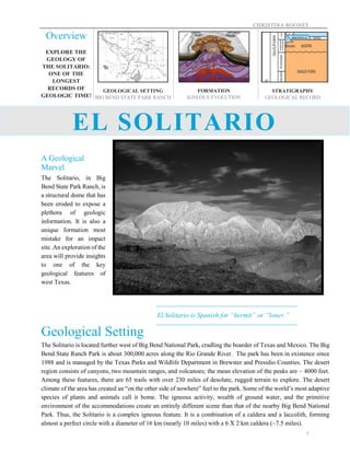
Overview
EXPLORE THE
GEOLOGY OF
THE SOLITARIO:
ONE OF THE
LONGEST
RECORDS OF
GEOLOGIC TIME!
GEOLOGICAL SETTING
BIG BEND STATE PARK RANCH
FORMATION
IGNEOUS EVOLUTION
STRATIGRAPHY
GEOLOGICAL RECORD
EL SOLITARIO
2. CHRISTINA ROONEY
2
Formation
A feature of this complexity was not formed in a single event,
rather over a 1 million year process. A series of predoming sill,
dike intrusion, laccolith, ash-flow eruption, caldera collapse,
sediment infill, more volcanism, and a late intrusion were all
involved in the formation of the laccolith. Fortunate for us, a team
of geologist have already completed the tedious task of recreating
the past. Three phases of magmatism in the Eocene initiated the
formation. Along with the magmatism, the fault of the additional
complexity of the geology goes to the nearby plate tectonic
activity. To begin explaining the origin of the Solitario, the
development of the laccolith and caldera (“lacco-caldera”) will be
clarified.
What is a Lacco-caldera?
A laccolith occurs when magma rises vertically through a dike,
then spreads laterally throughout the sedimentary rock in a sill.
This addition of igneous material then causes a dome-shaped
uplift in which overlying strata are now arched over it.
A caldera is generally defined as a large volcanic crater. Two
methods have been identified to explain their formation: 1) an
explosive volcanic eruption or 2) a collapse of surface rock into
an empty magma chamber.
In Solitario’s case, the second method would explain the lacco-
caldera situation. The three phases of magmatism will further aid
in the explanation of this lacco-caldera phenomena. The petrology
of the Solitario can be identified as silicic to intermediate, as well
as moderately alkalic.
Figure 3. Diagram of the lacco-caldera structure.
Figure 1. Map of the geological setting
of the Solitario.
Figure 4. Nearby tectonic activity of
Texas in relation to the Solitario.
Figure 2. Aerial view of Solitario.
3. CHRISTINA ROONEY
3
Phase I – 36 Ma Prior to doming:
Numerous rhyolitic sills and dikes intruded the Cretaceous and
Paleozoic rocks
Small (~1.5 km diameter) laccolith of porphyritic rhyolite intrudes
Phase II – 35.4 Ma Most voluminous pulse of magmatism activity:
Emplacement of main laccolith dome and intrusion of quartz-
phyric rhyolitic dikes
Ash-flow tuff eruption with vents causes caldera collapse, ends
growth of the dome (~10,000 year period)
o Composition of magma is confirmed by large pumice
fragments (65% SiO2 and high total alkalies), similar to
that of nearby calderas
Phase III – 35 Ma Late intrusions:
Series of small laccoliths and dikes emplaced in and around the
newly formed caldera
Other later dike intrusions in the northern and southern portion of
the caldera; all cut the caldera after its subsidence.
Eocene: division of the geologic
timescale in the Cenozoic Era;
56-33.9 million years ago.
Petrology: a sect of geology that
identifies of origin, distribution,
composition, and structure of
rocks.
Silicic: an igneous rock with at
least 65% silica.
Alkalic: rock richer in sodium
or potassium. Alkaline flows are
seen in the ending stages of
Hawaiian volcanoes, indicating
distance from mantle source,
analogous to the end of a
laccolith formation.
Rhyolite: volcanic rock
composed of felsic (silica-rich)
that is light in color and can have
a range of textures. In this
circumstance it is porphyritic.
Porphyritic: adjective used for
igneous rocks that have crystals
with distinct different sizes.
Quartz-phyric rhyolite: fine-
grained igneous rocks with
mineral crystals (scattered small
quartz megacrysts) undetectable
to the naked eye.
Figure 6. Model of caldera forming in laccolith of the Solitario A) Large, dike-fed
laccolith (5 km thick, ~33 km across) uplifts overlying strata, small lava flows and
tuff eruptions occur causing fractures along the uplifted edges, the magma chamber
is tapped, allowing an ash-flow eruption. B) Result of ash-flow eruption and caldera
collapse (2.5 km). Tuff continues to be deposited as an outflow sheet. C) An
additional influx of magma rises through dikes and intrudes the initial laccolithic
magma chamber, this uplifts the caldera ~ 2 km.
Definitions
Figure 5. The Southwest flank of
the Solitario, the erosional
processes and collapsed caldera
give the dome an exceptionally rare
appearance.
4. CHRISTINA ROONEY
4
Stratigraphy
Due to the intricate formation of the Solitario, the stratigraphy of the
area has chronicled a variety of igneous activity seen in the
developmental stages of the eroded dome structure we see today. To
further add to the chaos, three nearby orogenies had a slight role in
the altering positions and settlement of the geological record (Figure
4). Geologist consider the Solitario a geological marvel because it
holds one of the longest depositional time spans known. The
Paleozoic rock in Solitario represents 240 million years, with only
one discontinuity of ~ 30 million years during the Silurian. Another
notable feature of the Solitario stratigraphy is the 14 different and
mappable volcanic rocks in and round the dome. The rocks exposed
in the eroded dome span from Cambrian through the Quaternary. In
the core of the dome, the oldest rocks are Cambrian to
Pennsylvanian. These rocks have a depositional environment of an
ocean basin, therefore are clastic, silicic, and carbonate sedimentary
in character. The Cambrian to Ordovician is denoted by a thin
sequence of sedimentary rocks deposited in a deep to shallow marine
environment with shale, sandstone, chert, and limestone. An
interesting feature lies in the Ordovician shale, indicating a change
of energy and environment. The shale contains blocks of other rocks
that are olistoliths (chaotic mass or heterogeneous material). The
overlying Cretaceous rocks are clastic and carbonate shallow marine
deposits that collected in a deep basin in relation to the rifting that
formed the Gulf of Mexico. The upper sequence can be described as
mass limestone with marl alternating with shale deposits, evidence
of intertidal to subtidal environments. Differences in the Solitario’s
lithology has allowed geologist to obtain an idea of the changing
climatic conditions of the region.
Tectonic Effects
In three separate orogenies, the Solitario region has been effected in various ways. First, the linkage to the missing
Silurian rocks have been caused by the Llanorian Orogeny. This caused a slight uplift and tilt, which may have led
to quicker erosion rates, erasing that depositional period. The next deformation was caused by the Ouachita Orogeny
which began effecting the region from the Middle Pennsylvanian until the Early Permian. The previously mentioned
Paleozoic rocks were severely deformed through folding, the development of nappes (large thrust sheet that has
been moved ~1-3 miles from its original location), as well as multiple thrust faults on both a local and regional
scale. Near the end of the Cretaceous, the Laramide Orogeny was deforming North America from Canada to the
northern portions of Mexico. This orogeny is responsible for mountain building in parts of Montana, Wyoming, as
well as Colorado. The effects on the Solitario region were uplift and an eastward migration, this compression is
evident with the presence of stylolites (Figure 8) in the Cretaceous rock found on the rim of the dome.
Figure 7. Geological Time Scale
Figure 8. Stylolite – black lines are caused
from mineral material removed by pressure
dissolution. Evidence of tectonic activity.
Figure 9. Exposed Rhyolite sill with columnar
jointing, located on Eastern flank of Solitario.
Figure 10. Flanks of Solitario, indicating the
geological complexity with erosion, folding,
and uplift.