WVWA Presentation on the Permian Highway Pipeline
•Download as PPTX, PDF•
1 like•9,218 views

This is a presentation given by the Wimberley Valley Watershed Association to the Wimberley City Council on March 11th. This presentation is a collection of scientific data and maps showing the possible negative impacts of the Permian Highway Pipeline to our environment, our safety, our tourism economy, our landowner rights and property values. These slides show the Pipeline route overlaid on top of our existing karst features, endangered species habitat, water wells, aquifers, and highly populated areas.

Recommended
Recommended
More Related Content
What's hot
What's hot (20)
Similar to WVWA Presentation on the Permian Highway Pipeline
Similar to WVWA Presentation on the Permian Highway Pipeline (20)
Recently uploaded
Recently uploaded (20)
WVWA Presentation on the Permian Highway Pipeline
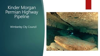
- 1. Kinder Morgan Permian Highway Pipeline Wimberley City Council
- 4. • Avoid the senstive topography and aquifers of the Hill Country • Avoid population density and growth • Are within 30 miles of the current pipeline length Alternate Routes
- 24. Springs
- 26. • Avoid the senstive topography and aquifers of the Hill Country • Avoid population density and growth • Are within 30 miles of the current pipeline length Alternate Routes
- 27. Explosions, Leaks & Evacuations For the Permian Highway Pipeline, the evacuation zone is a 1.4 mile diameter from the line. Fire supression contaminants will enter the aquifer and contaminate groundwater in an event such as this.
- 28. New Mexico: Dec. 2018 250,000 gal. Of gasoline were spilled into an agricultural ditch 168,000 gal. Were recovered 82,000 gal. Lost How much oil, gas, and other hydrocarbons would we lose in our karst aquifers?
- 30. Questions & Concerns Has KM estimated the number of karst features? What are the construction methods to eliminate potential impacts to karst features? Will KM develop a void mitigation plan? Will background water-quality sampling of wells be conducted? Will the pipeline be double-walled? Will KM conduct ongoing sampling of Trinity & Edwards Aquifer wells for possible pipeline contaminants? What liquids might be in the pipeline and how much could be released if a leak or spill occurs? Will KM notify GCDs if pipeline switches from transporting natural gas to crude or other liquid? What resources will be in place to respond in the event of a leak/contamination? In the event of drinking water contamination, what actions will be taken to protect water users?
Editor's Notes
- The Kinder Morgan pipeline is slated to come through the Texas Hill Country, where we have one of the largest and most sensitive karst aquifers in the world. Caverns such as this can be found throughout the region.
- This map highlights the current projected route by Kinder Morgan...
- When viewed from the perspective of population density, we can see that this route will put the line right in between Austin and San Antonio, in the middle of one of the fastest growing regions in the nation.
- On this map, we highlight two alternate routes that have comparable lengths to the current route – both are less than 460 miles long and would avoid the Hill Country altogether. We as a community deserve to know if Kinder Morgan has in fact selected the "best possible route" and hope they will conduct an environmental impact study for this route. The Hill Country is one of the most sensitive and most beautiful places in our entire state; this is not the place for a pipeline.
- From this perspective, we can see how it cuts through the contributing zone of the Edwards Aquifer, Cypress Creek Watershed, Slaughter Creek Watershed, through the Rechargze Zone, and then the Artesian Zone.
- A cross section of the Aquifer highlighting the various ways that water travels through the Drainage area into the Artesian zone.
- Bigote Swallet (Onion Creek Basin) Saunders Swallet (Blanco Basin)
- Through continual study of our aquifers, we've learned about how the water flows beneath our feet. We've learned that during times of drought, the flows from the Blanco River actually make their way up to Barton Springs; during times of regular flows, the Blanco River supplies water to the San Marcos Springs. With a pipeline coming right through the Blanco River Watershed, it is highly likely that both the San Marcos Springs and Barton Springs will be impacted by increased sedimentation and/or altered flows.
- On this map, we can see that this line cuts right through the Pleasant Valley Spring Conservation Area (which provides flow the Blanco River); the Cypress Creek Conservation area; and the Fer nBank Springs Conservation area. Each of these are pristine, clear waterways that will be directly impacted if this pipeline follows this course.
- Here we have multiple view points: aquifer recharge zones, karst areas, spring buffers, and water qaulity buffers in the region.
- Regional conservation groups have worked to conserve hundreds of acres across the Hill Country for wildlife, watershed protection, and native plant restoration. We can see how close and how often the projected route comes to these tracts of land.
- We saw this happen recently at Barton Springs, when a well was dug within the recharge zone for the springs.
- All of these blue dots are known artesian springs in the region – this does not include the ephemeral springs or private springs that are on private property. Again, the excavation and construction of this line will do insurmountable damange to these water features.
- This map features the projected route and all of the public and private water wells that will be in the vicinity. Out here in the Hill Country, many of us depend on water wells for our homes, this pipeline could alter the pressure and water quantity of the wells in the pathway.
- On this map, we highlight two alternate routes that have comparable lengths to the current route – both are less than 460 miles long and would avoid the Hill Country altogether. We as a community deserve to know if Kinder Morgan has in fact selected the "best possible route" and hope they will conduct an environmental impact study for this route. The Hill Country is one of the most sensitive and most beautiful places in our entire state; this is not the place for a pipeline.