SlideShare una empresa de Scribd logo
1 de 14
Nick Jones and Alexandra Gioutsou
Improving the Environment Agency’s
Incident Response
Nick Jones
Incident Management Digital Strategy Lead
Alexandra Gioutsou
GIS Analyst (Mapping and Visuals Officer
Lead)
Background
Incident Response – 2015/16
Incident Response – 2018
Over the past year user numbers have steadily increased as we went from a pilot to a beta and
now onto a production system…
235+
EA office-based staff (Mapping and
Visuals Officers)
2200+
EA field-based staff trained to use the
Collector App
IM Portal
Mapping and Visuals Officers (MAVOs)
Planning
During
Recovery
Planned
activity
Property
at risk
Drone
operation
Impact
and scale
Live
video
Live field
data
Summary
maps
Recovery
activity
Community
engagement
Easter Rain Event (31st March to 9th April 2018)
712
Collector for ArcGIS logins
49
Field based staff collecting
data
Points of data
captured
227
560+
Pictures and videos
captured
5
Drone deployments –
Yorkshire and Thames areas
9
Area teams involvedPoints tagged as
suitable for external
communication
64%
Flood outlines recorded (0 properties
within these outlines)
3
11
More visual information than ever before
Combining Drones and Collector data…
The Future
13
Thank you
14

Más contenido relacionado

La actualidad más candente

Use Cases for Digitizing and Digitalizing Oil & Gas
Use Cases for Digitizing and Digitalizing Oil & GasUse Cases for Digitizing and Digitalizing Oil & Gas
Use Cases for Digitizing and Digitalizing Oil & GasSatish Penmetsa
 
Designing a Language for Spatial Computing
Designing a Language for Spatial ComputingDesigning a Language for Spatial Computing
Designing a Language for Spatial ComputingAndrea Ballatore
 
GWT 2014: Emergency Conference - 03 la gestione del processo di acquisizione ...
GWT 2014: Emergency Conference - 03 la gestione del processo di acquisizione ...GWT 2014: Emergency Conference - 03 la gestione del processo di acquisizione ...
GWT 2014: Emergency Conference - 03 la gestione del processo di acquisizione ...Planetek Italia Srl
 
Integrating sanitary televising data with utility gis data within the city of...
Integrating sanitary televising data with utility gis data within the city of...Integrating sanitary televising data with utility gis data within the city of...
Integrating sanitary televising data with utility gis data within the city of...Wisconsin Land Information Association
 
ArcGIS GeoEvent Extension for Server
ArcGIS GeoEvent Extension for ServerArcGIS GeoEvent Extension for Server
ArcGIS GeoEvent Extension for ServerEsri
 
BIMstorm Overview - 31 Slides
BIMstorm Overview - 31 SlidesBIMstorm Overview - 31 Slides
BIMstorm Overview - 31 SlidesMike Bordenaro
 
IMGS Geospatial User Group 2014: Point Cloud Data in IMAGINE 2014
IMGS Geospatial User Group 2014: Point Cloud Data in IMAGINE 2014IMGS Geospatial User Group 2014: Point Cloud Data in IMAGINE 2014
IMGS Geospatial User Group 2014: Point Cloud Data in IMAGINE 2014IMGS
 
Klipfolio - Your Swiss Knife on data
Klipfolio - Your Swiss Knife on dataKlipfolio - Your Swiss Knife on data
Klipfolio - Your Swiss Knife on dataHumix
 
Expo 2010 - Presentation map table
Expo 2010 - Presentation map tableExpo 2010 - Presentation map table
Expo 2010 - Presentation map tablegrenzeloosduurzaam
 
S.1.4 Model for Energy Map Calculation
S.1.4 Model for Energy Map CalculationS.1.4 Model for Energy Map Calculation
S.1.4 Model for Energy Map CalculationSUNSHINEProject
 
S.3.4 Security and Privacy
S.3.4 Security and PrivacyS.3.4 Security and Privacy
S.3.4 Security and PrivacySUNSHINEProject
 
Geoverse Case Study: Using LiDAR to perform statewide inventory of sign assets
Geoverse Case Study: Using LiDAR to perform statewide inventory of sign assetsGeoverse Case Study: Using LiDAR to perform statewide inventory of sign assets
Geoverse Case Study: Using LiDAR to perform statewide inventory of sign assetsMerrick & Company
 
nCOVID-19 pivot-and-fan map
nCOVID-19 pivot-and-fan mapnCOVID-19 pivot-and-fan map
nCOVID-19 pivot-and-fan mapAndrew Zolnai
 
Rule-Driven, Fully-Configurable Asset Tracking with GIS
Rule-Driven, Fully-Configurable Asset Tracking with GISRule-Driven, Fully-Configurable Asset Tracking with GIS
Rule-Driven, Fully-Configurable Asset Tracking with GISSSP Innovations
 
ODSC Europe: Weather and Climate Data: Not Just for Meteorologists
ODSC Europe: Weather and Climate Data: Not Just for MeteorologistsODSC Europe: Weather and Climate Data: Not Just for Meteorologists
ODSC Europe: Weather and Climate Data: Not Just for MeteorologistsMargriet Groenendijk
 

La actualidad más candente (20)

Use Cases for Digitizing and Digitalizing Oil & Gas
Use Cases for Digitizing and Digitalizing Oil & GasUse Cases for Digitizing and Digitalizing Oil & Gas
Use Cases for Digitizing and Digitalizing Oil & Gas
 
Ajay vemuru spirent
Ajay vemuru spirentAjay vemuru spirent
Ajay vemuru spirent
 
Designing a Language for Spatial Computing
Designing a Language for Spatial ComputingDesigning a Language for Spatial Computing
Designing a Language for Spatial Computing
 
GWT 2014: Emergency Conference - 03 la gestione del processo di acquisizione ...
GWT 2014: Emergency Conference - 03 la gestione del processo di acquisizione ...GWT 2014: Emergency Conference - 03 la gestione del processo di acquisizione ...
GWT 2014: Emergency Conference - 03 la gestione del processo di acquisizione ...
 
What if
What ifWhat if
What if
 
Integrating sanitary televising data with utility gis data within the city of...
Integrating sanitary televising data with utility gis data within the city of...Integrating sanitary televising data with utility gis data within the city of...
Integrating sanitary televising data with utility gis data within the city of...
 
ArcGIS GeoEvent Extension for Server
ArcGIS GeoEvent Extension for ServerArcGIS GeoEvent Extension for Server
ArcGIS GeoEvent Extension for Server
 
2015 on Spatial Development (Personal Projects)
2015 on Spatial Development (Personal Projects)2015 on Spatial Development (Personal Projects)
2015 on Spatial Development (Personal Projects)
 
BIMstorm Overview - 31 Slides
BIMstorm Overview - 31 SlidesBIMstorm Overview - 31 Slides
BIMstorm Overview - 31 Slides
 
IMGS Geospatial User Group 2014: Point Cloud Data in IMAGINE 2014
IMGS Geospatial User Group 2014: Point Cloud Data in IMAGINE 2014IMGS Geospatial User Group 2014: Point Cloud Data in IMAGINE 2014
IMGS Geospatial User Group 2014: Point Cloud Data in IMAGINE 2014
 
Klipfolio - Your Swiss Knife on data
Klipfolio - Your Swiss Knife on dataKlipfolio - Your Swiss Knife on data
Klipfolio - Your Swiss Knife on data
 
Expo 2010 - Presentation map table
Expo 2010 - Presentation map tableExpo 2010 - Presentation map table
Expo 2010 - Presentation map table
 
Stevens Point Utility GIS
Stevens Point Utility GISStevens Point Utility GIS
Stevens Point Utility GIS
 
S.1.4 Model for Energy Map Calculation
S.1.4 Model for Energy Map CalculationS.1.4 Model for Energy Map Calculation
S.1.4 Model for Energy Map Calculation
 
S.3.4 Security and Privacy
S.3.4 Security and PrivacyS.3.4 Security and Privacy
S.3.4 Security and Privacy
 
Geoverse Case Study: Using LiDAR to perform statewide inventory of sign assets
Geoverse Case Study: Using LiDAR to perform statewide inventory of sign assetsGeoverse Case Study: Using LiDAR to perform statewide inventory of sign assets
Geoverse Case Study: Using LiDAR to perform statewide inventory of sign assets
 
nCOVID-19 pivot-and-fan map
nCOVID-19 pivot-and-fan mapnCOVID-19 pivot-and-fan map
nCOVID-19 pivot-and-fan map
 
Air Quality Map
Air Quality MapAir Quality Map
Air Quality Map
 
Rule-Driven, Fully-Configurable Asset Tracking with GIS
Rule-Driven, Fully-Configurable Asset Tracking with GISRule-Driven, Fully-Configurable Asset Tracking with GIS
Rule-Driven, Fully-Configurable Asset Tracking with GIS
 
ODSC Europe: Weather and Climate Data: Not Just for Meteorologists
ODSC Europe: Weather and Climate Data: Not Just for MeteorologistsODSC Europe: Weather and Climate Data: Not Just for Meteorologists
ODSC Europe: Weather and Climate Data: Not Just for Meteorologists
 

Similar a The Environment Agency - Improving Incident Response - Collaborative Working - Esri UK Annual Conference 2018

GIS Ireland 2014 - Dynamic GIS - Ciaran Kirk
GIS Ireland 2014 - Dynamic GIS - Ciaran KirkGIS Ireland 2014 - Dynamic GIS - Ciaran Kirk
GIS Ireland 2014 - Dynamic GIS - Ciaran KirkIMGS
 
Technology and "Big Data" in Mines
Technology and "Big Data" in MinesTechnology and "Big Data" in Mines
Technology and "Big Data" in Minessrkconsulting
 
Data IS the new dollar
Data IS the new dollarData IS the new dollar
Data IS the new dollarKendall James
 
Heterogeneous information integration for mountain augmented reality mobile apps
Heterogeneous information integration for mountain augmented reality mobile appsHeterogeneous information integration for mountain augmented reality mobile apps
Heterogeneous information integration for mountain augmented reality mobile appsDarian Frajberg
 
Event Processing in Sense and Respond Architectures
Event Processing in Sense and Respond ArchitecturesEvent Processing in Sense and Respond Architectures
Event Processing in Sense and Respond ArchitecturesBob Marcus
 
UNSmartMapMeetUp2023Aug18.pptx
UNSmartMapMeetUp2023Aug18.pptxUNSmartMapMeetUp2023Aug18.pptx
UNSmartMapMeetUp2023Aug18.pptxKazuya Sato
 
Analyzing GIS Staff Usage and Allocation for Improved GIS Operations
Analyzing GIS Staff Usage and Allocation for Improved GIS OperationsAnalyzing GIS Staff Usage and Allocation for Improved GIS Operations
Analyzing GIS Staff Usage and Allocation for Improved GIS OperationsGreg Babinski
 
Remote Sensing Applications in Agriculture at the USDA National Agricultural...
Remote Sensing Applications in Agriculture at the USDA  National Agricultural...Remote Sensing Applications in Agriculture at the USDA  National Agricultural...
Remote Sensing Applications in Agriculture at the USDA National Agricultural...Phongsakorn Uar-amrungkoon
 
Data Ecosystems for Geospatial Data
Data Ecosystems for Geospatial DataData Ecosystems for Geospatial Data
Data Ecosystems for Geospatial DataSlim Turki, Dr.
 
Presentation implementacion Project IGIS Serbia
Presentation implementacion Project IGIS SerbiaPresentation implementacion Project IGIS Serbia
Presentation implementacion Project IGIS SerbiaVladimir Milenkovic
 
geoSDI - Piattaforma italiana internet del futuro lite
geoSDI -  Piattaforma italiana internet del futuro  litegeoSDI -  Piattaforma italiana internet del futuro  lite
geoSDI - Piattaforma italiana internet del futuro liteDimitri Dello Buono
 
Lepton rf map
Lepton   rf mapLepton   rf map
Lepton rf mapShruti M
 
2013 Enterprise Track, GIS Provides Dynamic Situational Awareness in the Adam...
2013 Enterprise Track, GIS Provides Dynamic Situational Awareness in the Adam...2013 Enterprise Track, GIS Provides Dynamic Situational Awareness in the Adam...
2013 Enterprise Track, GIS Provides Dynamic Situational Awareness in the Adam...GIS in the Rockies
 
The State of GIS in Washington & Oregon The 2014 GMI Metric Survey
The State of GIS in Washington & Oregon  The 2014 GMI Metric SurveyThe State of GIS in Washington & Oregon  The 2014 GMI Metric Survey
The State of GIS in Washington & Oregon The 2014 GMI Metric SurveyGreg Babinski
 
Don Talend Geospatial Rural Utility Mobile Mapping Article
Don Talend Geospatial Rural Utility Mobile Mapping ArticleDon Talend Geospatial Rural Utility Mobile Mapping Article
Don Talend Geospatial Rural Utility Mobile Mapping ArticleDon Talend
 
2015 Annual Report of The Porter County GIS Departmant
2015 Annual Report of The Porter County GIS Departmant2015 Annual Report of The Porter County GIS Departmant
2015 Annual Report of The Porter County GIS DepartmantCharles T. Miller, GISP
 
The 'right' choices in GIS - Grontmij
The 'right' choices in GIS - GrontmijThe 'right' choices in GIS - Grontmij
The 'right' choices in GIS - GrontmijXander Bakker
 

Similar a The Environment Agency - Improving Incident Response - Collaborative Working - Esri UK Annual Conference 2018 (20)

GIS Ireland 2014 - Dynamic GIS - Ciaran Kirk
GIS Ireland 2014 - Dynamic GIS - Ciaran KirkGIS Ireland 2014 - Dynamic GIS - Ciaran Kirk
GIS Ireland 2014 - Dynamic GIS - Ciaran Kirk
 
Technology and "Big Data" in Mines
Technology and "Big Data" in MinesTechnology and "Big Data" in Mines
Technology and "Big Data" in Mines
 
Data IS the new dollar
Data IS the new dollarData IS the new dollar
Data IS the new dollar
 
Heterogeneous information integration for mountain augmented reality mobile apps
Heterogeneous information integration for mountain augmented reality mobile appsHeterogeneous information integration for mountain augmented reality mobile apps
Heterogeneous information integration for mountain augmented reality mobile apps
 
Event Processing in Sense and Respond Architectures
Event Processing in Sense and Respond ArchitecturesEvent Processing in Sense and Respond Architectures
Event Processing in Sense and Respond Architectures
 
UNSmartMapMeetUp2023Aug18.pptx
UNSmartMapMeetUp2023Aug18.pptxUNSmartMapMeetUp2023Aug18.pptx
UNSmartMapMeetUp2023Aug18.pptx
 
Analyzing GIS Staff Usage and Allocation for Improved GIS Operations
Analyzing GIS Staff Usage and Allocation for Improved GIS OperationsAnalyzing GIS Staff Usage and Allocation for Improved GIS Operations
Analyzing GIS Staff Usage and Allocation for Improved GIS Operations
 
Remote Sensing Applications in Agriculture at the USDA National Agricultural...
Remote Sensing Applications in Agriculture at the USDA  National Agricultural...Remote Sensing Applications in Agriculture at the USDA  National Agricultural...
Remote Sensing Applications in Agriculture at the USDA National Agricultural...
 
Data Ecosystems for Geospatial Data
Data Ecosystems for Geospatial DataData Ecosystems for Geospatial Data
Data Ecosystems for Geospatial Data
 
Presentation implementacion Project IGIS Serbia
Presentation implementacion Project IGIS SerbiaPresentation implementacion Project IGIS Serbia
Presentation implementacion Project IGIS Serbia
 
181012urbanplanning
181012urbanplanning181012urbanplanning
181012urbanplanning
 
geoSDI - Piattaforma italiana internet del futuro lite
geoSDI -  Piattaforma italiana internet del futuro  litegeoSDI -  Piattaforma italiana internet del futuro  lite
geoSDI - Piattaforma italiana internet del futuro lite
 
Lepton rf map
Lepton   rf mapLepton   rf map
Lepton rf map
 
2013 Enterprise Track, GIS Provides Dynamic Situational Awareness in the Adam...
2013 Enterprise Track, GIS Provides Dynamic Situational Awareness in the Adam...2013 Enterprise Track, GIS Provides Dynamic Situational Awareness in the Adam...
2013 Enterprise Track, GIS Provides Dynamic Situational Awareness in the Adam...
 
The State of GIS in Washington & Oregon The 2014 GMI Metric Survey
The State of GIS in Washington & Oregon  The 2014 GMI Metric SurveyThe State of GIS in Washington & Oregon  The 2014 GMI Metric Survey
The State of GIS in Washington & Oregon The 2014 GMI Metric Survey
 
Don Talend Geospatial Rural Utility Mobile Mapping Article
Don Talend Geospatial Rural Utility Mobile Mapping ArticleDon Talend Geospatial Rural Utility Mobile Mapping Article
Don Talend Geospatial Rural Utility Mobile Mapping Article
 
EENA 2021: Natural hazards – challenges, technologies and response (1/4)
EENA 2021: Natural hazards – challenges, technologies and response (1/4)EENA 2021: Natural hazards – challenges, technologies and response (1/4)
EENA 2021: Natural hazards – challenges, technologies and response (1/4)
 
2015 Annual Report of The Porter County GIS Departmant
2015 Annual Report of The Porter County GIS Departmant2015 Annual Report of The Porter County GIS Departmant
2015 Annual Report of The Porter County GIS Departmant
 
A nested information system on greenhouse gas emissions (SIGN SMART)
A nested information system on greenhouse gas emissions (SIGN SMART)A nested information system on greenhouse gas emissions (SIGN SMART)
A nested information system on greenhouse gas emissions (SIGN SMART)
 
The 'right' choices in GIS - Grontmij
The 'right' choices in GIS - GrontmijThe 'right' choices in GIS - Grontmij
The 'right' choices in GIS - Grontmij
 

Más de Esri UK

Welsh Conference 2023 - The Road Ahead
Welsh Conference 2023 - The Road AheadWelsh Conference 2023 - The Road Ahead
Welsh Conference 2023 - The Road AheadEsri UK
 
Welsh Conference 2023 Opening Plenary
Welsh Conference 2023 Opening PlenaryWelsh Conference 2023 Opening Plenary
Welsh Conference 2023 Opening PlenaryEsri UK
 
Solving sustainability challenges with geospatial information
Solving sustainability challenges with geospatial informationSolving sustainability challenges with geospatial information
Solving sustainability challenges with geospatial informationEsri UK
 
Streamlining the design and operation of infrastructure in Wales
Streamlining the design and operation of infrastructure in WalesStreamlining the design and operation of infrastructure in Wales
Streamlining the design and operation of infrastructure in WalesEsri UK
 
Ecological monitoring in Wales: data capture in the ERAMMP field survey
Ecological monitoring in Wales: data capture in the ERAMMP field surveyEcological monitoring in Wales: data capture in the ERAMMP field survey
Ecological monitoring in Wales: data capture in the ERAMMP field surveyEsri UK
 
Planning a brighter future with a GIS of the World
Planning a brighter future with a GIS of the WorldPlanning a brighter future with a GIS of the World
Planning a brighter future with a GIS of the WorldEsri UK
 
Help create a national walking network
Help create a national walking networkHelp create a national walking network
Help create a national walking networkEsri UK
 
Bringing ArcGIS spatial analysis to bear on IoT data
Bringing ArcGIS spatial analysis to bear on IoT dataBringing ArcGIS spatial analysis to bear on IoT data
Bringing ArcGIS spatial analysis to bear on IoT dataEsri UK
 
How climate data can help address the climate challenge
How climate data can help address the climate challengeHow climate data can help address the climate challenge
How climate data can help address the climate challengeEsri UK
 
Esri UK Road Ahead Welsh Conference
Esri UK Road Ahead Welsh ConferenceEsri UK Road Ahead Welsh Conference
Esri UK Road Ahead Welsh ConferenceEsri UK
 
Sweet - Esri UK
Sweet - Esri UKSweet - Esri UK
Sweet - Esri UKEsri UK
 
Enhance your maps with arcade - Esri UK
Enhance your maps with arcade - Esri UKEnhance your maps with arcade - Esri UK
Enhance your maps with arcade - Esri UKEsri UK
 
Get Further by Being Mobile – A Look at Advanced Mobile Techniques in the Arc...
Get Further by Being Mobile – A Look at Advanced Mobile Techniques in the Arc...Get Further by Being Mobile – A Look at Advanced Mobile Techniques in the Arc...
Get Further by Being Mobile – A Look at Advanced Mobile Techniques in the Arc...Esri UK
 
Arcadis - Improving Ground Engineering Data Flows - Smart Infrastructure - AC18
Arcadis - Improving Ground Engineering Data Flows - Smart Infrastructure - AC18Arcadis - Improving Ground Engineering Data Flows - Smart Infrastructure - AC18
Arcadis - Improving Ground Engineering Data Flows - Smart Infrastructure - AC18Esri UK
 
Using Jupyter Notebooks - Developers Forum - AC18
Using Jupyter Notebooks - Developers Forum - AC18Using Jupyter Notebooks - Developers Forum - AC18
Using Jupyter Notebooks - Developers Forum - AC18Esri UK
 
I Didn't Know You Could Do That -Technical - AC18
I Didn't Know You Could Do That -Technical - AC18I Didn't Know You Could Do That -Technical - AC18
I Didn't Know You Could Do That -Technical - AC18Esri UK
 
All About Angular and ArcGIS - Developers Forum - AC18
All About Angular and ArcGIS - Developers Forum - AC18All About Angular and ArcGIS - Developers Forum - AC18
All About Angular and ArcGIS - Developers Forum - AC18Esri UK
 
What's New in the Javascript API - Developers Forum - AC18
What's New in the Javascript API - Developers Forum - AC18What's New in the Javascript API - Developers Forum - AC18
What's New in the Javascript API - Developers Forum - AC18Esri UK
 
GIS Under the Radar - Smart Education - Higher - AC18
GIS Under the Radar - Smart Education - Higher - AC18GIS Under the Radar - Smart Education - Higher - AC18
GIS Under the Radar - Smart Education - Higher - AC18Esri UK
 
Switching Your Teaching to ArcGIS Pro - Smart Education - Higher - AC18
Switching Your Teaching to ArcGIS Pro - Smart Education - Higher - AC18Switching Your Teaching to ArcGIS Pro - Smart Education - Higher - AC18
Switching Your Teaching to ArcGIS Pro - Smart Education - Higher - AC18Esri UK
 

Más de Esri UK (20)

Welsh Conference 2023 - The Road Ahead
Welsh Conference 2023 - The Road AheadWelsh Conference 2023 - The Road Ahead
Welsh Conference 2023 - The Road Ahead
 
Welsh Conference 2023 Opening Plenary
Welsh Conference 2023 Opening PlenaryWelsh Conference 2023 Opening Plenary
Welsh Conference 2023 Opening Plenary
 
Solving sustainability challenges with geospatial information
Solving sustainability challenges with geospatial informationSolving sustainability challenges with geospatial information
Solving sustainability challenges with geospatial information
 
Streamlining the design and operation of infrastructure in Wales
Streamlining the design and operation of infrastructure in WalesStreamlining the design and operation of infrastructure in Wales
Streamlining the design and operation of infrastructure in Wales
 
Ecological monitoring in Wales: data capture in the ERAMMP field survey
Ecological monitoring in Wales: data capture in the ERAMMP field surveyEcological monitoring in Wales: data capture in the ERAMMP field survey
Ecological monitoring in Wales: data capture in the ERAMMP field survey
 
Planning a brighter future with a GIS of the World
Planning a brighter future with a GIS of the WorldPlanning a brighter future with a GIS of the World
Planning a brighter future with a GIS of the World
 
Help create a national walking network
Help create a national walking networkHelp create a national walking network
Help create a national walking network
 
Bringing ArcGIS spatial analysis to bear on IoT data
Bringing ArcGIS spatial analysis to bear on IoT dataBringing ArcGIS spatial analysis to bear on IoT data
Bringing ArcGIS spatial analysis to bear on IoT data
 
How climate data can help address the climate challenge
How climate data can help address the climate challengeHow climate data can help address the climate challenge
How climate data can help address the climate challenge
 
Esri UK Road Ahead Welsh Conference
Esri UK Road Ahead Welsh ConferenceEsri UK Road Ahead Welsh Conference
Esri UK Road Ahead Welsh Conference
 
Sweet - Esri UK
Sweet - Esri UKSweet - Esri UK
Sweet - Esri UK
 
Enhance your maps with arcade - Esri UK
Enhance your maps with arcade - Esri UKEnhance your maps with arcade - Esri UK
Enhance your maps with arcade - Esri UK
 
Get Further by Being Mobile – A Look at Advanced Mobile Techniques in the Arc...
Get Further by Being Mobile – A Look at Advanced Mobile Techniques in the Arc...Get Further by Being Mobile – A Look at Advanced Mobile Techniques in the Arc...
Get Further by Being Mobile – A Look at Advanced Mobile Techniques in the Arc...
 
Arcadis - Improving Ground Engineering Data Flows - Smart Infrastructure - AC18
Arcadis - Improving Ground Engineering Data Flows - Smart Infrastructure - AC18Arcadis - Improving Ground Engineering Data Flows - Smart Infrastructure - AC18
Arcadis - Improving Ground Engineering Data Flows - Smart Infrastructure - AC18
 
Using Jupyter Notebooks - Developers Forum - AC18
Using Jupyter Notebooks - Developers Forum - AC18Using Jupyter Notebooks - Developers Forum - AC18
Using Jupyter Notebooks - Developers Forum - AC18
 
I Didn't Know You Could Do That -Technical - AC18
I Didn't Know You Could Do That -Technical - AC18I Didn't Know You Could Do That -Technical - AC18
I Didn't Know You Could Do That -Technical - AC18
 
All About Angular and ArcGIS - Developers Forum - AC18
All About Angular and ArcGIS - Developers Forum - AC18All About Angular and ArcGIS - Developers Forum - AC18
All About Angular and ArcGIS - Developers Forum - AC18
 
What's New in the Javascript API - Developers Forum - AC18
What's New in the Javascript API - Developers Forum - AC18What's New in the Javascript API - Developers Forum - AC18
What's New in the Javascript API - Developers Forum - AC18
 
GIS Under the Radar - Smart Education - Higher - AC18
GIS Under the Radar - Smart Education - Higher - AC18GIS Under the Radar - Smart Education - Higher - AC18
GIS Under the Radar - Smart Education - Higher - AC18
 
Switching Your Teaching to ArcGIS Pro - Smart Education - Higher - AC18
Switching Your Teaching to ArcGIS Pro - Smart Education - Higher - AC18Switching Your Teaching to ArcGIS Pro - Smart Education - Higher - AC18
Switching Your Teaching to ArcGIS Pro - Smart Education - Higher - AC18
 

Último

eSoftTools IMAP Backup Software and migration tools
eSoftTools IMAP Backup Software and migration toolseSoftTools IMAP Backup Software and migration tools
eSoftTools IMAP Backup Software and migration toolsosttopstonverter
 
Simplifying Microservices & Apps - The art of effortless development - Meetup...
Simplifying Microservices & Apps - The art of effortless development - Meetup...Simplifying Microservices & Apps - The art of effortless development - Meetup...
Simplifying Microservices & Apps - The art of effortless development - Meetup...Rob Geurden
 
Amazon Bedrock in Action - presentation of the Bedrock's capabilities
Amazon Bedrock in Action - presentation of the Bedrock's capabilitiesAmazon Bedrock in Action - presentation of the Bedrock's capabilities
Amazon Bedrock in Action - presentation of the Bedrock's capabilitiesKrzysztofKkol1
 
VictoriaMetrics Q1 Meet Up '24 - Community & News Update
VictoriaMetrics Q1 Meet Up '24 - Community & News UpdateVictoriaMetrics Q1 Meet Up '24 - Community & News Update
VictoriaMetrics Q1 Meet Up '24 - Community & News UpdateVictoriaMetrics
 
JavaLand 2024 - Going serverless with Quarkus GraalVM native images and AWS L...
JavaLand 2024 - Going serverless with Quarkus GraalVM native images and AWS L...JavaLand 2024 - Going serverless with Quarkus GraalVM native images and AWS L...
JavaLand 2024 - Going serverless with Quarkus GraalVM native images and AWS L...Bert Jan Schrijver
 
Zer0con 2024 final share short version.pdf
Zer0con 2024 final share short version.pdfZer0con 2024 final share short version.pdf
Zer0con 2024 final share short version.pdfmaor17
 
Comparing Linux OS Image Update Models - EOSS 2024.pdf
Comparing Linux OS Image Update Models - EOSS 2024.pdfComparing Linux OS Image Update Models - EOSS 2024.pdf
Comparing Linux OS Image Update Models - EOSS 2024.pdfDrew Moseley
 
Powering Real-Time Decisions with Continuous Data Streams
Powering Real-Time Decisions with Continuous Data StreamsPowering Real-Time Decisions with Continuous Data Streams
Powering Real-Time Decisions with Continuous Data StreamsSafe Software
 
Precise and Complete Requirements? An Elusive Goal
Precise and Complete Requirements? An Elusive GoalPrecise and Complete Requirements? An Elusive Goal
Precise and Complete Requirements? An Elusive GoalLionel Briand
 
What’s New in VictoriaMetrics: Q1 2024 Updates
What’s New in VictoriaMetrics: Q1 2024 UpdatesWhat’s New in VictoriaMetrics: Q1 2024 Updates
What’s New in VictoriaMetrics: Q1 2024 UpdatesVictoriaMetrics
 
Understanding Flamingo - DeepMind's VLM Architecture
Understanding Flamingo - DeepMind's VLM ArchitectureUnderstanding Flamingo - DeepMind's VLM Architecture
Understanding Flamingo - DeepMind's VLM Architecturerahul_net
 
OpenChain AI Study Group - Europe and Asia Recap - 2024-04-11 - Full Recording
OpenChain AI Study Group - Europe and Asia Recap - 2024-04-11 - Full RecordingOpenChain AI Study Group - Europe and Asia Recap - 2024-04-11 - Full Recording
OpenChain AI Study Group - Europe and Asia Recap - 2024-04-11 - Full RecordingShane Coughlan
 
Salesforce Implementation Services PPT By ABSYZ
Salesforce Implementation Services PPT By ABSYZSalesforce Implementation Services PPT By ABSYZ
Salesforce Implementation Services PPT By ABSYZABSYZ Inc
 
Large Language Models for Test Case Evolution and Repair
Large Language Models for Test Case Evolution and RepairLarge Language Models for Test Case Evolution and Repair
Large Language Models for Test Case Evolution and RepairLionel Briand
 
Effectively Troubleshoot 9 Types of OutOfMemoryError
Effectively Troubleshoot 9 Types of OutOfMemoryErrorEffectively Troubleshoot 9 Types of OutOfMemoryError
Effectively Troubleshoot 9 Types of OutOfMemoryErrorTier1 app
 
Keeping your build tool updated in a multi repository world
Keeping your build tool updated in a multi repository worldKeeping your build tool updated in a multi repository world
Keeping your build tool updated in a multi repository worldRoberto Pérez Alcolea
 
Strategies for using alternative queries to mitigate zero results
Strategies for using alternative queries to mitigate zero resultsStrategies for using alternative queries to mitigate zero results
Strategies for using alternative queries to mitigate zero resultsJean Silva
 
SensoDat: Simulation-based Sensor Dataset of Self-driving Cars
SensoDat: Simulation-based Sensor Dataset of Self-driving CarsSensoDat: Simulation-based Sensor Dataset of Self-driving Cars
SensoDat: Simulation-based Sensor Dataset of Self-driving CarsChristian Birchler
 
Real-time Tracking and Monitoring with Cargo Cloud Solutions.pptx
Real-time Tracking and Monitoring with Cargo Cloud Solutions.pptxReal-time Tracking and Monitoring with Cargo Cloud Solutions.pptx
Real-time Tracking and Monitoring with Cargo Cloud Solutions.pptxRTS corp
 
UI5ers live - Custom Controls wrapping 3rd-party libs.pptx
UI5ers live - Custom Controls wrapping 3rd-party libs.pptxUI5ers live - Custom Controls wrapping 3rd-party libs.pptx
UI5ers live - Custom Controls wrapping 3rd-party libs.pptxAndreas Kunz
 

Último (20)

eSoftTools IMAP Backup Software and migration tools
eSoftTools IMAP Backup Software and migration toolseSoftTools IMAP Backup Software and migration tools
eSoftTools IMAP Backup Software and migration tools
 
Simplifying Microservices & Apps - The art of effortless development - Meetup...
Simplifying Microservices & Apps - The art of effortless development - Meetup...Simplifying Microservices & Apps - The art of effortless development - Meetup...
Simplifying Microservices & Apps - The art of effortless development - Meetup...
 
Amazon Bedrock in Action - presentation of the Bedrock's capabilities
Amazon Bedrock in Action - presentation of the Bedrock's capabilitiesAmazon Bedrock in Action - presentation of the Bedrock's capabilities
Amazon Bedrock in Action - presentation of the Bedrock's capabilities
 
VictoriaMetrics Q1 Meet Up '24 - Community & News Update
VictoriaMetrics Q1 Meet Up '24 - Community & News UpdateVictoriaMetrics Q1 Meet Up '24 - Community & News Update
VictoriaMetrics Q1 Meet Up '24 - Community & News Update
 
JavaLand 2024 - Going serverless with Quarkus GraalVM native images and AWS L...
JavaLand 2024 - Going serverless with Quarkus GraalVM native images and AWS L...JavaLand 2024 - Going serverless with Quarkus GraalVM native images and AWS L...
JavaLand 2024 - Going serverless with Quarkus GraalVM native images and AWS L...
 
Zer0con 2024 final share short version.pdf
Zer0con 2024 final share short version.pdfZer0con 2024 final share short version.pdf
Zer0con 2024 final share short version.pdf
 
Comparing Linux OS Image Update Models - EOSS 2024.pdf
Comparing Linux OS Image Update Models - EOSS 2024.pdfComparing Linux OS Image Update Models - EOSS 2024.pdf
Comparing Linux OS Image Update Models - EOSS 2024.pdf
 
Powering Real-Time Decisions with Continuous Data Streams
Powering Real-Time Decisions with Continuous Data StreamsPowering Real-Time Decisions with Continuous Data Streams
Powering Real-Time Decisions with Continuous Data Streams
 
Precise and Complete Requirements? An Elusive Goal
Precise and Complete Requirements? An Elusive GoalPrecise and Complete Requirements? An Elusive Goal
Precise and Complete Requirements? An Elusive Goal
 
What’s New in VictoriaMetrics: Q1 2024 Updates
What’s New in VictoriaMetrics: Q1 2024 UpdatesWhat’s New in VictoriaMetrics: Q1 2024 Updates
What’s New in VictoriaMetrics: Q1 2024 Updates
 
Understanding Flamingo - DeepMind's VLM Architecture
Understanding Flamingo - DeepMind's VLM ArchitectureUnderstanding Flamingo - DeepMind's VLM Architecture
Understanding Flamingo - DeepMind's VLM Architecture
 
OpenChain AI Study Group - Europe and Asia Recap - 2024-04-11 - Full Recording
OpenChain AI Study Group - Europe and Asia Recap - 2024-04-11 - Full RecordingOpenChain AI Study Group - Europe and Asia Recap - 2024-04-11 - Full Recording
OpenChain AI Study Group - Europe and Asia Recap - 2024-04-11 - Full Recording
 
Salesforce Implementation Services PPT By ABSYZ
Salesforce Implementation Services PPT By ABSYZSalesforce Implementation Services PPT By ABSYZ
Salesforce Implementation Services PPT By ABSYZ
 
Large Language Models for Test Case Evolution and Repair
Large Language Models for Test Case Evolution and RepairLarge Language Models for Test Case Evolution and Repair
Large Language Models for Test Case Evolution and Repair
 
Effectively Troubleshoot 9 Types of OutOfMemoryError
Effectively Troubleshoot 9 Types of OutOfMemoryErrorEffectively Troubleshoot 9 Types of OutOfMemoryError
Effectively Troubleshoot 9 Types of OutOfMemoryError
 
Keeping your build tool updated in a multi repository world
Keeping your build tool updated in a multi repository worldKeeping your build tool updated in a multi repository world
Keeping your build tool updated in a multi repository world
 
Strategies for using alternative queries to mitigate zero results
Strategies for using alternative queries to mitigate zero resultsStrategies for using alternative queries to mitigate zero results
Strategies for using alternative queries to mitigate zero results
 
SensoDat: Simulation-based Sensor Dataset of Self-driving Cars
SensoDat: Simulation-based Sensor Dataset of Self-driving CarsSensoDat: Simulation-based Sensor Dataset of Self-driving Cars
SensoDat: Simulation-based Sensor Dataset of Self-driving Cars
 
Real-time Tracking and Monitoring with Cargo Cloud Solutions.pptx
Real-time Tracking and Monitoring with Cargo Cloud Solutions.pptxReal-time Tracking and Monitoring with Cargo Cloud Solutions.pptx
Real-time Tracking and Monitoring with Cargo Cloud Solutions.pptx
 
UI5ers live - Custom Controls wrapping 3rd-party libs.pptx
UI5ers live - Custom Controls wrapping 3rd-party libs.pptxUI5ers live - Custom Controls wrapping 3rd-party libs.pptx
UI5ers live - Custom Controls wrapping 3rd-party libs.pptx
 

The Environment Agency - Improving Incident Response - Collaborative Working - Esri UK Annual Conference 2018

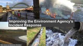
  • 1. Nick Jones and Alexandra Gioutsou Improving the Environment Agency’s Incident Response
  • 2. Nick Jones Incident Management Digital Strategy Lead Alexandra Gioutsou GIS Analyst (Mapping and Visuals Officer Lead)
  • 7. Over the past year user numbers have steadily increased as we went from a pilot to a beta and now onto a production system… 235+ EA office-based staff (Mapping and Visuals Officers) 2200+ EA field-based staff trained to use the Collector App IM Portal
  • 8. Mapping and Visuals Officers (MAVOs) Planning During Recovery Planned activity Property at risk Drone operation Impact and scale Live video Live field data Summary maps Recovery activity Community engagement
  • 9.
  • 10. Easter Rain Event (31st March to 9th April 2018) 712 Collector for ArcGIS logins 49 Field based staff collecting data Points of data captured 227 560+ Pictures and videos captured 5 Drone deployments – Yorkshire and Thames areas 9 Area teams involvedPoints tagged as suitable for external communication 64% Flood outlines recorded (0 properties within these outlines) 3
  • 11. 11 More visual information than ever before Combining Drones and Collector data…
  • 13. 13