Upgrading Under-Serviced Settlements in Kigali
•Descargar como PPT, PDF•
0 recomendaciones•87 vistas

Summary strategy for city-wide slum upgrading presented to Kigali Mayor. It contains detailed analysis and proposals to address systematically and scaled phisical and socio-environmental improvements. It is based on slum typologies defining a response package based on a strategy encouraging community based approaches for local development and environmental protection.

Recomendados
Recomendados
Más contenido relacionado
La actualidad más candente
La actualidad más candente (20)
Similar a Upgrading Under-Serviced Settlements in Kigali
Similar a Upgrading Under-Serviced Settlements in Kigali (20)
Más de Fernando Murillo
Más de Fernando Murillo (20)
Último
Último (20)
Upgrading Under-Serviced Settlements in Kigali
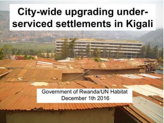
- 1. Government of Rwanda/UN Habitat December 1th 2016 City-wide upgrading under- serviced settlements in Kigali
- 2. Agenda I. Diagnosis II. Proposal III. Alternative implementation scenarios
- 3. Key definitions • Underserviced settlements: Areas lacking access roads, water/sanitation, social services, overcrowding and poor housing building materials (4 UN Habitat standards of adequate housing) • Settlement typologies: Differentiated according to socio- territorial profile within the urban structure (location, environmental threats, land tenure, etc) • City-wide strategy: Systematic, integral and coordinated interventions in all underserviced settlements to upgrade the existing case and prevent their proliferation in future.
- 4. 1. Diagnosis Land shortage: Topographical restrictions Infrastructure shortage: Under- serviced and disconnected areas Expansion of rental markets (shanty areas) Unaffordable housing and building materials Low density sprawl creating new under serviced settlements Lack of social cohesion. Segregation
- 5. Population analysis. Facts % Numbers Kigali population 100 1300000 Informal settlements 65,8 855400 Total households 223000 Built up area (Km2) 731,24 Average urban density (person/km2) 1556 Population % Unplanned Expected unplanned in 2022 Average growth rate Nyarugenge 284860 25,08 210511 30,09 256606 1,92 Gasabo 530901 46,75 244218 34,91 404447 5,2 Kicukiro 319661 28,15 244661 34,98 376330 4,4 Kigali 1135422 100 699390 100 4 Source: 4th Population census 2012 Average number of persons per household: 3,88
- 6. City center (30 hh) Fringe (22 hh) Suburban (18 hh) Settlements in city centers Peri-urban settlement Fringe settlements Urban growth trend
- 7. Housing facts • 223.000 dwelling units currently • 19% in good conditions • 32% to be upgrade • 48% to be replaced Under-serviced settlements results of 48+32 approx.
- 8. Low density residential development Medium density residential development High density residential development City center functions Case study selected for settlement upgrading and prevention
- 9. 2. Proposals Causes of underserviced settlements Proposals 1. Expansion of rental housing market I. Increase rental housing offer (densities) 2. Speculative land markets II. Encourage land banking (public/private) 3. Infrastructure shortage III: Key missing infrastructures supply to ensure full conectivity. 4. Unaffordable housing IV. Increase cooperative housing offer and upgrade existing stock. 4. Lack of social cohesion IV. Encourage tenant housing associations (new /build up areas) 6. Sprawl with low densities creating new underserviced slums VI. Harmonize master plan and settlement standards
- 10. • City is modernazing rapidly with a high number of under serviced settlements • Implementing Kigali master plan requires land currently occupied by congested under serviced area (increasing densities) • High economic and social costs demanding important financial resources (compensations) • Peace-meal interventions demonstrated to be insufficient (rental market neglected). Why city-wide upgrading upgrading
- 11. City-wide strategy approach Urban planning Infrastructure Housing Participation Infrastructure supply Enabling building environment Disaster risk reduction Housing association Land management Community mobilization Urban/metropolitan scale Community/housing scale Transport
- 12. Settlements by size/risky areas Areas dominated by unplanned settlements Small pocket settlements Relocation because location in risky areas
- 13. 1. Up-hill settlements 2. Down-hill settlements 3. Urban inaccesible settlements 4. Small pocket settlements 5. Center-overcrowded areas 6. Peri-urban settlements 7. Relocation because location in risky areas Proposed settlements types
- 14. 3 districts 73,128 has Nyarugenge 13.423 has Gasabo 43,002 has Kicuciro 16,702 has
- 15. Selection case studies Settlement cases Average size Location Predominance by district I. Up-hill settlements Massive (more than 10 hectares) Central Nyarugenge II. Down hill Middle size (between 1 to 10 hectares) Fringe Gasabo III. Inaccesible Middle size (between 1 to 10 hectares) Central Kicukiro IV. Small pocket Small size (less than 1 hectare) Fringe/Peri urban Nyarugenge V. Overcrowded center Massive (more than 10 hectares) Central Nyarugenge VI. Periurban Small size (less than 1 hectare) Peri-urban Gasabo VII. Relocation because location in risky areas Massive/Middle/small Central Nyarugenge/Gasab o/Kicukiro
- 16. Estimation of target households per settlement types Unplanned settlements types % Households 1. Old crowded centers 20 29000 2. Up-hill sloped areas 40 58000 3. Down hill 15 21750 4. Inaccesible areas 15 21750 5. Small pocket areas 8 11600 6. Peri-urban areas 2 2900 100 145000 Upon 223.000 total household today. 65 %
- 17. Selected settlements in Kigali Kagugu Nyamabuye Nyarurama Gasabo district Kicukiro districtNyarugenge district Agatare Tetero Kora Kiruhura Kagunga Rwampara
- 18. City-wide upgrade strategy per settlement type Gasabo district Kicukiro districtNyarugenge district I. Old center overcrowded Up hill- Down-hill Inaccesible settlements Small pocket settlement Peri-urban settlement New transport facilities
- 19. Type Social profile Urban standards Challenges I. Old overcrowded centers Tenants (100%) High density/resid (between 100 and 250 inh/has) Overcrowding Lack sanitation II. Up-hill sloped area Owners/tenan ts (40%/60%) Medium density, (between 80 and 100 inh/has) On going erosion. Landslide risks III. Down hills Dominated by tenants (80/20%) Low-medium density, mixed uses (between 80 and 100 inh/has) Contamination of the groundwater. Destroy wetlands IV Inaccesible areas Tenants (80/90%) Low-medium density/resid (between 60 and 80 h/h) Difficulties to access/service V. Small pocket areas Tenants (70/30%) Low density, mixed land uses (between 60 and 80) Overcrowding VI. Peri-urban areas Mostly land owners (90/100%) Very low density, agricultural (less than 20 inh/has) Loss of fertile land VII. High risk areas Displaced and migrants Low density mixed uses High risks
- 20. I. Old over-crowded centers
- 22. Proposed interventions Renewal of the area building up multistory building (up to 3) increasing densities to match those established by master plan Creation of public spaces designed to serve whole city Areas reserved for expansion of public infrastructure (transport) Re-structuring of the area by neighborhood cells (same land owners and tenants)
- 29. II. Up-hill slopped area
- 30. Up-hill informal settlement intervention model
- 31. Proposed cross section for up- hill and down-hill upgrade 2 km. 0,5 km. Retaining walls shaping terraces
- 32. Nyamugare
- 33. Proposed intervention up-hill informal settlements Opening border roads in the fringe with retaining walls Stair roads in concrete
- 34. Aerial view of settlement upgrading vision
- 35. Proposal for land readjustment The land readjustment proposal take advantage of risky areas (relocation of population) to create public spaces and connecting roads Such improvement bring benefits to improve environmental management of the area introducing basic social services Participatory land readjustment systems gives the chance to empower tenant roles in the upgrading process Planned expansion of the area through social housing supply and rental housing subsidized by the state mixed up with private investment
- 37. International reference: Favela- Bairrio program (Brazil)
- 39. Down hill informal settlements
- 40. Proposed intervention Access roads with retaining walls Central point for collection of sanitation system Sanitation network by gravitation Physical boundary to avoid expansion upon wetland
- 42. Model for land readjustment El model proposes subdividing the area in basic cells of around 10-20 plots setting a friendly agreement for access roads and public investments in rataining walls
- 46. Proposed interventions Expropriation of empty plots to open key access roads in unplanned settlements behind consolidated neighborhoods Opening of access roads parallel to drainages Border road front-back neighborhoods Re-structre of the settlement in cells according to accesibility Wat-San network supply
- 47. Rwampara
- 52. V. Small pocket areas
- 53. Small pocket informal settlements
- 54. Proposed interventions Regulate corridors and semi-public spaces to ensure privacy and good access in settlements Creation of public spaces (gardens, schools, health, etc) to increase the exchange between neighborhoods and unplanned settlements Building material bank to support tenants improving initiatives
- 59. Proposed interventions Social services supply (school, health, police) for peri-urban settlements consolidation Land tenure security for farming and support through micro-business credit and tools Provided irrigation system for farming Micro-industrial agriculture infrastructure (state funded) Main road and public transport system provided (subdivided)
- 62. Agricultural schemes High cost of transportation (1000 KF daily) Survival economy
- 63. 3. Alternative implementation scenarios Scenario A. Scenario B. Scenario C. Scenario D. Full Government response. Public housing and infrastructure. Government+ community. Public housing infrastructure Public-private corporation Private sector (real estate, land owners, investors, etc). Full package of affordable housing delivery in available land (including under-served settlements) Specific subsidized interventions targeting requested community priorities (infrastructures) Prioritization of public infra needs for under-serviced areas (access, wat/san, transport) Densification of prime areas (regulation) and promotion of rental housing Taxes, mortages, credits, other revenues. Taxes, land capture value and community work. Public and private investments Private investments pro- poor regulatory framework
- 64. Summary stakeholders Tenant cooperatives (construction new houses) Land owner associations (urban renewal) Neighborhood associations (tenants+owners joint venture for upgrading) Public enterprises (specific services supply) Private real estate developers City-wide settlement upgrade corporation Government lead: CoK/MINIFRA/RHA/Districts Support with land and housing subsidies Offer joint venture for land readjustment plan to increase densities with rental housing Offer infrastructure support package in exchange of community labor provided Coordinate service supply according to CoK master plan and socio-territorial priorities Offer zonning for priority investment in real estate development utilizing land value capture mechanisms
- 65. Summary financial plan Type Density Inh/has Cost analysis Estimated cost per household Land Infras (w/s) Housing I. Old overcrowded centers 400 inh/has Opening roads (+ land pooling) Water and sanitation Upgrade + build new units Big initial investment/low cost per HH II. Up-hill sloped area 150 inh/has Sidewalk + re- plotting Retaining walls- Drainage Upgrade/ renovation Medium initial investment/med ium cost per HH III. Down hill 80 inh/has Sidewalk Roads + replotting Water and sanitation network Upgrade/ renovation demolition High initial investment/high cost per HH IV Inaccesible areas 200 inhab/has Plots expropriations Roads Drainage and bridges Renewal/ renovation Low initial investment/low cost per HH V. Small pocket areas 60 inhab/has Semi-public corridors. Re location Sanitation Renovation Low investment/low cost per HH VI. Peri- urban areas 50 inh/has Land leasing x agriculture Transport Upgrade High initial inv/high ct/ HH
- 66. Proposed strategy x case studies selected Informal Settement District Name Project proposal Implementation startegy 1. Old overcrowded centers Nyarugenge/ Nyabugogo Muhima Gitera Nyarugenge Kiruhura Tetero Kora Agatare Complete restructuring and densification Agreement with land- owners and tenants 2. Up-hill Gasabo/ Gatsata Nyamugare Nyambuye Terracing for improving access and wat/san management Special taxes for landowners 3. Down hills Gasabo/ Remera Nyarurama Stop expansion Sanitation supply Incentive for cooperatives 4. Urban inaccesible Kicukiro/ Rwampara Kigarama Expropriation of entry-exit parcels. Bridges Negotiation with neighborhs/ 5. Small pocket Kicukiro Gikondo Kagunga Upgrade and regulation to create semi-public spaces Agreement between landowners and tenants 6. Peri-urban Kicukiro/ Kigarama Rwampara Guiding further development Agreement with land owner
- 67. Financial/management model Unplanned settlement upgrade • Retaining walls • Terracing plots • Opening access roads • Expropriating land for accesing inaccesible settlements • Wat-san provision • Land sharing for improvement Materials provided by CoK Labor provided by community Corporate responsibility for Wat/san Materials provided by CoK Labor provided by community Corporate responsibility for Wat/san Tenants offered land lease (PILLAR) Urban renewal • Land readjustment schemes • Rental housing construction CoK+Land owner+tenant+developer Urban expansion • Supply of infrastructures and social services • Subsidies for development CoK+Low income tenants (cooperatives)+real estate developer
- 68. Strategies for strenghtening community management • Database of beneficiaries of the upgrade and housing programmes • Use of traditional mobilization schemes. • Micro-credits for housing and initiate micro-business • Leasing system facilitating that tenants can become property owners along the time. • Profesional training in construction (plumbing, etc) to play the role of contractors for upgrading • Land banking system (land and materials) co-managed by CoK and communities involved
- 69. Step by step plan Activities Years 1 2 3 4 5 6 7 8 Adjustment of regulations Community empowerment Urban Infras supply Land banking (value capture) Land re-plotting Neighbourhod association self-upgrading Housing associations building new houses Recovering of public spaces (empty areas) and social services supply Real estate building multistory rental apartm
- 70. Annex • Methodology: set of combined key indicators obtained through interview to District Engineers, residents, field observation, aerial photo, and official statistics. Data are combined to guess dynamics and rationale of informal settlements (IS). • Comprehensive variables: Urban factors (location and access to services), physical pattern, land values, rental market behaviour, social profile including income, environmental threats, etc. • Case studies: 3 areas representative of the three districts. • Model for interventions: Model assess alternative schemes to intervene in informal settlements according to their priority needs and sustainable finance.
- 71. Information matrix District sector cell Age Acces Slop Land Own/ tenan Market values Bdg Envir Socio- econo Upgrade attitude Nyarurarama Nyamabuye Kagugu Rwampara Kagunga Kabuye Kiruhura Tetero Kora Agatare
- 72. • Urban renewal: Transformation of an existing built-up area to increase densities (matching standards from the master plan) • Settlement upgrade: Process focus on improving social wellfare in underserviced settlements keeping their existing built up structures and patterns • Rental markets: Areas where affordable renting is provided to counterbalance the influence of no regulated informal renting. • Pro-poor funding schemes: Financial alternatives to support social priorities through specific interventions • Revenue mechanisms: Alternatives to recover public resources invested in social development to extend benefits. Detailed definitions
- 73. Implementation strategy City-wide settlement upgrade corporation mandate: 1. Participative planning coordinated with master plan priorities 2. Land banking (legal review and private land purchase) 3. Guiding housing subsidies (social real estate trust investment trust). 4. Leading urban renewal exercises (through participative and inclusive land adjustment) 5. Funding project proposals from communities (social and infrastructure nature) 6. Coordinate supply of public services. Capture land value to finance city-wide actions 7. Define priorities for real estate development investments
- 74. Population/areas per districts according to CoK master plan Nyarugenge Gasabo Kicukiro Kigali Mixed land uses 68,29 168 177 High rise residential 13,23 55 112 Medium rise residential 806,29 955 1606 Low rise residential 359,38 1797 1389 Single family residential 78,58 4594 4097 Total 1325,77 7569 7381 16275,77 % informal settlements 70 35 55 Area occupied 1893,95714 21625,7143 13420 Average density (inhab/has) 111,148766 11,2929449 18,231073 Population 210511 244218 244661 699390 Households 54321,7344 64424,7428 60058,7531 178805,23
- 75. Housing projection (master plan) Housing type Housing share % Population share Housing size (sq meter) Area Dwelling unit Single family 55 28 250 93,12 40 Low rise 21.5 25,5 120 36,5 90 Medium rise 20 40 90 33,21,65 160 High rise 1 2.5 90 4,08 200 Mixed use 2.5 4 90 1,68 160 Total 100 100
- 76. Inputs from the analysis • Current trends indicates that underserviced areas results of “natural” land market need for densification • Implementation of the master plan will lead to significant shortage of affordable housing triggering underserviced settlements in the peripheries. • Full interventions requires to combine simple land market regulations with engagement of inhabitants and owners of the different types of under-serviced settlements. • Harmonization of densities and land uses assigned by master plan requires a detail planning exercise that this proposal seeks to contribute.
- 77. Access to drinkable water All cases are limited access to drinkable water, specially critical in those centrally located
- 78. Acess to health services All cases has problems to access health services, specially up-hill, down hill and inaccesible settlement types
- 79. Access to education All cases has access to education, except peri-urban settlement types
- 80. Inputs from the Social Real Estate Investment trust Kigali Housing Commission Kigali Trustees Corporation Ltds Rwanda Real Estate Exchange Citizen representation, Hurman Rights, complains, M&E, Master plan follow up Environment to attract long term funding Environment to attract short term funding in construction and multiply real state business
- 81. Participatory land readjustment scheme
- 82. 8. Expected outcomes • City-wide settlement upgrading strategy, shared with major stakeholders (RHA, CoK, communities, land owners, tenents, developers, etc). • Actions at multiple scales (city, neighborhoods and housing) with multiple funding sources. • Reconciliation of master plan and city wide IS upgrading standards. • Preliminary project interventions corresponding to the 6 different strategies proposed • Mitigation strategies of gentrification effects • Alternative financial models (existing, on going and proposed) • Regulatory framework focusing on land market and rental market monitoring and control (out of the TOR).
- 83. Density analysis Area Population % Densities Inh/has City center 480000 11,7647059 30000 30 Fringe areas 1400000 34,3137255 22000 22 Suburban 2200000 53,9215686 18000 18 4080000 100 Densities Uses Persons/Km2 Persons/hectares Low Suburban 3000 30 High Under serviced settlements 25000 250 Source: Master plan for CoK Urban existing Urban 2025 Urban year x Urbanized area (km2) 17 25 40 Area (Km2) 713,27 713,27 713,27 Population (inhabitants) 1200000 2900000 5000000 Gross density (inh/has) 16,70 39,50 68,50 Gross urban density (inh/has) 11000 15850 17000
- 84. Guiding principes for upgrading • City-wide coordination and institutional capacity building • Pro-poor participatory and empowering • Minimizing displacement by creating alternatives • Multiple upgrading strategies according settlement type and preferences of the residents • Encourage joint venture between tenants and land owners sharing the same neighborhoods • Promote construction of affordable housing enabling land markets and construction industry • Financial sustainability establishing a fair system of tax and revenues based on social priorities.
- 85. Township distribution provides a framework for settlement upgrading and housing interventions: Massive upgrade, middle size and small Proposed township distribution & upgrading plan
- 86. Gasabo district Detail of Kagugu
- 92. Kinyinya, Kagugu
- 100. Kicukiro district
- 101. Kicukiro district
- 104. Kagunga, Gikondo
- 112. Marembo II
- 113. Nyarugenge, District
- 114. Kiruhura
- 117. Tetero, Muhima
- 119. Tetero
- 123. Kora, Gitera
- 126. Kora
- 130. Proposed financial strategy Settlement approach Implemementation scheme Stakeholders Total target (household) 1. Old crowded centers Densification with land readjustment Land owners 29000 2. Up-hill sloped areas Community contracts Land owners+tenants 58000 3. Down hill Wat+San companies and community contracts Land owners+companies 21750 4. Inaccesible areas Government expropriate to open roads Government+Land owners+tenants 21750 5. Small pocket areas Land pooling to upgrade Land owners 11600 6. Peri-urban areas Guided relocation/IDP Rural-Urban communities 2900
- 142. Location of case studies Agatare Nyamabuye Tetero Kora Kagugu Kiruhura Nyarurama Kagunga Gasabo district. Kicukiro district. Nyarugenge district. Rwampara