SlideShare una empresa de Scribd logo
1 de 21
Descargar para leer sin conexión
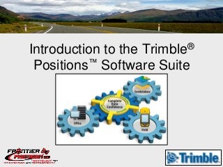
Introduction to the
                  Trimble ®

 Positions™ Software Suite
What is Trimble Positions?
• Software for High Accuracy
  Trimble GPS/GNSS Receivers
  running ArcGIS for WM
• Similar to
  GPSCorrect+GPSAnalyst for
  ArcPad+ArcMap*
• An ArcGIS Mobile Post-
  Processible Solution
Trimble Positions Components

•   Mobile Project Center
•   Mobile Extension
•   Desktop Add-In
•   Toolkit
Options for Deployment and Integration


• Off-the-shelf
  – Desktop add-in
  – Mobile Project Center extension
  – Positions Mobile extension
• Custom Application
  – Positions Toolkit
  – Embed the power of Trimble Positions into an
    focused, custom application based on ArcGIS
    Runtime SDK for WM
Data Confidence
•Data quality you can Trust
•Productivity, Efficiency, and Accuracy
•Complete Streamlined Workflow
Data Confidence: Data Quality
• Data seamlessly verified in the enterprise GIS for rapid
  field-to-office data flow;
• High quality data simple for field crews to capture;
• Collecting intelligent GPS/GNSS data, with honest
  accuracy ratings you can trust;
• Quality GIS data  Sound organizational
  decisions.
Data Confidence: Productivity, Efficiency, and Accuracy

• Simple workflows and feedback…

• Positioning which is more accessible and accurate
  than ever before…Floodlight™ technology

• GIS data quality depends on field crews delivering
  accurate field data…
Data Confidence: Streamlined Workflow

• Fully integrated data management process;


• Fully integrated into the ArcGIS environment—from
  Desktop, Server, to Windows Mobile;
Workflow
Workflow: Configure

                                     •    Using Esri Mobile Project Center,
     Esri Mobile Project Center          configure the ArcGIS for Windows
+ Trimble Positions Mobile Project       Mobile experience;
          Center extension
                                     •   With the Trimble Positions Mobile
                                         Project Center extension, configure
                                         accuracy thresholds and define field
                                         configurations;

                                     •   Create a package for deployment to
                                         field devices.
ESRI Mobile Project Center
Workflow: Collect
                                 •   Connect to a Trimble GNSS receiver

                                 •   Collect new or update existing
Esri ArcGIS for Windows Mobile
       + Trimble Positions           feature geometry
        Mobile extension
                                 •   Use accuracy-based logging to
                                     ensure the quality of spatial data
                                     before leaving the field

                                 •   Connect to real-time correction
                                     sources and collect data for post-
                                     processing
Workflow: Synchronize
                         • Use ArcGIS Server or
                           geoprocessing tools in ArcGIS
                           Desktop

                         • Synchronize all your field data,
                           including GNSS data for post-
Esri ArcGIS for Server     processing
          or
 ArcGIS for Desktop
                         • GNSS data management made
                           simple
Workflow: Correct & Verify

                          • Post-Process using pre-
                            defined profiles

Esri ArcGIS for Desktop
  + Trimble Positions     • Verify each feature against
     Desktop add-in         required accuracy

                          • Edit GNSS derived geometries
Workflow: Update

Esri ArcGIS for Desktop    • Single button update of the
  + Trimble Positions        geodatabase
     Desktop add-in

                           • Metadata populated into GIS
                             along with feature geometry

                           • File and enterprise
                             geodatabase support
Desktop Administration: Overview
Desktop Administration: Projects
Desktop Administration: Validate & Correct Sessions
Supported Platforms & Technologies

•   ESRI:
     – ArcGIS for Desktop 10.1 Standard or Advanced
        editions
     – ArcGIS for Windows Mobile 3.x
     – ArcGIS Mobile Project Center 3.x
     – File or enterprise geodatabase
•   Trimble:
     – Juno® 3B/3D & SB/SC/SD handhelds
     – GeoExplorer ® 6000 & 3000 series handhelds*
     – Pro 6T/6H and GPS Pathfinder ® Pro XT™/XH™
        receivers
     – Nomad ® 900G series handhelds

     * GeoXH™ 6000 with Centimeter option enabled is
        not supported
Licensing
• Node Locked License Support
  – Trimble Positions Desktop add-in
  – Trimble Positions Mobile extension


• Floating License Support
  – Trimble Positions Desktop add-in
For details or any more questions, email me at zache@frontierprecision.com

Más contenido relacionado

Más de GIS in the Rockies

2018 GIS in the Rockies Vendor Showcase (Th): ERDAS Imagine What's New and Ti...
2018 GIS in the Rockies Vendor Showcase (Th): ERDAS Imagine What's New and Ti...2018 GIS in the Rockies Vendor Showcase (Th): ERDAS Imagine What's New and Ti...
2018 GIS in the Rockies Vendor Showcase (Th): ERDAS Imagine What's New and Ti...GIS in the Rockies
 
2018 GIS in the Rockies Vendor Showcase (Th): Building High Performance Gover...
2018 GIS in the Rockies Vendor Showcase (Th): Building High Performance Gover...2018 GIS in the Rockies Vendor Showcase (Th): Building High Performance Gover...
2018 GIS in the Rockies Vendor Showcase (Th): Building High Performance Gover...GIS in the Rockies
 
2018 GIS in Recreation: The Making of a Trail
2018 GIS in Recreation: The Making of a Trail2018 GIS in Recreation: The Making of a Trail
2018 GIS in Recreation: The Making of a TrailGIS in the Rockies
 
2018 GIS in Recreation: The Latest Trail Technology Crowdsourcing Maps and Apps
2018 GIS in Recreation: The Latest Trail Technology Crowdsourcing Maps and Apps2018 GIS in Recreation: The Latest Trail Technology Crowdsourcing Maps and Apps
2018 GIS in Recreation: The Latest Trail Technology Crowdsourcing Maps and AppsGIS in the Rockies
 
2018 GIS in the Rockies: Riparian Shrub Assessment of the Mancos River Canyon...
2018 GIS in the Rockies: Riparian Shrub Assessment of the Mancos River Canyon...2018 GIS in the Rockies: Riparian Shrub Assessment of the Mancos River Canyon...
2018 GIS in the Rockies: Riparian Shrub Assessment of the Mancos River Canyon...GIS in the Rockies
 
2018 GIS in Development: Partnerships Lead to Additional Recreational Content...
2018 GIS in Development: Partnerships Lead to Additional Recreational Content...2018 GIS in Development: Partnerships Lead to Additional Recreational Content...
2018 GIS in Development: Partnerships Lead to Additional Recreational Content...GIS in the Rockies
 
2018 GIS in Recreation: Adding Value to Colorado the Beautiful Initiative carr
2018 GIS in Recreation: Adding Value to Colorado the Beautiful Initiative carr2018 GIS in Recreation: Adding Value to Colorado the Beautiful Initiative carr
2018 GIS in Recreation: Adding Value to Colorado the Beautiful Initiative carrGIS in the Rockies
 
2018 GIS in Recreation: A Creek Runs Through It
2018 GIS in Recreation: A Creek Runs Through It2018 GIS in Recreation: A Creek Runs Through It
2018 GIS in Recreation: A Creek Runs Through ItGIS in the Rockies
 
2018 GIS in Recreation: Virtually Touring the National Trails
2018 GIS in Recreation: Virtually Touring the National Trails2018 GIS in Recreation: Virtually Touring the National Trails
2018 GIS in Recreation: Virtually Touring the National TrailsGIS in the Rockies
 
2018 GIS in the Rockies PLSC Track: Turning Towards the Future
2018 GIS in the Rockies PLSC Track: Turning Towards the Future2018 GIS in the Rockies PLSC Track: Turning Towards the Future
2018 GIS in the Rockies PLSC Track: Turning Towards the FutureGIS in the Rockies
 
2018 GIS in the Rockies PLSC: Intro to PLSS
2018 GIS in the Rockies PLSC: Intro to PLSS2018 GIS in the Rockies PLSC: Intro to PLSS
2018 GIS in the Rockies PLSC: Intro to PLSSGIS in the Rockies
 
2018 GIS in the Rockies PLSC Track: Grid to Ground NATRF2022
2018 GIS in the Rockies PLSC Track: Grid to Ground NATRF20222018 GIS in the Rockies PLSC Track: Grid to Ground NATRF2022
2018 GIS in the Rockies PLSC Track: Grid to Ground NATRF2022GIS in the Rockies
 
2018 GIS in Development: USGS and Citizen Science Success and Enhancements fo...
2018 GIS in Development: USGS and Citizen Science Success and Enhancements fo...2018 GIS in Development: USGS and Citizen Science Success and Enhancements fo...
2018 GIS in Development: USGS and Citizen Science Success and Enhancements fo...GIS in the Rockies
 
2018 GIS in Development: Semantic Web
2018 GIS in Development: Semantic Web2018 GIS in Development: Semantic Web
2018 GIS in Development: Semantic WebGIS in the Rockies
 
2018 GIS in Development: Look Ma, No Server and Big Data Using Serverless Fun...
2018 GIS in Development: Look Ma, No Server and Big Data Using Serverless Fun...2018 GIS in Development: Look Ma, No Server and Big Data Using Serverless Fun...
2018 GIS in Development: Look Ma, No Server and Big Data Using Serverless Fun...GIS in the Rockies
 
2018 GIS in Development: Grass GIS Striking Terrain Visualizations in the Roc...
2018 GIS in Development: Grass GIS Striking Terrain Visualizations in the Roc...2018 GIS in Development: Grass GIS Striking Terrain Visualizations in the Roc...
2018 GIS in Development: Grass GIS Striking Terrain Visualizations in the Roc...GIS in the Rockies
 
2018 GIS in Development: FOSS4G in the Government (Proof of Concept)
2018 GIS in Development: FOSS4G in the Government (Proof of Concept)2018 GIS in Development: FOSS4G in the Government (Proof of Concept)
2018 GIS in Development: FOSS4G in the Government (Proof of Concept)GIS in the Rockies
 
2018 GIS in Development: Developing a National Map of Subsurface Infrastructure
2018 GIS in Development: Developing a National Map of Subsurface Infrastructure2018 GIS in Development: Developing a National Map of Subsurface Infrastructure
2018 GIS in Development: Developing a National Map of Subsurface InfrastructureGIS in the Rockies
 
2018 ASPRS: Big Data: Utilizing Landsat to Detect Ephemeral Water Sources in ...
2018 ASPRS: Big Data: Utilizing Landsat to Detect Ephemeral Water Sources in ...2018 ASPRS: Big Data: Utilizing Landsat to Detect Ephemeral Water Sources in ...
2018 ASPRS: Big Data: Utilizing Landsat to Detect Ephemeral Water Sources in ...GIS in the Rockies
 
2018 ASPRS: Big Data: Front Range Oblique Photography Available Today
2018 ASPRS: Big Data: Front Range Oblique Photography Available Today2018 ASPRS: Big Data: Front Range Oblique Photography Available Today
2018 ASPRS: Big Data: Front Range Oblique Photography Available TodayGIS in the Rockies
 

Más de GIS in the Rockies (20)

2018 GIS in the Rockies Vendor Showcase (Th): ERDAS Imagine What's New and Ti...
2018 GIS in the Rockies Vendor Showcase (Th): ERDAS Imagine What's New and Ti...2018 GIS in the Rockies Vendor Showcase (Th): ERDAS Imagine What's New and Ti...
2018 GIS in the Rockies Vendor Showcase (Th): ERDAS Imagine What's New and Ti...
 
2018 GIS in the Rockies Vendor Showcase (Th): Building High Performance Gover...
2018 GIS in the Rockies Vendor Showcase (Th): Building High Performance Gover...2018 GIS in the Rockies Vendor Showcase (Th): Building High Performance Gover...
2018 GIS in the Rockies Vendor Showcase (Th): Building High Performance Gover...
 
2018 GIS in Recreation: The Making of a Trail
2018 GIS in Recreation: The Making of a Trail2018 GIS in Recreation: The Making of a Trail
2018 GIS in Recreation: The Making of a Trail
 
2018 GIS in Recreation: The Latest Trail Technology Crowdsourcing Maps and Apps
2018 GIS in Recreation: The Latest Trail Technology Crowdsourcing Maps and Apps2018 GIS in Recreation: The Latest Trail Technology Crowdsourcing Maps and Apps
2018 GIS in Recreation: The Latest Trail Technology Crowdsourcing Maps and Apps
 
2018 GIS in the Rockies: Riparian Shrub Assessment of the Mancos River Canyon...
2018 GIS in the Rockies: Riparian Shrub Assessment of the Mancos River Canyon...2018 GIS in the Rockies: Riparian Shrub Assessment of the Mancos River Canyon...
2018 GIS in the Rockies: Riparian Shrub Assessment of the Mancos River Canyon...
 
2018 GIS in Development: Partnerships Lead to Additional Recreational Content...
2018 GIS in Development: Partnerships Lead to Additional Recreational Content...2018 GIS in Development: Partnerships Lead to Additional Recreational Content...
2018 GIS in Development: Partnerships Lead to Additional Recreational Content...
 
2018 GIS in Recreation: Adding Value to Colorado the Beautiful Initiative carr
2018 GIS in Recreation: Adding Value to Colorado the Beautiful Initiative carr2018 GIS in Recreation: Adding Value to Colorado the Beautiful Initiative carr
2018 GIS in Recreation: Adding Value to Colorado the Beautiful Initiative carr
 
2018 GIS in Recreation: A Creek Runs Through It
2018 GIS in Recreation: A Creek Runs Through It2018 GIS in Recreation: A Creek Runs Through It
2018 GIS in Recreation: A Creek Runs Through It
 
2018 GIS in Recreation: Virtually Touring the National Trails
2018 GIS in Recreation: Virtually Touring the National Trails2018 GIS in Recreation: Virtually Touring the National Trails
2018 GIS in Recreation: Virtually Touring the National Trails
 
2018 GIS in the Rockies PLSC Track: Turning Towards the Future
2018 GIS in the Rockies PLSC Track: Turning Towards the Future2018 GIS in the Rockies PLSC Track: Turning Towards the Future
2018 GIS in the Rockies PLSC Track: Turning Towards the Future
 
2018 GIS in the Rockies PLSC: Intro to PLSS
2018 GIS in the Rockies PLSC: Intro to PLSS2018 GIS in the Rockies PLSC: Intro to PLSS
2018 GIS in the Rockies PLSC: Intro to PLSS
 
2018 GIS in the Rockies PLSC Track: Grid to Ground NATRF2022
2018 GIS in the Rockies PLSC Track: Grid to Ground NATRF20222018 GIS in the Rockies PLSC Track: Grid to Ground NATRF2022
2018 GIS in the Rockies PLSC Track: Grid to Ground NATRF2022
 
2018 GIS in Development: USGS and Citizen Science Success and Enhancements fo...
2018 GIS in Development: USGS and Citizen Science Success and Enhancements fo...2018 GIS in Development: USGS and Citizen Science Success and Enhancements fo...
2018 GIS in Development: USGS and Citizen Science Success and Enhancements fo...
 
2018 GIS in Development: Semantic Web
2018 GIS in Development: Semantic Web2018 GIS in Development: Semantic Web
2018 GIS in Development: Semantic Web
 
2018 GIS in Development: Look Ma, No Server and Big Data Using Serverless Fun...
2018 GIS in Development: Look Ma, No Server and Big Data Using Serverless Fun...2018 GIS in Development: Look Ma, No Server and Big Data Using Serverless Fun...
2018 GIS in Development: Look Ma, No Server and Big Data Using Serverless Fun...
 
2018 GIS in Development: Grass GIS Striking Terrain Visualizations in the Roc...
2018 GIS in Development: Grass GIS Striking Terrain Visualizations in the Roc...2018 GIS in Development: Grass GIS Striking Terrain Visualizations in the Roc...
2018 GIS in Development: Grass GIS Striking Terrain Visualizations in the Roc...
 
2018 GIS in Development: FOSS4G in the Government (Proof of Concept)
2018 GIS in Development: FOSS4G in the Government (Proof of Concept)2018 GIS in Development: FOSS4G in the Government (Proof of Concept)
2018 GIS in Development: FOSS4G in the Government (Proof of Concept)
 
2018 GIS in Development: Developing a National Map of Subsurface Infrastructure
2018 GIS in Development: Developing a National Map of Subsurface Infrastructure2018 GIS in Development: Developing a National Map of Subsurface Infrastructure
2018 GIS in Development: Developing a National Map of Subsurface Infrastructure
 
2018 ASPRS: Big Data: Utilizing Landsat to Detect Ephemeral Water Sources in ...
2018 ASPRS: Big Data: Utilizing Landsat to Detect Ephemeral Water Sources in ...2018 ASPRS: Big Data: Utilizing Landsat to Detect Ephemeral Water Sources in ...
2018 ASPRS: Big Data: Utilizing Landsat to Detect Ephemeral Water Sources in ...
 
2018 ASPRS: Big Data: Front Range Oblique Photography Available Today
2018 ASPRS: Big Data: Front Range Oblique Photography Available Today2018 ASPRS: Big Data: Front Range Oblique Photography Available Today
2018 ASPRS: Big Data: Front Range Oblique Photography Available Today
 

2012 Vendor Session, Trimble Positions Software Suite, Zach Edwards

  • 1. Introduction to the Trimble ® Positions™ Software Suite
  • 2. What is Trimble Positions? • Software for High Accuracy Trimble GPS/GNSS Receivers running ArcGIS for WM • Similar to GPSCorrect+GPSAnalyst for ArcPad+ArcMap* • An ArcGIS Mobile Post- Processible Solution
  • 3. Trimble Positions Components • Mobile Project Center • Mobile Extension • Desktop Add-In • Toolkit
  • 4. Options for Deployment and Integration • Off-the-shelf – Desktop add-in – Mobile Project Center extension – Positions Mobile extension • Custom Application – Positions Toolkit – Embed the power of Trimble Positions into an focused, custom application based on ArcGIS Runtime SDK for WM
  • 5. Data Confidence •Data quality you can Trust •Productivity, Efficiency, and Accuracy •Complete Streamlined Workflow
  • 6. Data Confidence: Data Quality • Data seamlessly verified in the enterprise GIS for rapid field-to-office data flow; • High quality data simple for field crews to capture; • Collecting intelligent GPS/GNSS data, with honest accuracy ratings you can trust; • Quality GIS data  Sound organizational decisions.
  • 7. Data Confidence: Productivity, Efficiency, and Accuracy • Simple workflows and feedback… • Positioning which is more accessible and accurate than ever before…Floodlight™ technology • GIS data quality depends on field crews delivering accurate field data…
  • 8. Data Confidence: Streamlined Workflow • Fully integrated data management process; • Fully integrated into the ArcGIS environment—from Desktop, Server, to Windows Mobile;
  • 10. Workflow: Configure • Using Esri Mobile Project Center, Esri Mobile Project Center configure the ArcGIS for Windows + Trimble Positions Mobile Project Mobile experience; Center extension • With the Trimble Positions Mobile Project Center extension, configure accuracy thresholds and define field configurations; • Create a package for deployment to field devices.
  • 12. Workflow: Collect • Connect to a Trimble GNSS receiver • Collect new or update existing Esri ArcGIS for Windows Mobile + Trimble Positions feature geometry Mobile extension • Use accuracy-based logging to ensure the quality of spatial data before leaving the field • Connect to real-time correction sources and collect data for post- processing
  • 13. Workflow: Synchronize • Use ArcGIS Server or geoprocessing tools in ArcGIS Desktop • Synchronize all your field data, including GNSS data for post- Esri ArcGIS for Server processing or ArcGIS for Desktop • GNSS data management made simple
  • 14. Workflow: Correct & Verify • Post-Process using pre- defined profiles Esri ArcGIS for Desktop + Trimble Positions • Verify each feature against Desktop add-in required accuracy • Edit GNSS derived geometries
  • 15. Workflow: Update Esri ArcGIS for Desktop • Single button update of the + Trimble Positions geodatabase Desktop add-in • Metadata populated into GIS along with feature geometry • File and enterprise geodatabase support
  • 18. Desktop Administration: Validate & Correct Sessions
  • 19. Supported Platforms & Technologies • ESRI: – ArcGIS for Desktop 10.1 Standard or Advanced editions – ArcGIS for Windows Mobile 3.x – ArcGIS Mobile Project Center 3.x – File or enterprise geodatabase • Trimble: – Juno® 3B/3D & SB/SC/SD handhelds – GeoExplorer ® 6000 & 3000 series handhelds* – Pro 6T/6H and GPS Pathfinder ® Pro XT™/XH™ receivers – Nomad ® 900G series handhelds * GeoXH™ 6000 with Centimeter option enabled is not supported
  • 20. Licensing • Node Locked License Support – Trimble Positions Desktop add-in – Trimble Positions Mobile extension • Floating License Support – Trimble Positions Desktop add-in
  • 21. For details or any more questions, email me at zache@frontierprecision.com