Recommended

Recommended
More Related Content
What's hot
What's hot (20)
Viewers also liked
Viewers also liked (14)
Similar to Awra poster
Similar to Awra poster (20)
Recently uploaded
Recently uploaded (20)
Awra poster
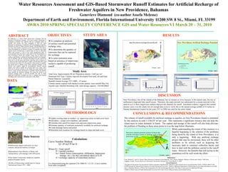
- 1. Water Resources Assessment and GIS-Based Stormwater Runoff Estimates for Artificial Recharge of Freshwater Aquifers in New Providence, Bahamas Genevieve Diamond (co-author Assefa Melesse) Department of Earth and Environment, Florida International University 11200 SW 8 St., Miami, FL 33199 AWRA 2010 SPRING SPECIALTY CONFERENCE GIS and Water Resources VI March 20 – 31, 2010 ABSTRACT The Bahamas is a small island nation that is dealing with the problem of freshwater shortage. All of the country's freshwater is contained in shallow lens aquifers that are recharged solely by rainfall. The country has been struggling to meet the water demands by employing a combination of over-pumping of aquifers, transport of water by barge between islands, and desalinization of sea water. The problem is greatest on the island of New Providence where the capital city of Nassau is located. As rainfall is the single natural source of freshwater, a careful study of ways to efficiently utilize this resource is vital to any water management plan. In recent decades there has been a great deal of new development on New Providence which has created a large area of impervious surfaces and thereby a substantial amount of runoff. Government's way of dealing with the increased flooding from this runoff has been, and is, to drill more and deeper injection wells to dispose of it. However, this runoff represents a supply of freshwater that could be utilized by the island. It is the purpose of this project to quantify this runoff and to identify areas where artificial recharge of the shallow lens aquifers might be accomplished. Remote sensing images were used to update the existing land cover maps. Since there are no natural streams on the island, the roads network was used to create streams and basins to calculate runoff and identify areas suitable for artificial recharge. By using this runoff in an artificial recharge plan, it will be possible not only to make additional freshwater available but also to mitigate the frequent flooding events experienced in some parts of the island. OBJECTIVES DATA To complete an analysis of surface runoff and potential recharge sites; To determine the quantity of rainwater that can be captured for recharge To select potential areas based on presence of impervious surfaces capable of producing runoff STUDY AREA RESULTS DISCUSSION CONCLUSIONS & RECOMMENDATIONSMETHODOLOGY December, 2000 Study Area Total Area: Approximately 80 mi2 Population density: 2,665 per mi2 Dominant Soil Type: Calcaric regosols developed from sand, silt and loam Parent Material: Limestone Rainfall Annual Average 1971-2000 – 55 inches Climate marine tropical with marked wet/dry pattern, most rainfall May-Oct Aquifer type: Ghyben-Hertzberg with total storage capacity: 120,448,000m3 New Providence International Airport Rainfall Totals 1971 - 2000 0.00 10.00 20.00 30.00 40.00 50.00 60.00 70.00 80.00 90.00 1971 1974 1977 1980 1983 1986 1989 1992 1995 1998 Total in inches 2 per. Mov. Avg. (Total in inches) 2004ArcInfo dataset with aerial, two foot contours, and paved roadway coverages Spreadsheets from Ministry of Works and Transportation with drainage wells GPS points The Nature Conservancy landcover, aquifers, political boundary layers Update existing maps as needed e.g. impervious areas on land cover layer Edit tables – assign curve numbers, add rainfall Calculate total runoff for impervious and semi-impervious areas Estimate quantity of rainwater potentially available for artificial recharge Create drainage basins and points Determine best locations for recharge based on slope and land cover New Providence Monthly Average Rainfall (ins) 1 2 3 4 5 6 7 8 9 10 Jan Feb M ar Apr M ay Jun Jul Aug Sep O ct Nov Dec Month Rainfall(Inches) Rainfall (ins) Office of Meteorology rainfall data for Nassau International Airport 1971 - 2000 Calculations Curve Number Method Q= (P-Ia)2/P-Ia+S Where Q = Total runoff P = rainfall (inches) Ia = Initial losses (interception, infiltration, depression storage, etc.), for this calculation taken as 0.2S S = recharge capacity of watershed (inches) S is determined using the equation CN=1000/10 + S, CN = Curve number from table (weighted) New Providence, like all the islands of the Bahamas, has no streams or rivers because, in the natural state, the rate of infiltration is high and little runoff occurs. Therefore, the roads network was substituted for a stream network in this analysis as it is these impervious surfaces that provide channels for runoff. Anecdotal evidence suggests that rainfall amount varies over the island, but not enough data exists to verify this so the annual average rainfall of 55 inches at Nassau International Airport for the years 1971 to 2000 was used for the entire island. Red arrows indicate potential recharge locations that coincide with dense clusters of drainage wells in flood- prone areas on NP References Cant, Richard V., and P. S. Weech. Water Resources Evaluation of the Bahamas. Tech. Nassau, Bahamas: Ministry of Works and Utilities, 1980. Print. England, Gordon. Nassau Stormwater Masterplan. Stormwater Solutions Inc. Cocoa Beach, FL 2009 Acknowledgments The grant for this project was provided by USDA Cooperative State Research, Education, and Extension Service (Grant Number USDA- CSREES 2006-51160- 03409) through the Agroecology Program at Florida International University.. Thanks to Bahamas Department of Meteorology for providing information on rainfall data, to Bahamas Ministry of Works and Transportation for GIS and drainage data and to The Nature Conservancy for additional GIS data. Thanks to Daniel Gann at Florida International University GIS Center for his willing assistance and invaluable advice. The volume of runoff available for artificial recharge to aquifers on New Providence Island is estimated by this analysis to total 5.336x10⁷ m3 per year. This represents a significant resource that can help the island meet its water demands in future. The capture and storage of this runoff will also help alleviate the problem of flooding in those areas prone to it as the map below illustrates. While understanding the extent of this resource is a hopeful beginning to the solution of the problems being faced by the island of New Providence, it is only a beginning. With any artificial recharge project that may be envisioned, there will be other problems to be solved, such as acquiring the necessary land to construct collection basins and how to deal with the pollution carried in the runoff water. However, the benefits that will accrue to the population will be well worth the effort. Data Sources