
Recomendados
Recomendados
Más contenido relacionado
Similar a P1 final-Liang
Último
Último (20)
P1 final-Liang
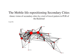
- 1. The Mobile life repositioning Secondary Cities -future vision of secondary cities by a tool of travel pattern in PUR of the Randstad Liang Wei
- 2. Content -Motivation -Introduction -Main Research Question -Analysis -Sub-Questions -Project Approach -Project Planning
- 3. Bohai Economic Rim Motivation Yangtze River Delta Starting From Yangtze River Delta Pearl River Delta
- 4. Network in Yangtze River Delta -Shanghai as a Dominate Megnet City -Two Large CitiesNanjing and Hang Zhou directing to Shanghai -Three of medium-sized cities connecting Shanghai much more than two core cities Nanjing Nanjing Wuxi Wuxi Suzhou `shanghai Suzhou Shanghai Shanghai Hangzhou Hangzhou Ningbo
- 5. Vision of Yangtze River Delta 2020 -Improve Reginal Competiveness in Global Level -Promoting Two Centers (Nanjing and Hangzhou) by promoting Economical Complementray for the Region -Six Medium-Sized Cities to be more innovative and Strengthen Local Industry
- 6. Migration to Mega-City as well as Medium-Sized Cities
- 7. Problems of Secondary Cities in Yangtz Pearl Delta Urban congestion Urbanisation and Expansion Increased Housing Price Lack of Identity
- 8. Identity of Secondary Cities in Yangtz Pear Delta Suzhou Changzhou Ningbo Wuxi
- 9. Randstad as a Polycentric Urban Region Randstad Region represents a very particular Division of Labour between the Randstad, the F Polycentric Urban Region in the world (Kloosterman and Musterd, 2001).
- 10. Learning from the Randstad: What is a Polycentric Urban Region in case of the Randstad? What kind of Roles do Secondary Cities play in the PUR of the Randstad?
- 11. Introdution the Randstad as a Polycentric Urban Region
- 12. Randstad as a Polycentric Urban Region Amsterdam,Den haag, Zaanstad Rotterdam, Utrecht as main cores, Velsen Schipol Area- Airport City (Maurits Schaafsma, 2009) will be another core. Amsterdam Haarlem Almere Hilversum Schipol Amersfoort Leiden Alphen a/d Rijn Zeist Utrecht Zoetemeer Den Haag Gouda Delft Rotterdam Dordrecht
- 13. Flow Between Sub-regions in Randstad 2028 These five cores play complementary role in this PRU. Therefore, communication between five cores has trend to be stronger.
- 14. Advantages of Polycentric Urban System a1 1. Decentraliztion of Economy (low land price, less congestion) Economy Specialisation (e.g Knowledge Economy) A a2 2. Urban Congestion including traffic jam, traffic accident, noise, pollution, etc. 3 Diversity of Social Structure and Social Cohesion B The European Commission is among the (political) actors who views polycentric b1 development as a boon to achieving social and spatial cohesion (and competitive- b2 b ness) at various spatial scales (The Polycentric Metropolis Unpacked, 2009). Monocentric Urban System/ Corridor City 4. Strengthen Identity of the Region a1 a1 Kees Terlouw proposed regional identity is shifting from thick to Thin Regional Identity are more network based and more economy and future oriented. A a2 A a2 B B b1 b1 b2 b2 Polycentric Urban System
- 15. Urban Congestion decrease urban congestion by improving polycentricity a1 a1 3 There are four ways: Type 1 is two-direction flow between a core city and its 1 secondary city (e.g. a2-A). Type 2 is flow between a secondary city and other core city (e.g. a2-B). A a2 Type 3 is flow between two secondary cities both of which A a2 2 belong to one core city (e.g. a1-a2). Type 4 is flow between two secondary cities both of which belong to different core cities (e.g. a2-b1) 4 B B b1 b1 b2 b2
- 16. Main Research Question: How can the development of secondary cities contribute to the emergence of a polycentric spatial structure?
- 17. Analysis Polycentric Structure of the Randstad in Depth
- 18. Important Notions of Polycentrism 1. using the concept of Polycentrism to expain an exisiting or emerging polycentric urban system - analytical dimension, or as a planning strategy refers to active encouragement of poly- centric development as a policy objective-normative dimen- sion (Davoudi, 2003) 2. Polycentrism in scalar dimension: “polycentricity can occur at multiple levels or spatial scales, and what is monocentric at one level can be polycentric at another-and vice versa” (Hall, 2003) 3. Level of Polycentrism: a) the lower lever: no relations between settlements, just distri bution of the population b) the media lever: minimum interaction, which centres are part of system and which are independent of it c) the synergetic lever: each centre has a city or regional scale function, and its function provides supplies for whole urban system (Champion, 2001)
- 19. Polycentricity on Different Scales Core Cities Core Cities Secondary Cities Secondary Symmetry Cities Relation Symmetry A-Symmetry Relation Relation A-Symmetry Relation “polycentricity can occur at multiple levels or spatial scales, and what is monocentric at one lev- el can be polycentric at another-and vice versa” (Hall, 2003)
- 20. Polycentricity by Different Topics - Company Network The strongest links and thus the highest potential for exchange typi- cally occurred between Amsterdam, Rotterdam, The Hague and Utrecht and not so much between these cit- ies and their surroundingsubcentres. This finding signals the existence of relationships at the pan-Rands- tad level, but simultaneously points at intra-regional fragmentation and‘disconnectedness’. Lambregts, B. (2009). Connected Cities in a Polycentric Mega City-region: Exploring Intra- and Extra-Regional Liankages Through Office Networks in the Randstad Rck, J. R. v., Oort, F. v., Raspe, O., Daalhuizen, F., & Brussel, J. v. (2006). Veel Steden Maken Nog Geen Randstad. Rotterdam: NAI Uitgevers
- 21. Polycentricity by Different Topics - Commuting Pattern 1. Commuting patterns between core cities are more ore less “Symmetry”. 2. Commuting patterns between core cities and sec- ondary cities are very “A-Symmetry”. 3. City-region of Amsterdam and Rotterdam are much more “A-Symmetry” than city-region of The Hague and Utrecht. Rck, J. R. v., Oort, F. v., Raspe, O., Daalhuizen, F., & Brussel, J. v. (2006). Veel Steden Maken Nog Geen Randstad. Rotterdam: NAI Uitgevers etry of commuting patterns between municipalities in the Randstad 1990/1994 and 2000/2003. (source:
- 22. Polycentricity by Different Topics - Shopping Network 1. Interaction mostly takes place between secondary cities and their own core cities. 2.Interaction between core cites is very low. 3. From this point, Randstad is just a cluster of four conurbations. Rck, J. R. v., Oort, F. v., Raspe, O., Daalhuizen, F., & Brussel, J. v. (2006). Veel Steden Maken Nog Geen Randstad. Rotterdam: NAI Uitgevers
- 23. Potentials of Secondary Cities in Monocentric Urban System Low Density Proxmity to Nature Family City Locality (spatially/ temporally)
- 24. Potentials of Secondary Cities in Polycentric Urban System Economical Mixed Functions Regional Identity Local+Global Specialization
- 25. Terlouw, K. (2009). Rescaling Regional Identities: communicating thick and thin regional identities. Studies in Ethnicity and Nationalism, 9(3), 452-464. Dune-Bollenstreek
- 26. Impact of Monocentric Urban System on the Urban Form Focus on Neighbourhood Quality Intergration with Green Local Identity Infrastructure Focus on Regional Scale
- 27. Impact of Polycentric Urban System on the Urban Form Diversity of Urban Fabric Stimulating and Restructure Urban Development M P Infrastructure Node Open to Network
- 28. Inter-city Travel Pattern as a Tool to Measure Relationships Daily Urban System Travel purpose: working, shopping and leisure -Question of “POINT” Travel behavior: Model Choice- cycling, car and public transport Distance - Question of “LINE” Migration: Complements Migration Substitute Migration ? secondary city secondary city ? desitination desitination travel behaviour ? travel behaviour ? Question of “POINT” Question of “LINE”
- 29. Main Research Question: How can the development of secondary cities contribute to the emergence of a polycentric spatial structure? Sub-questions: 1.Related to inter city travel pattern by different travel purposes (work, shop and leisure), which roles do secondary cities play in the PUR of the Randstad in economical, social and spatial aspects? 2.Related to inter city travel pattern by different travel behavior(model choice and distance), which roles do second- ary cities play in the PUR of the Randstad in economical, social and spatial aspects? 3.What are the development potential of secondary cities in the PUR of the Randstad? 3.How does inter city travel pattern influence urban form of secondary cities? 4.How could seondary cities make use of potentials by intervention into urban form? 6.What are the identities of the secondary cities attracting inter city travel? In which condition could secondary cit- ies make use of these identities to promote the regional identity? Key words: Polycentric Urban Region, Randstad region, secondary cities, network, intercity travel pattern,urban form, identity,
- 30. Project Approch: developing a Too Box
- 31. Selection of Secondary Cities: a1 A 1 a2 2 Zaanstad Haarlem B A b1 b2 S Hilversum Leiden Amersfoort 1+2 secondary cities connecting two cores Alpen a/d Rijn D Zoetermeer U Gouda Delft R
- 32. Selection of Secondary Cities: a1 3 A a2 Purmerend Lelystad Velsen Zaanstad 4 B Haarlem A Almere b1 b2 S Huizen Hilversum Nijkerk Leiden Amersfoort 3 between two secondary cities both of which belong to one core city Alpen a/d Rijn 4 between two secondary cities both of which belong to di erent core cities Zeist D Zoetermeer U Gouda Delft R
- 34. Tulip Industry
- 37. Living City and Tourism
- 38. Haarlem Connection to Schiphol Hoofddrop Proposed Light Metro Haarlem Proposed Tram Schalkwijk Schiphol
- 40. Methodology Scheme Teorical Framework: Analytical Tool: Technical Tool: Regional Scale Polycentrism Intercity Travel Pattern -Conceptual Dimension -Daily Urban System: -GIS + “Line” and “Point” + -Space Syntax City-Region Scale -Analytical Dimension -Migration “Line” and “Point” -Normative Dimension City Scale
- 41. velopment, or “transit oriented development” (Cervero 2004; Dittmar and Ohland 2004; Dunphy et al. 2004). City Scale Node Unbalanced Stress Analytical Tool in Scales areas 2 Exploring the relation between transport and node land use in station It is generally recognized that land use patterns and trans- Balance portation patterns are closely related to each other. It is eas- ily understood that the spatial separation of human activities creates a need for personal travel and goods transport, and thus in�uences the mobility behaviour of actors such as house- holds and �rms. Less widely appreciated is the converse im- Unbalanced pact of transport on land use (Banister 1995; Giuliano 2004; place Dependence Wegener and Fuerst 1999). It is obvious that the availability of infrastructure makes certain locations accessible, but exactly how developments in the transport system in�uence the lo- cational behaviour of landlords, investors, �rms, and house- Place holds is less clearly understood. �e idea of the “land use Figure 2: �e �ode-�lace Model (a�er Bertolini 1999). transport feedback cycle” (Giuliano 2004; Meyer and Miller 2001; Wegener and Fuerst 1999) is o�en used to illustrate �e node-place model distinguishes �ve ideal-typical situ- the complex relationship between land use and transport. In ations for a station area (Figure 2). Each situation re�ects a this cycle, land use and transport patterns both in�uence each particular relative position of a station area on the node and other. Land use patterns partly determine the location of hu- place scale, or, in other words, its position in the node or place man activities such as living, working, shopping, education, hierarchy of an urban region. �e “balanced” areas are found and leisure. �e distribution of human activities requires use along the middle line; their relative positions on both the node of the transport system to overcome the distance between the and place scales are roughly equal. It is expected that, due to Region Scale where these activities take place. �ese activities cre- locations City-Region Scale transport and land used interactions, these relative positions ate new travel demand and, consequently, a need for trans- will be comparable in most cases. At the top of the line are the portation services, whether in the form of new infrastructure “stressed” areas: locations where both the node and the place or more e�cient operation of existing facilities. �e resulting have been used to the fullest. “Stressed”station areas have a increase in accessibility co-determines the location decisions relatively strong position on both the node and place scales. of landlords, investors, households and �rms and so results in Further development in these areas can become problematic changes of the land use, starting the cycle again. �is process as multiple claims on the limited amount of space can easily continues until a (provisional) equilibrium is reached or until cause con�icts. At the bottom of the line are the “dependent” some external factor intervenes (Meyer and Miller 2001). areas where the struggle for space is minimal. Both the node �e node-place model of Bertolini (1999) follows the rea- and the place values are relatively so weak that factors other soning of the transport land use feedback cycle and aims at than internal node-place dynamics (e.g. subsidization) must further exploring the underlying relationships, with a focus on intervene in order for the area to sustain itself. Furthermore, station areas. �e basic idea is that improving the transport two unbalanced situations exist. Above the middle line are
- 42. Final Approach : Develop a design tool box for secondary cities instead of only one spe- cific design project As follows, there are several sub-approaches of this thesis. 1.Theoritical Framework: Comprehesion of concept of Polycentrism in the context of Randstad Region 2. Empirical Framework: Case Study 3.Analytical Tool: Intercity travel pattern as a tool to measure relationship of secondary cities in the Randstad
- 44. Phazing Tool Motivation -Intercity Travel Pattern -GIS+ Space Syntax Problem Statement Analysis -Regional Scale Normative Research Concept Design Aim Evaluation Questions -City-Region Scale Projcet -City Scale Tool Box Literature Theoretical Review Framwork Empirical Framwork Case Studies
- 45. Time Schedule Tool Motivation -Intercity Travel Pattern -GIS+ Space Syntax Problem Statement Analysis -Regional Scale Normative Research Concept Design Aim Evaluation Questions -City-Region Scale Projcet -City Scale Tool Box Literature Theoretical Review Framwork Empirical Framwork P1 P2 P3 P4 P5 Review Abstract Review Paper Graduation Final Report Thesis Plan Draft Case Studies Thesis Plan Thesis Report Topic Literature Methodology Analysis Tool Box Design Evaluation P1 Formulation Review SEP OCT NOV DEC JAN FEB MAR APR MAY JUN