
Recommended
More Related Content
What's hot
What's hot (20)
Similar to spatial databases ADBMS ppt
Similar to spatial databases ADBMS ppt (20)
Recently uploaded
Recently uploaded (20)
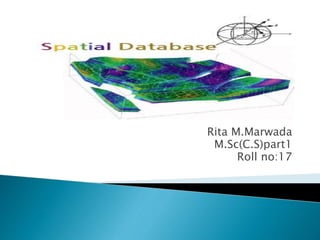
spatial databases ADBMS ppt
- 2. Definition of spatial databases Spatial data types Geographic information systems Conceptual data models for spatial databases Logical data models for spatial databases: raster and data model
- 3. A spatial database, or geodatabase is a database that is optimized to store and query data that represents objects defined in a geometric space. Most spatial databases allow representing simple geometric objects such as points, lines and polygons.
- 4. A spatial database is a collection of spatial data types, operators, indices, processing strategies, etc. and can work with many post-relational DBMS as well as programming languages like Java, Visual Basic etc.
- 5. Non-spatial queries: List the names of all bookstore with more than ten thousand titles. List the names of ten customers, in terms of sales, in the year 2001 Spatial Queries: List the names of all bookstores with ten miles of Minneapolis List all customers who live in Tennessee and its adjoining states Examples of non-spatial data Names, phone numbers, email addresses of people Examples of Spatial data Census Data NASA satellites imagery - terabytes of data per day Weather and Climate Data Rivers, Farms, ecological impact Medical Imaging
- 6. Consider a spatial dataset with: County boundary (dashed white line) Census block - name, area, population, boundary (dark line) Water bodies (dark polygons) Satellite Imagery (gray scale pixels) Storage in a SDBMS table: create table census_blocks ( name s tring, area float, population number, boundary polygon );
- 7. A database: ◦ Relation states(sname: string, area: region, spop: int) ◦ Relation cities(cname: string, center: point; ext: region) ◦ Relation rivers(rname: string, route:line) SELECT * FROM rivers WHERE route intersects R SELECT cname, sname FROM cities, states WHERE center inside area SELECT rname, length(intersection(route, California)) FROM rivers WHERE route intersects California
- 8. Selection queries: “Find all objects inside query q”, inside-> intersects, north Nearest Neighbor-queries: “Find the closets object to a query point q”, k-closest objects Spatial join queries: Two spatial relations S1 and S2, find all pairs: {x in S1, y in S2, and x rel y= true}, rel= intersect, inside, etc
- 9. Region
- 10. A geographical information system (GIS) is a computer -based database for storing, managing, manipulating And displaying data about things that exist or events that occur in space. In most cases the space being considered is the surface of the Earth, but it can range anywhere between a strand of DNA or a solar system. In other words, the key defining thing about these things or events is that they have a (geographic) location that is stored in the database along with their other characteristics that allow them to be visualised in the form of maps and the spatial relationships between them to be analysed. .
- 11. Examples include location-based service, Web-mapping, Web-based planning support system GIService is miniature, mobile, public, and task-specific If GISystem is data-centered, GIService is person-centered
- 13. Data structures are complex for GIS because they must include information pertaining to entities with respect to: position, topological relationships, and attribute information. It is the topologic and spatial aspects of GIS that distinguish it from other types of data bases. Introduction: There are presently three types of representations for geographic data: raster vector, and objects. raster - set of cells on a grid that represents an entity (entity --> symbol/color --> cells). vector -an entity is represented by nodes and their connecting arc or line segment (entity --> points, lines or areas --> connectivity) object – an entity is represented by an object which has as one of its attributes spatial information.
- 14. provide the organizing principles that translates the external data models into functional descriptions of how data objects are related to one another (e.g. non- spatial: E-R model; spatial: raster, vector, object representation).
- 15. provide the explicit forms that the conceptual models can take and is the first step in computing (e.g. non-spatial: hierarchical, network, relational; spatial: 2-d matrix, map file, location list, point dictionary, arc/nodes).
- 17. Definition: realization of the external model which sees the world as a continuously varying surface (field) through the use of 2-D Cartesian arrays forming sets of thematic layers. Space is discretized into a set of connected two dimensional units called a tessellation. The raster data model is an abstraction of the real world where the basic unit of data (points, lines and areas) is represented using a matrix of cells or 'pixels'. The raster model uses the grid-cell data structure where the geographic area is divided into cells identified by rows and columns. The following information must be known when using raster data: - grid extent (number of rows and columns) grid resolution (size of grid cell) Geo referencing information (e.g. corner coordinates) In the simplest form, each cell contains a value for the element. Any cell not containing a feature would have the value of "0". In more sophisticated systems, the cell value is a label that links to the record as an attribute
- 18. Vector modelin the vector data model, features are represented in the form of coordinates. The basic unit of data (points, lines and areas) is composed of a series of one or more coordinate points. For example a line is a collection of related points and an area is a collection of related lines. Vector data model: Definition: realization of the discrete model of real world using structures for storing and relating points, lines and polygons in sets of thematic layers. A point is defined by a single pair of coordinate values. A point normally represents a geographic feature that is too small to be represented as a line or area. For example, a port, a dock, or a hatchery can be represented as a point depending on the scale of the map on which it is be shown. A line is defined by an ordered list of coordinate pairs defining the points through which the line is drawn. Linear feature include contour lines, ship tracks and streams. At most mapping scales these features will retain their linear form, although the degree of detail and generalisation will vary with scale. A line is synonymous with an arc. An area is defined by the lines that make up its boundary. Areas are also referred to as polygons. Examples include ocean basins, lagoons, mangroves, lakes, etc. When shown on maps at a very small scale these features may also eventually become points.
- 20. Raster Model: Advantages Simple data structure Efficient for remotely sensed or scanned data Simple spatial analysis procedures Disadvantages Requires greater storage space on computer Depending on pixel size, graphical output may be less pleasing Projection transformations are more difficult More difficult to represent topological relationships Vector Model Advantages Data can be represented in its original resolution without generalisation Requires less disk storage space Topological relationships are readily maintained Graphical output more closely resembles hand-drawn maps Disadvantages More complex data structure Inefficient for remotely sensed data Some spatial analysis procedures are complex and process intensive Overlaying multiple vector maps is often time consuming
- 21. www.google.com