MH 370 and 911
•
0 recomendaciones•101 vistas

A presentation reviewing major incidents over the past couple of decades and concluding with an aspirational challenges in developing a geospatial information infrastructure. Opinion of the author.

Recomendados
Más contenido relacionado
Similar a MH 370 and 911
Similar a MH 370 and 911 (7)
Más de Robert (Bob) Williams
Más de Robert (Bob) Williams (20)
Último
Último (19)
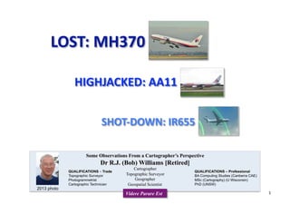
MH 370 and 911
- 2. Saturday, March 8 3.41am (Australian time): Malaysia Airlines flight MH370 takes off from Kuala Lumpur 5.40am: The plane disappears from Malaysian radar. March 9 3pm: Vietnam confirms the plane went missing in its airspace. March 10 FBI called in to investigate possible terrorism link. Malaysia dismisses the objects in South China Sea as not from the plane March 11 Malaysian authorities say the most likely cause is a catastrophic mid-air explosion caused either by a bomb or a highly unusual technical fault brought about by sabotage, hijack or ‘‘mental or personality problems’’. March 12 Malaysian authorities admit they are unsure which direction the plane was flying when it disappeared. Pilot’s final words released: ‘‘All right. Good night.’’ March 13 Chinese government releases satellite images of ‘‘floating objects’’ in the ‘‘suspected crash area’’ in the Gulf of Thailand. March 15 Satellite data shows the plane flew for seven hours after communications equipment was turned off, possibly towards Iran or south-west to the Indian Ocean. March 16 Malaysia Airlines reveals plane’s communications were deliberately turned off. March 18 Revealed that someone altered the flight path by typing a code into a flight management system. Australian-led search of the Indian Ocean begins. March 19 Malaysian defence minister asks US to share data from Pine Gap bases in Australia. March 20 Images released of potential wreckage 2300 kilometres south-west of Perth. Australia dispatches four Orion P3 maritime surveillance planes and RAAF C-130 Hercules aircraft, New Zealand sends another and the US sends a Poseidon submarine-hunting plane. March 21 Revealed that US satellite supplied the images of the floating debris. March 22 University of Western Australia oceanographer says the debris may have originated 500 kilometres away. March 23 Chinese satellite identifies another large object in the Indian Ocean. March 24 Australian Prime Minister Tony Abbott tells Parliament more possible wreckage been spotted. March 25 Malaysian Prime Minister Najib Razak announces MH370 crashed into the southern Indian Ocean killing all on board. Australia’s HMAS Success only ship in the southern search area. Ten Chinese ships and six Malaysian vessels, with three ship-borne helicopters, expected on Tuesday MARCH 2014 Timeline#: MH370 # As at 25 March 2014 2
- 4. MINISTER HISHAMMUDDIN told Four Corners that MH370 was tracked by the military in real time, but inexplicably, dismissed as not hostile by the officer on duty. The military also decided not to send up one of its planes to investigate. (to Hishammudin Hussein) But why not send the jets up if you, you have conceded earlier that you knew very early in the morning the plane was missing, there was four and a half hours time in which to respond... HISHAMMUDIN HUSSEIN: It was not hostile; it was commercial; it was from our airspace; we're not at war with anybody. Even if we sent them up, are you going to say that we're going to shoot it down? CARO MELDRUM‐HANNA: Well you said that, not me... HISHAMMUDIN HUSSEIN: No, I'm asking you. CARO MELDRUM‐HANNA: I could not possibly answer that… HISHAMMUDIN HUSSEIN: If you're not going to shoot it down, what's the point of sending it up? CARO MELDRUM‐HANNA: To see where it's going. HISHAMMUDIN HUSSEIN: Well to see where it going, you need a fighter for that? If you're talking about military procedures, and if I did shoot it down, you'd be the first to say, how can you shoot down a commercial airline with twenty 4 nationals, half of them Chinese, I'd be in a worse position probably. CARO MELDRUM‐HANNA: Why shoot it down though if it's not hostile? HISHAMMUDIN HUSSEIN: Well the Americans would. LOST: MH370 By Caro Meldrum‐Hanna and Wayne Harley Updated May 21, 2014 10:07:00 MAY 2014 LOST: MH370 HISHAMMUDIN HUSSEIN, Minister of Defence AcHng Minister of Transport, MALAYSIA Extract from FOUR CORNERS TRANSCRIPT 4
- 5. A hijacked passenger jet, American Flight 11, crashes into the north tower of the World Trade Center A second hijacked airliner, United Flight 175, crashes into the south tower of the World Trade Center 0845 EDT 0903 EDT “NORAD and the FAA were unprepared for the type of attacks launched against the United States on September 11th, 2001. They struggled under very difficult circumstances to improvise the homeland defense against a challenge that they had never encountered, and honestly never been trained to meet.” Philip Zelikow The term "new world order" has been used to refer to any new period of history evidencing a dramaHc change in world poliHcal thought and the balance of power. Despite various interpretaHons of this term, it is primarily associated with the ideological noHon of of global governance only in the sense of new collecHve efforts to idenHfy, understand, or address worldwide problems that go beyond the capacity of individual naHons to solve. (Wikipedia) July 22, 2004 When quesHoned by the 9/11 Commission, General Eberhart confirmed that if NORAD had been in the loop as the FAA said it was, his people would have been able “to shoot down all three aircraft — all four aircraft.” General Ralph Eberhart, US Northern Command American Flight 11 SEPTEMBER 2001 HIGHJACKED: AA11 5
- 6. AUGUST 2001 2001 – Friday 24 August. I gave briefings to a number of groups in Canberra on my overseas trip and highlighted deficiencies in the air traffic management systems. I introduced my presentations with a hypothetical event: an unidentified aircraft was approaching Australia across the Indian Ocean. What action needs to be taken? And when? My event was similar to the USS Vincennes – Iranian Air IR655 incident on July 3, 1988. In my presentation I reported that the databases were not designed to permit analytical processes; such as, does the ‘dot on the screen’ lie on a recognized air route? And does the ‘dot’ appear where a scheduled flight should be? I went on to recommend an opHon within Project capability development. The use of geospaHal, or military geographic, informaHon is pervasive. With respect to topics observed on the 2001 visit, I recommended that we need to explicitly address a known capability deficiency such as the Australian Defence Air Traffic System (ADATS) Two and a half weeks PRIOR to 911 Considering amendment to the Capability OpHons Document for Joint Project JP2064 Phase 2; Acknowledging that the concept of evolving from a publicaHon paradigm towards naXonal security paradigm via the logical stages of an informaHon service paradigm and a situaHon awareness paradigm consHtutes an audacious goal. If acknowledged as such then a jointly sponsored experiment to iden:fy capability development issues should be undertaken. SuggesXons were NOT even discussed # 2000-2001 Additional Estimates Hearing 21 February 2001 Major Capital Equipment Project Delays or Cost Overruns AIR 5186 Australian Defence Air Traffic System Slippage 59 months Contract 29 November 1995 6
- 7. Iran Air Flight 655 (IR655) was a commercial flight operated by Iran Air that flew from Tehran to Bandar Abbas to Dubai. On July 3, 1988, the airplane flying IR655 was shot down by the U.S. Navy guided missile cruiser USS Vincennes between Bandar Abbas and Dubai, killing all 290 passengers and crew aboard, including 38 non-Iranians. On the morning of July 3, the Vincennes crossed into Iranian territorial waters during clashes with Iranian gunboats. L-18 JULY 1988 SHOT‐DOWN: IR655 AIRCRASH INVESTIGATIONS En Route Chart (ERC) in area of incident 7
- 8. “… I’d like to take a few moments to recognise that you not only convene on the fourth anniversary of 911 but at a time when devastation along the Gulf Coast from Katrina shows us just how much work we have to do to be prepared. After four years you’d think that we’d be in a better position to coordinate federally a response to such a disaster. Imagine if a bunch of terrorists had blown up a levee how much fundamentally different would that be”. Senator Joe Biden, Address to [US] Homeland Security GIS Summit 2005 US Intelligence Reform “When asked last fall about pending intelligence reform, former Director of Central Intelligence GEORGE TENET said he felt like a patient on an operating table who, while being prepared for brain surgery, found himself surrounded by 12 surgeons, non of whom had gone to medical school”. By Scoge Barnes, GeoIntelligence, Jan 1, 2005 Thomas Kean, CHAIRMAN 9/11 COMMISSION July 22, 2004 “We have failures in: POLICY, MANAGEMENT, CAPABILITY and above all in IMAGINATION” INTER-AGENCY COLLABORATION MULTI-NATIONAL COOPERATION NATIONAL INFORMATION INFRASTRUCTURE NATIONAL SECURITY EXPERTISE & QUALIFICATION CRITICAL INFRASTRUCTURE PROTECTION EMERGENCY MANAGEMENT - ETC 8
- 9. Malaysia Airlines MH370 disappearance highlights radar deficiencies The ease with which Malaysia Airlines flight MH370 disappeared from radar systems illustrates an uncomfortable paradox in modern aviation: state-of-the-art airplanes rely on ageing ground infrastructure to tell them where to go. While satellites shape almost every aspect of modern life, the use of radar and radio in the cockpit has, for many pilots, changed little since before the jet engine was first flown. Even though Malaysia suspects someone may have hidden its tracks, the inability of 26 nations to find a 250-tonne Boeing 777 has shocked an increasingly connected world and exposed flaws in the use of radar, which fades over oceans and deserts. "It's not very accurate. The world's moved a bit further along," said Don Thoma, president of Aireon, a venture launched by US-based mobile satellite communications company Iridium and the Canadian air traffic control authority in 2012 to offer space-based tracking of planes. "We track our cars, we track our kids' cell phones, but we can't track airplanes when they are over oceans or other remote areas. "Satellites provide the obvious answer, experts say. "The way to go is satellite-based navigation and communication. In navigation, we need to get away from ground-based radar and in communications we need to get away from radios," radar expert and aviation consultant Hans Weber said. Wed 12 Mar 2014 More than just location!Terrain matching! IRAQ 1 Precision navigation! IRAQ 2 Satellite Navigation, also, has taken a long time to be adopted! 2014 – Major Issues & Challenges – Satellite navigation 9
- 10. 2014 – Major Issues & Challenges – Search & Rescue 1997 A national centre was established by the Federal Government in 1997 for coordination of Australia's civil search and rescue (SAR) activities. Coastwatch was a Division of the Australian Customs Service with its headquarters based in Canberra, Australia. The former Coastwatch Division is now known as the Border Protection Division of Customs and is a part of the Border Protection Command , a joint civil/military organisation responsible for civil maritime security. 2014 “The Australian Maritime Safety Authority (AMSA)'s Spatial Data Centre provides access to a range of historic vessel tracking information, positional information for our aids to vessel navigation network and boundaries for Australia’s search and rescue region. SDC isprogressively increasing the range of data available in a variety of data formats including ESRI shapefile, kml, data files (csv), PDF maps. It also provides access to a variety of contemporary map products available for download. Maps are suitable for printing, inclusion in reports, presentations and as educational material”. The Australian Customs and Border Protection Service is the Australian Federal Government agency responsible for managing the security and integrity of the Australian border. It facilitates the movement of legitimate international travellers and goods, whilst protecting the safety, security and commercial interests of Australians. Surely, surely, surely, after MH370 it must be time to address the management of our critical infrastructure – across the breadth of issues related to Critical Infrastructure – Threats to Security 10
- 11. We have a MAJOR capability, at least a quarter of a century behind where it ought to be, AND there is little chance of developing sophisticated systems capable of addressing issues such as those associated with MH370 UNLESS we have major organisational changes such as removing AGO from the Intelligence program, structuring it in the style recommended in the DER/DRP 1997, and placing it in a Joint Headquarters. Air Marshal Mark Binskin to be unveiled as new chief of Australian Defence Force Fri 4 Apr 2014 7:30am AEDT Paper maps and charts Dare to Change! It’s time to change! It’s time to develop a National Geospatial Information Infrastructure! 11
- 12. For comments from The Hon Malcolm Turnbull MP Minister for Communications OBSERVING that Australia does NOT have a National Mapping Agency The civilian capability resides as a Section within a Division of Geoscience Australia o AND that there are NO Senior Executives with qualifications in CARTOGRAPHY [there are a few with GEODESY] The military capability resides as a branch within Australian Geospatial-Intelligence Organisation (AGO) o AND that there are NO Senior Executives with appropriate qualifications in AGO [CARTOGRAPHY and GEODESY] o AND AGO is an intelligence organisation with all of the constraints of that status o AND the high costs of highly classified agencies o AND it relies on its US partner the US National Geospatial-Intelligence Agency (NGA) for leadership o AND, consequently, interacts in a most limited way with Australian academic and research establishments o AND that US NGA has NOT made the transition from producing standards maps and charts to managing a Geospatial Information Infrastructure RECOGNISING that there is a need to have a National agency appropriately skilled to undertake a multitude of tasks to meet the need of current and emerging systems across a wide range of activities WILL the Government consider (particularly after the MH370 incident) undertaking a review of CAPABILITY My opinion! There are many issues associated with the preceding slides. A starting challenge is to create a national agency 12