Mapping Santa Catarina, Brazil with SPOT 5 HRS and HRG by ENGEMAP
•
1 like•895 views

Spot Image and its partners add value to satellite imagery in Mapping. Case study - Mapping Santa Catarina, Brazil with SPOT 5 HRS and HRG

Recommended
Recommended
More Related Content
What's hot
What's hot (20)
Viewers also liked
Viewers also liked (11)
Similar to Mapping Santa Catarina, Brazil with SPOT 5 HRS and HRG by ENGEMAP
Similar to Mapping Santa Catarina, Brazil with SPOT 5 HRS and HRG by ENGEMAP (20)
More from Spot Image
More from Spot Image (7)
Recently uploaded
Recently uploaded (20)
Mapping Santa Catarina, Brazil with SPOT 5 HRS and HRG by ENGEMAP
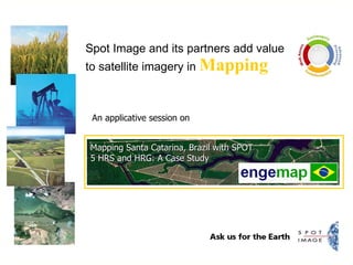
- 1. Spot Image and its partners add value to satellite imagery in Mapping An applicative session on Mapping Santa Catarina, Brazil with SPOT 5 HRS and HRG: A Case Study
- 2. Mapping Santa Catarina, Brazil with SPOT 5 HRS and HRG: A Case Study MSc. Weber Pires – Regional Director of Engemap Geotecnologia - Brazil “ HRG” “ HRS”
- 5. Articulation of the Maps at 1:25.000 scale for 11.000 km 2 area Digital Mapping and Charts Generation based exclusively in the Satellite SPOT5 imagery from HRS and HRG The Pilot Project in Brazil
- 7. Control Points Distribution Ground Control Points We collected 138 Ground Control Points – GCPs with GPS L1/L2 stations
- 8. Ortorectification Process Geometric correction – Ortorectification of SPOT Panchromatic Image with HV’s Multspectral Image with HV’s HRS SPOT DEM + +
- 9. Cut line generation Grid – Cartographic Articulation Digital Mosaic Seamless and color balanced Mosaic
- 10. Cartographic Vetorization using photo interpretation and visual analisis from SPOT 5 2,5m Image Vegetation Layer Digital Cartographic Generation
- 11. Hydrography extraction by stereoplotting Digital Cartographic Generation
- 12. Transportation System layer extraction Digital Cartographic Generation
- 13. Conventional stereo plotting from HRS pairs using LPS and PRO600 module with 3D visualization HRS Pair from SC, seashore 120 km 120 km 600 km Altimetry
- 14. Altimetry Based on HRS – automatic contourline generation, before and after edition Contour lines interpolated at 10m intervals (Automatic – Before Edition). Contour lines interpolated at 10m intervals (After Edition).
- 15. Final Products: Topo 1:50.000 &1:25.000
- 16. Accuracy Check Criciúma - SC PLANIMETRIC ORTOIMAGE from SPOT 2,5m - 1:25.000 / 1:10.000 PLANIMETRIC REST. Photogrametric Flight 1:8.000 – MAP scale at 1:2000 HIDRO 1:25.000 (SPOT 2,5m) HIDRO 1:2.000 (FOTO)
- 19. Thank You !!!. Assis – São Paulo – Florianópolis www.engemap.com.br 55 18 3421-2525 * 55 11 5181-4986 [email_address] enge map
- 20. ‘‘ Need the right imagery solutions for your job? Ask for Spot Image.’’ www.spotimage.com