SlideShare una empresa de Scribd logo
1 de 147
Descargar para leer sin conexión
BERKSHIRE PASSENGER RAIL STATION LOCATION AND DESIGN ANALYSIS, DRAFT FOR PUBLIC COMMENT—AUGUST 2014
ACKNOWLEDGEMENTS
BERKSHIRE PASSENGER RAIL STATION LOCATION AND DESIGN ANALYSIS Page 1
 Staff, Elected Officials, and Residents of the Berkshire Line Communities
 Karen Christensen and the Bring Back the Trains Campaign
 Bill Palmer, MassDOT
 Dustin Rhue, MassDOT
 Gary Sheppard, Berkshire Regional Transit Authority
 Bob Malnati, Berkshire Regional Transit Authority
 John R. Hanlon Jr., Housatonic Railroad Company
 Colin Pease, Housatonic Railroad Company
 Deborah Menette, Housatonic Railroad Company
Berkshire Regional Planning Commission
 Nathaniel Karns, AICP, Executive Director
 Thomas Matuszko, AICP, Assistant Director
 Clete Kus, AICP, Transportation Manager
 Mark Maloy, GIS, Data and IT Manager
 Brian Domina, Senior Planner
 Patricia Mullins, Senior Planner
 Gwen Miller, Planner
 Jaclyn Pacejo, Planner
ACKNOWLEDGEMENTS
BERKSHIRE PASSENGER RAIL STATION LOCATION AND DESIGN ANALYSIS Page 2
This page intentionally left blank.
BERKSHIRE PASSENGER RAIL STATION LOCATION AND DESIGN ANALYSIS Page 3
EXECUTIVE SUMMARY
Executive Summary
The Housatonic Railroad Company (HRRC)
has proposed re-establishing passenger rail
service between Danbury, Connecticut and
Pittsfield, Massachusetts on the former
Berkshire Line. The passenger rail service
between these two locations last operated
in 1971 shortly after the Penn Central
Transportation Company filed for bank-
ruptcy. The HRRC proposal would once
again make it possible for a passenger
boarding the passenger train at Grand Cen-
tral Station in New York City to reach Pitts-
field, Massachusetts by train in approxi-
mately four (4) hours and vice versa. For
the HRRC proposal to become reality, a sig-
nificant capital investment in Massachu-
setts, Connecticut and New York will need
to be made to upgrade the rail infrastruc-
ture along the Berkshire Line. Massachu-
setts has made an initial commitment to the
project by entering into an agreement to
acquire the Berkshire Line from HRRC and
committing $35 million dollars to upgrade
the rail infrastructure. Connecticut has not
yet made a commitment, but discussions
are underway between the state and HRRC.
The majority of the existing rail infrastruc-
ture is nearly a century old in both Con-
necticut and Massachusetts. The worn out
jointed rails and ties are not suitable for the
safe operation of a passenger rail service
and must be replaced. Another essential
component of the rail infrastructure are the
passenger rail stations. The ideal passenger
rail station will meet the needs of the com-
munity, the needs of the region and the op-
erational needs of the proposed passenger
rail service. In some instances, the nearly
century old historic passenger rail stations
may meet these needs and in other instances,
new locations may better serve them.
To address this issue, the Berkshire Regional
Planning Commission (BRPC) partnered
with HRRC to conduct this passenger rail
station location and design analysis with the
primary objective of identifying the most fea-
sible and advantageous locations for passen-
ger rail stations along the Berkshire Line.
Other objectives of this study include devel-
oping recommendations for passenger rail
station design, facilities and amenities; eval-
uating and refining the preliminary railroad
operations analysis; and assessing the poten-
tial economic, environmental, land use and
community benefits and impacts of the pro-
posed passenger rail service and the recom-
mended passenger rail station locations.
Funding for this study was provided
through a Transportation, Community and
Systems Preservation Grant awarded to the
BRPC by the U.S. Department of Transporta-
tion.
The development of the passenger rail sta-
tion location recommendations follow the
Sustainable Development Principles of the
Commonwealth of Massachusetts and smart
growth principles and principles from Sus-
tainable Berkshires (the regional plan for
Berkshire County). In accordance with these
principles, a conscious effort was made to
identify passenger rail station locations in
mixed use downtown areas that have exist-
ing pedestrian connectivity and existing
commercial establishments that would bene-
fit from a passenger rail station. The most
significant challenge in locating a passen-
ger rail station in a downtown area was
finding sites with sufficient room for park-
ing. Thus, for the recommended down-
town passenger rail stations a smaller
amount of parking, compared to a regional
passenger rail station, will likely be availa-
ble. The limited amount of parking at the
downtown locations should not be prob-
lematic as an overwhelming majority of
passengers using the service are projected
to be traveling north to Berkshire County
and will not have a need for parking. In
addition, the passenger rail stations pro-
posed for the City of Pittsfield and the
Town of Sheffield (if one is constructed)
are recommended to function as larger
regional stations and will provide more
parking for southbound passengers. Only
when no feasible location can be found in a
downtown areas does BRPC support the
construction of a passenger rail station out-
side of the mixed use downtown areas un-
less operational needs dictate otherwise.
Stations located outside of downtown are-
as would likely diminish the economic
benefit to the communities, and severely
diminish the potential for the proposed
passenger rail service to provide intra-
county transportation for residents and
visitors.
Map 1: Locus Map
BERKSHIRE PASSENGER RAIL STATION LOCATION AND DESIGN ANALYSIS Page 4
EXECUTIVE SUMMARY
Summary of Key Findings
1. The rail infrastructure along the Berkshire
Line needs total replacement. All of the near-
ly century old existing jointed rail and ties need
to be replaced with new ties and welded rail.
The at-grade public crossings require safety
upgrades and passenger rail stations need to be
retrofitted or built new. The estimated total cost
of the rail infrastructure improvements in both
Connecticut and Massachusetts exceeds $200
million dollars.
2. With input from HRRC, the ideal minimum
spacing between stations was determined to
be ten (10) miles apart for the passenger rail
service to operate efficiently.
3. Initial passenger rail stations are recommend-
ed for the City of Pittsfield, the Town of Lee
and the Town of Great Barrington. Passenger
rail stations located in these locations will best
serve the needs of the region and the operation-
al needs of the proposed passenger rail service.
4. The Joseph Scelsi Intermodal Transportation
Center on Columbus Avenue is the recom-
mended location for a regional passenger rail
station in the City of Pittsfield. A passenger
rail station located at this location, which is the
site of an active regional and inter-city bus de-
pot and passenger train station (Amtrak- Bos-
ton to Chicago), best serves the local needs of
the community, supports economic develop-
ment along North Street and adjacent commer-
cial areas, and facilitates intra-county transpor-
tation.
5. A new passenger rail station to be constructed
on the west side of the downtown area on
Railroad Street is the recommended location
for a passenger rail station in the Town of Lee.
A new passenger rail station in this location is
expected to serve the needs of the local commu-
nity, support existing commercial establish-
ments in the downtown area, further economic
development, and facilitate intra-county trans-
portation. Two possible scenarios are provided
in this report.
6. The reuse of the existing historic passenger
rail station site in the downtown area on Cas-
tle Street is the recommended location for a
passenger rail station in the Town of Great
Barrington. The reuse of the historic passen-
ger rail station site is expected to serve the
needs of the local community, support the ex-
isting commercial establishments in the down-
town area, further economic development, and
facilitate intra-county transportation.
7. The Town of Sheffield is conditionally recom-
mended as an initial location for a regional
passenger rail station. The southern part of
Sheffield may be an ideal location for a passen-
ger rail station to serve Sheffield and north-
western Connecticut if a passenger rail station
is not located in North Canaan, Connecticut. A
passenger rail station in both locations would
not allow the passenger rail service to operate
efficiently and is not recommended. HRRC
owns a ten (10) acre site (State Line) in this
area that is recommended for use as a passen-
ger rail station.
8. A passenger rail station is not recommended
for the Town of Lenox because it is located
within ten (10) miles of the City of Pittsfield
and the rail corridor passes through the less
densely developed area of the town. Lenox
residents will have access to the passenger rail
service at the Pittsfield station or the Lee sta-
tion.
9. A passenger rail station is not recommended
for the Town of Stockbridge because it is lo-
cated within ten (10) miles of Great Barring-
ton and the potential for additional economic
development in areas adjacent to the potential
passenger rail station locations is not as great
as the other communities. Stockbridge resi-
dents will have access to the passenger rail ser-
vice at the Lee station or the Great Barrington
station.
10. The attendees at the public meetings held
throughout the study period and respondents
to an online survey expressed strong support
for the return of passenger rail service to Berk-
shire County. The attendees/respondents also
expressed an interest in using the proposed
passenger rail service for travel within the
Berkshire region and to New York City.
11. The attendees at the public meetings and re-
spondents to the online survey identified prior-
ities for the types of amenities and services
offered at a Berkshire passenger rail station.
Strong pedestrian connectivity around a pas-
senger rail station was indicated as a top priori-
ty. The convenience of ticket purchasing and
access to and from the passenger rail station
were also identified as top priorities by
attendees/respondents.
12. Further refinement of the 2010 Market Street
Research (MSR) marketing study suggests that
over a five (5) year period annual ridership
between Berkshire County and points south
will increase to 1,086,874 one-way fares per
year.
13. The MSR marketing study suggests that peak
demand for the passenger rail service will be
on weekends in the summer months as a large
majority of the passengers traveling to Berk-
shire County will be visitors as opposed to
commuters. The MSR marketing study also
showed demand in the fall and winter months
as well.
14. The MSR marketing study suggests that travel
options at the passenger rail stations are an
important consideration for those who would
use the proposed passenger rail service.
Efforts will be made to coordinate departures/
arrivals with BRTA’s schedule.
15. The report titled “Economic Benefits of
Housatonic Railroad Passenger Ser-
vice” (Economic Report) authored by the Cen-
ter for Creative Community Development at
Williams College projects that the economic
benefits to the region over a ten year period (3
Joseph Scelsi Intermodal Transportation Center
BERKSHIRE PASSENGER RAIL STATION LOCATION AND DESIGN ANALYSIS Page 5
EXECUTIVE SUMMARY
years of construction and 7 years of oper-
ations) are expected to be significant. The
increase in economic output during the
first decade of the project is expected to
be in excess of $635 million dollars with
an average of 610 new jobs created.
16. The Economic Report suggests that the
tourism industry in the region will ex-
pand with an estimated 126 new jobs
created and an additional $12.5 million
dollars in economic output.
17. The Economic Report suggests that local
governments in the region could collect
approximately $2.6 million dollars more
annually, if the passenger rail service
was operating.
18. Noise impacts from the proposed pas-
senger rail service are not expected to be
significant throughout the majority of
the rail corridor. The most noticeable
noise impacts will occur around the pub-
lic at-grade crossings where federal regu-
lations require locomotive engineers to
routinely sound the locomotive’s horn.
Exceptions to the federal regulations al-
low communities to establish a “quiet
zone” where routine horn sounding at
public at-grade crossings is not permitted.
19. Vibration impacts from the proposed
passenger rail service are not expected to
be significant throughout a majority of
the rail corridor. The replacement of the
existing jointed rail with welded rail is
expected to decrease vibration and noise
impacts. Mitigation measures can be tak-
en for structures located close to the rail
corridor if vibration impacts become an
Map 2: Proposed Passenger Rail Station Communities issue.
Summary of Recommendations
 MassDOT is encouraged to make the
necessary improvements and upgrades
to the rail infrastructure necessary for a
passenger rail service to be operated on
the Berkshire Line.
 HRRC and the State of Connecticut are
encouraged to continue collaborating on
obtaining funds for the necessary im-
provements and upgrades to the rail
infrastructure necessary for a passenger
rail service be operated on the Berkshire
Line.
 MassDOT is encouraged to engage the
State of Connecticut to assist with col-
laboration efforts to inform federal leg-
islators of the needs and benefits associ-
ated with the re-introduction of the pro-
posed passenger rail service.
 HRRC and MassDOT are encouraged to
construct the passenger rail stations in
the locations recommended in this re-
port or make the funding available for
such construction.
 HRRC and MassDOT are encouraged to
proactively address potential noise and
vibration impacts during the reconstruc-
tion of the rail infrastructure.
 HRRC is encouraged to pursue the ac-
quisition of the rolling stock
(locomotives, passenger cars, etc.) nec-
essary to operate the proposed passen-
ger rail service.
 BRPC is encouraged to facilitate a dis-
cussion between the BRTA, MassDOT,
1Berkshire (Berkshire Chamber of Com-
merce, Berkshire Visitors Bureau) and
the municipalities recommended for ini-
tial passenger rail stations to determine
potential station ownership scenarios
and to identify what partnerships may
need to be developed to operate a suc-
cessful passenger rail station.
 HRRC and MassDOT are encouraged to
work with the BRTA and other providers
of transportation to ensure that transpor-
tation is available at the passenger rail
stations when passengers arrive.
 HRRC and the BRTA are encouraged to
develop a plan for how the proposed
passenger rail service can be used by res-
idents and visitors for intra-county trans-
portation.
 BRPC is encouraged to work coopera-
tively with its counterpart in northwest
Connecticut (Northwest Hills Council of
Governments) to finalize the location of a
joint facility to serve Sheffield and North
Canaan, CT.
 The Commonwealth of Massachusetts is
encouraged to make funding available
for the Berkshire Line communities that
are recommended to host initial passen-
ger rail stations so the communities can
engage in a detailed planning process to
maximize the benefits of the proposed
passenger rail station and minimize its
impacts.
 All of the Berkshire Line communities
are encouraged to stay involved in the
BERKSHIRE PASSENGER RAIL STATION LOCATION AND DESIGN ANALYSIS Page 6
EXECUTIVE SUMMARY
development of the proposed passen-
ger rail service and to communicate
concerns, if any, to BRPC, MassDOT
and HRRC.
 Each of the Berkshire Line communi-
ties may wish to consider establishing
a “quiet zone” in their community if it
is determined that the locomotive horn
noise will create considerable noise
impacts.
 In other localities where passenger rail
services have been introduced, public
authorities, rail carriers, federal and
state safety officials and citizens have
worked together with an organization
called Operation Lifesaver to develop
awareness and safety programs along
the rail lines. During the time when
construction is taking place to upgrade
the tracks and construct stations, it is
recommended that a similar program
be instituted along the rail line in the
Berkshires.
The following general recommendations
pertain to the four (4) Berkshire Line
communities recommended to host ini-
tial passenger rail stations. Specific rec-
ommendations can be found in the Station
Area Plans for each proposed passenger
rail station.
 Play an active role in the siting and
construction of the passenger rail sta-
tion. In particular, consider engaging
the entity responsible for the design
and construction of the proposed pas-
senger rail station to ensure the design
is compatible with the community.
 Consider that a passenger rail station
might be integrated into a mixed-use
building instead of a standalone tradi-
tional platform and shelter. The mixed
-use building could provide additional
revenue to the passenger rail station
owner from lease payments.
 Consider and plan for how the pro-
posed passenger rail station can be an
asset and gathering point for the com-
munity.
 Understand the capacity and condition
of any public parking infrastructure
and the proposed passenger rail sta-
tions impact on the parking. Develop a
parking strategy to ensure that long
term parking and short term parking
are available in the passenger rail sta-
tion area.
 Plan for additional mixed-use develop-
ment around the proposed station area
through amendments to the land use
regulations to encourage Transit Ori-
ented Development (TOD), the adap-
tive reuse of existing buildings and
infill development.
 Understand the condition and capacity
of utility infrastructure (sewer/water/
gas/electricity) to support additional
development around the proposed
passenger rail station locations.
 Consider pedestrian and bicycle con-
nectivity and ensure the surrounding
area provides safe access to the pro-
posed passenger rail station for pedes-
trians and cyclists. Consider installing
wayfinding signs to direct pedestrians
from the passenger rail station to the
downtown establishments
 Consider circulation patterns and
traffic flow to ensure the surrounding
areas do not become congested with
traffic.
BRPC supports the development of the
proposed passenger rail service because in
our estimation, the projected benefits to
the region’s economy and transportation
system outweigh the anticipated localized
impacts to a relatively small number of
areas. This endorsement of the proposed
passenger rail service is not intended to
minimize those instances where impacts
may occur. Our support for the proposed
passenger rail service assumes that the op-
erator of the passenger rail service will use
best practices to prevent and mitigate
those instances so that the quality of life of
those people living in proximity to the rail
corridor is not severely diminished.
Map 3: Recommended Station Locations
BERKSHIRE PASSENGER RAIL STATION LOCATION AND DESIGN ANALYSIS Page 7
Acknowledgements…………………………………………………………………………………………………………………………………………………………..………………………………………………………………………………………….…...……... 1
Executive Summary…………………………………………………………………………………………………………………………………………………………..………………………………………………………………………………………….…...……... 3
Table of Contents………………………………………………………………………………………………………………………………………………………………………………………………………………………………………………………...……………. 7
1. Introduction…………………………………………………………………………………………………………………………………………………………………….……….………………………………………………………………………………...…..….... 11
2. Study Area Descriptions……………………………………………………………………………………………………………………………………………………………………………………………..………………………………………………….……… 15
3. Existing Rail Corridor Conditions & Safety Upgrades………………………………………………………………………………………………………………………………………………………………………………………………………..……... 21
4. Station Location Analysis…………………………..……………………………………………………………………………………………………………………………..………………………………………………………………………………………….... 23
5. Environmental Analysis of Target Areas & Recommended Passenger Rail Station Locations….…………………………………………………………………………………………………………………………………………………. 59
6. Passenger Rail Station Sketch Plans and Ownership Considerations………………………………………………………………………………………………………………………………………………………………………………………. 65
7. Station Area Plans……………………………………………………………………………………………………………………………………………………………………………………………………………………………………………………...…………. 79
8. Ridership Forecasting & Preliminary Service Plan.……………………………………………………………………………………………………………………………………………………………………………………………………………….…. 107
9. Anticipated Benefits & Impacts……………………………………..…………………………………………………………………………………………………………………………………………………………………………………………………….…. 115
10. Public Participation……………………………………………………………………………………………………………………………………………………………………………………………………………………………………………..……….……... 121
11. Considerations for Berkshire Line Communities………………………………………………………………………………………………………………………………………………………………………………….……………………………..…. 125
Appendix………………………………………………………………………………………………………………………………………………………………………………………………………………………………………………..…………….…..……...………. 127
TABLE OF CONTENTS
BERKSHIRE PASSENGER RAIL STATION LOCATION AND DESIGN ANALYSIS Page 8
List of Maps, Tables and Graphics by Section
1. Introduction…………………………………………………………………………………………………………………………………………………………………….……….………………………………………………………………………………...…..…... 10
Map 1.1: Locus Map…………………………………………………………………………………………………………………………………………………………………….……….………………………………………………………………………………… 10
2. Study Area Descriptions……………………………………………………………………………………………………………………………………………………………………………………………..………………………………………………….……… 15
Map 2.1: Area Map…………………………………………………………………………………………………………………………………………………………………….……….…………………………………………………………………………………. 15
Map 2.2: Berkshire Line Communities…………………………………………………………………………………………………………………………………………………………………….……….……………………………………………………….. 15
Map 2.3: Existing Stations …………………………………………………………………………………………………………………………………………………………………….……….……………………………………………………………………….. 16
Table 2.1: Berkshire Line Communities…………………………………………………………………………………………………………………………………………………………………….……….………………………………………………………. 15
3. Existing Rail Corridor Conditions & Safety Upgrades………………………………………………………………………………………………………………………………………………………………………………………………………..……... 21
Map 3.1: Existing Rail by Weight Per Yard...…………………………….……………………………………………………………………………………………..………….……………………………………………………………………………….... 22
Table 3.1: Planned Improvements to the Berkshire Line………….……………………………………………………………………………………………..………….……………………………………………………………………………….... 21
4. Station Location Analysis…………………………..……………………………………………………………………………………………………………………………..………………………………………………………………………………………….... 23
Map 4.1: Buildable Land in Study Area…………………………………………………………………………………………………………………………………………………………………….……….……………………………………………………….. 24
Map 4.2: Target Areas…………………………………………………………………………………………………………………………………………………………………….……….……………………………………………………………………………… 24
Map 4.3: Pittsfield Target Areas…………………………………………………………………………………………………………………………………………………………………….……….…………………………………………………………………. 27
Map 4.4: Lenox Target Areas…………………………………………………………………………………………………………………………………………………………………….……….…………………………………………………………………….. 28
Map 4.5: Lee Target Areas…………………………………………………………………………………………………………………………………………………………………….……….………………………………………………………………………… 31
Map 4.6: Stockbridge Target Areas…………………………………………………………………………………………………………………………………………………………………….……….…………………………………………………………….. 35
Map 4.7: Great Barrington Target Areas…………………………………………………………………………………………………………………………………………………………………….……….……………………………………………………… 38
Map 4.8: Sheffield Target Areas…………………………………………………………………………………………………………………………………………………………………….……….………………………………………………………………… 42
Map 4.9: Berkshire Line…………………………………………………………………………………………………………………………………………………………………….……….…………………………………………………………………………… 48
Map 4.10: Population Density…………………………………………………………………………………………………………………………………………………………………….……….…………………………………………………………………… 48
Map 4.11: Attractions & Accommodations…………………………………………………………………………………………………………………………………………………………………….……….…………………………………………………… 49
Map 4.12: Five Mile Intervals on the Berkshire Line…………………………………………………………………………………………………………………………………………………………………….……….……………………………………… 49
Map 4.13: Recommended Station Locations…………………………………………………………………………………………………………………………………………………………………….……….……………………………………………….. 51
Table 4.1: Massachusetts Sustainable Development Principles…………………………………………………………………………………………………………………………………………………………………….……….……………………… 23
Table 4.2: Principles of Smart Growth…………………………………………………………………………………………………………………………………………………………………….……….………………………………………………………… 23
Table 4.3: Tier I Evaluation Criteria…………………………………………………………………………………………………………………………………………………………………….……….…………………………………………………………….. 23
Table 4.4: Acreage of Developable Land in the Study Area…………………………………………………………………………………………………………………………………………………………………….……….…………………………….. 24
Table 4.5: Characteristics of the Study Area…………………………………………………………………………………………………………………………………………………………………….……….………………………………………………… 24
Table 4.6: Tier 2 Evaluation Criteria…………………………………………………………………………………………………………………………………………………………………….……….…………………………………………………………… 25
Table 4.7: Target Area Rankings by Municipality…………………………………………………………………………………………………………………………………………………………………….……….…………………………………………… 26
Table 4.8: Pittsfield Target Area Rankings…………………………………………………………………………………………………………………………………………………………………….……….…………………………………………………… 27
Table 4.9: Lenox Target Area Rankings…………………………………………………………………………………………………………………………………………………………………….……….………………………………………………………. 30
TABLE OF CONTENTS
BERKSHIRE PASSENGER RAIL STATION LOCATION AND DESIGN ANALYSIS Page 9
Table 4.10: Lee Target Area Rankings…………………………………………………………………………………………………………………………………………………………………….……….………………………………………………………… 30
Table 4.11: Stockbridge Target Area Rankings…………………………………………………………………………………………………………………………………………………………………….……….…………………………………………….. 37
Table 4.12: Great Barrington Target Area Rankings…………………………………………………………………………………………………………………………………………………………………….……….……………………………………… 40
Table 4.13: Sheffield Target Area Rankings…………………………………………………………………………………………………………………………………………………………………….……….…………………………………………………. 44
Table 4.14: Tier 3 Operational & Regional Needs Evaluation Criteria…………………………………………………………………………………………………………………………………………………………………….……….……………….. 47
Table 4.15: Summary of Tier 3 Results…………………………………………………………………………………………………………………………………………………………………….……….……………………………………………………….. 50
Table 4.16: Summary of Recommended Target Areas…………………………………………………………………………………………………………………………………………………………………….……….…………………………………… 50
Table 4.17: Summary of Preferred and Alternative Station Locations…………………………………………………………………………………………………………………………………………………………………….……….………………. 51
5. Environmental Analysis of Target Areas & Recommended Passenger Rail Station Locations….…………………………………………………………………………………………………………………………………………………. 59
Table 5.1: Environmental Constraints…………………………………………………………………………………………………………………………………………………………………….……….…………………………………………………………. 59
Table 5.2: Acreage of Environmental Constraints in Target Areas…………………………………………………………………………………………………………………………………………………………………….……….……………………. 60
Table 5.3: Acreage of the Total Number of Environmental Constraints in Target Areas…………………………………………………………………………………………………………………………………………………………………….… 60
6. Passenger Rail Station Sketch Plans and Ownership Considerations……………………………………………………………………………………………………………………………………………………………………….………………. 63
Table 6.1: Passenger Rail Facilities on the Cape Flyer Service…………………………………………………………………………………………………………………………………………………………………….……….………………………… 75
Table 6.2: Passenger Rail Facilities on the Downeaster Service…………………………………………………………………………………………………………………………………………………………………….……….……………………… 75
Table 6.3: Passenger Rail Service Cost Comparisons…………………………………………………………………………….…………………………………………………………………………………………………….……….……………………… 77
7. Station Area Plans……………………………………………………………………………………………………………………………………………………………………………………………………………………………………………………...…………. 79
Figure 7.1: Intermodal Center Station Area…………………………………………………………………………………………………………………………………………………………………….……….………………………………………………….. 80
Figure 7.2: Land Use within the Intermodal Center Station Area…………………………………………………………………………………………………………………………………………………………………….……….……………………… 82
Figure 7.3: Historic Districts within the Intermodal Center Station Area…………………………………………………………………………………………………………………………………………………………………….……….……………. 83
Figure 7.4: Zoning within the Intermodal Center Station Area…………………………………………………………………………………………………………………………………………………………………….……….…………………………. 83
Figure 7.5: Public Infrastructure in the Intermodal Center Station Area…………………………………………………………………………………………………………………………………………………………………….……….……………. 84
Figure 7.6: Downtown Lee Station Area…………………………………………………………………………………………………………………………………………………………………….……….………………………………………………………. 87
Figure 7.7: Land Use within the Downtown Lee Station Area…………………………………………………………………………………………………………………………………………………………………….……….………………………….. 89
Figure 7.8: Environmental Constraints in the Downtown Lee Station Area…………………………………………………………………………………………………………………………………………………………………….……….………… 90
Figure 7.9: Zoning within the Downtown Lee Station Area…………………………………………………………………………………………………………………………………………………………………….……….……………………………… 91
Figure 7.10: Parking in Downtown Lee…………………………………………………………………………………………………………………………………………………………………….……….……………………………………………………….. 92
Figure 7.11: Sidewalks in the Downtown Lee Station Area…………………………………………………………………………………………………………………………………………………………………….……….……………………………… 92
Figure 7.12: Public Infrastructure in the Downtown Lee Station Area…………………………………………………………………………………………………………………………………………………………………….……….………………. 92
Figure 7.13: Downtown Great Barrington Station Area…………………………………………………………………………………………………………………………………………………………………….……….………………………………….. 94
Figure 7.14: Environmental Constraints in Downtown Great Barrington…………………………………………………………………………………………………………………………………………………………………….……….…………… 95
Figure 7.15: Land Use within the Downtown Great Barrington Station Area…………………………………………………………………………………………………………………………………………………………………….……….……… 96
Figure 7.16: Zoning within the Downtown Great Barrington Station Area…………………………………………………………………………………………………………………………………………………………………….……….………….. 97
TABLE OF CONTENTS
BERKSHIRE PASSENGER RAIL STATION LOCATION AND DESIGN ANALYSIS Page 10
Figure 7.17: Public Infrastructure in the Downtown Great Barrington Station Area…………………………………………………………………………………………………………………………………………………………………….……… 98
Figure 7.18: State Line Station Area…………………………………………………………………………………………………………………………………………………………………….……….…………………………………………………………… 101
Figure 7.19: Land Use within the Massachusetts State Line Station Area…………………………………………………………………………………………………………………………………………………………………….……….…………. 103
Figure 7.20: Environmental Constraints in Massachusetts State Line Station Area…………………………………………………………………………………………………………………………………………………………………….……… 104
Figure 7.21: Zoning in Massachusetts State Line Station Area…………………………………………………………………………………………………………………………………………………………………….……….……………………….. 104
Table 7.1: Northern Berkshires Population…………………………………………………………………………………………………………………………………………………………………….……….………………………………………………….. 80
8. Ridership Forecasting & Preliminary Service Plan.……………………………………………………………………………………………………………………………………………………………………………………………………………….…. 107
Figure 8.4: Factors Influencing Respondents Decision to Use Train Service…………………………………………………………………….……………………………….……….……………………………………………………………………… 110
Map 8.1: Ridership Study Areas……………………………………………………………………………………………………………………………………………………………….……….……………………………………………………………………… 108
Table 8.1: Respondent Information……………………………………………………………………………………………………………………………………………………….…….…………………………………...………………………………………. 107
Table 8.2: MSR Estimated Number of One-Way Tickets ……………………………………………………………………………………………………………………………………………………………….……….……………………………………… 107
Table 8.3: Ridership by Various Sub-regions……………………………………………………………………………………………………………………………………………………………….……….……………………………………………………… 108
Table 8.4: Forecasted Ridership by Proposed Passenger Rail Station……………………………………………………………………………………………………………………………………………………………….……….………….………… 109
Table 8.5: HRRC Sample Timetable………………………………………………..……………………………………………………………………………………………………………………………………………………………….……….………….………… 112
Table 8.6: Estimated Trip Times - Pittsfield, MA to New York City …...……………………………………………………………………………………………………………………………………………………………….……….………….………… 113
9. Anticipated Benefits & Impacts……………………………………..…………………………………………………………………………………………………………………………………………………………………………………………………….…. 115
Figure 9.1: Comparison of Different Noise Levels with Train Noise …………………………………………………………………………………………………………………………………………………………………….……..…………………… 117
Map 9.1: Public At-grade Crossings…………………………………………………………………………………………………………………………………………………………………….……….………………………………….………………………… 118
Table 9.1: Structure of the Economy in the Sheppard Report Study Area………………………………………………………………………………………………………………………………………………………….…….……….………………. 115
Table 9.2: Accrued Benefits During First Decade of Proposed Passenger Rail Service…………………………………………………………………………………………………………………………………….………………………….……… 116
Table 9.3: Comparison of Rail Impact…………………………………………………………………………………………………………………………………………………………………….……….………………….……………………………………… 118
Table 9.4: Summary of Noise Mitigation Measures…………………………………………………………………………………………………………………………………………………………………….…….………………………………………….. 120
10. Public Participation……………………………………………………………………………………………………………………………………………………………………………………………………………………………………………..……….……... 121
Table 10.1: Public Participation…………………………………………………………………………………………………………………………………….……………………………….……….………………………………………………………………… 121
Table 10.2: Survey Respondents’ Rankings of Passenger Rail Amenities………………………………………………………………………………………………………………………………………………………….………….……….………… 123
Table 10.3: Preferred Public Transportation Options…………………………………………………………………………………………………………………………………………………………………….……….…………………………………….. 123
11. Considerations for Berkshire Line Communities………………………………………………………………………………………………………………………………………………………………………………….……………………………..…. 125
[None]
TABLE OF CONTENTS
BERKSHIRE PASSENGER RAIL STATION LOCATION AND DESIGN ANALYSIS Page 11
1. INTRODUCTION
Passenger Rail Service in Berk-
shire County
For nearly eighty (80) years the New York,
New Haven and Hartford Railroad Com-
pany (“New Haven”) operated an active
freight and passenger rail service between
Pittsfield, Massachusetts and New York
City. The train operated via Danbury,
Connecticut to South Norwalk where pas-
sengers could connect directly into New
York City. In 1969, the New Haven entered
into a merger with the Penn Central Trans-
portation Company, which shortly thereaf-
ter filed for bankruptcy. Penn Central’s
bankruptcy filing marked the beginning of
the end for north to south passenger rail
service to Berkshire County. The last
scheduled passenger train to Berkshire
County operated in April 1971. Since that
time, Berkshire County has been without
direct north to south passenger rail ser-
vice.
Amtrak currently provides limited east to
west passenger rail service to Berkshire
County along the Lake Shore Limited Line
between Chicago and Boston. The Amtrak
service to Berkshire County is far from ro-
bust with only two trains a day stopping at
the Joseph A. Scelsi Intermodal Center in
Pittsfield, Massachusetts. Although this
report is focused on the restoration of
north to south passenger rail service to
New York City, the enhancement of east to
west passenger rail service to Boston is an
equally important issue that warrants the
attention of local, state and federal offi-
cials.
Proposal to Restore North to South
Passenger Rail Service
HRRC has proposed operating a passenger rail
service between Pittsfield, Massachusetts and
New York City via Danbury, Connecticut. (See
Map 1.1). The proposed service would connect to
Metro North’s Harlem line at Metro North’s
Southeast station for through trains to continue
or for passengers to continue on the Metro
North line into New York City. HRRC’s pro-
posed passenger rail service would operate
along the former New Haven right-of-way
known as the Berkshire Line into Danbury,
Connecticut and along a short section of the
line known as the Maybrook Line to Southeast.
HRRC’s proposed service along the Berkshire
Line will require a significant capital invest-
ment to upgrade the deteriorated rail infra-
structure and purchase equipment to operate a
safe and efficient passenger rail service. Re-
placing the deteriorated track would also serve
the existing and future freight railroad users
along the line which is critical in supporting
approximately 1,000 existing manufacturing
jobs in the Berkshires and northwest Connecti-
cut. HRRC has entered into separate discus-
sions with the Commonwealth of Massachu-
setts (Commonwealth) and the State of Con-
necticut to explore the formation of a public-
private partnership to determine how best to
fund the needed infrastructure improvements.
The Commonwealth has approved funding for
a phase 1 construction program that would up-
grade tracks to passenger rail standards. The
availability of phase 2 funding is dependent on
developing a plan for rail improvements in
Connecticut. Improvements are also needed on
the Maybrook Line in New York.
Need for the Station Location
and Design Analysis
Concerns over rising fuel prices and
the potential environmental and socie-
tal consequences of increased green-
house gas emissions have led the fed-
eral and many state governments, in-
cluding Massachusetts to consider in-
vesting in rail infrastructure for both
passenger and freight operations. The
FY 2014—2018 Massachusetts Capital
Improvement Plan (CIP) calls for the
investment of $35 million dollars to
make initial infrastructure upgrades
necessary to operate a freight and pas-
senger rail service on the Berkshire
Line. In accordance with the CIP, the
recently enacted 2014 Massachusetts
Transportation Bond Bill allocates
$113.8 million dollars for infrastructure
upgrades to the Berkshire Line.
The Berkshire Regional Transportation
Plan (2012), the FY14 Unified Planning
Work Program, Sustainable Berkshires
Plan (2014), and the Berkshire County
Comprehensive Economic Develop-
ment Strategy (2011) strongly support
the resumption of passenger rail ser-
vice along the Berkshire Line between
Danbury, Connecticut and Pittsfield,
Massachusetts.
 The 2014 Sustainable Berkshires
Regional Plan outlines a goal to “[d]
evelop a transportation system that
affords mobility for all, provides ap-
propriate access to employment, hous-
ing, services and recreation areas, is
Map 1.1: Locus Map
BERKSHIRE PASSENGER RAIL STATION LOCATION AND DESIGN ANALYSIS Page 12
1. INTRODUCTION
protective of the environment, enhances com-
munity livability, and operates safely.” The re-
sumption of the proposed passenger rail service
supports this goal. More specifically, the Plan
recommends that the transportation system
meet critical regional economic development
needs, by expanding freight and passenger rail
service and upgrading the associated infra-
structure.
 The Berkshire Metropolitan Planning Organiza-
tion (MPO) cited the development of a passen-
ger rail station needs assessment as a key objec-
tive in their Unified Planning Work Program
(October 1, 2013 – September 30, 2014). The
needs assessment would include “a refined op-
erational analysis, facility amenities and design
elements to improve transportation efficiency,
reduce environmental impacts and spur eco-
nomic development in a cost efficient manner.”
 In addition, the 2012 Berkshire Regional
Transportation Plan stresses the regional im-
portance of reintroducing north-south passen-
ger rail to the region: “This new passenger ser-
vice is critical for the Berkshires because of the
region’s strong ties to the greater metropolitan
New York economy. Substantial improvements
to the rail bed, acquisition of engines and
coaches, and station establishments or up-
grades are immediate requirements for begin-
ning the north-south passenger service.”
 More specifically, the 2012 Berkshire Regional
Transportation Plan calls for the region to “[a]
ssist the Housatonic Railroad Corporation to
acquire funding to implement passenger rail
service northward, from Danbury to Pittsfield”
and to “[e]stablish facility and space needs for
stations and parking areas along the north-
south Housatonic Railroad.”
 The 2011 Berkshire Region Comprehensive Eco-
nomic Development Strategy (CEDS), lists
regional passenger rail improvements as a Pri-
ority Project for 2013 with the indication that
the project meets one of the greatest regional
needs. For communities and the region, the de-
velopment of a passenger and expanded freight
rail network could increase modes of transpor-
tation; thus improving access to the area. With
increased access, there is the potential for great-
er economic investment.
The public, political and financial support for
HRRC’s proposed service has grown pushing this
“concept” of restoring passenger rail service to
Berkshire County closer to realization.
HRRC’s proposed passenger rail service has many
implications for Berkshire County that warrant fur-
ther investigation. The proposed service will un-
doubtedly have both benefits and impacts to the
region that need to be identified and understood.
The Berkshire economy is becoming ever more de-
pendent on tourism and service related jobs, thus
finding an efficient and sustainable way to move
people in and out of Berkshire County is an issue of
great regional importance. Yet, the increased fre-
quency of rail operations on the now infrequently
used Berkshire Line will impact the residents of the
six communities in new and different ways. This
study is necessary to identify and quantify the ben-
efits and impacts of the proposed service, to pro-
vide guidance to the decision makers as this pro-
posed service becomes more fully developed and
to help position the communities and the region to
maximize the benefits of the proposed service and
to avoid, mitigate and minimize any potential ad-
verse impacts.
Study Objectives
The study is intended to meet all of the following objectives:
Primary Objective
 To identify the feasible and most advantageous locations for passenger rail stations along
the Berkshire Line and to better position municipalities to capture the benefits of the ser-
vice while mitigating any potential adverse impacts.
Secondary Objectives
 To develop recommendations for passenger rail station designs, facilities and amenities
 To evaluate and refine the preliminary railroad operations analysis
 To assess the potential economic, environmental, land use and community benefits and
impacts of the proposed passenger rail service and passenger rail station locations.
Transportation, Community and System Preservation Program Objectives
 To improve the efficiency of the transportation system of the United States
 To reduce environmental impacts of transportation
 To reduce the need for costly future public infrastructure investments
 To ensure the efficient access to jobs, services and centers of trade
 To examine the community development patterns and identify strategies to encourage private
sector development patterns and investments that support these goals.
Contents of the Report
The report is divided into eleven (11) sections.
A description of each section follows:
Section 1. Introduction.
Section 2. Study Area Descriptions. This sec-
tion provides a description of Berkshire County
and the six (6) Berkshire Line communities.
This section also includes a discussion of the
existing and historic passenger rail stations of
the Berkshire Line.
Section 3. Existing Rail Corridor Conditions
& Safety Upgrades. This section provides a
description of the existing conditions of the rail
infrastructure on the Berkshire Line, the neces-
sary infrastructure and safety upgrades to op-
erate the proposed service and the current op-
erations of HRRC.
Section 4. Station Location Analysis. This
section describes the objectives, methodology,
evaluation criteria, and results of the passenger
rail station location analysis.
BERKSHIRE PASSENGER RAIL STATION LOCATION AND DESIGN ANALYSIS Page 13
1. INTRODUCTION
Section 5. Environmental Analysis of Target
Areas & Recommended Passenger Rail Station
Locations. This section describes the method-
ology and results from an environmental analy-
sis of the target areas and passenger rail station
locations.
Section 6. Passenger Rail Station Sketch Plans
& Ownership Considerations. This section
provides conceptual site plans for select passen-
ger rail station locations as well as designs for
consideration. This section also provides infor-
mation and recommendations on station owner-
ship.
Section 7. Station Area Plans. This section
consists of Station Area plans for select passen-
ger rail station locations. The Station Area plans
include a detailed analysis of the existing condi-
tions around the proposed passenger rail station
locations and provide recommendations for fu-
ture development and public improvements.
Section 8. Ridership Forecasting & Preliminary
Service Plan. This section discusses the pre-
liminary ridership estimates developed by Mar-
ket Street Research and the effort to refine these
numbers to isolate ridership in Berkshire Coun-
ty. This section also includes a preliminary ser-
vice plan and a discussion of ridership charac-
teristics that may help shape the initial service
plan.
Section 9. Anticipated Benefits & Impacts.
This section provides a discussion of the antici-
pated benefits of the proposed service. This sec-
tion also discusses the likely impacts of the pro-
posed service and ways to mitigate those im-
pacts.
Section 10. Public Participation. This section
outlines the public process undertaken in the
development of this report. This section also
includes summaries of the public input received
throughout the project.
Section 11. Considerations for Berkshire Line
Communities. This section lays out considera-
tions for Berkshire Line communities as the pro-
posed service continues to be developed.
BERKSHIRE PASSENGER RAIL STATION LOCATION AND DESIGN ANALYSIS Page 14
1. INTRODUCTION
This page intentionally left blank.
BERKSHIRE PASSENGER RAIL STATION LOCATION AND DESIGN ANALYSIS Page 15
2. STUDY AREA DESCRIPTIONS
Study Area Descriptions
The proposed passenger rail service calls for the re
-instatement of north-south passenger rail service
to Berkshire County. The Berkshire Line passes
through six (6) communities in Berkshire County
between the Massachusetts/Connecticut state line
and its northern terminus located in Pittsfield,
Massachusetts. This section includes a short de-
scription of Berkshire County and the six (6) Berk-
shire Line communities. This section also includes
a discussion of the existing stations of the Berk-
shire Line and the opportunities and challenges
that these stations, mostly historic, present for re-
use as modern passenger rail stations.
Berkshire County
Berkshire County is a mostly rural county
located in the far western region of the
Commonwealth of Massachusetts bor-
dered to the north by Vermont, to the west
by New York, to the south by Connecticut
and to the east by the Massachusetts coun-
ties of Franklin, Hampshire and Hampden.
Berkshire County is located ap-
proximately 2 ½ hours from Bos-
ton, Massachusetts and New York
City. Berkshire County is the larg-
est county in Massachusetts at 946
square miles of land, but is the
fourth least populated with a U.S.
Census Bureau 2013 population
estimate of 129,585 people. The
region consists of thirty-two mu-
nicipalities (30 towns and 2 cities).
The two most populous munici-
palities are the City of Pittsfield
and the City of North Adams,
with the Town of Great Barrington the
fifth most populous. Just over 40% of the
region’s population is located in the City
of Pittsfield and the City of North Adams.
The region’s landscape is dominated by
the Taconic Mountains to the west and the
Berkshire Hills to the east with the
Housatonic and Hoosic Rivers meandering
through scenic valleys. Due to the steep topogra-
phy and abundant water power much of the his-
toric development in the region occurred in the
valleys as the rivers provided a source of power to
operate mills. The historic development patterns
still exist today with much of the region’s popula-
tion located along the Housatonic or Hoosic Riv-
ers.
The Berkshire Line Communities
The Berkshire Line is a single track 86 mile rail-
road right-of-way that runs between Pittsfield,
Massachusetts and Danbury, Connecticut. The
Massachusetts portion of the Berkshire Line is ap-
proximately 38 miles long and runs between
Sheffield, Massachusetts and Pittsfield, Massachu-
setts. (See map 2.2.)
The Berkshire Line passes through the following
communities in Berkshire County:
Town of Sheffield – The right-of-way passes
south to north parallel to Route 7 splitting the
town nearly down the middle. The right-of-way
passes through the rural village of Ashley Falls
and through the center of Sheffield. Both Ashley
Falls and Sheffield Center are not densely devel-
oped. There are a number of at grade crossings in
the town.
Town of Great Barrington – The right-of-way
passes south to north following Route 7 and then
Route 41. The right-of-way passes through the
densely developed downtown center of Great Bar-
rington and further north through the smaller
Housatonic Village. Downtown Great Barrington
is a vibrant mixed use downtown center with pop-
ular cultural attractions, restaurants and places of
accommodation. Housatonic village is a small sce-
Table 2.1: Berkshire Line Communities
Municipality Population Berkshire Line
Passes Through the
Town/City Center
Town of Sheffield 3,233 Yes
Town of Great Barrington 7,003 Yes
Town of Stockbridge 1,961 Yes
Town of Lee 5,898 Yes
Town of Lenox 5,000 No
City of Pittsfield 44,168 Yes
Source: U.S. Census ACS 2008-2012
Map 2.1: Area Map
Map 2.2: Berkshire Line Communities
BERKSHIRE PASSENGER RAIL STATION LOCATION AND DESIGN ANALYSIS Page 16
2. STUDY AREA DESCRIPTIONS
nic village whose underutilized and va-
cant mill buildings present unique oppor-
tunities for redevelopment. Great Bar-
rington serves as the primary center for
southern Berkshire County.
Town of Stockbridge – The right-of-
way passes mostly west to east through
the Glendale section of town and then just
south of the center of Stockbridge. The
center of Stockbridge is a small mixed use
town center with a number of restaurants,
retail establishments, and places of accom-
modation.
Town of Lee – The right-of-way passes
west to east in the southern part of Lee
then runs northerly through the down-
town area. The downtown area in Lee is a
mixed use commercial – residential area
with numerous restaurants, retail estab-
lishments, and places of accommodation.
The right-of-way passes through several
vacant and underutilized mill complexes
located in the northern section of town.
Town of Lenox – The right-of-way runs
south to north through the town passing
through a small village known as Lenox
Dale. The right-of-way does not pass
through the more developed mixed use
downtown area. A significant portion of
the right-of-way passes through wetlands
associated with the Housatonic River.
City of Pittsfield – The right-of-way
passes south to north through suburban
residential areas and it ends immediately
south of the Joseph Scelsi Intermodal
Transportation Center at a junction with a
right-of-way owned by CSX. The Joseph
Scelsi Intermodal Transportation Center is
an existing bus and passenger rail station
in downtown Pittsfield.
Existing Stations of the Berkshire
Line
The Berkshire Line communities all host-
ed at least one passenger rail station when
the New Haven operated passenger rail
service; some of the communities, such as
Great Barrington and Sheffield, had multi-
ple passenger rail stations. In the years
since passenger rail service ended in the
Berkshires, the historic stations have met
varied fates. Some stations have been pre-
served and put to different uses, others
demolished and still yet another picked-
up and moved away from the railroad
right-of-way. In Pittsfield, the historic sta-
tion was demolished in 1968. In Sheffield,
the historic station was moved away from
the railroad right-of-way and is now used
as a residence. The historic stations in
Great Barrington, Stockbridge, Lee and
Lenox have been preserved and put to a
variety of uses such as an office, a restau-
rant and a museum. In Pittsfield, the Jo-
seph Scelsi Intermodal Transportation
Center is a new intermodal transportation
center that opened in 2004 on the CSX line
just north of the junction of the CSX and
HRRC railroad rights-of-way.
In summary, each community has an ex-
isting passenger rail station historic or
otherwise (see map 2.3), except for the
Town of Sheffield, which if located in the
appropriate locations could be investigat-
ed further to determine if the building
could be converted back for use as a pas-
senger rail station.
Other communities have successfully ret-
rofitted historic stations to suit the opera-
tional requirements of contemporary pas-
senger rail service. The retrofitting of an
existing historic train station is a concept
worth considering in situations only
where the location and reuse of the build-
ing are beneficial to the community, the
region, and the operation of the proposed
passenger rail service. The purpose of the
following section is to identify the existing
station buildings and parcel characteris-
tics and to identify the opportunities and
challenges to the reuse of the sites for con-
temporary passenger rail service. Howev-
er, whether an historic building or struc-
ture can be gainfully used as a contempo-
rary passenger rail station is outside the
scope of this study. Such feasibility can be
explored in greater depth as part of a sep-
arate study effort.
Pittsfield’s Beaux Art Union Station was demol-
ished in 1968 as part of urban renewal. The station
represents a type of station no longer present in
Berkshire county: “with tall arched windows, green-
veined marble walls, a high-domed terrazzo ceiling,
skylight, chandeliers and polishing woodwork—a
work for the ages”.
Map 2.3: Existing Stations
BERKSHIRE PASSENGER RAIL STATION LOCATION AND DESIGN ANALYSIS Page 17
2. STUDY AREA DESCRIPTIONS
Existing Passenger Rail Stations
Pittsfield: Joseph Scelsi Intermodal Transportation Center
Owner
Berkshire Regional
Transit Authority
Opportunities Challenges
Current Use Train and bus depot The Intermodal Center is a
nexus of public transporta-
tion services and is served by
both local and intercity bus
service. It is also served by
intercity east to west passen-
ger rail service via Amtrak.
Its location offers immediate
pedestrian access to the
commercial and cultural cen-
ter of Pittsfield. Off-site pub-
lic parking is available in
close proximity.
Due to capacity issues
on the CSX line, HRRC
would need to construct
a new rail siding on the
south side of the CSX
right-of-way. An elevated
pedestrian walkway
would need to be con-
structed to connect the
new platform to the ex-
isting building. There is
very little on-site parking
available.
Historic Designation None
Year Opened 2004
Lot Size 1.73 acres
Building Condition Good
Address
1 Columbus Avenue
Pittsfield, MA 01201
Lenox: Historic Station
Owner
Private -- Berkshire Scenic Railway
Museum
Opportunities Challenges
Current Use Museum The existing
structure could
serve to shelter
passengers
from the ele-
ments and
house ticket
kiosks.
The station currently operates as
a railroad museum. The owners
have expressed their preference
that the station remains as a mu-
seum. The station is located ap-
proximately two (2) miles from
downtown Lenox and does not
have good connectivity with the
rest of the town. This location
would require the construction
of a new high level platform and
retrofitted to incorporate ADA
accessibility requirements.
Historic Designation National Register of Historic Places
Year Built 1902-1903
Lot Size 4.05 acres
Building Condition Restored - Good
Address
10 Willow Creek Road
Lenox, MA 01240
BERKSHIRE PASSENGER RAIL STATION LOCATION AND DESIGN ANALYSIS Page 18
2. STUDY AREA DESCRIPTIONS
Lee: Sullivan Station
Owner Private -- Individual Opportunities Challenges
Current Use Restaurant The existing structure
could serve to shelter
passengers from the ele-
ments and house ticket
kiosks. The location in
the heart of downtown
has the potential to spur
additional economic ac-
tivity.
The station is currently be-
ing used as a restaurant.
The lot size is only 0.28
acres and there is very little
space for expansion on ad-
jacent lots. This location
would require the construc-
tion of a new high level plat-
form and retrofitted to in-
corporate ADA accessibility
requirements. Parking is
extremely limited.
Historic Designation
National Register of His-
toric Places
Year Built 1893
Lot Size 0.28 acres
Building Condition Restored – Good
Address
109 Railroad Street
Lee, MA 01238
Stockbridge: Historic Station
Owner
Private -- High Meadow
Foundation
Opportunities Challenges
Current Use Museum
HRRC owns land ad-
jacent to the historic
station site that if
combined could pro-
vide adequate space
for parking. The ex-
isting structure could
serve to shelter pas-
sengers from the ele-
ments and house
ticket kiosks.
The station is currently
leased and used as museum
and community room. This
location would require the
construction of a new high
level platform and retrofitted
to incorporate ADA accessi-
bility requirements. This lo-
cation is approximately three
-tenths of a mile from the
downtown area so pedestri-
an connectivity to the down-
town area is not ideal.
Historic Designation Unknown
Year Built 1893
Lot Size 0.88 acres
Building Condition Restored - Good
Address
2 Depot Street
Stockbridge, MA 01262
BERKSHIRE PASSENGER RAIL STATION LOCATION AND DESIGN ANALYSIS Page 19
2. STUDY AREA DESCRIPTIONS
Housatonic: Former Passenger Station
Owner Private -- Individual Opportunities Challenges
Current Use Recording studio The existing struc-
ture could serve to
shelter passengers
from the elements
and house ticket ki-
osks. The building is
approximately 6,300
square feet.
Housatonic Village is located ap-
proximately five (5) miles north of
downtown Great Barrington and
does not provide good connectivity
to the downtown area. The small
lot creates parking challenges. This
location would require the con-
struction of a new high level plat-
form and retrofitted to incorporate
ADA accessibility requirements.
Historic Designation None
Year Built 1900
Lot Size 0.16 acres
Building Condition Unknown
Address
168 Front Street
Great Barrington, MA
01230
Historically, Great Barrington had two passenger rail stations and a rail depot. The two passen-
ger stations were located in Downtown Great Barrington and Housatonic Village. The rail depot
was in Van Deusenville. The Downtown Great Barrington station still exists, as does the former
passenger station and freight station in Housatonic village. All of the existing historic stations
are privately owned and they may or may not be available for railroad station development.
Housatonic: Former Freight Station
Owner Private -- Individual Opportunities Challenges
Current Use Vacant The existing struc-
ture could serve to
shelter passenger
from the elements
and house ticket
kiosks. The build-
ing is approximate-
ly 6,900 square
feet.
Housatonic Village is located approxi-
mately five (5) miles north of down-
town Great Barrington and does not
provide good connectivity to the
downtown area. The small lot creates
parking challenges. This location
would require the construction of a
new high level platform and retrofit-
ted to incorporate ADA accessibility
requirements.
Historic Designation None
Year Built 1900
Lot Size 0.15 acres
Building Condition Unknown
Address
0 Front Street
Great Barrington, MA
01230
BERKSHIRE PASSENGER RAIL STATION LOCATION AND DESIGN ANALYSIS Page 20
2. STUDY AREA DESCRIPTIONS
Sheffield: Historic Station
Opportunities Challenges
Owner Private
N/A
The station has been relocated out
of the right-of way and is currently
used as a private residence.Current Use Residence
Sheffield once had two train stations. One station located in Ashley Falls, formerly located
at the intersection of School Street and Route 7, burned to the ground and was never rebuilt.
The station formerly located in the town center, near the existing town hall, has been relo-
cated and is currently used as a residence.
Downtown Great Barrington: Historic Station
Opportunities Challenges
Owner Private -- Alder Creek LLC The existing station site offers
direct access to downtown
Great Barrington, including the
Mahaiwe Theater, boutiques
and restaurants. The current
owner of the station owns adja-
cent parcels that might be used
for additional parking and to
improve traffic flow. The existing
structure could serve to shelter
passengers from the elements
and house ticket kiosks.
The location is relative-
ly constrained by exist-
ing development, mak-
ing configuring suffi-
cient parking a chal-
lenge. This location
would require the con-
struction of a new high
level platform and ret-
rofitted to incorporate
ADA accessibility re-
quirements.
Current Use Commercial
Historic Designation None
Year Built 1938
Lot Size 1.25 acres
Building Condition Restored - Good
Address
Castle Street
Great Barrington, MA 01230
Summary
Of the existing and historic stations, the Joseph Scelsi Intermodal Transportation Center presents
the best opportunity for using an existing station for the proposed passenger rail service. The his-
toric stations in the Towns of Lee and Great Barrington are located in the heart of downtown areas
and the potential exists for these passenger rail station sites to help revitalize those areas. The main
challenges with the reuse of the historic stations in these locations are the small lot size and non-
ADA compliant buildings. The historic station site in Stockbridge presents an opportunity for re-
use because of its location near the downtown area and the potential for an adjacent lot to be used
for additional parking; however the building would need to be modified to comply with the Amer-
icans with Disabilities Act of 1990. The historic station in the Town of Lenox is not located in the
downtown area and its owner has expressed its interest that the historic station, currently a muse-
um, not be considered for re-use. Lastly, the historic station in Sheffield which has been moved off
the rail corridor is not considered a viable option. With the historic stations and the rail infrastruc-
ture nearly a century old, a significant capital investment will need to be made to update both the
rail infrastructure (described in Section 3) and any historic stations selected for re-use as a contem-
porary passenger rail station.
BERKSHIRE PASSENGER RAIL STATION LOCATION AND DESIGN ANALYSIS Page 21
3. EXISTING RAIL CORRIDOR CONDITIONS AND SAFETY UPGRADES
Berkshire Line Existing Condi-
tions and Anticipated Track &
Infrastructure Upgrades
HRRC provided the information for
this section based upon its intimate
knowledge of the conditions of the
Berkshire Line over which it operates a
freight railroad service
Berkshire Line Existing Condi-
tions
The Berkshire Line runs from Danbury
Connecticut (Mile Post 0.0) to Pittsfield,
Massachusetts (Mile Post 86.3) where
the line intersects with the CSX main
line generally known as the Boston and
Albany. The distance from Danbury to
the Massachusetts state line is 50 miles
and from the Massachusetts/
Connecticut border at Milepost 50, the
line extends north 36.3 miles through
the Massachusetts towns of Sheffield,
Great Barrington, Stockbridge, Lee and
Lenox to the City of Pittsfield. The rail
line is generally single track, meaning
that trains operate north and south on
the same rails under the control of a
dispatcher. At several locations along
the rail line there are passing sidings
which provide space, if necessary, for
northbound and southbound trains to
pass each other.
While the entire Berkshire Line is
owned or controlled by the Housatonic
Railroad pending acquisition by
MassDOT for the Massachusetts por-
tion, it was assembled by HRRC
through leases or purchases from mul-
tiple railroads. Prior to Housatonic's
ownership the portion in Massachu-
setts was owned by what is now Pan
Am Southern. The middle section, be-
tween Canaan, Connecticut and New
Milford, Connecticut in the early 1970's
was owned by the bankrupt Penn Cen-
tral System and ultimately abandoned
by them and subsequently purchased
by the State of Connecticut. This mid-
dle portion was unused for a number
of years until it was leased by HRRC
when it reactivated rail service. The
southern portion of the line was pur-
chased by HRRC from the now defunct
Conrail railroad. Prior to being pur-
chased or leased by HRRC, significant
portions of the line had not received
any significant maintenance for many
years. HRRC not only restored service
over the entire Berkshire Line, but over
the years has invested in the property,
upgraded tracks and facilities and con-
tinually improved the property.
The Berkshire Line is somewhat unique
in that it is one of the few lines in Mas-
sachusetts that is maintained to carry
rail cars that have gross weights of
286,000 lbs and it is also maintained to
carry high and wide loads. Most other
lines in Massachusetts are limited to a
maximum of 263,000 lbs and all other
lines in Connecticut are limited
to 263,000 lbs. Thus, the line is
strategically important to the
region because it provides ac-
cess for the occasional over
sized load such as large trans-
formers. It also permits custom-
ers to benefit from heavier pay-
loads reducing their cost per ton
of material for shipments. To-
day, the railroad serves approxi-
mately 20 consignees in Massa-
chusetts and Connecticut, some
of whom are the largest employ-
ers and property tax payers in
the region.
While in recent times the rail line had
multiple owners, the line for many
years was owned by the New York,
New Haven and Hartford Railroad and
like other older New Haven Lines the
rail was manufactured in the early
1920's using open hearth technology
meaning the rail was not controlled
cooled making it increasingly brittle as
it ages. It is known as 107 lb rail which
refers to the weight per yard of rail. It
has served the line well for approxi-
mately 90 years, but it has reached the
end of its useful life and in Massachu-
setts, is scheduled for replacement un-
der a recently announced agreement
between HRRC and the Common-
wealth. In Massachusetts, the 107 lb
rail is generally located between the
Massachusetts/Connecticut state line
and Lee/Lenox. The very northern sec-
tion of the railroad contains 6 miles of
slightly newer and heavier weight 112
lb rail and a short 1.5 mile section of
modern 136 lb rail (See Map 3.1).
While the 112 lb rail remains servicea-
ble, it will need to be replaced in order
to efficiently and safely accommodate
the higher speed passenger trains that
are being planned for on this rail line.
The entire railroad is tied with wood
ties and the use of wood ties will con-
tinue in the future.
In recent years the railroad has experi-
enced a number of rail failures primari-
ly due to the age of the rail and to the
method used for manufacturing the
rail. In order to protect the rail service,
HRRC conducts frequent visual inspec-
tions of its tracks, a methodology re-
quired by federal law and regulation.
In addition, while not required by law
or regulation, HRRC also employs an
electronic inspection procedure work-
ing with two companies who are locat-
ed on the system. Periodically, special-
ized equipment is operated over por-
tions of the railroad with sensors that
can detect flaws that are not visible to
the naked eye. Using electronic and
visual inspection, HRRC has continu-
ously inspected the rail on its system
and this practice will continue into the
future. While this inspection approach
is effective at finding rail flaws before
they become an issue, replacement of
the rail with a new modern rail section
throughout the corridor is the best long
term solution. The existing track is not
capable of being used for passenger rail
service.
Anticipated Track & Infrastruc-
ture Upgrades
To achieve the aforementioned up-
grades, HRRC working with the Com-
monwealth of Massachusetts and with
the State of Connecticut, has embarked
on a comprehensive program to re-
place rail in both states. As previously
mentioned, the railroad is in the pro-
cess of executing an agreement with
the Commonwealth of Massachusetts
under which nearly all of the rail on
the Berkshire Line will be replaced
within the next two years.
Specifically, HRRC and MassDOT an-
ticipate executing agreements that will
Table 3.1: Planned Improvements to the Berkshire Line*
Phase Improvements Cost
1
 Replacement of the 107 lb jointed rail with 136 lb welded rail;
 Replacement of ties; and
 Bridge and culvert inspections and ratings
$35
million
2
 Replacement of the remaining 112 lb jointed rail with 136 lb welded rail;
 Replacement of ties;
 Construction of passing sidings;
 Bridge and culvert repairs;
 Install crossing and signal system;
 Construct stations and parking; and
 Acquire rolling stock
$78.8
million
$113.8
million
TOTAL
* Cost estimates and improvements are subject to change to as the project continues to develop.
BERKSHIRE PASSENGER RAIL STATION LOCATION AND DESIGN ANALYSIS Page 22
3. EXISTING RAIL CORRIDOR CONDITIONS AND SAFETY UPGRADES
provide for a Phase 1 rehabilitation of the entire
36.3 miles of rail line between the Connecticut
state line and Pittsfield. Work will vary by loca-
tion as some areas have received more investment
over the years than others. It is expected that the
Phase 1 project will include the installation of ap-
proximately 50,000 new ties and the replacement
of 30 miles of rail, all of which is the older 107 lb
rail referenced above. The actual number of ties
per mile will vary based on inspection with the
heavier tie installation focused on the areas where
welded rail will be installed. The new rail that will
be installed will be 136 lb, 6 inch base welded rail
that will meet passenger rail standards. In Con-
necticut, HRRC will be replacing approximately 6
miles of rail in the very near future and expects to
continue that process into the foreseeable future.
HRRC will also continue its ongoing aggressive
rail inspection program to protect the safety of the
railroad and the public.
In addition to replacing rail and ties, the Phase 1
project will address a number of roadway grade
crossings. Historically, when HRRC has renewed
roadway grade crossings, the old rail and ties in
the crossing were removed and replaced with
new ties and 136 lb welded rail. That policy will
prove beneficial as those crossings which have
been previously rehabilitated will not need to be
redone, saving money and permitting HRRC to
focus on other crossings in need of upgrades. As
new track is installed, crossings that have not
been improved with welded rail will be opened
and new rail will be installed. At the same time,
new crossing surfaces will be installed benefiting
roadway users. The Berkshire Line in Massachu-
setts contains a total of 51 crossings, 19 of which
are private. Thirty-five (35) of the 51 crossings
will be rebuilt and will receive new crossing sur-
faces. All public crossings will require active
warning devices including lights and gates when
passenger service is implemented. The majority
of this work will take place during Phase 2 of the
improvement project.
The first phase of the rehabilitation project will
also include the inspection of bridges and cul-
verts, including rating the bridges. The rail line in
Massachusetts contains 30 bridges including
wood structures, steel bridges and several mason-
ry structures. While nearly all of the bridges will
receive some attention prior to the initiation of
passenger service, it is anticipated that most of the
existing structures will remain in service. Some of
the smaller bridges, particularly older wooden
ones, can and will be eliminated and replaced
with precast concrete culverts. Others will be re-
placed with more modern structures suitable for
higher speed passenger services. While some
funding will be budgeted in the first phase for
bridge work, the actual level of work cannot be
determined until a structural inspection is com-
pleted on each bridge. This structural assessment
work will be completed early in the process so
that bridge work can be prioritized. While some
older, particularly wooden, bridges will be re-
placed, work on bridges is and will continue to be
an ongoing process. Generally, it is good practice
to replace older bridge decks with ballasted decks
that improve the efficiencies of track maintenance.
Work will include deck replacement, replacing of
bridge seats and painting. All bridges will con-
tinue to be prioritized based on engineering in-
spections so that work is programmed to address
identified deficiencies.
The Phase I improvements, in addition to facilitat-
ing the reintroduction of passenger rail service,
will also have positive impacts for the existing
freight service and on the economic competive-
ness of the region. The improvements will
ensure that freight can be safely shipped into
and out of the region., even the oversized
286,000 lb rail cars. The improvements also
support the existing companies that rely on
the freight service and who provide jobs to
approximately 800 Berkshire County resi-
dents.
As for Phase II of the project, the legislature
approved an additional $78.8 million dollars
for additional improvements. Phase II im-
provements will likely include additional rail
and tie replacements, passing sidings, bridge
work, crossing and signals, station facilities,
parking and rolling stock. MassDOT has indi-
cated that the Phase II investment is condi-
tioned on similar improvements being made
to the CT portion of the rail corridor.
A key factor for the Berkshire Line, both in
Massachusetts and Connecticut, is the geogra-
phy of the region. Housatonic Railroad oper-
ates through the Berkshires and the Litchfield
Hills and for many miles runs adjacent to the
Housatonic River. There is little straight or
tangent track between Danbury and Pittsfield.
In Massachusetts, there are some straighter
sections in the Sheffield area and over a small
portion of the railroad between Lenox and
Pittsfield. Because of the geography and ex-
tensive curvature along the railroad, speeds
for future passenger services will generally be re-
stricted to 59 MPH or less. However, with pru-
dent placement of stations, upgraded rails and
ties, diligent maintenance and the introduction of
high level platforms that make boarding and exit-
ing trains faster and safer, average speeds along
the line can be maintained at a very competitive
level.
Map 3.1: Existing Rail by Weight Per Yard
BERKSHIRE PASSENGER RAIL STATION LOCATION AND DESIGN ANALYSIS Page 23
4. STATION LOCATION ANALYSIS
Objective
The objective of the station location analysis is to
identify the feasible and most advantageous loca-
tions for passenger rail stations along the Berkshire
Line. The ideal passenger rail station locations will
meet the needs of the local community, the needs
of the region and the needs of the proposed pas-
senger rail service.
Methodology
The methodology developed and applied in this
analysis consists of a four-tiered site screening pro-
cess in order to identify feasible and advantageous
sites for the construction of passenger rail stations.
With guidance from the Commonwealth’s Sustain-
able Development Principles (see Table 4.1 at
right), Sustainable Berkshires (BRPC’s Regional Plan
for Berkshire County), principles of smart growth
(see Table 4.2 at right), best professional planning prac-
tices, and with input from local officials and the
public, project staff developed evaluation criteria
for each tier of the screening process.
 Tier 1 Objective: To identify developable
land immediately adjacent to the rail corridor
and group such land into target areas exclud-
ing such land that is not developable from fur-
ther consideration.
 Tier 2 Objective: (Local Needs) To conduct a
comparative analysis of the target areas in each
community to identify which target areas
would provide the greatest benefits to the com-
munity with the least adverse impacts if a pas-
senger rail station were constructed.
 Tier 3 Objective: (Regional and Operational
Needs) To identify which of the target areas
meet regional needs and certain operational
needs for the passenger rail service to operate
efficiently.
 Tier 4 Objective: To develop recommenda-
tions as to the preferred and alternative sites
for initial passenger rail stations in the Berk-
shire Line communities.
Focused Study Area for this Analysis
The station platform and other amenities must be
located immediately adjacent to the railroad tracks.
Thus, for the purposes of this analysis the study
area is defined as all land within five hundred
(500) feet on each side of the Berkshire Line rail
corridor from the Massachusetts – Connecticut
state line to the junction of the HRRC and CSX rail
corridors and further north along the CSX rail cor-
ridor to the Joseph Scelsi Intermodal Transporta-
tion Center. The study area includes a total of 4,445
acres of land in the six Berkshire Line communities
along thirty-eight (38) miles of railroad track.
Tier 1 – Identification of Developable
Land in the Study Area
The objective of Tier 1 is to identify developable
land immediately adjacent to the rail corridor and
group such land into target areas excluding such
land that is not developable from further consider-
ation. An area of land is considered not developa-
ble if it meets one of the criteria identified in Table
4.3 below. A GIS analysis was conducted using the
state GIS database to map the selected criteria in
the study area.
Rationale for Tier I Evaluation Criteria
Wetland Resource Areas. The construction of a passen-
ger rail station in a wetland resource area is diffi-
cult, environmentally disruptive and creates sig-
nificant project costs. Wetland resource areas serve
important functions such as protecting water qual-
ity, retaining floodwater and providing important
habitat for aquatic and other wildlife species. Alt-
hough certain railroad activities may be exempt
from state wetland protection laws, the important
functions that wetland resource areas serve and
the availability of alternative locations makes a
wetland resource area an inappropriate location
for a passenger rail station.
Steep Slopes Greater than 15%. The construction of a
passenger rail station on steep slopes over 15% is
difficult and creates significant project costs. Envi-
ronmental concerns such as drainage, slope stabili-
zation, and cut and fill associated with develop-
ment on steep slopes and the availability of alter-
native locations makes a steep slope over 15% an
inappropriate location for a passenger rail station.
Permanently Protected Open Space. Permanently pro-
tected open space land is prevented from develop-
ment through a deed restriction, legislative protec-
tion, or similar legal mechanism and is thus not
developable (e.g. land subject to a conservation
Table 4.1: Massachusetts Sustainable Development Principles
1. Concentrate Development and Mix Uses 2. Advance Equity
3. Make Efficient Decisions 4. Protect Land and Ecosystems
5. Use Natural Resources Wisely 6. Expand Housing Opportunities
7. Provide Transportation Choices 8. Increase Job and Business Opportunities
9. Promote Clean Energy 10. Plan Regionally
Source: Department of Housing and Community Development, Commonwealth of Massachusetts
Table 4.2: Principles of Smart Growth
1. Mix land uses 2. Take advantage of compact building design
3. Create a range of housing opportunities and choices 4. Create walkable neighborhoods
5. Foster distinctive, attractive communities with a
strong sense of place
6. Preserve open space, farmland, natural beauty,
and critical environmental areas
7. Strengthen and direct development towards existing
communities
8. Provide a variety of transportation choices
9. Make development decisions predictable, fair, and
cost effective
10. Encourage community and stakeholder col-
laboration in development decisions
Source: United States Environmental Protection Agency
Table 4.3: Tier I Evaluation Criteria
Wetland Resource Areas
Steep Slopes Greater than 15%
Permanently Protected Open Space
Lack of Physical Access to the Rail Corridor
Berkshire Passenger Rail Stations Analysis Draft Report

Más contenido relacionado

La actualidad más candente

The Development of Public Transportation Strategic Plan for Metro Cebu Volume...
The Development of Public Transportation Strategic Plan for Metro Cebu Volume...The Development of Public Transportation Strategic Plan for Metro Cebu Volume...
The Development of Public Transportation Strategic Plan for Metro Cebu Volume...Emmanuel Mongaya
 
Chapter 3 -Line-Based Analysis-edited-final
Chapter 3 -Line-Based Analysis-edited-finalChapter 3 -Line-Based Analysis-edited-final
Chapter 3 -Line-Based Analysis-edited-finalAdriana Abramovich
 
DRAFT Central Coast Regional Transport Strategy
DRAFT Central Coast Regional Transport StrategyDRAFT Central Coast Regional Transport Strategy
DRAFT Central Coast Regional Transport StrategyTransport Planning
 
Southwest Chief Maintenance Application
Southwest Chief Maintenance ApplicationSouthwest Chief Maintenance Application
Southwest Chief Maintenance ApplicationJoshua Sharf
 
KA6564 Assignment 4 - Urban Public Transport Report
KA6564 Assignment 4 - Urban Public Transport ReportKA6564 Assignment 4 - Urban Public Transport Report
KA6564 Assignment 4 - Urban Public Transport Reportarmada7000
 
April 9 VTA Mountain View Open House project display boards
April 9 VTA Mountain View Open House project display boardsApril 9 VTA Mountain View Open House project display boards
April 9 VTA Mountain View Open House project display boardsSCVTA
 
DSAPCommentLetter_Merge_Appendices
DSAPCommentLetter_Merge_AppendicesDSAPCommentLetter_Merge_Appendices
DSAPCommentLetter_Merge_AppendicesKenneth Rosales
 
TOWNSHIP OF LANGLEY/PROVINCIAL, REGIONAL AND LOCAL TRANSPORTATION PLANS AND S...
TOWNSHIP OF LANGLEY/PROVINCIAL, REGIONAL AND LOCAL TRANSPORTATION PLANS AND S...TOWNSHIP OF LANGLEY/PROVINCIAL, REGIONAL AND LOCAL TRANSPORTATION PLANS AND S...
TOWNSHIP OF LANGLEY/PROVINCIAL, REGIONAL AND LOCAL TRANSPORTATION PLANS AND S...South Fraser Blog
 
An Investigation Into The Potential Of Modern Streetcars In Halifax
An Investigation Into The Potential Of Modern Streetcars In HalifaxAn Investigation Into The Potential Of Modern Streetcars In Halifax
An Investigation Into The Potential Of Modern Streetcars In Halifaxpklassen
 
Romania - a railway Public Transport insight
Romania - a railway Public Transport insightRomania - a railway Public Transport insight
Romania - a railway Public Transport insightStefan Roseanu
 
Alternative BART Fares TRB - Miller Schabas - v7F
Alternative BART Fares TRB - Miller Schabas - v7FAlternative BART Fares TRB - Miller Schabas - v7F
Alternative BART Fares TRB - Miller Schabas - v7FRuth Miller
 
How to make Toronto to be one of best transit cities using existing fund
How to make Toronto to be one of best transit cities using existing fundHow to make Toronto to be one of best transit cities using existing fund
How to make Toronto to be one of best transit cities using existing fundjulianli
 

La actualidad más candente (20)

Regional Transportation Planning
Regional Transportation PlanningRegional Transportation Planning
Regional Transportation Planning
 
I-95 Corridor
I-95 CorridorI-95 Corridor
I-95 Corridor
 
The Development of Public Transportation Strategic Plan for Metro Cebu Volume...
The Development of Public Transportation Strategic Plan for Metro Cebu Volume...The Development of Public Transportation Strategic Plan for Metro Cebu Volume...
The Development of Public Transportation Strategic Plan for Metro Cebu Volume...
 
Chapter 3 -Line-Based Analysis-edited-final
Chapter 3 -Line-Based Analysis-edited-finalChapter 3 -Line-Based Analysis-edited-final
Chapter 3 -Line-Based Analysis-edited-final
 
Final EIS Appendix G Part 3
Final EIS Appendix G Part 3Final EIS Appendix G Part 3
Final EIS Appendix G Part 3
 
DRAFT Central Coast Regional Transport Strategy
DRAFT Central Coast Regional Transport StrategyDRAFT Central Coast Regional Transport Strategy
DRAFT Central Coast Regional Transport Strategy
 
Southwest Chief Maintenance Application
Southwest Chief Maintenance ApplicationSouthwest Chief Maintenance Application
Southwest Chief Maintenance Application
 
BUS PROCUREMENT
BUS PROCUREMENTBUS PROCUREMENT
BUS PROCUREMENT
 
Bus Rapid Transit (BRT) in Gauteng, S.A.
Bus Rapid Transit (BRT) in Gauteng, S.A.Bus Rapid Transit (BRT) in Gauteng, S.A.
Bus Rapid Transit (BRT) in Gauteng, S.A.
 
KA6564 Assignment 4 - Urban Public Transport Report
KA6564 Assignment 4 - Urban Public Transport ReportKA6564 Assignment 4 - Urban Public Transport Report
KA6564 Assignment 4 - Urban Public Transport Report
 
April 9 VTA Mountain View Open House project display boards
April 9 VTA Mountain View Open House project display boardsApril 9 VTA Mountain View Open House project display boards
April 9 VTA Mountain View Open House project display boards
 
DSAPCommentLetter_Merge_Appendices
DSAPCommentLetter_Merge_AppendicesDSAPCommentLetter_Merge_Appendices
DSAPCommentLetter_Merge_Appendices
 
TOWNSHIP OF LANGLEY/PROVINCIAL, REGIONAL AND LOCAL TRANSPORTATION PLANS AND S...
TOWNSHIP OF LANGLEY/PROVINCIAL, REGIONAL AND LOCAL TRANSPORTATION PLANS AND S...TOWNSHIP OF LANGLEY/PROVINCIAL, REGIONAL AND LOCAL TRANSPORTATION PLANS AND S...
TOWNSHIP OF LANGLEY/PROVINCIAL, REGIONAL AND LOCAL TRANSPORTATION PLANS AND S...
 
FEER
FEERFEER
FEER
 
An Investigation Into The Potential Of Modern Streetcars In Halifax
An Investigation Into The Potential Of Modern Streetcars In HalifaxAn Investigation Into The Potential Of Modern Streetcars In Halifax
An Investigation Into The Potential Of Modern Streetcars In Halifax
 
Bus Rapid Transit (BRT)
Bus Rapid Transit (BRT)Bus Rapid Transit (BRT)
Bus Rapid Transit (BRT)
 
Auditing the interchange
Auditing the interchangeAuditing the interchange
Auditing the interchange
 
Romania - a railway Public Transport insight
Romania - a railway Public Transport insightRomania - a railway Public Transport insight
Romania - a railway Public Transport insight
 
Alternative BART Fares TRB - Miller Schabas - v7F
Alternative BART Fares TRB - Miller Schabas - v7FAlternative BART Fares TRB - Miller Schabas - v7F
Alternative BART Fares TRB - Miller Schabas - v7F
 
How to make Toronto to be one of best transit cities using existing fund
How to make Toronto to be one of best transit cities using existing fundHow to make Toronto to be one of best transit cities using existing fund
How to make Toronto to be one of best transit cities using existing fund
 

Similar a Berkshire Passenger Rail Stations Analysis Draft Report

2002-Youve-Got-Connections
2002-Youve-Got-Connections2002-Youve-Got-Connections
2002-Youve-Got-ConnectionsKatherine Brower
 
Draft Feasibility report of the railway system in Karachi
Draft Feasibility report of the railway system in KarachiDraft Feasibility report of the railway system in Karachi
Draft Feasibility report of the railway system in KarachiUmer Mover
 
America 2050 High Speed Rail-works-best
America 2050 High Speed Rail-works-bestAmerica 2050 High Speed Rail-works-best
America 2050 High Speed Rail-works-bestVoice Malaysia
 
Passenger Rail vs. Multi-Modal Transportation Corridor
Passenger Rail vs. Multi-Modal Transportation CorridorPassenger Rail vs. Multi-Modal Transportation Corridor
Passenger Rail vs. Multi-Modal Transportation Corridorbudcolligan
 
CASCADES High-Speed Rail_Pacific NW Corridor Plan_Roger Bazeley
CASCADES High-Speed Rail_Pacific NW Corridor Plan_Roger BazeleyCASCADES High-Speed Rail_Pacific NW Corridor Plan_Roger Bazeley
CASCADES High-Speed Rail_Pacific NW Corridor Plan_Roger BazeleyRoger Bazeley, USA
 
Assessing Impact of Metro Stations Integrating Commercial Landuse & Transport...
Assessing Impact of Metro Stations Integrating Commercial Landuse & Transport...Assessing Impact of Metro Stations Integrating Commercial Landuse & Transport...
Assessing Impact of Metro Stations Integrating Commercial Landuse & Transport...Vivek Agnihotri
 
Urban Mobility Planning and the Development of Property Values - Views from A...
Urban Mobility Planning and the Development of Property Values - Views from A...Urban Mobility Planning and the Development of Property Values - Views from A...
Urban Mobility Planning and the Development of Property Values - Views from A...Mircea Enache, Ph.D.
 
Build it Right
Build it RightBuild it Right
Build it RightLee Haber
 
Connecticut River Valley Commuter Rail Proposal
Connecticut River Valley Commuter Rail ProposalConnecticut River Valley Commuter Rail Proposal
Connecticut River Valley Commuter Rail ProposalEric Nielsen
 
M I D W E S T H S R
M I D W E S T  H S RM I D W E S T  H S R
M I D W E S T H S Ranxora
 
Union City Letter to Samtrans Dumbarton Corridor
Union City Letter to Samtrans Dumbarton CorridorUnion City Letter to Samtrans Dumbarton Corridor
Union City Letter to Samtrans Dumbarton CorridorAdina Levin
 
final_incl_annexure_19082017.pdf
final_incl_annexure_19082017.pdffinal_incl_annexure_19082017.pdf
final_incl_annexure_19082017.pdfShishirrai
 
VC Research Final tcb
VC Research Final tcbVC Research Final tcb
VC Research Final tcbThomas Bothen
 
Possibilities For Bus Lane System
Possibilities For Bus Lane SystemPossibilities For Bus Lane System
Possibilities For Bus Lane SystemNaveen Chandra
 
Possibilities for Bus Lane System
Possibilities for Bus Lane SystemPossibilities for Bus Lane System
Possibilities for Bus Lane Systemguestf2886b
 

Similar a Berkshire Passenger Rail Stations Analysis Draft Report (20)

2002-Youve-Got-Connections
2002-Youve-Got-Connections2002-Youve-Got-Connections
2002-Youve-Got-Connections
 
Draft Feasibility report of the railway system in Karachi
Draft Feasibility report of the railway system in KarachiDraft Feasibility report of the railway system in Karachi
Draft Feasibility report of the railway system in Karachi
 
Info about ST3
Info about ST3Info about ST3
Info about ST3
 
America 2050 High Speed Rail-works-best
America 2050 High Speed Rail-works-bestAmerica 2050 High Speed Rail-works-best
America 2050 High Speed Rail-works-best
 
Nature of brt
Nature of brtNature of brt
Nature of brt
 
Passenger Rail vs. Multi-Modal Transportation Corridor
Passenger Rail vs. Multi-Modal Transportation CorridorPassenger Rail vs. Multi-Modal Transportation Corridor
Passenger Rail vs. Multi-Modal Transportation Corridor
 
Frequently asked questions
Frequently asked questionsFrequently asked questions
Frequently asked questions
 
CASCADES High-Speed Rail_Pacific NW Corridor Plan_Roger Bazeley
CASCADES High-Speed Rail_Pacific NW Corridor Plan_Roger BazeleyCASCADES High-Speed Rail_Pacific NW Corridor Plan_Roger Bazeley
CASCADES High-Speed Rail_Pacific NW Corridor Plan_Roger Bazeley
 
Assessing Impact of Metro Stations Integrating Commercial Landuse & Transport...
Assessing Impact of Metro Stations Integrating Commercial Landuse & Transport...Assessing Impact of Metro Stations Integrating Commercial Landuse & Transport...
Assessing Impact of Metro Stations Integrating Commercial Landuse & Transport...
 
Urban Mobility Planning and the Development of Property Values - Views from A...
Urban Mobility Planning and the Development of Property Values - Views from A...Urban Mobility Planning and the Development of Property Values - Views from A...
Urban Mobility Planning and the Development of Property Values - Views from A...
 
Build it Right
Build it RightBuild it Right
Build it Right
 
Connecticut River Valley Commuter Rail Proposal
Connecticut River Valley Commuter Rail ProposalConnecticut River Valley Commuter Rail Proposal
Connecticut River Valley Commuter Rail Proposal
 
M I D W E S T H S R
M I D W E S T  H S RM I D W E S T  H S R
M I D W E S T H S R
 
Ntaylor_FLL_CompPlanAmendments
Ntaylor_FLL_CompPlanAmendmentsNtaylor_FLL_CompPlanAmendments
Ntaylor_FLL_CompPlanAmendments
 
Union City Letter to Samtrans Dumbarton Corridor
Union City Letter to Samtrans Dumbarton CorridorUnion City Letter to Samtrans Dumbarton Corridor
Union City Letter to Samtrans Dumbarton Corridor
 
final_incl_annexure_19082017.pdf
final_incl_annexure_19082017.pdffinal_incl_annexure_19082017.pdf
final_incl_annexure_19082017.pdf
 
VC Research Final tcb
VC Research Final tcbVC Research Final tcb
VC Research Final tcb
 
Possibilities For Bus Lane System
Possibilities For Bus Lane SystemPossibilities For Bus Lane System
Possibilities For Bus Lane System
 
Possibilities for Bus Lane System
Possibilities for Bus Lane SystemPossibilities for Bus Lane System
Possibilities for Bus Lane System
 
West of England Joint Transport Study summary newsletter
West of England Joint Transport Study summary newsletterWest of England Joint Transport Study summary newsletter
West of England Joint Transport Study summary newsletter
 

Último

Call In girls Connaught Place (DELHI)⇛9711147426🔝Delhi NCR
Call In girls Connaught Place (DELHI)⇛9711147426🔝Delhi NCRCall In girls Connaught Place (DELHI)⇛9711147426🔝Delhi NCR
Call In girls Connaught Place (DELHI)⇛9711147426🔝Delhi NCRjennyeacort
 
办理(Victoria毕业证书)维多利亚大学毕业证成绩单原版一比一
办理(Victoria毕业证书)维多利亚大学毕业证成绩单原版一比一办理(Victoria毕业证书)维多利亚大学毕业证成绩单原版一比一
办理(Victoria毕业证书)维多利亚大学毕业证成绩单原版一比一z xss
 
EMP (Environment Management Plan . .pptx
EMP (Environment Management Plan . .pptxEMP (Environment Management Plan . .pptx
EMP (Environment Management Plan . .pptxSarmad Naeem
 
التغيرات المناخية وتاثيرها على القطاع الزراعي المصري
التغيرات المناخية وتاثيرها على القطاع الزراعي المصريالتغيرات المناخية وتاثيرها على القطاع الزراعي المصري
التغيرات المناخية وتاثيرها على القطاع الزراعي المصريRawhyaShaheen
 
885MTAMount DMU University Bachelor's Diploma in Education
885MTAMount DMU University Bachelor's Diploma in Education885MTAMount DMU University Bachelor's Diploma in Education
885MTAMount DMU University Bachelor's Diploma in Educationz xss
 
Düsseldorf U学位证,杜塞尔多夫大学毕业证书1:1制作
Düsseldorf U学位证,杜塞尔多夫大学毕业证书1:1制作Düsseldorf U学位证,杜塞尔多夫大学毕业证书1:1制作
Düsseldorf U学位证,杜塞尔多夫大学毕业证书1:1制作f3774p8b
 
global trend Chapter 1.presentation power point
global trend Chapter 1.presentation power pointglobal trend Chapter 1.presentation power point
global trend Chapter 1.presentation power pointyohannisyohannis54
 
Science, Technology and Nation Building.pptx
Science, Technology and Nation Building.pptxScience, Technology and Nation Building.pptx
Science, Technology and Nation Building.pptxgrandmarshall132
 
BIODIVERSITY QUIZ ELIMINATION ROUND.pptx
BIODIVERSITY QUIZ ELIMINATION ROUND.pptxBIODIVERSITY QUIZ ELIMINATION ROUND.pptx
BIODIVERSITY QUIZ ELIMINATION ROUND.pptxROLANARIBATO3
 
原版1:1复刻塔夫斯大学毕业证Tufts毕业证留信学历认证
原版1:1复刻塔夫斯大学毕业证Tufts毕业证留信学历认证原版1:1复刻塔夫斯大学毕业证Tufts毕业证留信学历认证
原版1:1复刻塔夫斯大学毕业证Tufts毕业证留信学历认证jdkhjh
 
Al Jaddaf Housewife Call Girls +971509530047 Al Jaddaf Call Girls
Al Jaddaf Housewife Call Girls +971509530047 Al Jaddaf Call GirlsAl Jaddaf Housewife Call Girls +971509530047 Al Jaddaf Call Girls
Al Jaddaf Housewife Call Girls +971509530047 Al Jaddaf Call Girlstiril72860
 
Limnology and Wetland Management 2023 NaRM.pptx
Limnology and Wetland Management 2023 NaRM.pptxLimnology and Wetland Management 2023 NaRM.pptx
Limnology and Wetland Management 2023 NaRM.pptxTesfahunTesema
 
Making a Difference: Understanding the Upcycling and Recycling Difference
Making a Difference: Understanding the Upcycling and Recycling DifferenceMaking a Difference: Understanding the Upcycling and Recycling Difference
Making a Difference: Understanding the Upcycling and Recycling DifferenceSwag Cycle
 
NO1 Certified Rohani Amil In Islamabad Amil Baba in Rawalpindi Kala Jadu Amil...
NO1 Certified Rohani Amil In Islamabad Amil Baba in Rawalpindi Kala Jadu Amil...NO1 Certified Rohani Amil In Islamabad Amil Baba in Rawalpindi Kala Jadu Amil...
NO1 Certified Rohani Amil In Islamabad Amil Baba in Rawalpindi Kala Jadu Amil...Amil baba
 
Environmental Management System - ISO 14001:2015-
Environmental Management System      - ISO 14001:2015-Environmental Management System      - ISO 14001:2015-
Environmental Management System - ISO 14001:2015-Kawther MEKNI
 
办理英属哥伦比亚大学毕业证成绩单|购买加拿大UBC文凭证书
办理英属哥伦比亚大学毕业证成绩单|购买加拿大UBC文凭证书办理英属哥伦比亚大学毕业证成绩单|购买加拿大UBC文凭证书
办理英属哥伦比亚大学毕业证成绩单|购买加拿大UBC文凭证书zdzoqco
 
原版定制copy澳洲詹姆斯库克大学毕业证JCU毕业证成绩单留信学历认证保障质量
原版定制copy澳洲詹姆斯库克大学毕业证JCU毕业证成绩单留信学历认证保障质量原版定制copy澳洲詹姆斯库克大学毕业证JCU毕业证成绩单留信学历认证保障质量
原版定制copy澳洲詹姆斯库克大学毕业证JCU毕业证成绩单留信学历认证保障质量sehgh15heh
 
Air Pollution Control Technique and application.
Air Pollution Control Technique and application.Air Pollution Control Technique and application.
Air Pollution Control Technique and application.yadavsuyash008
 
'Upcycling Research' presentation for SNU GSES
'Upcycling Research' presentation for SNU GSES'Upcycling Research' presentation for SNU GSES
'Upcycling Research' presentation for SNU GSESKyungeun Sung
 

Último (20)

Call In girls Connaught Place (DELHI)⇛9711147426🔝Delhi NCR
Call In girls Connaught Place (DELHI)⇛9711147426🔝Delhi NCRCall In girls Connaught Place (DELHI)⇛9711147426🔝Delhi NCR
Call In girls Connaught Place (DELHI)⇛9711147426🔝Delhi NCR
 
办理(Victoria毕业证书)维多利亚大学毕业证成绩单原版一比一
办理(Victoria毕业证书)维多利亚大学毕业证成绩单原版一比一办理(Victoria毕业证书)维多利亚大学毕业证成绩单原版一比一
办理(Victoria毕业证书)维多利亚大学毕业证成绩单原版一比一
 
EMP (Environment Management Plan . .pptx
EMP (Environment Management Plan . .pptxEMP (Environment Management Plan . .pptx
EMP (Environment Management Plan . .pptx
 
التغيرات المناخية وتاثيرها على القطاع الزراعي المصري
التغيرات المناخية وتاثيرها على القطاع الزراعي المصريالتغيرات المناخية وتاثيرها على القطاع الزراعي المصري
التغيرات المناخية وتاثيرها على القطاع الزراعي المصري
 
885MTAMount DMU University Bachelor's Diploma in Education
885MTAMount DMU University Bachelor's Diploma in Education885MTAMount DMU University Bachelor's Diploma in Education
885MTAMount DMU University Bachelor's Diploma in Education
 
Düsseldorf U学位证,杜塞尔多夫大学毕业证书1:1制作
Düsseldorf U学位证,杜塞尔多夫大学毕业证书1:1制作Düsseldorf U学位证,杜塞尔多夫大学毕业证书1:1制作
Düsseldorf U学位证,杜塞尔多夫大学毕业证书1:1制作
 
global trend Chapter 1.presentation power point
global trend Chapter 1.presentation power pointglobal trend Chapter 1.presentation power point
global trend Chapter 1.presentation power point
 
Science, Technology and Nation Building.pptx
Science, Technology and Nation Building.pptxScience, Technology and Nation Building.pptx
Science, Technology and Nation Building.pptx
 
BIODIVERSITY QUIZ ELIMINATION ROUND.pptx
BIODIVERSITY QUIZ ELIMINATION ROUND.pptxBIODIVERSITY QUIZ ELIMINATION ROUND.pptx
BIODIVERSITY QUIZ ELIMINATION ROUND.pptx
 
原版1:1复刻塔夫斯大学毕业证Tufts毕业证留信学历认证
原版1:1复刻塔夫斯大学毕业证Tufts毕业证留信学历认证原版1:1复刻塔夫斯大学毕业证Tufts毕业证留信学历认证
原版1:1复刻塔夫斯大学毕业证Tufts毕业证留信学历认证
 
Al Jaddaf Housewife Call Girls +971509530047 Al Jaddaf Call Girls
Al Jaddaf Housewife Call Girls +971509530047 Al Jaddaf Call GirlsAl Jaddaf Housewife Call Girls +971509530047 Al Jaddaf Call Girls
Al Jaddaf Housewife Call Girls +971509530047 Al Jaddaf Call Girls
 
Limnology and Wetland Management 2023 NaRM.pptx
Limnology and Wetland Management 2023 NaRM.pptxLimnology and Wetland Management 2023 NaRM.pptx
Limnology and Wetland Management 2023 NaRM.pptx
 
Making a Difference: Understanding the Upcycling and Recycling Difference
Making a Difference: Understanding the Upcycling and Recycling DifferenceMaking a Difference: Understanding the Upcycling and Recycling Difference
Making a Difference: Understanding the Upcycling and Recycling Difference
 
NO1 Certified Rohani Amil In Islamabad Amil Baba in Rawalpindi Kala Jadu Amil...
NO1 Certified Rohani Amil In Islamabad Amil Baba in Rawalpindi Kala Jadu Amil...NO1 Certified Rohani Amil In Islamabad Amil Baba in Rawalpindi Kala Jadu Amil...
NO1 Certified Rohani Amil In Islamabad Amil Baba in Rawalpindi Kala Jadu Amil...
 
Biopesticide. pptx.
Biopesticide. pptx.Biopesticide. pptx.
Biopesticide. pptx.
 
Environmental Management System - ISO 14001:2015-
Environmental Management System      - ISO 14001:2015-Environmental Management System      - ISO 14001:2015-
Environmental Management System - ISO 14001:2015-
 
办理英属哥伦比亚大学毕业证成绩单|购买加拿大UBC文凭证书
办理英属哥伦比亚大学毕业证成绩单|购买加拿大UBC文凭证书办理英属哥伦比亚大学毕业证成绩单|购买加拿大UBC文凭证书
办理英属哥伦比亚大学毕业证成绩单|购买加拿大UBC文凭证书
 
原版定制copy澳洲詹姆斯库克大学毕业证JCU毕业证成绩单留信学历认证保障质量
原版定制copy澳洲詹姆斯库克大学毕业证JCU毕业证成绩单留信学历认证保障质量原版定制copy澳洲詹姆斯库克大学毕业证JCU毕业证成绩单留信学历认证保障质量
原版定制copy澳洲詹姆斯库克大学毕业证JCU毕业证成绩单留信学历认证保障质量
 
Air Pollution Control Technique and application.
Air Pollution Control Technique and application.Air Pollution Control Technique and application.
Air Pollution Control Technique and application.
 
'Upcycling Research' presentation for SNU GSES
'Upcycling Research' presentation for SNU GSES'Upcycling Research' presentation for SNU GSES
'Upcycling Research' presentation for SNU GSES
 

Berkshire Passenger Rail Stations Analysis Draft Report

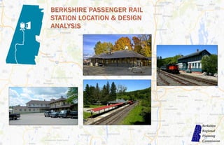
  • 1. BERKSHIRE PASSENGER RAIL STATION LOCATION AND DESIGN ANALYSIS, DRAFT FOR PUBLIC COMMENT—AUGUST 2014
  • 2. BERKSHIRE PASSENGER RAIL STATION LOCATION AND DESIGN ANALYSIS, DRAFT FOR PUBLIC COMMENT—AUGUST 2014
  • 3. ACKNOWLEDGEMENTS BERKSHIRE PASSENGER RAIL STATION LOCATION AND DESIGN ANALYSIS Page 1  Staff, Elected Officials, and Residents of the Berkshire Line Communities  Karen Christensen and the Bring Back the Trains Campaign  Bill Palmer, MassDOT  Dustin Rhue, MassDOT  Gary Sheppard, Berkshire Regional Transit Authority  Bob Malnati, Berkshire Regional Transit Authority  John R. Hanlon Jr., Housatonic Railroad Company  Colin Pease, Housatonic Railroad Company  Deborah Menette, Housatonic Railroad Company Berkshire Regional Planning Commission  Nathaniel Karns, AICP, Executive Director  Thomas Matuszko, AICP, Assistant Director  Clete Kus, AICP, Transportation Manager  Mark Maloy, GIS, Data and IT Manager  Brian Domina, Senior Planner  Patricia Mullins, Senior Planner  Gwen Miller, Planner  Jaclyn Pacejo, Planner
  • 4. ACKNOWLEDGEMENTS BERKSHIRE PASSENGER RAIL STATION LOCATION AND DESIGN ANALYSIS Page 2 This page intentionally left blank.
  • 5. BERKSHIRE PASSENGER RAIL STATION LOCATION AND DESIGN ANALYSIS Page 3 EXECUTIVE SUMMARY Executive Summary The Housatonic Railroad Company (HRRC) has proposed re-establishing passenger rail service between Danbury, Connecticut and Pittsfield, Massachusetts on the former Berkshire Line. The passenger rail service between these two locations last operated in 1971 shortly after the Penn Central Transportation Company filed for bank- ruptcy. The HRRC proposal would once again make it possible for a passenger boarding the passenger train at Grand Cen- tral Station in New York City to reach Pitts- field, Massachusetts by train in approxi- mately four (4) hours and vice versa. For the HRRC proposal to become reality, a sig- nificant capital investment in Massachu- setts, Connecticut and New York will need to be made to upgrade the rail infrastruc- ture along the Berkshire Line. Massachu- setts has made an initial commitment to the project by entering into an agreement to acquire the Berkshire Line from HRRC and committing $35 million dollars to upgrade the rail infrastructure. Connecticut has not yet made a commitment, but discussions are underway between the state and HRRC. The majority of the existing rail infrastruc- ture is nearly a century old in both Con- necticut and Massachusetts. The worn out jointed rails and ties are not suitable for the safe operation of a passenger rail service and must be replaced. Another essential component of the rail infrastructure are the passenger rail stations. The ideal passenger rail station will meet the needs of the com- munity, the needs of the region and the op- erational needs of the proposed passenger rail service. In some instances, the nearly century old historic passenger rail stations may meet these needs and in other instances, new locations may better serve them. To address this issue, the Berkshire Regional Planning Commission (BRPC) partnered with HRRC to conduct this passenger rail station location and design analysis with the primary objective of identifying the most fea- sible and advantageous locations for passen- ger rail stations along the Berkshire Line. Other objectives of this study include devel- oping recommendations for passenger rail station design, facilities and amenities; eval- uating and refining the preliminary railroad operations analysis; and assessing the poten- tial economic, environmental, land use and community benefits and impacts of the pro- posed passenger rail service and the recom- mended passenger rail station locations. Funding for this study was provided through a Transportation, Community and Systems Preservation Grant awarded to the BRPC by the U.S. Department of Transporta- tion. The development of the passenger rail sta- tion location recommendations follow the Sustainable Development Principles of the Commonwealth of Massachusetts and smart growth principles and principles from Sus- tainable Berkshires (the regional plan for Berkshire County). In accordance with these principles, a conscious effort was made to identify passenger rail station locations in mixed use downtown areas that have exist- ing pedestrian connectivity and existing commercial establishments that would bene- fit from a passenger rail station. The most significant challenge in locating a passen- ger rail station in a downtown area was finding sites with sufficient room for park- ing. Thus, for the recommended down- town passenger rail stations a smaller amount of parking, compared to a regional passenger rail station, will likely be availa- ble. The limited amount of parking at the downtown locations should not be prob- lematic as an overwhelming majority of passengers using the service are projected to be traveling north to Berkshire County and will not have a need for parking. In addition, the passenger rail stations pro- posed for the City of Pittsfield and the Town of Sheffield (if one is constructed) are recommended to function as larger regional stations and will provide more parking for southbound passengers. Only when no feasible location can be found in a downtown areas does BRPC support the construction of a passenger rail station out- side of the mixed use downtown areas un- less operational needs dictate otherwise. Stations located outside of downtown are- as would likely diminish the economic benefit to the communities, and severely diminish the potential for the proposed passenger rail service to provide intra- county transportation for residents and visitors. Map 1: Locus Map
  • 6. BERKSHIRE PASSENGER RAIL STATION LOCATION AND DESIGN ANALYSIS Page 4 EXECUTIVE SUMMARY Summary of Key Findings 1. The rail infrastructure along the Berkshire Line needs total replacement. All of the near- ly century old existing jointed rail and ties need to be replaced with new ties and welded rail. The at-grade public crossings require safety upgrades and passenger rail stations need to be retrofitted or built new. The estimated total cost of the rail infrastructure improvements in both Connecticut and Massachusetts exceeds $200 million dollars. 2. With input from HRRC, the ideal minimum spacing between stations was determined to be ten (10) miles apart for the passenger rail service to operate efficiently. 3. Initial passenger rail stations are recommend- ed for the City of Pittsfield, the Town of Lee and the Town of Great Barrington. Passenger rail stations located in these locations will best serve the needs of the region and the operation- al needs of the proposed passenger rail service. 4. The Joseph Scelsi Intermodal Transportation Center on Columbus Avenue is the recom- mended location for a regional passenger rail station in the City of Pittsfield. A passenger rail station located at this location, which is the site of an active regional and inter-city bus de- pot and passenger train station (Amtrak- Bos- ton to Chicago), best serves the local needs of the community, supports economic develop- ment along North Street and adjacent commer- cial areas, and facilitates intra-county transpor- tation. 5. A new passenger rail station to be constructed on the west side of the downtown area on Railroad Street is the recommended location for a passenger rail station in the Town of Lee. A new passenger rail station in this location is expected to serve the needs of the local commu- nity, support existing commercial establish- ments in the downtown area, further economic development, and facilitate intra-county trans- portation. Two possible scenarios are provided in this report. 6. The reuse of the existing historic passenger rail station site in the downtown area on Cas- tle Street is the recommended location for a passenger rail station in the Town of Great Barrington. The reuse of the historic passen- ger rail station site is expected to serve the needs of the local community, support the ex- isting commercial establishments in the down- town area, further economic development, and facilitate intra-county transportation. 7. The Town of Sheffield is conditionally recom- mended as an initial location for a regional passenger rail station. The southern part of Sheffield may be an ideal location for a passen- ger rail station to serve Sheffield and north- western Connecticut if a passenger rail station is not located in North Canaan, Connecticut. A passenger rail station in both locations would not allow the passenger rail service to operate efficiently and is not recommended. HRRC owns a ten (10) acre site (State Line) in this area that is recommended for use as a passen- ger rail station. 8. A passenger rail station is not recommended for the Town of Lenox because it is located within ten (10) miles of the City of Pittsfield and the rail corridor passes through the less densely developed area of the town. Lenox residents will have access to the passenger rail service at the Pittsfield station or the Lee sta- tion. 9. A passenger rail station is not recommended for the Town of Stockbridge because it is lo- cated within ten (10) miles of Great Barring- ton and the potential for additional economic development in areas adjacent to the potential passenger rail station locations is not as great as the other communities. Stockbridge resi- dents will have access to the passenger rail ser- vice at the Lee station or the Great Barrington station. 10. The attendees at the public meetings held throughout the study period and respondents to an online survey expressed strong support for the return of passenger rail service to Berk- shire County. The attendees/respondents also expressed an interest in using the proposed passenger rail service for travel within the Berkshire region and to New York City. 11. The attendees at the public meetings and re- spondents to the online survey identified prior- ities for the types of amenities and services offered at a Berkshire passenger rail station. Strong pedestrian connectivity around a pas- senger rail station was indicated as a top priori- ty. The convenience of ticket purchasing and access to and from the passenger rail station were also identified as top priorities by attendees/respondents. 12. Further refinement of the 2010 Market Street Research (MSR) marketing study suggests that over a five (5) year period annual ridership between Berkshire County and points south will increase to 1,086,874 one-way fares per year. 13. The MSR marketing study suggests that peak demand for the passenger rail service will be on weekends in the summer months as a large majority of the passengers traveling to Berk- shire County will be visitors as opposed to commuters. The MSR marketing study also showed demand in the fall and winter months as well. 14. The MSR marketing study suggests that travel options at the passenger rail stations are an important consideration for those who would use the proposed passenger rail service. Efforts will be made to coordinate departures/ arrivals with BRTA’s schedule. 15. The report titled “Economic Benefits of Housatonic Railroad Passenger Ser- vice” (Economic Report) authored by the Cen- ter for Creative Community Development at Williams College projects that the economic benefits to the region over a ten year period (3 Joseph Scelsi Intermodal Transportation Center
  • 7. BERKSHIRE PASSENGER RAIL STATION LOCATION AND DESIGN ANALYSIS Page 5 EXECUTIVE SUMMARY years of construction and 7 years of oper- ations) are expected to be significant. The increase in economic output during the first decade of the project is expected to be in excess of $635 million dollars with an average of 610 new jobs created. 16. The Economic Report suggests that the tourism industry in the region will ex- pand with an estimated 126 new jobs created and an additional $12.5 million dollars in economic output. 17. The Economic Report suggests that local governments in the region could collect approximately $2.6 million dollars more annually, if the passenger rail service was operating. 18. Noise impacts from the proposed pas- senger rail service are not expected to be significant throughout the majority of the rail corridor. The most noticeable noise impacts will occur around the pub- lic at-grade crossings where federal regu- lations require locomotive engineers to routinely sound the locomotive’s horn. Exceptions to the federal regulations al- low communities to establish a “quiet zone” where routine horn sounding at public at-grade crossings is not permitted. 19. Vibration impacts from the proposed passenger rail service are not expected to be significant throughout a majority of the rail corridor. The replacement of the existing jointed rail with welded rail is expected to decrease vibration and noise impacts. Mitigation measures can be tak- en for structures located close to the rail corridor if vibration impacts become an Map 2: Proposed Passenger Rail Station Communities issue. Summary of Recommendations  MassDOT is encouraged to make the necessary improvements and upgrades to the rail infrastructure necessary for a passenger rail service to be operated on the Berkshire Line.  HRRC and the State of Connecticut are encouraged to continue collaborating on obtaining funds for the necessary im- provements and upgrades to the rail infrastructure necessary for a passenger rail service be operated on the Berkshire Line.  MassDOT is encouraged to engage the State of Connecticut to assist with col- laboration efforts to inform federal leg- islators of the needs and benefits associ- ated with the re-introduction of the pro- posed passenger rail service.  HRRC and MassDOT are encouraged to construct the passenger rail stations in the locations recommended in this re- port or make the funding available for such construction.  HRRC and MassDOT are encouraged to proactively address potential noise and vibration impacts during the reconstruc- tion of the rail infrastructure.  HRRC is encouraged to pursue the ac- quisition of the rolling stock (locomotives, passenger cars, etc.) nec- essary to operate the proposed passen- ger rail service.  BRPC is encouraged to facilitate a dis- cussion between the BRTA, MassDOT, 1Berkshire (Berkshire Chamber of Com- merce, Berkshire Visitors Bureau) and the municipalities recommended for ini- tial passenger rail stations to determine potential station ownership scenarios and to identify what partnerships may need to be developed to operate a suc- cessful passenger rail station.  HRRC and MassDOT are encouraged to work with the BRTA and other providers of transportation to ensure that transpor- tation is available at the passenger rail stations when passengers arrive.  HRRC and the BRTA are encouraged to develop a plan for how the proposed passenger rail service can be used by res- idents and visitors for intra-county trans- portation.  BRPC is encouraged to work coopera- tively with its counterpart in northwest Connecticut (Northwest Hills Council of Governments) to finalize the location of a joint facility to serve Sheffield and North Canaan, CT.  The Commonwealth of Massachusetts is encouraged to make funding available for the Berkshire Line communities that are recommended to host initial passen- ger rail stations so the communities can engage in a detailed planning process to maximize the benefits of the proposed passenger rail station and minimize its impacts.  All of the Berkshire Line communities are encouraged to stay involved in the
  • 8. BERKSHIRE PASSENGER RAIL STATION LOCATION AND DESIGN ANALYSIS Page 6 EXECUTIVE SUMMARY development of the proposed passen- ger rail service and to communicate concerns, if any, to BRPC, MassDOT and HRRC.  Each of the Berkshire Line communi- ties may wish to consider establishing a “quiet zone” in their community if it is determined that the locomotive horn noise will create considerable noise impacts.  In other localities where passenger rail services have been introduced, public authorities, rail carriers, federal and state safety officials and citizens have worked together with an organization called Operation Lifesaver to develop awareness and safety programs along the rail lines. During the time when construction is taking place to upgrade the tracks and construct stations, it is recommended that a similar program be instituted along the rail line in the Berkshires. The following general recommendations pertain to the four (4) Berkshire Line communities recommended to host ini- tial passenger rail stations. Specific rec- ommendations can be found in the Station Area Plans for each proposed passenger rail station.  Play an active role in the siting and construction of the passenger rail sta- tion. In particular, consider engaging the entity responsible for the design and construction of the proposed pas- senger rail station to ensure the design is compatible with the community.  Consider that a passenger rail station might be integrated into a mixed-use building instead of a standalone tradi- tional platform and shelter. The mixed -use building could provide additional revenue to the passenger rail station owner from lease payments.  Consider and plan for how the pro- posed passenger rail station can be an asset and gathering point for the com- munity.  Understand the capacity and condition of any public parking infrastructure and the proposed passenger rail sta- tions impact on the parking. Develop a parking strategy to ensure that long term parking and short term parking are available in the passenger rail sta- tion area.  Plan for additional mixed-use develop- ment around the proposed station area through amendments to the land use regulations to encourage Transit Ori- ented Development (TOD), the adap- tive reuse of existing buildings and infill development.  Understand the condition and capacity of utility infrastructure (sewer/water/ gas/electricity) to support additional development around the proposed passenger rail station locations.  Consider pedestrian and bicycle con- nectivity and ensure the surrounding area provides safe access to the pro- posed passenger rail station for pedes- trians and cyclists. Consider installing wayfinding signs to direct pedestrians from the passenger rail station to the downtown establishments  Consider circulation patterns and traffic flow to ensure the surrounding areas do not become congested with traffic. BRPC supports the development of the proposed passenger rail service because in our estimation, the projected benefits to the region’s economy and transportation system outweigh the anticipated localized impacts to a relatively small number of areas. This endorsement of the proposed passenger rail service is not intended to minimize those instances where impacts may occur. Our support for the proposed passenger rail service assumes that the op- erator of the passenger rail service will use best practices to prevent and mitigate those instances so that the quality of life of those people living in proximity to the rail corridor is not severely diminished. Map 3: Recommended Station Locations
  • 9. BERKSHIRE PASSENGER RAIL STATION LOCATION AND DESIGN ANALYSIS Page 7 Acknowledgements…………………………………………………………………………………………………………………………………………………………..………………………………………………………………………………………….…...……... 1 Executive Summary…………………………………………………………………………………………………………………………………………………………..………………………………………………………………………………………….…...……... 3 Table of Contents………………………………………………………………………………………………………………………………………………………………………………………………………………………………………………………...……………. 7 1. Introduction…………………………………………………………………………………………………………………………………………………………………….……….………………………………………………………………………………...…..….... 11 2. Study Area Descriptions……………………………………………………………………………………………………………………………………………………………………………………………..………………………………………………….……… 15 3. Existing Rail Corridor Conditions & Safety Upgrades………………………………………………………………………………………………………………………………………………………………………………………………………..……... 21 4. Station Location Analysis…………………………..……………………………………………………………………………………………………………………………..………………………………………………………………………………………….... 23 5. Environmental Analysis of Target Areas & Recommended Passenger Rail Station Locations….…………………………………………………………………………………………………………………………………………………. 59 6. Passenger Rail Station Sketch Plans and Ownership Considerations………………………………………………………………………………………………………………………………………………………………………………………. 65 7. Station Area Plans……………………………………………………………………………………………………………………………………………………………………………………………………………………………………………………...…………. 79 8. Ridership Forecasting & Preliminary Service Plan.……………………………………………………………………………………………………………………………………………………………………………………………………………….…. 107 9. Anticipated Benefits & Impacts……………………………………..…………………………………………………………………………………………………………………………………………………………………………………………………….…. 115 10. Public Participation……………………………………………………………………………………………………………………………………………………………………………………………………………………………………………..……….……... 121 11. Considerations for Berkshire Line Communities………………………………………………………………………………………………………………………………………………………………………………….……………………………..…. 125 Appendix………………………………………………………………………………………………………………………………………………………………………………………………………………………………………………..…………….…..……...………. 127 TABLE OF CONTENTS
  • 10. BERKSHIRE PASSENGER RAIL STATION LOCATION AND DESIGN ANALYSIS Page 8 List of Maps, Tables and Graphics by Section 1. Introduction…………………………………………………………………………………………………………………………………………………………………….……….………………………………………………………………………………...…..…... 10 Map 1.1: Locus Map…………………………………………………………………………………………………………………………………………………………………….……….………………………………………………………………………………… 10 2. Study Area Descriptions……………………………………………………………………………………………………………………………………………………………………………………………..………………………………………………….……… 15 Map 2.1: Area Map…………………………………………………………………………………………………………………………………………………………………….……….…………………………………………………………………………………. 15 Map 2.2: Berkshire Line Communities…………………………………………………………………………………………………………………………………………………………………….……….……………………………………………………….. 15 Map 2.3: Existing Stations …………………………………………………………………………………………………………………………………………………………………….……….……………………………………………………………………….. 16 Table 2.1: Berkshire Line Communities…………………………………………………………………………………………………………………………………………………………………….……….………………………………………………………. 15 3. Existing Rail Corridor Conditions & Safety Upgrades………………………………………………………………………………………………………………………………………………………………………………………………………..……... 21 Map 3.1: Existing Rail by Weight Per Yard...…………………………….……………………………………………………………………………………………..………….……………………………………………………………………………….... 22 Table 3.1: Planned Improvements to the Berkshire Line………….……………………………………………………………………………………………..………….……………………………………………………………………………….... 21 4. Station Location Analysis…………………………..……………………………………………………………………………………………………………………………..………………………………………………………………………………………….... 23 Map 4.1: Buildable Land in Study Area…………………………………………………………………………………………………………………………………………………………………….……….……………………………………………………….. 24 Map 4.2: Target Areas…………………………………………………………………………………………………………………………………………………………………….……….……………………………………………………………………………… 24 Map 4.3: Pittsfield Target Areas…………………………………………………………………………………………………………………………………………………………………….……….…………………………………………………………………. 27 Map 4.4: Lenox Target Areas…………………………………………………………………………………………………………………………………………………………………….……….…………………………………………………………………….. 28 Map 4.5: Lee Target Areas…………………………………………………………………………………………………………………………………………………………………….……….………………………………………………………………………… 31 Map 4.6: Stockbridge Target Areas…………………………………………………………………………………………………………………………………………………………………….……….…………………………………………………………….. 35 Map 4.7: Great Barrington Target Areas…………………………………………………………………………………………………………………………………………………………………….……….……………………………………………………… 38 Map 4.8: Sheffield Target Areas…………………………………………………………………………………………………………………………………………………………………….……….………………………………………………………………… 42 Map 4.9: Berkshire Line…………………………………………………………………………………………………………………………………………………………………….……….…………………………………………………………………………… 48 Map 4.10: Population Density…………………………………………………………………………………………………………………………………………………………………….……….…………………………………………………………………… 48 Map 4.11: Attractions & Accommodations…………………………………………………………………………………………………………………………………………………………………….……….…………………………………………………… 49 Map 4.12: Five Mile Intervals on the Berkshire Line…………………………………………………………………………………………………………………………………………………………………….……….……………………………………… 49 Map 4.13: Recommended Station Locations…………………………………………………………………………………………………………………………………………………………………….……….……………………………………………….. 51 Table 4.1: Massachusetts Sustainable Development Principles…………………………………………………………………………………………………………………………………………………………………….……….……………………… 23 Table 4.2: Principles of Smart Growth…………………………………………………………………………………………………………………………………………………………………….……….………………………………………………………… 23 Table 4.3: Tier I Evaluation Criteria…………………………………………………………………………………………………………………………………………………………………….……….…………………………………………………………….. 23 Table 4.4: Acreage of Developable Land in the Study Area…………………………………………………………………………………………………………………………………………………………………….……….…………………………….. 24 Table 4.5: Characteristics of the Study Area…………………………………………………………………………………………………………………………………………………………………….……….………………………………………………… 24 Table 4.6: Tier 2 Evaluation Criteria…………………………………………………………………………………………………………………………………………………………………….……….…………………………………………………………… 25 Table 4.7: Target Area Rankings by Municipality…………………………………………………………………………………………………………………………………………………………………….……….…………………………………………… 26 Table 4.8: Pittsfield Target Area Rankings…………………………………………………………………………………………………………………………………………………………………….……….…………………………………………………… 27 Table 4.9: Lenox Target Area Rankings…………………………………………………………………………………………………………………………………………………………………….……….………………………………………………………. 30 TABLE OF CONTENTS
  • 11. BERKSHIRE PASSENGER RAIL STATION LOCATION AND DESIGN ANALYSIS Page 9 Table 4.10: Lee Target Area Rankings…………………………………………………………………………………………………………………………………………………………………….……….………………………………………………………… 30 Table 4.11: Stockbridge Target Area Rankings…………………………………………………………………………………………………………………………………………………………………….……….…………………………………………….. 37 Table 4.12: Great Barrington Target Area Rankings…………………………………………………………………………………………………………………………………………………………………….……….……………………………………… 40 Table 4.13: Sheffield Target Area Rankings…………………………………………………………………………………………………………………………………………………………………….……….…………………………………………………. 44 Table 4.14: Tier 3 Operational & Regional Needs Evaluation Criteria…………………………………………………………………………………………………………………………………………………………………….……….……………….. 47 Table 4.15: Summary of Tier 3 Results…………………………………………………………………………………………………………………………………………………………………….……….……………………………………………………….. 50 Table 4.16: Summary of Recommended Target Areas…………………………………………………………………………………………………………………………………………………………………….……….…………………………………… 50 Table 4.17: Summary of Preferred and Alternative Station Locations…………………………………………………………………………………………………………………………………………………………………….……….………………. 51 5. Environmental Analysis of Target Areas & Recommended Passenger Rail Station Locations….…………………………………………………………………………………………………………………………………………………. 59 Table 5.1: Environmental Constraints…………………………………………………………………………………………………………………………………………………………………….……….…………………………………………………………. 59 Table 5.2: Acreage of Environmental Constraints in Target Areas…………………………………………………………………………………………………………………………………………………………………….……….……………………. 60 Table 5.3: Acreage of the Total Number of Environmental Constraints in Target Areas…………………………………………………………………………………………………………………………………………………………………….… 60 6. Passenger Rail Station Sketch Plans and Ownership Considerations……………………………………………………………………………………………………………………………………………………………………….………………. 63 Table 6.1: Passenger Rail Facilities on the Cape Flyer Service…………………………………………………………………………………………………………………………………………………………………….……….………………………… 75 Table 6.2: Passenger Rail Facilities on the Downeaster Service…………………………………………………………………………………………………………………………………………………………………….……….……………………… 75 Table 6.3: Passenger Rail Service Cost Comparisons…………………………………………………………………………….…………………………………………………………………………………………………….……….……………………… 77 7. Station Area Plans……………………………………………………………………………………………………………………………………………………………………………………………………………………………………………………...…………. 79 Figure 7.1: Intermodal Center Station Area…………………………………………………………………………………………………………………………………………………………………….……….………………………………………………….. 80 Figure 7.2: Land Use within the Intermodal Center Station Area…………………………………………………………………………………………………………………………………………………………………….……….……………………… 82 Figure 7.3: Historic Districts within the Intermodal Center Station Area…………………………………………………………………………………………………………………………………………………………………….……….……………. 83 Figure 7.4: Zoning within the Intermodal Center Station Area…………………………………………………………………………………………………………………………………………………………………….……….…………………………. 83 Figure 7.5: Public Infrastructure in the Intermodal Center Station Area…………………………………………………………………………………………………………………………………………………………………….……….……………. 84 Figure 7.6: Downtown Lee Station Area…………………………………………………………………………………………………………………………………………………………………….……….………………………………………………………. 87 Figure 7.7: Land Use within the Downtown Lee Station Area…………………………………………………………………………………………………………………………………………………………………….……….………………………….. 89 Figure 7.8: Environmental Constraints in the Downtown Lee Station Area…………………………………………………………………………………………………………………………………………………………………….……….………… 90 Figure 7.9: Zoning within the Downtown Lee Station Area…………………………………………………………………………………………………………………………………………………………………….……….……………………………… 91 Figure 7.10: Parking in Downtown Lee…………………………………………………………………………………………………………………………………………………………………….……….……………………………………………………….. 92 Figure 7.11: Sidewalks in the Downtown Lee Station Area…………………………………………………………………………………………………………………………………………………………………….……….……………………………… 92 Figure 7.12: Public Infrastructure in the Downtown Lee Station Area…………………………………………………………………………………………………………………………………………………………………….……….………………. 92 Figure 7.13: Downtown Great Barrington Station Area…………………………………………………………………………………………………………………………………………………………………….……….………………………………….. 94 Figure 7.14: Environmental Constraints in Downtown Great Barrington…………………………………………………………………………………………………………………………………………………………………….……….…………… 95 Figure 7.15: Land Use within the Downtown Great Barrington Station Area…………………………………………………………………………………………………………………………………………………………………….……….……… 96 Figure 7.16: Zoning within the Downtown Great Barrington Station Area…………………………………………………………………………………………………………………………………………………………………….……….………….. 97 TABLE OF CONTENTS
  • 12. BERKSHIRE PASSENGER RAIL STATION LOCATION AND DESIGN ANALYSIS Page 10 Figure 7.17: Public Infrastructure in the Downtown Great Barrington Station Area…………………………………………………………………………………………………………………………………………………………………….……… 98 Figure 7.18: State Line Station Area…………………………………………………………………………………………………………………………………………………………………….……….…………………………………………………………… 101 Figure 7.19: Land Use within the Massachusetts State Line Station Area…………………………………………………………………………………………………………………………………………………………………….……….…………. 103 Figure 7.20: Environmental Constraints in Massachusetts State Line Station Area…………………………………………………………………………………………………………………………………………………………………….……… 104 Figure 7.21: Zoning in Massachusetts State Line Station Area…………………………………………………………………………………………………………………………………………………………………….……….……………………….. 104 Table 7.1: Northern Berkshires Population…………………………………………………………………………………………………………………………………………………………………….……….………………………………………………….. 80 8. Ridership Forecasting & Preliminary Service Plan.……………………………………………………………………………………………………………………………………………………………………………………………………………….…. 107 Figure 8.4: Factors Influencing Respondents Decision to Use Train Service…………………………………………………………………….……………………………….……….……………………………………………………………………… 110 Map 8.1: Ridership Study Areas……………………………………………………………………………………………………………………………………………………………….……….……………………………………………………………………… 108 Table 8.1: Respondent Information……………………………………………………………………………………………………………………………………………………….…….…………………………………...………………………………………. 107 Table 8.2: MSR Estimated Number of One-Way Tickets ……………………………………………………………………………………………………………………………………………………………….……….……………………………………… 107 Table 8.3: Ridership by Various Sub-regions……………………………………………………………………………………………………………………………………………………………….……….……………………………………………………… 108 Table 8.4: Forecasted Ridership by Proposed Passenger Rail Station……………………………………………………………………………………………………………………………………………………………….……….………….………… 109 Table 8.5: HRRC Sample Timetable………………………………………………..……………………………………………………………………………………………………………………………………………………………….……….………….………… 112 Table 8.6: Estimated Trip Times - Pittsfield, MA to New York City …...……………………………………………………………………………………………………………………………………………………………….……….………….………… 113 9. Anticipated Benefits & Impacts……………………………………..…………………………………………………………………………………………………………………………………………………………………………………………………….…. 115 Figure 9.1: Comparison of Different Noise Levels with Train Noise …………………………………………………………………………………………………………………………………………………………………….……..…………………… 117 Map 9.1: Public At-grade Crossings…………………………………………………………………………………………………………………………………………………………………….……….………………………………….………………………… 118 Table 9.1: Structure of the Economy in the Sheppard Report Study Area………………………………………………………………………………………………………………………………………………………….…….……….………………. 115 Table 9.2: Accrued Benefits During First Decade of Proposed Passenger Rail Service…………………………………………………………………………………………………………………………………….………………………….……… 116 Table 9.3: Comparison of Rail Impact…………………………………………………………………………………………………………………………………………………………………….……….………………….……………………………………… 118 Table 9.4: Summary of Noise Mitigation Measures…………………………………………………………………………………………………………………………………………………………………….…….………………………………………….. 120 10. Public Participation……………………………………………………………………………………………………………………………………………………………………………………………………………………………………………..……….……... 121 Table 10.1: Public Participation…………………………………………………………………………………………………………………………………….……………………………….……….………………………………………………………………… 121 Table 10.2: Survey Respondents’ Rankings of Passenger Rail Amenities………………………………………………………………………………………………………………………………………………………….………….……….………… 123 Table 10.3: Preferred Public Transportation Options…………………………………………………………………………………………………………………………………………………………………….……….…………………………………….. 123 11. Considerations for Berkshire Line Communities………………………………………………………………………………………………………………………………………………………………………………….……………………………..…. 125 [None] TABLE OF CONTENTS
  • 13. BERKSHIRE PASSENGER RAIL STATION LOCATION AND DESIGN ANALYSIS Page 11 1. INTRODUCTION Passenger Rail Service in Berk- shire County For nearly eighty (80) years the New York, New Haven and Hartford Railroad Com- pany (“New Haven”) operated an active freight and passenger rail service between Pittsfield, Massachusetts and New York City. The train operated via Danbury, Connecticut to South Norwalk where pas- sengers could connect directly into New York City. In 1969, the New Haven entered into a merger with the Penn Central Trans- portation Company, which shortly thereaf- ter filed for bankruptcy. Penn Central’s bankruptcy filing marked the beginning of the end for north to south passenger rail service to Berkshire County. The last scheduled passenger train to Berkshire County operated in April 1971. Since that time, Berkshire County has been without direct north to south passenger rail ser- vice. Amtrak currently provides limited east to west passenger rail service to Berkshire County along the Lake Shore Limited Line between Chicago and Boston. The Amtrak service to Berkshire County is far from ro- bust with only two trains a day stopping at the Joseph A. Scelsi Intermodal Center in Pittsfield, Massachusetts. Although this report is focused on the restoration of north to south passenger rail service to New York City, the enhancement of east to west passenger rail service to Boston is an equally important issue that warrants the attention of local, state and federal offi- cials. Proposal to Restore North to South Passenger Rail Service HRRC has proposed operating a passenger rail service between Pittsfield, Massachusetts and New York City via Danbury, Connecticut. (See Map 1.1). The proposed service would connect to Metro North’s Harlem line at Metro North’s Southeast station for through trains to continue or for passengers to continue on the Metro North line into New York City. HRRC’s pro- posed passenger rail service would operate along the former New Haven right-of-way known as the Berkshire Line into Danbury, Connecticut and along a short section of the line known as the Maybrook Line to Southeast. HRRC’s proposed service along the Berkshire Line will require a significant capital invest- ment to upgrade the deteriorated rail infra- structure and purchase equipment to operate a safe and efficient passenger rail service. Re- placing the deteriorated track would also serve the existing and future freight railroad users along the line which is critical in supporting approximately 1,000 existing manufacturing jobs in the Berkshires and northwest Connecti- cut. HRRC has entered into separate discus- sions with the Commonwealth of Massachu- setts (Commonwealth) and the State of Con- necticut to explore the formation of a public- private partnership to determine how best to fund the needed infrastructure improvements. The Commonwealth has approved funding for a phase 1 construction program that would up- grade tracks to passenger rail standards. The availability of phase 2 funding is dependent on developing a plan for rail improvements in Connecticut. Improvements are also needed on the Maybrook Line in New York. Need for the Station Location and Design Analysis Concerns over rising fuel prices and the potential environmental and socie- tal consequences of increased green- house gas emissions have led the fed- eral and many state governments, in- cluding Massachusetts to consider in- vesting in rail infrastructure for both passenger and freight operations. The FY 2014—2018 Massachusetts Capital Improvement Plan (CIP) calls for the investment of $35 million dollars to make initial infrastructure upgrades necessary to operate a freight and pas- senger rail service on the Berkshire Line. In accordance with the CIP, the recently enacted 2014 Massachusetts Transportation Bond Bill allocates $113.8 million dollars for infrastructure upgrades to the Berkshire Line. The Berkshire Regional Transportation Plan (2012), the FY14 Unified Planning Work Program, Sustainable Berkshires Plan (2014), and the Berkshire County Comprehensive Economic Develop- ment Strategy (2011) strongly support the resumption of passenger rail ser- vice along the Berkshire Line between Danbury, Connecticut and Pittsfield, Massachusetts.  The 2014 Sustainable Berkshires Regional Plan outlines a goal to “[d] evelop a transportation system that affords mobility for all, provides ap- propriate access to employment, hous- ing, services and recreation areas, is Map 1.1: Locus Map
  • 14. BERKSHIRE PASSENGER RAIL STATION LOCATION AND DESIGN ANALYSIS Page 12 1. INTRODUCTION protective of the environment, enhances com- munity livability, and operates safely.” The re- sumption of the proposed passenger rail service supports this goal. More specifically, the Plan recommends that the transportation system meet critical regional economic development needs, by expanding freight and passenger rail service and upgrading the associated infra- structure.  The Berkshire Metropolitan Planning Organiza- tion (MPO) cited the development of a passen- ger rail station needs assessment as a key objec- tive in their Unified Planning Work Program (October 1, 2013 – September 30, 2014). The needs assessment would include “a refined op- erational analysis, facility amenities and design elements to improve transportation efficiency, reduce environmental impacts and spur eco- nomic development in a cost efficient manner.”  In addition, the 2012 Berkshire Regional Transportation Plan stresses the regional im- portance of reintroducing north-south passen- ger rail to the region: “This new passenger ser- vice is critical for the Berkshires because of the region’s strong ties to the greater metropolitan New York economy. Substantial improvements to the rail bed, acquisition of engines and coaches, and station establishments or up- grades are immediate requirements for begin- ning the north-south passenger service.”  More specifically, the 2012 Berkshire Regional Transportation Plan calls for the region to “[a] ssist the Housatonic Railroad Corporation to acquire funding to implement passenger rail service northward, from Danbury to Pittsfield” and to “[e]stablish facility and space needs for stations and parking areas along the north- south Housatonic Railroad.”  The 2011 Berkshire Region Comprehensive Eco- nomic Development Strategy (CEDS), lists regional passenger rail improvements as a Pri- ority Project for 2013 with the indication that the project meets one of the greatest regional needs. For communities and the region, the de- velopment of a passenger and expanded freight rail network could increase modes of transpor- tation; thus improving access to the area. With increased access, there is the potential for great- er economic investment. The public, political and financial support for HRRC’s proposed service has grown pushing this “concept” of restoring passenger rail service to Berkshire County closer to realization. HRRC’s proposed passenger rail service has many implications for Berkshire County that warrant fur- ther investigation. The proposed service will un- doubtedly have both benefits and impacts to the region that need to be identified and understood. The Berkshire economy is becoming ever more de- pendent on tourism and service related jobs, thus finding an efficient and sustainable way to move people in and out of Berkshire County is an issue of great regional importance. Yet, the increased fre- quency of rail operations on the now infrequently used Berkshire Line will impact the residents of the six communities in new and different ways. This study is necessary to identify and quantify the ben- efits and impacts of the proposed service, to pro- vide guidance to the decision makers as this pro- posed service becomes more fully developed and to help position the communities and the region to maximize the benefits of the proposed service and to avoid, mitigate and minimize any potential ad- verse impacts. Study Objectives The study is intended to meet all of the following objectives: Primary Objective  To identify the feasible and most advantageous locations for passenger rail stations along the Berkshire Line and to better position municipalities to capture the benefits of the ser- vice while mitigating any potential adverse impacts. Secondary Objectives  To develop recommendations for passenger rail station designs, facilities and amenities  To evaluate and refine the preliminary railroad operations analysis  To assess the potential economic, environmental, land use and community benefits and impacts of the proposed passenger rail service and passenger rail station locations. Transportation, Community and System Preservation Program Objectives  To improve the efficiency of the transportation system of the United States  To reduce environmental impacts of transportation  To reduce the need for costly future public infrastructure investments  To ensure the efficient access to jobs, services and centers of trade  To examine the community development patterns and identify strategies to encourage private sector development patterns and investments that support these goals. Contents of the Report The report is divided into eleven (11) sections. A description of each section follows: Section 1. Introduction. Section 2. Study Area Descriptions. This sec- tion provides a description of Berkshire County and the six (6) Berkshire Line communities. This section also includes a discussion of the existing and historic passenger rail stations of the Berkshire Line. Section 3. Existing Rail Corridor Conditions & Safety Upgrades. This section provides a description of the existing conditions of the rail infrastructure on the Berkshire Line, the neces- sary infrastructure and safety upgrades to op- erate the proposed service and the current op- erations of HRRC. Section 4. Station Location Analysis. This section describes the objectives, methodology, evaluation criteria, and results of the passenger rail station location analysis.
  • 15. BERKSHIRE PASSENGER RAIL STATION LOCATION AND DESIGN ANALYSIS Page 13 1. INTRODUCTION Section 5. Environmental Analysis of Target Areas & Recommended Passenger Rail Station Locations. This section describes the method- ology and results from an environmental analy- sis of the target areas and passenger rail station locations. Section 6. Passenger Rail Station Sketch Plans & Ownership Considerations. This section provides conceptual site plans for select passen- ger rail station locations as well as designs for consideration. This section also provides infor- mation and recommendations on station owner- ship. Section 7. Station Area Plans. This section consists of Station Area plans for select passen- ger rail station locations. The Station Area plans include a detailed analysis of the existing condi- tions around the proposed passenger rail station locations and provide recommendations for fu- ture development and public improvements. Section 8. Ridership Forecasting & Preliminary Service Plan. This section discusses the pre- liminary ridership estimates developed by Mar- ket Street Research and the effort to refine these numbers to isolate ridership in Berkshire Coun- ty. This section also includes a preliminary ser- vice plan and a discussion of ridership charac- teristics that may help shape the initial service plan. Section 9. Anticipated Benefits & Impacts. This section provides a discussion of the antici- pated benefits of the proposed service. This sec- tion also discusses the likely impacts of the pro- posed service and ways to mitigate those im- pacts. Section 10. Public Participation. This section outlines the public process undertaken in the development of this report. This section also includes summaries of the public input received throughout the project. Section 11. Considerations for Berkshire Line Communities. This section lays out considera- tions for Berkshire Line communities as the pro- posed service continues to be developed.
  • 16. BERKSHIRE PASSENGER RAIL STATION LOCATION AND DESIGN ANALYSIS Page 14 1. INTRODUCTION This page intentionally left blank.
  • 17. BERKSHIRE PASSENGER RAIL STATION LOCATION AND DESIGN ANALYSIS Page 15 2. STUDY AREA DESCRIPTIONS Study Area Descriptions The proposed passenger rail service calls for the re -instatement of north-south passenger rail service to Berkshire County. The Berkshire Line passes through six (6) communities in Berkshire County between the Massachusetts/Connecticut state line and its northern terminus located in Pittsfield, Massachusetts. This section includes a short de- scription of Berkshire County and the six (6) Berk- shire Line communities. This section also includes a discussion of the existing stations of the Berk- shire Line and the opportunities and challenges that these stations, mostly historic, present for re- use as modern passenger rail stations. Berkshire County Berkshire County is a mostly rural county located in the far western region of the Commonwealth of Massachusetts bor- dered to the north by Vermont, to the west by New York, to the south by Connecticut and to the east by the Massachusetts coun- ties of Franklin, Hampshire and Hampden. Berkshire County is located ap- proximately 2 ½ hours from Bos- ton, Massachusetts and New York City. Berkshire County is the larg- est county in Massachusetts at 946 square miles of land, but is the fourth least populated with a U.S. Census Bureau 2013 population estimate of 129,585 people. The region consists of thirty-two mu- nicipalities (30 towns and 2 cities). The two most populous munici- palities are the City of Pittsfield and the City of North Adams, with the Town of Great Barrington the fifth most populous. Just over 40% of the region’s population is located in the City of Pittsfield and the City of North Adams. The region’s landscape is dominated by the Taconic Mountains to the west and the Berkshire Hills to the east with the Housatonic and Hoosic Rivers meandering through scenic valleys. Due to the steep topogra- phy and abundant water power much of the his- toric development in the region occurred in the valleys as the rivers provided a source of power to operate mills. The historic development patterns still exist today with much of the region’s popula- tion located along the Housatonic or Hoosic Riv- ers. The Berkshire Line Communities The Berkshire Line is a single track 86 mile rail- road right-of-way that runs between Pittsfield, Massachusetts and Danbury, Connecticut. The Massachusetts portion of the Berkshire Line is ap- proximately 38 miles long and runs between Sheffield, Massachusetts and Pittsfield, Massachu- setts. (See map 2.2.) The Berkshire Line passes through the following communities in Berkshire County: Town of Sheffield – The right-of-way passes south to north parallel to Route 7 splitting the town nearly down the middle. The right-of-way passes through the rural village of Ashley Falls and through the center of Sheffield. Both Ashley Falls and Sheffield Center are not densely devel- oped. There are a number of at grade crossings in the town. Town of Great Barrington – The right-of-way passes south to north following Route 7 and then Route 41. The right-of-way passes through the densely developed downtown center of Great Bar- rington and further north through the smaller Housatonic Village. Downtown Great Barrington is a vibrant mixed use downtown center with pop- ular cultural attractions, restaurants and places of accommodation. Housatonic village is a small sce- Table 2.1: Berkshire Line Communities Municipality Population Berkshire Line Passes Through the Town/City Center Town of Sheffield 3,233 Yes Town of Great Barrington 7,003 Yes Town of Stockbridge 1,961 Yes Town of Lee 5,898 Yes Town of Lenox 5,000 No City of Pittsfield 44,168 Yes Source: U.S. Census ACS 2008-2012 Map 2.1: Area Map Map 2.2: Berkshire Line Communities
  • 18. BERKSHIRE PASSENGER RAIL STATION LOCATION AND DESIGN ANALYSIS Page 16 2. STUDY AREA DESCRIPTIONS nic village whose underutilized and va- cant mill buildings present unique oppor- tunities for redevelopment. Great Bar- rington serves as the primary center for southern Berkshire County. Town of Stockbridge – The right-of- way passes mostly west to east through the Glendale section of town and then just south of the center of Stockbridge. The center of Stockbridge is a small mixed use town center with a number of restaurants, retail establishments, and places of accom- modation. Town of Lee – The right-of-way passes west to east in the southern part of Lee then runs northerly through the down- town area. The downtown area in Lee is a mixed use commercial – residential area with numerous restaurants, retail estab- lishments, and places of accommodation. The right-of-way passes through several vacant and underutilized mill complexes located in the northern section of town. Town of Lenox – The right-of-way runs south to north through the town passing through a small village known as Lenox Dale. The right-of-way does not pass through the more developed mixed use downtown area. A significant portion of the right-of-way passes through wetlands associated with the Housatonic River. City of Pittsfield – The right-of-way passes south to north through suburban residential areas and it ends immediately south of the Joseph Scelsi Intermodal Transportation Center at a junction with a right-of-way owned by CSX. The Joseph Scelsi Intermodal Transportation Center is an existing bus and passenger rail station in downtown Pittsfield. Existing Stations of the Berkshire Line The Berkshire Line communities all host- ed at least one passenger rail station when the New Haven operated passenger rail service; some of the communities, such as Great Barrington and Sheffield, had multi- ple passenger rail stations. In the years since passenger rail service ended in the Berkshires, the historic stations have met varied fates. Some stations have been pre- served and put to different uses, others demolished and still yet another picked- up and moved away from the railroad right-of-way. In Pittsfield, the historic sta- tion was demolished in 1968. In Sheffield, the historic station was moved away from the railroad right-of-way and is now used as a residence. The historic stations in Great Barrington, Stockbridge, Lee and Lenox have been preserved and put to a variety of uses such as an office, a restau- rant and a museum. In Pittsfield, the Jo- seph Scelsi Intermodal Transportation Center is a new intermodal transportation center that opened in 2004 on the CSX line just north of the junction of the CSX and HRRC railroad rights-of-way. In summary, each community has an ex- isting passenger rail station historic or otherwise (see map 2.3), except for the Town of Sheffield, which if located in the appropriate locations could be investigat- ed further to determine if the building could be converted back for use as a pas- senger rail station. Other communities have successfully ret- rofitted historic stations to suit the opera- tional requirements of contemporary pas- senger rail service. The retrofitting of an existing historic train station is a concept worth considering in situations only where the location and reuse of the build- ing are beneficial to the community, the region, and the operation of the proposed passenger rail service. The purpose of the following section is to identify the existing station buildings and parcel characteris- tics and to identify the opportunities and challenges to the reuse of the sites for con- temporary passenger rail service. Howev- er, whether an historic building or struc- ture can be gainfully used as a contempo- rary passenger rail station is outside the scope of this study. Such feasibility can be explored in greater depth as part of a sep- arate study effort. Pittsfield’s Beaux Art Union Station was demol- ished in 1968 as part of urban renewal. The station represents a type of station no longer present in Berkshire county: “with tall arched windows, green- veined marble walls, a high-domed terrazzo ceiling, skylight, chandeliers and polishing woodwork—a work for the ages”. Map 2.3: Existing Stations
  • 19. BERKSHIRE PASSENGER RAIL STATION LOCATION AND DESIGN ANALYSIS Page 17 2. STUDY AREA DESCRIPTIONS Existing Passenger Rail Stations Pittsfield: Joseph Scelsi Intermodal Transportation Center Owner Berkshire Regional Transit Authority Opportunities Challenges Current Use Train and bus depot The Intermodal Center is a nexus of public transporta- tion services and is served by both local and intercity bus service. It is also served by intercity east to west passen- ger rail service via Amtrak. Its location offers immediate pedestrian access to the commercial and cultural cen- ter of Pittsfield. Off-site pub- lic parking is available in close proximity. Due to capacity issues on the CSX line, HRRC would need to construct a new rail siding on the south side of the CSX right-of-way. An elevated pedestrian walkway would need to be con- structed to connect the new platform to the ex- isting building. There is very little on-site parking available. Historic Designation None Year Opened 2004 Lot Size 1.73 acres Building Condition Good Address 1 Columbus Avenue Pittsfield, MA 01201 Lenox: Historic Station Owner Private -- Berkshire Scenic Railway Museum Opportunities Challenges Current Use Museum The existing structure could serve to shelter passengers from the ele- ments and house ticket kiosks. The station currently operates as a railroad museum. The owners have expressed their preference that the station remains as a mu- seum. The station is located ap- proximately two (2) miles from downtown Lenox and does not have good connectivity with the rest of the town. This location would require the construction of a new high level platform and retrofitted to incorporate ADA accessibility requirements. Historic Designation National Register of Historic Places Year Built 1902-1903 Lot Size 4.05 acres Building Condition Restored - Good Address 10 Willow Creek Road Lenox, MA 01240
  • 20. BERKSHIRE PASSENGER RAIL STATION LOCATION AND DESIGN ANALYSIS Page 18 2. STUDY AREA DESCRIPTIONS Lee: Sullivan Station Owner Private -- Individual Opportunities Challenges Current Use Restaurant The existing structure could serve to shelter passengers from the ele- ments and house ticket kiosks. The location in the heart of downtown has the potential to spur additional economic ac- tivity. The station is currently be- ing used as a restaurant. The lot size is only 0.28 acres and there is very little space for expansion on ad- jacent lots. This location would require the construc- tion of a new high level plat- form and retrofitted to in- corporate ADA accessibility requirements. Parking is extremely limited. Historic Designation National Register of His- toric Places Year Built 1893 Lot Size 0.28 acres Building Condition Restored – Good Address 109 Railroad Street Lee, MA 01238 Stockbridge: Historic Station Owner Private -- High Meadow Foundation Opportunities Challenges Current Use Museum HRRC owns land ad- jacent to the historic station site that if combined could pro- vide adequate space for parking. The ex- isting structure could serve to shelter pas- sengers from the ele- ments and house ticket kiosks. The station is currently leased and used as museum and community room. This location would require the construction of a new high level platform and retrofitted to incorporate ADA accessi- bility requirements. This lo- cation is approximately three -tenths of a mile from the downtown area so pedestri- an connectivity to the down- town area is not ideal. Historic Designation Unknown Year Built 1893 Lot Size 0.88 acres Building Condition Restored - Good Address 2 Depot Street Stockbridge, MA 01262
  • 21. BERKSHIRE PASSENGER RAIL STATION LOCATION AND DESIGN ANALYSIS Page 19 2. STUDY AREA DESCRIPTIONS Housatonic: Former Passenger Station Owner Private -- Individual Opportunities Challenges Current Use Recording studio The existing struc- ture could serve to shelter passengers from the elements and house ticket ki- osks. The building is approximately 6,300 square feet. Housatonic Village is located ap- proximately five (5) miles north of downtown Great Barrington and does not provide good connectivity to the downtown area. The small lot creates parking challenges. This location would require the con- struction of a new high level plat- form and retrofitted to incorporate ADA accessibility requirements. Historic Designation None Year Built 1900 Lot Size 0.16 acres Building Condition Unknown Address 168 Front Street Great Barrington, MA 01230 Historically, Great Barrington had two passenger rail stations and a rail depot. The two passen- ger stations were located in Downtown Great Barrington and Housatonic Village. The rail depot was in Van Deusenville. The Downtown Great Barrington station still exists, as does the former passenger station and freight station in Housatonic village. All of the existing historic stations are privately owned and they may or may not be available for railroad station development. Housatonic: Former Freight Station Owner Private -- Individual Opportunities Challenges Current Use Vacant The existing struc- ture could serve to shelter passenger from the elements and house ticket kiosks. The build- ing is approximate- ly 6,900 square feet. Housatonic Village is located approxi- mately five (5) miles north of down- town Great Barrington and does not provide good connectivity to the downtown area. The small lot creates parking challenges. This location would require the construction of a new high level platform and retrofit- ted to incorporate ADA accessibility requirements. Historic Designation None Year Built 1900 Lot Size 0.15 acres Building Condition Unknown Address 0 Front Street Great Barrington, MA 01230
  • 22. BERKSHIRE PASSENGER RAIL STATION LOCATION AND DESIGN ANALYSIS Page 20 2. STUDY AREA DESCRIPTIONS Sheffield: Historic Station Opportunities Challenges Owner Private N/A The station has been relocated out of the right-of way and is currently used as a private residence.Current Use Residence Sheffield once had two train stations. One station located in Ashley Falls, formerly located at the intersection of School Street and Route 7, burned to the ground and was never rebuilt. The station formerly located in the town center, near the existing town hall, has been relo- cated and is currently used as a residence. Downtown Great Barrington: Historic Station Opportunities Challenges Owner Private -- Alder Creek LLC The existing station site offers direct access to downtown Great Barrington, including the Mahaiwe Theater, boutiques and restaurants. The current owner of the station owns adja- cent parcels that might be used for additional parking and to improve traffic flow. The existing structure could serve to shelter passengers from the elements and house ticket kiosks. The location is relative- ly constrained by exist- ing development, mak- ing configuring suffi- cient parking a chal- lenge. This location would require the con- struction of a new high level platform and ret- rofitted to incorporate ADA accessibility re- quirements. Current Use Commercial Historic Designation None Year Built 1938 Lot Size 1.25 acres Building Condition Restored - Good Address Castle Street Great Barrington, MA 01230 Summary Of the existing and historic stations, the Joseph Scelsi Intermodal Transportation Center presents the best opportunity for using an existing station for the proposed passenger rail service. The his- toric stations in the Towns of Lee and Great Barrington are located in the heart of downtown areas and the potential exists for these passenger rail station sites to help revitalize those areas. The main challenges with the reuse of the historic stations in these locations are the small lot size and non- ADA compliant buildings. The historic station site in Stockbridge presents an opportunity for re- use because of its location near the downtown area and the potential for an adjacent lot to be used for additional parking; however the building would need to be modified to comply with the Amer- icans with Disabilities Act of 1990. The historic station in the Town of Lenox is not located in the downtown area and its owner has expressed its interest that the historic station, currently a muse- um, not be considered for re-use. Lastly, the historic station in Sheffield which has been moved off the rail corridor is not considered a viable option. With the historic stations and the rail infrastruc- ture nearly a century old, a significant capital investment will need to be made to update both the rail infrastructure (described in Section 3) and any historic stations selected for re-use as a contem- porary passenger rail station.
  • 23. BERKSHIRE PASSENGER RAIL STATION LOCATION AND DESIGN ANALYSIS Page 21 3. EXISTING RAIL CORRIDOR CONDITIONS AND SAFETY UPGRADES Berkshire Line Existing Condi- tions and Anticipated Track & Infrastructure Upgrades HRRC provided the information for this section based upon its intimate knowledge of the conditions of the Berkshire Line over which it operates a freight railroad service Berkshire Line Existing Condi- tions The Berkshire Line runs from Danbury Connecticut (Mile Post 0.0) to Pittsfield, Massachusetts (Mile Post 86.3) where the line intersects with the CSX main line generally known as the Boston and Albany. The distance from Danbury to the Massachusetts state line is 50 miles and from the Massachusetts/ Connecticut border at Milepost 50, the line extends north 36.3 miles through the Massachusetts towns of Sheffield, Great Barrington, Stockbridge, Lee and Lenox to the City of Pittsfield. The rail line is generally single track, meaning that trains operate north and south on the same rails under the control of a dispatcher. At several locations along the rail line there are passing sidings which provide space, if necessary, for northbound and southbound trains to pass each other. While the entire Berkshire Line is owned or controlled by the Housatonic Railroad pending acquisition by MassDOT for the Massachusetts por- tion, it was assembled by HRRC through leases or purchases from mul- tiple railroads. Prior to Housatonic's ownership the portion in Massachu- setts was owned by what is now Pan Am Southern. The middle section, be- tween Canaan, Connecticut and New Milford, Connecticut in the early 1970's was owned by the bankrupt Penn Cen- tral System and ultimately abandoned by them and subsequently purchased by the State of Connecticut. This mid- dle portion was unused for a number of years until it was leased by HRRC when it reactivated rail service. The southern portion of the line was pur- chased by HRRC from the now defunct Conrail railroad. Prior to being pur- chased or leased by HRRC, significant portions of the line had not received any significant maintenance for many years. HRRC not only restored service over the entire Berkshire Line, but over the years has invested in the property, upgraded tracks and facilities and con- tinually improved the property. The Berkshire Line is somewhat unique in that it is one of the few lines in Mas- sachusetts that is maintained to carry rail cars that have gross weights of 286,000 lbs and it is also maintained to carry high and wide loads. Most other lines in Massachusetts are limited to a maximum of 263,000 lbs and all other lines in Connecticut are limited to 263,000 lbs. Thus, the line is strategically important to the region because it provides ac- cess for the occasional over sized load such as large trans- formers. It also permits custom- ers to benefit from heavier pay- loads reducing their cost per ton of material for shipments. To- day, the railroad serves approxi- mately 20 consignees in Massa- chusetts and Connecticut, some of whom are the largest employ- ers and property tax payers in the region. While in recent times the rail line had multiple owners, the line for many years was owned by the New York, New Haven and Hartford Railroad and like other older New Haven Lines the rail was manufactured in the early 1920's using open hearth technology meaning the rail was not controlled cooled making it increasingly brittle as it ages. It is known as 107 lb rail which refers to the weight per yard of rail. It has served the line well for approxi- mately 90 years, but it has reached the end of its useful life and in Massachu- setts, is scheduled for replacement un- der a recently announced agreement between HRRC and the Common- wealth. In Massachusetts, the 107 lb rail is generally located between the Massachusetts/Connecticut state line and Lee/Lenox. The very northern sec- tion of the railroad contains 6 miles of slightly newer and heavier weight 112 lb rail and a short 1.5 mile section of modern 136 lb rail (See Map 3.1). While the 112 lb rail remains servicea- ble, it will need to be replaced in order to efficiently and safely accommodate the higher speed passenger trains that are being planned for on this rail line. The entire railroad is tied with wood ties and the use of wood ties will con- tinue in the future. In recent years the railroad has experi- enced a number of rail failures primari- ly due to the age of the rail and to the method used for manufacturing the rail. In order to protect the rail service, HRRC conducts frequent visual inspec- tions of its tracks, a methodology re- quired by federal law and regulation. In addition, while not required by law or regulation, HRRC also employs an electronic inspection procedure work- ing with two companies who are locat- ed on the system. Periodically, special- ized equipment is operated over por- tions of the railroad with sensors that can detect flaws that are not visible to the naked eye. Using electronic and visual inspection, HRRC has continu- ously inspected the rail on its system and this practice will continue into the future. While this inspection approach is effective at finding rail flaws before they become an issue, replacement of the rail with a new modern rail section throughout the corridor is the best long term solution. The existing track is not capable of being used for passenger rail service. Anticipated Track & Infrastruc- ture Upgrades To achieve the aforementioned up- grades, HRRC working with the Com- monwealth of Massachusetts and with the State of Connecticut, has embarked on a comprehensive program to re- place rail in both states. As previously mentioned, the railroad is in the pro- cess of executing an agreement with the Commonwealth of Massachusetts under which nearly all of the rail on the Berkshire Line will be replaced within the next two years. Specifically, HRRC and MassDOT an- ticipate executing agreements that will Table 3.1: Planned Improvements to the Berkshire Line* Phase Improvements Cost 1  Replacement of the 107 lb jointed rail with 136 lb welded rail;  Replacement of ties; and  Bridge and culvert inspections and ratings $35 million 2  Replacement of the remaining 112 lb jointed rail with 136 lb welded rail;  Replacement of ties;  Construction of passing sidings;  Bridge and culvert repairs;  Install crossing and signal system;  Construct stations and parking; and  Acquire rolling stock $78.8 million $113.8 million TOTAL * Cost estimates and improvements are subject to change to as the project continues to develop.
  • 24. BERKSHIRE PASSENGER RAIL STATION LOCATION AND DESIGN ANALYSIS Page 22 3. EXISTING RAIL CORRIDOR CONDITIONS AND SAFETY UPGRADES provide for a Phase 1 rehabilitation of the entire 36.3 miles of rail line between the Connecticut state line and Pittsfield. Work will vary by loca- tion as some areas have received more investment over the years than others. It is expected that the Phase 1 project will include the installation of ap- proximately 50,000 new ties and the replacement of 30 miles of rail, all of which is the older 107 lb rail referenced above. The actual number of ties per mile will vary based on inspection with the heavier tie installation focused on the areas where welded rail will be installed. The new rail that will be installed will be 136 lb, 6 inch base welded rail that will meet passenger rail standards. In Con- necticut, HRRC will be replacing approximately 6 miles of rail in the very near future and expects to continue that process into the foreseeable future. HRRC will also continue its ongoing aggressive rail inspection program to protect the safety of the railroad and the public. In addition to replacing rail and ties, the Phase 1 project will address a number of roadway grade crossings. Historically, when HRRC has renewed roadway grade crossings, the old rail and ties in the crossing were removed and replaced with new ties and 136 lb welded rail. That policy will prove beneficial as those crossings which have been previously rehabilitated will not need to be redone, saving money and permitting HRRC to focus on other crossings in need of upgrades. As new track is installed, crossings that have not been improved with welded rail will be opened and new rail will be installed. At the same time, new crossing surfaces will be installed benefiting roadway users. The Berkshire Line in Massachu- setts contains a total of 51 crossings, 19 of which are private. Thirty-five (35) of the 51 crossings will be rebuilt and will receive new crossing sur- faces. All public crossings will require active warning devices including lights and gates when passenger service is implemented. The majority of this work will take place during Phase 2 of the improvement project. The first phase of the rehabilitation project will also include the inspection of bridges and cul- verts, including rating the bridges. The rail line in Massachusetts contains 30 bridges including wood structures, steel bridges and several mason- ry structures. While nearly all of the bridges will receive some attention prior to the initiation of passenger service, it is anticipated that most of the existing structures will remain in service. Some of the smaller bridges, particularly older wooden ones, can and will be eliminated and replaced with precast concrete culverts. Others will be re- placed with more modern structures suitable for higher speed passenger services. While some funding will be budgeted in the first phase for bridge work, the actual level of work cannot be determined until a structural inspection is com- pleted on each bridge. This structural assessment work will be completed early in the process so that bridge work can be prioritized. While some older, particularly wooden, bridges will be re- placed, work on bridges is and will continue to be an ongoing process. Generally, it is good practice to replace older bridge decks with ballasted decks that improve the efficiencies of track maintenance. Work will include deck replacement, replacing of bridge seats and painting. All bridges will con- tinue to be prioritized based on engineering in- spections so that work is programmed to address identified deficiencies. The Phase I improvements, in addition to facilitat- ing the reintroduction of passenger rail service, will also have positive impacts for the existing freight service and on the economic competive- ness of the region. The improvements will ensure that freight can be safely shipped into and out of the region., even the oversized 286,000 lb rail cars. The improvements also support the existing companies that rely on the freight service and who provide jobs to approximately 800 Berkshire County resi- dents. As for Phase II of the project, the legislature approved an additional $78.8 million dollars for additional improvements. Phase II im- provements will likely include additional rail and tie replacements, passing sidings, bridge work, crossing and signals, station facilities, parking and rolling stock. MassDOT has indi- cated that the Phase II investment is condi- tioned on similar improvements being made to the CT portion of the rail corridor. A key factor for the Berkshire Line, both in Massachusetts and Connecticut, is the geogra- phy of the region. Housatonic Railroad oper- ates through the Berkshires and the Litchfield Hills and for many miles runs adjacent to the Housatonic River. There is little straight or tangent track between Danbury and Pittsfield. In Massachusetts, there are some straighter sections in the Sheffield area and over a small portion of the railroad between Lenox and Pittsfield. Because of the geography and ex- tensive curvature along the railroad, speeds for future passenger services will generally be re- stricted to 59 MPH or less. However, with pru- dent placement of stations, upgraded rails and ties, diligent maintenance and the introduction of high level platforms that make boarding and exit- ing trains faster and safer, average speeds along the line can be maintained at a very competitive level. Map 3.1: Existing Rail by Weight Per Yard
  • 25. BERKSHIRE PASSENGER RAIL STATION LOCATION AND DESIGN ANALYSIS Page 23 4. STATION LOCATION ANALYSIS Objective The objective of the station location analysis is to identify the feasible and most advantageous loca- tions for passenger rail stations along the Berkshire Line. The ideal passenger rail station locations will meet the needs of the local community, the needs of the region and the needs of the proposed pas- senger rail service. Methodology The methodology developed and applied in this analysis consists of a four-tiered site screening pro- cess in order to identify feasible and advantageous sites for the construction of passenger rail stations. With guidance from the Commonwealth’s Sustain- able Development Principles (see Table 4.1 at right), Sustainable Berkshires (BRPC’s Regional Plan for Berkshire County), principles of smart growth (see Table 4.2 at right), best professional planning prac- tices, and with input from local officials and the public, project staff developed evaluation criteria for each tier of the screening process.  Tier 1 Objective: To identify developable land immediately adjacent to the rail corridor and group such land into target areas exclud- ing such land that is not developable from fur- ther consideration.  Tier 2 Objective: (Local Needs) To conduct a comparative analysis of the target areas in each community to identify which target areas would provide the greatest benefits to the com- munity with the least adverse impacts if a pas- senger rail station were constructed.  Tier 3 Objective: (Regional and Operational Needs) To identify which of the target areas meet regional needs and certain operational needs for the passenger rail service to operate efficiently.  Tier 4 Objective: To develop recommenda- tions as to the preferred and alternative sites for initial passenger rail stations in the Berk- shire Line communities. Focused Study Area for this Analysis The station platform and other amenities must be located immediately adjacent to the railroad tracks. Thus, for the purposes of this analysis the study area is defined as all land within five hundred (500) feet on each side of the Berkshire Line rail corridor from the Massachusetts – Connecticut state line to the junction of the HRRC and CSX rail corridors and further north along the CSX rail cor- ridor to the Joseph Scelsi Intermodal Transporta- tion Center. The study area includes a total of 4,445 acres of land in the six Berkshire Line communities along thirty-eight (38) miles of railroad track. Tier 1 – Identification of Developable Land in the Study Area The objective of Tier 1 is to identify developable land immediately adjacent to the rail corridor and group such land into target areas excluding such land that is not developable from further consider- ation. An area of land is considered not developa- ble if it meets one of the criteria identified in Table 4.3 below. A GIS analysis was conducted using the state GIS database to map the selected criteria in the study area. Rationale for Tier I Evaluation Criteria Wetland Resource Areas. The construction of a passen- ger rail station in a wetland resource area is diffi- cult, environmentally disruptive and creates sig- nificant project costs. Wetland resource areas serve important functions such as protecting water qual- ity, retaining floodwater and providing important habitat for aquatic and other wildlife species. Alt- hough certain railroad activities may be exempt from state wetland protection laws, the important functions that wetland resource areas serve and the availability of alternative locations makes a wetland resource area an inappropriate location for a passenger rail station. Steep Slopes Greater than 15%. The construction of a passenger rail station on steep slopes over 15% is difficult and creates significant project costs. Envi- ronmental concerns such as drainage, slope stabili- zation, and cut and fill associated with develop- ment on steep slopes and the availability of alter- native locations makes a steep slope over 15% an inappropriate location for a passenger rail station. Permanently Protected Open Space. Permanently pro- tected open space land is prevented from develop- ment through a deed restriction, legislative protec- tion, or similar legal mechanism and is thus not developable (e.g. land subject to a conservation Table 4.1: Massachusetts Sustainable Development Principles 1. Concentrate Development and Mix Uses 2. Advance Equity 3. Make Efficient Decisions 4. Protect Land and Ecosystems 5. Use Natural Resources Wisely 6. Expand Housing Opportunities 7. Provide Transportation Choices 8. Increase Job and Business Opportunities 9. Promote Clean Energy 10. Plan Regionally Source: Department of Housing and Community Development, Commonwealth of Massachusetts Table 4.2: Principles of Smart Growth 1. Mix land uses 2. Take advantage of compact building design 3. Create a range of housing opportunities and choices 4. Create walkable neighborhoods 5. Foster distinctive, attractive communities with a strong sense of place 6. Preserve open space, farmland, natural beauty, and critical environmental areas 7. Strengthen and direct development towards existing communities 8. Provide a variety of transportation choices 9. Make development decisions predictable, fair, and cost effective 10. Encourage community and stakeholder col- laboration in development decisions Source: United States Environmental Protection Agency Table 4.3: Tier I Evaluation Criteria Wetland Resource Areas Steep Slopes Greater than 15% Permanently Protected Open Space Lack of Physical Access to the Rail Corridor