PaikkaOppi - webbased learning environment
•Download as PPTX, PDF•
1 like•205 views

PaikkaOppi is an Internet-based learning environment for GIS (Geographical Information System) studies.

Recommended
Recommended
More Related Content
Similar to PaikkaOppi - webbased learning environment
Similar to PaikkaOppi - webbased learning environment (20)
More from Helsingin yliopisto
More from Helsingin yliopisto (20)
Recently uploaded
Recently uploaded (20)
PaikkaOppi - webbased learning environment
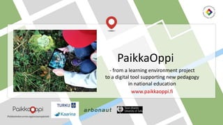
- 1. - from a learning environment project to a digital tool supporting new pedagogy in national education www.paikkaoppi.fi PaikkaOppi
- 2. What is geographical infromation? Why to learn it?
- 3. It is • sensed • experimented • observed • measured • remembered Geographical information (GI) is place specific information of environment
- 4. Mapping and GIS skills are a citizen’s multi-literacy skill Mapping and GIS skills are becoming increasingly important when : • navigating and informing locations eg. in emergency situations. • finding information from map services, eg. the nearest ATM, a good café etc. • participating eg. usage of cities’ map services or finding and utilizing spatial data produced by different organizations. • Geographical Information Technology is utilized more in working life now than ever before. • environmental research, for example, the mapping of flood risk areas • urban planning • in companies with traffic control planning in order to optimize transportations • in marketing when planning the locations of supermarkets and hypermarkets as well as the regional targeting of direct marketing. Usage of GIS in education: • In the new core curriculum research skills are already mentioned during the first classes of primary school. • PaikkaOppi is a great tool for research containing ready-made map data. Environmental observations can be examined, recorded, analyzed, presented and shared.
- 6. • Financed by The Finnish National Board of Education. • The service has been used in education of biology and geography in Finnish high schools throughout the 2000s. • Aims of current projects: • the usage of PaikkaOppi has increased in schools nationwide and PaikkaOppi is an essential part of e-learning materials of Finnish schools at at all levels. • To develop pedagogical materials which support the idea of an integrated curriculum alongside student-centered and problem-based learning. Vision for the future: the service could be developed as a tool for science education, inspiring creativity and innovation in students. New research information and open data will be utilized in learning. Projects: PaikkaOppi Plus and Plus2
- 7. Finnish innovation PaikkaOppi is an open web-based learning environment of GIS for schools. It consists of: 1. a web-based GIS application that can be used to view and produce GI datasets. 2. a set of ready-made exercises and project frameworks.
- 8. • Datasets, pedagogical tools and learning materials are free for users. • All Finnish schools have equal possibilities to use them. • Schools don’t need to invest in separate GIS-programs and maps. Equality of education
- 9. • The Finnish National Board of Education • Universities of Turku and Helsinki • National Land Survey of Finland, Finnish Geospatial Research Institute, Lounaispaikka, Arbonaut Oy • Education arranged cities: Turku, Kaarina and Joensuu Developed in co-operation with several partners in the 2000s
- 10. GIS enhances students’: Information processing skills Reasoning skills Questioning skills Creative thinking Evaluation skills Almost all citizens will need the ability to handle spatial data in the future. Teaching of GIS can develop students’ logical thinking and problem-solving abilities which are needed in all school subjects.
- 11. Base map and terrain models of Finland. PaikkaOppi offers a diverse selection of map data presentation including: • Orto-, aerial and satellite photos • Hydrology (water systems) • Geology and topography • Land use and traffic • Environmental research • Nature protection areas • Community structure and planning • Cultural environment and historical maps • Geographical grid systems • Local names and administrative maps Various map themes in PaikkaOppi map application
- 12. What you can do with PaikkaOppi -map application?
- 13. Functions of PaikkaOppi map application
- 14. Mathematics. Pictures of symmetrics in nature of the city are positioned on the map. l Geography and home economics. Local food project. Where does the food come from? Dinner is prepared from local ingredients. Information is collected of local farmers’ food production practices and the effects they have on humans, animals and environment. Finnish, history. Traditional knowledge is collected as a text, audio or video format. For example, intervewing people that have lived in an area for a long time. Videos are presented in a map and then shared with residents of an area.. Biology, environmental studies. Mobile herbarium. Images and descritions of plants on the map. Chemistry and geography. Study of water system. Water samples from various waters are compared and results are presented on the map. Why samples differ from each other? Mathematics and geography: estimation of geometric shapes in a vicinity. Create and calculate routes, their length and areas on the map. Information collected from surroundings can be presented in a map format
- 15. For exercising the usage of PaikkaOppi map platform. Suitable for students in all levels. Short GI-exercises for stimulating students at the beginning or in the end of a lesson or study period. Outdoor learning and observation of own neighborhood with PaikkaOppi mobile application. Classroom projects. Including analysing data. Pedagogical models for various school subjects and for integrated curriculum ABC of GIS Tiny tasks Mini research projects Act out of doors
- 16. Using either a blank or detailed map of Finland (including provincies and municipalities) students can then add their own data to the map, including: • Biggest Finnsih cities • Historical borders • Biggest water systems • Dialect areas • Bio-geographical areas • Home places (domiciles) of finnish artists • Domiciles of parents and grandparents • Summerholiday routes in Finland • Add music to local places • Locales of movies or tv-series … Student estimations of locations of biggest Finnish cities. You can place your own markers on the map: areas points lines ”Mark events and phenomena on a map of Finland!”
- 17. Integrated pedagogical models in PaikkaOppi
- 18. The maps are available in Finnish, English and German. There is also detailed biology and geography integration. Students can present with images and texts or videoclips their favrourite places in many languages. Map presentation is shared with other classes in Finland as a class trip tip . The development and testing of the model: Class teachers Sirkku Alin and Kati Andersen Puolala school, Turku Class trip -maps
- 19. Winter plants Excercise in a primary education. It integrates biology, geography, physical training and visual arts. Students studied various winter plants and animals using them in winter as a nourishment. Students collected them, took pictures and put them on a map using educational games and handicrafts. Development of the model: Class teacher Maritta Tammio Piispanlähteen koulun 2b, Kaarina Integrated research of chemistry and geography. Analysis of water samples taken from lakes, rivers, sea water pH, opacity, conductivity of electricity and Oxygen saturation. Results are marked on a PaikkaOppi map. Development of the model: Teachers of biology and geography: Ari Kalske, Minna Hämäläinen Luostarinvuoren koulun 9 lk, Turku and MobiLuma –project from the university of Turku Reserach of water systems
- 20. Thank you! Contact: Project coordinator Ph.D Virpi Hirvensalo virpi.hirvensalo@turku.fi