SlideShare una empresa de Scribd logo
1 de 45
Using in-house built translator & Open Source Technologies: A Technical Perspective By Faizan Tayyab Senior GIS Developer
[object Object],[object Object],[object Object],[object Object],[object Object],[object Object],[object Object],[object Object],[object Object]
[object Object],[object Object],[object Object],[object Object]
[object Object],[object Object],[object Object]
[object Object],[object Object],[object Object],[object Object]
[object Object],[object Object],[object Object],[object Object],[object Object],[object Object],[object Object],[object Object],[object Object],[object Object],[object Object],[object Object],[object Object],[object Object],[object Object],[object Object],[object Object]
 
 
MasterMap Data Area feature with  one TOID
[object Object],[object Object],[object Object],[object Object],[object Object],[object Object],[object Object],[object Object],[object Object],[object Object],[object Object],[object Object]
[object Object],[object Object],[object Object],[object Object],[object Object],[object Object],[object Object],[object Object]
[object Object]
[object Object],[object Object],<title> My Book </title> <author> James McGill </author>
[object Object],[object Object],[object Object],[object Object],[object Object],[object Object],[object Object],[object Object],[object Object],[object Object],*galdos inc Field Field Field Field 15 line east East Hope Rd
[object Object],[object Object],[object Object],[object Object]
[object Object],[object Object],[object Object],[object Object],[object Object],[object Object],[object Object],[object Object],[object Object]
[object Object],[object Object],[object Object],[object Object],[object Object],[object Object],[object Object],[object Object],[object Object],[object Object],[object Object],[object Object],[object Object],[object Object],[object Object],[object Object],[object Object],[object Object],[object Object],[object Object],[object Object]
[object Object],[object Object],[object Object],[object Object],[object Object],[object Object],[object Object],[object Object],[object Object]
[object Object],[object Object],[object Object]
Db 1 Db 2 Db 3 Web Server 1 Web Server 2 Web Server 3 Internet Web Client Raster image HTTP Request Response (Raster Image)
[object Object],[object Object],[object Object],[object Object],[object Object],[object Object],[object Object],[object Object],[object Object],[object Object]
[object Object],[object Object],[object Object],[object Object],[object Object],[object Object],[object Object],[object Object],[object Object],[object Object],[object Object],[object Object],[object Object],[object Object]
 
[object Object],[object Object],[object Object]
Db 1 Db 2 Db 3 Web Server 1 Web Server 2 Web Server 3 Internet Web Client Vector image HTTP Request Response (GML)
[object Object],[object Object],[object Object],[object Object],[object Object],[object Object]
[object Object],[object Object],[object Object],[object Object],[object Object],[object Object],[object Object],[object Object],[object Object],[object Object],[object Object],[object Object],[object Object],[object Object],[object Object],[object Object]
<?xml version=&quot;1.0&quot; encoding=&quot;utf-8&quot; ?>  - <ogcwfs:FeatureCollection xsi:schemaLocation=&quot; http://www.ordnancesurvey.co.uk/xml/namespaces/osgb http://192.168.100.50/magnesium/wfs/OS?REQUEST=DescribeFeatureType&SERVICE=WFS&TYPENAME=AddressPointType,CartographicSymbolType,DepartedFeatureType,AbstractFeatureType,FeatureCollectionType,TopographicLineType,TopographicAreaType,TopographicPointType,CartographicTextType,BoundaryLineType&TYPENS=http%3A%2F%2Fwww.ordnancesurvey.co.uk%2Fxml%2Fnamespaces%2Fosgb http://www.opengis.net/gml http://192.168.100.50/magnesium/wfs/OS?REQUEST=DescribeFeatureType&SERVICE=WFS&TYPENAME=featureCollection&TYPENS=http%3A%2F%2Fwww.opengis.net%2Fgml http://www.opengis.net/wfs http://192.168.100.50/magnesium/wfs/OS/REQUEST/get/DATA/LPR/wfs/basic.xsd &quot; xmlns:gml=&quot; http://www.opengis.net/gml &quot; xmlns:xsi=&quot; http://www.w3.org/2001/XMLSchema-instance &quot; xmlns:xlink=&quot; http://www.w3.org/1999/xlink &quot; xmlns:ogcwfs=&quot; http://www.opengis.net/wfs &quot; xmlns:osgb=&quot; http://www.ordnancesurvey.co.uk/xml/namespaces/osgb &quot;> -  <gml:boundedBy> -  <gml:Box srsName=&quot; osgb:BNG &quot;>     <gml:coordinates> 294588.2,712553.7 294759.88,712755.4 </gml:coordinates>      </gml:Box>   </gml:boundedBy> <gml:featureMember> <osgb:TopographicArea fid=&quot;osgb1000039334441&quot;> <osgb:featureCode>10021</osgb:featureCode>  <osgb:version>2</osgb:version>  <osgb:versionDate>2001-11-05</osgb:versionDate>  <osgb:theme>Buildings</osgb:theme>  <osgb:calculatedAreaValue>12.928</osgb:calculatedAreaValue>  <osgb:descriptiveGroup>A Road</osgb:descriptiveGroup>  <osgb:make>Manmade</osgb:make>  <osgb:physicalLevel>50</osgb:physicalLevel>  <osgb:polygon> <gml:Polygon srsName=&quot;osgb:BNG&quot;> <gml:outerBoundaryIs> <gml:LinearRing srsName=&quot;osgb:BNG&quot;> <gml:coordinates>294654.52,712605.92 294651.02,712602.62  294652.88,712600.68 294656.38,712603.98 294654.52,712605.92 </gml:coordinates>  </gml:LinearRing> </gml:outerBoundaryIs> </gml:Polygon> </osgb:polygon> </osgb:TopographicArea> </gml:featureMember> - <gml:featureMember></ogcwfs:FeatureCollection>
[object Object],[object Object],[object Object],[object Object],[object Object]
[object Object],[object Object],[object Object],[object Object],[object Object],[object Object]
[object Object],[object Object],[object Object],[object Object],[object Object],[object Object]
[object Object],[object Object]
[object Object],[object Object],[object Object]
[object Object],[object Object]
[object Object],[object Object]
[object Object],[object Object]
[object Object],[object Object],[object Object],[object Object],[object Object]
[object Object],[object Object],[object Object],[object Object],[object Object],[object Object],[object Object],[object Object],[object Object],[object Object],[object Object],[object Object],[object Object],[object Object]
MYSQL Database + Spatial Extension * http://dev.mysql.com/tech-resources/articles/4.1/gis-with-mysql.html GIS Data Types* More Information  http://dev.mysql.com/doc/refman/6.0/en/spatial-extensions.html
[object Object],[object Object],[object Object],[object Object],[object Object],[object Object]
[object Object],[object Object],[object Object],[object Object]
[object Object],[object Object]
[object Object],[object Object],[object Object],[object Object],[object Object],[object Object],[object Object],[object Object]
[object Object],[object Object],[object Object]
[object Object],[object Object],[object Object]

Más contenido relacionado

Destacado

Energia y medio ..
Energia y medio ..Energia y medio ..
Energia y medio ..sucasaca
 
Actividad ·3
Actividad ·3Actividad ·3
Actividad ·3Bigkevin
 
Pptmiperu 130109081448-phpapp02 (1)
Pptmiperu 130109081448-phpapp02 (1)Pptmiperu 130109081448-phpapp02 (1)
Pptmiperu 130109081448-phpapp02 (1)Pilar Grau Cabrera
 
9781439035665 ppt ch07
9781439035665 ppt ch079781439035665 ppt ch07
9781439035665 ppt ch07Terry Yoast
 
Borrador 2 trc 110 143darwinsaransig.
Borrador 2 trc 110 143darwinsaransig.Borrador 2 trc 110 143darwinsaransig.
Borrador 2 trc 110 143darwinsaransig.Darwin Saransig
 
History of nonprofits 5.qxd
History of nonprofits 5.qxdHistory of nonprofits 5.qxd
History of nonprofits 5.qxdsugeladi
 
15131 Wg2 Sum 2007 Port
15131 Wg2  Sum 2007 Port15131 Wg2  Sum 2007 Port
15131 Wg2 Sum 2007 PortMyris Silva
 
Wittgenstein, Ludwig Investigaciones Filosoficas
Wittgenstein, Ludwig   Investigaciones FilosoficasWittgenstein, Ludwig   Investigaciones Filosoficas
Wittgenstein, Ludwig Investigaciones Filosoficasguesta1922c3
 
Microsoft SQL Server - Intel Processors and Microsoft Power Pivot Presentation
Microsoft SQL Server - Intel Processors and Microsoft Power Pivot PresentationMicrosoft SQL Server - Intel Processors and Microsoft Power Pivot Presentation
Microsoft SQL Server - Intel Processors and Microsoft Power Pivot PresentationMicrosoft Private Cloud
 
15130 Sum Wg1 2007 Port
15130 Sum Wg1 2007  Port15130 Sum Wg1 2007  Port
15130 Sum Wg1 2007 PortMyris Silva
 

Destacado (16)

Energia y medio ..
Energia y medio ..Energia y medio ..
Energia y medio ..
 
Mexico
MexicoMexico
Mexico
 
Dna Of The Church
Dna Of The ChurchDna Of The Church
Dna Of The Church
 
Educacion y genero oit
Educacion y genero oitEducacion y genero oit
Educacion y genero oit
 
Actividad ·3
Actividad ·3Actividad ·3
Actividad ·3
 
Pptmiperu 130109081448-phpapp02 (1)
Pptmiperu 130109081448-phpapp02 (1)Pptmiperu 130109081448-phpapp02 (1)
Pptmiperu 130109081448-phpapp02 (1)
 
9781439035665 ppt ch07
9781439035665 ppt ch079781439035665 ppt ch07
9781439035665 ppt ch07
 
Borrador 2 trc 110 143darwinsaransig.
Borrador 2 trc 110 143darwinsaransig.Borrador 2 trc 110 143darwinsaransig.
Borrador 2 trc 110 143darwinsaransig.
 
History of nonprofits 5.qxd
History of nonprofits 5.qxdHistory of nonprofits 5.qxd
History of nonprofits 5.qxd
 
15131 Wg2 Sum 2007 Port
15131 Wg2  Sum 2007 Port15131 Wg2  Sum 2007 Port
15131 Wg2 Sum 2007 Port
 
15 06-24 mae-informe-diario
15 06-24 mae-informe-diario15 06-24 mae-informe-diario
15 06-24 mae-informe-diario
 
Cianuro en la linaza
Cianuro en la linazaCianuro en la linaza
Cianuro en la linaza
 
Wittgenstein, Ludwig Investigaciones Filosoficas
Wittgenstein, Ludwig   Investigaciones FilosoficasWittgenstein, Ludwig   Investigaciones Filosoficas
Wittgenstein, Ludwig Investigaciones Filosoficas
 
Microsoft SQL Server - Intel Processors and Microsoft Power Pivot Presentation
Microsoft SQL Server - Intel Processors and Microsoft Power Pivot PresentationMicrosoft SQL Server - Intel Processors and Microsoft Power Pivot Presentation
Microsoft SQL Server - Intel Processors and Microsoft Power Pivot Presentation
 
Mitm
MitmMitm
Mitm
 
15130 Sum Wg1 2007 Port
15130 Sum Wg1 2007  Port15130 Sum Wg1 2007  Port
15130 Sum Wg1 2007 Port
 

Similar a White Paper on OS Master Map

Top FME Recipes: Cook’nup XML
Top FME Recipes: Cook’nup XMLTop FME Recipes: Cook’nup XML
Top FME Recipes: Cook’nup XMLSafe Software
 
Learning Lessons From Neogeography .. GeoRSS at the Ordnance Survey
Learning Lessons From Neogeography .. GeoRSS at the Ordnance SurveyLearning Lessons From Neogeography .. GeoRSS at the Ordnance Survey
Learning Lessons From Neogeography .. GeoRSS at the Ordnance Surveymikel_maron
 
Creating Maps With Style
Creating Maps With StyleCreating Maps With Style
Creating Maps With Stylerobertbray
 
FME Workspace Template Collection for Reading Fundamental Geographic Data in ...
FME Workspace Template Collection for Reading Fundamental Geographic Data in ...FME Workspace Template Collection for Reading Fundamental Geographic Data in ...
FME Workspace Template Collection for Reading Fundamental Geographic Data in ...Safe Software
 
Rendering OpenStreetMap Data using Mapnik
Rendering OpenStreetMap Data using MapnikRendering OpenStreetMap Data using Mapnik
Rendering OpenStreetMap Data using MapnikGraham Jones
 
Google Mapy (Jaroslav Bengl)
Google Mapy (Jaroslav Bengl)Google Mapy (Jaroslav Bengl)
Google Mapy (Jaroslav Bengl)Jiří Šmída
 
Beholding the giant pyramid of application development; why Ajax applications...
Beholding the giant pyramid of application development; why Ajax applications...Beholding the giant pyramid of application development; why Ajax applications...
Beholding the giant pyramid of application development; why Ajax applications...Javeline B.V.
 
Windows Phone 7 Bing Maps Control
Windows Phone 7 Bing Maps ControlWindows Phone 7 Bing Maps Control
Windows Phone 7 Bing Maps ControlChris Pendleton
 
Mappetizer Web mapping software
Mappetizer Web mapping softwareMappetizer Web mapping software
Mappetizer Web mapping softwareRuthLang
 
Using KML for Thematic Mapping
Using KML for Thematic MappingUsing KML for Thematic Mapping
Using KML for Thematic MappingBjorn Sandvik
 
2017 PLSC Track: Using a Standard Version of ArcMap with External VRS Recieve...
2017 PLSC Track: Using a Standard Version of ArcMap with External VRS Recieve...2017 PLSC Track: Using a Standard Version of ArcMap with External VRS Recieve...
2017 PLSC Track: Using a Standard Version of ArcMap with External VRS Recieve...GIS in the Rockies
 
Intro GIS.pptx
Intro GIS.pptxIntro GIS.pptx
Intro GIS.pptxSamiDan2
 
Clip and Ship: MapServer for Data Distribution
Clip and Ship: MapServer for Data DistributionClip and Ship: MapServer for Data Distribution
Clip and Ship: MapServer for Data DistributionFOSS4G 2011
 
Mapnik Sotm 2007
Mapnik Sotm 2007Mapnik Sotm 2007
Mapnik Sotm 2007artemp
 

Similar a White Paper on OS Master Map (20)

Top FME Recipes: Cook’nup XML
Top FME Recipes: Cook’nup XMLTop FME Recipes: Cook’nup XML
Top FME Recipes: Cook’nup XML
 
Advanced Kml
Advanced KmlAdvanced Kml
Advanced Kml
 
The State of GeoServer
The State of GeoServerThe State of GeoServer
The State of GeoServer
 
Learning Lessons From Neogeography .. GeoRSS at the Ordnance Survey
Learning Lessons From Neogeography .. GeoRSS at the Ordnance SurveyLearning Lessons From Neogeography .. GeoRSS at the Ordnance Survey
Learning Lessons From Neogeography .. GeoRSS at the Ordnance Survey
 
Creating Maps With Style
Creating Maps With StyleCreating Maps With Style
Creating Maps With Style
 
FME Workspace Template Collection for Reading Fundamental Geographic Data in ...
FME Workspace Template Collection for Reading Fundamental Geographic Data in ...FME Workspace Template Collection for Reading Fundamental Geographic Data in ...
FME Workspace Template Collection for Reading Fundamental Geographic Data in ...
 
Rendering OpenStreetMap Data using Mapnik
Rendering OpenStreetMap Data using MapnikRendering OpenStreetMap Data using Mapnik
Rendering OpenStreetMap Data using Mapnik
 
Google Mapy (Jaroslav Bengl)
Google Mapy (Jaroslav Bengl)Google Mapy (Jaroslav Bengl)
Google Mapy (Jaroslav Bengl)
 
Beholding the giant pyramid of application development; why Ajax applications...
Beholding the giant pyramid of application development; why Ajax applications...Beholding the giant pyramid of application development; why Ajax applications...
Beholding the giant pyramid of application development; why Ajax applications...
 
Windows Phone 7 Bing Maps Control
Windows Phone 7 Bing Maps ControlWindows Phone 7 Bing Maps Control
Windows Phone 7 Bing Maps Control
 
Mappetizer Web mapping software
Mappetizer Web mapping softwareMappetizer Web mapping software
Mappetizer Web mapping software
 
Using KML for Thematic Mapping
Using KML for Thematic MappingUsing KML for Thematic Mapping
Using KML for Thematic Mapping
 
2017 PLSC Track: Using a Standard Version of ArcMap with External VRS Recieve...
2017 PLSC Track: Using a Standard Version of ArcMap with External VRS Recieve...2017 PLSC Track: Using a Standard Version of ArcMap with External VRS Recieve...
2017 PLSC Track: Using a Standard Version of ArcMap with External VRS Recieve...
 
Intro GIS.pptx
Intro GIS.pptxIntro GIS.pptx
Intro GIS.pptx
 
GIS Data Types
GIS Data TypesGIS Data Types
GIS Data Types
 
Intro to Spatial data
Intro to Spatial data Intro to Spatial data
Intro to Spatial data
 
Unit3 slides
Unit3 slidesUnit3 slides
Unit3 slides
 
Clip and Ship: MapServer for Data Distribution
Clip and Ship: MapServer for Data DistributionClip and Ship: MapServer for Data Distribution
Clip and Ship: MapServer for Data Distribution
 
Agi08 Jeremy Morley
Agi08 Jeremy MorleyAgi08 Jeremy Morley
Agi08 Jeremy Morley
 
Mapnik Sotm 2007
Mapnik Sotm 2007Mapnik Sotm 2007
Mapnik Sotm 2007
 

White Paper on OS Master Map

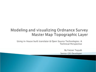
  • 1. Using in-house built translator & Open Source Technologies: A Technical Perspective By Faizan Tayyab Senior GIS Developer
  • 2.
  • 3.
  • 4.
  • 5.
  • 6.
  • 7.  
  • 8.  
  • 9. MasterMap Data Area feature with one TOID
  • 10.
  • 11.
  • 12.
  • 13.
  • 14.
  • 15.
  • 16.
  • 17.
  • 18.
  • 19.
  • 20. Db 1 Db 2 Db 3 Web Server 1 Web Server 2 Web Server 3 Internet Web Client Raster image HTTP Request Response (Raster Image)
  • 21.
  • 22.
  • 23.  
  • 24.
  • 25. Db 1 Db 2 Db 3 Web Server 1 Web Server 2 Web Server 3 Internet Web Client Vector image HTTP Request Response (GML)
  • 26.
  • 27.
  • 28. <?xml version=&quot;1.0&quot; encoding=&quot;utf-8&quot; ?> - <ogcwfs:FeatureCollection xsi:schemaLocation=&quot; http://www.ordnancesurvey.co.uk/xml/namespaces/osgb http://192.168.100.50/magnesium/wfs/OS?REQUEST=DescribeFeatureType&SERVICE=WFS&TYPENAME=AddressPointType,CartographicSymbolType,DepartedFeatureType,AbstractFeatureType,FeatureCollectionType,TopographicLineType,TopographicAreaType,TopographicPointType,CartographicTextType,BoundaryLineType&TYPENS=http%3A%2F%2Fwww.ordnancesurvey.co.uk%2Fxml%2Fnamespaces%2Fosgb http://www.opengis.net/gml http://192.168.100.50/magnesium/wfs/OS?REQUEST=DescribeFeatureType&SERVICE=WFS&TYPENAME=featureCollection&TYPENS=http%3A%2F%2Fwww.opengis.net%2Fgml http://www.opengis.net/wfs http://192.168.100.50/magnesium/wfs/OS/REQUEST/get/DATA/LPR/wfs/basic.xsd &quot; xmlns:gml=&quot; http://www.opengis.net/gml &quot; xmlns:xsi=&quot; http://www.w3.org/2001/XMLSchema-instance &quot; xmlns:xlink=&quot; http://www.w3.org/1999/xlink &quot; xmlns:ogcwfs=&quot; http://www.opengis.net/wfs &quot; xmlns:osgb=&quot; http://www.ordnancesurvey.co.uk/xml/namespaces/osgb &quot;> - <gml:boundedBy> - <gml:Box srsName=&quot; osgb:BNG &quot;>   <gml:coordinates> 294588.2,712553.7 294759.88,712755.4 </gml:coordinates>   </gml:Box>   </gml:boundedBy> <gml:featureMember> <osgb:TopographicArea fid=&quot;osgb1000039334441&quot;> <osgb:featureCode>10021</osgb:featureCode> <osgb:version>2</osgb:version> <osgb:versionDate>2001-11-05</osgb:versionDate> <osgb:theme>Buildings</osgb:theme> <osgb:calculatedAreaValue>12.928</osgb:calculatedAreaValue> <osgb:descriptiveGroup>A Road</osgb:descriptiveGroup> <osgb:make>Manmade</osgb:make> <osgb:physicalLevel>50</osgb:physicalLevel> <osgb:polygon> <gml:Polygon srsName=&quot;osgb:BNG&quot;> <gml:outerBoundaryIs> <gml:LinearRing srsName=&quot;osgb:BNG&quot;> <gml:coordinates>294654.52,712605.92 294651.02,712602.62 294652.88,712600.68 294656.38,712603.98 294654.52,712605.92 </gml:coordinates> </gml:LinearRing> </gml:outerBoundaryIs> </gml:Polygon> </osgb:polygon> </osgb:TopographicArea> </gml:featureMember> - <gml:featureMember></ogcwfs:FeatureCollection>
  • 29.
  • 30.
  • 31.
  • 32.
  • 33.
  • 34.
  • 35.
  • 36.
  • 37.
  • 38.
  • 39. MYSQL Database + Spatial Extension * http://dev.mysql.com/tech-resources/articles/4.1/gis-with-mysql.html GIS Data Types* More Information http://dev.mysql.com/doc/refman/6.0/en/spatial-extensions.html
  • 40.
  • 41.
  • 42.
  • 43.
  • 44.
  • 45.