
Recomendados
Más contenido relacionado
La actualidad más candente
La actualidad más candente (20)
Similar a Application of remote sensing in forest ecosystem
Similar a Application of remote sensing in forest ecosystem (20)
Último
Último (20)
Application of remote sensing in forest ecosystem
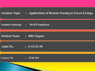
- 1. Seminar Topic ; Applications of Remote Sensing in Forest Ecology Seminar Incharge ; Dr.H.P.Sankhyan Student Name ; Bibi Nagaar Adm.No. ; F-15-23-M Course No ; FGR-591
- 2. Introduction to Remote sensing Introduction to Forest ecology Relationship between Remote Sensing and Forest Ecology Applications of Remote Sensing in Forest Ecology. Case Studies Conclusions
- 3. REMOTE SENSING. The science of acquiring information about an object, without entering in contact with it, by sensing and recording reflected or emitted energy and processing, analyzing, and applying that information. The processes of collecting information about Earth surfaces and phenomena using sensors not in physical contact with the surfaces and phenomena of interest. There is a medium of transmission involved i.e. Earth’s Atmosphere.
- 4. PRINCIPLES OF REMOTE SENSING Detection and discrimination of objects or surface features means detecting and recording of radiant energy reflected or emitted by objects or surface material. Different objects return different amount of energy in different bands of the electromagnetic spectrum, incident upon it. This depends on the Property of material (structural, chemical, and physical) Surface roughness Angle of incidence Intensity Wavelength of radiant energy.
- 7. Active Remote Sensors Laser altimeter Lidar Radar Passive Remote Sensors Accelometer Radiometer Spectrometer
- 8. Three main types of sensors used Optical (Visible/IR) Radar (Microwave) LiDAR (Mostly NIR)
- 9. Remote sensing involves the use of aircraft or satellites to collect photographs or scanned images of the Earth’s surface. The origins of remote sensing date back to a photograph taken from a balloon in 1858. By World War I, the aeroplane had become the main platform from which aerial photography was collected.
- 10. Balloon photography (1858) Pigeon cameras (1903) Kite photography (1890) Aircraft (WWI and WWII)Space (1947) Remote Sensing & GIS Applications Directorate
- 11. Remote Sensing & GIS Applications Directorate
- 12. Energy Source or Illumination (A) Radiation and the Atmosphere (B) Interaction with the Target (C) Recording of Enery by the Sensor (D) g Transmission, Reception, and Processing (E) Interpretation ad Annalysis (F) Application (G) Source: Canadian Centre for Remote Sensing Remote Sensing Process Components
- 13. Data acquisition Processing Analysis Accuracy assessment Information distribution to users
- 14. NOAA-AVHRR GOES MODIS Landsat TM and ETM SPOT IKONOS Quick bird Remote Sensing & GIS Applications Directorate
- 15. The study of living organisms in the natural environment How they interact with one another How they interact with their environment © 2008 Paul Billiet ODWS
- 18. Cellular level Tissue level Organ level Organ system level Individual level
- 19. Population level Community level Ecosystem level Biosphere level
- 25. A variety of ecological applications require data from broad spatial extents that cannot be collected using field based methods. Remote sensing data and techniques address these needs, which include identifying and detailing the characteristics of species habitats Predicting the distribution of species Spatial variability in species richness Detecting natural and human-caused change at scales ranging from individual landscapes to the entire world. Ecologists and conservation biologists are finding new ways to approach their research with the powerful tools and data from remote sensing.
- 28. 1.Land cover classification .Satellite remote sensing is used to estimate the Variety Type Extent of land cover throughout a study region, meeting a fundamental need that is common to many ecological applications. Land cover data describe the physiographical characteristics of the surface environ- ment, which can range from bare rock to tropical forest and that are usually derived by applying statistical clustering methods to multispectral remote sensing data . Remote sensing also assist in the development of land use data that reflect human interactions with the physical environment.
- 35. Integrated Ecosystem Measurements Unlike field-based measurements of ecosystem function, which cannot easily be converted to estimates of function across entire ecosystems, remote sensing can provide simultaneous estimates of ecosystem functions Net primary productivity (NPP) represents one aspect of inte grated ecosystem function.
- 36. Recently,the Moderate Resolution Imaging Spectro Radiometer (MODIS) NPP, based on a micrometeorological approach was developed by Rahman et al. (2004) to provide a consistent, continuous estimate of photosynthetic production (Heinsh et al., 2006) hereinafter referred to as the MODNPP model. MODNPP = 0.5139(MODPRI × APAR) − 1.9818 where, MOD PRI is MODIS-derived photochemical reflectance index, APAR refers to absorbed photosynthetically active radiation by vegetation and 0.5139 and 1.9818 are constants
- 38. The landscape parameters-patch shape, patch size, number of patches, porosity, fragmentation and juxtaposition, and have been analyzed to delineate the disturbance regimes. Roy et al. (2005) using vegetation type map of Andaman & Nicobar islands studied the patch characteristics in terms of patch size, number, shape, porosity and land cover diversity (IIRS, 2003). Prasad et al. (2009) analyzed the levels of forest fragmentation and its effect on species diversity in north Andaman forest using satellite data and GIS-based fragmentation model. Analysis of patch characteristics and species distribution showed high species richness in less fragmented evergreen forests.
- 39. Assessment of Forest Productivity Satellite sensors accurately detect forest productivity, they provide cost and effort advantages over traditional field survey methods. Productivity estimates based on satellite data have been produced with some success for agronomic ecosystems (Olang 1983) Wetlands (Butera et al. 1984; Hardisky et al. 1984), and Shrublands (Strong et al. 1985).
- 40. In a study, predictive models of wood mean annual increment of volume in three regions of the United States (southern Illinois, eastern Ten- nessee, and northeast New York) were developed using CIS, TM data, and digital bio geographical data on forest productivity and soils, slope, solar radiation, and/or vegetation type (Cook et al. 1987; Cook et al. 1989). In general, forest produc- tivity was more accurately predicted with a combi- nation of TM and biogeographical variables than with either data type alone.
- 42. Vegetation type maps in conjunction with phytosociology, topography and soil are used in identifying areas of high economic value (Reddy et al., 2008). The direct identification of economically important of species depends on the extent of distribution and resolution of satellite data. Vegetation formations like pines, sal, teak, which grow gregariously under unique climatic and geological formations are easily identified using remote sensing and the quantitative estimates of timber and biomass are obtained using optimized ground inventories.
- 44. Monitoring - Changing Biodiversity Levin (1999) emphasized the problem of biodiversity prediction and mentioned the need to understand processes that add to or remove the species from an ecosystem by changing the surrounding environment of the ecosystem under study. Predictions of biodiversity change is quite challenging because of large uncertainties associated with the complex dynamics of ecological systems. By using remotely sensed data to describe the changes brought about in vegetated areas of Vindhyan hills over a period of 10 years as a result of fragmentation and its impact on biodiversity have been successfully described (Jha et al. 2005). A high degree of influence of land-use history, fire regimes and other disturbances impacts the vegetation and the biogeochemical characteristics of currently existing ecosystems (Compton and Boone, 2000; Goodale and Aber, 2001)
- 45. Assessment of Forest Damage The assessment of forest damage is an important use of remote sensing data. Many of the changes in tree or foliage morphology resulting from stress can be detected with remote sensors (Jackson 1986). Furthermore, the spectral signature of stressed trees indicate not only the degree of stress but also the type of stress. For example, TMS imagery of damaged red spruce (Picea rubens) stands in Vermont shows a large reduction in the shortwave-infrared reflectance (Rock et al. 1986). Field verification of the image revealed that the foliage of the highly damaged spruce stands was drier and less dense than that of undamaged stands (Rock et al. 1986; Vogelmann and Rock 1986).
- 48. Deforestation in the Amazon basin of Brazil has been quantified by using AVHRR band 3 thermal data which, unlike the visible bands, can penetrate the ubiquitous cloudcover of the region . Estimates of deforestation were obtained by using band 3 to detect both the fires associated with lines of active deforestation and the devegetated areas, which are warmer. The studies of Rondonia, Brazil, indicate that the deforested area increased from 4200 km’ in 1978 to 10,000 km’ in 1982 to 27,000 km’ in 1985 to over 35,000 km’ in 1987 (Malingreau and Tucker 1987; Malingreau and Tucker 1988).
- 49. Habitat loss Satellite measurements of broad-scale trends in vege- tation provide direct estimates of habitat loss, increasing the power of applied ecological studies to detect changes in species distributions or extinction rates. Defore- station in humid tropical forests, which house many terrestrial biodiversity hotspots, is a globally leading cause of species loss. It has proven very difficult to estimate accurately the extent of humid tropical deforestation because of poor monitoring infrastructure in many countries and inconsistencies among existing monitoring regimes.
- 50. Satellite data from the 1990s, based on AVHRR and SPOT4/Vegetation and supplemented by high-resolution Landsat and SPOT4/HRVIR (high resol- ution visible and infrared) data, have been integrated to generate the best estimates of rates of deforestation among remaining humid tropical forests .
- 51. Deforestation ‘hotspots’ could also be detected. Fire, another leading source of change, especially extensive in areas that have previously been damaged by deforestation. A combination of AVHRR, Landsat TM (Thematic Mapper) and radar data were used to detect the impact of deforestation on the burn like- lihood of forests in East Kalimantan, Indonesia .
- 52. Satellite remote sensing data has been extensively used to map forests of tropics whereas up to date data about spatial distribution are absent or lacking. In India, the initial attempt at national level has been on 1: 250,000 scale using visual interpretation of false color images. National Remote Sensing Agency for the first time studied 1: 1 million images for the periods 1972-75 and 1980-82 and forests were classified into three categories .
- 64. Study on mapping and sustainable forest management in Rewari district was carried out to map the forest cover areas, crown density analysis of reserved forests and potential afforestation sites. IRS data was used and visual image analysis techniques were employed. The study area covers 1559 sq. km and consists of tropical thorn forest with some tropical dry deciduous species.
- 67. Important tree species recommended are Prosopis cineraria, Acacia arabica Acacia tortilis Zizyphus numulleria, Lasirus sindicus Cencherus ciliaris
- 68. S. No. Category Area (ha) % to total Forest cover 1 Closed Forest 424 14.21 2 Block Plantation 3163 85.79 Total 3587 100.00
- 69. S. No. Category Area (ha) % to total Potential land 1 Degraded block plantation 1421 10.87 2 Scrub land 4993 38.20 3 Degraded pasture/ grazing land 3595 27.50 4. Sand 1691 12.93 5. Rocky land 1369 10.47 Total 13069 100.00
- 73. Remote sensing is indispensable for ecological and con- servation biological applications and will play an increas- ingly important role in the future. For many purposes, it provides the only means of measuring the characteristics of habitats across broad areas and detecting environ- mental changes that occur as a result of human or natural processes. These data areincreasingly easy to find and use. Although field and remote sensing data are often collected at divergent spatial scales, ecologists have begun to recog- nize both the potential and the pitfalls of satellite information.
- 74. Established remote sensing systems provide opportunities to develop and apply new measurements of ecosystem function across landscapes, regions and continents. New efforts to predict the consequences of ecosystem function change, both natural and human- induced, on the regional and global distributions and abundances of species should be a high research priority. The full range of remote sensing techniques for identifying land covers, measuring the biophysical properties of ecosystems and detecting environmental change will need to be integrated with existing and new ecological data to meet this ambitious challenge.
- 75. THANK YOU FOR YOUR KIND ATTENTION