
Recomendados
Más contenido relacionado
La actualidad más candente
La actualidad más candente (19)
Destacado
Destacado (18)
Similar a future city proposal
Similar a future city proposal (20)
Más de claudwietan
Más de claudwietan (13)
Último
Último (20)
future city proposal
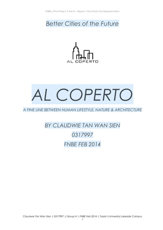
- 1. ENBE | Final Project | Part A – Report | The Future City Representation Better Cities of the Future AL COPERTO A FINE LINE BETWEEN HUMAN LIFESTYLE, NATURE & ARCHITECTURE BY CLAUDWIE TAN WAN SIEN 0317997 FNBE FEB 2014 Claudwie Tan Wan Sien | 0317997 | Group H | FNBE Feb 2014 | Taylor’s University Lakeside Campus 1
- 2. ENBE | Final Project | Part A – Report | The Future City Representation Content: 1. Introduction 3 2. A City (Investigation on better city guidelines & issues) 3. Investigation & Data Collection: Ancient and old city 4. Investigation & Data Collection: The present city 5. Investigation & Data Collection: The future city 6. Case study on the selected type of the future city 7. The New “X” City 8. The Conclusion 9. References list Claudwie Tan Wan Sien | 0317997 | Group H | FNBE Feb 2014 | Taylor’s University Lakeside Campus 2
- 3. ENBE | Final Project | Part A – Report | The Future City Representation 1. Introduction A city – the home of urbanization and civilization and the highest form of social organization. It is the place for every people to carry out their dailt routine. It is a place for them to live their lives on the phase of the earth. Hence, for this project, my city is unstable and unsuitable for my people to live in. As the mayor of the city, I have to come out with ideas to sustain my city by rebuilding a new future city, either an underground city, an underwater city, a floating city or a land city. Claudwie Tan Wan Sien | 0317997 | Group H | FNBE Feb 2014 | Taylor’s University Lakeside Campus 3
- 4. ENBE | Final Project | Part A – Report | The Future City Representation 2. The City Claudwie Tan Wan Sien | 0317997 | Group H | FNBE Feb 2014 | Taylor’s University Lakeside Campus 4
- 5. ENBE | Final Project | Part A – Report | The Future City Representation 2.1 The Definition(s) of City City, pronounced as ˈsɪti/, is defined as a large town or the center of population, commerce and culture. City also means an incorporated municipality, usually governed by a mayor or a group of councilmen. A city is actually a place of business, learning, living, connectivity between the people, walkability among places, etc.; an All-In-One structure for self-sustainability for the present and future generation. 2.2 What is the brief history of city? The building of cities has a long history. Although city planning as an organised profession has existed for less than a century, all cities display various degrees of forethought and conscious design in their layout and functioning. Early humans led a nomadic existence, relying on hunting and gathering to sustain their lives. Between 8,000 and 10,000 years ago, cultivation of plants and the domestication of animals allowed for more permanent settlements. During the fourth millennium B.C., the requirements for the "urban revolution" were finally met: the production of storable food, introduction to various writing systems, a more complex social organisation, and technological advances such as the plough, and potter's wheel. Cities exist for many reasons, and the diversity of urban forms can be traced to the complex functions that cities perform. Cities serve as centers of storage, trade, and manufacture. The agricultural surplus from the surrounding countryside is processed and distributed in cities. Cities also grew up around marketplaces, where goods from distant places could be exchanged for local products. Throughout Claudwie Tan Wan Sien | 0317997 | Group H | FNBE Feb 2014 | Taylor’s University Lakeside Campus 5
- 6. ENBE | Final Project | Part A – Report | The Future City Representation the history, cities have been founded at the intersections of transportation routes, or at points where goods must shift from one mode of transportation to another, as at river and ocean ports. Religious elements played an important role throughout urban history. Ancient peoples had sacred places, often associated with cemeteries or shrines, around which cities grew. Ancient cities usually had large temple precincts with monumental religious buildings. Many medieval cities were built near monasteries and cathedrals. Cities often provide protection in a precarious world. During attacks, the rural populace could flee behind city walls, where defence forces assembled to repel the enemy. The wall served this purpose for millennia, until the invention of heavy artillery rendered walls useless in warfare. With the advent of modern aerial warfare, cities have become prime targets for destruction rather than safe havens. 2.3 What makes a city? A city needs to have certain basic elements that are necessary for the development of the city itself, as well as the people, which includes: - Stability of economy - Suitable amount of human population - Convenient public transportations - Basic public infrastructures - City zoning - Education system - Community work among the people Claudwie Tan Wan Sien | 0317997 | Group H | FNBE Feb 2014 | Taylor’s University Lakeside Campus 6
- 7. ENBE | Final Project | Part A – Report | The Future City Representation - Defense system - Religious and cultural practices - Constant supply of electricity and water - Enforcement of laws and regulations 2.4 What makes a good city? However, one of the most important elements that makes a city good is the sustainability, the balancing of economy, social and environment, ensuring the stability of development in all aspects of the city, such as: - Organised zoning of the city - Proper communication and connectivity planning - Using renewable energy resources as power sources - Buildings and houses are energy efficient - Wide range of education opportunities for young generation - Low rate of unemployment among the citizens - Accessible public spaces where people are able to congregate - Efficient and safe public transportation Claudwie Tan Wan Sien | 0317997 | Group H | FNBE Feb 2014 | Taylor’s University Lakeside Campus 7
- 8. ENBE | Final Project | Part A – Report | The Future City Representation - Zero pollution Implementation of the idea of green city planning to development of city - Recycling waste products - Low carbon urban transportation to reduce pollution - Encourage walkability by providing safe, large pathways along the roads - Good leadership qualities in the city leader(s) 2.5 What is a future city? Future cities have been characterised and defined by a number of factors including sustainability, social and economic development, as well as a high quality of life. Future cities use information and communication technologies (ICT) to be more intelligent and efficient in the use of resources, resulting in cost and energy savings, improved service delivery and Claudwie Tan Wan Sien | 0317997 | Group H | FNBE Feb 2014 | Taylor’s University Lakeside Campus 8
- 9. ENBE | Final Project | Part A – Report | The Future City Representation quality of life, and reduced environmental footprint – all supporting innovation and the low-carbon economy. From my opinion, future city, also called the smart city, focuses on the sustainability issues such as buildings, energy networks and transportation system. Personally, I think that the definition of a “Future City” needs to include the following concepts: - Operate as efficiently as possible, so that resources such as energy, transportation systems and water are used optimally, providing a low-cost, low-carbon basis for economic and social growth, and an attractive, healthy environment in which to live and work. - Create sustainable, equitably distributed growth, where education and employment opportunities are widely available to all citizens and communities, and with a focus on delivering social and environmental outcomes as well as economic growth. - Enable citizens, communities, entrepreneurs and businessmen to do their best to contribute to the economy of the city. - Education system that provides the skills that will be needed by future industries as technology evolves. - Cut down the usage of transportations that give out pollutants to the atmosphere, encourage walking, cycling and using public transportations. - Using renewable energy resources to generate power sources. Claudwie Tan Wan Sien | 0317997 | Group H | FNBE Feb 2014 | Taylor’s University Lakeside Campus 9
- 10. ENBE | Final Project | Part A – Report | The Future City Representation 2.6 What are the features of future city? - High security and strong defense system. - Using renewable energy sources, such as wind turbines, solar panels, or bio-gas created from sewage. Cities provide economies of scale that make such energy sources viable. - Innovation in hybrid public transportations - Increase in pedestrianization. - Xeriscaping (garden & landscape design for water conservation) - Reduce the need of air conditioning by planting trees, add natural ventilation systems, and increase in water features and green spaces, equaling at least 30% of the city’s surface. - Introduce Zero-Energy Building (a building with zero net energy consumption, meaning the total amount of energy used by the building on an annual basis is roughly equal to the amount of renewable energy created on the site). Claudwie Tan Wan Sien | 0317997 | Group H | FNBE Feb 2014 | Taylor’s University Lakeside Campus 10
- 11. ENBE | Final Project | Part A – Report | The Future City Representation 3. Investigation & Data Collection: Ancient and Old City 3.1 Which ancient city are you concentrating on? Tenochtitlan, the capital city of the Mexican civilization, located on an island in Lake Texcoco in the Valley of Mexico, consisting of the Mexica people, is founded in 1325. It was an urban island settlement that housed 200,000 inhabitats at its height. It was one of the largest cities in the world at the time of the Spanish conquest and also the center of a prosperous Aztec society until it was conquered by Spanish Conquistadors led by Hernan Cortes. Today the ruins of Tenochtitlan are located near Mexico City, Mexico Claudwie Tan Wan Sien | 0317997 | Group H | FNBE Feb 2014 | Taylor’s University Lakeside Campus 11
- 12. ENBE | Final Project | Part A – Report | The Future City Representation 3.2 When did it start? History and all. The state religion of the Mexica civilization awaited the fulfillment of an ancient prophecy: that the wandering tribes would find the destined site for a great city whose location would be signaled by an eagle eating a snake while perched atop a cactus. The Aztecs saw this vision on what was then a small swampy island in Lake Texcoco, a vision that is now immortalized in Mexico's coat of arms and on the Mexican flag. Not deterred by the unfavourable terrain, they set about building their city, using the chinampa system (floating gardens) for agriculture. A thriving culture developed, and the Mexica civilization came to dominate other tribes around Mexico. The small natural island perpetually enlarged as Tenochtitlan grew to become the most Claudwie Tan Wan Sien | 0317997 | Group H | FNBE Feb 2014 | Taylor’s University Lakeside Campus 12
- 13. ENBE | Final Project | Part A – Report | The Future City Representation powerful city in Mesoamerica. Commercial routes were developed that brought goods from places as far as the Gulf of Mexico, the Pacific Ocean and even the Inca Empire. After a flood of Lake Texcoco, the city was rebuilt under the rule of Ahuitzotl in a style that made it one of the grandest ever in Mesoamerica. Spanish conquistador Hernán Cortés arrived in Tenochtitlan on November 8, 1519. With an estimated population between 200,000 and 300,000, many scholars believe Tenochtitlan to be the largest city in the world at that time. It was five times the size of the contemporary London of Henry VIII. In a letter to the Spanish king, Cortés wrote that Tenochtitlan was as large as Seville or Córdoba. Cortes' men were in awe at the sight of the splendid city and many wondered if they were in a dream. The most common estimates of the population are of over 200,000 people. One of the few comprehensive academic surveys of Mesoamerican city and town sizes arrived at a population of 212,500 living on 13.5 km2 (5.2 sq mi), It is also said that at one time, Moctezuma had rule over an empire of almost five million people in central and southern Mexico because he had extended his rule to surrounding territories to gain tribute and prisoners to sacrifice to the gods. 3.3 What makes it a significant city and what are the details? The zoning of the city and the city planning make Tenochtitlan a significant city. The geometric of the city and its location was in a strategic position. The entire city of Tenochtitlan was divided into 5 quadrants, including the center one. There were canals that divide the city in the 4 cardinal directions. The central plaza was not the only administrative and religious center in the city. Claudwie Tan Wan Sien | 0317997 | Group H | FNBE Feb 2014 | Taylor’s University Lakeside Campus 13
- 14. ENBE | Final Project | Part A – Report | The Future City Representation The city planning of Tenochtitlan divided the city into 4 zones, i.e. campan. Each zone was divided on 20 districts, i.e. calpullis. Each district was crossed by streets (tlaxilcalli). There main 3 streets that crossed the city. The districts were divided by channels used for transportation, with wood bridges that were removed at night. Tenochtitlan had a great symmetry. All constructions had to be approved by the calmimilocatl (functionary in charge of the city planning). The city was divided into four neighborhoods. divided by channels used for transportation, with wood bridges that were removed at night. Each neighborhood had some specialty in arts and craft. In the center of the city, there were the public buildings, temples and schools. Inside a walled square, 300 meters to a side, was the ceremonial center. There were about 45 public buildings including: the Templo Mayor, the temple of Quetzalcoatl, the ball game, the tzompantli or rack of skulls, the temple of the sun, the platforms for the gladiatorial sacrifice, and some minor temples. Outside was the palace of Montezuma with 100 rooms, each one with its own bath, for the lords and ambassadors of allies and conquered people. Also located nearby was the cuicalli or house of the songs, and the calmecac. 3.4 Conclusion about the city The city is well planned by having by having an agency to control and manage the land properties and zoning of the city. A great city must have a strong system to separate and arrange different zones Claudwie Tan Wan Sien | 0317997 | Group H | FNBE Feb 2014 | Taylor’s University Lakeside Campus 14
- 15. ENBE | Final Project | Part A – Report | The Future City Representation in it such as residential area, rural area, industrial area and social area. 3.5 What are the elements that can be used to your future city? - Single nuclear theory The center of Tenochtitlan, which consists of the important building such as temple of mayor, is the major part of the city. The major complexes formed the center of the city and other parts of city originate from the center of the nucleus. - Multi nuclear theory Several independent points were formed rather than only forming one central business district. Each independent point acts as growth center from a particular kind of land use such as housing areas, industry zones and commercial areas, merged to form a single urban area. - Smart city planning and strategic geometric of the city Claudwie Tan Wan Sien | 0317997 | Group H | FNBE Feb 2014 | Taylor’s University Lakeside Campus 15
- 16. ENBE | Final Project | Part A – Report | The Future City Representation 4. Investigation & Data Collection: Present Cities 4.1.1 What city are you concentrating on? Vauban, a new neighborhood planned for 5,000 inhabitants and 600 jobs 4 km to the south of the town center in Freiburg, Germany. It was built as a sustainable model district on the site of a former French military base, and is named after Sébastien Le Prestre de Vauban, the 17th century French Marshal who built fortifications in Freiburg while the region was under French rule. The construction began in the mid-1990s. Claudwie Tan Wan Sien | 0317997 | Group H | FNBE Feb 2014 | Taylor’s University Lakeside Campus 16
- 17. ENBE | Final Project | Part A – Report | The Future City Representation 4.2.1 When did it start? History and all. The site was originally developed as a military base in 1936, and was taken over after World War II by the French forces occupying the region. The military left in 1992. Over a period of some years the vacant structures were occupied by various tribes of hippies and anarchists. Following battles with the city government, squatters won the rights to four of the original twenty barracks. At the same time a group which came to be called Forum Vauban was pressing the City Council to develop the site in an eco- friendly way. The remaining 38 hectares were acquired by Freiburg City Council, who delegated the mandatory community consultation to Forum Vauban. This collaboration between the Council and Forum Vauban led to the master plan with its car-free concept. Most of the individual plots were sold to Baugruppen (co-housing groups) whose bids were assessed against criteria favouring families with children, older people and Freiburg residents. Some Baugruppen were formed by architects, others by prospective residents planning varying elements of self-build. Some of the other plots were sold to private developers. Claudwie Tan Wan Sien | 0317997 | Group H | FNBE Feb 2014 | Taylor’s University Lakeside Campus 17
- 18. ENBE | Final Project | Part A – Report | The Future City Representation Another part of the site was developed for student dormitories for the University of Freiburg. Some former residents of these structures have taken up residence in a diverse assortment of cars, vans, and retired civil service vehicles, forming what has been named Wagenplatz. More "alternative" projects have, among other things, converted old barracks at a low cost, such as S.U.S.I., a self-governed independent residential initiative that, through an alternative living concept, developed living spaces for students as well as subsidized housing. A self-governing "Community Center Building 037" has been established in one of the preserved barracks. Some former barracks were occupied in early 2005, as they would have been demolished. 4.3.1 What makes it a significant city and what are the details? All houses are built to low energy consumption standard, with 100 units designed to the Passivhaus ultra-low energy building standard. Other buildings are heated by power station burning wood chips, while others have Solar collectors. The best example of sustainable building is the Solar Settlement in Vauban, a 59 PlusEnergy home housing community, the first housing community where all homes produce positive energy balance. The solar energy surplus is then sold back into the city's grid for a profit on every home. Within Vauban, transportation is primarily by foot or bicycle. The development is connected to the Freiburg city center by a tramway, and is laid out linearly along the tracks such that all homes are within walking distance of a tram stop. In 2009, around 70% of households had chosen to live without a private car. The level of car ownership has fallen over time. Claudwie Tan Wan Sien | 0317997 | Group H | FNBE Feb 2014 | Taylor’s University Lakeside Campus 18
- 19. ENBE | Final Project | Part A – Report | The Future City Representation Transportation network in Vauban. The preference for walking and cycling can be partly attributed to the layout of the district. Building on previous experience, the plan departs from the simple inherited grid, and creates a network which incorporates the principle of “filtered permeability”. It means that the network geometry favours the active modes of transport and, selectively, “filters out” the car. This is accomplished by reducing the number of streets that run through the neighbourhood. Instead, most local streets are crescents and cul-de-sacs (see drawing). While they are discontinuous for cars, they connect to a network of pedestrian and bike paths which permeate the entire neighbourhood. In addition, these paths go through or by open spaces adding to the enjoyment of the trip. The logic of filtering a mode of transport is fully expressed in a new comprehensive model for laying out neighbourhoods and districts – the Fused Grid. Most of Vauban's residential streets are described as stellplatzfrei (free from parking spaces). Vehicles are allowed down these streets at walking pace to pick up and deliver but not to park, although there are some infractions as the system depends essentially on social consensus - there are few official controls. Each year, households are required to sign a declaration stating either that they do not own a car, or that they do, in which case they must buy a space in one of the multi-storey car parks on the periphery, at a cost of 17,500€ (in 2006). The city-wide car club has the greatest concentration of its 2,500 members in Vauban – at least ten of its cars are stationed around the district. Claudwie Tan Wan Sien | 0317997 | Group H | FNBE Feb 2014 | Taylor’s University Lakeside Campus 19
- 20. ENBE | Final Project | Part A – Report | The Future City Representation 4.4.1 What are the elements that can be used to your future city? - City planned around green transportation - Pedestrian and bicycle paths form a highly-connected transportation network - All buildings in the city must meet minimum low energy consumption standards of 65kWh/m2 a - Green building - Green city planning - Zero pollution city 4.1.2 What city are you concentrating on? Shibuya is a special ward in Tokyo, Japan. As of 2008, it has an estimated population of 208,371 and a population density of 13,540 people per km². The total area is 15.11 km². The name "Shibuya" is also used to refer to the shopping district which surrounds Shibuya Station, one of Tokyo's busiest railway stations. This area is known as one of the fashion centers of Japan, particularly for young people, and as a major nightlife area. 4.2.2 When did it start? History and all. Shibuya was historically the site of a castle in which the Shibuya family resided from the 11th century through the Edo period. Following the opening of the Yamanote Line in 1885, Shibuya began to emerge as a railway terminal for southwestern Tokyo and eventually as a major commercial and entertainment center. The Tokyu Toyoko Line opened in 1932, making Shibuya a key terminal between Tokyo and Yokohama, and was joined by the forerunner of theKeio Inokashira Line in 1933 and the forerunner of the Tokyo Metro Ginza Line in 1938. One of the best-known stories Claudwie Tan Wan Sien | 0317997 | Group H | FNBE Feb 2014 | Taylor’s University Lakeside Campus 20
- 21. ENBE | Final Project | Part A – Report | The Future City Representation concerning Shibuya is the story of Hachikō, a dog who waited on his late master at Shibuya Station every day from 1923 to 1935, eventually becoming a national celebrity for his loyalty. A statue of Hachikō was built adjacent to the station, and the surrounding Hachikō Square is now the most popular meeting point in the area. During the occupation of Japan, Yoyogi Park was used as a housing compound for U.S. personnel known as "Washington Heights." The US military left in 1964, and much of the park was repurposed as venues for the 1964 Summer Olympics. The ward itself served as part of theathletics 50 km walk and marathon course during the 1964 games.5 Shibuya has achieved great popularity among youngsters since 1980s. There are several famous fashion department stores in Shibuya. Shibuya 109 is a major shopping center near Shibuya Station. The contemporary fashion scene in Shibuya extends northward from Shibuya Station to Harajuku, where youth culture reigns; Omotesandō, the zelkova tree- and fashion brand-lined street; and Sendagaya, Tokyo's apparel design district. During the late 1990s, Shibuya also became known as the center of the IT industry in Japan. 4.3.2 What makes it a significant city and what are the details? - Green areas include Meiji Shrine, Shinjuku Gyoen and Yoyogi Park. - Popular buildings such as the Shibuya 109, United Nations University, Yebisu Garden Place and Cerulean Tower (the tallest building in the Shibuya Station area) - Shibuya Station, the main station in Shibuya - Shibuya Crossing Claudwie Tan Wan Sien | 0317997 | Group H | FNBE Feb 2014 | Taylor’s University Lakeside Campus 21
- 22. ENBE | Final Project | Part A – Report | The Future City Representation Shibuya is famous for its scramble crossing. It is located in front of the Shibuya Station Hachikō exit and stops vehicles in all directions to allow pedestrians to inundate the entire intersection. The statue of Hachikō, a dog, between the station and the intersection, is a common meeting place and almost always crowded. 4.4.2 What are the elements that can be used to your future city? - Green buildings and green spaces - Organized city zoning - Well-planned railway routes 4.5 Conclusion about the cities Both Vauban and Shibuya have great city planning that allows further development in the cities. A significant city have to achieve strategic city zoning that involves all aspects such as industrial, residential, transportation, urbanization, commercial, green spaces and green buildings. Claudwie Tan Wan Sien | 0317997 | Group H | FNBE Feb 2014 | Taylor’s University Lakeside Campus 22
- 23. ENBE | Final Project | Part A – Report | The Future City Representation 5.Investigation & Data Collection: Future Cities 5.1 What city are you concentrating on? Shimizu TRY 2004 Mega-City Pyramid, a hypothetical project for construction of a massive pyramid over Tokyo Bay in Japan. The structure would be more than 14 times as high as the Great Pyramid at Giza, and would house 1,000,000 people. The structure would be 2000 meters above sea level, including 5 stacked trusses, each with similar dimensions to the great pyramid of Giza. This pyramid would answer Tokyo's increasing lack of space, although the project would only handle 1/47th of the Greater Tokyo Area's population. The proposed structure is so large that it cannot be built with currently available materials, due to their weight. The design relies on the future availability of super-strong lightweight materials based on carbon nanotubes. 5.2 What makes it a significant city and what are the details? - Multi-purpose city extension combining business, residential, commercial, research, cultural and leisure amenities. - A continuous circulatory transportation system, featuring elevators, moving walkways and smart vehicles will allow people and shipment containers to travel to different sectors, automatically switching routes and between modes of transport to provide the most efficient path. - Construction exposes the interior spaces to abundant sunlight and fresh air. - Each building inside the city have its own energy resources, i.e. sun and wind. Claudwie Tan Wan Sien | 0317997 | Group H | FNBE Feb 2014 | Taylor’s University Lakeside Campus 23
- 24. ENBE | Final Project | Part A – Report | The Future City Representation 5.3 Conclusion about the city The Shimizu TRY 2004 Mega City Pyramid has great city planning by building multi-purpose city extensions which improves accessibility. Besides, the continuous circulatory transportation system uses high technology, which makes it a signficant city. 5.4 What are the elements that you can use to your future city? - Multi-purpose buildings - Using renewable energy to generate power sources. - Every sector of the building is connected by circulatory transportation system, featuring 3 levels – vehicle, pedestrian and bicycle, as well as railway. Claudwie Tan Wan Sien | 0317997 | Group H | FNBE Feb 2014 | Taylor’s University Lakeside Campus 24
- 25. ENBE | Final Project | Part A – Report | The Future City Representation 6. Case study on the selected type of the future city 6.1 Solution for making the future city? As the Mayor of the X city, I constantly did research from time to time and asked myself questions on the problems faced by the current city and the ways on how to overcome the circumstances by referencing he past, present and future city. 6.2 What are the important consideration and guideline or important information when planning for a future city? - Safe and efficient transportation system. - Organised city zoning. - Green city planning. - Introduce green spaces and green buildings to the city. Claudwie Tan Wan Sien | 0317997 | Group H | FNBE Feb 2014 | Taylor’s University Lakeside Campus 25
- 26. ENBE | Final Project | Part A – Report | The Future City Representation - Convenient access to every locations in the community. - Improve walkability of city by building highly-connected pedestrian and bicycle pathways. - Well-planned railway routes. - Every building in the city must meet low energy consumption standard or they have to obtain their own energy buy other sustainable resources such as sunlight, water and wind. 7. The New “X” City: Al Coperto 7.1 How did you come up with the solution to create this new city? Why did the city, Al Coperto come about? It was all because of the ongoing irresponsible human activities and greed that have made the present city not livable. Global warming together with the change of climate all over the globe caused sea water level to rise and made this city unsuitable for the two main elements that makes the city – the man and the nature. Claudwie Tan Wan Sien | 0317997 | Group H | FNBE Feb 2014 | Taylor’s University Lakeside Campus 26
- 27. ENBE | Final Project | Part A – Report | The Future City Representation Therefore, the only way to overcome this issue is to create another city by enhancing the city to green city, promoting green city planning to make the city sustainable. 7.2 Why is it floating on the surface of water? The city that I’ve chosen for my future city is a floating city. The purpose of choosing floating city out of the three other choices, i.e. flying city, underground city and land city, is due to the rising of the sea level. The sudden rise of sea level has caused many lower cities submerged below sea level, including Port Dickson, the X city, thus threatening the lives of living organisms. Therefore, as the mayor of the X city, I came out with an idea that a new X city have to be created in order to solve the problems. Also, it’s the best that the X city is a city floating on the surface of the sea because the rising sea level would not be a reason that the people could be worried about as the city is able to flow parallel and directly propotional to the water current. 7.3 How did the name of the new future city come about? Claudwie Tan Wan Sien | 0317997 | Group H | FNBE Feb 2014 | Taylor’s University Lakeside Campus 27
- 28. ENBE | Final Project | Part A – Report | The Future City Representation The new name of the future city is called “Al Coperto”, which means indoor in Italian. Al Coperto is actually an indoor city, initially inspired by the plan view of a pair of shoes. 7.4 Who are the people in the new X city? In my new X city, the people could come from different parts of the world as my city is opened to anyone, with no nationality and race restrictions. 7.5 What is the important characteristic and elements ? - Highly coonected transportation network - Usage of sustainable technology - Futureproof - Self sustain city Claudwie Tan Wan Sien | 0317997 | Group H | FNBE Feb 2014 | Taylor’s University Lakeside Campus 28
- 29. ENBE | Final Project | Part A – Report | The Future City Representation - Energy efficient city - Green city planning - Culture and religious practices 7.6 Conclusion about the new X city I believe that the floating city proposal of Al Coperto is able to provide sustainability for the people in the future. Al Coperto uses renewable energy resources to generate power that will not be used up within finite years, minimizes carbon footprint in the city as the city plan is designed to have maximum walkability and accessibility, as well as green spaces and green technologies that involves in the green city planning. Although Al Coperto does not have to most stunning design and the most sophisticated technologies, in my opinion, Al Coperto has the potential to be an eco-friendly and a sustainable city in the future. Claudwie Tan Wan Sien | 0317997 | Group H | FNBE Feb 2014 | Taylor’s University Lakeside Campus 29
- 30. ENBE | Final Project | Part A – Report | The Future City Representation 8. Conclusion After weeks and weeks of continuous research regarding urban planning and design, I realize that it is extremely challenging to be an urban planner because a lot of aspects have to be considered about. However, the exposure on urban planning is surely a commendable experience after all. Along completing this report, I’ve learnt that as a good city planner, one always have to place the people as the main priority as they are the main component in a city. It is important to acknowledge what the people need to sustain their lives and for Claudwie Tan Wan Sien | 0317997 | Group H | FNBE Feb 2014 | Taylor’s University Lakeside Campus 30
- 31. ENBE | Final Project | Part A – Report | The Future City Representation their convenience. Besides, while planning a city, it is crucial to concern about inserting green spaces and green technologies into the layout of a city. If the sustainability of the city is achieved, the people, us, are already living in the future because a future city is a sustainable city. 9. Reference Links Claudwie Tan Wan Sien | 0317997 | Group H | FNBE Feb 2014 | Taylor’s University Lakeside Campus 31
- 32. ENBE | Final Project | Part A – Report | The Future City Representation - https://www.google.com/search? q=al+coperto+google+translate&oq=al+coperto+google+tra nslate&aqs=chrome..69i57.11590j0j4&sourceid=chrome&es_s m=91&ie=UTF-8 - http://www.metro.tokyo.jp/ENGLISH/INFO/ - http://mapsof.net/map/tokyo-railway-and-subway-map - http://www.gradjevinarstvo.rs/tekstovi_slike/tekstovi/frajburg %20modal%20split.jpg - http://www.atlasextinctnations.com/2012/01/how-aztecs- organized-themselves-part-1.html - http://www.natgeocreative.com/comp/02/376/22446.jpg - https://www.google.com/search? q=al+coperto+google+translate&oq=al+coperto+google+tra nslate&aqs=chrome..69i57.11590j0j4&sourceid=chrome&es_s m=91&ie=UTF-8 - http://www.shimz.co.jp/english/theme/dream/try.html - http://forum.skyscraperpage.com/showthread.php? t=149802 Claudwie Tan Wan Sien | 0317997 | Group H | FNBE Feb 2014 | Taylor’s University Lakeside Campus 32