SlideShare una empresa de Scribd logo
1 de 15
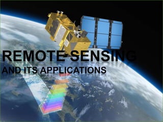
REMOTE SENSING
AND ITS APPLICATIONS
Remote Sensing
Weather forecasting
Google mapping
Remote Sensing?
 Remote sensing is defined as the technique
of obtaining information about objects
through the analysis of data collected by
special instruments that are not in physical
contact with the objects of investigation.
 Collection of information about an object
without coming into physical contact.
 The information needs a physical carrier to
travel from the objects/events to the sensors
through an intervening medium.
 The electromagnetic radiation is normally
used as an information carrier in remote
sensing.
 The output of a remote sensing system is
usually an image representing the scene
being observed.
 The technology of modern remote sensing
began with the invention of the camera more
than 150 years ago.
 The idea and practice of looking down at the
Earth's surface emerged in the 1840s when
pictures were taken from cameras secured to
tethered balloons for purposes of topographic
mapping.
 Satellite remote sensing can be traced to the
early days of the space age (both Russian and
American programs) and actually began as a
dual approach to imaging surfaces using
several types of sensors from spacecraft.
 The term "remote sensing," first used in the
United States in the 1950s by Ms. Evelyn
Pruitt of the U.S.
History
Elements involved in Remote sensing
1. Energy Source or Illumination
(A)
2. Radiation and the Atmosphere
(B)
3. Interaction with the Object (C)
4. Recording of Energy by the
Sensor (D)
5. Transmission, Reception and
Processing (E)
6. Interpretation and Analysis (F)
7. Application (G)
Remote Sensing Sensors
 Active Remote Sensors :-
 Active remote sensing uses an artificial source for
energy.
 For example the satellite itself can send a pulse of
energy which can interact with the target.
 In active remote sensing, humans can control the
nature (wavelength, power, duration) of the source
energy. Active remote sensing can be carried out
during day and night and in all weather conditions.
Conti…
Passive remote sensing:-
 Passive remote sensing depends on a natural
source to provide energy.
 For example sun is the most powerful and
commonly used source of energy for passive
remote sensing.
 The satellite sensor in this case records primarily
the radiation that is reflected from the target.
ACTIVE & PASSIVE REMOTE
SENSING
Platforms
Platforms :
The base on which remote
sensors are placed to
acquire information about
the Earth surface is called
platforms.
• Ground based
• Airborne
• Space borne
Platforms used for Remote
Sensing
 Ground-based platforms: ground, vehicles and/or towers
=> up to 50 m
 Airborne platforms: airplanes, helicopters, high-altitude
aircrafts, balloons => up to 50 km
 Space borne: rockets, satellites, shuttle => from about 100
km to 36000 km
1. Space shuttle: 250-300 km
2. Space station: 300-400 km
3. Low-level satellites: 700-1500 km
4. High-level satellites: about 36000 km
Advantages of remote sensing:-
 Provides a regional view (large areas).
 Provides repetitive looks at the same area.
 Remote sensors "see" over a broader.
portion of the spectrum than the human
eye.
 Provides geo-referenced, digital, data.
 Some remote sensors operate in all
seasons, at night, and in bad weather.
DISADVANTAGE OF REMOTE
SENSING:-
 Expensive to build and operate
 Needs ground verification
 Not the best tool for small areas
 Needs expert system to extract data
Applications of Remote sensing
 Meteorology
 Profiling of atmospheric temp. and water
vapor
 Measuring wind velocity
 Oceanography
 Measurements of sea surface temperature
 Mapping ocean currents
 Glaciology
 Mapping motion of sea ice and ice sheets
 Determining the navigability of the sea
 Geology
 Identification of rock types
 Location of geological faults and
anomalies
Applications of Remote sensing
 Agriculture
Monitoring the extend and type of vegetation
Mapping soil types
 Hydrology
Assessing water resources
Forecasting melt water run-off from snow
 Disaster control
Warning of sand and dust storms, flooding
Monitoring of pollution
7528
Thankyou
for
yourkindattention!!!

Más contenido relacionado

La actualidad más candente

GIS presentation
GIS presentationGIS presentation
GIS presentationarniontech
 
Global Positioning System
Global Positioning System Global Positioning System
Global Positioning System Himanshu Agrawal
 
Introduction to remote sensing and gis
Introduction to remote sensing and gisIntroduction to remote sensing and gis
Introduction to remote sensing and gisMohsin Siddique
 
Image interpretation keys & image resolution
Image interpretation keys & image resolutionImage interpretation keys & image resolution
Image interpretation keys & image resolutionPramoda Raj
 
Indian remote sensing satellites
Indian  remote  sensing  satellitesIndian  remote  sensing  satellites
Indian remote sensing satellitesPramoda Raj
 
GEOGRAPHICAL INFORMATION SYSTEM (GIS)
GEOGRAPHICAL INFORMATION SYSTEM (GIS)GEOGRAPHICAL INFORMATION SYSTEM (GIS)
GEOGRAPHICAL INFORMATION SYSTEM (GIS)subhashB10
 
Application of Remote Sensing in Agriculture
Application of Remote Sensing in AgricultureApplication of Remote Sensing in Agriculture
Application of Remote Sensing in AgricultureUTTAM KUMAR
 
Remote sensing - Sensors, Platforms and Satellite orbits
Remote sensing - Sensors, Platforms and Satellite orbitsRemote sensing - Sensors, Platforms and Satellite orbits
Remote sensing - Sensors, Platforms and Satellite orbitsAjay Singh Lodhi
 
Components of gis
Components of gisComponents of gis
Components of gisPramoda Raj
 
Microwave remote sensing
Microwave remote sensingMicrowave remote sensing
Microwave remote sensingMohsin Siddique
 
Geographic information system
Geographic information systemGeographic information system
Geographic information systemSumanta Das
 
Application of remote sensing
Application of remote sensingApplication of remote sensing
Application of remote sensingAnurag Kumar
 
Remote Sensing Data Acquisition,Scanning/Imaging systems
Remote Sensing Data Acquisition,Scanning/Imaging systemsRemote Sensing Data Acquisition,Scanning/Imaging systems
Remote Sensing Data Acquisition,Scanning/Imaging systemsdaniyal rustam
 
A Brief Introduction to Remote Sensing Satellites
A Brief Introduction to Remote Sensing Satellites A Brief Introduction to Remote Sensing Satellites
A Brief Introduction to Remote Sensing Satellites Alireza Rahimzadeganasl
 
Remote Sensing and GIS in Land Use / Land Cover Mapping
Remote Sensing and GIS in Land Use / Land Cover MappingRemote Sensing and GIS in Land Use / Land Cover Mapping
Remote Sensing and GIS in Land Use / Land Cover MappingVenkatKamal1
 
Introduction and Application of GIS
Introduction and Application of GISIntroduction and Application of GIS
Introduction and Application of GISSatish Taji
 

La actualidad más candente (20)

GIS presentation
GIS presentationGIS presentation
GIS presentation
 
Global Positioning System
Global Positioning System Global Positioning System
Global Positioning System
 
Introduction to remote sensing and gis
Introduction to remote sensing and gisIntroduction to remote sensing and gis
Introduction to remote sensing and gis
 
Image interpretation keys & image resolution
Image interpretation keys & image resolutionImage interpretation keys & image resolution
Image interpretation keys & image resolution
 
Indian remote sensing satellites
Indian  remote  sensing  satellitesIndian  remote  sensing  satellites
Indian remote sensing satellites
 
Remote sensing
Remote sensingRemote sensing
Remote sensing
 
GEOGRAPHICAL INFORMATION SYSTEM (GIS)
GEOGRAPHICAL INFORMATION SYSTEM (GIS)GEOGRAPHICAL INFORMATION SYSTEM (GIS)
GEOGRAPHICAL INFORMATION SYSTEM (GIS)
 
Application of Remote Sensing in Agriculture
Application of Remote Sensing in AgricultureApplication of Remote Sensing in Agriculture
Application of Remote Sensing in Agriculture
 
GIS PPT
GIS PPTGIS PPT
GIS PPT
 
Remote sensing - Sensors, Platforms and Satellite orbits
Remote sensing - Sensors, Platforms and Satellite orbitsRemote sensing - Sensors, Platforms and Satellite orbits
Remote sensing - Sensors, Platforms and Satellite orbits
 
Spatial data for GIS
Spatial data for GISSpatial data for GIS
Spatial data for GIS
 
Components of gis
Components of gisComponents of gis
Components of gis
 
Concept of remote sensing
Concept of remote sensingConcept of remote sensing
Concept of remote sensing
 
Microwave remote sensing
Microwave remote sensingMicrowave remote sensing
Microwave remote sensing
 
Geographic information system
Geographic information systemGeographic information system
Geographic information system
 
Application of remote sensing
Application of remote sensingApplication of remote sensing
Application of remote sensing
 
Remote Sensing Data Acquisition,Scanning/Imaging systems
Remote Sensing Data Acquisition,Scanning/Imaging systemsRemote Sensing Data Acquisition,Scanning/Imaging systems
Remote Sensing Data Acquisition,Scanning/Imaging systems
 
A Brief Introduction to Remote Sensing Satellites
A Brief Introduction to Remote Sensing Satellites A Brief Introduction to Remote Sensing Satellites
A Brief Introduction to Remote Sensing Satellites
 
Remote Sensing and GIS in Land Use / Land Cover Mapping
Remote Sensing and GIS in Land Use / Land Cover MappingRemote Sensing and GIS in Land Use / Land Cover Mapping
Remote Sensing and GIS in Land Use / Land Cover Mapping
 
Introduction and Application of GIS
Introduction and Application of GISIntroduction and Application of GIS
Introduction and Application of GIS
 

Destacado

Elements of remote sensing
Elements of remote sensingElements of remote sensing
Elements of remote sensingAlbein Vivek
 
Differential gps (dgps) 09 04-12
Differential gps (dgps) 09 04-12Differential gps (dgps) 09 04-12
Differential gps (dgps) 09 04-12Sumant Diwakar
 
Dgps concept
Dgps conceptDgps concept
Dgps conceptegovindia
 
Carmon remote sensinggis
Carmon remote sensinggisCarmon remote sensinggis
Carmon remote sensinggisnavdeepjamwal
 
Remote Sensing Techniques for Oceanography Satelitte and In Situ Observations
Remote Sensing Techniques for Oceanography Satelitte and In Situ ObservationsRemote Sensing Techniques for Oceanography Satelitte and In Situ Observations
Remote Sensing Techniques for Oceanography Satelitte and In Situ ObservationsA.Tuğsan İşiaçık Çolak
 
Global positioning system(GPS)
Global positioning system(GPS)Global positioning system(GPS)
Global positioning system(GPS)Arghaya Goswami
 
Ppt on remote sensing system
Ppt on remote sensing systemPpt on remote sensing system
Ppt on remote sensing systemAlisha Korpal
 
Components of Remote Sensing
Components of Remote SensingComponents of Remote Sensing
Components of Remote SensingAbby Varghese
 
Advantages and disadvantages of Remote Sensing
Advantages and disadvantages of Remote SensingAdvantages and disadvantages of Remote Sensing
Advantages and disadvantages of Remote SensingEr Abhi Vashi
 
Electromagnetic waves
Electromagnetic wavesElectromagnetic waves
Electromagnetic wavesmeenng
 
Electromagnetic Waves Class 12
Electromagnetic Waves Class 12 Electromagnetic Waves Class 12
Electromagnetic Waves Class 12 Self-employed
 
Electromagnetic waves
Electromagnetic wavesElectromagnetic waves
Electromagnetic wavesKANNAN
 
Electromagnetic waves
Electromagnetic wavesElectromagnetic waves
Electromagnetic wavess7822143g
 
What is GIS
What is GISWhat is GIS
What is GISEsri
 
Basic of Remote Sensing
Basic of Remote SensingBasic of Remote Sensing
Basic of Remote Sensinggueste5cfed
 
REMOTE SENSING
REMOTE SENSINGREMOTE SENSING
REMOTE SENSINGKANNAN
 

Destacado (20)

Elements of remote sensing
Elements of remote sensingElements of remote sensing
Elements of remote sensing
 
remote sensing
remote sensingremote sensing
remote sensing
 
Differential gps (dgps) 09 04-12
Differential gps (dgps) 09 04-12Differential gps (dgps) 09 04-12
Differential gps (dgps) 09 04-12
 
Dgps concept
Dgps conceptDgps concept
Dgps concept
 
Carmon remote sensinggis
Carmon remote sensinggisCarmon remote sensinggis
Carmon remote sensinggis
 
Remote Sensing Techniques for Oceanography Satelitte and In Situ Observations
Remote Sensing Techniques for Oceanography Satelitte and In Situ ObservationsRemote Sensing Techniques for Oceanography Satelitte and In Situ Observations
Remote Sensing Techniques for Oceanography Satelitte and In Situ Observations
 
GPS
GPS GPS
GPS
 
Global positioning system(GPS)
Global positioning system(GPS)Global positioning system(GPS)
Global positioning system(GPS)
 
Semiconductor laser
Semiconductor laserSemiconductor laser
Semiconductor laser
 
Ppt on remote sensing system
Ppt on remote sensing systemPpt on remote sensing system
Ppt on remote sensing system
 
Components of Remote Sensing
Components of Remote SensingComponents of Remote Sensing
Components of Remote Sensing
 
Advantages and disadvantages of Remote Sensing
Advantages and disadvantages of Remote SensingAdvantages and disadvantages of Remote Sensing
Advantages and disadvantages of Remote Sensing
 
Electromagnetic waves
Electromagnetic wavesElectromagnetic waves
Electromagnetic waves
 
Electromagnetic Waves Class 12
Electromagnetic Waves Class 12 Electromagnetic Waves Class 12
Electromagnetic Waves Class 12
 
Electromagnetic waves
Electromagnetic wavesElectromagnetic waves
Electromagnetic waves
 
Electromagnetic waves
Electromagnetic wavesElectromagnetic waves
Electromagnetic waves
 
Electromagnetic waves
Electromagnetic wavesElectromagnetic waves
Electromagnetic waves
 
What is GIS
What is GISWhat is GIS
What is GIS
 
Basic of Remote Sensing
Basic of Remote SensingBasic of Remote Sensing
Basic of Remote Sensing
 
REMOTE SENSING
REMOTE SENSINGREMOTE SENSING
REMOTE SENSING
 

Similar a RS-APPLICATIONS

remote sensing
remote sensingremote sensing
remote sensing78harshith
 
Remote Sensing_2020-21 (1).pdf
Remote Sensing_2020-21  (1).pdfRemote Sensing_2020-21  (1).pdf
Remote Sensing_2020-21 (1).pdfBAGARAGAZAROMUALD2
 
Remote sensing and its applications in environment
Remote sensing and its applications in environmentRemote sensing and its applications in environment
Remote sensing and its applications in environmentMuhammad Sajjad
 
Remote Sensing - by Ashwini
Remote Sensing - by AshwiniRemote Sensing - by Ashwini
Remote Sensing - by AshwiniSanthosh Sundar
 
remote sensing for study.docx
remote sensing for study.docxremote sensing for study.docx
remote sensing for study.docxbbc37142
 
Chapter 1 (Introduction to remote sensing)
Chapter 1 (Introduction to remote sensing)Chapter 1 (Introduction to remote sensing)
Chapter 1 (Introduction to remote sensing)Shankar Gangaju
 
rsgis-unitii-160731062950.pdf
rsgis-unitii-160731062950.pdfrsgis-unitii-160731062950.pdf
rsgis-unitii-160731062950.pdfBSuresh26
 
Remote sensing by Priyanshu kumar, 9608684800
Remote sensing by Priyanshu kumar, 9608684800Remote sensing by Priyanshu kumar, 9608684800
Remote sensing by Priyanshu kumar, 9608684800PRIYANSHU KUMAR
 
Basic Understanding of Remote Sensing.pdf
Basic Understanding of Remote Sensing.pdfBasic Understanding of Remote Sensing.pdf
Basic Understanding of Remote Sensing.pdfrupalibgisnetra
 
civil Remote Sensing ppt.pptx
civil Remote Sensing ppt.pptxcivil Remote Sensing ppt.pptx
civil Remote Sensing ppt.pptxHellGod3
 
applicationsofremotesensingingeologicalaspects-170606133459.pdf
applicationsofremotesensingingeologicalaspects-170606133459.pdfapplicationsofremotesensingingeologicalaspects-170606133459.pdf
applicationsofremotesensingingeologicalaspects-170606133459.pdfCIVIL48
 
Applications of remote sensing in geological aspects
Applications of remote sensing in geological aspectsApplications of remote sensing in geological aspects
Applications of remote sensing in geological aspectsPramoda Raj
 

Similar a RS-APPLICATIONS (20)

Remote sensing
Remote sensingRemote sensing
Remote sensing
 
remote sensing
remote sensingremote sensing
remote sensing
 
Remote Sensing_2020-21 (1).pdf
Remote Sensing_2020-21  (1).pdfRemote Sensing_2020-21  (1).pdf
Remote Sensing_2020-21 (1).pdf
 
Remote sensing
Remote sensingRemote sensing
Remote sensing
 
Ch 5 b remote sensing
Ch 5 b remote sensingCh 5 b remote sensing
Ch 5 b remote sensing
 
Remote sensing
Remote sensingRemote sensing
Remote sensing
 
Remote sensing and its applications in environment
Remote sensing and its applications in environmentRemote sensing and its applications in environment
Remote sensing and its applications in environment
 
Remote Sensing - by Ashwini
Remote Sensing - by AshwiniRemote Sensing - by Ashwini
Remote Sensing - by Ashwini
 
remote sensing for study.docx
remote sensing for study.docxremote sensing for study.docx
remote sensing for study.docx
 
Chapter 1 (Introduction to remote sensing)
Chapter 1 (Introduction to remote sensing)Chapter 1 (Introduction to remote sensing)
Chapter 1 (Introduction to remote sensing)
 
rsgis-unitii-160731062950.pdf
rsgis-unitii-160731062950.pdfrsgis-unitii-160731062950.pdf
rsgis-unitii-160731062950.pdf
 
Report
ReportReport
Report
 
Introduction to Remote Sensing
Introduction to Remote SensingIntroduction to Remote Sensing
Introduction to Remote Sensing
 
intro.pptx
intro.pptxintro.pptx
intro.pptx
 
Remote sensing by Priyanshu kumar, 9608684800
Remote sensing by Priyanshu kumar, 9608684800Remote sensing by Priyanshu kumar, 9608684800
Remote sensing by Priyanshu kumar, 9608684800
 
Basic Understanding of Remote Sensing.pdf
Basic Understanding of Remote Sensing.pdfBasic Understanding of Remote Sensing.pdf
Basic Understanding of Remote Sensing.pdf
 
Remote sensing
Remote sensingRemote sensing
Remote sensing
 
civil Remote Sensing ppt.pptx
civil Remote Sensing ppt.pptxcivil Remote Sensing ppt.pptx
civil Remote Sensing ppt.pptx
 
applicationsofremotesensingingeologicalaspects-170606133459.pdf
applicationsofremotesensingingeologicalaspects-170606133459.pdfapplicationsofremotesensingingeologicalaspects-170606133459.pdf
applicationsofremotesensingingeologicalaspects-170606133459.pdf
 
Applications of remote sensing in geological aspects
Applications of remote sensing in geological aspectsApplications of remote sensing in geological aspects
Applications of remote sensing in geological aspects
 

Último

Incoming and Outgoing Shipments in 3 STEPS Using Odoo 17
Incoming and Outgoing Shipments in 3 STEPS Using Odoo 17Incoming and Outgoing Shipments in 3 STEPS Using Odoo 17
Incoming and Outgoing Shipments in 3 STEPS Using Odoo 17Celine George
 
Concurrency Control in Database Management system
Concurrency Control in Database Management systemConcurrency Control in Database Management system
Concurrency Control in Database Management systemChristalin Nelson
 
ENGLISH 7_Q4_LESSON 2_ Employing a Variety of Strategies for Effective Interp...
ENGLISH 7_Q4_LESSON 2_ Employing a Variety of Strategies for Effective Interp...ENGLISH 7_Q4_LESSON 2_ Employing a Variety of Strategies for Effective Interp...
ENGLISH 7_Q4_LESSON 2_ Employing a Variety of Strategies for Effective Interp...JhezDiaz1
 
4.18.24 Movement Legacies, Reflection, and Review.pptx
4.18.24 Movement Legacies, Reflection, and Review.pptx4.18.24 Movement Legacies, Reflection, and Review.pptx
4.18.24 Movement Legacies, Reflection, and Review.pptxmary850239
 
Keynote by Prof. Wurzer at Nordex about IP-design
Keynote by Prof. Wurzer at Nordex about IP-designKeynote by Prof. Wurzer at Nordex about IP-design
Keynote by Prof. Wurzer at Nordex about IP-designMIPLM
 
4.16.24 Poverty and Precarity--Desmond.pptx
4.16.24 Poverty and Precarity--Desmond.pptx4.16.24 Poverty and Precarity--Desmond.pptx
4.16.24 Poverty and Precarity--Desmond.pptxmary850239
 
Visit to a blind student's school🧑‍🦯🧑‍🦯(community medicine)
Visit to a blind student's school🧑‍🦯🧑‍🦯(community medicine)Visit to a blind student's school🧑‍🦯🧑‍🦯(community medicine)
Visit to a blind student's school🧑‍🦯🧑‍🦯(community medicine)lakshayb543
 
INTRODUCTION TO CATHOLIC CHRISTOLOGY.pptx
INTRODUCTION TO CATHOLIC CHRISTOLOGY.pptxINTRODUCTION TO CATHOLIC CHRISTOLOGY.pptx
INTRODUCTION TO CATHOLIC CHRISTOLOGY.pptxHumphrey A Beña
 
Barangay Council for the Protection of Children (BCPC) Orientation.pptx
Barangay Council for the Protection of Children (BCPC) Orientation.pptxBarangay Council for the Protection of Children (BCPC) Orientation.pptx
Barangay Council for the Protection of Children (BCPC) Orientation.pptxCarlos105
 
HỌC TỐT TIẾNG ANH 11 THEO CHƯƠNG TRÌNH GLOBAL SUCCESS ĐÁP ÁN CHI TIẾT - CẢ NĂ...
HỌC TỐT TIẾNG ANH 11 THEO CHƯƠNG TRÌNH GLOBAL SUCCESS ĐÁP ÁN CHI TIẾT - CẢ NĂ...HỌC TỐT TIẾNG ANH 11 THEO CHƯƠNG TRÌNH GLOBAL SUCCESS ĐÁP ÁN CHI TIẾT - CẢ NĂ...
HỌC TỐT TIẾNG ANH 11 THEO CHƯƠNG TRÌNH GLOBAL SUCCESS ĐÁP ÁN CHI TIẾT - CẢ NĂ...Nguyen Thanh Tu Collection
 
ICS2208 Lecture6 Notes for SL spaces.pdf
ICS2208 Lecture6 Notes for SL spaces.pdfICS2208 Lecture6 Notes for SL spaces.pdf
ICS2208 Lecture6 Notes for SL spaces.pdfVanessa Camilleri
 
Music 9 - 4th quarter - Vocal Music of the Romantic Period.pptx
Music 9 - 4th quarter - Vocal Music of the Romantic Period.pptxMusic 9 - 4th quarter - Vocal Music of the Romantic Period.pptx
Music 9 - 4th quarter - Vocal Music of the Romantic Period.pptxleah joy valeriano
 
Field Attribute Index Feature in Odoo 17
Field Attribute Index Feature in Odoo 17Field Attribute Index Feature in Odoo 17
Field Attribute Index Feature in Odoo 17Celine George
 
ECONOMIC CONTEXT - PAPER 1 Q3: NEWSPAPERS.pptx
ECONOMIC CONTEXT - PAPER 1 Q3: NEWSPAPERS.pptxECONOMIC CONTEXT - PAPER 1 Q3: NEWSPAPERS.pptx
ECONOMIC CONTEXT - PAPER 1 Q3: NEWSPAPERS.pptxiammrhaywood
 
THEORIES OF ORGANIZATION-PUBLIC ADMINISTRATION
THEORIES OF ORGANIZATION-PUBLIC ADMINISTRATIONTHEORIES OF ORGANIZATION-PUBLIC ADMINISTRATION
THEORIES OF ORGANIZATION-PUBLIC ADMINISTRATIONHumphrey A Beña
 
Full Stack Web Development Course for Beginners
Full Stack Web Development Course  for BeginnersFull Stack Web Development Course  for Beginners
Full Stack Web Development Course for BeginnersSabitha Banu
 
ANG SEKTOR NG agrikultura.pptx QUARTER 4
ANG SEKTOR NG agrikultura.pptx QUARTER 4ANG SEKTOR NG agrikultura.pptx QUARTER 4
ANG SEKTOR NG agrikultura.pptx QUARTER 4MiaBumagat1
 
Activity 2-unit 2-update 2024. English translation
Activity 2-unit 2-update 2024. English translationActivity 2-unit 2-update 2024. English translation
Activity 2-unit 2-update 2024. English translationRosabel UA
 

Último (20)

Incoming and Outgoing Shipments in 3 STEPS Using Odoo 17
Incoming and Outgoing Shipments in 3 STEPS Using Odoo 17Incoming and Outgoing Shipments in 3 STEPS Using Odoo 17
Incoming and Outgoing Shipments in 3 STEPS Using Odoo 17
 
Concurrency Control in Database Management system
Concurrency Control in Database Management systemConcurrency Control in Database Management system
Concurrency Control in Database Management system
 
ENGLISH 7_Q4_LESSON 2_ Employing a Variety of Strategies for Effective Interp...
ENGLISH 7_Q4_LESSON 2_ Employing a Variety of Strategies for Effective Interp...ENGLISH 7_Q4_LESSON 2_ Employing a Variety of Strategies for Effective Interp...
ENGLISH 7_Q4_LESSON 2_ Employing a Variety of Strategies for Effective Interp...
 
4.18.24 Movement Legacies, Reflection, and Review.pptx
4.18.24 Movement Legacies, Reflection, and Review.pptx4.18.24 Movement Legacies, Reflection, and Review.pptx
4.18.24 Movement Legacies, Reflection, and Review.pptx
 
Keynote by Prof. Wurzer at Nordex about IP-design
Keynote by Prof. Wurzer at Nordex about IP-designKeynote by Prof. Wurzer at Nordex about IP-design
Keynote by Prof. Wurzer at Nordex about IP-design
 
Raw materials used in Herbal Cosmetics.pptx
Raw materials used in Herbal Cosmetics.pptxRaw materials used in Herbal Cosmetics.pptx
Raw materials used in Herbal Cosmetics.pptx
 
4.16.24 Poverty and Precarity--Desmond.pptx
4.16.24 Poverty and Precarity--Desmond.pptx4.16.24 Poverty and Precarity--Desmond.pptx
4.16.24 Poverty and Precarity--Desmond.pptx
 
Visit to a blind student's school🧑‍🦯🧑‍🦯(community medicine)
Visit to a blind student's school🧑‍🦯🧑‍🦯(community medicine)Visit to a blind student's school🧑‍🦯🧑‍🦯(community medicine)
Visit to a blind student's school🧑‍🦯🧑‍🦯(community medicine)
 
INTRODUCTION TO CATHOLIC CHRISTOLOGY.pptx
INTRODUCTION TO CATHOLIC CHRISTOLOGY.pptxINTRODUCTION TO CATHOLIC CHRISTOLOGY.pptx
INTRODUCTION TO CATHOLIC CHRISTOLOGY.pptx
 
Barangay Council for the Protection of Children (BCPC) Orientation.pptx
Barangay Council for the Protection of Children (BCPC) Orientation.pptxBarangay Council for the Protection of Children (BCPC) Orientation.pptx
Barangay Council for the Protection of Children (BCPC) Orientation.pptx
 
HỌC TỐT TIẾNG ANH 11 THEO CHƯƠNG TRÌNH GLOBAL SUCCESS ĐÁP ÁN CHI TIẾT - CẢ NĂ...
HỌC TỐT TIẾNG ANH 11 THEO CHƯƠNG TRÌNH GLOBAL SUCCESS ĐÁP ÁN CHI TIẾT - CẢ NĂ...HỌC TỐT TIẾNG ANH 11 THEO CHƯƠNG TRÌNH GLOBAL SUCCESS ĐÁP ÁN CHI TIẾT - CẢ NĂ...
HỌC TỐT TIẾNG ANH 11 THEO CHƯƠNG TRÌNH GLOBAL SUCCESS ĐÁP ÁN CHI TIẾT - CẢ NĂ...
 
ICS2208 Lecture6 Notes for SL spaces.pdf
ICS2208 Lecture6 Notes for SL spaces.pdfICS2208 Lecture6 Notes for SL spaces.pdf
ICS2208 Lecture6 Notes for SL spaces.pdf
 
Music 9 - 4th quarter - Vocal Music of the Romantic Period.pptx
Music 9 - 4th quarter - Vocal Music of the Romantic Period.pptxMusic 9 - 4th quarter - Vocal Music of the Romantic Period.pptx
Music 9 - 4th quarter - Vocal Music of the Romantic Period.pptx
 
Field Attribute Index Feature in Odoo 17
Field Attribute Index Feature in Odoo 17Field Attribute Index Feature in Odoo 17
Field Attribute Index Feature in Odoo 17
 
ECONOMIC CONTEXT - PAPER 1 Q3: NEWSPAPERS.pptx
ECONOMIC CONTEXT - PAPER 1 Q3: NEWSPAPERS.pptxECONOMIC CONTEXT - PAPER 1 Q3: NEWSPAPERS.pptx
ECONOMIC CONTEXT - PAPER 1 Q3: NEWSPAPERS.pptx
 
THEORIES OF ORGANIZATION-PUBLIC ADMINISTRATION
THEORIES OF ORGANIZATION-PUBLIC ADMINISTRATIONTHEORIES OF ORGANIZATION-PUBLIC ADMINISTRATION
THEORIES OF ORGANIZATION-PUBLIC ADMINISTRATION
 
Full Stack Web Development Course for Beginners
Full Stack Web Development Course  for BeginnersFull Stack Web Development Course  for Beginners
Full Stack Web Development Course for Beginners
 
ANG SEKTOR NG agrikultura.pptx QUARTER 4
ANG SEKTOR NG agrikultura.pptx QUARTER 4ANG SEKTOR NG agrikultura.pptx QUARTER 4
ANG SEKTOR NG agrikultura.pptx QUARTER 4
 
YOUVE_GOT_EMAIL_PRELIMS_EL_DORADO_2024.pptx
YOUVE_GOT_EMAIL_PRELIMS_EL_DORADO_2024.pptxYOUVE_GOT_EMAIL_PRELIMS_EL_DORADO_2024.pptx
YOUVE_GOT_EMAIL_PRELIMS_EL_DORADO_2024.pptx
 
Activity 2-unit 2-update 2024. English translation
Activity 2-unit 2-update 2024. English translationActivity 2-unit 2-update 2024. English translation
Activity 2-unit 2-update 2024. English translation
 

RS-APPLICATIONS

  • 1. REMOTE SENSING AND ITS APPLICATIONS
  • 3. Remote Sensing?  Remote sensing is defined as the technique of obtaining information about objects through the analysis of data collected by special instruments that are not in physical contact with the objects of investigation.  Collection of information about an object without coming into physical contact.  The information needs a physical carrier to travel from the objects/events to the sensors through an intervening medium.  The electromagnetic radiation is normally used as an information carrier in remote sensing.  The output of a remote sensing system is usually an image representing the scene being observed.
  • 4.  The technology of modern remote sensing began with the invention of the camera more than 150 years ago.  The idea and practice of looking down at the Earth's surface emerged in the 1840s when pictures were taken from cameras secured to tethered balloons for purposes of topographic mapping.  Satellite remote sensing can be traced to the early days of the space age (both Russian and American programs) and actually began as a dual approach to imaging surfaces using several types of sensors from spacecraft.  The term "remote sensing," first used in the United States in the 1950s by Ms. Evelyn Pruitt of the U.S. History
  • 5. Elements involved in Remote sensing 1. Energy Source or Illumination (A) 2. Radiation and the Atmosphere (B) 3. Interaction with the Object (C) 4. Recording of Energy by the Sensor (D) 5. Transmission, Reception and Processing (E) 6. Interpretation and Analysis (F) 7. Application (G)
  • 6. Remote Sensing Sensors  Active Remote Sensors :-  Active remote sensing uses an artificial source for energy.  For example the satellite itself can send a pulse of energy which can interact with the target.  In active remote sensing, humans can control the nature (wavelength, power, duration) of the source energy. Active remote sensing can be carried out during day and night and in all weather conditions.
  • 7. Conti… Passive remote sensing:-  Passive remote sensing depends on a natural source to provide energy.  For example sun is the most powerful and commonly used source of energy for passive remote sensing.  The satellite sensor in this case records primarily the radiation that is reflected from the target.
  • 8. ACTIVE & PASSIVE REMOTE SENSING
  • 9. Platforms Platforms : The base on which remote sensors are placed to acquire information about the Earth surface is called platforms. • Ground based • Airborne • Space borne
  • 10. Platforms used for Remote Sensing  Ground-based platforms: ground, vehicles and/or towers => up to 50 m  Airborne platforms: airplanes, helicopters, high-altitude aircrafts, balloons => up to 50 km  Space borne: rockets, satellites, shuttle => from about 100 km to 36000 km 1. Space shuttle: 250-300 km 2. Space station: 300-400 km 3. Low-level satellites: 700-1500 km 4. High-level satellites: about 36000 km
  • 11. Advantages of remote sensing:-  Provides a regional view (large areas).  Provides repetitive looks at the same area.  Remote sensors "see" over a broader. portion of the spectrum than the human eye.  Provides geo-referenced, digital, data.  Some remote sensors operate in all seasons, at night, and in bad weather.
  • 12. DISADVANTAGE OF REMOTE SENSING:-  Expensive to build and operate  Needs ground verification  Not the best tool for small areas  Needs expert system to extract data
  • 13. Applications of Remote sensing  Meteorology  Profiling of atmospheric temp. and water vapor  Measuring wind velocity  Oceanography  Measurements of sea surface temperature  Mapping ocean currents  Glaciology  Mapping motion of sea ice and ice sheets  Determining the navigability of the sea  Geology  Identification of rock types  Location of geological faults and anomalies
  • 14. Applications of Remote sensing  Agriculture Monitoring the extend and type of vegetation Mapping soil types  Hydrology Assessing water resources Forecasting melt water run-off from snow  Disaster control Warning of sand and dust storms, flooding Monitoring of pollution