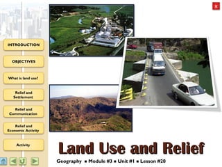
Geography M3 Relief and Land use
•Download as PPT, PDF•
8 likes•5,377 views

This document discusses the relationship between land relief and land use. It begins by defining land use as how humans utilize land for settlement, communication, and economic activities. It then examines how relief impacts these land uses, with flat areas generally supporting dense settlement and extensive road networks, while hilly or mountainous areas typically have more dispersed rural populations and less dense road infrastructure. Various economic activities like agriculture are also shown to depend on relief, with large-scale farming usually occurring on flatland. In summary, the document analyzes how relief influences patterns of human occupation and activity on the landscape.

Recommended
Recommended
More Related Content
What's hot
What's hot (20)
Viewers also liked
Viewers also liked (8)
Similar to Geography M3 Relief and Land use
Similar to Geography M3 Relief and Land use (20)
More from eLearningJa
More from eLearningJa (20)
Recently uploaded
Recently uploaded (20)
Geography M3 Relief and Land use
- 1. OBJECTIVES What is land use? Relief and Settlement Relief and Communication Relief and Economic Activity Activity INTRODUCTION Land Use and ReliefLand Use and Relief Geography Module #3 Unit #1 Lesson #20
- 2. OBJECTIVES What is land use? Relief and Settlement Relief and Communication Relief and Economic Activity Activity INTRODUCTION IntroductionIntroduction Topographical maps show the relief of an area as well as how land is used for communication, settlement and industries.This combination makes it possible for us to understand the relationships seen on maps. This power point presentation will help you to describe and analyze the relationship between relief and the pattern and types land use. 2
- 3. OBJECTIVES What is land use? Relief and Settlement Relief and Communication Relief and Economic Activity Activity INTRODUCTION ObjectivesObjectives By the end of the presentation you should be able to: Explain the term land use Analyze the relationship between relief and settlement type and pattern Discuss the relationship between relief and communication Describe the relationship between relief and the type and location of industries 3
- 4. OBJECTIVES What is land use? Relief and Settlement Relief and Communication Relief and Economic Activity Activity INTRODUCTION What is land use?What is land use? 4 Land use refers to the ways in which man utilizes an area for settlement, communication, and economic activitiesCLICK HERE TO FIND OUT.
- 5. OBJECTIVES What is land use? Relief and Settlement Relief and Communication Relief and Economic Activity Activity INTRODUCTION What is Land use?What is Land use? Activity 1.1Activity 1.1 1. On the next slide, identify types of land use on topographical map . 2. Type in the each box below the map the type of land use at A, B and C. 3. Click the CHECK button for feedback. 5
- 6. OBJECTIVES What is land use? Relief and Settlement Relief and Communication Relief and Economic Activity Activity INTRODUCTION Land use on Topographic MapsLand use on Topographic Maps 6 Economic activity (agriculture, yellow sugar cane) Settlement (pink areas)Communication (roads are red lines on the map
- 7. OBJECTIVES What is land use? Relief and Settlement Relief and Communication Relief and Economic Activity Activity INTRODUCTION Land use on Topographic MapsLand use on Topographic Maps 7 Economic activity Settlement Communication Note: Settlement - (pink areas) Communication (roads are red lines on the map), Economic activity (agriculture - yellow sugar cane).
- 8. OBJECTIVES What is land use? Relief and Settlement Relief and Communication Relief and Economic Activity Activity INTRODUCTION Relief and SettlementRelief and Settlement A settlement is any place where people live and carry out their daily activities. The relief of an area affects the settlement pattern that develops. 8
- 9. OBJECTIVES What is land use? Relief and Settlement Relief and Communication Relief and Economic Activity Activity INTRODUCTION Relief and SettlementRelief and Settlement 9 http://www.geographylwc.org.uk/GCSE/igcse/Settlement/setpatterns.html
- 10. OBJECTIVES What is land use? Relief and Settlement Relief and Communication Relief and Economic Activity Activity INTRODUCTION Relief and SettlementRelief and Settlement 10 Flat areas such as plains usually support urban settlements. Settlement pattern is usually compact or nucleated. Settlements in these areas cover an extensive area. It is much easier to construct buildings on flat land
- 11. OBJECTIVES What is land use? Relief and Settlement Relief and Communication Relief and Economic Activity Activity INTRODUCTION Relief and SettlementRelief and Settlement Flat areas that are poorly drained such as mangrove swamps do not usually support large populations. 11 http://apassionforscience.pbworks.com/w/page/51728349/1A1_2012%20Group%C2%A0
- 12. OBJECTIVES What is land use? Relief and Settlement Relief and Communication Relief and Economic Activity Activity INTRODUCTION Portland RidgePortland Ridge 12 This area is a wetland.
- 13. OBJECTIVES What is land use? Relief and Settlement Relief and Communication Relief and Economic Activity Activity INTRODUCTION Relief and SettlementRelief and Settlement However, artificial drainage can make the area more habitable http://www.protectingourwater.org/transcripts/7/ 13
- 14. OBJECTIVES What is land use? Relief and Settlement Relief and Communication Relief and Economic Activity Activity INTRODUCTION Relief and SettlementRelief and Settlement Hilly or mountainous areas usually support rural populations. It is more difficult to construct buildings in hilly areas. Settlement patterns are usually linear or dispersed http://antropyton.blogspot.com/ 14
- 15. OBJECTIVES What is land use? Relief and Settlement Relief and Communication Relief and Economic Activity Activity INTRODUCTION Relief and SettlementRelief and Settlement 15 Settlements also develop in valleys.
- 16. OBJECTIVES What is land use? Relief and Settlement Relief and Communication Relief and Economic Activity Activity INTRODUCTION Relief and CommunicationRelief and Communication Communication refers to the various ways people use to get from one place to another.These ways include roads, railways and airports 16 http://www.jamaicamyway.com/jamaican-history/flat-bridge-jamaica/
- 17. OBJECTIVES What is land use? Relief and Settlement Relief and Communication Relief and Economic Activity Activity INTRODUCTION Relief and CommunicationRelief and Communication Flat areas usually have a dense network of roads. It is easier and cheaper to construct roads on flat land. 17 http://ieeexplore.ieee.org/ieee_pilot/articles/08tro05/tro-milford-2004520/article.html
- 18. OBJECTIVES What is land use? Relief and Settlement Relief and Communication Relief and Economic Activity Activity INTRODUCTION Relief and CommunicationRelief and Communication Hilly or mountainous areas usually have a low density of roads. 18
- 19. OBJECTIVES What is land use? Relief and Settlement Relief and Communication Relief and Economic Activity Activity INTRODUCTION Relief and CommunicationRelief and Communication It is difficult and sometimes impossible to construct roads in mountainous areas. In hilly areas bridges and embankments have to be constructed. Road density is low in hilly or mountainous areas. http://www.ubertramp.com/index.php? option=com_content&view=article&id=460:highway-to-hell- bolivias-road-of-death&catid=60:destination-based- articles&Itemid=432 19
- 20. OBJECTIVES What is land use? Relief and Settlement Relief and Communication Relief and Economic Activity Activity INTRODUCTION Relief and Economic ActivityRelief and Economic Activity Relief affects the type of economic activity that is carried out. Large scale agriculture such as sugar cane cultivation is usually done on flat land where it is easy to use machines. http://www.worthyparkestate.com/heritage.php 20
- 21. OBJECTIVES What is land use? Relief and Settlement Relief and Communication Relief and Economic Activity Activity INTRODUCTION Relief and Economic ActivityRelief and Economic Activity 21 Large scale cultivation occurs mainly on flat land.
- 22. OBJECTIVES What is land use? Relief and Settlement Relief and Communication Relief and Economic Activity Activity INTRODUCTION Relief and Economic ActivityRelief and Economic Activity In most instances small farming is carried out on sloping land. 22 http://www.drylandfarming.org/FB/Honduras7.html
- 23. OBJECTIVES What is land use? Relief and Settlement Relief and Communication Relief and Economic Activity Activity INTRODUCTION Relief and Economic ActivityRelief and Economic Activity Manufacturing industries use large heavy equipment that require flat land. 23
- 24. OBJECTIVES What is land use? Relief and Settlement Relief and Communication Relief and Economic Activity Activity INTRODUCTION ActivityActivity Examine the map extract on the next slide carefully and then label the sections numbered 1-7 on the map, in the box below. Use the words in the list to help you. LISTLIST Large scale agriculture High density road network Low density road network Lowland areas Highland areas Nucleated settlement Isolated settlement 24
- 25. OBJECTIVES What is land use? Relief and Settlement Relief and Communication Relief and Economic Activity Activity INTRODUCTION Label parts numbered 1-7 on the map, in the box below. Click the map to check your answers. 25 7. Isolated settlement 1. Large scale agriculture 1. Large scale agriculture 2. High density road network 6. Nucleated settlement 3. Low density road network 5. Highland area 4. Lowland area 7. 1. 1. 2. 6. 3. 5. 4. LIST Large scale agriculture High density road network Low density road network Lowland areas Highland areas Nucleated settlement Isolated settlement
- 26. OBJECTIVES What is land use? Relief and Settlement Relief and Communication Relief and Economic Activity Activity INTRODUCTION SolutionSolution 26 Isolated settlement Large scale agriculture Large scale agriculture High density road network Nucleated settlement Low density road network Highland area Lowland area
- 27. OBJECTIVES What is land use? Relief and Settlement Relief and Communication Relief and Economic Activity Activity INTRODUCTION End of ActivityEnd of Activity You have reached the end of the activity. If you wish to review this lesson, go to the first slide. If you have finished viewing the lesson, click the Close (X) button. 27 CREDITS
- 28. OBJECTIVES What is land use? Relief and Settlement Relief and Communication Relief and Economic Activity Activity INTRODUCTION CREDITSCREDITS Maps used in this presentation were obtained from the National Land Agency, Kingston Jamaica 28
Editor's Notes
- (highlight the valley)
- (highlight the main roads on the map extract)
- (highlight yellow areas – sugar cane cultivation)
- Read this before viewing as slide show. Note. If you are using PowerPoint 2007, before you begin, look for the Security Warning below the ribbon, above this slide and click the Options button. In the Security Alert box, click “Enable This Content”. If the Security Warning does not appear, then view the presentation as Slide Show. If you are using PowerPoint 2013, look below the ribbon. If you see a Security Warning, click Enable Content before viewing in Slide Show View.