GM Symposium 2016: Nate Wood, Research Geographer, USGS
1. Nathan Wood, PhD
Nina Abdollahian
Jamie Jones
Western Geographic Science CenterU.S. Department of the Interior
U.S. Geological Survey
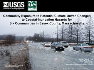
Community Exposure to Potential Climate-Driven Changes
to Coastal-Inundation Hazards for
Six Communities in Essex County, Massachusetts
Photograph: Joe Teixeira via National Wildlife Federation
2. Overview
• Hazards Vulnerability Team,
USGS Western Geographic
Science Center
• Exposure analysis request
by the National Wildlife
Federation, in connection
with the U.S. Department of
Interior NE Climate Science
Center
• Report available for free at
https://pubs.er.usgs.gov/
publication/ofr20161187
15. Natural Areas
• Conservation lands
• Land with Endangered Species
• Priority habitats
• Areas of critical environmental concern
• Community Preservation Act locations
• Various state data sources (MassGIS)
Parker River NWR, MA
18. Demographics of Residents
High – greater than 10% of in-hazard pop.
• Renter-occupied households (9% Rowley, < 5% Essex)
• Over 65 years in age
• Disabled population (< 5% in Essex)
• Only high school degrees
Moderate - 5-9% of in-hazard pop.
• Poverty status established (15% in Rowley, < 5% in
Salisbury and Essex)
Minor - Less than 5% of
in-hazard population
• Unemployed (6% in Newbury)
• Living in mobile homes
• Living in group quarters (11% in
Rowley)
• No phone household
• English as a second language
• Under 5 years in age
• Residents with no vehicle
19. Businesses in hazard zones
Photograph: Joe Teixeira via National Wildlife Federation
30. For more information
• Report (free for download)
• USGS Open-File Report 2016-1187
• https://pubs.er.usgs.gov/publication/ofr20161187
• Contact me - Nathan Wood, nwood@usgs.gov
• USGS vulnerability research - http://geography.wr.usgs.gov/science/vulnerability
Thank You
Photograph: National Wildlife Federation