![Mission Context ,[object Object],[object Object],[object Object],“ Earth Science and Applications from Space: National Imperatives for the next Decade and Beyond” (National Research Council, 2007) http://www.nap.edu SMAP is one of four Tier-1 missions recommended by the U.S. NRC Earth Science Decadal Survey Tier 1: Soil Moisture Active Passive (SMAP) ICESAT II DESDynI CLARREO Tier 2: SWOT HYSPIRI ASCENDS GEO-CAFE ACE Tier 3: LIST PATH GRACE-II SCLP GACM 3D-WINDS](data:image/gif;base64,R0lGODlhAQABAIAAAAAAAP///yH5BAEAAAAALAAAAAABAAEAAAIBRAA7)
Recomendados
Recomendados
Más contenido relacionado
La actualidad más candente
La actualidad más candente (20)
Similar a TH3.L10.1: THE NASA SOIL MOISTURE ACTIVE PASSIVE (SMAP) MISSION: OVERVIEW
Similar a TH3.L10.1: THE NASA SOIL MOISTURE ACTIVE PASSIVE (SMAP) MISSION: OVERVIEW (20)
Más de grssieee
Más de grssieee (20)
TH3.L10.1: THE NASA SOIL MOISTURE ACTIVE PASSIVE (SMAP) MISSION: OVERVIEW
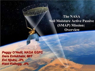
- 1. The NASA Soil Moisture Active Passive (SMAP) Mission: Overview Peggy O’Neill, NASA GSFC Dara Entekhabi, MIT Eni Njoku, JPL Kent Kellogg, JPL
- 4. Predictability of seasonal climate is dependent on boundary conditions such as sea surface temperature (SST) and soil moisture – soil moisture is particularly important over continental interiors. Difference in Summer Rainfall: 1993 (flood) minus 1988 (drought) years Observations Prediction driven by SST and soil moisture Prediction driven just by SST -5 0 +5 Rainfall Difference [mm/day] (Schubert et al., 2002) New space-based soil moisture observations and data assimilation modeling can improve forecasts of local storms and seasonal climate anomalies With Realistic Soil Moisture 24-Hours Ahead High-Resolution Atmospheric Model Forecasts Observed Rainfall 0000Z to 0400Z 13/7/96 (Chen et al., 2001) Buffalo Creek Basin High resolution soil moisture data will improve numerical weather prediction (NWP) over continents by accurately initializing land surface states Without Realistic Soil Moisture NWP Rainfall Prediction Seasonal Climate Predictability Value of Soil Moisture Data to Weather and Climate
- 8. * Mean latency under normal operating conditions. Latency defined as time from data acquisition by instrument to availability to designated archive. The SMAP project will make a best effort to reduce these latencies. SMAP Data Products Table (Publicly Available) Data Product Short Name Short Description Spatial Resolution Grid Spacing Latency* L1A_Radar Radar raw data in time order NA NA 12 hours L1A_Radiometer Radiometer raw data in time order NA NA 12 hours L1B_S0_LoRes Low resolution radar σ o in time order 5x30 km NA 12 hours L1B_TB Radiometer T B in time order 40 km NA 12 hours L1C_S0_HiRes High resolution radar σ o (half orbit, gridded) 1x1 km to 1x30 km 1 km 12 hours L1C_TB Radiometer T B (half orbit, gridded) 40 km 36 km 12 hours L2_SM_P Soil moisture (radiometer, half orbit) 40 km 36 km 24 hours L2_SM_A/P Soil moisture (radar/radiometer, half orbit) 9 km 9 km 24 hours L3_F/T_A Freeze/thaw state (radar, daily composite) 3 km 3 km 48 hours L3_SM_P Soil moisture (radiometer, daily composite) 40 km 36 km 48 hours L3_SM_A/P Soil moisture (radar/radiometer, daily composite) 9 km 9 km 48 hours L4_SM Soil moisture (surface & root zone) 9 km 9 km 7 days L4_C Carbon net ecosystem exchange (NEE) 9 km 1 km 14 days
- 9. L3_SM_A/P Combined Soil Moisture Product (9 km) L2_SM_P Radiometer Soil Moisture Product (36 km) L2_SM_A Radar Soil Moisture Product (3 km) L1C_S0_Hi-Res Radar Backscatter Product (1-3 km) L1C_TB Radiometer Brightness Temperature Product (36 km) Algorithm Evaluation In Progress Using SMAP End-to-End Science Simulation Testbed
- 10. Level 4 Soil Moisture and Carbon Simulated Products Volumetric Soil Moisture (%) Level 4 Soil Moisture (Surface and Root Zone estimates) Mean Daily Net CO 2 Exchange
- 12. Potential Applications Identified at the SMAP Applications Workshop, Sept 2009 [Talk #5 this session – Crow et al. on SMAP testbed] SMAP OBJECTIVES POTENTIAL SMAP APPLICATIONS Weather Natural Disasters Climate Variability & Change Agriculture & Forestry Human Health Ecology Water Resources Ocean Resources Soil moisture and freeze-thaw information for water, energy and carbon cycle processes More accurate weather forecasts; prediction of severe rainfall; operational severe weather forecasts; mobility and visibility Drought early warning decision support; key variable in floods and landslides; operational flood forecast; lake and river ice breakup; desertification Extend climate prediction capability; Linkages between terrestrial water, energy, and carbon cycles; land / atmos. fluxes Predictions of agricultural productivity; famine early warning; Monitoring agricultural drought Landscape epidemiology; heat stress and drought monitoring; insect infestation; emergency response plans Carbon source/sink monitoring; Ecosystems forecasts; monitoring vegetation and water relationships over land Global water balance; estimates of streamflow & river discharge; more effective management Sea-ice mapping for navigation, especially in coastal zones; temporal changes in ocean salinity Fire susceptibility; global flood mapping; heat-wave forecasting Crop management at the farm scale; Input to fuel loading models Monitoring wetlands resources and bird migration Monitoring variability of water stored in lakes, reservoirs, wetlands and river channels Ocean wind speed and direction, related to hurricane monitoring = likely mission application = potential mission application
Notas del editor
- Oct. 23, 2008