1. Njingti-Nfor, Tadjou J.M. Nouayou R / International Journal Of Engineering Research And
Applications (IJERA) ISSN: 2248-9622 www.ijera.com
Vol. 2, Issue 5, September- October 2012, Pp.396-403
An application of Audiomagnetotelluric prospecting method to
determine the dip of the sedimentary-metamorphic contact
Njingti-Nfor 1, , Tadjou J.M.2, and Nouayou R3
1
Department of Physics, Advanced Teachers’ Training College, University of Yaounde I; Cameroon
2
National Institute of Cartography, Scientific and Technical Research, Cameroon;
3
Department of Physics, Faculty of Science, University of Yaoundé I, Cameroon
Abstract
From the geometric mean values of were suggestive of a pronounced westward lateral
apparent resistivity, iso-resistivity contour maps spread. The values of dip at contact between the
were drawn using audiomagnetotellurics data sedimentary and the metamorphic formations at
collected along two profiles traversing the various depths beginning from the surface varied
metamorphic and sedimentary formations. On from 58˚ to 73˚ for one profile and from 21˚ to 60˚
these maps, resistivity discontinuity observed for another profile, showing that the contact is
along the contour lines indicated the existence in abrupt and deep-seated with little lateral spread
this area of a contact between two blocks of at depth. The results of our study have confirmed
different lithologies. By drawing tangents along a the fact that the contact between the
specific contour line (20 Ωm) which is considered metamorphic and sedimentary formations can be
as reference separating the two formations, the recognised through a sharp and distinct
dips of down dropping under each station were resistivity contrast along a given profile.
calculated. The values of dip in the sedimentary
formation, which have maximum values of 10˚ at Keywords: Audiomagnetotellurics, dip,
a depth of 1400 m and 17˚ at a depth of 800 m, discontinuity, contact, iso-resistivity, deep
I. INTRODUCTION
The onshore Douala sedimentary basin The basin marks the transition between the
situated at the edge of the Gulf of Guinea extends Niger Delta basin to the Southwest and the Gabon
from latitudes 3° 15' N to 4° 30' N. This basin is basin to the Southeast. Part of the area consists of
about 60 km long and covers an estimated surface estuaries of the Wouri, Sanaga, the Dibamba and the
area of 7000 km2. It is bordered to the East by the Moungo rivers. The basin itself is low-lying with an
Precambrian rocks of the Congo Craton. To the average altitude of about 100 m above sea level, flat
North and North-west, it is separated from the Rio- and swampy around the estuaries and is covered
del Rey basin by the Cameroon Volcanic Line. To with coastal sands and generally blanketed with
the South, it tapers towards Kribi and outcrops in the mangrove forest, characteristic of sedimentary
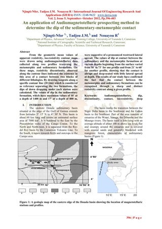
Campo area. basins (Figure 1).
NIGERIA
CAMEROON
Study area
0 30 km
Figure 1: A geologic map of the eastern edge of the Douala basin showing the location of magnetotelluric
stations and profiles.
396 | P a g e
2. Njingti-Nfor, Tadjou J.M. Nouayou R / International Journal Of Engineering Research And
Applications (IJERA) ISSN: 2248-9622 www.ijera.com
Vol. 2, Issue 5, September- October 2012, Pp.396-403
1: Alluvium, lacustrine clay; 2: Shale, clay, greywacke (Paleocene); 3: Basal sandstone facies (Albian-
Senonian);
4: Embrechite gneiss, Amphibolites; 5: Quartzite; 6: Muscovite gneiss, sillimanite and hypersthenes with quartz
composition; 7: Granitised gneiss, undifferentiated gneiss and migmatite; 8: Magnetotelluric sounding station
The basins of the African continent date haematite. Minerals found in the sand apart from
from the Mesozoic and subsequently have been quartz and clay are ilmenite, magnetite, muscovite,
filled with continental lacustrine evaporitic and hornblende, hypersthenes, zircon, garnet, kyanite
normal marine sediments. Most of the coasts south and sillimanite probably drained into the plains of
of the Equator either have low cliffs of Precambrian the basin by the Moungo, Dibamba, and Wouri
igneous and metamorphic rocks where the basement rivers from western Cameroon and by the Sanaga
reaches the coast or of Mesozoic and Cenozoic river from Adamawa region.
strata, where coastal basins are being eroded [1].The The zone under study is around the
origin of the Douala basin is directly linked to the Dibamba river and forms part of the Loungahe
opening of the South Atlantic during the Cretaceous series which is one of the four stratigraphic series
[2]. that outcrop at the edge of the Cameroon Atlantic
The sedimentary column of the Douala basin has a coast ([6], [7], [8], [9]). The series consists of coarse
Precambrian basement overlain by Mesozoic and unconsolidated sandstones mixed with marls,
Cenozoic sediments which are characterised by calcareous and silty clay whose age is considered as
coarse detrital deposits of variable thickness known Senonian [6]. This forms a facies, which is
as "basal sandstones" [2]. The basal sandstones are diachronous of the Aptian-Albian and Upper
essentially composed of arkosic sandstones and Senonian (in Campo and Moungo) basin
conglomerates. Lying above these coarse grained respectively. The important fact about the series is
sedimentary rocks are marine shale, sandstones and that it marks the sedimentary-crystalline
limestone of Albian-Santonian age ([3], [4]). To the (metamorphic) contact. Its thickness is estimated to
West of the basin is found mostly marshes and to be between 500 to 600 m [10] and was deposited in
the East are Quaternary alluvial deposits [5]. The a piedmont type sedimentation, which seems to have
sand deposits are generally coarse with colours been successively confined and opened into the sea
ranging from brick red to chocolate brown, arranged in a chisel-like mechanism [11] and which was
in slate (platform) or leaflets and cemented with concurrently filled with sediments of the proto-gulf
goethite and sometimes of Guinea [12].
II. METHODOLOGY
A. Geometric mean values of apparent
resistivity
The instrument used to collect the be important in sedimentary areas because of the
audiomagnetotelluric data is the ECA 540 AMT high conductivity, but are generally minimal in
resistivity meter, which has a frequency range from metamorphic areas where rocks are highly resistive.
4.1 Hz to 2300 Hz giving a total number of twelve Conventionally the methods used to analyse and
frequencies [13]. The audiomagnetotelluric data interpret data included: plotting sounding curves,
collected give the fundamental information plotting resistivity profiles, drawing pseudo-
necessary for the analysis and interpretation. These sections, and drawing geoelectric sections for each
data are never complete and may not generally be of the principal directions [17]. However, [18]
very exact due to inherent uncertainties brought introduced new methods of analysis and
about by natural and artificial errors. The natural interpretation of audiomagnetotelluric data, which
uncertainties are associated to the erratic nature of consist essentially of calculating geometric mean
the telluric currents caused by natural factors like values of apparent resistivity and, using the data so
cosmic radiations. While the artificial factors could obtained, to draw iso-resistivity contour maps.
be the presence of an electric grid line and road According to the same author, the geometric mean
traffic in the vicinity of the prospecting [14]. and not the arithmetic mean, is considered because
Generally, these uncertainties are minimised in the intervening factors such as geologic time and
field by taking a series of up to five values of texture, contact, temperature and pressure variations
apparent resistivity for each value of frequency and on allochtonous or autochtonous rocks, always have
from a field curve, determining the line-of-best fit an influence from the surrounding rocks that makes
[15]. But these resistivity values equally depend on the variation in resistivity from one rock type to the
the presence of pore fluid and their salinity within other continuous and not discrete. Thus this method
the rocks, which are not constant as they too depend supposes that for each frequency, and for the values
on both the season, the temperature, the pressure of apparent resistivity got in the two principal
and the degree of compaction of the rocks [16].
These, thus introduce other uncertainties, which can
397 | P a g e
3. Njingti-Nfor, Tadjou J.M. Nouayou R / International Journal Of Engineering Research And
Applications (IJERA) ISSN: 2248-9622 www.ijera.com
Vol. 2, Issue 5, September- October 2012, Pp.396-403
directions, the geometric mean value a can be
following the lateral evolution of a given iso-
resistivity contour line beginning from the station
calculated using the formula: nearest to the contact or suspected discontinuity to
a t l (1) stations furthest away from it. Using this contour
line as the reference, the slope of the contact under
where t is the transverse resistivity and l is each station along the profile can be calculated by
the longitudinal resistivity. This gives sets of drawing a tangent to the contour line at that point
geometric mean values of apparent resistivity for and looking for its gradient. The second way is by
each frequency that are used to draw iso-resistivity following the evolution with depth of the contact as
contour maps. It is from such iso-resistivity contour we move from the contour line nearest to the surface
maps that the angles of dip at various points of to the one right in the subsurface. This is done for
contact between the sedimentary and metamorphic the station(s) closest to the contact or suspected
basement in the eastern discontinuity chosen as reference(s). Figure 2 is an
illustration of how the calculation can be done.
edge of the Douala sedimentary basin are
determined in this work. The pseudo-depth of
penetration The principle of the “skin-effect”
according to which the depth of penetration of the
telluric current decreases with an increase in
frequency is used to determine the pseudo-depth of
penetration. Therefore, from the geometric mean
values of resistivity for each frequency, the depth of
penetration in kilometres is calculated using the
formula:
P 0.503 a f (2)
where f is the applied frequency in Hz, P in km
From field observations, the depth of penetration in
the Douala sedimentary zone is shallow (down to a Figure 2: Method of the calculation of dip source
maximum of about 4.2 km). This might be due to using iso-resistivity contour
the fact that the AMT resistivity meter uses higher
frequencies, which in turn means low penetration he dip is then calculated using the equation [16].
depths brought about by a rapid attenuation of the V
telluric current, due to the high conductivity of tan( )
sedimentary rocks. The same situation is not H
obtained in the metamorphic zones, where the rocks (3)
are very resistive, and depths of about 50 km or where V is the vertical separation of two points on
more could be attained [17]. the contour line and H is the horizontal separation
B. ip of contact from iso-resistivity contour measured in the same units as V. The dip direction
map at any point will be parallel to the tangent or the
There are two ways by which the dip of as contour line in case the two coincide.
geologic structure can be calculated from the iso-
resistivity contour map. The first way is by
C. Spatial distribution of stations
For each station, twelve series of measurements zone of sedimentary-metamorphic basement contact,
were made for the component of the electric field where [10] reported the presence of a tectonic fault.
intensity, its mutually perpendicular component of However, three factors influenced the choice of the
magnetic field intensity and values of apparent station-to-station spacing. The stations were
resistivity in the two predetermined directions. implanted in a zone where there is easy accessibility
These directions were determined using the method because of the mangrove nature of the vegetation.
of rotation [17]. In the field, station-to-station They were also implanted far from the electric grid
spacing is determined with respect to the nature of whose current can influence the telluric current
the subsurface (which could be as a result of values ([14], [19]). The unelectrified part of the
geological investigations already done in the area of highways was considered. Thirdly, stations were
research). In such a situation, stations are close chosen such that they were close together near
together around suspected structural and/or suspected discontinuity and more spread out away
resistivity discontinuities and more spaced out where from it. The principal directions of the
there are little or less important disruptions. In the measurements were chosen as N-S and E-W [17],
case of the present study, the choice of the area of the edge under consideration being in the region but
study was based on the fact that it lies within the oriented close to the N-S direction.
398 | P a g e
4. Njingti-Nfor, Tadjou J.M. Nouayou R / International Journal Of Engineering Research And
Applications (IJERA) ISSN: 2248-9622 www.ijera.com
Vol. 2, Issue 5, September- October 2012, Pp.396-403
D. Presentation of profiles
In the analysis and interpretation of data, stations are distance of about 13 km but 9 km when projected. It
projected along an axis so that they all lie on a comprises five stations D1, D2, D3, D4, and D5.
straight line and thus constitute a profile. This is Profile Y extends from Mangoule to Bonepoupa III
done in order to make maximum use of the (on the way to Yabassi), covering a total distance of
information gathered from the field and also for easy 16 km but 8 km when projected. This equally
analysis and interpretation. The projection is made in comprises five stations Y1, Y2, Y3, Y4, and Y5, with
such a way that all the stations lie perpendicular to Y1 and Y2 coinciding with D5 and D4 respectively.
the line of structure (contact) to be determined. One The average station-to-station spacing is about 1.5
of the stations (the most westerly located in this km. In the analysis and interpretation, profile D is a
case) is chosen as base-station with respect to which projection from West to East of all the stations along
the distances to all the other stations are determined. the original profile D, with D5 as origin. Profile Y is
The work that was carried out in this zone was done a projection from West to East of all the stations
for two profiles Y and D (Figure 1). Profile D along the original profile Y with Y3 as origin. Thus
extends from Bonepoupa I (close to river Dibamba) the two profiles are parallel to each other.
to Mangoule (on the road to Douala), covering a
West AMT stations East
Y1 Y2 Y3 Y4 Y5
-0.40
-0.80
-1.20 tangent
V
-1.60 H
-2.00
-2.40
-3.0 -2.0 -1.0 0.0 1.0 2.0 3.0
W Distance (km) E
Figure 3: Iso-resistivity contour map of profile Y
E. Iso-resistivity contour maps
In a vertical plane with the lateral distance of other representation of the variation of apparent resistivity
stations from the base-station along the horizontal with depth for a vertical cross-section through a slice
axis, the pseudo-depth of penetration in the of Earth. They illustrate the shape of structure(s)
vertically downward directed axis, the geometric within the sub-surface. If the sub-surface is
mean of the apparent resistivity values are plotted. homogeneous and has uniformly varying apparent
When points of the same geometric mean apparent resistivity values, the contours are horizontal and
resistivity values are connected together, the line parallel, uniformly spaced and unfolded. Abrupt
constitutes an iso-resistivity contour line [18]. Such changes in the values of apparent resistivity are
lines drawn for all the geometric mean values in a indicated on the contour maps by curved contours.
profile give the iso-resistivity contour map. This These might represent folds, faults, contacts or
indicates the variation of the geometric mean values intrusions. The contour intervals are determined
of apparent resistivity with depth along a lateral from the range of apparent resistivity values. In the
direction perpendicular to the line of structure or present study, the prospecting was done in a
direction of minimum resistivity. These contour sedimentary region, where the apparent resistivity
maps provide a more effective and efficient values are in tens or hundreds of ohm-metres and the
399 | P a g e
5. Njingti-Nfor, Tadjou J.M. Nouayou R / International Journal Of Engineering Research And
Applications (IJERA) ISSN: 2248-9622 www.ijera.com
Vol. 2, Issue 5, September- October 2012, Pp.396-403
contour intervals have been chosen based on this variation.
III. PRESENTATION OF RESULTS
Iso-resistivity contour maps
The Audiomagnetotelluric data used in this work maps drawn from the geometric mean values of
enabled authors to locate precisely a metamorphic apparent resistivity for the two profiles Y and D,
basement-sedimentary contact in this zone. But they which are both oriented from west to east are
were not able to give an estimate of the dip of the presented in Figures 3 and 4 respectively.
contact around the area of study. The iso-resistivity
.
West AMT stations East
D5 D4 D3 D2 D1
-0.5
. -1.0
-1.5
-2.0
-2.5
-3.0
-3.5
-4.0
-3.0 -2.0 -1.0 0.0 1.0 2.0 3.0 4.0 5.0
W Distance (km) E
Figure 4: Iso-resistivity contour map of profile D
Profile Y has a total length of about 8.0 km and a very closely packed in the metamorphic area with
maximum pseudo-depth of penetration of about 2.4 the lines almost vertically plunging. What is more
km. Profile D has a total length of about 9.0 km and remarkable for both profiles is that the contours on
a maximum pseudo-depth of penetration of about 4.2 the metamorphic portions are highly distinct and
km. On each profile, the most westerly located highly concentrated. [15] equally identified the two
portion is the sedimentary formation while the distinct blocks in their work. Applying equation (3)
metamorphic formation is found close to the Far- on figures 3 and 4 the values of dip are calculated
East. The iso-resistivity contour lines in the and the results are as presented in tables 1 to 5.
sedimentary area are sparsely distributed, but are
IV. INTERPRETATION AND DISCUSSION
OF RESULTS
A. Profile Y (Figure 3)
The values of the dip along the 20Ωm contour line indicate a discontinuity along the contour line with a
under stations Y1, Y2, and Y3, as presented in Table 1, flat top between Y4 and Y5. The change in the sign
are very low and apparently constant. Starting from of dip indicates the presence of an anticline between
a depth of 1900 m below station Y1, the contour rises Y4 and Y5, whose crest has probably been eroded
gradually to a depth of 900 m under station Y3 that is with time leading to a flat top of about 1100 m of
at the crest of an anticlinorium, which is not visible lateral distance. As we move down into the
at the surface. This is shown by a change of angle of subsurface below station Y4 and at contour intervals
dip from a positive value of 16˚ to a negative value of 10Ωm, the calculated angles of dip at different
of -22˚ as we move along the contour line from west depths are as presented in Table 2. The 20Ωm
to east. At Y4, the dip is extremely high with a contour line has a distinguishingly high dip of 73˚ at
positive value of 73˚, which changes to a negative surface level.
but still high value of - 63˚ at Y5. These high values
400 | P a g e
6. Njingti-Nfor, Tadjou J.M. Nouayou R / International Journal Of Engineering Research And
Applications (IJERA) ISSN: 2248-9622 www.ijera.com
Vol. 2, Issue 5, September- October 2012, Pp.396-403
Table 1: Dip at contact along west-east orientation of the 20 m contour line for profile Y
Station Y1 Y2 Y3 Y4 Y5
Depth in km 1.9 2.1 0.9 0.0 0.0
Vertical separation (V) 0.8 0.8 0.8 0.8 1.6 1.2
Horizontal separation (H) in km 2.6 2.75 2.75 - 2.0 0.5 - 0.6
Value of dip 17 ˚ 16˚ 16˚ -22˚ 73˚ - 63˚
The other values, which are equally high, are intervals of 10 Ωm and at various depths are as
constant at 58˚ and occur at various depths ranging
presented in Table 3. All the values are negative and
from 700 m to 2300 m below the surface. The high
have magnitudes of about 60˚. The negative values
values show that there is an abrupt and almost sub-
indicate that the contour lines are plunging
vertical discontinuity under this station. The
downward from west to east. The high values show
constant values indicate that near the discontinuity,
that there is an abrupt discontinuity around this
contour lines are parallel and have very little lateral
station, which has constant magnitude of dip and
spread with depth. To the far-east of profile Y,
therefore should show very little lateral spread with
below station Y5, the values of dip at contour
depth.
Table 2 :Dip at contact on the different contour lines under station Y4 line for profile Y
Contour lines in ( m ) 20 30 40 50 60 70
Depth in km 0.0 0.7 1.0 1.7 2.0 2.3
Vertical separation (V) 1.6 0.8 0.8 0.8 1.2 1.2
Horizontal separation (H) in km 0.5 0.5 0.5 .5 0.75 0.75
Value of dip 73˚ 58˚ 58˚ 58˚ 58˚ 58˚
Table 3: Dip at contact on the different contour lines under station Y5 line for profile Y
Contour lines in ( m ) 30 40 50 60 70 80
Depth km 0.3 0.6 1.1 1.4 1.6 2.1
Vertical separation (V) 1.2 1.2 0.8 0.8 1.2 1.2
Horizontal separation (H) in - 0.6 - 0.7 -0.5 -0.5 -0.75 -0.75
km
Value of dip - 63˚ - 60˚ - 60˚ - 60˚ - 60˚ - 60˚
B. Profile D (Figure 4)
The values of the dip along the 20Ωm contour line but negative, indicative of a low amplitude anticline
under stations D5, D4, D3, D2 and D1 are presented in between D5 and D4. Under station D3 at a depth of
Table 4. The values of dip vary as we move along 1200 m, the value of dip is 31˚. This value is
the contour line from west to east. Under station D5, considered high showing that the station is at the
at a depth of 1400 m, the value of 10˚ is low and edge of a discontinuity in the form of an anticline
positive. Under station D4, the contour line is at 800 whose crest is occupied by stations D2, and D1,
m and the value of dip is -11˚, which is equally low which both have a dip of 0˚ with the surface.
Table 4: Dip at contact along west-east orientation of the 20 ( m ) contour line for profile D
Station D5 D4 D3 D2 D1
Depth in km 1.4 0.8 1.2 0.0 0.0
Vertical separation (V) 0.9 1.0 1.5 0.0 0.0
Horizontal separation (H) in km 5.3 - 5.0 5.8 5.8 8.0
Value of dip 10 ˚ - 11˚ 31˚ 0˚ 0˚
As we move down into the subsurface from a depth become very high and constant at about 60˚. The
of 200 m to 3250 m below station D2 and at contour high values show the presence of an abrupt and sub-
intervals of 20Ωm, the calculated angles of dip are vertical discontinuity. The constant values indicate
as presented in Table 5. From 200 m on contour 40 that contour lines are parallel and the discontinuity is
Ωm to 800 m on contour 80 Ωm, the value of dip highly concentrated having a gradual lateral spread
can be considered low varying from 21˚ to 24˚. From with depth.
a depth of 1750 m to 3250 m, the values of dip
Table 5: Dip at contact on the different contour lines under station D2 line for profile D
401 | P a g e
7. Njingti-Nfor, Tadjou J.M. Nouayou R / International Journal Of Engineering Research And
Applications (IJERA) ISSN: 2248-9622 www.ijera.com
Vol. 2, Issue 5, September- October 2012, Pp.396-403
Contour lines in ( m ) 40 60 80 100 120 140
Depth km 0.2 0.6 0.8 1.75 2.9 3.25
Vertical separation (V) 1.3 1.3 0.9 2.0 1.3 1.3
Horizontal separation (H) in 3.3 3.3 2.0 1.0 0.75 0.75
km
Value of dip 21˚ 21˚ 24˚ 63˚ 60˚ 60˚
V. CONCLUSION
Using pseudo-sections of transverse sedimentary and the metamorphic formations. The
resistivity, the audiomagnetotelluric method enabled metamorphic formation can therefore be observed on
us to locate the contact between the sedimentary- the surface between stationsY4 and Y5 with a lateral
metamorphic basement formations thanks to the distance of about 1 km. On the other hand, for
sharp resistivity contrast. The method of drawing profile D the contact between the two formations is
iso-resistivity contour maps from geometric mean more pronounced only to the west of station D2 with
values used here has enabled us to confirm this angles of dip increasing with depth from 0˚ at the
result. From the iso-resistivity contour maps, we surface to a very high and constant value of 60˚ at
have been able to successfully calculate the dip at depth. The metamorphic formation can be observed
various positions and depths under each profile. Our at the surface to the east of D3.The values of dip got
results show that the values of dip under stations Y1, in this study are quite different from those got by
Y2, D5, and D4 are low and apparently constant for earlier study which corresponds to 3%, that is only
each profile, suggestive of a greater westward lateral 2˚ for the top most sedimentary layer and vary
spread, which goes beyond the limit considered in between 12 and 13% that corresponds to about 7˚
this work, and should correspond to the sedimentary between either stations D4 and D3 or Y2 and Y3.
formation. It also shows that at contact between the Considering that the conclusions were drawn for
sedimentary and the metamorphic formations, the transverse pseudo-section of resistivity we suspect
dip is very steep with angles varying from 58˚ to that different values would have been got if the
73˚. For profile Y these angles of dip maintain longitudinal pseudo-section was used and therefore
nearly constant values of 58˚ with depth under conclude that the method used in the present study is
station Y4 that is to the west and of -60˚ under much more revealing
station Y5 to east of the contact between the
.
REFERENCES
[1]. Adediran, S. A. and Adegoke, O. S. [6]. De Vries (1936). Mission de recherché des
(1987). Evolution of the sedimentary basins hydrocarbures du Cameroun. Effectuée en
of the Gulf of Guinea, in G. Matheis and H. 1935-1936. Rapport Général, Service des
Schandlemeier (eds) Current research in mines du Cameroun. 72p.
sciences. Balkema Rotterdam p. 283-286. [7]. Njike, N. P. R. (1984). Contribution a
[2]. Baptupe, M. (1996). Aspect of the l’etude geologique, stratigraphique et
stratigraphic evolution of the Douala basin, structurale de la bordure du basin atlantique
Cameroon (abstract), in S. Jardiné, I. au Cameroun. These Doc. 3eme Cycle, Univ.
Deklasz and J. P. Debenary eds. Geologie Yaounde.
d'Atlantique Sud: Elf Aquitaine edition [8]. Njike, N. P. R. and Belinga, S. M., (1987).
memoir 16, p. 694.
Le Diachronisme du grès de base, le
[3]. Belmonte, Y. C. (1996). Stratigraphie du
Paléoenvironnement et le role de
basins sedimentaire du Cameroun, in J. E.
l’ouverture de l’Atlantique Sud. Ann. Fac.
Van Hinte (ed.): Proceedings of the second
Sci. Terre IV, No. 3-4, 103-119.
West African Micopaleontological
[9]. Njingti-Nfor Manguelle-Dicoum E.,
colloquim, Ibadan. P. 7-24.
Tabod C. Tadjou J. M. (2001).
[4]. Emery K. O. (1975). Continental Margin Application of audiomagnetotelluric
of Western African Angola to Serra Leone. soundings to determine the types of rocks
Am. Assoc. Petrol. Geol. Bull. Vol. 59, No. and their geologic ages –A case study of the
12, 2209-2265. Eastern Edge of the Douala Sedimentary
[5]. Hausknecht J. J. (1966). Note sur l’etude Basin in Cameroon. The 2nd International
photogeologique de la bordure du basin Conference on the Geology of Africa, Vol.
sedimentaire du Cameroun entre 3° et 4° N. (I), p-p, 787-797 Assuit, Egypt.
Entreprise de recherches et activités [10]. Dumort J. C. (1968). Notice explicative
pétrolières. Département Geologique sur la feuille de Douala – Ouest. Direction
Central. des Mines et de la Géologie du Cameroun,
69p, index, 1 carte h. t.
402 | P a g e
8. Njingti-Nfor, Tadjou J.M. Nouayou R / International Journal Of Engineering Research And
Applications (IJERA) ISSN: 2248-9622 www.ijera.com
Vol. 2, Issue 5, September- October 2012, Pp.396-403
[11]. Morgan W. J. (1972). Deep mantle
convention plumes and plates motions. Am.
Ass. Petrol. Geol. Bull. 56, 203-213
[12]. Deltheil J. R., Le Foumier J. and
Micholet J., (1975). Schema devolution
sédimentaire d’une marge continentale
stable: Exemple type du Golfe de Guinee,
de l’Angola au Cameroun. IXéme Congrés
International de la sédimentologie. Mince-
France.
[13]. Benderitter, Y. (1982). Interprétation des
mesures magnétotellurique obtenues avec
un resistivimètre ECA, CNRS, CRG,
Garchy.
[14]. Garcia, X., and Jones, A. G., (2001).
Atmospheric sources for audio-
magnetotelluric (AMT) sounding.
Geophysics, 67, 448-458.
[15]. Manguelle-Dicoum E., Nouayou R.,
Bokossah A. S. and Kwende-Mbanwi T.
E. (1993). Auomagnetotelluric soundings
on the basement – sedimentary transition
zone around the eastern margin of the
Douala basin in Cameroon. Journal of
African earth Sciences, Vol. 17, No. 4, pp.
487-497.
[16]. Groshong R. H. Jr (1999). 3-D Structural
Geology. A guide to structure and surface
map interpretation. ISBN 3-540-65422-4
springer- Verlag Berlin Heidelberg Ne
York.
[17]. Manguelle-Dicoum E. (1988). Etude
Géophysique des structures superficielles et
profondes de la region de Mbalmayo. Thése
de Doctorat és-sciences (Géophysique).
Université de Yaoundé.
[18]. Njingti N., Manguelle-Dicoum E.,
Mbom-Abane, Tadjou J. M. (2001).
Evidence of major tectonic dislocations
along the southern edge of the Pan African
mobile zone and the Congo Craton contact
in Southern region of Cameroon. The 2nd
International Conference on the Geology of
Africa, Vol. (I), p-p, 799-811 Assuit, Egypt.
[19]. Cagniard, L., (1953). Principe de la
methode magnetotellurique, nouvelle
methode de prospection géophysique.
Annales de Géophysique T. 9. 95-124.
403 | P a g e

![Njingti-Nfor, Tadjou J.M. Nouayou R / International Journal Of Engineering Research And
Applications (IJERA) ISSN: 2248-9622 www.ijera.com
Vol. 2, Issue 5, September- October 2012, Pp.396-403
1: Alluvium, lacustrine clay; 2: Shale, clay, greywacke (Paleocene); 3: Basal sandstone facies (Albian-
Senonian);
4: Embrechite gneiss, Amphibolites; 5: Quartzite; 6: Muscovite gneiss, sillimanite and hypersthenes with quartz
composition; 7: Granitised gneiss, undifferentiated gneiss and migmatite; 8: Magnetotelluric sounding station
The basins of the African continent date haematite. Minerals found in the sand apart from
from the Mesozoic and subsequently have been quartz and clay are ilmenite, magnetite, muscovite,
filled with continental lacustrine evaporitic and hornblende, hypersthenes, zircon, garnet, kyanite
normal marine sediments. Most of the coasts south and sillimanite probably drained into the plains of
of the Equator either have low cliffs of Precambrian the basin by the Moungo, Dibamba, and Wouri
igneous and metamorphic rocks where the basement rivers from western Cameroon and by the Sanaga
reaches the coast or of Mesozoic and Cenozoic river from Adamawa region.
strata, where coastal basins are being eroded [1].The The zone under study is around the
origin of the Douala basin is directly linked to the Dibamba river and forms part of the Loungahe
opening of the South Atlantic during the Cretaceous series which is one of the four stratigraphic series
[2]. that outcrop at the edge of the Cameroon Atlantic
The sedimentary column of the Douala basin has a coast ([6], [7], [8], [9]). The series consists of coarse
Precambrian basement overlain by Mesozoic and unconsolidated sandstones mixed with marls,
Cenozoic sediments which are characterised by calcareous and silty clay whose age is considered as
coarse detrital deposits of variable thickness known Senonian [6]. This forms a facies, which is
as "basal sandstones" [2]. The basal sandstones are diachronous of the Aptian-Albian and Upper
essentially composed of arkosic sandstones and Senonian (in Campo and Moungo) basin
conglomerates. Lying above these coarse grained respectively. The important fact about the series is
sedimentary rocks are marine shale, sandstones and that it marks the sedimentary-crystalline
limestone of Albian-Santonian age ([3], [4]). To the (metamorphic) contact. Its thickness is estimated to
West of the basin is found mostly marshes and to be between 500 to 600 m [10] and was deposited in
the East are Quaternary alluvial deposits [5]. The a piedmont type sedimentation, which seems to have
sand deposits are generally coarse with colours been successively confined and opened into the sea
ranging from brick red to chocolate brown, arranged in a chisel-like mechanism [11] and which was
in slate (platform) or leaflets and cemented with concurrently filled with sediments of the proto-gulf
goethite and sometimes of Guinea [12].
II. METHODOLOGY
A. Geometric mean values of apparent
resistivity
The instrument used to collect the be important in sedimentary areas because of the
audiomagnetotelluric data is the ECA 540 AMT high conductivity, but are generally minimal in
resistivity meter, which has a frequency range from metamorphic areas where rocks are highly resistive.
4.1 Hz to 2300 Hz giving a total number of twelve Conventionally the methods used to analyse and
frequencies [13]. The audiomagnetotelluric data interpret data included: plotting sounding curves,
collected give the fundamental information plotting resistivity profiles, drawing pseudo-
necessary for the analysis and interpretation. These sections, and drawing geoelectric sections for each
data are never complete and may not generally be of the principal directions [17]. However, [18]
very exact due to inherent uncertainties brought introduced new methods of analysis and
about by natural and artificial errors. The natural interpretation of audiomagnetotelluric data, which
uncertainties are associated to the erratic nature of consist essentially of calculating geometric mean
the telluric currents caused by natural factors like values of apparent resistivity and, using the data so
cosmic radiations. While the artificial factors could obtained, to draw iso-resistivity contour maps.
be the presence of an electric grid line and road According to the same author, the geometric mean
traffic in the vicinity of the prospecting [14]. and not the arithmetic mean, is considered because
Generally, these uncertainties are minimised in the intervening factors such as geologic time and
field by taking a series of up to five values of texture, contact, temperature and pressure variations
apparent resistivity for each value of frequency and on allochtonous or autochtonous rocks, always have
from a field curve, determining the line-of-best fit an influence from the surrounding rocks that makes
[15]. But these resistivity values equally depend on the variation in resistivity from one rock type to the
the presence of pore fluid and their salinity within other continuous and not discrete. Thus this method
the rocks, which are not constant as they too depend supposes that for each frequency, and for the values
on both the season, the temperature, the pressure of apparent resistivity got in the two principal
and the degree of compaction of the rocks [16].
These, thus introduce other uncertainties, which can
397 | P a g e](data:image/gif;base64,R0lGODlhAQABAIAAAAAAAP///yH5BAEAAAAALAAAAAABAAEAAAIBRAA7)