Arch JA Guysayko
•
0 likes•1,060 views

One of the 12 entries to the "Salog kan Buhay" contest for Best Conceptual Design for revitalizing Naga River.

Recommended
More Related Content
What's hot
What's hot (20)
Viewers also liked
Similar to Arch JA Guysayko
Similar to Arch JA Guysayko (20)
More from Willy Prilles
More from Willy Prilles (11)
Recently uploaded
Recently uploaded (20)
Arch JA Guysayko
- 4. WHY CAN’T WE HAVE PLACES LIKE THESE IN OUR PARKS? IN OUR OWN CITY?
- 5. IN OUR OWN RIVER?
- 6. SALOG NAGA : SALOG KAN BUHAY REVITALIZATION PROJECT FOR THE NAGA CITY RIVER DESIGN & CONCEPTS BY: JULIA ANGELA U. GUYSAYKO LANDSCAPE ARCHITECT
- 7. Historically, Naga City has been known as a flourishing village off the riverbanks of Naga River. Being the center of trade and commerce of Bicol and parts of modern Southern Tagalog and Central Luzon during the colonial period, the Naga City River has played a major role in the development of the city.
- 8. The river also serves as the main venue of the fluvial procession celebrated during the Penafrancia Fiesta.
- 9. Ironically, through the years of the city’s development, the Naga River was neglected and left at the mercy of the illegal settlers.
- 10. The ever constant brown color and the shallowing level threatens the riparian life, if such still exisits.
- 13. REHABILITATE THE NAGA RIVER This project aims to provide measures for the cleaning and greening of our river.
- 14. Present conditions show how the river has yet to be developed into a more useful and beneficial resource. The design shall provide solutions to stop soil erosion and revitalize the river environment for future use and enjoyment.
- 15. PROVIDE AN URBAN PARK In order for the development to be effective, local residents must be able to enjoy the space designed for them.
- 16. This project shall present an urban space well-designed so that people will utilize it with delight and gratification and in turn become part of their local way of life.
- 17. PROMOTE LOCAL TOURISM Naga City has been nationally distinguished as one of the fastest growing cities in the country. Tourism plays a major role in this regard.
- 18. PROMOTE LOCAL TOURISM It is therefore a necessary objective to explore all means of tourism alternatives to further boost our local economy.
- 19. DESIGN CONCEPTS
- 20. REVITALIZATION A healthy river is a bountiful river and shall be teeming with life. A river is a source of food & water. These can be realized through soil stabilization measures to prevent more erosion and introduction of lush vegetation to aerate and sustain the anticipated growth of riparian biodiversity.
- 21. AVAILABILITY & ACCESSIBILITY A river is a corridor for navigation and transportation. Allocation of docks and jetties open up the riverway for additional farm to market traders and also contributes to local tourism through initiating the transportation of passengers to and from nearby towns.
- 22. PEDESTRIANIZATION Utilization of the riparian environment and its riverbanks will strengthen our appreciation and love for the Naga River through the development of foreshore ways and pedestrian zones. Introduction of walkways, jogging paths and foot bridges opens up the Naga River for the public’s enjoyment and use.
- 23. GREENING Plants and trees keep air fresh by absorbing carbon dioxide and producing oxygen. Introduction of plants and trees alongside the walkway and jogging path will initiate a greener environment that is more inviting to the pedestrians and end users of the space.
- 24. DESIGN ELEMENTS
- 25. VEGETATED RIPRAP Silt and soil erosion is a constant problem in our river. There are parts that have become shallow than necessary which impedes the proper flow of water and access by river travelers.
- 26. One solution to this is to protect the riverbanks through a riprap designed to hold the remaining soil and enhance the riparian biodiversity through vegetation.
- 27. The riprap shall be of perforated pre-cast concrete installed along the riverbanks.
- 28. Vegetation such as Ipomoea pes caprae or beach morning glory is a most suitable plant that thrives in the upper parts of beaches and tolerates salt water and endures salty air.
- 29. The result of which is a soft image of a rather imposing concrete wall. A serene view.
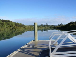
- 30. Ports are boat docks for merchants, farm traders and passengers accessible for the loading and unloading of goods and services. PORTS Semi circle dock Floating Deck
- 31. PORTS There are three key locations designated for the ports.
- 32. The first port, Port 1, is located at the mouth of the Naga River exiting the Bicol River. This port will cater to traders and passengers directly to and from the nearby towns accessed through the Bicol River. This location is also favorable to merchants & passengers going to the nearby LCC mall which has its passenger terminal going to opposite towns. The second port, Port 2, is located right at the heart of the Naga City Market which is presently utilized for the same purpose. This location will be the main drop off point for traders and passengers that will directly access the market and busy roads of Naga City. The thirt port, Port 3, is located at the farther end of the Naga River and will be utilized by merchants and passengers from Balatas and Cararayan. This port will also open up local tourists to flock the busy spots of Magsaysay, or become the start-off point for travelers going to Calabanga, Pacol all the way up the side of Mount Isarog.
- 33. Ultimately, the aim for the establishment of these ports is to initiate a regular transport system that will benefit the river dwellers. Subsequently, we may expect a growth in local tourism brought by the accessibility and the public awareness that these ports have risen to.
- 34. WALKWAYS, JOGGING PATHS & FOOT BRIDGES Walkways and jogging paths shall line both sides of the Naga River covering a total length of 4.56 kilometers with 2.08 kilometers on the Penafrancia riverside and 2.48 kilometers on the Dayangdang riverside. Paver stones Cobble stones Walkways shall have a typical width of 1.5 meters finished with cobblestones or paverstones loosely laid on sand for easier drainage.
- 35. WALKWAYS, JOGGING PATHS & FOOT BRIDGES Jogging Paths shall also line both sides of the River and spanning a total length the same as the walkways. Jogging paths shall be of asphalt finish to provide traction for the users.
- 36. Due to the distant spaces between existing bridges along the river, pedestrians may need to cross over from side of the river to another. Thus, footbridges shall be installed to provide access ways for such necessities. There may be a time during the day when one side of the river gets less shade than the other which will displease the pedestrians from walking along. Another thing, riverside dwellers can utilize the bridge to reach the opposite side without having the need to take the car, thus saving up on time and fuel Footbridges shall have a minimum width of 2 meters and will be finished with GFRC Simulated Timber to create a softer feel to the structure and its surroundings. Necessary safety railings, posts and lights shall be installed for a user friendly structure.
- 37. LANDSCAPING TREES & PLANTS The entire development shall be unified with a landscaping of trees and plants on both sides of the river from one end to another. This will provide shade to pedestrians and beautify the entire stretch with green elements rather than the imposing concrete walls that we see at present.
- 38. LANDSCAPING TREES & PLANTS Unfortunately, there is a lack of space for expansion along our riverbanks.
- 39. This problem can be eliminated by planting over the riprap on a built in structure and finished with simulated boulders to soften.
- 40. This problem can be eliminated by planting over the riprap on a built in structure and finished with simulated boulders to soften.
- 41. ACCESSORIES Lamp posts shall be provided at every 15 meters distance for improved accessibility and added security when necessary. The design shall be inspired from the Spanish colonial period where oil lamp styles were in use. LAMP POSTS
- 42. Garden benches shall also be installed at designated rest areas with scenic spots. GARDEN BENCHES Trees shall be planted alongside all the benches to provide shade and better ambience.
- 43. Eventually, each space that is presently at this condition…
- 44. Will turn out to be as orderly, pleasantly and environmentally healthy as this.
- 45. THANK YOU VERY MUCH AND GOOD DAY!