Mapping OldWeather
•
0 recomendaciones•628 vistas

Presentation given at Spatial Ignite at #wherecampdc

Recomendados
Más contenido relacionado
Similar a Mapping OldWeather
Similar a Mapping OldWeather (15)
Más de Javier de la Torre
Más de Javier de la Torre (20)
Último
Último (20)
Mapping OldWeather
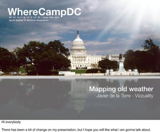
- 1. WhereCampDC 38° 53′ 42.4″ N, 77° 2′ 12″ W :: June 10th, 2011 Ignite Spatial @ National Geographic Mapping old weather Javier de la Torre - Vizzuality Hi everybody There has been a bit of change on my presentation, but I hope you will like what i am gonna talk about.
- 2. So we are trying to recreate how was the climate 100 years ago in the oceans. And of course at this time there were not many observatories, but luckily sailors around the world were capturing this information in the so called log books.
- 3. Log of HMS Invincible,1914-12-08 A log book is like a diary where the sailors wrote what was going on every day. Their position, the weather, etc. Only in England there is probably more than 250.000 log books providing an incredible source of new data.
- 4. But interpreting those logs books is a hard task. Computers dont manage to do it. So this is the reason why oldweather.org was created, to provide crowdsourcing of those log books.
- 5. And this is how it works. You get to a page of a log book of a ship and start transcribing. First the date, the location... it could be a port or coordinates.
- 6. Then there is the actual weather records, temperature, wind, etc. You can basically move the window around capturing multiple of those. And finally you can capture any other notes they might wrote on the sides.
- 7. You can become a captain! But how we convince people to help us? Well, first of all because you can promote to a captain! The more log book you digitized from a ship the more chances. And people love that! I also believe there is a lot of people helping here because this stuff matters.
- 8. “A friend rings to say she's really sorry, but she's going to have to cancel your evening out, and your first thought is "Great, I can get on with my ship!" http://forum.oldweather.org/index.php?topic=1432.0 Thats when the community aspect bright! If you look at the project forum there is some really commited people that even put their kids to work on their ships... there is people really addicted to it.
- 9. And how are we doing? Not bad. Started last November and we have 68% of all log books scanned, thats more than half a million pages!
- 10. And this is how it looks in a map all those annotations. Remember, for each of these points we have the temperature, pressure, wind... it is GOLD for climatologist.
- 11. Philip Broham has already start visualizing the results and here you can see just a little time lapse in 1917. The traces of the ships are colored based on the temperature. It is relly curious to see the full movie...
- 12. www.oldweather.org/voyages Other visualization done by Stuart Lynn displays the voyages for each boat together with the stories happening at the boat, so you can slide and see their trips and understand what was going on in the boats.
- 13. Individual transcriptions are about 97% accurate Of 1000 transcribed logbook entries: 3 will be lost because of transcription errors 10 will be illegible At least 3 will be errors in the logs http://blogs.zooniverse.org/ oldweather/2011/03/better-than-the- defence/ And how precise is this? Well, turned that people are very accurate when transcribing, up to 97% of the time they agree with another 3 persons transcribing the same. Which shows you the power of crowdsourcing at its best.
- 14. May 1911 But all this is done for a reason. We want to recreate the weather on the oceans long time ago so that we can understand our current and future climates. And for most areas this is the only source of information we are gonna have.
- 15. http://www.seayourhistory.org.uk burials One side thing of the project that I love is the events going on in the boats. Like for example when people passed away, like this sailor. There is people even looking for old relatives history!
- 16. also celebrations. And in terms of sports? Well is Britain, must be football, but i love that Dance was the third!
- 17. 90-year-old social graph of Old Weather Or another type of info is captured is when boats met in the oceans. They wrote it and now we can visualize which were the most "sociable" boats out there.
- 18. www.oldweather.org/team Rob Allan Philip Brohan Chris Lintott Lucinda Donnachie Clive Wilkinson Stuart Lynn Arfon Smith Gordon Smith This is work been done by lot of people from the MetOffice in UK, the University of Oxford and some others like us, if you are interested on the project check out some of the really nice videos they prepared for the launched. I promise they are great.
- 19. Citizen Science Everybody is invited! http://en.wikipedia.org/wiki/Citizen_science So if you are interested on this kind of projects they are called Citizen Science. Getting the people to help scientist to create new data or solving problems that are complicate for computers. So if you want to see other examples visit the page in Wikipedia where there is a lot of references.
- 20. Like for example PlanetHunters, a project where you can help scientist to discover new planets outside the solar system. With over 2 million classifications already done there already more than 60 candidates! But thats another story for a space ignite...
- 21. Javier de la Torre @jatorre WhereCampDC 38° 53′ 42.4″ N, 77° 2′ 12″ W J u n e 1 0 t h , 2 0 11 Ignite Spatial @ National Geographic THANK YOU VERY MUCH!