
Recommended
More Related Content
Featured
Featured (20)
7th Grade Lesson Plans Monday
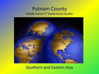
- 1. Putnam County Middle School 7th Grade Social Studies Southern and Eastern Asia
- 2. Standards • SS7G9 The student will locate selected features in Southern and Eastern Asia. – a. Locate on a world and regional political-physical map: Ganges River, Huang He (Yellow River), Indus River, Mekong River, Yangtze (Chang Jiang) River, Bay of Bengal, Indian Ocean, Sea of Japan, South China Sea, Yellow Sea, Gobi Desert , Taklimakan Desert, Himalayan Mountains, and Korean Peninsula. – b. Locate on a world and regional political-physical map the countries of China, India, Indonesia, Japan, North Korea, South Korea, and Vietnam. • SS7G11 The student will explain the impact of location, climate, physical characteristics, distribution of natural resources, and population distribution on Southern and Eastern Asia. – a. Describe the impact climate and location has on population distribution in Southern and Eastern Asia. – b. Describe how the mountain, desert, and water features of Southern and Eastern Asia have affected the population in terms of where people live, the types of work they do, and how they travel.
- 3. Features of South and East Asia H C K J Which is the Indus River?
- 4. Features of South and East Asia H C K J Which is the Ganges River?
- 5. Features of South and East Asia H C K J Which is the Huang He (Yellow) River?
- 6. Features of South and East Asia H C J K Which is the Yangtze (Chang Jiang) River?
- 7. Features of South and East Asia • Google Earth Tour for: – Bay of Bengal – Mekong River – Sea of Japan – South China Sea – Yellow Sea – Gobi Desert – Taklimakan Desert – Himalayan Mountains – Korean Peninsula
- 8. Features of South and East Asia • There may be a test on the locations of Asia’s features. Make sure to take the maps home to complete and study.
- 9. Features of South and East Asia Population Density
- 10. Features of South and East Asia • Population of India • 1,189,172,906 (July 2011 est.) • India started population control in the 1950’s India's Population Chart 1980 India's Population Chart 1950 100+ India's Population Chart 2010 90-94 80-84 90-94 90-94 70-74 75-79 60-64 75-79 50-54 60-64 Age Group 60-64 % Females 40-44 45-49 45-49 % Males 30-34 30-34 20-24 30-34 15-19 10-14 15-19 0-4 0-4 0-4 -10.000 -5.000 0.000 5.000 10.000 -10.000 -5.000 0.000 5.000 10.000 -10.000 -5.000 0.000 5.000 10.000 Percent of Population
- 12. Features of South and East Asia • Population of United States • 310,382,000 (July 2011 est.) • Does the United States have A Population Control Policy?
- 14. Features of South and East Asia Agriculture
- 15. Features of South and East Asia Monsoons
- 16. Features of South and East Asia Monsoons
- 17. Features of South and East Asia India gets most of its rainfall in couple months as compared to Georgia for the entire year, could that explain flooding? Rainfall
- 18. Features of South and East Asia Flooding Due to Monsoons
- 19. Features of South and East Asia When the Monsoons Are Not Present
- 20. Features of South and East Asia • SS7G9 The student will locate selected features in Southern and Eastern Asia. – a. Locate on a world and regional political-physical map: Ganges River, Huang He (Yellow River), Indus River, Mekong River, Yangtze (Chang Jiang) River, Bay of Bengal, Indian Ocean, Sea of Japan, South China Sea, Yellow Sea, Gobi Desert , Taklimakan Desert, Himalayan Mountains, and Korean Peninsula. – b. Locate on a world and regional political-physical map the countries of China, India, Indonesia, Japan, North Korea, South Korea, and Vietnam. • SS7G11 The student will explain the impact of location, climate, physical characteristics, distribution of natural resources, and population distribution on Southern and Eastern Asia. – a. Describe the impact climate and location has on population distribution in Southern and Eastern Asia. – b. Describe how the mountain, desert, and water features of Southern and Eastern Asia have affected the population in terms of where people live, the types of work they do, and how they travel.
Editor's Notes
- Introduction of selfPart of Social Studies is GeographyAsk How is Geography importantHow and why Geography is important to how the world isWhy do we need to know?
- Let the students know that we will be going over these locations and hand out blank maps
- Hand out blank maps,Direct the students to fill out the locations as shown over the next several slidesNational Standards : Element 1: The World in Spatial Terms. Standards 1 – 6http://staff.harrisonburg.k12.va.us/~cwalton/walton/solpracticetest.htm
- Hand out blank maps,Direct the students to fill out the locations as shown over the next several slidesNational Standards : Element 1: The World in Spatial Terms. Standards 1 – 6http://staff.harrisonburg.k12.va.us/~cwalton/walton/solpracticetest.htm
- Hand out blank maps,Direct the students to fill out the locations as shown over the next several slidesNational Standards : Element 1: The World in Spatial Terms. Standards 1 – 6http://staff.harrisonburg.k12.va.us/~cwalton/walton/solpracticetest.htm
- Hand out blank maps,Direct the students to fill out the locations as shown over the next several slidesNational Standards : Element 1: The World in Spatial Terms. Standards 1 – 6http://staff.harrisonburg.k12.va.us/~cwalton/walton/solpracticetest.htm
- Hand out blank maps,Direct the students to fill out the locations as shown via Google EarthNational Standards : Element 1: The World in Spatial Terms. Standards 1 – 6 3: Physical Systems, Standards 7 & 8
- Hand out blank maps,Direct the students to fill out the locations National Standards : Element 1: The World in Spatial Terms. Standards 1 – 6
- Ask: From the identification of the previous maps, what can we say about the population distribution?National Standards : Element 2: Places and Regions, Standards 5 & 6 4: Human Systems, Standards 9 & 12http://wps.prenhall.com/wps/media/objects/3059/3132709/fig14-5_popdensity.GIF
- Explain how to read the population chart.Discuss as to what are the possible reasons of population differences.https://www.cia.gov/library/publications/the-world-factbook/geos/in.htmlhttp://www.un.org
- https://www.cia.gov/library/publications/the-world-factbook/geos/ch.htmlhttp://www.un.orgWhat affects could this population as it gets older have on taxes, healthcare, schools, police, fire.
- https://www.cia.gov/library/publications/the-world-factbook/geos/us.htmlhttp://www.un.orgAsk what is the significance of the Arrow?What affects could this population as it gets older have on taxes, healthcare, schools, police, fire.
- https://www.cia.gov/library/publications/the-world-factbook/geos/ch.htmlhttp://www.un.orgWhat affects could this population as it gets older have on taxes, healthcare, schools, police, fire.
- http://www.livemint.com/2009/07/16135859/Poor-monsoon-stalks-India-desp.htmlhttp://guides.library.yale.edu/content.php?pid=240585&sid=1985494http://adayinlife.timesofindia.com/photos/agricultural-map-of-india/143970Rice needs a lot of water to grow, where would you plant the rice?How did the water get there?
- http://www.gohydrology.org/2009/05/florida-monsoons.htmlBriefly / simply explain WHY the rains occur.http://www.bartholomewmaps.com/world_country_profile.asp?countryname=India
- http://www.newworldencyclopedia.org/entry/Image:India_annual_rainfall_map_en.svghttp://www.srh.noaa.gov/images/ffc/gapcpn7.gif
- http://www.nytimes.com/2007/07/06/world/asia/06monsoon.htmlhttp://www.climategrump.net/2011/04/unseasonal-disasters-and-the-legend-of-the-timely-monsoons/
- http://ngm.nationalgeographic.com/2009/11/india-rain/corbett-text
- Don’t forget the maps!!!