Appendix A Economic Analysis
•
1 like•549 views

This document provides an economic analysis of the potential impacts of expanding the south runway at the Fort Lauderdale-Hollywood International Airport. It summarizes the following: 1) Expanding the south runway would negatively impact over 1,696 residential properties that are not compatible with noise levels of 65+ DNL, including two communities and other residential areas. 2) Research shows residential properties near airports typically experience a 9-15% reduction in value due to increased noise levels. Applying this range to the affected properties' $366 million estimated market value results in $33-55 million in lost property value. 3) The City of Dania Beach could see reductions in annual property tax revenues ranging from $1

Recommended
More Related Content
Viewers also liked
Viewers also liked (20)
Similar to Appendix A Economic Analysis
Similar to Appendix A Economic Analysis (20)
More from city of dania beach
More from city of dania beach (20)
Recently uploaded
Recently uploaded (20)
Appendix A Economic Analysis
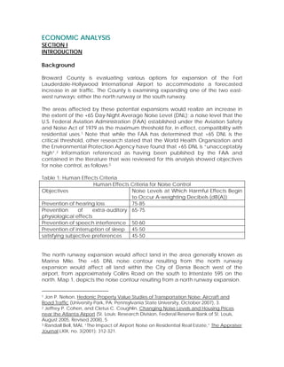
- 1. ECONOMIC ANALYSIS SECTION I INTRODUCTION Background Broward County is evaluating various options for expansion of the Fort Lauderdale-Hollywood International Airport to accommodate a forecasted increase in air traffic. The County is examining expanding one of the two east- west runways; either the north runway or the south runway. The areas affected by these potential expansions would realize an increase in the extent of the +65 Day-Night Average Noise Level (DNL); a noise level that the U.S. Federal Aviation Administration (FAA) established under the Aviation Safety and Noise Act of 1979 as the maximum threshold for, in effect, compatibility with residential uses.1 Note that while the FAA has determined that +65 DNL is the critical threshold, other research stated that the World Health Organization and the Environmental Protection Agency have found that +65 DNL is “unacceptably high”.2 Information referenced as having been published by the FAA and contained in the literature that was reviewed for this analysis showed objectives for noise control, as follows:3 Table 1: Human Effects Criteria Human Effects Criteria for Noise Control Objectives Noise Levels at Which Harmful Effects Begin to Occur A-weighting Decibels (dB(A)) Prevention of hearing loss 75-85 Prevention of extra-auditory 65-75 physiological effects Prevention of speech interference 50-60 Prevention of interruption of sleep 45-50 satisfying subjective preferences 45-50 The north runway expansion would affect land in the area generally known as Marina Mile. The +65 DNL noise contour resulting from the north runway expansion would affect all land within the City of Dania Beach west of the airport, from approximately Collins Road on the south to Interstate 595 on the north. Map 1, depicts the noise contour resulting from a north runway expansion. 1 Jon P. Nelson, Hedonic Property Value Studies of Transportation Noise: Aircraft and Road Traffic (University Park, PA: Pennsylvania State University, October 2007), 3. 2 Jeffrey P. Cohen, and Cletus C. Coughlin, Changing Noise Levels and Housing Prices near the Atlanta Airport (St. Louis: Research Division, Federal Reserve Bank of St. Louis, August 2005, Revised 2008), 5. 3 Randall Bell, MAI, “The Impact of Airport Noise on Residential Real Estate,” The Appraiser Journal LXIX, no. 3(2001): 312-321.
- 2. Map 1 North Runway Expansion Noise Contours The land use designations for property affected by the north runway expansion are all non-residential; primarily industrial land uses with some commercial and a small portion of utility land use designation. Noise levels that are 65 DNL or higher are considered by the FAA to be incompatible only with residential uses.4 Since the land uses affected by the north runway expansion within the City of Dania Beach are all non-residential, the existing land uses can be considered to be compatible with the north runway expansion and, therefore, no economic impact is anticipated. The south runway expansion would affect land south and west of the airport. Map 2 depicts the +65 DNL resulting from the south runway expansion utilizing the FAA’s preferred B1b alternative. The property affected by this expansion alternative is almost all residential; a use not compatible with a +65 DNL 4“Aircraft Noise and Noise Monitoring,” Federal Aviation Administration, http://www.faa.gov/airports/airport_development/omp/FAQ/Noise_Monitoring/ (accessed August 12, 2009). Note that DNL is a day-night average of aircraft noise and does not reflect noise levels of an actual event.
- 3. according to the FAA. South of the airport, two residential communities are affected. These are Melaleuca Gardens, a waterfront community containing 375 parcels of mostly single family detached homes, and Ocean Waterway Mobile Home Park, which contains approximately 271 mobile homes.5 In addition, the majority of residential properties due west of the south runway will be within the +65 DNL noise contour and, therefore, affected by the expansion. While some residential uses north of Griffin Road do not fall within the +65 DNL, virtually all properties will be significantly affected by the noise increase since the DNL is only a 24-hour average and does not directly reflect single noise events. Map 2 South Runway Expansion Noise Contours The FAA has determined that, to the extent feasible, it would attempt to achieve community cohesion when mitigation strategies are applied.6 The FAA stated that “in some cases, this may require a mitigation area to extend beyond the 5 For Melaleuca Gardens, the Broward County Property Appraiser’s data shows 334 single family homes, 35 multi-family parcels, 3 vacant single family lots, 2 parks and 1 utility. 6 Federal Aviation Administration, FAA Record of Decision: The Development and Expansion of Runway 9R/27L and Other Associated Airport Projects at Fort Lauderdale- Hollywood International Airport, December 2008.
- 4. boundary of the 65 DNL noise contour to follow natural geographic boundaries, street patterns, and contiguous neighborhood boundaries”.7 The Record of Decision produced by the FAA noted that an estimated 1,051 dwelling units will be affected by the +65 DNL noise contour that would result from a south runway expansion. However, if the noise contours are extended to include logical boundaries of the residential areas, which would include all of Melaleuca Gardens, Ocean Waterway Mobile Home Park and all affected residential areas north of Griffin Road, then 1,696 residential parcels will be affected by a south runway expansion.8 Significance of Analysis and Focus The impact of the south runway expansion utilizing the FAA’s preferred B1b alternative will have a significant impact on the two residential communities immediately south of the airport and the residential areas west of the airport and north of Griffin Road within the City. Residential properties will likely suffer a diminution of value compared to comparable properties not affected by noise and, as a result, it is anticipated that the City will experience a decrease in ad valorem revenues because of the anticipated decline in property value. The economic impact of the south runway expansion should be quantified to determine the potential effect to both property owners and the City, and a strategy developed to assist in offsetting any negative economic impacts. Methodology The exact dollar amount of the economic impact to property owners and, therefore, the City will directly depend on the appraised values of the residential properties after the runway expansion has occurred. It is not feasible to determine that dollar value at this juncture, nor is it financially realistic to appraise all 1,696 properties. However, a survey of available literature can provide an indication of the range of the percentage of value diminution. This information can be applied to data from the Broward County Property Appraiser’s office to establish an estimate of economic impact. Scope and Organization of Analysis This analysis is limited to an identification of the range of residential property devaluation that can be anticipated as a result of increased noise levels associated with a south runway expansion, and a calculation of the resulting revenue loss to the City of Dania Beach. The analysis does not examine the potential impact to the City’s detailed budget, nor does it identify and examine the possible secondary and tertiary effects of reduced revenues. It focuses on a 7Ibid. 8The Mellgren Planning Group GIS analysis, September 15, 2009. This GIS analysis is based upon the noise contour shape file provided by the FAA and Broward County Property Appraiser 2009 parcel and tax roll data.
- 5. range of potential loss of value to residents and ad valorem revenues to the City, and suggests an offsetting program and options for the City to consider. This analysis is organized in four sections. Following this introduction is Section II, which provides a review and discussion of existing information, as well as formulation of a methodology to estimate impact. Section III provides the application of the methodology. The final section presents a summary of findings, conclusions and recommendations.
- 6. SECTION II REVIEW OF INFORMATION AND METHODOLOGY Property Devaluation A review of available information and data concerning the diminution of housing values due to aircraft noise showed a broad range of findings. The subject has been studied over the past several decades and the actual methodology to predict economic impact has been the focus of discussion. The results of actual case studies of individual airports vary. Additionally, many of the studies undertaken were done prior to January 1, 2000; the year when federal law mandated Stage 3, or quieter, aircraft. The common finding in both older and more recent analyses, however, is that the value of residential properties significantly affected by aircraft noise is markedly less than a home with similar attributes that is not affected by noise. A 2008 working paper prepared by the Research Division of the Federal Reserve Bank of St. Louis examined the economic impact of airport related noise on housing values in neighborhoods proximate to the Hartsfield-Jackson Atlanta International Airport. That study stated that “after accounting for proximity, housing characteristics and demographic variables, houses in noisier areas sold for less than houses subjected to less noise”.9 This study utilized a hedonic pricing model that analyzed and compared data for 1995 to 1999 and 2000 to 2002, utilizing a number of statistical methods and variables, which produced varying results.10 To summarize, the study stated it estimated that homes in the 65 decibel noise contour lost value that ranged from 7.5 percent utilizing a semi-log specification to 10.6 percent using a linear specification. For houses in the 70 decibel noise contour, the devaluation ranged from 12.3 percent utilizing a semi- log specification to 17.7 percent using a linear specification.11 Note that the study referred to decibel noise contours as opposed to DNL. However, these two measures are equivalent.12 Another analysis was prepared in 2004 by Daniel P. McMillen of the Department of Economics and Institute for Government and Public Affairs of the University of 9 Jeffrey P. Cohen, and Cletus C. Coughlin, Changing Noise Levels and Housing Prices near the Atlanta Airport (St. Louis: Research Division, Federal Reserve Bank of St. Louis, August 2005, Revised 2008), 1. 10 Hedonic modeling is a method of identifying the value of certain attributes by deconstructing an item being evaluated into its individual characteristics and estimating the value of each of the characteristics; a methodology to assign price value to noise. 11 Ibid., 23. Note that these data are for 2000-2002, which would provide a more conservative estimate of value diminution since Stage 3 (quieter) aircraft regulations went into effect on January 1, 2000. 12 Jon P. Nelson, Hedonic Property Value Studies of Transportation Noise: Aircraft and Road Traffic (University Park, PA: Pennsylvania State University, October 2007), 2.
- 7. Illinois at Chicago.13 McMillen examined the diminution of property values as a result of runway expansion at Chicago O’Hare Airport. In his analysis, he found that there is an approximate 9.2 percent decrease in value of homes that are subject to aircraft noise. A third study was published by the Bryan School of Business & Economics of the University of North Carolina at Greensboro in 2006. That analysis examined the effect of announcing airport expansion on housing prices. Specifically, the study examined the impact on housing prices when Federal Express decided to locate its regional air cargo hub at the Piedmont-Triad International Airport (PTI). The PTI serves the Greensboro/High Point/Winston-Salem metropolitan area. The researchers found that there was a 9.2 percent diminution of value within a 2.5 mile radius of the airport after the announcement.14 The significance of this study is that it indicates the perceived impact of noise, indicative of a stated preference as opposed to a hedonic analysis discussed in the other literature, but still consistent with those findings. Methodology The Federal Reserve Bank of St. Louis found a diminution of value within the 65 decibel level contour that ranged from 7.5 percent to 10.6 percent, which results in a mean of 9.05 percent. For the 70 decibel contour, the reduction in value ranged from 12.3 percent to 17.7 percent, or a mean of 15 percent. The other two studies each found a 9.2 percent reduction in value, which is within the mean range of 9.05 percent and 15 percent. The Broward County Property Appraiser’s website contains property value information. The “just value” of each property represents an average of approximately 85 percent of the market value.15 Utilizing Geographic Information Systems (GIS), the just value of all residential properties within the affected area will be identified, and the just value increased by 15 percent to achieve the approximate market value. That number will then be reduced by 9.05 percent and then by 15 percent to obtain the total devaluation in today’s dollar, and then divided by the number of affected parcels to identify the average loss per parcel. Subsequently, GIS will be utilized to obtain the total assessed value of all residential property in the affected area. The assessed value includes the value for homesteaded properties as well as the just value for those properties that have no homestead exemption. It is the taxable value. That number will be increased by 15 percent, and the result reduced by the range of diminution; 9.05 13 Daniel P. McMillen, “Airport expansions and property values: the case of Chicago O’Hare Airport,” Journal of Urban Economics 55 (2004): 627-640. 14 G. Donald Jud and Daniel T. Winkler, “The Announcement Effect of an Airport Expansion on Housing Prices,” Journal of Real Estate Finance and Economics 33 (2006): 91-103. 15 Email from Lori Parrish, Broward County Property Appraiser, 24 July 2009 at 4:47 p.m. Ms. Parrish indicated that 85 percent is the average, but the percentage ranges from 78 to 94.
- 8. percent and 15 percent. The results will then be multiplied by the City’s millage rate to identify the decline in ad valorem revenues that the City of Dania Beach could anticipate if the south runway is expanded.
- 9. SECTION III APPLICATION OF METHODOLOGY Impact to Property Owners The following table shows the number of units or parcels by type, along with the aggregate just value according to the Broward County Property Appraiser. Table 2: Just Value of Residential Units/Parcels within Affected Area USE NUMBER OF DESCRIPTION JUST VALUE CODE UNITS/PARCELS 04 Condominium 91 $7,614,590 01 Single Family Detached 1,078 $250,122,060 08 Multi-Family <10 Units 133 $31,898,930 03 Multi-Family > 10 Units 5 $4,261,020 00 Vacant Residential 118 $15,587,640 05 Cooperatives16 271 $9,415,020 TOTAL: 1,696 $318,899,260 Source: Broward County Property Appraiser, 2009 parcel and tax roll data. According to the Broward County Property Appraiser, the just value is, on average, approximately 85 percent of the market value. Market value reflects comparable sales in the area and reflects an approximation of what a property owner could expect to receive as a sales price. Applying the 15 percent increase to the total just value in Table X above in order to determine the market value, results in a total market value of $366,734,149. As the survey of the literature showed, however, a loss of value ranging from 9.05 percent to 15 percent can be expected if the south runway is expanded. This would be equal to a total loss of between $33,189,440 and $55,010,122. Utilizing the unit or parcel count of 1,696, this equates to an average approximate loss per property, of between $19,569 and $32,435, in today’s dollars. Impact to City of Dania Beach Utilizing GIS to analyze information from the property appraiser’s office, all residential uses within the area west of the airport and north of Griffin Road, as well as Ocean Waterway Mobile Home Park and Melaleuca Gardens were identified. The data, along with the assessed value are contained in Table 3. 16 Ocean Waterway Mobile Home Park is a cooperative.
- 10. Table 3: Assessed Value of Residential Units/Parcels within Affected Area USE NUMBER OF DESCRIPTION ASSESSED VALUE CODE UNITS/PARCELS 04 Condominium 91 $7,470,590 01 Single Family Detached 1,078 $185,899,770 08 Multi-Family <10 Units 133 $29,071,920 03 Multi-Family > 10 Units 5 $4,261,020 00 Vacant Residential 118 $15,587,640 05 Cooperatives 271 $12,749,59017 TOTAL: 1,696 $255,040,530 Source: Broward County Property Appraiser, 2009 parcel and tax roll data. The data show that there are a total of 1,696 parcels or units with a total assessed or taxable value of $255,040,530. The literature showed that the estimated diminution in value resulting from runway expansion can be expected to range from 9.05 percent to 15 percent. Application of these percentages results in range of value loss of $23,081,168 to $38,256,080 in today’s dollars. The City’s adopted millage rate for FY 2009-2010 is 6.0043. With this millage rate, the City can anticipate receiving $6.0043 for each $1,000 of taxable value. Applying the millage rate to the loss of value as calculated above results in an estimated loss of ad valorem revenue to the City of Dania Beach of between $138,586 and $229,701, in today’s dollars. The loss is significant to both homeowners and the City. The loss to the homesteaded homeowner who lives in the house is even greater. Not only will the owner fail to realize full market value, but also there are the costs associated with acquisition of a new residence and relocation. With respect to those properties that are not occupied by the owner, the loss may be considered to be a calculated business risk. Of the 1,696 parcels within the affected area, 947, or 55.8 percent, are homesteaded, while the balance can be considered investment properties or second homes.18 The breakdown of homesteaded properties by use is shown in the following table. Table 4: Homesteaded Properties within Affected Area NUMBER OF NUMBER PERCENT USE UNITS/PARCELS HOMESTEADED HOMESTEADED Condominium 91 9 9.9 Single-Family 1,078 856 79.4 17 The assessed value, which includes homestead exemptions, for the Ocean Waterway cooperative is greater than the just value, which includes no homestead exemptions. The Broward County Property Appraiser assigned no building values in the just valuation, but has assigned building values for the assessed value for all but 91 of the owners. 18 The Mellgren Planning Group GIS analysis, September 15, 2009. This GIS analysis is based upon Broward County Property Appraiser 2009 parcel and tax roll data.
- 11. NUMBER OF NUMBER PERCENT USE UNITS/PARCELS HOMESTEADED HOMESTEADED Multi-Family <10 units 133 42 31.6 Multi-Family >10 units 5 0 0 Vacant Residential 118 0 0 Cooperatives 271 40 14.8 TOTAL: 1,696 947 55.8 Source: Broward County Property Appraiser, 2009 parcel and tax roll data. As the data show, more than half of the property owners are homeowners who claim their home as their principal place of residence. The balance of owners, however, may be considered to have made a business decision to invest in real estate and, therefore, took the implicit risk inherent in any business dealing.
- 12. SECTION IV CONCLUSIONS Conclusions Application of the percentage of dollar loss of value to the total assessed value of residential property that would be affected by the south runway expansion results in a significant loss to property owners. Each of the 1,696 parcel or unit owners can anticipate losing between $19,569 and $32,435, in today’s dollars, from the market value. In addition, the City of Dania Beach can expect to realize a loss of ad valorem revenues that ranges from $138,586 to $229,701 per year.