SlideShare a Scribd company logo
1 of 15
Global Positioning Systems GIS IFall 2011
Uses of GPS Technology Navigation Marine Automobile Aircraft Wayfinding Disaster relief Hiking Walking tours Eco-burials Precise Timekeeping Military Troop accountability Coordination Targeting Selective Availability Surveying Property delineation Infrastructure assessment Planning OpenStreetMap
What GPS can’t do. Track you. It’s a one way system. You need special equipment to collect the signals then transmit your location through other means. Follow you inside or underground. Just your hand can block a GPS signal. Further tracking required dead reckoning, inertial navigation, or different technology.  Show you where to go. Consumer GPSs rely on a special purpose GIS. As you should know, it’s only as good as the data available.
GPS Systems GPS systems use a constellation of satellites with known orbits. Each satellite beams an encoded signal towards Earth. A GPS receiver can read the coded signals to determine the receiver’s location on the earth using triangulation. Higher end GPS units can use the code and the carrier wave for higher accuracy.(“Code vs Carrier”)
How does it work? The encoded message allows a receiver to determine its position on the Earth once 3 satellites (2D) or 4 or more satellites (3D) are in view.  The encoded signal includes additional data: Ephemeris: the precise orbital information about one satellite Almanac: granular information about the entire system.
Types of GPS Autonomous GPS (“GPS”) relies entirely on the signals received from the satellites to determine the user’s location. Assisted GPS (“A-GPS”) uses an outside network (cellular, WiFi) to download the Ephemeris and Almanac, shortening the Time To First Fix. Differential GPS (“DGPS”) uses a static base station GPS to provide additional information about the signal, boosting accuracy.
Listening to the GPS Signal How is the signal affected? Position on the Earth Health of satellites Multipath issues Weather disruption Vegetation cover Quality of receiver Additional signals
Uncertainty in GIS Data Just because you receive a location from a GPS does not mean it is 100% correct. Uncertainty influences many aspects of our work. Remember, it is impossible to make a perfect representation of the world, so uncertainty about it is inevitable.
Sources of Uncertainty Measurement error: different observers, measuring instruments Specification error: omitted variables Ambiguity, vagueness and the quality of a GIS representation A catch-all for ‘incomplete’ representations or a ‘quality’ measure
Levels of Uncertainty
Reporting Measurements The amount of detail in a reported measurement (e.g., output from a GPS) should reflect its accuracy. Stated precision of: “14.4m” implies an accuracy of 0.1m “14m” implies an accuracy of 1m Excess precision should be removed when publishing coordinates.
The term precision is often used to refer to the repeatability of measurements. In both diagrams six measurements have been taken of the same position, represented by the center of the circle. On the left, successive measurements have similar values (they are precise), but show a bias away from the correct value (they are inaccurate). On the right, precision is lower but accuracy is higher.
Positional Accuracy Consumer GPS receivers have a horizontal positional accuracy of ±5m (16ft). Multipath and scattering impacts accuracy. Accuracy can be improved using differential GPS. Stated as Dilution of PrecisionxDOP (G, P, H, V, T…)
Dilution of Precision Numeric value that corresponds to the degree of error in the current GPS position. Geometric – satellites are too close together. Horizontal, vertical, and positional dilutions. Time dilution – the shift from “actual”time. Value typically from 1-50. Lower value, lower dilution, better quality. GPS Forecast and NANUs
Selective Availability Before 2000, GPS was limited to US Military use. Random error was introduced into the civilian signal, intentionally reducing precision. Now SA is turned off, but can be selectively turned on for specific regions of the world.

More Related Content

What's hot

Android GPS Tutorial
Android GPS TutorialAndroid GPS Tutorial
Android GPS Tutorial
Ahsanul Karim
 
Global positioning system
Global positioning systemGlobal positioning system
Global positioning system
Dhiren Paryani
 

What's hot (20)

Basics of GPS
Basics of GPSBasics of GPS
Basics of GPS
 
GLOBAL POSITIONING SYSTEM (GPS)
GLOBAL POSITIONING SYSTEM (GPS) GLOBAL POSITIONING SYSTEM (GPS)
GLOBAL POSITIONING SYSTEM (GPS)
 
Presentation on GPS by Harvendra Singh
Presentation on GPS by Harvendra SinghPresentation on GPS by Harvendra Singh
Presentation on GPS by Harvendra Singh
 
The Gps Technology Paras
The Gps Technology ParasThe Gps Technology Paras
The Gps Technology Paras
 
Dgps
DgpsDgps
Dgps
 
DIFFERENTIAL GPS (DGPS)
DIFFERENTIAL GPS (DGPS)DIFFERENTIAL GPS (DGPS)
DIFFERENTIAL GPS (DGPS)
 
Dgps concept
Dgps conceptDgps concept
Dgps concept
 
Introduction to GPS
Introduction to GPSIntroduction to GPS
Introduction to GPS
 
Handheld GPS Training for Municipal Use
Handheld GPS Training for Municipal UseHandheld GPS Training for Municipal Use
Handheld GPS Training for Municipal Use
 
Gps seminar
Gps seminarGps seminar
Gps seminar
 
GPS and GIS
GPS and GISGPS and GIS
GPS and GIS
 
Gps eser
Gps eserGps eser
Gps eser
 
Global Positioning System
Global Positioning System Global Positioning System
Global Positioning System
 
Differential gps
Differential gpsDifferential gps
Differential gps
 
GIS and GPS - Presentation to 4th graders at King Kaumualii Elementary School
GIS and GPS - Presentation to 4th graders at King Kaumualii Elementary SchoolGIS and GPS - Presentation to 4th graders at King Kaumualii Elementary School
GIS and GPS - Presentation to 4th graders at King Kaumualii Elementary School
 
Global Positioning System (GPS)
Global Positioning System (GPS)Global Positioning System (GPS)
Global Positioning System (GPS)
 
Android GPS Tutorial
Android GPS TutorialAndroid GPS Tutorial
Android GPS Tutorial
 
Global positioning system
Global positioning systemGlobal positioning system
Global positioning system
 
5. lecture 4 data capturing techniques - satellite and aerial images
5. lecture 4   data capturing techniques - satellite and aerial images5. lecture 4   data capturing techniques - satellite and aerial images
5. lecture 4 data capturing techniques - satellite and aerial images
 
5. lecture 4 data capturing techniques - satellite and aerial images
5. lecture 4   data capturing techniques - satellite and aerial images5. lecture 4   data capturing techniques - satellite and aerial images
5. lecture 4 data capturing techniques - satellite and aerial images
 

Viewers also liked

GIS & Facilities - NJAPPA Talk - April 26 2012
GIS & Facilities - NJAPPA Talk - April 26 2012GIS & Facilities - NJAPPA Talk - April 26 2012
GIS & Facilities - NJAPPA Talk - April 26 2012
John Reiser
 
Classification Systems
Classification SystemsClassification Systems
Classification Systems
John Reiser
 
Introduction to 3D Data
Introduction to 3D DataIntroduction to 3D Data
Introduction to 3D Data
John Reiser
 
Habitat Change Analysis Project
Habitat Change Analysis ProjectHabitat Change Analysis Project
Habitat Change Analysis Project
John Reiser
 
Network Analysis in ArcGIS
Network Analysis in ArcGISNetwork Analysis in ArcGIS
Network Analysis in ArcGIS
John Reiser
 
Data Models - GIS I
Data Models - GIS IData Models - GIS I
Data Models - GIS I
John Reiser
 
How culture can make or break a company
How culture can make or break a companyHow culture can make or break a company
How culture can make or break a company
Akash Jauhari
 
Are indian stock market driven more by sentiments than fundamentals- A Resear...
Are indian stock market driven more by sentiments than fundamentals- A Resear...Are indian stock market driven more by sentiments than fundamentals- A Resear...
Are indian stock market driven more by sentiments than fundamentals- A Resear...
Akash Jauhari
 
Reading Topographic Maps
Reading Topographic MapsReading Topographic Maps
Reading Topographic Maps
duncanpatti
 
Resources & rivalry in Central asia
Resources & rivalry in Central asiaResources & rivalry in Central asia
Resources & rivalry in Central asia
Akash Jauhari
 
Are Indian Stock driven by pure Sentiments
Are Indian Stock driven by pure SentimentsAre Indian Stock driven by pure Sentiments
Are Indian Stock driven by pure Sentiments
Akash Jauhari
 

Viewers also liked (20)

NJAPPA 2012 - Campus Facilities
NJAPPA 2012 - Campus FacilitiesNJAPPA 2012 - Campus Facilities
NJAPPA 2012 - Campus Facilities
 
GIS & Facilities - NJAPPA Talk - April 26 2012
GIS & Facilities - NJAPPA Talk - April 26 2012GIS & Facilities - NJAPPA Talk - April 26 2012
GIS & Facilities - NJAPPA Talk - April 26 2012
 
Using Dashboards to Understand Spatial Data
Using Dashboards to Understand Spatial DataUsing Dashboards to Understand Spatial Data
Using Dashboards to Understand Spatial Data
 
Doing more with SQL
Doing more with SQLDoing more with SQL
Doing more with SQL
 
Classification Systems
Classification SystemsClassification Systems
Classification Systems
 
Mapping the Way - ESRI EdUC 2011
Mapping the Way - ESRI EdUC 2011Mapping the Way - ESRI EdUC 2011
Mapping the Way - ESRI EdUC 2011
 
Introduction to 3D Data
Introduction to 3D DataIntroduction to 3D Data
Introduction to 3D Data
 
Habitat Change Analysis Project
Habitat Change Analysis ProjectHabitat Change Analysis Project
Habitat Change Analysis Project
 
Network Analysis in ArcGIS
Network Analysis in ArcGISNetwork Analysis in ArcGIS
Network Analysis in ArcGIS
 
Data Models - GIS I
Data Models - GIS IData Models - GIS I
Data Models - GIS I
 
Intro to GIS and Remote Sensing
Intro to GIS and Remote SensingIntro to GIS and Remote Sensing
Intro to GIS and Remote Sensing
 
New paradigm for national mapping organization
New paradigm for national mapping organizationNew paradigm for national mapping organization
New paradigm for national mapping organization
 
Week 1.2 course description 02 251-101
Week 1.2 course description 02 251-101 Week 1.2 course description 02 251-101
Week 1.2 course description 02 251-101
 
How culture can make or break a company
How culture can make or break a companyHow culture can make or break a company
How culture can make or break a company
 
Are indian stock market driven more by sentiments than fundamentals- A Resear...
Are indian stock market driven more by sentiments than fundamentals- A Resear...Are indian stock market driven more by sentiments than fundamentals- A Resear...
Are indian stock market driven more by sentiments than fundamentals- A Resear...
 
Reading Topographic Maps
Reading Topographic MapsReading Topographic Maps
Reading Topographic Maps
 
Resources & rivalry in Central asia
Resources & rivalry in Central asiaResources & rivalry in Central asia
Resources & rivalry in Central asia
 
Are Indian Stock driven by pure Sentiments
Are Indian Stock driven by pure SentimentsAre Indian Stock driven by pure Sentiments
Are Indian Stock driven by pure Sentiments
 
C-Si Module Manufacturers in India
C-Si Module Manufacturers in IndiaC-Si Module Manufacturers in India
C-Si Module Manufacturers in India
 
Location analytics: A New Dimension for your Applications
Location analytics: A New Dimension for your ApplicationsLocation analytics: A New Dimension for your Applications
Location analytics: A New Dimension for your Applications
 

Similar to GPS - Fall 2011 (20)

Gps
GpsGps
Gps
 
Gps
GpsGps
Gps
 
How GPS Works
How GPS WorksHow GPS Works
How GPS Works
 
Global Positioning System (GPS)
Global Positioning System (GPS)Global Positioning System (GPS)
Global Positioning System (GPS)
 
Dgps seminar
Dgps seminarDgps seminar
Dgps seminar
 
How_GPS_Works.ppt
How_GPS_Works.pptHow_GPS_Works.ppt
How_GPS_Works.ppt
 
Introduction togps shsm
Introduction togps shsmIntroduction togps shsm
Introduction togps shsm
 
Global Positioning System
Global Positioning System Global Positioning System
Global Positioning System
 
GNSS
GNSSGNSS
GNSS
 
Global positioning system
Global positioning systemGlobal positioning system
Global positioning system
 
gps technology
gps technologygps technology
gps technology
 
Dgps seminar
Dgps seminarDgps seminar
Dgps seminar
 
Intro of Differential GPS.pptx
Intro of Differential GPS.pptxIntro of Differential GPS.pptx
Intro of Differential GPS.pptx
 
What Is GPS
What Is  GPSWhat Is  GPS
What Is GPS
 
GPS-1.ppt
GPS-1.pptGPS-1.ppt
GPS-1.ppt
 
GPS-1.ppt
GPS-1.pptGPS-1.ppt
GPS-1.ppt
 
GPS-1.ppt
GPS-1.pptGPS-1.ppt
GPS-1.ppt
 
GPS-1.ppt
GPS-1.pptGPS-1.ppt
GPS-1.ppt
 
GPS-3.ppt
GPS-3.pptGPS-3.ppt
GPS-3.ppt
 
GPS-1.ppt
GPS-1.pptGPS-1.ppt
GPS-1.ppt
 

More from John Reiser

GIS Day at BCC 2012
GIS Day at BCC 2012GIS Day at BCC 2012
GIS Day at BCC 2012
John Reiser
 
Going Mobile with HTML5
Going Mobile with HTML5Going Mobile with HTML5
Going Mobile with HTML5
John Reiser
 
Measurement and Scale
Measurement and ScaleMeasurement and Scale
Measurement and Scale
John Reiser
 
Data Storage and Processing
Data Storage and ProcessingData Storage and Processing
Data Storage and Processing
John Reiser
 
Getting your Data Out There: An Introduction to Distributed GIS
Getting your Data Out There:An Introduction to Distributed GISGetting your Data Out There:An Introduction to Distributed GIS
Getting your Data Out There: An Introduction to Distributed GIS
John Reiser
 

More from John Reiser (19)

Python and GIS: Improving Your Workflow
Python and GIS: Improving Your WorkflowPython and GIS: Improving Your Workflow
Python and GIS: Improving Your Workflow
 
Python Programming and GIS
Python Programming and GISPython Programming and GIS
Python Programming and GIS
 
NJ MAP: Building a different kind of GIS platform using open source tools.
NJ MAP: Building a different kind of GIS platform using open source tools.NJ MAP: Building a different kind of GIS platform using open source tools.
NJ MAP: Building a different kind of GIS platform using open source tools.
 
Portfolio Workshop
Portfolio WorkshopPortfolio Workshop
Portfolio Workshop
 
GIS Day at BCC 2012
GIS Day at BCC 2012GIS Day at BCC 2012
GIS Day at BCC 2012
 
Mapping the Human Environment
Mapping the Human EnvironmentMapping the Human Environment
Mapping the Human Environment
 
Going Mobile with HTML5
Going Mobile with HTML5Going Mobile with HTML5
Going Mobile with HTML5
 
Mapping the Way
Mapping the WayMapping the Way
Mapping the Way
 
New Jersey Land Change Viewer
New Jersey Land Change ViewerNew Jersey Land Change Viewer
New Jersey Land Change Viewer
 
Measurement and Scale
Measurement and ScaleMeasurement and Scale
Measurement and Scale
 
Map Projections
Map ProjectionsMap Projections
Map Projections
 
Geodatabases
GeodatabasesGeodatabases
Geodatabases
 
GIS Modeling
GIS ModelingGIS Modeling
GIS Modeling
 
Data Storage and Processing
Data Storage and ProcessingData Storage and Processing
Data Storage and Processing
 
GIS Data Types
GIS Data TypesGIS Data Types
GIS Data Types
 
Getting your Data Out There: An Introduction to Distributed GIS
Getting your Data Out There:An Introduction to Distributed GISGetting your Data Out There:An Introduction to Distributed GIS
Getting your Data Out There: An Introduction to Distributed GIS
 
IMGIS - Brief History of Mapping
IMGIS - Brief History of MappingIMGIS - Brief History of Mapping
IMGIS - Brief History of Mapping
 
Internet-enabled GIS - Spring 2011
Internet-enabled GIS - Spring 2011Internet-enabled GIS - Spring 2011
Internet-enabled GIS - Spring 2011
 
Internet-enabled GIS for Planners
Internet-enabled GIS for PlannersInternet-enabled GIS for Planners
Internet-enabled GIS for Planners
 

Recently uploaded

Vishram Singh - Textbook of Anatomy Upper Limb and Thorax.. Volume 1 (1).pdf
Vishram Singh - Textbook of Anatomy  Upper Limb and Thorax.. Volume 1 (1).pdfVishram Singh - Textbook of Anatomy  Upper Limb and Thorax.. Volume 1 (1).pdf
Vishram Singh - Textbook of Anatomy Upper Limb and Thorax.. Volume 1 (1).pdf
ssuserdda66b
 
Jual Obat Aborsi Hongkong ( Asli No.1 ) 085657271886 Obat Penggugur Kandungan...
Jual Obat Aborsi Hongkong ( Asli No.1 ) 085657271886 Obat Penggugur Kandungan...Jual Obat Aborsi Hongkong ( Asli No.1 ) 085657271886 Obat Penggugur Kandungan...
Jual Obat Aborsi Hongkong ( Asli No.1 ) 085657271886 Obat Penggugur Kandungan...
ZurliaSoop
 
1029 - Danh muc Sach Giao Khoa 10 . pdf
1029 -  Danh muc Sach Giao Khoa 10 . pdf1029 -  Danh muc Sach Giao Khoa 10 . pdf
1029 - Danh muc Sach Giao Khoa 10 . pdf
QucHHunhnh
 
Spellings Wk 3 English CAPS CARES Please Practise
Spellings Wk 3 English CAPS CARES Please PractiseSpellings Wk 3 English CAPS CARES Please Practise
Spellings Wk 3 English CAPS CARES Please Practise
AnaAcapella
 
Salient Features of India constitution especially power and functions
Salient Features of India constitution especially power and functionsSalient Features of India constitution especially power and functions
Salient Features of India constitution especially power and functions
KarakKing
 

Recently uploaded (20)

Dyslexia AI Workshop for Slideshare.pptx
Dyslexia AI Workshop for Slideshare.pptxDyslexia AI Workshop for Slideshare.pptx
Dyslexia AI Workshop for Slideshare.pptx
 
Vishram Singh - Textbook of Anatomy Upper Limb and Thorax.. Volume 1 (1).pdf
Vishram Singh - Textbook of Anatomy  Upper Limb and Thorax.. Volume 1 (1).pdfVishram Singh - Textbook of Anatomy  Upper Limb and Thorax.. Volume 1 (1).pdf
Vishram Singh - Textbook of Anatomy Upper Limb and Thorax.. Volume 1 (1).pdf
 
Kodo Millet PPT made by Ghanshyam bairwa college of Agriculture kumher bhara...
Kodo Millet  PPT made by Ghanshyam bairwa college of Agriculture kumher bhara...Kodo Millet  PPT made by Ghanshyam bairwa college of Agriculture kumher bhara...
Kodo Millet PPT made by Ghanshyam bairwa college of Agriculture kumher bhara...
 
Micro-Scholarship, What it is, How can it help me.pdf
Micro-Scholarship, What it is, How can it help me.pdfMicro-Scholarship, What it is, How can it help me.pdf
Micro-Scholarship, What it is, How can it help me.pdf
 
ComPTIA Overview | Comptia Security+ Book SY0-701
ComPTIA Overview | Comptia Security+ Book SY0-701ComPTIA Overview | Comptia Security+ Book SY0-701
ComPTIA Overview | Comptia Security+ Book SY0-701
 
Introduction to Nonprofit Accounting: The Basics
Introduction to Nonprofit Accounting: The BasicsIntroduction to Nonprofit Accounting: The Basics
Introduction to Nonprofit Accounting: The Basics
 
UGC NET Paper 1 Mathematical Reasoning & Aptitude.pdf
UGC NET Paper 1 Mathematical Reasoning & Aptitude.pdfUGC NET Paper 1 Mathematical Reasoning & Aptitude.pdf
UGC NET Paper 1 Mathematical Reasoning & Aptitude.pdf
 
Jual Obat Aborsi Hongkong ( Asli No.1 ) 085657271886 Obat Penggugur Kandungan...
Jual Obat Aborsi Hongkong ( Asli No.1 ) 085657271886 Obat Penggugur Kandungan...Jual Obat Aborsi Hongkong ( Asli No.1 ) 085657271886 Obat Penggugur Kandungan...
Jual Obat Aborsi Hongkong ( Asli No.1 ) 085657271886 Obat Penggugur Kandungan...
 
1029 - Danh muc Sach Giao Khoa 10 . pdf
1029 -  Danh muc Sach Giao Khoa 10 . pdf1029 -  Danh muc Sach Giao Khoa 10 . pdf
1029 - Danh muc Sach Giao Khoa 10 . pdf
 
Fostering Friendships - Enhancing Social Bonds in the Classroom
Fostering Friendships - Enhancing Social Bonds  in the ClassroomFostering Friendships - Enhancing Social Bonds  in the Classroom
Fostering Friendships - Enhancing Social Bonds in the Classroom
 
On National Teacher Day, meet the 2024-25 Kenan Fellows
On National Teacher Day, meet the 2024-25 Kenan FellowsOn National Teacher Day, meet the 2024-25 Kenan Fellows
On National Teacher Day, meet the 2024-25 Kenan Fellows
 
Sociology 101 Demonstration of Learning Exhibit
Sociology 101 Demonstration of Learning ExhibitSociology 101 Demonstration of Learning Exhibit
Sociology 101 Demonstration of Learning Exhibit
 
Spellings Wk 3 English CAPS CARES Please Practise
Spellings Wk 3 English CAPS CARES Please PractiseSpellings Wk 3 English CAPS CARES Please Practise
Spellings Wk 3 English CAPS CARES Please Practise
 
Mixin Classes in Odoo 17 How to Extend Models Using Mixin Classes
Mixin Classes in Odoo 17  How to Extend Models Using Mixin ClassesMixin Classes in Odoo 17  How to Extend Models Using Mixin Classes
Mixin Classes in Odoo 17 How to Extend Models Using Mixin Classes
 
Salient Features of India constitution especially power and functions
Salient Features of India constitution especially power and functionsSalient Features of India constitution especially power and functions
Salient Features of India constitution especially power and functions
 
ICT role in 21st century education and it's challenges.
ICT role in 21st century education and it's challenges.ICT role in 21st century education and it's challenges.
ICT role in 21st century education and it's challenges.
 
Explore beautiful and ugly buildings. Mathematics helps us create beautiful d...
Explore beautiful and ugly buildings. Mathematics helps us create beautiful d...Explore beautiful and ugly buildings. Mathematics helps us create beautiful d...
Explore beautiful and ugly buildings. Mathematics helps us create beautiful d...
 
Unit-IV; Professional Sales Representative (PSR).pptx
Unit-IV; Professional Sales Representative (PSR).pptxUnit-IV; Professional Sales Representative (PSR).pptx
Unit-IV; Professional Sales Representative (PSR).pptx
 
FSB Advising Checklist - Orientation 2024
FSB Advising Checklist - Orientation 2024FSB Advising Checklist - Orientation 2024
FSB Advising Checklist - Orientation 2024
 
Holdier Curriculum Vitae (April 2024).pdf
Holdier Curriculum Vitae (April 2024).pdfHoldier Curriculum Vitae (April 2024).pdf
Holdier Curriculum Vitae (April 2024).pdf
 

GPS - Fall 2011

  • 1. Global Positioning Systems GIS IFall 2011
  • 2. Uses of GPS Technology Navigation Marine Automobile Aircraft Wayfinding Disaster relief Hiking Walking tours Eco-burials Precise Timekeeping Military Troop accountability Coordination Targeting Selective Availability Surveying Property delineation Infrastructure assessment Planning OpenStreetMap
  • 3. What GPS can’t do. Track you. It’s a one way system. You need special equipment to collect the signals then transmit your location through other means. Follow you inside or underground. Just your hand can block a GPS signal. Further tracking required dead reckoning, inertial navigation, or different technology. Show you where to go. Consumer GPSs rely on a special purpose GIS. As you should know, it’s only as good as the data available.
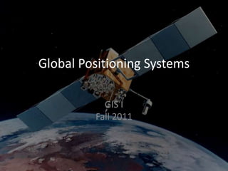
  • 4. GPS Systems GPS systems use a constellation of satellites with known orbits. Each satellite beams an encoded signal towards Earth. A GPS receiver can read the coded signals to determine the receiver’s location on the earth using triangulation. Higher end GPS units can use the code and the carrier wave for higher accuracy.(“Code vs Carrier”)
  • 5. How does it work? The encoded message allows a receiver to determine its position on the Earth once 3 satellites (2D) or 4 or more satellites (3D) are in view. The encoded signal includes additional data: Ephemeris: the precise orbital information about one satellite Almanac: granular information about the entire system.
  • 6. Types of GPS Autonomous GPS (“GPS”) relies entirely on the signals received from the satellites to determine the user’s location. Assisted GPS (“A-GPS”) uses an outside network (cellular, WiFi) to download the Ephemeris and Almanac, shortening the Time To First Fix. Differential GPS (“DGPS”) uses a static base station GPS to provide additional information about the signal, boosting accuracy.
  • 7. Listening to the GPS Signal How is the signal affected? Position on the Earth Health of satellites Multipath issues Weather disruption Vegetation cover Quality of receiver Additional signals
  • 8. Uncertainty in GIS Data Just because you receive a location from a GPS does not mean it is 100% correct. Uncertainty influences many aspects of our work. Remember, it is impossible to make a perfect representation of the world, so uncertainty about it is inevitable.
  • 9. Sources of Uncertainty Measurement error: different observers, measuring instruments Specification error: omitted variables Ambiguity, vagueness and the quality of a GIS representation A catch-all for ‘incomplete’ representations or a ‘quality’ measure
  • 11. Reporting Measurements The amount of detail in a reported measurement (e.g., output from a GPS) should reflect its accuracy. Stated precision of: “14.4m” implies an accuracy of 0.1m “14m” implies an accuracy of 1m Excess precision should be removed when publishing coordinates.
  • 12. The term precision is often used to refer to the repeatability of measurements. In both diagrams six measurements have been taken of the same position, represented by the center of the circle. On the left, successive measurements have similar values (they are precise), but show a bias away from the correct value (they are inaccurate). On the right, precision is lower but accuracy is higher.
  • 13. Positional Accuracy Consumer GPS receivers have a horizontal positional accuracy of ±5m (16ft). Multipath and scattering impacts accuracy. Accuracy can be improved using differential GPS. Stated as Dilution of PrecisionxDOP (G, P, H, V, T…)
  • 14. Dilution of Precision Numeric value that corresponds to the degree of error in the current GPS position. Geometric – satellites are too close together. Horizontal, vertical, and positional dilutions. Time dilution – the shift from “actual”time. Value typically from 1-50. Lower value, lower dilution, better quality. GPS Forecast and NANUs
  • 15. Selective Availability Before 2000, GPS was limited to US Military use. Random error was introduced into the civilian signal, intentionally reducing precision. Now SA is turned off, but can be selectively turned on for specific regions of the world.