Fce 552 part0
•Download as PPT, PDF•
0 likes•246 views

This document summarizes an Engineering Survey IV course offered by the Department of Geospatial & Space Technology at the University of Nairobi. The course covers topics like triangulation, trilateration, resection, grid systems, azimuth determination, photogrammetry, remote sensing, and their applications in civil engineering projects. The course is assessed through exams, coursework, and a term paper. It is a 45-hour, 1-unit course taught by Prof. John Bosco Kyalo Kiema.

Recommended
Recommended
More Related Content
Viewers also liked
Similar to Fce 552 part0
More from Leonardus Ouma
Recently uploaded
Recently uploaded (20)
Fce 552 part0
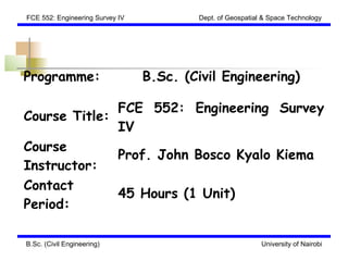
- 1. FCE 552: Engineering Survey IV Dept. of Geospatial & Space Technology Programme: B.Sc. (Civil Engineering) FCE 552: Engineering Survey Course Title: IV Course Prof. John Bosco Kyalo Kiema Instructor: Contact 45 Hours (1 Unit) Period: B.Sc. (Civil Engineering) University of Nairobi
- 2. FCE 552: Engineering Survey IV Dept. of Geospatial & Space Technology COURSE OUTLINE Triangulation; trilateration and resection. Grid systems: convergence of meridian, scale factors. Determination of azimuth. Photogrammetry; air photography, flying for air photography and ground control. Photo- interpretation; theory of mapping from stereoscopic pairs, practical use of stereosplotters for civil engineering works. Introduction to remote sensing and its application in Civil Engineering. Route location surveys; reconnaissance, preliminary and location surveys for highways, railways, pipelines and canals. B.Sc. (Civil Engineering) University of Nairobi
- 3. FCE 552: Engineering Survey IV Dept. of Geospatial & Space Technology PRESENTATION OUTLINE 1) Horizontal Control 2) Azimuth Determination 3) Introduction to Photogrammetry 4) Fundamentals of GPS 5) Introduction to Remote Sensing 6) Fundamentals of GIS 7) Role of GS&T in Implementation and Maintenance of Civil Engineering Projects B.Sc. (Civil Engineering) University of Nairobi
- 4. FCE 552: Engineering Survey IV Dept. of Geospatial & Space Technology COURSE ASSESSMENT EXAM COURSE CAT PASS TOTAL WORK MARK 70 20 10 40 100 B.Sc. (Civil Engineering) University of Nairobi
- 5. FCE 552: Engineering Survey IV Dept. of Geospatial & Space Technology REFERENCES (1) 1. Kennie, T.J.M., and Petrie, G. (Eds.)., 2000. Engineering Surveying Technology. Blackie Academic & Professional. 2. Kizito, F. 2009. Water Supply Management in an Urban Utility: A Prototype Decision Support Framework. KTH. Stochholm, Sweden. 3. Konecny, G. 2003. Geoinformation. Taylor & Francis. New York. 4. Moffitt, F.H., and Mikhail, E., 1980. Photogrammetry. 3rd Ed., Harper & Row Publishers, New York. B.Sc. (Civil Engineering) University of Nairobi
- 6. FCE 552: Engineering Survey IV Dept. of Geospatial & Space Technology REFERENCES (2) 5. Murai, S., 1999. GIS Work Book: Fundamentals. National Space Development Agency of Japan/ Remote Sensing Technology Center of Japan. 6. Richards, J.A., 1993. Remote Sensing: Digital Image Analysis. Springer-Verlag. Berlin. 7. Schenk, T., 2005. Introduction to Photogrammetry. The Ohio State University, Columbus. B.Sc. (Civil Engineering) University of Nairobi
- 7. FCE 552: Engineering Survey IV Dept. of Geospatial & Space Technology TERM PAPER Discuss the role of observational, information and communication technologies in addressing global water issues. (Submission Date:) B.Sc. (Civil Engineering) University of Nairobi