SlideShare una empresa de Scribd logo
1 de 12
Map it!
ADDING VISUAL CONTENT TO YOUR
RESEARCH GRABS THE EYE…
Basic introduction to maps
 Whether it be a chart of outer space or a plan of a
university campus, maps play an essential role in
our everyday lives (NRCan)
 For general information about mapping see the
introductory guide from the Atlas of Canada
Why do I want to use maps?
 Many topics have a spatial (place) or temporal (time)
aspect that can be clearly shown with a map
 Maps can make a visual point quickly
 When doing research for subjects like history, biology,
architecture, international politics and, of course,
geography or environmental studies you may need to look
at a map to understand the material you are studying
 Topographic maps show features of the earth’s surface
 Thematic maps show particular topics like geology, political
boundaries or history to explain the context of spatial data
Maps at Carleton
 The Carleton library has a wonderful collection of sheet
maps and atlases covering the entire world (and outer
space)
 These are located in the Maps, Data and Government
Information Centre (MADGIC) located on floor 2 of the
MacOdrum Library
 Library Map Specialists can assist your research in many
ways
 As well, maps are widely available on the Internet and map
images can be imported into your papers
Start from the Library’s home
page
What’s on the Maps home page?
Use the Custom Google Search
Engine to find Online Maps
Can I make a map?
 There is special ESRI ArcGIS software that lets you create
a map from spatial data but you do have to know how to
use this software...
 The library has an extensive collection of data and air
photos for use with this software as well as access to
Google Earth Pro and Statistics Canada mapping in the E-
Stat database
 If you want to know more, visit the GIS web pages
How can I find out what maps and
atlases the library has?
 All atlases are listed in the library’s online catalogue but…
 Not all of our sheet maps are listed in the catalogue yet –
mainly maps received from 2001 onwards and selected
historical maps have been catalogued
 If you are having trouble finding a map be sure to ask for
help at the MADGIC information desk
So now that I’ve found my map,
how do I cite it for my paper?
HELP!! I still can’t find what I
need…
Remember that the staff in MADGIC is there to help you.
Come in for a visit, phone, or contact them online
Maps enrich our knowledge of the
world
 Thanks for your attention today
 Please be sure to visit MADGIC to learn more about how
you can use maps to enhance your general knowledge and
your research

Más contenido relacionado

La actualidad más candente

Status and Perspectives of GIS Application in BANGLADESH
Status and Perspectives of GIS Application in BANGLADESHStatus and Perspectives of GIS Application in BANGLADESH
Status and Perspectives of GIS Application in BANGLADESHBayes Ahmed
 
World GIS Day
World GIS DayWorld GIS Day
World GIS DayGeoBlogs
 
Free and Open Palestine
Free and Open PalestineFree and Open Palestine
Free and Open Palestinemikel_maron
 
Introduction to gis and its application
Introduction to gis and its application Introduction to gis and its application
Introduction to gis and its application gandhinagar
 
Agi 2008: Usability And Gis
Agi 2008: Usability And GisAgi 2008: Usability And Gis
Agi 2008: Usability And GisMuki Haklay
 
OpenStreetMap in Palestine
OpenStreetMap in PalestineOpenStreetMap in Palestine
OpenStreetMap in Palestinemikel_maron
 
Telling Stories with Maps - Esri UK Annual Conference 2016ac
Telling Stories with Maps - Esri UK Annual Conference 2016acTelling Stories with Maps - Esri UK Annual Conference 2016ac
Telling Stories with Maps - Esri UK Annual Conference 2016acEsri UK
 
Geospatial Applications in Civil Engineering
Geospatial Applications in Civil EngineeringGeospatial Applications in Civil Engineering
Geospatial Applications in Civil EngineeringSriharsha Rangineni
 
Gis applications in civil engineering
Gis applications in civil engineeringGis applications in civil engineering
Gis applications in civil engineeringShanake Dissanayake
 
GIS Data Availability in Bangladesh_Final
GIS Data Availability in Bangladesh_FinalGIS Data Availability in Bangladesh_Final
GIS Data Availability in Bangladesh_FinalRazimulseye
 
Gis for library staff
Gis for library staffGis for library staff
Gis for library staffciakov
 
Geographical Information System(GIS) in Urban Design
Geographical Information System(GIS) in Urban DesignGeographical Information System(GIS) in Urban Design
Geographical Information System(GIS) in Urban DesignPurushottam Uttarwar
 
Guest Lecture GIS Course Rienk Kuipers 16 04 2021
Guest Lecture GIS Course Rienk Kuipers 16 04 2021Guest Lecture GIS Course Rienk Kuipers 16 04 2021
Guest Lecture GIS Course Rienk Kuipers 16 04 2021Rienk Kuipers
 
6th International Conference on Cartography & GIS 13-17 June, 2016 Albena ‪#‎...
6th International Conference on Cartography & GIS 13-17 June, 2016 Albena ‪#‎...6th International Conference on Cartography & GIS 13-17 June, 2016 Albena ‪#‎...
6th International Conference on Cartography & GIS 13-17 June, 2016 Albena ‪#‎...Jasmine Desclaux-Salachas
 
INTRODUCTION TO GIS
INTRODUCTION TO GISINTRODUCTION TO GIS
INTRODUCTION TO GISHamzaAhmad91
 

La actualidad más candente (20)

( G . i . s )
( G . i . s )( G . i . s )
( G . i . s )
 
Status and Perspectives of GIS Application in BANGLADESH
Status and Perspectives of GIS Application in BANGLADESHStatus and Perspectives of GIS Application in BANGLADESH
Status and Perspectives of GIS Application in BANGLADESH
 
World GIS Day
World GIS DayWorld GIS Day
World GIS Day
 
Urban planing & gis
Urban planing & gisUrban planing & gis
Urban planing & gis
 
Free and Open Palestine
Free and Open PalestineFree and Open Palestine
Free and Open Palestine
 
application of gis
application of gisapplication of gis
application of gis
 
Introduction to gis and its application
Introduction to gis and its application Introduction to gis and its application
Introduction to gis and its application
 
Agi 2008: Usability And Gis
Agi 2008: Usability And GisAgi 2008: Usability And Gis
Agi 2008: Usability And Gis
 
OpenStreetMap in Palestine
OpenStreetMap in PalestineOpenStreetMap in Palestine
OpenStreetMap in Palestine
 
Telling Stories with Maps - Esri UK Annual Conference 2016ac
Telling Stories with Maps - Esri UK Annual Conference 2016acTelling Stories with Maps - Esri UK Annual Conference 2016ac
Telling Stories with Maps - Esri UK Annual Conference 2016ac
 
Geospatial Applications in Civil Engineering
Geospatial Applications in Civil EngineeringGeospatial Applications in Civil Engineering
Geospatial Applications in Civil Engineering
 
Gis applications in civil engineering
Gis applications in civil engineeringGis applications in civil engineering
Gis applications in civil engineering
 
GIS Data Availability in Bangladesh_Final
GIS Data Availability in Bangladesh_FinalGIS Data Availability in Bangladesh_Final
GIS Data Availability in Bangladesh_Final
 
Gis applications
Gis applicationsGis applications
Gis applications
 
Fundamentals of gis
Fundamentals of gisFundamentals of gis
Fundamentals of gis
 
Gis for library staff
Gis for library staffGis for library staff
Gis for library staff
 
Geographical Information System(GIS) in Urban Design
Geographical Information System(GIS) in Urban DesignGeographical Information System(GIS) in Urban Design
Geographical Information System(GIS) in Urban Design
 
Guest Lecture GIS Course Rienk Kuipers 16 04 2021
Guest Lecture GIS Course Rienk Kuipers 16 04 2021Guest Lecture GIS Course Rienk Kuipers 16 04 2021
Guest Lecture GIS Course Rienk Kuipers 16 04 2021
 
6th International Conference on Cartography & GIS 13-17 June, 2016 Albena ‪#‎...
6th International Conference on Cartography & GIS 13-17 June, 2016 Albena ‪#‎...6th International Conference on Cartography & GIS 13-17 June, 2016 Albena ‪#‎...
6th International Conference on Cartography & GIS 13-17 June, 2016 Albena ‪#‎...
 
INTRODUCTION TO GIS
INTRODUCTION TO GISINTRODUCTION TO GIS
INTRODUCTION TO GIS
 

Destacado (8)

Presentation to wdim_students
Presentation to wdim_studentsPresentation to wdim_students
Presentation to wdim_students
 
Epwp E Londen 17 June2008
Epwp E Londen 17 June2008Epwp E Londen 17 June2008
Epwp E Londen 17 June2008
 
Romans 8 2 mms 11 13 and 20 22011
Romans 8 2 mms  11 13 and 20 22011Romans 8 2 mms  11 13 and 20 22011
Romans 8 2 mms 11 13 and 20 22011
 
Rubattino Portfolio
Rubattino PortfolioRubattino Portfolio
Rubattino Portfolio
 
Luke 1 1 4 42.3 mms 03 06 2012 jesus in the old testment
Luke 1 1 4 42.3   mms 03 06 2012 jesus in the old testmentLuke 1 1 4 42.3   mms 03 06 2012 jesus in the old testment
Luke 1 1 4 42.3 mms 03 06 2012 jesus in the old testment
 
Kon nichi wa_ruby
Kon nichi wa_rubyKon nichi wa_ruby
Kon nichi wa_ruby
 
Philippians 3 outline now
Philippians  3 outline nowPhilippians  3 outline now
Philippians 3 outline now
 
Belajar cara belajar
Belajar cara belajarBelajar cara belajar
Belajar cara belajar
 

Similar a Add Visual Content With Maps

ESSDACK Teaching with Maps
ESSDACK Teaching with MapsESSDACK Teaching with Maps
ESSDACK Teaching with MapsGlenn Wiebe
 
Iste 2015 byod session presentation
Iste 2015 byod session presentationIste 2015 byod session presentation
Iste 2015 byod session presentationelangran
 
2013 liasa poster putting gis librarianship on the south african map_online
2013 liasa poster putting gis librarianship on the south african map_online2013 liasa poster putting gis librarianship on the south african map_online
2013 liasa poster putting gis librarianship on the south african map_onlineLinda_Kelly
 
UCT GIS Labs
UCT GIS LabsUCT GIS Labs
UCT GIS Labspvhead123
 
Mapping Skillshare with School of Data
Mapping Skillshare with School of DataMapping Skillshare with School of Data
Mapping Skillshare with School of DataSchool of Data
 
LoCloud geolocation enrichment tools: On the Map
LoCloud geolocation enrichment tools: On the MapLoCloud geolocation enrichment tools: On the Map
LoCloud geolocation enrichment tools: On the Maplocloud
 
Maps according to forms anjj
Maps according to forms anjjMaps according to forms anjj
Maps according to forms anjjAngielica
 
Free GIS in the Classroom
Free GIS in the ClassroomFree GIS in the Classroom
Free GIS in the ClassroomGeoBlogs
 
Intro to qgis workshop
Intro to qgis workshopIntro to qgis workshop
Intro to qgis workshopepurpur
 
Cincinnati Tableau User Group Event #8 (Mapping)
Cincinnati Tableau User Group Event #8 (Mapping)Cincinnati Tableau User Group Event #8 (Mapping)
Cincinnati Tableau User Group Event #8 (Mapping)Russell Spangler
 
GA Cambridge Branch - January 2019
GA Cambridge Branch - January 2019GA Cambridge Branch - January 2019
GA Cambridge Branch - January 2019GeoBlogs
 
Statistical techniques in geographical analysis
Statistical techniques in geographical analysisStatistical techniques in geographical analysis
Statistical techniques in geographical analysisakida mbugi
 

Similar a Add Visual Content With Maps (20)

ESSDACK Teaching with Maps
ESSDACK Teaching with MapsESSDACK Teaching with Maps
ESSDACK Teaching with Maps
 
Unit 8: Comparing Maps
Unit 8: Comparing MapsUnit 8: Comparing Maps
Unit 8: Comparing Maps
 
Iste 2015 byod session presentation
Iste 2015 byod session presentationIste 2015 byod session presentation
Iste 2015 byod session presentation
 
2013 liasa poster putting gis librarianship on the south african map_online
2013 liasa poster putting gis librarianship on the south african map_online2013 liasa poster putting gis librarianship on the south african map_online
2013 liasa poster putting gis librarianship on the south african map_online
 
UCT GIS Labs
UCT GIS LabsUCT GIS Labs
UCT GIS Labs
 
Mapping Skillshare with School of Data
Mapping Skillshare with School of DataMapping Skillshare with School of Data
Mapping Skillshare with School of Data
 
MapMaker.pdf
MapMaker.pdfMapMaker.pdf
MapMaker.pdf
 
LoCloud geolocation enrichment tools: On the Map
LoCloud geolocation enrichment tools: On the MapLoCloud geolocation enrichment tools: On the Map
LoCloud geolocation enrichment tools: On the Map
 
Cartography intro
Cartography introCartography intro
Cartography intro
 
GIS
GISGIS
GIS
 
fact sheet 2015
fact sheet 2015fact sheet 2015
fact sheet 2015
 
Maps according to forms anjj
Maps according to forms anjjMaps according to forms anjj
Maps according to forms anjj
 
Fixing GIS in Education
Fixing GIS in EducationFixing GIS in Education
Fixing GIS in Education
 
Free GIS in the Classroom
Free GIS in the ClassroomFree GIS in the Classroom
Free GIS in the Classroom
 
Intro to qgis workshop
Intro to qgis workshopIntro to qgis workshop
Intro to qgis workshop
 
Cincinnati Tableau User Group Event #8 (Mapping)
Cincinnati Tableau User Group Event #8 (Mapping)Cincinnati Tableau User Group Event #8 (Mapping)
Cincinnati Tableau User Group Event #8 (Mapping)
 
GA Cambridge Branch - January 2019
GA Cambridge Branch - January 2019GA Cambridge Branch - January 2019
GA Cambridge Branch - January 2019
 
Digimapforschools 5minburst
Digimapforschools 5minburstDigimapforschools 5minburst
Digimapforschools 5minburst
 
Geography and Cartography
Geography and CartographyGeography and Cartography
Geography and Cartography
 
Statistical techniques in geographical analysis
Statistical techniques in geographical analysisStatistical techniques in geographical analysis
Statistical techniques in geographical analysis
 

Último

Pharmaceutical Marketting: Unit-5, Pricing
Pharmaceutical Marketting: Unit-5, PricingPharmaceutical Marketting: Unit-5, Pricing
Pharmaceutical Marketting: Unit-5, PricingArunagarwal328757
 
PULMONARY EDEMA AND ITS MANAGEMENT.pdf
PULMONARY EDEMA AND  ITS  MANAGEMENT.pdfPULMONARY EDEMA AND  ITS  MANAGEMENT.pdf
PULMONARY EDEMA AND ITS MANAGEMENT.pdfDolisha Warbi
 
Hematology and Immunology - Leukocytes Functions
Hematology and Immunology - Leukocytes FunctionsHematology and Immunology - Leukocytes Functions
Hematology and Immunology - Leukocytes FunctionsMedicoseAcademics
 
Report Back from SGO: What’s New in Uterine Cancer?.pptx
Report Back from SGO: What’s New in Uterine Cancer?.pptxReport Back from SGO: What’s New in Uterine Cancer?.pptx
Report Back from SGO: What’s New in Uterine Cancer?.pptxbkling
 
PNEUMOTHORAX AND ITS MANAGEMENTS.pdf
PNEUMOTHORAX   AND  ITS  MANAGEMENTS.pdfPNEUMOTHORAX   AND  ITS  MANAGEMENTS.pdf
PNEUMOTHORAX AND ITS MANAGEMENTS.pdfDolisha Warbi
 
Wessex Health Partners Wessex Integrated Care, Population Health, Research & ...
Wessex Health Partners Wessex Integrated Care, Population Health, Research & ...Wessex Health Partners Wessex Integrated Care, Population Health, Research & ...
Wessex Health Partners Wessex Integrated Care, Population Health, Research & ...Wessex Health Partners
 
Primary headache and facial pain. (2024)
Primary headache and facial pain. (2024)Primary headache and facial pain. (2024)
Primary headache and facial pain. (2024)Mohamed Rizk Khodair
 
SYNDESMOTIC INJURY- ANATOMICAL REPAIR.pptx
SYNDESMOTIC INJURY- ANATOMICAL REPAIR.pptxSYNDESMOTIC INJURY- ANATOMICAL REPAIR.pptx
SYNDESMOTIC INJURY- ANATOMICAL REPAIR.pptxdrashraf369
 
Presentació "Real-Life VR Integration for Mild Cognitive Impairment Rehabilit...
Presentació "Real-Life VR Integration for Mild Cognitive Impairment Rehabilit...Presentació "Real-Life VR Integration for Mild Cognitive Impairment Rehabilit...
Presentació "Real-Life VR Integration for Mild Cognitive Impairment Rehabilit...Badalona Serveis Assistencials
 
Glomerular Filtration and determinants of glomerular filtration .pptx
Glomerular Filtration and  determinants of glomerular filtration .pptxGlomerular Filtration and  determinants of glomerular filtration .pptx
Glomerular Filtration and determinants of glomerular filtration .pptxDr.Nusrat Tariq
 
PERFECT BUT PAINFUL TKR -ROLE OF SYNOVECTOMY.pptx
PERFECT BUT PAINFUL TKR -ROLE OF SYNOVECTOMY.pptxPERFECT BUT PAINFUL TKR -ROLE OF SYNOVECTOMY.pptx
PERFECT BUT PAINFUL TKR -ROLE OF SYNOVECTOMY.pptxdrashraf369
 
PULMONARY EMBOLISM AND ITS MANAGEMENTS.pdf
PULMONARY EMBOLISM AND ITS MANAGEMENTS.pdfPULMONARY EMBOLISM AND ITS MANAGEMENTS.pdf
PULMONARY EMBOLISM AND ITS MANAGEMENTS.pdfDolisha Warbi
 
Presentation on General Anesthetics pdf.
Presentation on General Anesthetics pdf.Presentation on General Anesthetics pdf.
Presentation on General Anesthetics pdf.Prerana Jadhav
 
Basic principles involved in the traditional systems of medicine PDF.pdf
Basic principles involved in the traditional systems of medicine PDF.pdfBasic principles involved in the traditional systems of medicine PDF.pdf
Basic principles involved in the traditional systems of medicine PDF.pdfDivya Kanojiya
 
Introduction to Sports Injuries by- Dr. Anjali Rai
Introduction to Sports Injuries by- Dr. Anjali RaiIntroduction to Sports Injuries by- Dr. Anjali Rai
Introduction to Sports Injuries by- Dr. Anjali RaiGoogle
 
April 2024 ONCOLOGY CARTOON by DR KANHU CHARAN PATRO
April 2024 ONCOLOGY CARTOON by  DR KANHU CHARAN PATROApril 2024 ONCOLOGY CARTOON by  DR KANHU CHARAN PATRO
April 2024 ONCOLOGY CARTOON by DR KANHU CHARAN PATROKanhu Charan
 
epilepsy and status epilepticus for undergraduate.pptx
epilepsy and status epilepticus  for undergraduate.pptxepilepsy and status epilepticus  for undergraduate.pptx
epilepsy and status epilepticus for undergraduate.pptxMohamed Rizk Khodair
 
Biomechanics- Shoulder Joint!!!!!!!!!!!!
Biomechanics- Shoulder Joint!!!!!!!!!!!!Biomechanics- Shoulder Joint!!!!!!!!!!!!
Biomechanics- Shoulder Joint!!!!!!!!!!!!ibtesaam huma
 
Let's Talk About It: To Disclose or Not to Disclose?
Let's Talk About It: To Disclose or Not to Disclose?Let's Talk About It: To Disclose or Not to Disclose?
Let's Talk About It: To Disclose or Not to Disclose?bkling
 
POST NATAL EXERCISES AND ITS IMPACT.pptx
POST NATAL EXERCISES AND ITS IMPACT.pptxPOST NATAL EXERCISES AND ITS IMPACT.pptx
POST NATAL EXERCISES AND ITS IMPACT.pptxvirengeeta
 

Último (20)

Pharmaceutical Marketting: Unit-5, Pricing
Pharmaceutical Marketting: Unit-5, PricingPharmaceutical Marketting: Unit-5, Pricing
Pharmaceutical Marketting: Unit-5, Pricing
 
PULMONARY EDEMA AND ITS MANAGEMENT.pdf
PULMONARY EDEMA AND  ITS  MANAGEMENT.pdfPULMONARY EDEMA AND  ITS  MANAGEMENT.pdf
PULMONARY EDEMA AND ITS MANAGEMENT.pdf
 
Hematology and Immunology - Leukocytes Functions
Hematology and Immunology - Leukocytes FunctionsHematology and Immunology - Leukocytes Functions
Hematology and Immunology - Leukocytes Functions
 
Report Back from SGO: What’s New in Uterine Cancer?.pptx
Report Back from SGO: What’s New in Uterine Cancer?.pptxReport Back from SGO: What’s New in Uterine Cancer?.pptx
Report Back from SGO: What’s New in Uterine Cancer?.pptx
 
PNEUMOTHORAX AND ITS MANAGEMENTS.pdf
PNEUMOTHORAX   AND  ITS  MANAGEMENTS.pdfPNEUMOTHORAX   AND  ITS  MANAGEMENTS.pdf
PNEUMOTHORAX AND ITS MANAGEMENTS.pdf
 
Wessex Health Partners Wessex Integrated Care, Population Health, Research & ...
Wessex Health Partners Wessex Integrated Care, Population Health, Research & ...Wessex Health Partners Wessex Integrated Care, Population Health, Research & ...
Wessex Health Partners Wessex Integrated Care, Population Health, Research & ...
 
Primary headache and facial pain. (2024)
Primary headache and facial pain. (2024)Primary headache and facial pain. (2024)
Primary headache and facial pain. (2024)
 
SYNDESMOTIC INJURY- ANATOMICAL REPAIR.pptx
SYNDESMOTIC INJURY- ANATOMICAL REPAIR.pptxSYNDESMOTIC INJURY- ANATOMICAL REPAIR.pptx
SYNDESMOTIC INJURY- ANATOMICAL REPAIR.pptx
 
Presentació "Real-Life VR Integration for Mild Cognitive Impairment Rehabilit...
Presentació "Real-Life VR Integration for Mild Cognitive Impairment Rehabilit...Presentació "Real-Life VR Integration for Mild Cognitive Impairment Rehabilit...
Presentació "Real-Life VR Integration for Mild Cognitive Impairment Rehabilit...
 
Glomerular Filtration and determinants of glomerular filtration .pptx
Glomerular Filtration and  determinants of glomerular filtration .pptxGlomerular Filtration and  determinants of glomerular filtration .pptx
Glomerular Filtration and determinants of glomerular filtration .pptx
 
PERFECT BUT PAINFUL TKR -ROLE OF SYNOVECTOMY.pptx
PERFECT BUT PAINFUL TKR -ROLE OF SYNOVECTOMY.pptxPERFECT BUT PAINFUL TKR -ROLE OF SYNOVECTOMY.pptx
PERFECT BUT PAINFUL TKR -ROLE OF SYNOVECTOMY.pptx
 
PULMONARY EMBOLISM AND ITS MANAGEMENTS.pdf
PULMONARY EMBOLISM AND ITS MANAGEMENTS.pdfPULMONARY EMBOLISM AND ITS MANAGEMENTS.pdf
PULMONARY EMBOLISM AND ITS MANAGEMENTS.pdf
 
Presentation on General Anesthetics pdf.
Presentation on General Anesthetics pdf.Presentation on General Anesthetics pdf.
Presentation on General Anesthetics pdf.
 
Basic principles involved in the traditional systems of medicine PDF.pdf
Basic principles involved in the traditional systems of medicine PDF.pdfBasic principles involved in the traditional systems of medicine PDF.pdf
Basic principles involved in the traditional systems of medicine PDF.pdf
 
Introduction to Sports Injuries by- Dr. Anjali Rai
Introduction to Sports Injuries by- Dr. Anjali RaiIntroduction to Sports Injuries by- Dr. Anjali Rai
Introduction to Sports Injuries by- Dr. Anjali Rai
 
April 2024 ONCOLOGY CARTOON by DR KANHU CHARAN PATRO
April 2024 ONCOLOGY CARTOON by  DR KANHU CHARAN PATROApril 2024 ONCOLOGY CARTOON by  DR KANHU CHARAN PATRO
April 2024 ONCOLOGY CARTOON by DR KANHU CHARAN PATRO
 
epilepsy and status epilepticus for undergraduate.pptx
epilepsy and status epilepticus  for undergraduate.pptxepilepsy and status epilepticus  for undergraduate.pptx
epilepsy and status epilepticus for undergraduate.pptx
 
Biomechanics- Shoulder Joint!!!!!!!!!!!!
Biomechanics- Shoulder Joint!!!!!!!!!!!!Biomechanics- Shoulder Joint!!!!!!!!!!!!
Biomechanics- Shoulder Joint!!!!!!!!!!!!
 
Let's Talk About It: To Disclose or Not to Disclose?
Let's Talk About It: To Disclose or Not to Disclose?Let's Talk About It: To Disclose or Not to Disclose?
Let's Talk About It: To Disclose or Not to Disclose?
 
POST NATAL EXERCISES AND ITS IMPACT.pptx
POST NATAL EXERCISES AND ITS IMPACT.pptxPOST NATAL EXERCISES AND ITS IMPACT.pptx
POST NATAL EXERCISES AND ITS IMPACT.pptx
 

Add Visual Content With Maps

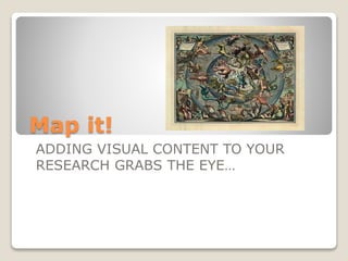
  • 1. Map it! ADDING VISUAL CONTENT TO YOUR RESEARCH GRABS THE EYE…
  • 2. Basic introduction to maps  Whether it be a chart of outer space or a plan of a university campus, maps play an essential role in our everyday lives (NRCan)  For general information about mapping see the introductory guide from the Atlas of Canada
  • 3. Why do I want to use maps?  Many topics have a spatial (place) or temporal (time) aspect that can be clearly shown with a map  Maps can make a visual point quickly  When doing research for subjects like history, biology, architecture, international politics and, of course, geography or environmental studies you may need to look at a map to understand the material you are studying  Topographic maps show features of the earth’s surface  Thematic maps show particular topics like geology, political boundaries or history to explain the context of spatial data
  • 4. Maps at Carleton  The Carleton library has a wonderful collection of sheet maps and atlases covering the entire world (and outer space)  These are located in the Maps, Data and Government Information Centre (MADGIC) located on floor 2 of the MacOdrum Library  Library Map Specialists can assist your research in many ways  As well, maps are widely available on the Internet and map images can be imported into your papers
  • 5. Start from the Library’s home page
  • 6. What’s on the Maps home page?
  • 7. Use the Custom Google Search Engine to find Online Maps
  • 8. Can I make a map?  There is special ESRI ArcGIS software that lets you create a map from spatial data but you do have to know how to use this software...  The library has an extensive collection of data and air photos for use with this software as well as access to Google Earth Pro and Statistics Canada mapping in the E- Stat database  If you want to know more, visit the GIS web pages
  • 9. How can I find out what maps and atlases the library has?  All atlases are listed in the library’s online catalogue but…  Not all of our sheet maps are listed in the catalogue yet – mainly maps received from 2001 onwards and selected historical maps have been catalogued  If you are having trouble finding a map be sure to ask for help at the MADGIC information desk
  • 10. So now that I’ve found my map, how do I cite it for my paper?
  • 11. HELP!! I still can’t find what I need… Remember that the staff in MADGIC is there to help you. Come in for a visit, phone, or contact them online
  • 12. Maps enrich our knowledge of the world  Thanks for your attention today  Please be sure to visit MADGIC to learn more about how you can use maps to enhance your general knowledge and your research

Notas del editor

  1. Welcome to this introductory session on how to locate maps that can enrich your research papers and your knowledge of the world This session will take about 20 minutes and there will be time for questions and practice at the end
  2. Fade in each statement with a click Point out the list of topics covered by the National Atlas in the left hand navigation bar Click on ‘climate change’ and show the range of topics covered under this heading Reminder that the National Atlas can be found through the library catalogue and the online maps quick starts
  3. Fade in each statement Click on ‘topographic’ and show the explanatory guide on the maps home page Click on ‘thematic maps’ to see a definition and a list of census maps as an example of thematic mapping Click on Ottawa-Hull under Census Metropolitan areas and then on ‘visible minorities’ – enlarge map for viewing using the + symbol at the top Point out the print and save options for this map
  4. Click on ‘floor 2’ and point out the location of MPL (the location code used in the catalogue for sheet maps) and MPA and MPF the location codes for printed atlases
  5. Point out the link to the Maps home page in the left hand column – click on it and advance to the next slide
  6. Point out the information in each sector of the page and finish by clicking on ‘online maps’ to advance to the next slide
  7. Click on the ‘online maps’ link to get to a live page Point out the quick starts section with links to some very good basic places to get maps Click on Perry Castaneda link and show the list of countries and historical maps and the link under Canada to the Carleton online search engine (under maps of Canada on other websites) Use the Google search box and do a search for ‘arctic’ ‘ice’ and ‘canada’
  8. Fly in each statement slowly by clicking Emphasize that GIS mapping requires some expertise which can be obtained either by taking a course at Carleton or registering for an online introductory course (see the GIS pages for more information) Click on GIS web pages link and point out the list of data and the Virtual Campus information Click on library home page and point to the GIS link on that page
  9. Click on ‘catalogued’ and search by keyword for “arctic ice” as a phrase and ‘canada’ using the location filter for maps and atlases Repeat this keyword search with just single words: arctic, ice, and canada and see how many more hits you get with a less specific search Look at “Annual arctic ice atlas” from the list and point out the call number and location codes (click on MPA to show floor plan where atlases are found), and the subject headings with –Maps. Click on the ‘online text’ link to show that this map is also online.