GLCC-DEP Presentation to Derwood Community, Waste Delineation & Nature and Extent Study (9-24-09)
•
0 recomendaciones•1,930 vistas


Recomendados
Recomendados
Más contenido relacionado
La actualidad más candente
La actualidad más candente (19)
Similar a GLCC-DEP Presentation to Derwood Community, Waste Delineation & Nature and Extent Study (9-24-09)
Similar a GLCC-DEP Presentation to Derwood Community, Waste Delineation & Nature and Extent Study (9-24-09) (20)
Más de Recycling and Resource Management Division
Más de Recycling and Resource Management Division (15)
GLCC-DEP Presentation to Derwood Community, Waste Delineation & Nature and Extent Study (9-24-09)
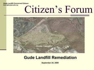
- 1. Citizen’s Forum Gude Landfill Remediation September 24, 2009 Gude Landfill Concerned Citizens GLCC@hollybrooke.org
- 2. Keith Ligon, GLCC Gude Landfill Concerned Citizens GLCC@hollybrooke.org
- 3. Who is Here Tonight Homeowner’s Associations Dave Peterson, President HOA#1 Laszlo Harsanyi, President HOA #2 Nick Radonic, President HOA #3 Montgomery County Peter Karasik, Chief of Operations, DEP Steve Lezinski, Operations Manager Gude Landfill, DEP David Lake, Manager, Water & Wastewater Policy Group, DEP Ask questions at any time Gude Landfill Concerned Citizens (GLCC) Keith Ligon Julia Tillery Bob Day Dean Dozier Gude Landfill Concerned Citizens GLCC@hollybrooke.org Engineering, Science & Technology John Kumm, P.E., Mark Gutberlet, P.E. Barbara Roeper, P.E.
- 4. Agenda Introductions and GLCC/DEP Relationship Keith Ligon, GLCC County Responsibilities and Landfill History Peter Karasik, DEP Landfill Operations and Remediation Approach Steve Lezinski, DEP DEP Groundwater & Surface Water Monitoring David Lake, DEP Community Concerns and State of Maryland Dean Dozier, GLCC Site Characterization, Risks and Remediation Action John Kumm, EA Reuse Possibilities Bob Day, GLCC Closing Bob Day, GLCC Gude Landfill Concerned Citizens GLCC@hollybrooke.org
- 5. County data indicates that contaminated groundwater may be moving off site Our concern is the health and safety of Derwood residents Gude Landfill (GLF) is a large tract of centrally located land that will continue to attract ideas about its reuse We oppose any use of the landfill prior to the completion of the remediation GLCC Objectives Our objective is a County funded program that will position the Gude Landfill as a good Derwood neighbor for the foreseeable future Gude Landfill Concerned Citizens GLCC@hollybrooke.org
- 6. GLCC/DEP Meetings Joint monthly meetings between GLCC and DEP started June 2009, held second Thursday at 7:30 pm We are aligning our interests and objectives We are seeking a win-win in our efforts The meetings are open, candid, and business like Minutes are posted on the County Remediation website DEP has been open and transparent with data sharing Posting all Gude Landfill Remediation data on County Website Access to engineering firm for questions/discussions Responsive and accessible to our requests Science will tell us if there are risks to worry about Gude Landfill Concerned Citizens GLCC@hollybrooke.org
- 9. DEP Responsibilities Maintenance of Closed Landfill Infrastructure Water Quality and Gas Monitoring Evaluate and Assess Existing Conditions at the Landfill with respect to Contamination and Health Risks Maintain compliance with Maryland Dept. of the Environmental Regulations Maintain Open and Transparent Relationship with GLCC and Community
- 10. Gude Landfill Site Overview Located at 600 East Gude Drive, Rockville, Maryland Landfill operated from 1964 –1982 Approximately 4.8 million tons of waste Sized at 90 – 100 acres Predated all modern landfill design regulations Resource Conservation and Recovery Act (RCRA) No clay or synthetic base liner or final capping system
- 11. Gude Landfill Final Cover System – Well Vegetated
- 12. Gude Landfill Maintenance - Stormwater Ponding
- 13. Gude Landfill Maintenance - Leachate Seeps
- 14. Gude Landfill Maintenance - Leachate Seep Repairs
- 15. Gude Landfill Summary - Landfill Gas Management Landfill gas is produced as part of waste decomposition Consists primarily of methane (CH4) and carbon dioxide (CO2) Controlled via an active collection system (installed 1985) and burned at the Enclosed Flare Station (installed 2005) 40 to 50 vertical extraction wells with horizontal above ground piping scattered around the site 33 vertical gas extraction wells on the northwestern slope property boundary to control migration Former landfill gas to energy power plant beneficially used landfill gas to generate electricity 1985 – 2006 (1.5 – 2.7 MW) New Landfill Gas-to-Energy Facility Operational June 2009 (0.8 MW)
- 16. Gude Landfill Landfill Gas Collection System
- 18. Gude Landfill
- 19. Gude Landfill Current Operations and Activities What’s Been Happing at the Gude Landfill Post- Closure Care Cover System, Stormwater, Leachate Seep Mngt. Gas and Groundwater and Surface Water Monitoring Landfill Gas-to-Energy Facility Operational Maryland Department of the Environment (MDE) and Remediation Site Inspections and Corrective Actions Approved Site Monitoring and Remediation Plans
- 20. Gude Landfill MDE and Remediation Maryland Dept. of the Environment Inspections & Approvals Site Inspections for Leachate Seeps, Stormwater Ponding, etc. Landfill Gas Monitoring Plan (4/22/09) Groundwater and Surface Water Monitoring Plan (5/11/09) Remediation Approach (5/27/09) Elements of the Remediation Northeast Maryland Waste Disposal Authority: IGA EA Engineering, Science and Technology: Consultant via IGA Phase 0: Aerial/Field Survey and Waste Delineation, initiated (5/15/09) Phase 1: Nature and Extent Study scope of work is finalized (9/10/09) Continued Working Relationship with Community Gude Landfill Concerned Citizens Meetings Held Monthly
- 21. Gude Landfill MDE and Remediation Phase 0: Aerial/Field Survey and Waste Delineation Aerial Mapping – Flyover complete and County provided comments on Draft Aerial Survey Field Survey – Existing Site Features (monitoring wells, structures, pipes, etc.) continue to be captured to create a real-time Site Plan Waste Delineation – test pitting and hard auguring along property boundary nearly complete to located the limit of waste. M-NCPPC preliminary approval granted to test pit on park land to locate limit of waste beyond the Landfill property. Phase 1: Nature and Extent Study Scope of Work Finalized Assess contamination and human exposure pathways Review of DEP Groundwater and Surface Water Data Review of Stormwater Management Facilities Future Phases of Work Remediation Alternatives and Reuse Investigation, Design, Construction, Site Reuse
- 22. David Lake, DEP Gude Landfill Concerned Citizens GLCC@hollybrooke.org
- 23. Gude Landfill Water Quality Monitoring Program Montgomery County DEP has operated a water quality monitoring program since 1984 Automated records exist from 2001 to present
- 24. Groundwater Monitoring Specifics DEP now monitors 20 groundwater wells Located on landfill perimeter Permitted by State Samples taken spring and fall Parameters Volatile organic compounds (VOCs) Semi-volatile compounds (SVOCs) Pesticides Heavy metals Miscellaneous (including pH, turbidity, conductivity.)
- 25. Gude Landfill and Monitoring Sites
- 26. Groundwater Monitoring Results Maximum Contaminant Level (MCL) – EPA Regulatory Standard for Drinking Water Quality No Drinking Water Wells Adjacent to Gude Landfill 52,000 data points since 2001 < 1% (500+) exceed MCL established for drinking water 70% of samples exceeding MCLs were from wells OB03 and OB11 (see map)
- 27. Sites Exceeding MCLs FrequencyDistribution of Locations Exceeding MCLs Gude Landfill - April 2001 Through March 2008 97 95 72 68 31 22 15 14 13 6 6 5 5 4 2 2 2 2 1 1 1 1 0 20 40 60 80 100 120 OB03 OB11 OB10 OB02A OB08A OB15 OB025 OB02 OB07 OB105 ST065 Monitoring Location Frequency
- 28. Surface Water (stream) Monitoring 5 Surface water locations sampled (most outside landfill - see map) Sampling is on Crabbs Branch and Southlawn Branch of Rock Creek 6800 data points since 2001 Total of 7 data points (0.1%) have exceeded the MCL for all parameters; of these 5 were for organic compounds
- 29. Water Quality Monitoring Conclusions All residential houses, businesses and other occupied structures are on the public water system (no potable water wells) Human exposure to any detected pollutants has been negligible based on information to date No toxic concentrations Stream sampling shows no indication of aquatic impacts
- 30. Industrial Area Around Gude Landfill Many industrial and commercial activities Ready-mix concrete plants, asphalt plant, salvage yard, automotive repair shops, and impervious surfaces DEP and MDE have received complaints and actively pursued enforcement cases for many years in this area Sediment and pH (recorded at pH 12) are constant problems Stream water quality and habitat are “poor” in Southlawn Branch and its tributaries
- 31. Dean Dozier, GLCC Gude Landfill Concerned Citizens GLCC@hollybrooke.org
- 32. State Of Maryland Gude Landfill Concerned Citizens GLCC@hollybrooke.org
- 33. Groundwater Contamination • Well OB-3/3A closest to Derwood houses • OB-3 had 97 above EPA Drinking Water limits • OB-3A had 68 above EPA Drinking Water Limits • Observed chemicals are contaminants in EPA’s Clean Water Act and on Hazardous Waste List Trichloroethane Dichloroethane Vinyl Chloride Benzene Tetrachloroethene Chlorobenzene Toluene Dichloropropane Cyanide Mercury Lead Chromium Arsenic Chemicals Found in Samples OB3/3A Frequency Distribution of Locations Exceeding MCLs Gude Landfill - April 2001 Through March 2008 97 95 72 68 31 22 15 14 13 6 6 0 20 40 60 80 100 120 OB03 OB11A OB11 OB03A OB10 OB12 OB02A OB01 OB08A OB08 OB15 Monitoring Location Frequency(#) DEP Data DEP Data Gude Landfill Concerned Citizens GLCC@hollybrooke.org
- 34. Phase 0. Aerial Survey Field Survey Waste Delineation I. Nature and Extent II Remediation Alternatives III Prepare Bid Docs for Alternatives IV Remediation Phase I V Remediation Phase II (future) Remediation Approach Q3 Q4 Q1 Q2 Q3 Q4 Q1 Q2 Q3 Q4 Q1 Q2 Q3 Q4 2010 2011 2012 Apr Sep Oct Dec Jan Jul Aug-Sep Oct-Nov Gude Landfill Concerned Citizens GLCC@hollybrooke.org Oct Mar Dec 2009
- 35. John Kumm, EA
- 36. Maximum Contaminant Level (MCL) – EPA Regulatory Standard for Drinking Water Quality Site Characterization, Risk and Remediation Presented by: Barb Roeper, P.E., PMP EA Engineering, Science, and Technology, Inc. ®
- 38. Historical Search Review deed history Review historical records Review old aerial photographs Review old tax and fire insurance maps Interview current and former employees Compile historical sampling data, if available
- 39. Site Walk Locate surface hazards Look for evidence of impacted areas Understand site conditions
- 40. Site Investigation Planning Data gap identification Sample type, location, and depth Data types and objectives Health and safety requirements
- 41. Soil Sampling Test pits Soil borings Surface Soil Sediment
- 42. Install Monitoring Wells • Determine stratigraphy • Determine direction and velocity of groundwater flow • Collect soil samples
- 43. Groundwater Sampling Collect general groundwater parameters Collect samples for chemical analyses Determine groundwater levels and the presence of other non-aqueous fluids
- 44. Surface Water Sampling Collect water quality parameters Collect samples for chemical analyses
- 45. Surveying Locations Elevations Reference to established datum
- 46. Lake WATER TABLE at -17 ft MSL GROUNDWATER FLOW DIRECTION MW-4 MW-3 B-1 B-4 MW-2MW-1 B-5 MW-5 0 ft MSL -10 ft MSL -20 ft MSL Elevation Home Drinking Well Conceptual Model
- 47. Risk Evaluation
- 48. Risk Evaluation RISK CHARACTERIZATION How much risk? TOXICITY ASSESSMENT How harmful is it? Carcinogenic or non-carcinogenic? EXPOSURE ASSESSMENT Is anyone exposed? How often? How long? How much? HAZARD ASSESSMENT What was detected? What are the reported concentrations?
- 49. Risk Evaluation The following must occur to have a complete exposure pathway: chemical release route of exposure potential receptor (current and/or future) Incomplete exposure pathways do not result in exposure and are not included in the risk evaluation
- 50. Remediation and Restoration Investigation and Site Assessment Develop remedial action objectives based on nature and extent of impacts, potential risk, and proposed reuse Identify feasible alternatives, ranging from no action to full- scale remediation Design Implementation Operation & Maintenance)
- 51. Bob Day, GLCC Gude Landfill Concerned Citizens GLCC@hollybrooke.org
- 52. Reuse of Gude Landfill 1983 M-NCPPC Plan In 1983 the County was planning a park on the Gude Landfill - athletic fields, picnic areas, golf driving range, amphitheater,… Gude Landfill Concerned Citizens GLCC@hollybrooke.org
- 53. Reuse of Gude Landfill Settling Waste None Heavy Construction Remediation Efforts Simple Complex Not Expensive Very Expensive Months Years Reuse Categories Gude Landfill Concerned Citizens GLCC@hollybrooke.org
- 54. Reuse of Gude Landfill Walking Paths Baseball Fields Tree Farm Soccer Fields Toddler Playground Xtry Bike Paths Running Trails Solar Farm Archery Range Model Acft Kids Play Area Community Center Picnic Area Tennis Courts Community Vegetable Gardens “Water Park” Help us fill this in Send your ideas: GLCC@Hollybrooke.org Dog Park Gude Landfill Concerned Citizens GLCC@hollybrooke.org
- 55. Closing We need your ideas for re-use Your ideas are important, and your opinion counts Tell us what you would like on the Gude Landfill Contact any one of us – at any time Remediation will not be a quick process, so be patient We can make the Landfill into a good neighbor And limited reuse may be possible Gude Landfill Concerned Citizens GLCC@hollybrooke.org Gude Landfill Concerned Citizens GLCC@hollybrooke.org