SlideShare una empresa de Scribd logo
1 de 32
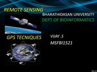
REMOTE SENSING
GPS TECNIQUES VIJAY .S
MSFBI1521
BHARATHIDASAN UNIVERSITY
DEPT OF BIOINFORMATICS
Global Positioning System
HISTORY
In 1956 the American physicalist
Friedwardt winterberg proposed a test of
general relativity which was used in the
design of GPS.
The US began the project of GPS in 1973
to overcome the limitations of previous
navigation system.
In 1978 the first experimental BLOCK-1
GPS satellite was launched.
What is GPS ?
A very precise positioning system
• Developed and maintained by the US
Department of Defense (DOD)
• Satellite Based
* 24 satellites
* 20,200 km high orbit
BUT!
Although it is a very precise
geographic positioning system
•It is very easy to get youself into trouble
•Why?
•Because you (probably) don’t understand
how it works
•And that leads to garbage
Characteristics of GPS
• Free
• Precise
• Reliable
• Anytime & anywhere
• All weather
• Unlimited user capacity
How GPS Works ………
Uses measurements from 4+ satellites
Distance = travel time x speed of light
GPS Receivers
Methods of data collection
Three methods of positioning
• Autonomous
10-20 meters
• Differential
2-5 meters
• Phase Differential
centimeter
2-5m10-20 m
cm
How accurate is GPS?
Depends on some variables
• Design of receiver
• Relative positions of satellites, often
known as DOP (Dilution of Precision)
• Postprocessing
• Time spent on measurement
REMOTE SIENSING
What is remote sensing used for?
Remote sensing is a method for getting information
about of different objects on the planet, without any
physical contacts with it.
Image Source: cimss.ssec.wisc.edu
Elements of Remote Sensing
Source:staff.aub.edu.lb
Satellite pictures
Satellite imagery consists of
photographs from which
collected by satellites.
Image Source: www.wonderwhizkids.com
Image Source: www.loneotaku.net
Japan Satellite View
Satellites offer a Global View
What does satellite image give you?
-Information on land cover, land use, habitats and
infrastructure
-multiple engagements by time series
-Mapping and monitoring changes and predict future
Application of Remote Sensing
Urbanization & Transportation
• Urban planning
• Roads network and transportation
planning
• City expansion
• City boundaries by time
• Wetland delineation
Image source: www.ldeo.columbia.edu
Image source: www.geospectra.net
Satellite image of deforestation
 Wageningen UR 2002
Types of Satellites
Geostationary
Satellites
A geostationary satellite is one
of the satellites which is getting
remote sense data and
located satellite at an altitude of
approximately 36000 kilometres
and directly over the equator.
Image Source: cimss.ssec.wisc.edu
Polar-Orbiting
Satellites
A polar orbit is a satellite
which is located near to
above of poles. This
satellite mostly uses for
earth observation by time.
Types of Satellites
Image Source: globalmicrowave.org
Some Image Processing Software
• ERDAS Imagine
• ENVI
• ILWIS
• ArcGIS
31
Remote sensing and gps

Más contenido relacionado

La actualidad más candente

Remote Sensing - Fundamentals
Remote Sensing - FundamentalsRemote Sensing - Fundamentals
Remote Sensing - FundamentalsAjay Singh Lodhi
 
hyperspectral remote sensing and its geological applications
hyperspectral remote sensing and its geological applicationshyperspectral remote sensing and its geological applications
hyperspectral remote sensing and its geological applicationsabhijeet_banerjee
 
Intro of Differential GPS.pptx
Intro of Differential GPS.pptxIntro of Differential GPS.pptx
Intro of Differential GPS.pptxmaniatindia
 
Radar remote sensing, P K MANI
Radar remote sensing, P K MANIRadar remote sensing, P K MANI
Radar remote sensing, P K MANIP.K. Mani
 
Fundamentals of Remote Sensing
Fundamentals of Remote SensingFundamentals of Remote Sensing
Fundamentals of Remote SensingShah Naseer
 
Aerial photography.pptx
Aerial photography.pptxAerial photography.pptx
Aerial photography.pptxPramoda Raj
 
Emr intraction with atmosphere
Emr intraction with atmosphereEmr intraction with atmosphere
Emr intraction with atmosphereRahat Hasan
 
Remote Sensing Platforms and Its types
Remote Sensing Platforms and Its typesRemote Sensing Platforms and Its types
Remote Sensing Platforms and Its typesSenthamizhan M
 
Remote Sensing Platforms and Sensors
Remote Sensing Platforms and SensorsRemote Sensing Platforms and Sensors
Remote Sensing Platforms and SensorsUday kumar Devalla
 
Global Positioning System
Global Positioning System Global Positioning System
Global Positioning System Himanshu Agrawal
 
Sensors for remote sensing
Sensors for remote sensingSensors for remote sensing
Sensors for remote sensingMohsin Siddique
 
Photogrammatic survey
Photogrammatic surveyPhotogrammatic survey
Photogrammatic surveyRonakModi34
 
GIS Plateform and satellite
GIS Plateform and satelliteGIS Plateform and satellite
GIS Plateform and satelliteMohsin Siddique
 
Introduction to Landsat
Introduction to LandsatIntroduction to Landsat
Introduction to LandsatNizam GIS
 

La actualidad más candente (20)

Remote Sensing - Fundamentals
Remote Sensing - FundamentalsRemote Sensing - Fundamentals
Remote Sensing - Fundamentals
 
Global Positioning system (Gps)
Global Positioning system (Gps)Global Positioning system (Gps)
Global Positioning system (Gps)
 
hyperspectral remote sensing and its geological applications
hyperspectral remote sensing and its geological applicationshyperspectral remote sensing and its geological applications
hyperspectral remote sensing and its geological applications
 
Geodesy
GeodesyGeodesy
Geodesy
 
Photogrammetry 1.
Photogrammetry 1.Photogrammetry 1.
Photogrammetry 1.
 
Intro of Differential GPS.pptx
Intro of Differential GPS.pptxIntro of Differential GPS.pptx
Intro of Differential GPS.pptx
 
Radar remote sensing, P K MANI
Radar remote sensing, P K MANIRadar remote sensing, P K MANI
Radar remote sensing, P K MANI
 
Fundamentals of Remote Sensing
Fundamentals of Remote SensingFundamentals of Remote Sensing
Fundamentals of Remote Sensing
 
Aerial photography.pptx
Aerial photography.pptxAerial photography.pptx
Aerial photography.pptx
 
Emr intraction with atmosphere
Emr intraction with atmosphereEmr intraction with atmosphere
Emr intraction with atmosphere
 
Remote Sensing Platforms and Its types
Remote Sensing Platforms and Its typesRemote Sensing Platforms and Its types
Remote Sensing Platforms and Its types
 
Remote Sensing Platforms and Sensors
Remote Sensing Platforms and SensorsRemote Sensing Platforms and Sensors
Remote Sensing Platforms and Sensors
 
Remote sensing
Remote sensingRemote sensing
Remote sensing
 
Dgps
DgpsDgps
Dgps
 
Global Positioning System
Global Positioning System Global Positioning System
Global Positioning System
 
Optical remote sensing
Optical remote sensingOptical remote sensing
Optical remote sensing
 
Sensors for remote sensing
Sensors for remote sensingSensors for remote sensing
Sensors for remote sensing
 
Photogrammatic survey
Photogrammatic surveyPhotogrammatic survey
Photogrammatic survey
 
GIS Plateform and satellite
GIS Plateform and satelliteGIS Plateform and satellite
GIS Plateform and satellite
 
Introduction to Landsat
Introduction to LandsatIntroduction to Landsat
Introduction to Landsat
 

Similar a Remote sensing and gps

Remote Sensing PPT
Remote Sensing PPTRemote Sensing PPT
Remote Sensing PPTAmal Murali
 
Presentation A.K Nigam sir (2) (1).pptx
Presentation A.K Nigam sir (2)  (1).pptxPresentation A.K Nigam sir (2)  (1).pptx
Presentation A.K Nigam sir (2) (1).pptxspeedcomcyber25
 
Global Positioning System (GPS)
Global Positioning System (GPS) Global Positioning System (GPS)
Global Positioning System (GPS) ManjuChauhan16
 
Advances in Agricultural remote sensings
Advances in Agricultural remote sensingsAdvances in Agricultural remote sensings
Advances in Agricultural remote sensingsAyanDas644783
 
Remote sensing and its applications, DIP, GIS, GPS
Remote sensing and its applications, DIP, GIS, GPSRemote sensing and its applications, DIP, GIS, GPS
Remote sensing and its applications, DIP, GIS, GPSUniversity of Jammu
 
Global positioning system (gps)
Global positioning system (gps)Global positioning system (gps)
Global positioning system (gps)Gokul Saud
 
Chapter 1 (Introduction to remote sensing)
Chapter 1 (Introduction to remote sensing)Chapter 1 (Introduction to remote sensing)
Chapter 1 (Introduction to remote sensing)Shankar Gangaju
 
Global positioning system
Global positioning systemGlobal positioning system
Global positioning systemdivyapunna
 
Global Positioning system GPS - Dr. S. Balamurugan
Global Positioning system GPS - Dr. S. BalamuruganGlobal Positioning system GPS - Dr. S. Balamurugan
Global Positioning system GPS - Dr. S. BalamuruganPrakash Kumar Sekar
 
GPSS ,DEFENITION,TYPE,WORKING,PRINCIPLES
GPSS ,DEFENITION,TYPE,WORKING,PRINCIPLESGPSS ,DEFENITION,TYPE,WORKING,PRINCIPLES
GPSS ,DEFENITION,TYPE,WORKING,PRINCIPLESSALIAALIAS
 
Global positioning system
Global positioning systemGlobal positioning system
Global positioning systemDivya Lattoo
 

Similar a Remote sensing and gps (20)

Rs
RsRs
Rs
 
2014_Remote Sensing.pptx
2014_Remote Sensing.pptx2014_Remote Sensing.pptx
2014_Remote Sensing.pptx
 
Remote Sensing PPT
Remote Sensing PPTRemote Sensing PPT
Remote Sensing PPT
 
Remot sensing
Remot sensingRemot sensing
Remot sensing
 
Remote Sensing
Remote SensingRemote Sensing
Remote Sensing
 
Presentation A.K Nigam sir (2) (1).pptx
Presentation A.K Nigam sir (2)  (1).pptxPresentation A.K Nigam sir (2)  (1).pptx
Presentation A.K Nigam sir (2) (1).pptx
 
Concept of remote sensing
Concept of remote sensingConcept of remote sensing
Concept of remote sensing
 
Global Positioning System (GPS)
Global Positioning System (GPS) Global Positioning System (GPS)
Global Positioning System (GPS)
 
Advances in Agricultural remote sensings
Advances in Agricultural remote sensingsAdvances in Agricultural remote sensings
Advances in Agricultural remote sensings
 
Remote sensing and its applications, DIP, GIS, GPS
Remote sensing and its applications, DIP, GIS, GPSRemote sensing and its applications, DIP, GIS, GPS
Remote sensing and its applications, DIP, GIS, GPS
 
Global positioning system (gps)
Global positioning system (gps)Global positioning system (gps)
Global positioning system (gps)
 
Chapter 1 (Introduction to remote sensing)
Chapter 1 (Introduction to remote sensing)Chapter 1 (Introduction to remote sensing)
Chapter 1 (Introduction to remote sensing)
 
Gps and its application
Gps and its applicationGps and its application
Gps and its application
 
Global positioning system
Global positioning systemGlobal positioning system
Global positioning system
 
Global Positioning system GPS - Dr. S. Balamurugan
Global Positioning system GPS - Dr. S. BalamuruganGlobal Positioning system GPS - Dr. S. Balamurugan
Global Positioning system GPS - Dr. S. Balamurugan
 
GIS FINAL REPORT.pdf
GIS FINAL REPORT.pdfGIS FINAL REPORT.pdf
GIS FINAL REPORT.pdf
 
Seminar
SeminarSeminar
Seminar
 
Global positioning system
Global positioning systemGlobal positioning system
Global positioning system
 
GPSS ,DEFENITION,TYPE,WORKING,PRINCIPLES
GPSS ,DEFENITION,TYPE,WORKING,PRINCIPLESGPSS ,DEFENITION,TYPE,WORKING,PRINCIPLES
GPSS ,DEFENITION,TYPE,WORKING,PRINCIPLES
 
Global positioning system
Global positioning systemGlobal positioning system
Global positioning system
 

Último

Blowin' in the Wind of Caste_ Bob Dylan's Song as a Catalyst for Social Justi...
Blowin' in the Wind of Caste_ Bob Dylan's Song as a Catalyst for Social Justi...Blowin' in the Wind of Caste_ Bob Dylan's Song as a Catalyst for Social Justi...
Blowin' in the Wind of Caste_ Bob Dylan's Song as a Catalyst for Social Justi...DhatriParmar
 
Grade Three -ELLNA-REVIEWER-ENGLISH.pptx
Grade Three -ELLNA-REVIEWER-ENGLISH.pptxGrade Three -ELLNA-REVIEWER-ENGLISH.pptx
Grade Three -ELLNA-REVIEWER-ENGLISH.pptxkarenfajardo43
 
Student Profile Sample - We help schools to connect the data they have, with ...
Student Profile Sample - We help schools to connect the data they have, with ...Student Profile Sample - We help schools to connect the data they have, with ...
Student Profile Sample - We help schools to connect the data they have, with ...Seán Kennedy
 
Daily Lesson Plan in Mathematics Quarter 4
Daily Lesson Plan in Mathematics Quarter 4Daily Lesson Plan in Mathematics Quarter 4
Daily Lesson Plan in Mathematics Quarter 4JOYLYNSAMANIEGO
 
Q4-PPT-Music9_Lesson-1-Romantic-Opera.pptx
Q4-PPT-Music9_Lesson-1-Romantic-Opera.pptxQ4-PPT-Music9_Lesson-1-Romantic-Opera.pptx
Q4-PPT-Music9_Lesson-1-Romantic-Opera.pptxlancelewisportillo
 
31 ĐỀ THI THỬ VÀO LỚP 10 - TIẾNG ANH - FORM MỚI 2025 - 40 CÂU HỎI - BÙI VĂN V...
31 ĐỀ THI THỬ VÀO LỚP 10 - TIẾNG ANH - FORM MỚI 2025 - 40 CÂU HỎI - BÙI VĂN V...31 ĐỀ THI THỬ VÀO LỚP 10 - TIẾNG ANH - FORM MỚI 2025 - 40 CÂU HỎI - BÙI VĂN V...
31 ĐỀ THI THỬ VÀO LỚP 10 - TIẾNG ANH - FORM MỚI 2025 - 40 CÂU HỎI - BÙI VĂN V...Nguyen Thanh Tu Collection
 
Q-Factor HISPOL Quiz-6th April 2024, Quiz Club NITW
Q-Factor HISPOL Quiz-6th April 2024, Quiz Club NITWQ-Factor HISPOL Quiz-6th April 2024, Quiz Club NITW
Q-Factor HISPOL Quiz-6th April 2024, Quiz Club NITWQuiz Club NITW
 
Grade 9 Quarter 4 Dll Grade 9 Quarter 4 DLL.pdf
Grade 9 Quarter 4 Dll Grade 9 Quarter 4 DLL.pdfGrade 9 Quarter 4 Dll Grade 9 Quarter 4 DLL.pdf
Grade 9 Quarter 4 Dll Grade 9 Quarter 4 DLL.pdfJemuel Francisco
 
Unraveling Hypertext_ Analyzing Postmodern Elements in Literature.pptx
Unraveling Hypertext_ Analyzing  Postmodern Elements in  Literature.pptxUnraveling Hypertext_ Analyzing  Postmodern Elements in  Literature.pptx
Unraveling Hypertext_ Analyzing Postmodern Elements in Literature.pptxDhatriParmar
 
ClimART Action | eTwinning Project
ClimART Action    |    eTwinning ProjectClimART Action    |    eTwinning Project
ClimART Action | eTwinning Projectjordimapav
 
Decoding the Tweet _ Practical Criticism in the Age of Hashtag.pptx
Decoding the Tweet _ Practical Criticism in the Age of Hashtag.pptxDecoding the Tweet _ Practical Criticism in the Age of Hashtag.pptx
Decoding the Tweet _ Practical Criticism in the Age of Hashtag.pptxDhatriParmar
 
week 1 cookery 8 fourth - quarter .pptx
week 1 cookery 8  fourth  -  quarter .pptxweek 1 cookery 8  fourth  -  quarter .pptx
week 1 cookery 8 fourth - quarter .pptxJonalynLegaspi2
 
DIFFERENT BASKETRY IN THE PHILIPPINES PPT.pptx
DIFFERENT BASKETRY IN THE PHILIPPINES PPT.pptxDIFFERENT BASKETRY IN THE PHILIPPINES PPT.pptx
DIFFERENT BASKETRY IN THE PHILIPPINES PPT.pptxMichelleTuguinay1
 
Multi Domain Alias In the Odoo 17 ERP Module
Multi Domain Alias In the Odoo 17 ERP ModuleMulti Domain Alias In the Odoo 17 ERP Module
Multi Domain Alias In the Odoo 17 ERP ModuleCeline George
 
Reading and Writing Skills 11 quarter 4 melc 1
Reading and Writing Skills 11 quarter 4 melc 1Reading and Writing Skills 11 quarter 4 melc 1
Reading and Writing Skills 11 quarter 4 melc 1GloryAnnCastre1
 
ICS2208 Lecture6 Notes for SL spaces.pdf
ICS2208 Lecture6 Notes for SL spaces.pdfICS2208 Lecture6 Notes for SL spaces.pdf
ICS2208 Lecture6 Notes for SL spaces.pdfVanessa Camilleri
 
Measures of Position DECILES for ungrouped data
Measures of Position DECILES for ungrouped dataMeasures of Position DECILES for ungrouped data
Measures of Position DECILES for ungrouped dataBabyAnnMotar
 

Último (20)

Blowin' in the Wind of Caste_ Bob Dylan's Song as a Catalyst for Social Justi...
Blowin' in the Wind of Caste_ Bob Dylan's Song as a Catalyst for Social Justi...Blowin' in the Wind of Caste_ Bob Dylan's Song as a Catalyst for Social Justi...
Blowin' in the Wind of Caste_ Bob Dylan's Song as a Catalyst for Social Justi...
 
Grade Three -ELLNA-REVIEWER-ENGLISH.pptx
Grade Three -ELLNA-REVIEWER-ENGLISH.pptxGrade Three -ELLNA-REVIEWER-ENGLISH.pptx
Grade Three -ELLNA-REVIEWER-ENGLISH.pptx
 
Student Profile Sample - We help schools to connect the data they have, with ...
Student Profile Sample - We help schools to connect the data they have, with ...Student Profile Sample - We help schools to connect the data they have, with ...
Student Profile Sample - We help schools to connect the data they have, with ...
 
Daily Lesson Plan in Mathematics Quarter 4
Daily Lesson Plan in Mathematics Quarter 4Daily Lesson Plan in Mathematics Quarter 4
Daily Lesson Plan in Mathematics Quarter 4
 
INCLUSIVE EDUCATION PRACTICES FOR TEACHERS AND TRAINERS.pptx
INCLUSIVE EDUCATION PRACTICES FOR TEACHERS AND TRAINERS.pptxINCLUSIVE EDUCATION PRACTICES FOR TEACHERS AND TRAINERS.pptx
INCLUSIVE EDUCATION PRACTICES FOR TEACHERS AND TRAINERS.pptx
 
Faculty Profile prashantha K EEE dept Sri Sairam college of Engineering
Faculty Profile prashantha K EEE dept Sri Sairam college of EngineeringFaculty Profile prashantha K EEE dept Sri Sairam college of Engineering
Faculty Profile prashantha K EEE dept Sri Sairam college of Engineering
 
Q4-PPT-Music9_Lesson-1-Romantic-Opera.pptx
Q4-PPT-Music9_Lesson-1-Romantic-Opera.pptxQ4-PPT-Music9_Lesson-1-Romantic-Opera.pptx
Q4-PPT-Music9_Lesson-1-Romantic-Opera.pptx
 
31 ĐỀ THI THỬ VÀO LỚP 10 - TIẾNG ANH - FORM MỚI 2025 - 40 CÂU HỎI - BÙI VĂN V...
31 ĐỀ THI THỬ VÀO LỚP 10 - TIẾNG ANH - FORM MỚI 2025 - 40 CÂU HỎI - BÙI VĂN V...31 ĐỀ THI THỬ VÀO LỚP 10 - TIẾNG ANH - FORM MỚI 2025 - 40 CÂU HỎI - BÙI VĂN V...
31 ĐỀ THI THỬ VÀO LỚP 10 - TIẾNG ANH - FORM MỚI 2025 - 40 CÂU HỎI - BÙI VĂN V...
 
Q-Factor HISPOL Quiz-6th April 2024, Quiz Club NITW
Q-Factor HISPOL Quiz-6th April 2024, Quiz Club NITWQ-Factor HISPOL Quiz-6th April 2024, Quiz Club NITW
Q-Factor HISPOL Quiz-6th April 2024, Quiz Club NITW
 
Grade 9 Quarter 4 Dll Grade 9 Quarter 4 DLL.pdf
Grade 9 Quarter 4 Dll Grade 9 Quarter 4 DLL.pdfGrade 9 Quarter 4 Dll Grade 9 Quarter 4 DLL.pdf
Grade 9 Quarter 4 Dll Grade 9 Quarter 4 DLL.pdf
 
Unraveling Hypertext_ Analyzing Postmodern Elements in Literature.pptx
Unraveling Hypertext_ Analyzing  Postmodern Elements in  Literature.pptxUnraveling Hypertext_ Analyzing  Postmodern Elements in  Literature.pptx
Unraveling Hypertext_ Analyzing Postmodern Elements in Literature.pptx
 
ClimART Action | eTwinning Project
ClimART Action    |    eTwinning ProjectClimART Action    |    eTwinning Project
ClimART Action | eTwinning Project
 
Decoding the Tweet _ Practical Criticism in the Age of Hashtag.pptx
Decoding the Tweet _ Practical Criticism in the Age of Hashtag.pptxDecoding the Tweet _ Practical Criticism in the Age of Hashtag.pptx
Decoding the Tweet _ Practical Criticism in the Age of Hashtag.pptx
 
week 1 cookery 8 fourth - quarter .pptx
week 1 cookery 8  fourth  -  quarter .pptxweek 1 cookery 8  fourth  -  quarter .pptx
week 1 cookery 8 fourth - quarter .pptx
 
DIFFERENT BASKETRY IN THE PHILIPPINES PPT.pptx
DIFFERENT BASKETRY IN THE PHILIPPINES PPT.pptxDIFFERENT BASKETRY IN THE PHILIPPINES PPT.pptx
DIFFERENT BASKETRY IN THE PHILIPPINES PPT.pptx
 
Multi Domain Alias In the Odoo 17 ERP Module
Multi Domain Alias In the Odoo 17 ERP ModuleMulti Domain Alias In the Odoo 17 ERP Module
Multi Domain Alias In the Odoo 17 ERP Module
 
Reading and Writing Skills 11 quarter 4 melc 1
Reading and Writing Skills 11 quarter 4 melc 1Reading and Writing Skills 11 quarter 4 melc 1
Reading and Writing Skills 11 quarter 4 melc 1
 
ICS2208 Lecture6 Notes for SL spaces.pdf
ICS2208 Lecture6 Notes for SL spaces.pdfICS2208 Lecture6 Notes for SL spaces.pdf
ICS2208 Lecture6 Notes for SL spaces.pdf
 
Paradigm shift in nursing research by RS MEHTA
Paradigm shift in nursing research by RS MEHTAParadigm shift in nursing research by RS MEHTA
Paradigm shift in nursing research by RS MEHTA
 
Measures of Position DECILES for ungrouped data
Measures of Position DECILES for ungrouped dataMeasures of Position DECILES for ungrouped data
Measures of Position DECILES for ungrouped data
 

Remote sensing and gps

  • 1. REMOTE SENSING GPS TECNIQUES VIJAY .S MSFBI1521 BHARATHIDASAN UNIVERSITY DEPT OF BIOINFORMATICS
  • 3. HISTORY In 1956 the American physicalist Friedwardt winterberg proposed a test of general relativity which was used in the design of GPS. The US began the project of GPS in 1973 to overcome the limitations of previous navigation system. In 1978 the first experimental BLOCK-1 GPS satellite was launched.
  • 4.
  • 5. What is GPS ? A very precise positioning system • Developed and maintained by the US Department of Defense (DOD) • Satellite Based * 24 satellites * 20,200 km high orbit
  • 6. BUT! Although it is a very precise geographic positioning system •It is very easy to get youself into trouble •Why? •Because you (probably) don’t understand how it works •And that leads to garbage
  • 7. Characteristics of GPS • Free • Precise • Reliable • Anytime & anywhere • All weather • Unlimited user capacity
  • 8.
  • 9.
  • 10.
  • 11.
  • 12.
  • 13. How GPS Works ……… Uses measurements from 4+ satellites Distance = travel time x speed of light
  • 15. Methods of data collection Three methods of positioning • Autonomous 10-20 meters • Differential 2-5 meters • Phase Differential centimeter 2-5m10-20 m cm
  • 16. How accurate is GPS? Depends on some variables • Design of receiver • Relative positions of satellites, often known as DOP (Dilution of Precision) • Postprocessing • Time spent on measurement
  • 17.
  • 19. What is remote sensing used for? Remote sensing is a method for getting information about of different objects on the planet, without any physical contacts with it. Image Source: cimss.ssec.wisc.edu
  • 20.
  • 21.
  • 22. Elements of Remote Sensing Source:staff.aub.edu.lb
  • 23.
  • 24.
  • 25. Satellite pictures Satellite imagery consists of photographs from which collected by satellites. Image Source: www.wonderwhizkids.com Image Source: www.loneotaku.net Japan Satellite View
  • 26. Satellites offer a Global View What does satellite image give you? -Information on land cover, land use, habitats and infrastructure -multiple engagements by time series -Mapping and monitoring changes and predict future
  • 27. Application of Remote Sensing Urbanization & Transportation • Urban planning • Roads network and transportation planning • City expansion • City boundaries by time • Wetland delineation Image source: www.ldeo.columbia.edu Image source: www.geospectra.net
  • 28. Satellite image of deforestation  Wageningen UR 2002
  • 29. Types of Satellites Geostationary Satellites A geostationary satellite is one of the satellites which is getting remote sense data and located satellite at an altitude of approximately 36000 kilometres and directly over the equator. Image Source: cimss.ssec.wisc.edu
  • 30. Polar-Orbiting Satellites A polar orbit is a satellite which is located near to above of poles. This satellite mostly uses for earth observation by time. Types of Satellites Image Source: globalmicrowave.org
  • 31. Some Image Processing Software • ERDAS Imagine • ENVI • ILWIS • ArcGIS 31