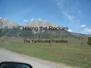
Hiking the Yamnuska Traverse
•Descargar como PPT, PDF•
2 recomendaciones•3,387 vistas

The document summarizes a hike along the Yamnuska Traverse route in the Rockies. It describes various stages of the hike including climbing eastward up the back side, traversing an area called "the notch", rounding a ledge while holding onto "the cable", and taking in views of Calgary along the route. It concludes by describing the descent back down the southwest slope, crossing scree, and noting the geology revealed in the rock faces during the hike.

Recomendados
Más contenido relacionado
Similar a Hiking the Yamnuska Traverse
Similar a Hiking the Yamnuska Traverse (20)
Más de Maureen Flynn-Burhoe
Más de Maureen Flynn-Burhoe (12)
Último
Último (15)
Hiking the Yamnuska Traverse
- 1. Hiking the Rockies The Yamnuska Traverse
- 2. Mount Yamnuska’s climbing face the scree descent The summit The “traverse” climbs right to (B), rounds the back to the summit, descends at left (C) then the scree and ends at (A). Many scale this vertical face. C B A
- 3. Climbing eastward toward B Glen Booth at first lookout
- 4. Starting up back side about 4 km upwards About 1 m snow on trail
- 5. About 3 km to go – several crossed the avalanche area then up the centre. Some Slid as they crossed. We stayed left and crossed above the snow.
- 6. Traversing “the notch” View south of “the notch”
- 7. Hook by which some reach “the notch”
- 8. Next stage after “the notch” straight ahead and up.
- 9. Next viewing station – facing Calgary.
- 10. Above the treeline now – only 2 km to go to summit
- 11. A climber suddenly emerges from a hole in the face called “the chimney”
- 12. The rope and carabiners that brought them through “the chimney”
- 13. The summit is in sight about 2 km ahead. But first, you have to round the ledge clinging to “the cable”.
- 14. It’s the cable, or this..
- 15. Some like greater challenges.. Holding the cable while carrying the dog along the ledge.
- 16. The view down from “the cable ledge” The next step after the “ledge”
- 17. View just after cable & 1.5 km from the summit. Ledge & “the cable”
- 18. The view northward at this point. Not bad!
- 19. The final climb to the summit. May 23, 2011 Ian, at 65, it’s a cinch!
- 20. View towards Calgary near summit.
- 21. View southeastward from summit and the way “down” the traverse. The sun has melted the snow on this side.
- 22. Life “at the summit”.. Climbers and hikers meet.
- 23. The peaks in the distance southward are about the same or higher.
- 24. Smiles of satisfaction, awe and reverence.. deep reverence for the mysteries of life.
- 25. Some choose to reach the summit this way, hanging by a hook and ropes… But, the mountain is constantly breaking off and falling. In any case, we have to descend now And have to cross the forest far below until the fork in the road where the car is parked.. about 4.5 km downward.
- 26. Beginning the descent on the southwest slope.
- 29. Crossing this is not as easy as it might appear.. When you slip, you slide and only a tree or solid rock can stop you.
- 30. This is the famous “reverse fault” of Yamnuska.. The rock on top is older than the rock below it. We have to cross the scree just below this reverse fault to get back.
- 31. The folds in the rock face above tell of a tortured twisting & folding as continental Plates collided and subducted far below the seashore that formed these layers.
- 32. The climbing face above, scree below and Calgary off to the right ahead. The only way down from here Is to “run the scree!”