![[object Object],[object Object],[object Object],[object Object],[object Object],[object Object]](data:image/gif;base64,R0lGODlhAQABAIAAAAAAAP///yH5BAEAAAAALAAAAAABAAEAAAIBRAA7)
Recommended
More Related Content
Similar to Mapping Everyday Geographies
Similar to Mapping Everyday Geographies (20)
More from Paula Owens
More from Paula Owens (8)
Recently uploaded
Recently uploaded (20)
Mapping Everyday Geographies
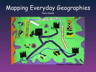
- 1. Mapping Everyday Geographies Paula Owens Hirwaun Primary School
- 5. There’s water down there (checks sand around gingerly) Oh it’s not too bad! I found a worm! There’s sharks in there! And snakes and worms! Is it a crab? I found a crab! I think it was pinching someone and someone stomped on it. I think this crab has lost his body! From Primary Geographer Autumn 2008
- 6. Can you see the unexpected ....... in the everyday? How can you record your responses geographically?
- 7. Task : using the range of maps provided, walk around the short route suggested or choose one of your own . Work in small groups and capture your own impressions of the walk. You may wish to use one or more of the suggested techniques and prompts to help structure your walk or you can develop your own. Journey strings : tie souvenirs and finds from your walk onto the string in sequential order – use these prompts to recall and map. Emotional mapping: focus on feelings along the way , either choosing the range of responses before hand or freely responding in different places. Activity mapping: what are people doing ? Sound and textures: rubbings and / or recording sounds along the way Environmental Quality: focus on the quality of the environment – what criteria will you use? What will your focus be?
- 8. Emotional mapping? Texture mapping? Special spots? Sketching? Digital recording? Activity mapping? Environmental quality? Sound mapping? Using journey strings?
- 9. How will you record your impressions along the way? Sketches, drawings, rubbings? Digital images, audio or video? Words? Symbols? Artefacts? Over to you!
- 10. When you get back, make a map of your journey You have: Large sheets of paper, A range of pens, stickers, glue, post its and crayons Internet connection to upload digital media and use digital mapping REMEMBER – THIS IS REAL WORLD ‘MESSY’ MAPPING !
- 11. www.multimap.com - postcode search OS map view Choose one of the following maps – printed off and laminated - to help you
- 12. www.multimap.com - postcode search aerial view
- 13. http://maps.google.com/ - map view
- 14. www.quikmaps.com map view add emoticons, routes, comments
- 15. Some outcomes Mapping Sounds and Signs “ We used different colour post -its to map human and natural sounds – as you can see we found very little of the latter!”
- 16. Activity Mapping – what are people doing here? We didn’t want to follow the suggested route but went instead to St Pancras Station and mapped everyday activities using a floor plan provided to give us some idea of outlines and direction.
- 17. Food for thought – going global in your local! We were amazed by the range and diversity of the eating outlets on offer and the links to the global dimension. Our journey string was used to collect food related items along the way.
- 18. We called our map ‘Looking up’ and taking this viewpoint we found lots of exciting views and noticed things we wouldn’t have normally paid attention to. Looking Up!
- 20. The Elements of the map Perspective : the view from above [using plan shapes, aerial/spatial layout] Symbols : how features are shown [using pictorial and symbolic, and a key] Location : where features are [using relative locations and grid systems] Direction : which way [using relative directions and compass directions] Scale : distance and size [using proximity, relative distances and sizes, and metric measurements] Purpose : what is to be shown [using a title] Selection : what is to be included [exploring decisions about content] Simon Catling http://www.geography.org.uk/projects/gtip/thinkpieces/makingmaps/ What elements did our messy maps have? Quite a lot!
- 21. Mapping our Globe - Links & Further Reading http://www.geography.org.uk/resources/mappingourglobe/linksfurtherreading/#top Primary Geography Handbook Extension Project - Maps and Stories (4-7, 6 – 9, 8 – 11) http://www.geography.org.uk/projects/primaryhandbook/mapsandstories/ http://www.geography.org.uk/projects/globaldimension/learningactivities/maps/#top This presentation will also be available to download from our professional networking site for the Geography Champions network http://geographychampions.ning.com Developing maps and affective mapping More Ideas