SLR Storm Image Loop
•
1 recomendación•732 vistas

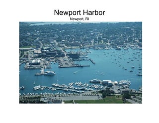
This document provides photos and information about hurricanes, coastal flooding events, and sea level rise in Newport, Rhode Island and surrounding areas. It discusses historical hurricanes like the 1938 hurricane, more recent storms like Tropical Storm Irene and Hurricane Sandy, and their impacts. It also summarizes data on rising sea levels from tide gauge records for Newport and satellite observations. The document examines how higher sea levels could increase risks of coastal flooding and erosion, and affect coastal habitats and infrastructure like onsite wastewater treatment systems. It presents modeling of potential sea level rise impacts and notes that observed sea level rise has exceeded previous projections.

Recomendados
Más contenido relacionado
La actualidad más candente
La actualidad más candente (19)
Destacado
Similar a SLR Storm Image Loop
Similar a SLR Storm Image Loop (20)
Más de riseagrant
Más de riseagrant (20)
Último
Último (20)
SLR Storm Image Loop
- 2. Thames Street 1938 Hurricane Photos: New England Hurricane A Factual Pictorial Record Works Progress Administration 1938
- 4. Ocean Drive Newport, RI Evacuation Routes Photos: Works Progress Administration 1938, New England Hurricane A Factual Pictorial Record
- 5. Drinking water facilities Easton, Green End, Nelson and Gardner Ponds Reservoirs Newport, RI 28% of Newport Water District capacity ~5000 residents and businesses
- 6. Easton Reservoir after Tropical Storm Irene Photo credit: Janet Freedman
- 7. Easton Beach after Irene
- 8. Easton Beach after Irene
- 9. Sandy Storm Damage in Newport - October 29, 2013
- 10. Sandy Storm Damage in Newport - October 29, 2013
- 11. Sandy Storm Damage in Newport - October 29, 2013
- 12. Sandy Storm Damage in Newport - October 29, 2013
- 15. December 12, 2008 Tidal Flood Event A Glimpse into the Future of Waterplace Park? Gilbane Office Trailer James Boyd RI Coastal Resources Management Council
- 17. Peak Flood Elevation December 12, 2008
- 18. Flood Elevation December 12, 2008
- 23. Will Providence look more like Venice in the future? Photo: NY Times – Venice, Italy – December 1, 2008
- 24. Social Adaptation to Sea Level Rise? Photo: NY Times – Venice, Italy – December 1, 2008
- 25. Why Worry About Coastal Setbacks? GONE! 2005 2007
- 26. Why Worry About Coastal Setbacks?
- 27. Why Worry About Coastal Setbacks? October 30, 2012
- 28. Coastal Erosion Happens During Storms! Tropical Storms (Hurricanes) Extra-tropical storms (Nor’easters)
- 29. Atlantic Basin Tropical Storm Tracks 1851-2000 Graphic: USGS
- 30. Misquamicut 2012 Photo: RIDOT October 30, 2012
- 31. Hurricane Sandy October 2012 Coastal Erosion from Storms
- 32. The Ocean Mist Circa 1950s
- 33. The Ocean Mist – Matunuck December 9, 2009
- 35. HEIGHT NOW Rate of Rise 1930-1996 9.4 +/- 1 inch/100 yr Rate of Rise 1930-2013 10.8 +/- .7 inch/100 yr Adapted from: http://tidesandcurrents.noaa.gov/sltrends/ sltrends_station.shtml?stnid=8452660%20Newport,%20RI Boothroyd 2013
- 36. Satellite Radar Altimeter Data CU Sea Level Rise Research Group – University of Colorado http://sealevel.colorado.edu/
- 37. Observed Sea Level Rise is HIGHER than Projections 3.2 mm/yr observed vs. IPCC FAR estimate of 2.0 mm/yr (1993-2011) Boothroyd 2013 Rahmstorf et al., 2012
- 38. Glass and Pilkey, 2013. Earth Vol. 58, No. 5
- 40. Sea Level Affecting Marshes Model (SLAMM) North Kingstown Pilot Project (2011) http://seagrant.gso.uri.edu/climate/habitat.html
- 41. Higher sea levels = more property at risk Hurricane Sandy 2012 Graphic courtesy of Jon Boothroyd URI
- 42. Rising sea levels will impact shoreline OWTS!
- 43. Sea Level Rise Influence on Groundwater Problem! Source: USGS http://wh.er.usgs.gov/slr/coastalgroundwater.html
- 44. Super-storm Sandy Impacts to RI Communities Westerly Charlestown Photo: RIDOT Narragansett South Kingstown
- 46. State Building Code Violations
- 47. CRMC Setbacks in Post-Storm Reality Property line extent abutting town road Inland edge of coastal feature Photo: RIDOT Less than 50 feet!
- 48. What is Freeboard? Base Flood Elevation (BFE) Design Flood Elevation (DFE) Freeboard Base Flood Elevation (BFE) Source: FEMA Coastal Construction Manual 2000
- 49. Debris Removal from Overwash Sand - Westerly
- 51. Photo: RIDOT October 30, 2012 WWW.CRMC.RI.GOV