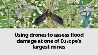
Using Drones to Assess Flood Damage at One of Europe's Largest Mines
•
4 likes•1,388 views

Read how Serbian company GeoGIS Consultants used a senseFly eBee drone (UAV/UAS) to assess flood damage at the Kolubara lignite pit. Explore the full project story: https://www.sensefly.com/fileadmin/user-cases/2015/senseFly-Case-Study-Mine-Flood-Mapping-Serbia.pdf

Recommended
Recommended
More Related Content
Recently uploaded
Recently uploaded (20)
Featured
Featured (20)
Using Drones to Assess Flood Damage at One of Europe's Largest Mines
- 1. Using drones to assess flood damage at one of largest mines
- 2. In May 2014, Serbia was hit by massive floods following the heaviest rainfall there since records began.
- 3. Several rivers broke their banks, completely flooding some of the .
- 4. The overflowing of the river Kolubara also flooded part of the Kolubara Mine Basin, approximately 45 km (28 miles) south of Belgrade.
- 5. The Kolubara pit is a huge 9 km2 (3.5 mi2) pit, part of an estimated 540,000,000 tonnes of lignite reserves in the Kolubara mining fields.
- 6. GeoGIS Consultants to supply accurate 2D orthomosaic images & digital terrain models (DTMs) of the flooded section of mine, in order to calculate the best method of draining the remaining water from the site.
- 7. And to plan a new river channel in order to change its direction and prevent such problems happening again in future.
- 8. So why did GeoGIS decide to work with a drone?
- 9. Speed #1
- 10. Using classical surveying methods, such as LiDAR or total stations, would have been slow, and therefore expensive. a terrestrial approach might have taken 3on-site teams around 2 months.
- 12. Satellite images could have been an option, except that GeoGIS needed higher data resolution than they offered.
- 13. How did GeoGIS do it?
- 14. They planned their flight, setting the ground resolution to 7 cm (2.75 in) per pixel in the eMotion software.
- 15. They also set 25 ground control points, plus additional field points, using independent GPS receivers & continuous kinematics. These measurements enabled them to fine-tune using MicroSurvey CAD and ArcGIS.
- 16. 3 staff then performed 6 eBee flights. Each flight lasted approximately 33 minutes and captured between 180 and 250 images.
- 17. Since the client was very focused on getting their data quickly, GeoGIS managed to set all the GCPs, plan the flights and fly them all in one day.
- 18. The result?
- 19. The client received the data products it required within a week and was full of praise for GeoGIS
- 20. particularly with the data turnaround Aleksandar Milosavljevic, geodetic engineer, GeoGIS
- 21. 1 Flight planning 2 Setting GCPs 3 Flights 4 Data processing Point cloud filtering/classifying /cleaning Point cloud feature extraction & DTM creation Drawing preparation (CAD) PROJECT WORKFLOW
- 23. To learn more about drones in mining, visit: www.senseFly.com/applications/mining To read the full report of this project, visit: https://www.sensefly.com/fileadmin/user- cases/2015/senseFly-Case-Study-Mine-Flood- Mapping-Serbia.pdf And GeoGIS Consultants are online at: www.geogis.co.rs