
Recommended
More Related Content
What's hot
What's hot (20)
Similar to Solomon Zerihun seminar presentation
Similar to Solomon Zerihun seminar presentation (20)
Recently uploaded
Recently uploaded (20)
Solomon Zerihun seminar presentation
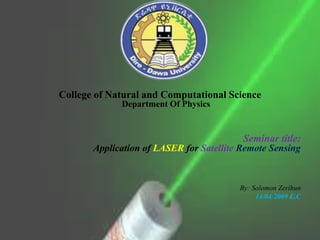
- 1. College of Natural and Computational Science Department Of Physics Seminar title: Application of LASER for Satellite Remote Sensing By: Solomon Zerihun 14/04/2009 E.C
- 2. Outline • Introduction to Laser • Working Principle of Laser • Application of Laser • Introduction about satellite • Application of satellite • Remote sensing • Application of remote sensing • Summary
- 3. The basic scientific principle behind a laser was first put forward by DR. charles H.townes in 1954. The efforts of several scientists laser led to the development of the first laser called pulsed laser in 1960. The process which makes lasers possible, Stimulated Emission, was proposed in 1917 by Albert Einstein
- 5. Principle of laser action • The interaction of light with matter involves three processes: Photon absorption, Spontaneous emission and Stimulated emission. Consider a simple two level energy system having the lower and higher energy levels with populations. 06/06/2015 DDU
- 6. Two level system absorption Spontaneous emission Stimulated emission hn hn hn E1 E2 E1 E2 hn =E2-E1
- 7. Inter Action of atom with EM Radiation Absorption of Radiation Before Absorption
- 10. Applications of Lasers and Photonics • Industrial • Medical • Commercial • Agricultural Pesticide Concentration, Drought, • Quality control of products • Remote sensing • Communication Energy • Spectroscopy • Problems in Physics • Isotropy of space • Gravitational wave detection, • Standardization of Meter, • Distance Measurement High Power Lasers 10/10/2017 Dire Dawa University 10
- 11. Laser printer Laser pointer Laser: everywhere in your life
- 12. THE COUNTING OF ATOMS IN A SUBSTANCE BECAME POSSIBLE BECAUSE OF LASER. IN COMPUTERS, LASERS ARE USED TO RETRIEVE STORED INFORMATION FORM A COMPACT DISC(CD)
- 13. LASERS ARE USED IN FIBRE-OPTIC ENDOSCOPE TO DETECT ULCERS IN THE INTESTINES. LASERS ARE USED FOR BLOODLESS SURGERY.
- 14. Entertainment
- 15. Military
- 16. NOWADAYS, WE CAN FLY A PLANE WITH THE HELP OF LASER RAYS. MAN HAS INVENTED TO FLY A PLANE WITHOUT USING ANY FUEL. LASER IS USEFUL TO MANKIND IN MANY WAYS. IN FUTURE, MANY UNBELIEVABLE THINGS ARE GOING TO HAPPEN WITH THE USE OF LASER RAYS.
- 17. LASER ARE USED IN SPACE COMMUNICATION, IN RADARS AND IN SATELLITES.
- 18. Laser end
- 19. What is a Satellite? • Satellite: In astronomical terms, a satellite is a celestial body that orbits around a planet. – Example: The moon is a satellite of Earth. • In aerospace terms, a satellite is a space vehicle launched by humans and orbits around Earth or another celestial body.
- 20. Circular Motion • Artificial satellites travel around Earth in almost circular path • An object moving in a circular path is accelerating because it is constantly changing direction
- 21. Satellite Motion • Gravity continuously changes its direction • The speed required to keep a satellite in orbit is 7,900m/s
- 22. History of satellite communication • 1945 Arthur C. Clarke publishes an essay about „Extra Terrestrial Relays“ • 1960 first reflecting communication satellite ECHO • 1963 first geostationary satellite SYNCOM • 1965 first commercial geostationary satellite • 1976 three MARISAT satellites for maritime communication • 1982 first mobile satellite telephone system INMARSAT-A • 1998 global satellite systems for small mobile phones .......
- 23. Applications Traditionally – weather satellites – radio and TV broadcast satellites – military satellites – satellites for navigation and localization (e.g., GPS) Telecommunication – global telephone connections – backbone for global networks – connections for communication in remote places or underdeveloped areas – global mobile communication
- 25. Satellite categories Low Earth Orbit (LEO) Medium Earth Orbit (MEO) Geosynchronous Orbit (GEO) GEO: EXACTLY 22 238 miles MEO: typically around 8000 miles HEO:var. LEO: typically between 500 and 1000 miles
- 27. GEO Satellites • Altitude: ~35.786 km. • One-way propagation delay: 250-280 ms • 3 to 4 satellites for global coverage • Mostly used in video broadcasting – Example: TURKSAT satellites • Another applications: Weather forecast, global communications, military applications • Advantage: well-suited for broadcast services • Disadvantages: Long delay, high free-space attenuation 27
- 28. MEO Satellites • Altitude: 10.000 – 15.000 km • One-way propagation delay: 100 – 130 ms • 10 to 15 satellites for global coverage • Infrequent handover • Orbit period: ~6 hr • Mostly used in navigation –GPS, Galileo, Glonass • Communications: Inmarsat, ICO 28
- 29. LEO Satellites • Altitude: 700 – 2.000 km • One-way propagation delay: 5 – 20 ms • More than 32 satellites for global coverage • Orbit period: ~2 hr • Applications: – Earth Observation • GoogleEarth image providers (DigitalGlobe, etc.) • RASAT (First satellite to be produced solely in Turkey) – Communications • Globalstar, Iridium 29
- 30. If we relate with Earth's Atmosphere
- 31. Satellite end
- 32. What is remote sensing? • Remote Sensing: is the collection of information relating to objects without being in physical contact with them. Thus our eyes and ears are remote sensors, and the same is true for cameras and microphones and for many instruments used for all kinds of applications
- 33. cont, • The science (and art) of acquiring information about an object, without entering in contact with it, by sensing and recording reflected or emitted energy and processing, analyzing, and applying that information.
- 35. Cont, In remote sensing on our source of light we may have • Transmittance, • Scattering and • Absorption
- 36. Applications of Remote Sensing There are probably hundreds of applications - these are typical: • Meteorology - Study of atmospheric temperature, pressure, water vapor, and wind velocity. • Oceanography: Measuring sea surface temperature, mapping ocean currents, and wave energy spectra and depth sounding of coastal and ocean depths • Geology- Identification of rock type, mapping faults and structure. • Geodesy- Measuring the figure of the Earth and its gravity field.
- 37. Cont, • Agriculture Monitoring the biomass of land vegetation • Forest- monitoring the health of crops, mapping soil moisture • Botany- forecasting crop yields. • Hydrology- Assessing water resources from snow, rainfall and underground • Disaster warning and assessment - Monitoring of floods and landslides, • monitoring volcanic activity, assessing damage zones from natural disasters.
- 38. Cont, • Planning applications - Mapping ecological zones, monitoring deforestation, • monitoring urban land use. • Oil and mineral exploration- Locating natural oil seeps and slicks, mapping • geological structures, monitoring oil field subsidence. • Military- developing precise maps for planning, monitoring military • infrastructure, monitoring ship and troop movements • Space program- is the backbone of the space program • Seismology: as a premonition.
- 39. Types Remote Sensing System Visual remote sensing system
- 45. Satellite Remote Sensing "eyes in the sky"
- 46. Types Satellite Remote Sensing • There are two main types of remote sensing: Passive remote sensing and Active remote sensing. What makes Passive and Active is the source of light !!!!
- 47. • The sun is a source of energy or radiation, which provides a very convenient source of energy for remote sensing. The sun's energy is either reflected, as it is for visible wavelengths, or absorbed and then reemitted, as it is for thermal infrared wavelengths.
- 48. Passive
- 49. • Passive sensors detect natural radiation that is emitted or reflected by the object or surrounding area being observed. Reflected sunlight is the most common source of radiation measured by passive sensors. Examples of passive remote sensors include film photography, infrared, and radiometers.
- 50. Active
- 51. Active remote sensing, on the other hand, emits energy in order to scan objects and areas where upon a sensor then detects and measures the radiation that is reflected or backscattered from the target. RADAR is an example of active remote sensing where the time delay between emission and return is measured, establishing the location, height, speeds and direction of an object.
- 53. Summary Correlations • During night time we may have not natural source of light. So for this time we have to use man made source of light. From those LASER is the only best solution to use as a source
- 55. Energetic Laser Should have on the satellite
- 56. Active
- 58. አመሰግናለሁ:: Thanks