SlideShare una empresa de Scribd logo
1 de 34
Descargar para leer sin conexión
Groundwater Level and Subsidence in
the Texas Gulf Coast – USGS Science
in support of groundwater
sustainability
      By Michael J. Turco, Mark C. Kasmarek, Michaela R. Johnson, and Jason K. Ramage


                            In cooperation with the
      Harris-Galveston Subsidence District, City of Houston, Fort Bend
    Subsidence District, Lone Star Groundwater Conservation District , and
             Brazoria County Groundwater Conservation District
                                                                                                    T       B
                                                                                                R               E
                                                                                            O           B
                                                                                                        U
                                                                                                        D


                                                                                                                    N


                                                                                    F


                                                                                                                        D
                                                                                                    E       X


                                                                                                                A
                                                                                                T
                                                                                                        S


                                                                                S


                                                                                                                             T
                                                                                                                            IC


                                                                                 U
                                                                                    B
                                                                                        S                               R
                                                                                            ID
                                                                                               E                 ST
                                                                                                   N CE     DI
Who is the USGS?
•   Mission: The U.S. Geological Survey (USGS) serves the Nation by providing
    reliable scientific information to describe and understand the Earth; minimize
    loss of life and property from natural disasters; manage water, biological,
    energy, and mineral resources; and enhance and protect our quality of life.

•   As the Nation's largest water, earth, and biological science and civilian
    mapping agency, the USGS collects, monitors, analyzes, and provides
    scientific understanding about natural resource conditions, issues, and
    problems. The diversity of our scientific expertise enables us to carry out
    large-scale, multi-disciplinary investigations and provide impartial scientific
    information to resource managers, planners, and other customers.
GAMEPLAN
• Introduction
• Groundwater level
   – Hydrogeology
   – Summary results of 2011-2012 survey
• Subsidence
   – Clay-compaction and Subsidence
   – Methods of Measure
   – Recent subsidence
• Modeling
• Summary
Study Area
Houston Climate 2011
GROUNDWATER LEVELS
• USGS measures water-level in about 800 wells annually
• Specific criteria is followed when adding a well to the network;
  always looking to expand network
• Measured data are compared over several temporal ranges on a
  well by well basis
• Three primary water bearing units within the Gulf Coast Aquifer
  System (Chicot, Evangeline, and Jasper)
• Water-levels measured and quality-assured following USGS
  documented methods
• All maps peer-reviewed and published annually
Hydrogeology
2012 Chicot Aquifer Network
2011-2012 Chicot Water Level Change
Explanation
    Decline
    No Change
    Rise

C.I. 20 ft                                            -100 to 200


                1977-2012 Chicot Water Level Change
Hydrogeology
2012 Evangeline Aquifer Network
2011-2012 Evangeline Water Level Change
Explanation
    Decline
    No Change
    Rise            C.I. 20 & 40 ft                       -360 to 260


                1977-2012 Evangeline Water Level Change
Hydrogeology
2012 Jasper Aquifer Network
2011-2012 Jasper Water Level Change
C.I. 20 ft
                                                   -220 to 0


             2000-2012 Jasper Water Level Change
SUBSIDENCE
•   Subsidence associated with shallow fluid
    withdrawal in the TX Gulf Coast Region has
    been studied by USGS and others since the
    ~1950s
•   Goose Creek Oil Field first documented case
    (Pratt and Johnson, 1926)

•   USGS has estimated that about 15 feet of
    subsidence has occurred along the Houston
    Ship Channel since 1917
Clay Compaction
How do you measure subsidence?

•   Borehole extensometer
     – Modified deep well used in Houston, California, China, Mexico
•   1st order leveling
     – Reoccupy benchmarks from Waco to Galveston
•   PAM-GPS network
     – Sub-cm accuracy at established benchmarks reoccupied periodically over
         time
•   Historical LIDAR comparisons
     – Comparison of recent LIDAR data and historical topography
•   InSAR
     – Satellite based method of detecting subtle land-surface change over large
         areas
SIM Sheet 15


Borehole Extensometer Locations, Texas, USA
Extensometer
Harris County


                                                     Liberty County

                                                     Chambers County


Fort Bend County


                Brazoria County

                                  Galveston County


                                                                       Updip Extensometer Data
Harris County

                                                               Liberty County

                                                               Chambers County


                     Fort Bend
                      County


                                                   Galveston
                                                     County
                                 Brazoria County


SIM Sheet 16


           Pasadena and Clear Lake Extensometer Data
Estimated Subsidence 1915-2001
PAM-GPS Land Surface Elevation Change
Recent Subsidence Estimated using PAM-GPS Data
PAM-GPS Horizontal and Vertical Velocity field
Estimated
 Subsidence using
InSAR analysis and
  PAM-GPS Data
Estimating future subsidence

•   Requires substantial historical
    information
•   PRESS Models – developed by
    FUGRO Inc. to predict subsidence
    based detailed local hydrogeologic
    data and predicted changes in
    water level
•   MODFLOW Model – developed by
    USGS; multiple evolutions over the
    last 25+years; simulates water-
    level and subsidence regionally
Estimating Future subsidence
Summary

•   Groundwater data collected today, although maybe used for an immediate
    resource need, become more valuable as time moves on. Without data today,
    the ability to evaluate the effects of changing water use, regulatory strategies,
    or new water sources is greatly diminished.
•   A long history of collaboration and data collection as resulted in a robust data
    set used by multiple agencies to manage the groundwater resource and
    minimize subsidence in the Houston area.
•   Subsidence monitoring as evolved over the last 35 years, multiple approaches
    to evaluating past and current subsidence has yielded a strong data set used to
    calibrate models that can then predict future subsidence based estimated water
    needs and aquifer response.
Water Use and Water Availability – USGS Science in support of
groundwater sustainability with case study in Houston, Texas,
                            USA


                         QUESTIONS?


                                                                     CONTACT:
                                               USGS Texas Water Science Center
                                                     Gulf Coast Program Office
                                                         The Woodlands, Texas
                                                              Ph: 936-271-5300
                                                             http://tx.usgs.gov

Más contenido relacionado

Destacado

Surface subsidence associated with block caving
Surface subsidence associated with block cavingSurface subsidence associated with block caving
Surface subsidence associated with block cavingDr. Alex Vyazmensky
 
TH4.L09 - GEOLOGICAL AND GEOHAZARD APPLICATIONS OF RADARSAT-2
TH4.L09 - GEOLOGICAL AND GEOHAZARD APPLICATIONS OF RADARSAT-2TH4.L09 - GEOLOGICAL AND GEOHAZARD APPLICATIONS OF RADARSAT-2
TH4.L09 - GEOLOGICAL AND GEOHAZARD APPLICATIONS OF RADARSAT-2grssieee
 
Subsidence control in coal mines
Subsidence control in coal minesSubsidence control in coal mines
Subsidence control in coal minesSunil Varma
 
Ground Improvement by Vibro Stone Columns
Ground Improvement by Vibro Stone ColumnsGround Improvement by Vibro Stone Columns
Ground Improvement by Vibro Stone ColumnsDesh Sonyok
 
Stone column
Stone columnStone column
Stone columnGEOMIND
 
Geohazard mapping and assessment program
Geohazard mapping and assessment programGeohazard mapping and assessment program
Geohazard mapping and assessment programMarho Realty
 

Destacado (7)

Surface subsidence associated with block caving
Surface subsidence associated with block cavingSurface subsidence associated with block caving
Surface subsidence associated with block caving
 
In sar 1-1-2011
In sar 1-1-2011In sar 1-1-2011
In sar 1-1-2011
 
TH4.L09 - GEOLOGICAL AND GEOHAZARD APPLICATIONS OF RADARSAT-2
TH4.L09 - GEOLOGICAL AND GEOHAZARD APPLICATIONS OF RADARSAT-2TH4.L09 - GEOLOGICAL AND GEOHAZARD APPLICATIONS OF RADARSAT-2
TH4.L09 - GEOLOGICAL AND GEOHAZARD APPLICATIONS OF RADARSAT-2
 
Subsidence control in coal mines
Subsidence control in coal minesSubsidence control in coal mines
Subsidence control in coal mines
 
Ground Improvement by Vibro Stone Columns
Ground Improvement by Vibro Stone ColumnsGround Improvement by Vibro Stone Columns
Ground Improvement by Vibro Stone Columns
 
Stone column
Stone columnStone column
Stone column
 
Geohazard mapping and assessment program
Geohazard mapping and assessment programGeohazard mapping and assessment program
Geohazard mapping and assessment program
 

Más de The Texas Network, LLC

WHCRWA MUD directors' outreach workshop June 8, 2017
WHCRWA MUD directors' outreach workshop June 8, 2017WHCRWA MUD directors' outreach workshop June 8, 2017
WHCRWA MUD directors' outreach workshop June 8, 2017The Texas Network, LLC
 
TWCA Webinar - New “Waters of the United States” Rule
TWCA Webinar - New “Waters of the United States” RuleTWCA Webinar - New “Waters of the United States” Rule
TWCA Webinar - New “Waters of the United States” RuleThe Texas Network, LLC
 
Pass the Salt: Desalination Brine Disposal Challenges
Pass the Salt: Desalination Brine Disposal ChallengesPass the Salt: Desalination Brine Disposal Challenges
Pass the Salt: Desalination Brine Disposal ChallengesThe Texas Network, LLC
 
Methods to promote freshwater inflow to East Matagorda Bay
Methods to promote freshwater inflow to East Matagorda BayMethods to promote freshwater inflow to East Matagorda Bay
Methods to promote freshwater inflow to East Matagorda BayThe Texas Network, LLC
 
The Economic Power of Water - GE’s Focus on Reuse
The Economic Power of Water - GE’s Focus on ReuseThe Economic Power of Water - GE’s Focus on Reuse
The Economic Power of Water - GE’s Focus on ReuseThe Texas Network, LLC
 
Texas Drought Over? (But then again…)
Texas Drought Over?  (But then again…)Texas Drought Over?  (But then again…)
Texas Drought Over? (But then again…)The Texas Network, LLC
 
Evaluating the Relative Cost of Service from Publicly Funded vs. Privately Fi...
Evaluating the Relative Cost of Service from Publicly Funded vs. Privately Fi...Evaluating the Relative Cost of Service from Publicly Funded vs. Privately Fi...
Evaluating the Relative Cost of Service from Publicly Funded vs. Privately Fi...The Texas Network, LLC
 
SURFACE WATER ISSUES IN THE GMA 7 JPINT PLANNING PROCESS
SURFACE WATER ISSUES IN THE GMA 7 JPINT PLANNING PROCESSSURFACE WATER ISSUES IN THE GMA 7 JPINT PLANNING PROCESS
SURFACE WATER ISSUES IN THE GMA 7 JPINT PLANNING PROCESSThe Texas Network, LLC
 
RESPONDING TO A WATER SUPPLY CONTAMINATION EVENT
RESPONDING TO A WATER SUPPLY CONTAMINATION EVENT RESPONDING TO A WATER SUPPLY CONTAMINATION EVENT
RESPONDING TO A WATER SUPPLY CONTAMINATION EVENT The Texas Network, LLC
 
U.S. Army Corps of Engineers Infrastructure Strategies in Texas
U.S. Army Corps of Engineers Infrastructure Strategies in TexasU.S. Army Corps of Engineers Infrastructure Strategies in Texas
U.S. Army Corps of Engineers Infrastructure Strategies in TexasThe Texas Network, LLC
 
Individual liability for Water Authority Board Members
Individual liability for Water Authority Board MembersIndividual liability for Water Authority Board Members
Individual liability for Water Authority Board MembersThe Texas Network, LLC
 
The Future is Now: The Rapidly Evolving Landscape of ASR in Texas
The Future is Now: The Rapidly Evolving Landscape of ASR in TexasThe Future is Now: The Rapidly Evolving Landscape of ASR in Texas
The Future is Now: The Rapidly Evolving Landscape of ASR in TexasThe Texas Network, LLC
 
Pecos/Devils River Watershed Projects Part II
Pecos/Devils River Watershed Projects Part IIPecos/Devils River Watershed Projects Part II
Pecos/Devils River Watershed Projects Part IIThe Texas Network, LLC
 

Más de The Texas Network, LLC (20)

WHCRWA MUD directors' outreach workshop June 8, 2017
WHCRWA MUD directors' outreach workshop June 8, 2017WHCRWA MUD directors' outreach workshop June 8, 2017
WHCRWA MUD directors' outreach workshop June 8, 2017
 
WHCRWA APWA Presentation on CIP
WHCRWA APWA Presentation on CIPWHCRWA APWA Presentation on CIP
WHCRWA APWA Presentation on CIP
 
WHCRWA Town Hall and Open House 2015
WHCRWA Town Hall and Open House 2015WHCRWA Town Hall and Open House 2015
WHCRWA Town Hall and Open House 2015
 
TWCA Webinar - New “Waters of the United States” Rule
TWCA Webinar - New “Waters of the United States” RuleTWCA Webinar - New “Waters of the United States” Rule
TWCA Webinar - New “Waters of the United States” Rule
 
Pass the Salt: Desalination Brine Disposal Challenges
Pass the Salt: Desalination Brine Disposal ChallengesPass the Salt: Desalination Brine Disposal Challenges
Pass the Salt: Desalination Brine Disposal Challenges
 
Texas Water Development Board Update
Texas Water Development Board UpdateTexas Water Development Board Update
Texas Water Development Board Update
 
Professional Ethics
Professional EthicsProfessional Ethics
Professional Ethics
 
Groundwater Management GMA/GCD Panel
Groundwater Management GMA/GCD PanelGroundwater Management GMA/GCD Panel
Groundwater Management GMA/GCD Panel
 
Methods to promote freshwater inflow to East Matagorda Bay
Methods to promote freshwater inflow to East Matagorda BayMethods to promote freshwater inflow to East Matagorda Bay
Methods to promote freshwater inflow to East Matagorda Bay
 
The Economic Power of Water - GE’s Focus on Reuse
The Economic Power of Water - GE’s Focus on ReuseThe Economic Power of Water - GE’s Focus on Reuse
The Economic Power of Water - GE’s Focus on Reuse
 
Texas Drought Over? (But then again…)
Texas Drought Over?  (But then again…)Texas Drought Over?  (But then again…)
Texas Drought Over? (But then again…)
 
Evaluating the Relative Cost of Service from Publicly Funded vs. Privately Fi...
Evaluating the Relative Cost of Service from Publicly Funded vs. Privately Fi...Evaluating the Relative Cost of Service from Publicly Funded vs. Privately Fi...
Evaluating the Relative Cost of Service from Publicly Funded vs. Privately Fi...
 
SURFACE WATER ISSUES IN THE GMA 7 JPINT PLANNING PROCESS
SURFACE WATER ISSUES IN THE GMA 7 JPINT PLANNING PROCESSSURFACE WATER ISSUES IN THE GMA 7 JPINT PLANNING PROCESS
SURFACE WATER ISSUES IN THE GMA 7 JPINT PLANNING PROCESS
 
RESPONDING TO A WATER SUPPLY CONTAMINATION EVENT
RESPONDING TO A WATER SUPPLY CONTAMINATION EVENT RESPONDING TO A WATER SUPPLY CONTAMINATION EVENT
RESPONDING TO A WATER SUPPLY CONTAMINATION EVENT
 
TWCA Speech – Rep. James Frank
TWCA Speech – Rep. James FrankTWCA Speech – Rep. James Frank
TWCA Speech – Rep. James Frank
 
U.S. Army Corps of Engineers Infrastructure Strategies in Texas
U.S. Army Corps of Engineers Infrastructure Strategies in TexasU.S. Army Corps of Engineers Infrastructure Strategies in Texas
U.S. Army Corps of Engineers Infrastructure Strategies in Texas
 
Individual liability for Water Authority Board Members
Individual liability for Water Authority Board MembersIndividual liability for Water Authority Board Members
Individual liability for Water Authority Board Members
 
From Projectile to Pump Station
From Projectile to Pump StationFrom Projectile to Pump Station
From Projectile to Pump Station
 
The Future is Now: The Rapidly Evolving Landscape of ASR in Texas
The Future is Now: The Rapidly Evolving Landscape of ASR in TexasThe Future is Now: The Rapidly Evolving Landscape of ASR in Texas
The Future is Now: The Rapidly Evolving Landscape of ASR in Texas
 
Pecos/Devils River Watershed Projects Part II
Pecos/Devils River Watershed Projects Part IIPecos/Devils River Watershed Projects Part II
Pecos/Devils River Watershed Projects Part II
 

Último

Man or Manufactured_ Redefining Humanity Through Biopunk Narratives.pptx
Man or Manufactured_ Redefining Humanity Through Biopunk Narratives.pptxMan or Manufactured_ Redefining Humanity Through Biopunk Narratives.pptx
Man or Manufactured_ Redefining Humanity Through Biopunk Narratives.pptxDhatriParmar
 
Blowin' in the Wind of Caste_ Bob Dylan's Song as a Catalyst for Social Justi...
Blowin' in the Wind of Caste_ Bob Dylan's Song as a Catalyst for Social Justi...Blowin' in the Wind of Caste_ Bob Dylan's Song as a Catalyst for Social Justi...
Blowin' in the Wind of Caste_ Bob Dylan's Song as a Catalyst for Social Justi...DhatriParmar
 
Congestive Cardiac Failure..presentation
Congestive Cardiac Failure..presentationCongestive Cardiac Failure..presentation
Congestive Cardiac Failure..presentationdeepaannamalai16
 
Tree View Decoration Attribute in the Odoo 17
Tree View Decoration Attribute in the Odoo 17Tree View Decoration Attribute in the Odoo 17
Tree View Decoration Attribute in the Odoo 17Celine George
 
CHUYÊN ĐỀ ÔN THEO CÂU CHO HỌC SINH LỚP 12 ĐỂ ĐẠT ĐIỂM 5+ THI TỐT NGHIỆP THPT ...
CHUYÊN ĐỀ ÔN THEO CÂU CHO HỌC SINH LỚP 12 ĐỂ ĐẠT ĐIỂM 5+ THI TỐT NGHIỆP THPT ...CHUYÊN ĐỀ ÔN THEO CÂU CHO HỌC SINH LỚP 12 ĐỂ ĐẠT ĐIỂM 5+ THI TỐT NGHIỆP THPT ...
CHUYÊN ĐỀ ÔN THEO CÂU CHO HỌC SINH LỚP 12 ĐỂ ĐẠT ĐIỂM 5+ THI TỐT NGHIỆP THPT ...Nguyen Thanh Tu Collection
 
Team Lead Succeed – Helping you and your team achieve high-performance teamwo...
Team Lead Succeed – Helping you and your team achieve high-performance teamwo...Team Lead Succeed – Helping you and your team achieve high-performance teamwo...
Team Lead Succeed – Helping you and your team achieve high-performance teamwo...Association for Project Management
 
Shark introduction Morphology and its behaviour characteristics
Shark introduction Morphology and its behaviour characteristicsShark introduction Morphology and its behaviour characteristics
Shark introduction Morphology and its behaviour characteristicsArubSultan
 
How to Manage Buy 3 Get 1 Free in Odoo 17
How to Manage Buy 3 Get 1 Free in Odoo 17How to Manage Buy 3 Get 1 Free in Odoo 17
How to Manage Buy 3 Get 1 Free in Odoo 17Celine George
 
Narcotic and Non Narcotic Analgesic..pdf
Narcotic and Non Narcotic Analgesic..pdfNarcotic and Non Narcotic Analgesic..pdf
Narcotic and Non Narcotic Analgesic..pdfPrerana Jadhav
 
Q-Factor General Quiz-7th April 2024, Quiz Club NITW
Q-Factor General Quiz-7th April 2024, Quiz Club NITWQ-Factor General Quiz-7th April 2024, Quiz Club NITW
Q-Factor General Quiz-7th April 2024, Quiz Club NITWQuiz Club NITW
 
DBMSArchitecture_QueryProcessingandOptimization.pdf
DBMSArchitecture_QueryProcessingandOptimization.pdfDBMSArchitecture_QueryProcessingandOptimization.pdf
DBMSArchitecture_QueryProcessingandOptimization.pdfChristalin Nelson
 
CLASSIFICATION OF ANTI - CANCER DRUGS.pptx
CLASSIFICATION OF ANTI - CANCER DRUGS.pptxCLASSIFICATION OF ANTI - CANCER DRUGS.pptx
CLASSIFICATION OF ANTI - CANCER DRUGS.pptxAnupam32727
 
Objectives n learning outcoms - MD 20240404.pptx
Objectives n learning outcoms - MD 20240404.pptxObjectives n learning outcoms - MD 20240404.pptx
Objectives n learning outcoms - MD 20240404.pptxMadhavi Dharankar
 
Decoding the Tweet _ Practical Criticism in the Age of Hashtag.pptx
Decoding the Tweet _ Practical Criticism in the Age of Hashtag.pptxDecoding the Tweet _ Practical Criticism in the Age of Hashtag.pptx
Decoding the Tweet _ Practical Criticism in the Age of Hashtag.pptxDhatriParmar
 
Mythology Quiz-4th April 2024, Quiz Club NITW
Mythology Quiz-4th April 2024, Quiz Club NITWMythology Quiz-4th April 2024, Quiz Club NITW
Mythology Quiz-4th April 2024, Quiz Club NITWQuiz Club NITW
 

Último (20)

Man or Manufactured_ Redefining Humanity Through Biopunk Narratives.pptx
Man or Manufactured_ Redefining Humanity Through Biopunk Narratives.pptxMan or Manufactured_ Redefining Humanity Through Biopunk Narratives.pptx
Man or Manufactured_ Redefining Humanity Through Biopunk Narratives.pptx
 
Blowin' in the Wind of Caste_ Bob Dylan's Song as a Catalyst for Social Justi...
Blowin' in the Wind of Caste_ Bob Dylan's Song as a Catalyst for Social Justi...Blowin' in the Wind of Caste_ Bob Dylan's Song as a Catalyst for Social Justi...
Blowin' in the Wind of Caste_ Bob Dylan's Song as a Catalyst for Social Justi...
 
Congestive Cardiac Failure..presentation
Congestive Cardiac Failure..presentationCongestive Cardiac Failure..presentation
Congestive Cardiac Failure..presentation
 
Plagiarism,forms,understand about plagiarism,avoid plagiarism,key significanc...
Plagiarism,forms,understand about plagiarism,avoid plagiarism,key significanc...Plagiarism,forms,understand about plagiarism,avoid plagiarism,key significanc...
Plagiarism,forms,understand about plagiarism,avoid plagiarism,key significanc...
 
Tree View Decoration Attribute in the Odoo 17
Tree View Decoration Attribute in the Odoo 17Tree View Decoration Attribute in the Odoo 17
Tree View Decoration Attribute in the Odoo 17
 
CHUYÊN ĐỀ ÔN THEO CÂU CHO HỌC SINH LỚP 12 ĐỂ ĐẠT ĐIỂM 5+ THI TỐT NGHIỆP THPT ...
CHUYÊN ĐỀ ÔN THEO CÂU CHO HỌC SINH LỚP 12 ĐỂ ĐẠT ĐIỂM 5+ THI TỐT NGHIỆP THPT ...CHUYÊN ĐỀ ÔN THEO CÂU CHO HỌC SINH LỚP 12 ĐỂ ĐẠT ĐIỂM 5+ THI TỐT NGHIỆP THPT ...
CHUYÊN ĐỀ ÔN THEO CÂU CHO HỌC SINH LỚP 12 ĐỂ ĐẠT ĐIỂM 5+ THI TỐT NGHIỆP THPT ...
 
Team Lead Succeed – Helping you and your team achieve high-performance teamwo...
Team Lead Succeed – Helping you and your team achieve high-performance teamwo...Team Lead Succeed – Helping you and your team achieve high-performance teamwo...
Team Lead Succeed – Helping you and your team achieve high-performance teamwo...
 
Spearman's correlation,Formula,Advantages,
Spearman's correlation,Formula,Advantages,Spearman's correlation,Formula,Advantages,
Spearman's correlation,Formula,Advantages,
 
Shark introduction Morphology and its behaviour characteristics
Shark introduction Morphology and its behaviour characteristicsShark introduction Morphology and its behaviour characteristics
Shark introduction Morphology and its behaviour characteristics
 
How to Manage Buy 3 Get 1 Free in Odoo 17
How to Manage Buy 3 Get 1 Free in Odoo 17How to Manage Buy 3 Get 1 Free in Odoo 17
How to Manage Buy 3 Get 1 Free in Odoo 17
 
Narcotic and Non Narcotic Analgesic..pdf
Narcotic and Non Narcotic Analgesic..pdfNarcotic and Non Narcotic Analgesic..pdf
Narcotic and Non Narcotic Analgesic..pdf
 
Q-Factor General Quiz-7th April 2024, Quiz Club NITW
Q-Factor General Quiz-7th April 2024, Quiz Club NITWQ-Factor General Quiz-7th April 2024, Quiz Club NITW
Q-Factor General Quiz-7th April 2024, Quiz Club NITW
 
DBMSArchitecture_QueryProcessingandOptimization.pdf
DBMSArchitecture_QueryProcessingandOptimization.pdfDBMSArchitecture_QueryProcessingandOptimization.pdf
DBMSArchitecture_QueryProcessingandOptimization.pdf
 
CARNAVAL COM MAGIA E EUFORIA _
CARNAVAL COM MAGIA E EUFORIA            _CARNAVAL COM MAGIA E EUFORIA            _
CARNAVAL COM MAGIA E EUFORIA _
 
CLASSIFICATION OF ANTI - CANCER DRUGS.pptx
CLASSIFICATION OF ANTI - CANCER DRUGS.pptxCLASSIFICATION OF ANTI - CANCER DRUGS.pptx
CLASSIFICATION OF ANTI - CANCER DRUGS.pptx
 
Paradigm shift in nursing research by RS MEHTA
Paradigm shift in nursing research by RS MEHTAParadigm shift in nursing research by RS MEHTA
Paradigm shift in nursing research by RS MEHTA
 
Mattingly "AI & Prompt Design" - Introduction to Machine Learning"
Mattingly "AI & Prompt Design" - Introduction to Machine Learning"Mattingly "AI & Prompt Design" - Introduction to Machine Learning"
Mattingly "AI & Prompt Design" - Introduction to Machine Learning"
 
Objectives n learning outcoms - MD 20240404.pptx
Objectives n learning outcoms - MD 20240404.pptxObjectives n learning outcoms - MD 20240404.pptx
Objectives n learning outcoms - MD 20240404.pptx
 
Decoding the Tweet _ Practical Criticism in the Age of Hashtag.pptx
Decoding the Tweet _ Practical Criticism in the Age of Hashtag.pptxDecoding the Tweet _ Practical Criticism in the Age of Hashtag.pptx
Decoding the Tweet _ Practical Criticism in the Age of Hashtag.pptx
 
Mythology Quiz-4th April 2024, Quiz Club NITW
Mythology Quiz-4th April 2024, Quiz Club NITWMythology Quiz-4th April 2024, Quiz Club NITW
Mythology Quiz-4th April 2024, Quiz Club NITW
 

Groundwater Level and Subsidence in the Texas Gulf Coast

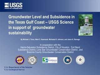
  • 1. Groundwater Level and Subsidence in the Texas Gulf Coast – USGS Science in support of groundwater sustainability By Michael J. Turco, Mark C. Kasmarek, Michaela R. Johnson, and Jason K. Ramage In cooperation with the Harris-Galveston Subsidence District, City of Houston, Fort Bend Subsidence District, Lone Star Groundwater Conservation District , and Brazoria County Groundwater Conservation District T B R E O B U D N F D E X A T S S T IC U B S R ID E ST N CE DI
  • 2. Who is the USGS? • Mission: The U.S. Geological Survey (USGS) serves the Nation by providing reliable scientific information to describe and understand the Earth; minimize loss of life and property from natural disasters; manage water, biological, energy, and mineral resources; and enhance and protect our quality of life. • As the Nation's largest water, earth, and biological science and civilian mapping agency, the USGS collects, monitors, analyzes, and provides scientific understanding about natural resource conditions, issues, and problems. The diversity of our scientific expertise enables us to carry out large-scale, multi-disciplinary investigations and provide impartial scientific information to resource managers, planners, and other customers.
  • 3. GAMEPLAN • Introduction • Groundwater level – Hydrogeology – Summary results of 2011-2012 survey • Subsidence – Clay-compaction and Subsidence – Methods of Measure – Recent subsidence • Modeling • Summary
  • 6. GROUNDWATER LEVELS • USGS measures water-level in about 800 wells annually • Specific criteria is followed when adding a well to the network; always looking to expand network • Measured data are compared over several temporal ranges on a well by well basis • Three primary water bearing units within the Gulf Coast Aquifer System (Chicot, Evangeline, and Jasper) • Water-levels measured and quality-assured following USGS documented methods • All maps peer-reviewed and published annually
  • 9. 2011-2012 Chicot Water Level Change
  • 10. Explanation Decline No Change Rise C.I. 20 ft -100 to 200 1977-2012 Chicot Water Level Change
  • 14. Explanation Decline No Change Rise C.I. 20 & 40 ft -360 to 260 1977-2012 Evangeline Water Level Change
  • 17. 2011-2012 Jasper Water Level Change
  • 18. C.I. 20 ft -220 to 0 2000-2012 Jasper Water Level Change
  • 19. SUBSIDENCE • Subsidence associated with shallow fluid withdrawal in the TX Gulf Coast Region has been studied by USGS and others since the ~1950s • Goose Creek Oil Field first documented case (Pratt and Johnson, 1926) • USGS has estimated that about 15 feet of subsidence has occurred along the Houston Ship Channel since 1917
  • 21. How do you measure subsidence? • Borehole extensometer – Modified deep well used in Houston, California, China, Mexico • 1st order leveling – Reoccupy benchmarks from Waco to Galveston • PAM-GPS network – Sub-cm accuracy at established benchmarks reoccupied periodically over time • Historical LIDAR comparisons – Comparison of recent LIDAR data and historical topography • InSAR – Satellite based method of detecting subtle land-surface change over large areas
  • 22. SIM Sheet 15 Borehole Extensometer Locations, Texas, USA
  • 24. Harris County Liberty County Chambers County Fort Bend County Brazoria County Galveston County Updip Extensometer Data
  • 25. Harris County Liberty County Chambers County Fort Bend County Galveston County Brazoria County SIM Sheet 16 Pasadena and Clear Lake Extensometer Data
  • 27. PAM-GPS Land Surface Elevation Change
  • 28. Recent Subsidence Estimated using PAM-GPS Data
  • 29. PAM-GPS Horizontal and Vertical Velocity field
  • 30. Estimated Subsidence using InSAR analysis and PAM-GPS Data
  • 31. Estimating future subsidence • Requires substantial historical information • PRESS Models – developed by FUGRO Inc. to predict subsidence based detailed local hydrogeologic data and predicted changes in water level • MODFLOW Model – developed by USGS; multiple evolutions over the last 25+years; simulates water- level and subsidence regionally
  • 33. Summary • Groundwater data collected today, although maybe used for an immediate resource need, become more valuable as time moves on. Without data today, the ability to evaluate the effects of changing water use, regulatory strategies, or new water sources is greatly diminished. • A long history of collaboration and data collection as resulted in a robust data set used by multiple agencies to manage the groundwater resource and minimize subsidence in the Houston area. • Subsidence monitoring as evolved over the last 35 years, multiple approaches to evaluating past and current subsidence has yielded a strong data set used to calibrate models that can then predict future subsidence based estimated water needs and aquifer response.
  • 34. Water Use and Water Availability – USGS Science in support of groundwater sustainability with case study in Houston, Texas, USA QUESTIONS? CONTACT: USGS Texas Water Science Center Gulf Coast Program Office The Woodlands, Texas Ph: 936-271-5300 http://tx.usgs.gov