Jungle bus - Digital transport 4 Africa conference
•
2 recomendaciones•201 vistas

Presentation by Florian Lainez during the Digital transport 4 Africa conference www.digitaltransport4africa.org/

Recomendados
Recomendados
Más contenido relacionado
Más de Florian Lainez
Más de Florian Lainez (19)
Último
Último (20)
Jungle bus - Digital transport 4 Africa conference
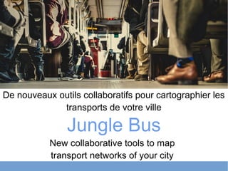
- 1. Jungle Bus De nouveaux outils collaboratifs pour cartographier les transports de votre ville New collaborative tools to map transport networks of your city
- 3. There is no public transport map for more than 60% of the cities in the World. We need to change that.
- 5. Solution 1. Improving tools 2. Engaging people
- 6. Result
- 7. Deliverable
- 8. Transit map of Accra, Ghana Jungle Bus
- 9. How do we map Africa?
- 10. OpenStreetMap as a hub
- 11. Jungle Bus mobile app
- 12. Jungle Bus chatbot Live demo http://junglebus.io/chatbot
- 13. Our partners
- 14. What about you ?
Notas del editor
- FLORIAN
- Enock is 24. He lives in Accra, Ghana. Everyday he takes the trotro. He knows his everyday lines by heart but faces issues when unplanned transport No passenger information No transport map But, come on: that’s Accra, capital of Ghana, 2M hab
- OpenStreetMap is the perfect platform to face this challenge
- During the Mapanica project, the local community created the transport network’s data of Managua, the capital of Nicaragua (2M inhabitants). Presentation from SotM 2016 in Brussels by Felix Delattre and the local community of Nicaragua. Jungle Bus aims to reproduce this success story.
- To be successful in this great challenge we need to: 1. Go simple: produce new tools to simplify transport mapping in OSM 2. Support local communities to map their own public transport network in OSM
- 320 lines 2700 stops Less than 10 contributors needed: all locals. One summer work
- Timetable, request an itinerary, see where the trotro goes in the city Enock is happy : he rediscover his city, he can go see his mother And you know what? He also has better acces to a lot of services including healthcare, education, work
- AFD expectations achieved Need of Public Transportation Department of Accra Metropolitan Assembly covered You see Ghana on the map? What about the rest of Africa?
- We support local community and, with Jungle Bus, we keep providing simpler tools. OpenStreetMap = Wikipedia of maps Worldwide community to create the best map of the World with open geographical data
- Strenghts of OSM: -Open Data, worldwide standard: digital common -crowdsourcing: community contribution (managed by citizens) : in Accra since 2 months: 5 edits on lines, 9 on stops: good maintenance of the data -community ecosystem: OSMTracker, Google Summer of code: PT assistant -low cost & open source solution -timetable: OSM2GTFS : GTFS is used by transport companies -informal transport: the route changes often. Only stops is good enough for routing Transport networks are complex, so we need simple tools to handle this complexity
- Enock’s brother uses the app while going to the beach during week-ends. He is a baker and doesn’t know anything about maps. In the morning he takes his dog out for a walk. He maps all missing bus stops with a SIMPLE tool. He can add missing information such as if a stop has a shelter or a bench. The app is open source and works worldwide, even without data network. Currently translated to french, english, spanish, german, potugese, bresilian portugese, russian, polish and japanese
- Very simple to create data: even my mother can do it
- Come map with us Use the app Contribute to the code
- Questions?