SlideShare una empresa de Scribd logo
1 de 28
Grid Computing in Remote Sensing Data Processing
Vishnu-131858
Contents
 Introduction to Grid computing
Requirements for remote sensing data processing on grid environment
Advantages for remote sensing systems to employ a grid computing
The structure and character of system based on grid
Grid middleware for remote sensing image processing
Literature review
Case study1
Case study2
Summery
References
Introduction
A huge amount of remotely sensed data is acquired every day.
These Remote sensing images need to be processed and stored in real
time or near-real time.
Processing the huge amount of data with complicated algorithms
needs great computational power beyond a single machine because it
is not only data intensive, but also computation intensive.
Grid computing is a promising technology that seeks to easily and
efficiently coordinates the sharing of geographically distributed
computing resources, thereby bring supercomputing power to its
users.
Some grid projects have been carried out, such as Globus, Condor
and Unicore.
Requirements for remote sensing data processing on grid
environment
Main objective is to design and build a Grid-Based Problem Solving
Environment to allow sharing of software and computational
resources for remote sensing data processing among different
organizations, through high speed networks.
The following requirements are identified for this grid environment:
Sharing of computational resources
Sharing of software resources
Management of resources.
Secure usage of the services available on the grid in agreement with
the access policies.
 Efficient usage of the network links.
Composing and compiling of new processing applications upon the
cooperation of existing ones.
Supporting different data formats.
ATYPICAL VIEW OF GRID
ENVIRONMENT
User
Resource Broker
Grid Resources
Grid Information Service
A User sends computation
or data intensive application
to Global Grids in order to
speed up the execution of
the application.
A Resource Broker distribute the
jobs in an application to the Grid
resources based on user’s QoS
requirements and details of available
Grid resources for further executions.
Grid Resources
(Cluster, PC, Supercomputer, data
base, instruments, etc.) in the
Global Grid execute the user jobs.
Grid Information Service
system collects the details of
the available Grid resources
and passes the information
to the resource broker.
Computation result
Grid application
Computational jobs
Details of Grid resources
Processed jobs
Advantages for remote sensing systems to employ a grid
computing
• Cost savings through the sharing of resources
• Scalability to meet variations in resource demands and balance
work loads
• Shorter time to results
• Enable collaboration across organizations and among widely
distributed users, by sharing resources (data, software, and
hardware).
• More efficient use of available resources
• Increased productivity through standardization and access to
additional resources.
The Structure of Remote sensing processingsystem based on Grid
The overall architecture of remote sensing processing system based
on Grid and service is composed of a structure which includes the
following four layers
Data layer it can offer various raw products to processing service
unified system upon users’ request for
further and deeper processing results.
Processing layer is formed by
various services for remote sensing
processing whose package mode are
Grid services based on high-performance
environment .
Figure shows the layered system
architecture and its relationship
Grid layer, the main role it plays is
managing both the data and service resources so that to achieve the
goal of sharing the resources,
providing a unified system operating environment of remote
sensing application and coordinating the tasks of remote sensing
processing.
Application support layer.
 Its role is the connectivity between the remote sensing systems
facing end-users and various sources of remote sensing processing
in Grid.
It is formed by middleware supporting Grid, Tools such as
automatic generation tools of remote sensing application, user
interfaces, application deployment tools, etc.
Grid Middleware for remote sensing image Processing
Grid middleware for remote sensing image processing to meet the
needs of real time or near-real time processing.
The middleware is an advanced high throughput Condor-based
computing grid middleware that supports
The execution of remote sensing image
Processing over a geographically distributed, and
Heterogeneous collection of resources.
Condor system provides the technologies for resource discovery,
dynamic task-resource matching, communication, and result
collection, etc.
The scheme of grid middleware for image processing
Functions of each sub-modules:
Tasks partition --user can input the number of tasks partitioned, and
then the tasks will be auto-partitioned.
Task submission --user can submit all the partitioned tasks to the grid
manager.
Task execution --include remote sensing image processing programs,
when the tasks are submitted, relative programs will be remotely
called by the grid nodes for the task execution.
Task monitoring --used to monitor the image processing progress,
Result collection --all the execution results on each grid node will be
auto-collected,
Result piecing --all the returned results will be merged into one final
whole image, which is the final result of image processing just like
that obtained on a single computer.
Literature review
• Chaolin Wu et.al.(2005) analysed a way to solving the large-scale or complex
problems through grid computing.
• To apply the Grid computing to remote sensing information, a Remote Sensing
Information Grid analysis and Service Node (RSIGN) has been established in
Tele-geoprocessing Group, Institute of Remote sensing Applications, Chinese
Academy of Sciences.
• The management and distribution of the tasks are key problems in RSIGN node.
How to distribute and manage the tasks has significant influence on the efficiency
of the whole Grid system.
• Also discussed on two main strategies for RSIGN node: geometric parallel and
algorithm parallel. and
• How to choose the best task managing strategy for different problems in remote
sensing information processing and analysis.
Yong Xue, Tong Yu et al.(2006) proposed,
A New Approach to Generate the Look-Up Table for Aerosol Remote Sensing on
Grid Platform.
LUT is popular used in aerosol remote sensing retrieval which is a matrix of
dependency variable corresponding a set of combinations of independent variable
values.
They used 6S module to generate LUT. And Also discuss approaches to
parameterization, task partitioning, generated methodology, and the collection of
result.
Jing Dong et.al. (2012) designed
The cluster as a hierarchical one, and achieved a Global Task Scheduler for the
workflow process, improved the system performance.
It is One of the most effective solutions is Grid Computing platform built on the
basis of network, which is a scalable virtual unified platform with unlimited
computing power and storage capacity.
The RSSN (Remote Sensing Information Service Grid Node) is a PC cluster for
Remote Sensing Quantitative Retrieval. It was used for producing aerosol optical
depth (AOD) production covered the land area of Asia.
The Computing pool was built with common commercial PCs instead of Servers
or Workstations because of their price advantage. The PCs were connected as a
loosely coupled LAN via Network Switches.
Casestudy1
Analysis of image de-blurringdistributedprocessing
• To test the performance of distributed image deblurring on a
grid, the first experiment was conducted on a grid testbed of 4
commodity PCs nodes connected using 100Mbps Ethernet
switch have the same performance.
• The image data used for their experiments is 128Mb satellite
remotely sensed image.
• The geometric parallel strategy is taken in our distributed
processing experiments.
• Figure shows The overlap strategy of image division. (Grey area is the
neighbourhood pixels for sub-image1)
• The whole image was partitioned into 4 sub-images as equally as possible,
which is same to the number of grid nodes.
• To check the performance of our grid middleware and grid computing test
bed, a comparison is made between our work and a traditional computational
test on a single computer conducted with only one grid node of the test bed.
 Fig shows The comparison between the
original image (upper) and de-blurred
image (bottom) on grid test bed
 Table shows the performance for 4 tasks
partitioned and 4 available grid nodes of
grid computing testbed-1 in their
preliminary experiment.
• The execution time on testbed-1 Tg is much less than that on a single
computer Ts, which demonstrates the good performance of thier grid
middleware for improving the efficiency of image deblurring
processing.
• Conclusion:
• By means of image processing grid middleware, grid nodes can be
aggregated to meet the needs of intensive remote sensing image
processing computations. Using grid computing platform, real time or
near real time remote sensing image processing may be realized
Casestudy2
ANewApproachto Generate the Look-UpTable forAerosolRemote Sensing
on Grid Platform
• This case study focuses on realization of the compute-intensive look-
up table generation on GCP-ARS (Grid Computation Platform for
Aerosol Remote Sensing), which was one grid middleware that are
developing based on Condor system.
• GCP-ARS architecture mainly consists of three entities: clients, a
resource broke, and producers.
• Aerosol retrieval is launched though a client GUI for execution at
producers that share its idle cycles through the resource broker.
• The resource broke manages tasks application execution, resource
management and result collection by means of Condor system.
Methodology
For aerosol retrieval, they refer to apparent reflectance matrix
corresponding to Sensor-Target-Solar geometric conditions, ground
surface reflectance, aerosol and atmosphere conditions.
6S methodology is selected for LUT generation, which is Radiative
Transfer Models (RTM) for atmospheric radiative calculation.
6S codes can simulate the radiance and reflectance in the solar
spectral region (0.25- 4.0um) considering the scattering and absorbing
atmospheric effects due to gases and aerosol, as well as the surface
effects.
• The generation of LUT is actually time-consumed.
• Building one LUT of 91125 input combinations sets needs about 2
days on one PC.
• Figure 4.2.1 show the flow chart to generate the LUT.
 Parameterization include
Radiative Transfer Model
parameters input, LUT structure
parameters such as maximum,
minimum value and of each
independent variable, which
decide the structure and size of
the LUT, tasks partition
parameters, execution program
(default is 6S codes) selection.
 Execution phase refer to the
computation of dependency
variable by execution program.
 The final LUT will be saved at
termination
EXPERIMENTSANDANALYSIS
Experiments were carried out on a grid computing pool consists of 5 low
commodity PCs nodes connected using 100Mbps Ethernet switch.
Their test is to generate one Apparent Reflectance LUT corresponding to
independent variables: solar zenith, sensor zenith, relative zenith, ground
surface reflectance and aerosol optical thickness (AOT).
Table shows the structure information of LUT generated
 Table shows the performance for varying number of tasks partitioned
and producers.
 The sequential execution time(Ts) was from test on a single computer.
The execution time (Tn) decreases with the number of tasks
partitioned increasing when the number of available producers is more
than number of tasks partitioned due to more producers contribute to
the execution at a time.
CONCLUSION:
• LUT could be quickly set up through grid computing
technique, which, by pooling and aggregating the idle CPU circle
together, has high throughput computing to meet the needs of
intensive computations.
• The LUT generated by 6S module could be used for GCP-ARS to
retrieve the aerosol optical thickness (AOT).
Summery
• Grid platform for Distributed Remote sensing Image processing are
very encouraging, which show the good potential of grid computing
technology for satellite image processing.
• By means of image processing grid middleware, grid nodes can be
aggregated to meet the needs of intensive remote sensing image
processing computations.
• Using grid computing platform, real time or near real time remote
sensing image processing may be realized.
REFERENCES
• Giovanni Aloisio, Massimo Cafaro, Italo Epicoco, Gianvito Quarta; “A
Problem Solving Environment for Remote Sensing Data Processing”,
Proceedings of the International Conference on Information Technology:
Coding and Computing (2004)
• Jiakui Tang, Aijun Zhang, Shengyang Li “Preliminary Research on Grid-
based Remote Sensing Image distributed Processing” IFIP International
Conference on Network and Parallel Computing – Workshops,2007.
• L. Fusco, R. Cossu, and C. Retscher. “Open Grid Services for Envisat and
Earth observation applications,” in High Performance Computing in Remote
Sensing, A. Plaza and C. Chang (Eds.), Chapman & Hall, Taylor & Francis
Group, 2008
• Liang zhonga & hongchao maa ” research of fast processing and
distribution remote sensing image based on the grid technique” the
international archives of the photogrammetry, remote sensing and spatial
information sciences. vol. xxxvii. part b4. beijing 2008.
• Tang, J.K., Xue, Y., Guan, Y.N.et.al.”A New Approach to Generate
the Look-up Table Using Grid Computing Platform for Aerosol
Remote Sensing”, 2004 IEEE International Geoscience and Remote
Sensing Symposium.
• Tianhe Yinet.al. “Eco-environmental Information Grid Platform and
Its Implement” Ministry of Science & Technology of Zhejiang, 2010.
• Wan wei1, yong xue “A high performance remote sensing retrieval
application on an institutional desktop grid” China Center for
Resource Satellite Data and Application, Beijing 100830, China. 2009
•Any queries…
Thank
you…

Más contenido relacionado

La actualidad más candente

A Review on Scheduling in Cloud Computing
A Review on Scheduling in Cloud ComputingA Review on Scheduling in Cloud Computing
A Review on Scheduling in Cloud Computingijujournal
 
Survey on Load Rebalancing for Distributed File System in Cloud
Survey on Load Rebalancing for Distributed File System in CloudSurvey on Load Rebalancing for Distributed File System in Cloud
Survey on Load Rebalancing for Distributed File System in CloudAM Publications
 
Efficient Point Cloud Pre-processing using The Point Cloud Library
Efficient Point Cloud Pre-processing using The Point Cloud LibraryEfficient Point Cloud Pre-processing using The Point Cloud Library
Efficient Point Cloud Pre-processing using The Point Cloud LibraryCSCJournals
 
Algorithm selection for sorting in embedded and mobile systems
Algorithm selection for sorting in embedded and mobile systemsAlgorithm selection for sorting in embedded and mobile systems
Algorithm selection for sorting in embedded and mobile systemsJigisha Aryya
 
Image transmission in wireless sensor networks
Image transmission in wireless sensor networksImage transmission in wireless sensor networks
Image transmission in wireless sensor networkseSAT Publishing House
 
Task programming in cloud computing
Task programming in cloud computingTask programming in cloud computing
Task programming in cloud computingSuresh Pokharel
 
Cell Charge Approximation for Accelerating Molecular Simulation on CUDA-Enabl...
Cell Charge Approximation for Accelerating Molecular Simulation on CUDA-Enabl...Cell Charge Approximation for Accelerating Molecular Simulation on CUDA-Enabl...
Cell Charge Approximation for Accelerating Molecular Simulation on CUDA-Enabl...ijcax
 
Performance Optimization of Clustering On GPU
 Performance Optimization of Clustering On GPU Performance Optimization of Clustering On GPU
Performance Optimization of Clustering On GPUijsrd.com
 
A NOBEL HYBRID APPROACH FOR EDGE DETECTION
A NOBEL HYBRID APPROACH FOR EDGE  DETECTIONA NOBEL HYBRID APPROACH FOR EDGE  DETECTION
A NOBEL HYBRID APPROACH FOR EDGE DETECTIONijcses
 
Task Scheduling methodology in cloud computing
Task Scheduling methodology in cloud computing Task Scheduling methodology in cloud computing
Task Scheduling methodology in cloud computing Qutub-ud- Din
 
Review on Green Networking Solutions
Review on Green Networking SolutionsReview on Green Networking Solutions
Review on Green Networking Solutionsiosrjce
 
An Approach to Reduce Energy Consumption in Cloud data centers using Harmony ...
An Approach to Reduce Energy Consumption in Cloud data centers using Harmony ...An Approach to Reduce Energy Consumption in Cloud data centers using Harmony ...
An Approach to Reduce Energy Consumption in Cloud data centers using Harmony ...ijccsa
 
An optimization framework for cloud based data management model in smart grid
An optimization framework for cloud based data management model in smart gridAn optimization framework for cloud based data management model in smart grid
An optimization framework for cloud based data management model in smart grideSAT Journals
 

La actualidad más candente (16)

A Review on Scheduling in Cloud Computing
A Review on Scheduling in Cloud ComputingA Review on Scheduling in Cloud Computing
A Review on Scheduling in Cloud Computing
 
Survey on Load Rebalancing for Distributed File System in Cloud
Survey on Load Rebalancing for Distributed File System in CloudSurvey on Load Rebalancing for Distributed File System in Cloud
Survey on Load Rebalancing for Distributed File System in Cloud
 
Efficient Point Cloud Pre-processing using The Point Cloud Library
Efficient Point Cloud Pre-processing using The Point Cloud LibraryEfficient Point Cloud Pre-processing using The Point Cloud Library
Efficient Point Cloud Pre-processing using The Point Cloud Library
 
Algorithm selection for sorting in embedded and mobile systems
Algorithm selection for sorting in embedded and mobile systemsAlgorithm selection for sorting in embedded and mobile systems
Algorithm selection for sorting in embedded and mobile systems
 
Image transmission in wireless sensor networks
Image transmission in wireless sensor networksImage transmission in wireless sensor networks
Image transmission in wireless sensor networks
 
Task programming in cloud computing
Task programming in cloud computingTask programming in cloud computing
Task programming in cloud computing
 
Cell Charge Approximation for Accelerating Molecular Simulation on CUDA-Enabl...
Cell Charge Approximation for Accelerating Molecular Simulation on CUDA-Enabl...Cell Charge Approximation for Accelerating Molecular Simulation on CUDA-Enabl...
Cell Charge Approximation for Accelerating Molecular Simulation on CUDA-Enabl...
 
call for papers, research paper publishing, where to publish research paper, ...
call for papers, research paper publishing, where to publish research paper, ...call for papers, research paper publishing, where to publish research paper, ...
call for papers, research paper publishing, where to publish research paper, ...
 
IMQA Poster
IMQA PosterIMQA Poster
IMQA Poster
 
50120140505008
5012014050500850120140505008
50120140505008
 
Performance Optimization of Clustering On GPU
 Performance Optimization of Clustering On GPU Performance Optimization of Clustering On GPU
Performance Optimization of Clustering On GPU
 
A NOBEL HYBRID APPROACH FOR EDGE DETECTION
A NOBEL HYBRID APPROACH FOR EDGE  DETECTIONA NOBEL HYBRID APPROACH FOR EDGE  DETECTION
A NOBEL HYBRID APPROACH FOR EDGE DETECTION
 
Task Scheduling methodology in cloud computing
Task Scheduling methodology in cloud computing Task Scheduling methodology in cloud computing
Task Scheduling methodology in cloud computing
 
Review on Green Networking Solutions
Review on Green Networking SolutionsReview on Green Networking Solutions
Review on Green Networking Solutions
 
An Approach to Reduce Energy Consumption in Cloud data centers using Harmony ...
An Approach to Reduce Energy Consumption in Cloud data centers using Harmony ...An Approach to Reduce Energy Consumption in Cloud data centers using Harmony ...
An Approach to Reduce Energy Consumption in Cloud data centers using Harmony ...
 
An optimization framework for cloud based data management model in smart grid
An optimization framework for cloud based data management model in smart gridAn optimization framework for cloud based data management model in smart grid
An optimization framework for cloud based data management model in smart grid
 

Similar a Grid Computing Boosts Remote Sensing Data Processing

Inroduction to grid computing by gargi shankar verma
Inroduction to grid computing by gargi shankar vermaInroduction to grid computing by gargi shankar verma
Inroduction to grid computing by gargi shankar vermagargishankar1981
 
Grid and cluster_computing_chapter1
Grid and cluster_computing_chapter1Grid and cluster_computing_chapter1
Grid and cluster_computing_chapter1Bharath Kumar
 
Gridcomputingppt
GridcomputingpptGridcomputingppt
Gridcomputingpptnavjasser
 
Development and Performance Evaluation Of A Lan-Based EDGE-Detection Tool
Development and Performance Evaluation Of A Lan-Based EDGE-Detection Tool  Development and Performance Evaluation Of A Lan-Based EDGE-Detection Tool
Development and Performance Evaluation Of A Lan-Based EDGE-Detection Tool ijsc
 
DEVELOPMENT AND PERFORMANCE EVALUATION OF A LAN-BASED EDGE-DETECTION TOOL
DEVELOPMENT AND PERFORMANCE EVALUATION OF A LAN-BASED EDGE-DETECTION TOOL DEVELOPMENT AND PERFORMANCE EVALUATION OF A LAN-BASED EDGE-DETECTION TOOL
DEVELOPMENT AND PERFORMANCE EVALUATION OF A LAN-BASED EDGE-DETECTION TOOL ijsc
 
Comparative Study of Neural Networks Algorithms for Cloud Computing CPU Sched...
Comparative Study of Neural Networks Algorithms for Cloud Computing CPU Sched...Comparative Study of Neural Networks Algorithms for Cloud Computing CPU Sched...
Comparative Study of Neural Networks Algorithms for Cloud Computing CPU Sched...IJECEIAES
 
High Performance Computing for Satellite Image Processing and Analyzing – A ...
High Performance Computing for Satellite Image  Processing and Analyzing – A ...High Performance Computing for Satellite Image  Processing and Analyzing – A ...
High Performance Computing for Satellite Image Processing and Analyzing – A ...Editor IJCATR
 
A STUDY ON JOB SCHEDULING IN CLOUD ENVIRONMENT
A STUDY ON JOB SCHEDULING IN CLOUD ENVIRONMENTA STUDY ON JOB SCHEDULING IN CLOUD ENVIRONMENT
A STUDY ON JOB SCHEDULING IN CLOUD ENVIRONMENTpharmaindexing
 
A CLOUD BASED ARCHITECTURE FOR WORKING ON BIG DATA WITH WORKFLOW MANAGEMENT
A CLOUD BASED ARCHITECTURE FOR WORKING ON BIG DATA WITH WORKFLOW MANAGEMENTA CLOUD BASED ARCHITECTURE FOR WORKING ON BIG DATA WITH WORKFLOW MANAGEMENT
A CLOUD BASED ARCHITECTURE FOR WORKING ON BIG DATA WITH WORKFLOW MANAGEMENTIJwest
 
SPEED-UP IMPROVEMENT USING PARALLEL APPROACH IN IMAGE STEGANOGRAPHY
SPEED-UP IMPROVEMENT USING PARALLEL APPROACH IN IMAGE STEGANOGRAPHY SPEED-UP IMPROVEMENT USING PARALLEL APPROACH IN IMAGE STEGANOGRAPHY
SPEED-UP IMPROVEMENT USING PARALLEL APPROACH IN IMAGE STEGANOGRAPHY cscpconf
 
PIMRC-2012, Sydney, Australia, 28 July, 2012
PIMRC-2012, Sydney, Australia, 28 July, 2012PIMRC-2012, Sydney, Australia, 28 July, 2012
PIMRC-2012, Sydney, Australia, 28 July, 2012Charith Perera
 
Java Abs Grid Information Retrival System
Java Abs   Grid Information Retrival SystemJava Abs   Grid Information Retrival System
Java Abs Grid Information Retrival Systemncct
 
Lecture_IIITD.pptx
Lecture_IIITD.pptxLecture_IIITD.pptx
Lecture_IIITD.pptxachakracu
 

Similar a Grid Computing Boosts Remote Sensing Data Processing (20)

A01260104
A01260104A01260104
A01260104
 
Grid Computing
Grid ComputingGrid Computing
Grid Computing
 
Inroduction to grid computing by gargi shankar verma
Inroduction to grid computing by gargi shankar vermaInroduction to grid computing by gargi shankar verma
Inroduction to grid computing by gargi shankar verma
 
Grid Presentation
Grid PresentationGrid Presentation
Grid Presentation
 
Grid and cluster_computing_chapter1
Grid and cluster_computing_chapter1Grid and cluster_computing_chapter1
Grid and cluster_computing_chapter1
 
Gridcomputingppt
GridcomputingpptGridcomputingppt
Gridcomputingppt
 
Development and Performance Evaluation Of A Lan-Based EDGE-Detection Tool
Development and Performance Evaluation Of A Lan-Based EDGE-Detection Tool  Development and Performance Evaluation Of A Lan-Based EDGE-Detection Tool
Development and Performance Evaluation Of A Lan-Based EDGE-Detection Tool
 
DEVELOPMENT AND PERFORMANCE EVALUATION OF A LAN-BASED EDGE-DETECTION TOOL
DEVELOPMENT AND PERFORMANCE EVALUATION OF A LAN-BASED EDGE-DETECTION TOOL DEVELOPMENT AND PERFORMANCE EVALUATION OF A LAN-BASED EDGE-DETECTION TOOL
DEVELOPMENT AND PERFORMANCE EVALUATION OF A LAN-BASED EDGE-DETECTION TOOL
 
GRID COMPUTING.ppt
GRID COMPUTING.pptGRID COMPUTING.ppt
GRID COMPUTING.ppt
 
Comparative Study of Neural Networks Algorithms for Cloud Computing CPU Sched...
Comparative Study of Neural Networks Algorithms for Cloud Computing CPU Sched...Comparative Study of Neural Networks Algorithms for Cloud Computing CPU Sched...
Comparative Study of Neural Networks Algorithms for Cloud Computing CPU Sched...
 
High Performance Computing for Satellite Image Processing and Analyzing – A ...
High Performance Computing for Satellite Image  Processing and Analyzing – A ...High Performance Computing for Satellite Image  Processing and Analyzing – A ...
High Performance Computing for Satellite Image Processing and Analyzing – A ...
 
A STUDY ON JOB SCHEDULING IN CLOUD ENVIRONMENT
A STUDY ON JOB SCHEDULING IN CLOUD ENVIRONMENTA STUDY ON JOB SCHEDULING IN CLOUD ENVIRONMENT
A STUDY ON JOB SCHEDULING IN CLOUD ENVIRONMENT
 
A CLOUD BASED ARCHITECTURE FOR WORKING ON BIG DATA WITH WORKFLOW MANAGEMENT
A CLOUD BASED ARCHITECTURE FOR WORKING ON BIG DATA WITH WORKFLOW MANAGEMENTA CLOUD BASED ARCHITECTURE FOR WORKING ON BIG DATA WITH WORKFLOW MANAGEMENT
A CLOUD BASED ARCHITECTURE FOR WORKING ON BIG DATA WITH WORKFLOW MANAGEMENT
 
SPEED-UP IMPROVEMENT USING PARALLEL APPROACH IN IMAGE STEGANOGRAPHY
SPEED-UP IMPROVEMENT USING PARALLEL APPROACH IN IMAGE STEGANOGRAPHY SPEED-UP IMPROVEMENT USING PARALLEL APPROACH IN IMAGE STEGANOGRAPHY
SPEED-UP IMPROVEMENT USING PARALLEL APPROACH IN IMAGE STEGANOGRAPHY
 
Grid Computing
Grid ComputingGrid Computing
Grid Computing
 
imagefiltervhdl.pptx
imagefiltervhdl.pptximagefiltervhdl.pptx
imagefiltervhdl.pptx
 
PIMRC-2012, Sydney, Australia, 28 July, 2012
PIMRC-2012, Sydney, Australia, 28 July, 2012PIMRC-2012, Sydney, Australia, 28 July, 2012
PIMRC-2012, Sydney, Australia, 28 July, 2012
 
Grid computing
Grid computingGrid computing
Grid computing
 
Java Abs Grid Information Retrival System
Java Abs   Grid Information Retrival SystemJava Abs   Grid Information Retrival System
Java Abs Grid Information Retrival System
 
Lecture_IIITD.pptx
Lecture_IIITD.pptxLecture_IIITD.pptx
Lecture_IIITD.pptx
 

Más de Abhiram Kanigolla

ASSESSMENT OF SOIL SALINITY USING REMOTE SENSING
ASSESSMENT OF SOIL SALINITY USING REMOTE SENSINGASSESSMENT OF SOIL SALINITY USING REMOTE SENSING
ASSESSMENT OF SOIL SALINITY USING REMOTE SENSINGAbhiram Kanigolla
 
HYPERSPECTRAL RS IN MINERAL MAPPING
HYPERSPECTRAL RS IN MINERAL MAPPINGHYPERSPECTRAL RS IN MINERAL MAPPING
HYPERSPECTRAL RS IN MINERAL MAPPINGAbhiram Kanigolla
 
APPLICATION OF KRIGING IN GROUND WATER STUDIES
APPLICATION OF KRIGING IN GROUND WATER STUDIESAPPLICATION OF KRIGING IN GROUND WATER STUDIES
APPLICATION OF KRIGING IN GROUND WATER STUDIESAbhiram Kanigolla
 
AIR POLLUTION MONITORING USING RS
AIR POLLUTION MONITORING USING RSAIR POLLUTION MONITORING USING RS
AIR POLLUTION MONITORING USING RSAbhiram Kanigolla
 
REMOTE SENSING IN ARCHAEOLOGY
REMOTE SENSING IN ARCHAEOLOGYREMOTE SENSING IN ARCHAEOLOGY
REMOTE SENSING IN ARCHAEOLOGYAbhiram Kanigolla
 
PRECISE AGRICULTURE USING GPS
PRECISE AGRICULTURE USING GPSPRECISE AGRICULTURE USING GPS
PRECISE AGRICULTURE USING GPSAbhiram Kanigolla
 
LIDAR TECHNOLOGY AND ITS APPLICATION ON FORESTRY
LIDAR TECHNOLOGY AND ITS APPLICATION ON FORESTRYLIDAR TECHNOLOGY AND ITS APPLICATION ON FORESTRY
LIDAR TECHNOLOGY AND ITS APPLICATION ON FORESTRYAbhiram Kanigolla
 
APPLICATIONS OF ARC SWAT MODEL FOR HYDROLOGICAL MODELLING
APPLICATIONS OF ARC SWAT MODEL FOR HYDROLOGICAL MODELLINGAPPLICATIONS OF ARC SWAT MODEL FOR HYDROLOGICAL MODELLING
APPLICATIONS OF ARC SWAT MODEL FOR HYDROLOGICAL MODELLINGAbhiram Kanigolla
 
WETLAND MAPPING USING RS AND GIS
WETLAND MAPPING USING RS AND GISWETLAND MAPPING USING RS AND GIS
WETLAND MAPPING USING RS AND GISAbhiram Kanigolla
 
CLIMATE CHANGE IMPACT ASSESSMENT ON MELTING GLACIERS USING RS & GIS
CLIMATE CHANGE IMPACT ASSESSMENT ON MELTING GLACIERS USING RS & GISCLIMATE CHANGE IMPACT ASSESSMENT ON MELTING GLACIERS USING RS & GIS
CLIMATE CHANGE IMPACT ASSESSMENT ON MELTING GLACIERS USING RS & GISAbhiram Kanigolla
 
APPLICATIONS OF RS AND GIS FOR DEVELOPMENT OF SMALL HYDROPOWER PLANTS (SHP)
APPLICATIONS OF RS AND GIS  FOR DEVELOPMENT OF SMALL HYDROPOWER PLANTS (SHP)APPLICATIONS OF RS AND GIS  FOR DEVELOPMENT OF SMALL HYDROPOWER PLANTS (SHP)
APPLICATIONS OF RS AND GIS FOR DEVELOPMENT OF SMALL HYDROPOWER PLANTS (SHP)Abhiram Kanigolla
 
MINERAL EXPLORATION USING ASTER IMAGE
MINERAL EXPLORATION USING ASTER IMAGE MINERAL EXPLORATION USING ASTER IMAGE
MINERAL EXPLORATION USING ASTER IMAGE Abhiram Kanigolla
 
Climate change impact assessment on hydrology on river basins
Climate change impact assessment on hydrology on river basinsClimate change impact assessment on hydrology on river basins
Climate change impact assessment on hydrology on river basinsAbhiram Kanigolla
 
Applications of Remote Sensing
Applications of Remote SensingApplications of Remote Sensing
Applications of Remote SensingAbhiram Kanigolla
 
R programming language in spatial analysis
R programming language in spatial analysisR programming language in spatial analysis
R programming language in spatial analysisAbhiram Kanigolla
 
IMPACT OF COAL MINING ON LAND USE/LAND COVER USING REMOTE SENSING AND GIS TEC...
IMPACT OF COAL MINING ON LAND USE/LAND COVER USING REMOTE SENSING AND GIS TEC...IMPACT OF COAL MINING ON LAND USE/LAND COVER USING REMOTE SENSING AND GIS TEC...
IMPACT OF COAL MINING ON LAND USE/LAND COVER USING REMOTE SENSING AND GIS TEC...Abhiram Kanigolla
 

Más de Abhiram Kanigolla (20)

ASSESSMENT OF SOIL SALINITY USING REMOTE SENSING
ASSESSMENT OF SOIL SALINITY USING REMOTE SENSINGASSESSMENT OF SOIL SALINITY USING REMOTE SENSING
ASSESSMENT OF SOIL SALINITY USING REMOTE SENSING
 
GIS IN DISASTER MANAGEMENT
GIS IN DISASTER MANAGEMENTGIS IN DISASTER MANAGEMENT
GIS IN DISASTER MANAGEMENT
 
HYPERSPECTRAL RS IN MINERAL MAPPING
HYPERSPECTRAL RS IN MINERAL MAPPINGHYPERSPECTRAL RS IN MINERAL MAPPING
HYPERSPECTRAL RS IN MINERAL MAPPING
 
APPLICATION OF KRIGING IN GROUND WATER STUDIES
APPLICATION OF KRIGING IN GROUND WATER STUDIESAPPLICATION OF KRIGING IN GROUND WATER STUDIES
APPLICATION OF KRIGING IN GROUND WATER STUDIES
 
AIR POLLUTION MONITORING USING RS
AIR POLLUTION MONITORING USING RSAIR POLLUTION MONITORING USING RS
AIR POLLUTION MONITORING USING RS
 
REMOTE SENSING IN ARCHAEOLOGY
REMOTE SENSING IN ARCHAEOLOGYREMOTE SENSING IN ARCHAEOLOGY
REMOTE SENSING IN ARCHAEOLOGY
 
PRECISE AGRICULTURE USING GPS
PRECISE AGRICULTURE USING GPSPRECISE AGRICULTURE USING GPS
PRECISE AGRICULTURE USING GPS
 
LIDAR TECHNOLOGY AND ITS APPLICATION ON FORESTRY
LIDAR TECHNOLOGY AND ITS APPLICATION ON FORESTRYLIDAR TECHNOLOGY AND ITS APPLICATION ON FORESTRY
LIDAR TECHNOLOGY AND ITS APPLICATION ON FORESTRY
 
APPLICATIONS OF ARC SWAT MODEL FOR HYDROLOGICAL MODELLING
APPLICATIONS OF ARC SWAT MODEL FOR HYDROLOGICAL MODELLINGAPPLICATIONS OF ARC SWAT MODEL FOR HYDROLOGICAL MODELLING
APPLICATIONS OF ARC SWAT MODEL FOR HYDROLOGICAL MODELLING
 
WETLAND MAPPING USING RS AND GIS
WETLAND MAPPING USING RS AND GISWETLAND MAPPING USING RS AND GIS
WETLAND MAPPING USING RS AND GIS
 
3D CITY MODELS
3D CITY MODELS3D CITY MODELS
3D CITY MODELS
 
CLIMATE CHANGE IMPACT ASSESSMENT ON MELTING GLACIERS USING RS & GIS
CLIMATE CHANGE IMPACT ASSESSMENT ON MELTING GLACIERS USING RS & GISCLIMATE CHANGE IMPACT ASSESSMENT ON MELTING GLACIERS USING RS & GIS
CLIMATE CHANGE IMPACT ASSESSMENT ON MELTING GLACIERS USING RS & GIS
 
APPLICATIONS OF RS AND GIS FOR DEVELOPMENT OF SMALL HYDROPOWER PLANTS (SHP)
APPLICATIONS OF RS AND GIS  FOR DEVELOPMENT OF SMALL HYDROPOWER PLANTS (SHP)APPLICATIONS OF RS AND GIS  FOR DEVELOPMENT OF SMALL HYDROPOWER PLANTS (SHP)
APPLICATIONS OF RS AND GIS FOR DEVELOPMENT OF SMALL HYDROPOWER PLANTS (SHP)
 
MINERAL EXPLORATION USING ASTER IMAGE
MINERAL EXPLORATION USING ASTER IMAGE MINERAL EXPLORATION USING ASTER IMAGE
MINERAL EXPLORATION USING ASTER IMAGE
 
Climate change impact assessment on hydrology on river basins
Climate change impact assessment on hydrology on river basinsClimate change impact assessment on hydrology on river basins
Climate change impact assessment on hydrology on river basins
 
Applications of Remote Sensing
Applications of Remote SensingApplications of Remote Sensing
Applications of Remote Sensing
 
R programming language in spatial analysis
R programming language in spatial analysisR programming language in spatial analysis
R programming language in spatial analysis
 
GPS IN AVIATION SYSTEM
GPS IN AVIATION SYSTEMGPS IN AVIATION SYSTEM
GPS IN AVIATION SYSTEM
 
IMPACT OF COAL MINING ON LAND USE/LAND COVER USING REMOTE SENSING AND GIS TEC...
IMPACT OF COAL MINING ON LAND USE/LAND COVER USING REMOTE SENSING AND GIS TEC...IMPACT OF COAL MINING ON LAND USE/LAND COVER USING REMOTE SENSING AND GIS TEC...
IMPACT OF COAL MINING ON LAND USE/LAND COVER USING REMOTE SENSING AND GIS TEC...
 
application of gis
application of gisapplication of gis
application of gis
 

Último

Measures of Central Tendency: Mean, Median and Mode
Measures of Central Tendency: Mean, Median and ModeMeasures of Central Tendency: Mean, Median and Mode
Measures of Central Tendency: Mean, Median and ModeThiyagu K
 
CARE OF CHILD IN INCUBATOR..........pptx
CARE OF CHILD IN INCUBATOR..........pptxCARE OF CHILD IN INCUBATOR..........pptx
CARE OF CHILD IN INCUBATOR..........pptxGaneshChakor2
 
How to Make a Pirate ship Primary Education.pptx
How to Make a Pirate ship Primary Education.pptxHow to Make a Pirate ship Primary Education.pptx
How to Make a Pirate ship Primary Education.pptxmanuelaromero2013
 
1029 - Danh muc Sach Giao Khoa 10 . pdf
1029 -  Danh muc Sach Giao Khoa 10 . pdf1029 -  Danh muc Sach Giao Khoa 10 . pdf
1029 - Danh muc Sach Giao Khoa 10 . pdfQucHHunhnh
 
Z Score,T Score, Percential Rank and Box Plot Graph
Z Score,T Score, Percential Rank and Box Plot GraphZ Score,T Score, Percential Rank and Box Plot Graph
Z Score,T Score, Percential Rank and Box Plot GraphThiyagu K
 
1029-Danh muc Sach Giao Khoa khoi 6.pdf
1029-Danh muc Sach Giao Khoa khoi  6.pdf1029-Danh muc Sach Giao Khoa khoi  6.pdf
1029-Danh muc Sach Giao Khoa khoi 6.pdfQucHHunhnh
 
SOCIAL AND HISTORICAL CONTEXT - LFTVD.pptx
SOCIAL AND HISTORICAL CONTEXT - LFTVD.pptxSOCIAL AND HISTORICAL CONTEXT - LFTVD.pptx
SOCIAL AND HISTORICAL CONTEXT - LFTVD.pptxiammrhaywood
 
microwave assisted reaction. General introduction
microwave assisted reaction. General introductionmicrowave assisted reaction. General introduction
microwave assisted reaction. General introductionMaksud Ahmed
 
The Most Excellent Way | 1 Corinthians 13
The Most Excellent Way | 1 Corinthians 13The Most Excellent Way | 1 Corinthians 13
The Most Excellent Way | 1 Corinthians 13Steve Thomason
 
Contemporary philippine arts from the regions_PPT_Module_12 [Autosaved] (1).pptx
Contemporary philippine arts from the regions_PPT_Module_12 [Autosaved] (1).pptxContemporary philippine arts from the regions_PPT_Module_12 [Autosaved] (1).pptx
Contemporary philippine arts from the regions_PPT_Module_12 [Autosaved] (1).pptxRoyAbrique
 
Presentation by Andreas Schleicher Tackling the School Absenteeism Crisis 30 ...
Presentation by Andreas Schleicher Tackling the School Absenteeism Crisis 30 ...Presentation by Andreas Schleicher Tackling the School Absenteeism Crisis 30 ...
Presentation by Andreas Schleicher Tackling the School Absenteeism Crisis 30 ...EduSkills OECD
 
Kisan Call Centre - To harness potential of ICT in Agriculture by answer farm...
Kisan Call Centre - To harness potential of ICT in Agriculture by answer farm...Kisan Call Centre - To harness potential of ICT in Agriculture by answer farm...
Kisan Call Centre - To harness potential of ICT in Agriculture by answer farm...Krashi Coaching
 
Accessible design: Minimum effort, maximum impact
Accessible design: Minimum effort, maximum impactAccessible design: Minimum effort, maximum impact
Accessible design: Minimum effort, maximum impactdawncurless
 
BASLIQ CURRENT LOOKBOOK LOOKBOOK(1) (1).pdf
BASLIQ CURRENT LOOKBOOK  LOOKBOOK(1) (1).pdfBASLIQ CURRENT LOOKBOOK  LOOKBOOK(1) (1).pdf
BASLIQ CURRENT LOOKBOOK LOOKBOOK(1) (1).pdfSoniaTolstoy
 
Interactive Powerpoint_How to Master effective communication
Interactive Powerpoint_How to Master effective communicationInteractive Powerpoint_How to Master effective communication
Interactive Powerpoint_How to Master effective communicationnomboosow
 
POINT- BIOCHEMISTRY SEM 2 ENZYMES UNIT 5.pptx
POINT- BIOCHEMISTRY SEM 2 ENZYMES UNIT 5.pptxPOINT- BIOCHEMISTRY SEM 2 ENZYMES UNIT 5.pptx
POINT- BIOCHEMISTRY SEM 2 ENZYMES UNIT 5.pptxSayali Powar
 
“Oh GOSH! Reflecting on Hackteria's Collaborative Practices in a Global Do-It...
“Oh GOSH! Reflecting on Hackteria's Collaborative Practices in a Global Do-It...“Oh GOSH! Reflecting on Hackteria's Collaborative Practices in a Global Do-It...
“Oh GOSH! Reflecting on Hackteria's Collaborative Practices in a Global Do-It...Marc Dusseiller Dusjagr
 

Último (20)

Mattingly "AI & Prompt Design: Structured Data, Assistants, & RAG"
Mattingly "AI & Prompt Design: Structured Data, Assistants, & RAG"Mattingly "AI & Prompt Design: Structured Data, Assistants, & RAG"
Mattingly "AI & Prompt Design: Structured Data, Assistants, & RAG"
 
Measures of Central Tendency: Mean, Median and Mode
Measures of Central Tendency: Mean, Median and ModeMeasures of Central Tendency: Mean, Median and Mode
Measures of Central Tendency: Mean, Median and Mode
 
CARE OF CHILD IN INCUBATOR..........pptx
CARE OF CHILD IN INCUBATOR..........pptxCARE OF CHILD IN INCUBATOR..........pptx
CARE OF CHILD IN INCUBATOR..........pptx
 
TataKelola dan KamSiber Kecerdasan Buatan v022.pdf
TataKelola dan KamSiber Kecerdasan Buatan v022.pdfTataKelola dan KamSiber Kecerdasan Buatan v022.pdf
TataKelola dan KamSiber Kecerdasan Buatan v022.pdf
 
How to Make a Pirate ship Primary Education.pptx
How to Make a Pirate ship Primary Education.pptxHow to Make a Pirate ship Primary Education.pptx
How to Make a Pirate ship Primary Education.pptx
 
1029 - Danh muc Sach Giao Khoa 10 . pdf
1029 -  Danh muc Sach Giao Khoa 10 . pdf1029 -  Danh muc Sach Giao Khoa 10 . pdf
1029 - Danh muc Sach Giao Khoa 10 . pdf
 
Z Score,T Score, Percential Rank and Box Plot Graph
Z Score,T Score, Percential Rank and Box Plot GraphZ Score,T Score, Percential Rank and Box Plot Graph
Z Score,T Score, Percential Rank and Box Plot Graph
 
1029-Danh muc Sach Giao Khoa khoi 6.pdf
1029-Danh muc Sach Giao Khoa khoi  6.pdf1029-Danh muc Sach Giao Khoa khoi  6.pdf
1029-Danh muc Sach Giao Khoa khoi 6.pdf
 
SOCIAL AND HISTORICAL CONTEXT - LFTVD.pptx
SOCIAL AND HISTORICAL CONTEXT - LFTVD.pptxSOCIAL AND HISTORICAL CONTEXT - LFTVD.pptx
SOCIAL AND HISTORICAL CONTEXT - LFTVD.pptx
 
microwave assisted reaction. General introduction
microwave assisted reaction. General introductionmicrowave assisted reaction. General introduction
microwave assisted reaction. General introduction
 
The Most Excellent Way | 1 Corinthians 13
The Most Excellent Way | 1 Corinthians 13The Most Excellent Way | 1 Corinthians 13
The Most Excellent Way | 1 Corinthians 13
 
Contemporary philippine arts from the regions_PPT_Module_12 [Autosaved] (1).pptx
Contemporary philippine arts from the regions_PPT_Module_12 [Autosaved] (1).pptxContemporary philippine arts from the regions_PPT_Module_12 [Autosaved] (1).pptx
Contemporary philippine arts from the regions_PPT_Module_12 [Autosaved] (1).pptx
 
Presentation by Andreas Schleicher Tackling the School Absenteeism Crisis 30 ...
Presentation by Andreas Schleicher Tackling the School Absenteeism Crisis 30 ...Presentation by Andreas Schleicher Tackling the School Absenteeism Crisis 30 ...
Presentation by Andreas Schleicher Tackling the School Absenteeism Crisis 30 ...
 
Kisan Call Centre - To harness potential of ICT in Agriculture by answer farm...
Kisan Call Centre - To harness potential of ICT in Agriculture by answer farm...Kisan Call Centre - To harness potential of ICT in Agriculture by answer farm...
Kisan Call Centre - To harness potential of ICT in Agriculture by answer farm...
 
Accessible design: Minimum effort, maximum impact
Accessible design: Minimum effort, maximum impactAccessible design: Minimum effort, maximum impact
Accessible design: Minimum effort, maximum impact
 
Staff of Color (SOC) Retention Efforts DDSD
Staff of Color (SOC) Retention Efforts DDSDStaff of Color (SOC) Retention Efforts DDSD
Staff of Color (SOC) Retention Efforts DDSD
 
BASLIQ CURRENT LOOKBOOK LOOKBOOK(1) (1).pdf
BASLIQ CURRENT LOOKBOOK  LOOKBOOK(1) (1).pdfBASLIQ CURRENT LOOKBOOK  LOOKBOOK(1) (1).pdf
BASLIQ CURRENT LOOKBOOK LOOKBOOK(1) (1).pdf
 
Interactive Powerpoint_How to Master effective communication
Interactive Powerpoint_How to Master effective communicationInteractive Powerpoint_How to Master effective communication
Interactive Powerpoint_How to Master effective communication
 
POINT- BIOCHEMISTRY SEM 2 ENZYMES UNIT 5.pptx
POINT- BIOCHEMISTRY SEM 2 ENZYMES UNIT 5.pptxPOINT- BIOCHEMISTRY SEM 2 ENZYMES UNIT 5.pptx
POINT- BIOCHEMISTRY SEM 2 ENZYMES UNIT 5.pptx
 
“Oh GOSH! Reflecting on Hackteria's Collaborative Practices in a Global Do-It...
“Oh GOSH! Reflecting on Hackteria's Collaborative Practices in a Global Do-It...“Oh GOSH! Reflecting on Hackteria's Collaborative Practices in a Global Do-It...
“Oh GOSH! Reflecting on Hackteria's Collaborative Practices in a Global Do-It...
 

Grid Computing Boosts Remote Sensing Data Processing

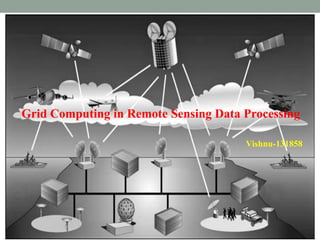
  • 1. Grid Computing in Remote Sensing Data Processing Vishnu-131858
  • 2. Contents  Introduction to Grid computing Requirements for remote sensing data processing on grid environment Advantages for remote sensing systems to employ a grid computing The structure and character of system based on grid Grid middleware for remote sensing image processing Literature review Case study1 Case study2 Summery References
  • 3. Introduction A huge amount of remotely sensed data is acquired every day. These Remote sensing images need to be processed and stored in real time or near-real time. Processing the huge amount of data with complicated algorithms needs great computational power beyond a single machine because it is not only data intensive, but also computation intensive. Grid computing is a promising technology that seeks to easily and efficiently coordinates the sharing of geographically distributed computing resources, thereby bring supercomputing power to its users. Some grid projects have been carried out, such as Globus, Condor and Unicore.
  • 4. Requirements for remote sensing data processing on grid environment Main objective is to design and build a Grid-Based Problem Solving Environment to allow sharing of software and computational resources for remote sensing data processing among different organizations, through high speed networks. The following requirements are identified for this grid environment: Sharing of computational resources Sharing of software resources Management of resources. Secure usage of the services available on the grid in agreement with the access policies.  Efficient usage of the network links. Composing and compiling of new processing applications upon the cooperation of existing ones. Supporting different data formats.
  • 5. ATYPICAL VIEW OF GRID ENVIRONMENT User Resource Broker Grid Resources Grid Information Service A User sends computation or data intensive application to Global Grids in order to speed up the execution of the application. A Resource Broker distribute the jobs in an application to the Grid resources based on user’s QoS requirements and details of available Grid resources for further executions. Grid Resources (Cluster, PC, Supercomputer, data base, instruments, etc.) in the Global Grid execute the user jobs. Grid Information Service system collects the details of the available Grid resources and passes the information to the resource broker. Computation result Grid application Computational jobs Details of Grid resources Processed jobs
  • 6. Advantages for remote sensing systems to employ a grid computing • Cost savings through the sharing of resources • Scalability to meet variations in resource demands and balance work loads • Shorter time to results • Enable collaboration across organizations and among widely distributed users, by sharing resources (data, software, and hardware). • More efficient use of available resources • Increased productivity through standardization and access to additional resources.
  • 7. The Structure of Remote sensing processingsystem based on Grid The overall architecture of remote sensing processing system based on Grid and service is composed of a structure which includes the following four layers Data layer it can offer various raw products to processing service unified system upon users’ request for further and deeper processing results. Processing layer is formed by various services for remote sensing processing whose package mode are Grid services based on high-performance environment . Figure shows the layered system architecture and its relationship
  • 8. Grid layer, the main role it plays is managing both the data and service resources so that to achieve the goal of sharing the resources, providing a unified system operating environment of remote sensing application and coordinating the tasks of remote sensing processing. Application support layer.  Its role is the connectivity between the remote sensing systems facing end-users and various sources of remote sensing processing in Grid. It is formed by middleware supporting Grid, Tools such as automatic generation tools of remote sensing application, user interfaces, application deployment tools, etc.
  • 9. Grid Middleware for remote sensing image Processing Grid middleware for remote sensing image processing to meet the needs of real time or near-real time processing. The middleware is an advanced high throughput Condor-based computing grid middleware that supports The execution of remote sensing image Processing over a geographically distributed, and Heterogeneous collection of resources. Condor system provides the technologies for resource discovery, dynamic task-resource matching, communication, and result collection, etc.
  • 10. The scheme of grid middleware for image processing
  • 11. Functions of each sub-modules: Tasks partition --user can input the number of tasks partitioned, and then the tasks will be auto-partitioned. Task submission --user can submit all the partitioned tasks to the grid manager. Task execution --include remote sensing image processing programs, when the tasks are submitted, relative programs will be remotely called by the grid nodes for the task execution. Task monitoring --used to monitor the image processing progress, Result collection --all the execution results on each grid node will be auto-collected, Result piecing --all the returned results will be merged into one final whole image, which is the final result of image processing just like that obtained on a single computer.
  • 12. Literature review • Chaolin Wu et.al.(2005) analysed a way to solving the large-scale or complex problems through grid computing. • To apply the Grid computing to remote sensing information, a Remote Sensing Information Grid analysis and Service Node (RSIGN) has been established in Tele-geoprocessing Group, Institute of Remote sensing Applications, Chinese Academy of Sciences. • The management and distribution of the tasks are key problems in RSIGN node. How to distribute and manage the tasks has significant influence on the efficiency of the whole Grid system. • Also discussed on two main strategies for RSIGN node: geometric parallel and algorithm parallel. and • How to choose the best task managing strategy for different problems in remote sensing information processing and analysis.
  • 13. Yong Xue, Tong Yu et al.(2006) proposed, A New Approach to Generate the Look-Up Table for Aerosol Remote Sensing on Grid Platform. LUT is popular used in aerosol remote sensing retrieval which is a matrix of dependency variable corresponding a set of combinations of independent variable values. They used 6S module to generate LUT. And Also discuss approaches to parameterization, task partitioning, generated methodology, and the collection of result. Jing Dong et.al. (2012) designed The cluster as a hierarchical one, and achieved a Global Task Scheduler for the workflow process, improved the system performance. It is One of the most effective solutions is Grid Computing platform built on the basis of network, which is a scalable virtual unified platform with unlimited computing power and storage capacity. The RSSN (Remote Sensing Information Service Grid Node) is a PC cluster for Remote Sensing Quantitative Retrieval. It was used for producing aerosol optical depth (AOD) production covered the land area of Asia. The Computing pool was built with common commercial PCs instead of Servers or Workstations because of their price advantage. The PCs were connected as a loosely coupled LAN via Network Switches.
  • 14. Casestudy1 Analysis of image de-blurringdistributedprocessing • To test the performance of distributed image deblurring on a grid, the first experiment was conducted on a grid testbed of 4 commodity PCs nodes connected using 100Mbps Ethernet switch have the same performance. • The image data used for their experiments is 128Mb satellite remotely sensed image. • The geometric parallel strategy is taken in our distributed processing experiments.
  • 15. • Figure shows The overlap strategy of image division. (Grey area is the neighbourhood pixels for sub-image1) • The whole image was partitioned into 4 sub-images as equally as possible, which is same to the number of grid nodes. • To check the performance of our grid middleware and grid computing test bed, a comparison is made between our work and a traditional computational test on a single computer conducted with only one grid node of the test bed.
  • 16.  Fig shows The comparison between the original image (upper) and de-blurred image (bottom) on grid test bed  Table shows the performance for 4 tasks partitioned and 4 available grid nodes of grid computing testbed-1 in their preliminary experiment.
  • 17. • The execution time on testbed-1 Tg is much less than that on a single computer Ts, which demonstrates the good performance of thier grid middleware for improving the efficiency of image deblurring processing. • Conclusion: • By means of image processing grid middleware, grid nodes can be aggregated to meet the needs of intensive remote sensing image processing computations. Using grid computing platform, real time or near real time remote sensing image processing may be realized
  • 18. Casestudy2 ANewApproachto Generate the Look-UpTable forAerosolRemote Sensing on Grid Platform • This case study focuses on realization of the compute-intensive look- up table generation on GCP-ARS (Grid Computation Platform for Aerosol Remote Sensing), which was one grid middleware that are developing based on Condor system. • GCP-ARS architecture mainly consists of three entities: clients, a resource broke, and producers. • Aerosol retrieval is launched though a client GUI for execution at producers that share its idle cycles through the resource broker. • The resource broke manages tasks application execution, resource management and result collection by means of Condor system.
  • 19. Methodology For aerosol retrieval, they refer to apparent reflectance matrix corresponding to Sensor-Target-Solar geometric conditions, ground surface reflectance, aerosol and atmosphere conditions. 6S methodology is selected for LUT generation, which is Radiative Transfer Models (RTM) for atmospheric radiative calculation. 6S codes can simulate the radiance and reflectance in the solar spectral region (0.25- 4.0um) considering the scattering and absorbing atmospheric effects due to gases and aerosol, as well as the surface effects. • The generation of LUT is actually time-consumed. • Building one LUT of 91125 input combinations sets needs about 2 days on one PC. • Figure 4.2.1 show the flow chart to generate the LUT.
  • 20.  Parameterization include Radiative Transfer Model parameters input, LUT structure parameters such as maximum, minimum value and of each independent variable, which decide the structure and size of the LUT, tasks partition parameters, execution program (default is 6S codes) selection.  Execution phase refer to the computation of dependency variable by execution program.  The final LUT will be saved at termination
  • 21. EXPERIMENTSANDANALYSIS Experiments were carried out on a grid computing pool consists of 5 low commodity PCs nodes connected using 100Mbps Ethernet switch. Their test is to generate one Apparent Reflectance LUT corresponding to independent variables: solar zenith, sensor zenith, relative zenith, ground surface reflectance and aerosol optical thickness (AOT). Table shows the structure information of LUT generated
  • 22.  Table shows the performance for varying number of tasks partitioned and producers.  The sequential execution time(Ts) was from test on a single computer. The execution time (Tn) decreases with the number of tasks partitioned increasing when the number of available producers is more than number of tasks partitioned due to more producers contribute to the execution at a time.
  • 23. CONCLUSION: • LUT could be quickly set up through grid computing technique, which, by pooling and aggregating the idle CPU circle together, has high throughput computing to meet the needs of intensive computations. • The LUT generated by 6S module could be used for GCP-ARS to retrieve the aerosol optical thickness (AOT).
  • 24. Summery • Grid platform for Distributed Remote sensing Image processing are very encouraging, which show the good potential of grid computing technology for satellite image processing. • By means of image processing grid middleware, grid nodes can be aggregated to meet the needs of intensive remote sensing image processing computations. • Using grid computing platform, real time or near real time remote sensing image processing may be realized.
  • 25. REFERENCES • Giovanni Aloisio, Massimo Cafaro, Italo Epicoco, Gianvito Quarta; “A Problem Solving Environment for Remote Sensing Data Processing”, Proceedings of the International Conference on Information Technology: Coding and Computing (2004) • Jiakui Tang, Aijun Zhang, Shengyang Li “Preliminary Research on Grid- based Remote Sensing Image distributed Processing” IFIP International Conference on Network and Parallel Computing – Workshops,2007. • L. Fusco, R. Cossu, and C. Retscher. “Open Grid Services for Envisat and Earth observation applications,” in High Performance Computing in Remote Sensing, A. Plaza and C. Chang (Eds.), Chapman & Hall, Taylor & Francis Group, 2008 • Liang zhonga & hongchao maa ” research of fast processing and distribution remote sensing image based on the grid technique” the international archives of the photogrammetry, remote sensing and spatial information sciences. vol. xxxvii. part b4. beijing 2008.
  • 26. • Tang, J.K., Xue, Y., Guan, Y.N.et.al.”A New Approach to Generate the Look-up Table Using Grid Computing Platform for Aerosol Remote Sensing”, 2004 IEEE International Geoscience and Remote Sensing Symposium. • Tianhe Yinet.al. “Eco-environmental Information Grid Platform and Its Implement” Ministry of Science & Technology of Zhejiang, 2010. • Wan wei1, yong xue “A high performance remote sensing retrieval application on an institutional desktop grid” China Center for Resource Satellite Data and Application, Beijing 100830, China. 2009

Notas del editor

  1. In fact, the amount of data to be transferred from end users to nodes and vice-versa is quite large. The data movement, considering that it can be a bottle neck, impacts on the global performance of the architecture.