SlideShare una empresa de Scribd logo
1 de 10
Descargar para leer sin conexión
Application of Differential Systems in Global
Navigation Satellite Systems
Ali N. Khojasteh1
, Saeed Mazaheri1
, Mehdi Jamshidi1
, Ehsan Vahedi1*
1
Department of Electrical Engineering, Shahid Ashrafi Airport, Kermanshah, Iran
*E-mail:sadra113@gmail.com
Abstract. Global Navigation Satellite Systems (GNSS) include different parts
such as control and monitoring stations for the Earth and space settings.
Timing, positioning, and control of navigation methods are the main outputs of
GNSS. Based on Approach Procedure with Vertical guidance (APV), local and
global Satellite Navigation Systems used for positioning and precision approach
in aviation instead of present systems like Instrumental Landing Systems (ILS)
and its future predict of ICAO. But these systems have errors in positioning and
velocity measurements. The differential corrections are determined by single or
multiple reference stations. The single reference station concept is simple but
the position accuracy is decreases. This article compares differential systems
methods for correcting the errors..
Keywords: GNSS; Satellite; Navigation; Differential Systems; DGNSS
1 Introduction
The Global Navigation Satellite Systems (GNSS), including the US’s Global
Positioning System (GPS), Russia’s GLONASS, EU’s Galileo and China Beidou
(also called COMPASS) as well as several regional navigation satellite systems, can
be characterized as a highly precise, continuous, all-weather and near-real-time
microwave (L-band) technique with signals through the Earth’s atmosphere. These
characteristics of GNSS imply more and wider applications and potentials. Each
GNSS satellite continuously broadcasts radio signals in two or more frequencies in L-
band (1–2 GHz) with wavelength around 20 cm, the direct signals are be used for
navigation, positioning and timing. The refracted signals from GNSS Radio
occultation satellites together with ground GNSS observations can provide the high-
resolution tropospheric water vapor, temperature and pressure, tropopause parameters
and ionospheric total electron content (TEC) and electron density profile as well. The
GNSS reflected signals from the ocean and land surface could determine the ocean
height, wind speed and wind direction of ocean surface, oil moisture, ice and snow
thickness. Therefore, the refracted and reflected GPS signals can image the Earth’s
surface environments as a new, highly precise, continuous, all-weather and near-real-
time remote sensing tool, which will play a key role in various atmospheric sounding,
ocean remote sensing and land/hydrology mapping. In the following sections, the
GNSS history, system, signals, theory and applications are introduced (Fig. 1).
Fig.1. Global Navigation Satellite Systems (GNSS).
2 GNSS Signals and Systems
GNSS is consisting of a space segment having a constellation of satellites in Medium
Earth Orbit (MEO) at the height of nearly 20,000 km and above, control segment
having monitoring and control stations to monitor/control/update the constellation of
satellites and the user segment; consisting of receivers to give position, velocity and
time (PVT) of the static and mobile user all over the globe at all times using at least
four satellites of the constellation in view.
The Global Navigation Satellite System (GNSS) has a well-defined structure,
initially designed by US and USSR and then is being followed by the systems like
Galileo and Beidou. The basic segments like space, control, user and augmentation
are discussed in next lines. The reference architecture is about the GPS as it is only
the fully operational at this moment with maximum information too. The signal
structure is also discussed briefly to understand the basic principle of navigation and
finding the position and time information.
2.1 Space Segment
It consists of constellation of satellites equipped with navigational payload, precise
atomic clocks, navigational antennas and other subsystems like thermal, propulsion,
attitude and orbit determination and control (AODC), Tracking, Telemetry and
Command (TT&C) and power subsystems. The constellation is designed considering
the availability of at least four satellites at all times across the globe. The satellites are
arranged in different planes to provide the best geometric dilution of precision
(GDOP), a parameter of satellite geometry. Medium Earth Orbits (MEO), 20,000–
30,000 km, are chosen for the constellation of satellites due to considerable launch
cost and global coverage.
2.2 Control Segment
It consists of master control center along with some monitoring stations and telemetry
telecommand antennas spread all over the globe to perform the following main tasks.
- Measures the position of each satellite and controls its attitude and orbit;
- Monitors the signals broadcast by satellites
- Sends information to satellites for a proper clock alignment
- Sends information to satellites for the navigation message
2.3 User Segment
User segment consists of mainly the GNSS receivers to process the signals received
from the satellites and estimates the user’s position. The functionalities common to
any kind of receiver can be summarized as identification of the satellites in view,
estimation of the user-satellite distance and Triangulation.
2.3 Augmentation Segment
It includes additional equipment like local elements, pseudolites or Geo-Satellites
allowing new services or improved performance. Differential GPS (DGPS), Local
area GPS (LGPS), Wide Area GPS (WGPS), WAAS (Wide Area Augmentation
System), GDGPS (Global Differential GPS) by NASA, MSAS (Multifunction
Satellite Augmentation System) by Japan and EGNOS (European Global Navigation
Overlay System) by European Union are the few examples.
3 GNSS Signals
GNSS signals are summarized in Table 1 (Hofmann-Wellenhof et al. 2008). For
example, GPS satellites continuously broadcast right-hand circularly polarized signals
with both the navigation message and ranging codes modulated on two L-band
microwave carrier frequencies, i.e., the L1 (f1=1.57542 GHz, λ1≈19.0 cm) and L2
(f2=1.2276 GHz, λ2≈24.4 cm). Starting from 2006, as part of GPS modernization
effort, two new civilian-use signals L2C (L2 frequency, C denoting civilian) and L5
(fL5=1.17645 GHz, λL5≈25.5 cm) were broadcasting on the new generation GPS
satellites. Also another civilian-use frequency L1C is down the road in the near future.
The navigation message includes the ephemeris data, used to calculate the position of
the individual GPS satellite in orbit at the time of signal transmission, and the
almanac data with the information about the time and status of the entire satellite
constellation. On the other hand, the ranging code enables the user’s receiver to
determine the transit (or propagation) time of the signal and thereby determine the
satellite-to-user range. The satellite network uses a CDMA (code division multiple
access) spread-spectrum technique where the low-bit-rate message data is encoded
with a high-rate “pseudo-random noise” (PRN) sequence that is unique for each GPS
satellite. The PRN is a binary signal with random noise-like properties, which is
generated by mathematical algorithm or “code”, and consists of repeated pattern of
1’s and 0’s. Both L1 and L2 signals are modulated by a pseudo-random precision
ranging code (P code). The L1 carrier signal is also modulated with coarse/acquisition
(C/A) ranging code for civilian use. The P code can be encrypted as a so-called P(Y)
which is only available to military equipment with a proper decryption key. The L1
and L2 signals received from each GPS satellite can be expressed as follows (Spilker
1980):
(1)
(2)
where CC/A and CP1 are the received powers of the in-phase and quadrature
components of the L1 signal, respectively, CP2 is the received power of L2, D(t) is an
amplitude modulation for L1 and L2 containing navigation data, X(t) is a
pseudorandom sequence of ±1, known as clear acquisition or C/A code-modulating
the in-phase component of L1 at a rate of 1.023 MHz, and P(t) is a pseudorandom
sequence of ±1, known as P-code-modulating the quadrature component of L1 and L2
at a rate of 10.23 MHz. The C/A-Code and the P-Code are examples of PRN codes.
Each satellite transmits a unique C/A-Code and P-Code sequence (on the same L1 and
L2 frequencies), and hence a satellite may be identified according to its “PRN
number”, e.g. PRN2 or PRN14 are particular GPS satellites.
The CDMA technique allows the receiver to recognize multiple satellites on the
same frequency with different PRNs. A GPS receiver will detect amplitude, pseudo-
range and phase measurements for each C/A, L1 P-code (P1) and L2 P-code (P2)
signals. The C/A and P1 contained identical informations, however, the C/A is
preferred over P1 due to its stronger power and not being encrypted. Note that the
pseudo-range is an absolute measurement of differential group delay between time of
transmission and reception. It is the sum of the actual range between the transmitter
and the receiver, atmospheric and ionospheric delays and transmitter and receiver
clocks offsets. Note that the early GPS included a feature called Selective Availability
(SA) that adds intentional, time varying errors of up to 100 m (328 ft) to the publicly
available navigation signals. This was intended to deny an unauthorized use of GPS
signals. The SA service was eventually terminated in year 2000.
Table1. GNSS Signals
4 GNSS Error Sources
GNSS User Equivalent Errors (USER) is defined as the errors in PVT computation
due to three segments of GNSS architecture. In space segment, the source of error can
be satellite clock stability, satellite perturbations or selective availability (turned off in
May 2001). The control segment causes the errors like ephemeris prediction and the
user segment contributes the major part due to Ionospheric delay, Tropospheric delay,
receiver noise, multi-path, indoor positioning or due to urban canyons.
- Satellite and receiver clock errors
- Satellite orbit errors
- Atmospheric effects (ionosphere, troposphere)
- Multipath: signal reflected from surfaces near the receiver
- Antenna phase centre
- Solar radiation pressure
- Satellite Geometry
- Relativistic Effects
- Receiver noise
- Signal Obstruction
Fig.2 GNSS Refracted and reflected signals and geometry
4.1 GNSS Constellation Satellite Error
GNSS constellation satellite error mainly includes inherent orbital position error of
the satellite and clock error. The former is mainly caused by influences of various
perturbative forces, number of monitoring station and spatial distribution, number and
precision of orbital parameters, and non-real-time property of ephemeris, and the
range error caused thereby is approximately within 1.5 m–7.0 m; influences on range
error are tried to be weakened generally through simultaneous observation to work
out the difference or method of orbit improvement to limit it within the error scope of
1 m. The latter refers to the nonsynchronous deviation between satellite clock and
GNSS standard time due to frequency offset and frequency drift between clock of
GNSS constellation satellite and GNSS standard time; total quantity of such deviation
may reach 1 ms, and equivalent range error caused thereby may reach 300 km; the
deviation may correct the clock error model through continuous measurement of the
ground station to limit the equivalent range error within 6 m; if residual error of
GNSS constellation satellite clock is further weakened, it may be realized through
differential technology.
4.2 GNSS Signal Propagation Error
GNSS signal propagation error mainly includes ionospheric refraction, tropospheric
refraction, multipath error, etc. Ionospheric refraction error: Ionospheric refraction
error is in direct proportion to atmospheric electron density and inversely proportional
to the penetrated electromagnetic wave frequency. Atmospheric electron density
varies with radiation intensity of the Sun and other celestial bodies, season, time,
geographic position, etc. For GNSS constellation satellite signal, randomness of solar
activity is large, so the difference of impact of ionospheric refraction on GNSS
navigation and positioning error is large, and it is impossible to establish precise
mathematical model for it. During GNSS navigation and positioning, methods may be
generally adopted to weaken the impact of ionosphere on the precision of GNSS
navigation and positioning include: (1) correction through double frequency
observation; (2) correction through simultaneous observation value to work out the
difference, i.e., relative positioning method.
An effective method to reduce influence of tropospheric refraction on navigation and
positioning error is to estimate the propagation delay of electromagnetic wave in the
troposphere. Measures commonly taken at present mainly include: (1) working out
the difference through simultaneous observation to effectively reduce or even
eliminate influences on delay of troposphere; (2) improving atmospheric model of
troposphere through measured data nearby the monitoring station.
Besides directly receiving signals sent by GNSS constellation satellite, GNSS receiver
also receives GNSS constellation satellite signals sent for once or many times by
buildings surrounding the receiver antenna, i.e., during actual measurement, signals
received by GNSS antenna are signals superimposed by direct and reflected wave.
Phase delay may exist between reflected and direct wave since the length of path
passed by the two signals is different, and multipath error is thereby caused. It is
difficult to establish accurate error model due to the uncertainty of reflection
coefficient of reflector and the distance between it and the receiver antenna. Measures
may be taken to reduce multipath error at present mainly include: (1) trying to make
GNSS receiver antenna avoid object surface with large reflection coefficient; (2)
using GNSS receiver antenna with good directivity such as the choking coil antenna.
4.3 Signal Reception Error
Such errors mainly include GNSS receiver measurement error, GNSS receiver clock
error, antenna phase center error, etc. Among them, besides related to measurement
resolution of software and hardware of GNSS receiver for constellation satellite
signals, GNSS receiver measurement error is also related to installation precision of
GNSS receiver antenna. GNSS receiver clock error is related to the receiver, so the
clock error may be taken as an unknown parameter to estimate such error by working
out the pseudo-range equation; influences of such error may also be eliminated by
working out the differential treatment through observation quantity. Antenna phase
center error is caused by different incident angles, and equivalent range error may
reach a few millimeters or even a few centimeters according to conditions of antenna
performance.
5 Differential Systems
The signal of GNSSS was relayed from geosynchronous satellites to the user
equipment. The user equipment responded to the signal with the geostationary
satellites. Finally, the master ground station computed the user position using two-
way run-time measurement, implementing either measurements from three satellites
or additionally implementing height information from a barometer. The GEOSTAR
systems work as a model for the Twin-Star program of China, which later became
Beidou-1. The US’s company Qualcomm launched the OmniTRACS system in 1988
to provide a space-based service for position determination and data dissemination for
America. EutelTRACS operated in cooperation with the European
Telecommunication Satellite Organization. The systems have been developed mainly
for fleet management purposes. Both systems rely on a concept similar to GEOSTAR.
A ranging signal is transmitted from a ground station with geostationary satellites to
the user and back again. The position is derived from run-time measurements
incorporating height information of an elevation model .The subsystem for position
determination is denoted as Qualcomm automatic satellite position reporting
(QASPR). Meanwhile Omni-TRACS and EutelTRACS also integrate GNSS receivers
in the user equipment to increase the positioning performance. The bidirectional
communication link transmits the GNSS position to the service center.
The degradation of the GPS point positioning accuracy by selective
availability (SA) has led to the development of differential techniques. While the
degradation has been deactivated but the methods still evolve to increase the
performance parameters of GNSS. The basic concept of differential GNSS (DGNSS)
relies on two or more receivers. From the known reference receiver location and the
satellite position there results in a computed range, which is opposed to the measured
range. A reference station or a reference network broadcasts differential corrections
which are used by the roving receiver to eliminate GNSS inherent errors in the
measurement (Fig. 3).
Fig.3 Basic concept of differential positioning
Three groups of GNSS range biases are distinguished: satellite-specific biases, signal
propagation errors, and receiver-specific biases. DGNSS eliminates or reduces the
satellite-specific biases and the signal propagation errors. The differential corrections
are determined by a single or by multiple reference stations. The single-reference
station concept is simple but the position accuracy decreases with increasing distance
from the reference station. The rover receives the differential corrections from one
reference station using a dedicated data link. The multiple-reference station concept
relies on several spatially distributed reference stations which determine differential
corrections and emit them to the user receiver. The network of reference stations
guarantees a homogeneous service performance over a larger coverage area.
Disadvantages of the multiple-reference station concept are the increased complexity
and costs for the service provider, and an increasing latency of the correction data due
to the network communication.
5.1 Differential Correction Domains
Three different approaches to compute differential corrections exist. Solution-domain
approach, measurement-domain approach, and state space approach. In the solution-
domain approach, the coordinate difference between the measured position and the
known position of the reference station is transmitted to the rover.These differences
are used to correct the rover position. As long as both receivers use measurements to
the same satellites and the same atmospheric models, this simple method will provide
good results. Local obstructions as well as an increasing distance between reference
stations and rover will result in a different satellite constellation. This concept is
mainly used in conjunction with the single-reference station concept.
The measurement-domain approach relies on a comparison of the
measurements and the computed ranges. The difference in pseudo-ranges determines
the pseudo-range corrections (PRC) and the range rate corrections (RRC). The rover
uses PRC and RRC to correct its own measurements. PRC and RRC are either a
weighted average of the reference station network, as mentioned by Szabo and
Tubman (1994), or direct observations of one reference station. In case of DGNSS
with a single reference station, the accuracy decreases as a function of distance from
the reference station at a rate of approximately 1 cm per 1 km. Conventional DGNSS
system concepts rely on raw or smoothed code pseudo-ranges. Position accuracies in
the meter level are achievable using code measurements. Phase smoothed code ranges
are necessary to obtain the submeter level. Precise DGNSS services, in contrast, use
phase pseudo-ranges. In this way, accuracies at the subdecimeter level can be
obtained in real time for ranges up to some 20 km. The compromise of higher
positioning accuracy of precise DGNSS is the necessity of ambiguity resolution.
Commonly the ambiguities must be resolved on-the-fly and therefore (generally)
dual-frequency receivers are required. DGNSS systems implementing the
measurement-domain approach are commonly denoted as extended or local-area
differential (LAD) GNSS.
In the state-space approach, the reference network models the various error
sources and transmits the model parameters to the rover. This concept is particularly
applied in augmentation systems but also in precise point positioning, where accurate
ephemerides and clock parameters are estimated. The use of dual-frequency receivers
simplifies the derivation of the ionospheric influence. Commonly a grid of
ionospheric vertical delay corrections is modelled. The remaining calibrated residual
between known range and measured range is projected onto the orbit and satellite
clock error. The high number of model parameters requires a network of reference
stations. The density of the network is lower compared to the measurement domain
approach. Systems following the state-space approach are designated as wide-area
differential (WAD) GNSS. Algorithms for the state-space approach can be found in
Mueller et al. (1994) or Kee (1996).
6 Examples of Differential Systems
The Fugro company introduced the commercial services OmniSTAR, SkyFix, and
StarFix for differential positioning. The use of OmniSTAR is exclusively allowed to
be used for onshore applications, whereas the other two have been introduced for
marine applications. OmniSTAR provides three levels of services: a VBS (virtual
base station) sub-meter positioning service, a better than 20 cm service, and a high-
performance better than 10 cm service level. For all services, about 100 terrestrial
reference stations are located around the world. In VBS mode, the reference stations
track the GPS satellites and compute differential code corrections, every station
individually. The differential corrections are encoded in a Radio Technical
Commission for Maritime Services (RTCM) format and transmitted to the user
receiver. The receiver then applies an inverse distance-weighted least-squares solution
to generate corrections of a virtual reference station. The medium service relies on
phase measurements and precise point positioning methods, thus integrating precise
ephemerides and clock information which are estimated based on the reference station
network. The ionospheric influence is eliminated by dual-frequency receivers. In the
high-performance mode, phase corrections and dual-frequency methods are applied.
SkyFix and StarFix are similar in concept but rely on different technologies, thus,
providing two redundant systems for increased integrity. The SkyFix and StarFix
technique apply the precise point positioning concept, which Fugro denotes as
satellite differential GPS (SDGPS). The differential information is provided to the
user via several commercial geostationary satellites which provide worldwide
coverage of about 90% excluding the north and south poles. The L-band satellite
signals in the frequency band 1531–1559MHz are decoded by dedicated receiver
modules and the correction information is provided to the GNSS receivers.
6.1 StarFire
The StarFire global space-based differential system is a commercial precise point
positioning service developed by John Deere and Company. StarFire relies on 60
globally distributed monitoring stations and two independent control centres both
located in the US. The space segment consists of three Inmarsat satellites which
provide global coverage except for the north and south poles. The satellites are
positioned at 98ºW, 25ºE, and 109ºE longitude and transmit correction signals in the
L-band. The differential corrections consist of precise orbit and clock values which
are used in a dual-frequency receiver to achieve position accuracy in the sub-meter
range.
6.1 GDGPS
The Jet Propulsion Laboratory (JPL) of NASA developed a global differential GPS
(DGPS) named GDGPS to provide high-accuracy GPS differential information in real
time to support NASA science missions. Dual-frequency receivers which eliminate
the ionospheric error integrate the ephemerides and clock differential corrections to
achieve higher position accuracies. Correction data transmission rates of up to 1 Hz
are possible. A global network of 100 stations operated by JPL and international
partner organizations allows treating the ephemerides and clock corrections. At the
same time the performance of the GPS satellites is monitored. Thus, any GPS satellite
failure is reported to the user receiver in nearly real time. The correction information
is accessible, e.g., via Internet using the Internet-based global DGPS service. The
real-time differential correction message is also planned to be transmitted using S-
band frequencies of the tracking and data relay satellite system (TDRSS). This service
is especially designed for spacecraft which determine their position using GPS
signals.
6.2 National DGNSS
Numerous national, regional, and urban DGNSS services have been created which
provide differential information at a service fee. Various companies, e.g., power
suppliers, create their own DGNSS network for their special fields of application and
requirements. National DGNSS services are exemplarily named and shortly described
in the following paragraphs. The Austrian positioning service (APOS) integrates
GNSS measurements of about 40 reference stations. In addition, measurements of
reference stations of neighboring countries are used to increase the accuracy and
homogeneity of the data. APOS provides different service levels, beside others RTK
and DGPS services. The data streams are accessible via Internet or cellular networks.
The satellite positioning service (SAPOS) provides DGNSS services for the German
territory. Three service levels are offered providing real-time positioning service,
high-precision real-time positioning, and geodetic high-precision positioning service.
The data is transmitted in the VHF band or using cellular networks. The high-
precision service provides position accuracies in the 1 to 5 cm range.
The objective of the European position determination system (EUPOS), an
initiative started in March 2002, is to establish a uniform DGNSS basis infrastructure
in central and eastern Europe. EUPOS seeks to enhance the cross-border
compatibility of the DGNSS systems. The goal is to integrate 870 reference stations
in 14 countries in a common network. The correction information shall be useable for
land, marine, and air applications but also for geodetic point positioning, i.e.,
providing sub-meter real-time services as well as subcentimeter in post-processing.
The EUPOS data will be accessible via Internet, cellular networks, or VHF.
7 Conclution
In this article at firs GNSS was introduced. Then signals and their sources and
specifications was inspected. Famous satellites which used for GPS, GNSS, and
navigation were listed. Different forms of GNSS and differential systems were
studied and at last a comparison among them indicates their advantages and
disadvantages.
References
AShuangen Jin, E. Cardellach, F. Xie. (2014). GNSS Remote Sensing, Springer.
Hofmann Wellenhof, Wasle. (2007). GNSS: Global Navigation Satellite Systems,
Springer.
J. Dutronc & N. Colcy, (1990), Land Mobile Communications in Ku-Band Results of
a Test Compaign on EUTELSAT I-F1, International Journal of Satellite
Communications, Vol. 8.
Bar-Sever et al, (2010), One-centimeter Orbit for Jason-1: New GPS-Based
Strategies, Taylor & Francis.

Más contenido relacionado

La actualidad más candente

telemetry tracking and command systems
telemetry tracking and command systemstelemetry tracking and command systems
telemetry tracking and command systemsShaheem TM
 
Extraction of Ephemeris file from Matlab SDR
Extraction of Ephemeris file from Matlab SDRExtraction of Ephemeris file from Matlab SDR
Extraction of Ephemeris file from Matlab SDRAsimKhan367
 
SATELLITE COMMUNICATION AND IT'S APPLICATION IN GPS
SATELLITE COMMUNICATION AND IT'S APPLICATION IN GPSSATELLITE COMMUNICATION AND IT'S APPLICATION IN GPS
SATELLITE COMMUNICATION AND IT'S APPLICATION IN GPSArkaprava Jana
 
Conceptual design and architecture of turkish communication satellite turksat...
Conceptual design and architecture of turkish communication satellite turksat...Conceptual design and architecture of turkish communication satellite turksat...
Conceptual design and architecture of turkish communication satellite turksat...Atılay Mayadağ
 
Doc 9849 Global Navigation Satellite System
Doc 9849 Global Navigation Satellite SystemDoc 9849 Global Navigation Satellite System
Doc 9849 Global Navigation Satellite SystemOlexiy Pogurelskiy
 

La actualidad más candente (20)

telemetry tracking and command systems
telemetry tracking and command systemstelemetry tracking and command systems
telemetry tracking and command systems
 
Gps measurements
Gps measurementsGps measurements
Gps measurements
 
P8.9
P8.9P8.9
P8.9
 
Gps
GpsGps
Gps
 
Gps final main
Gps final mainGps final main
Gps final main
 
Extraction of Ephemeris file from Matlab SDR
Extraction of Ephemeris file from Matlab SDRExtraction of Ephemeris file from Matlab SDR
Extraction of Ephemeris file from Matlab SDR
 
SATELLITE COMMUNICATION AND IT'S APPLICATION IN GPS
SATELLITE COMMUNICATION AND IT'S APPLICATION IN GPSSATELLITE COMMUNICATION AND IT'S APPLICATION IN GPS
SATELLITE COMMUNICATION AND IT'S APPLICATION IN GPS
 
8 17
8 178 17
8 17
 
Final Lecture Enav211
Final Lecture Enav211Final Lecture Enav211
Final Lecture Enav211
 
Conceptual design and architecture of turkish communication satellite turksat...
Conceptual design and architecture of turkish communication satellite turksat...Conceptual design and architecture of turkish communication satellite turksat...
Conceptual design and architecture of turkish communication satellite turksat...
 
GPS IN AVIATION SYSTEM
GPS IN AVIATION SYSTEMGPS IN AVIATION SYSTEM
GPS IN AVIATION SYSTEM
 
Global positioningsystem
Global positioningsystemGlobal positioningsystem
Global positioningsystem
 
Global Navigation Satellite System (GNSS) update
Global Navigation Satellite System (GNSS) updateGlobal Navigation Satellite System (GNSS) update
Global Navigation Satellite System (GNSS) update
 
Doc 9849 Global Navigation Satellite System
Doc 9849 Global Navigation Satellite SystemDoc 9849 Global Navigation Satellite System
Doc 9849 Global Navigation Satellite System
 
Gps
GpsGps
Gps
 
review
reviewreview
review
 
G P S IN INDIA
G P S IN INDIAG P S IN INDIA
G P S IN INDIA
 
Gps
GpsGps
Gps
 
GPS-errors-1
GPS-errors-1GPS-errors-1
GPS-errors-1
 
GNSS
GNSSGNSS
GNSS
 

Destacado

Final guia bibl carnem cardona 23
Final guia bibl  carnem cardona 23Final guia bibl  carnem cardona 23
Final guia bibl carnem cardona 23Carmen Cardona
 
Trabajo de informatica de angie
Trabajo de informatica de angieTrabajo de informatica de angie
Trabajo de informatica de angieangiepao96
 
Utilizacion de la web 2
Utilizacion de la web 2Utilizacion de la web 2
Utilizacion de la web 2Ramon Rangel
 
Trabajo de informatica angie
Trabajo de informatica angieTrabajo de informatica angie
Trabajo de informatica angieangiepao96
 
Presentación tema 1
Presentación tema 1Presentación tema 1
Presentación tema 1paolaconde
 
SUNILKUMAR_NEWCV02
SUNILKUMAR_NEWCV02SUNILKUMAR_NEWCV02
SUNILKUMAR_NEWCV02Sunil Kumar
 
彼得前書第一章
彼得前書第一章彼得前書第一章
彼得前書第一章hkyeung
 
жер жөнүндөгү илимдер жана
жер жөнүндөгү илимдер жанажер жөнүндөгү илимдер жана
жер жөнүндөгү илимдер жанаatay99AA
 

Destacado (15)

2011
20112011
2011
 
Trasporte aéreo
Trasporte aéreoTrasporte aéreo
Trasporte aéreo
 
Trasporte aéreo
Trasporte aéreoTrasporte aéreo
Trasporte aéreo
 
Estandares
EstandaresEstandares
Estandares
 
Final guia bibl carnem cardona 23
Final guia bibl  carnem cardona 23Final guia bibl  carnem cardona 23
Final guia bibl carnem cardona 23
 
Control estratégico
Control estratégicoControl estratégico
Control estratégico
 
Trabajo de informatica de angie
Trabajo de informatica de angieTrabajo de informatica de angie
Trabajo de informatica de angie
 
Utilizacion de la web 2
Utilizacion de la web 2Utilizacion de la web 2
Utilizacion de la web 2
 
Trabajo de informatica angie
Trabajo de informatica angieTrabajo de informatica angie
Trabajo de informatica angie
 
Presentación tema 1
Presentación tema 1Presentación tema 1
Presentación tema 1
 
MI Webinar 13Mar2013
MI Webinar 13Mar2013MI Webinar 13Mar2013
MI Webinar 13Mar2013
 
Voleibol
VoleibolVoleibol
Voleibol
 
SUNILKUMAR_NEWCV02
SUNILKUMAR_NEWCV02SUNILKUMAR_NEWCV02
SUNILKUMAR_NEWCV02
 
彼得前書第一章
彼得前書第一章彼得前書第一章
彼得前書第一章
 
жер жөнүндөгү илимдер жана
жер жөнүндөгү илимдер жанажер жөнүндөгү илимдер жана
жер жөнүндөгү илимдер жана
 

Similar a Application of differential systems in global navigation satellite systems

DUAL BAND GNSS ANTENNA PHASE CENTER CHARACTERIZATION FOR AUTOMOTIVE APPLICATIONS
DUAL BAND GNSS ANTENNA PHASE CENTER CHARACTERIZATION FOR AUTOMOTIVE APPLICATIONSDUAL BAND GNSS ANTENNA PHASE CENTER CHARACTERIZATION FOR AUTOMOTIVE APPLICATIONS
DUAL BAND GNSS ANTENNA PHASE CENTER CHARACTERIZATION FOR AUTOMOTIVE APPLICATIONSjantjournal
 
Different GNSS (Global Navigation Satellite System) Receiver’s combination an...
Different GNSS (Global Navigation Satellite System) Receiver’s combination an...Different GNSS (Global Navigation Satellite System) Receiver’s combination an...
Different GNSS (Global Navigation Satellite System) Receiver’s combination an...IJMTST Journal
 
Introduction to gps and gnss
Introduction to gps and gnssIntroduction to gps and gnss
Introduction to gps and gnssVivek Srivastava
 
Design and First Results of an UAV-Borne L-Band Radiometer for Multiple Monit...
Design and First Results of an UAV-Borne L-Band Radiometer for Multiple Monit...Design and First Results of an UAV-Borne L-Band Radiometer for Multiple Monit...
Design and First Results of an UAV-Borne L-Band Radiometer for Multiple Monit...Angelo State University
 
GPS DOCUMENT
GPS DOCUMENTGPS DOCUMENT
GPS DOCUMENTTuhin_Das
 
Global positioning system (gps)
Global positioning  system (gps)Global positioning  system (gps)
Global positioning system (gps)Vandana Verma
 
Assessment of the Accuracy of Processing GPS Static Baselines Up To 40 Km Us...
Assessment of the Accuracy of Processing GPS Static Baselines  Up To 40 Km Us...Assessment of the Accuracy of Processing GPS Static Baselines  Up To 40 Km Us...
Assessment of the Accuracy of Processing GPS Static Baselines Up To 40 Km Us...IJMER
 
Latest Advances in GPS technology Seminar report
Latest Advances in GPS technology Seminar reportLatest Advances in GPS technology Seminar report
Latest Advances in GPS technology Seminar reportMode Gautam Raj
 
INS/GPS Integrated Navigation Technology for Hypersonic UAV
INS/GPS Integrated Navigation Technology for Hypersonic UAVINS/GPS Integrated Navigation Technology for Hypersonic UAV
INS/GPS Integrated Navigation Technology for Hypersonic UAVNooria Sukmaningtyas
 
Perspectives and Trends of Satellite Navigation.pptx
Perspectives and Trends of Satellite Navigation.pptxPerspectives and Trends of Satellite Navigation.pptx
Perspectives and Trends of Satellite Navigation.pptxroshan375533
 
#4 gps introduction & gps messages
#4 gps introduction & gps messages#4 gps introduction & gps messages
#4 gps introduction & gps messagesMohammedHusain20
 

Similar a Application of differential systems in global navigation satellite systems (20)

Gps
GpsGps
Gps
 
DUAL BAND GNSS ANTENNA PHASE CENTER CHARACTERIZATION FOR AUTOMOTIVE APPLICATIONS
DUAL BAND GNSS ANTENNA PHASE CENTER CHARACTERIZATION FOR AUTOMOTIVE APPLICATIONSDUAL BAND GNSS ANTENNA PHASE CENTER CHARACTERIZATION FOR AUTOMOTIVE APPLICATIONS
DUAL BAND GNSS ANTENNA PHASE CENTER CHARACTERIZATION FOR AUTOMOTIVE APPLICATIONS
 
DUAL BAND GNSS ANTENNA PHASE CENTER CHARACTERIZATION FOR AUTOMOTIVE APPLICATIONS
DUAL BAND GNSS ANTENNA PHASE CENTER CHARACTERIZATION FOR AUTOMOTIVE APPLICATIONSDUAL BAND GNSS ANTENNA PHASE CENTER CHARACTERIZATION FOR AUTOMOTIVE APPLICATIONS
DUAL BAND GNSS ANTENNA PHASE CENTER CHARACTERIZATION FOR AUTOMOTIVE APPLICATIONS
 
Mobile mapping terminology
Mobile mapping terminologyMobile mapping terminology
Mobile mapping terminology
 
Different GNSS (Global Navigation Satellite System) Receiver’s combination an...
Different GNSS (Global Navigation Satellite System) Receiver’s combination an...Different GNSS (Global Navigation Satellite System) Receiver’s combination an...
Different GNSS (Global Navigation Satellite System) Receiver’s combination an...
 
Introduction to gps and gnss
Introduction to gps and gnssIntroduction to gps and gnss
Introduction to gps and gnss
 
Design and First Results of an UAV-Borne L-Band Radiometer for Multiple Monit...
Design and First Results of an UAV-Borne L-Band Radiometer for Multiple Monit...Design and First Results of an UAV-Borne L-Band Radiometer for Multiple Monit...
Design and First Results of an UAV-Borne L-Band Radiometer for Multiple Monit...
 
GPS DOCUMENT
GPS DOCUMENTGPS DOCUMENT
GPS DOCUMENT
 
Global positioning system (gps)
Global positioning  system (gps)Global positioning  system (gps)
Global positioning system (gps)
 
Assessment of the Accuracy of Processing GPS Static Baselines Up To 40 Km Us...
Assessment of the Accuracy of Processing GPS Static Baselines  Up To 40 Km Us...Assessment of the Accuracy of Processing GPS Static Baselines  Up To 40 Km Us...
Assessment of the Accuracy of Processing GPS Static Baselines Up To 40 Km Us...
 
Latest Advances in GPS technology Seminar report
Latest Advances in GPS technology Seminar reportLatest Advances in GPS technology Seminar report
Latest Advances in GPS technology Seminar report
 
INS/GPS Integrated Navigation Technology for Hypersonic UAV
INS/GPS Integrated Navigation Technology for Hypersonic UAVINS/GPS Integrated Navigation Technology for Hypersonic UAV
INS/GPS Integrated Navigation Technology for Hypersonic UAV
 
Perspectives and Trends of Satellite Navigation.pptx
Perspectives and Trends of Satellite Navigation.pptxPerspectives and Trends of Satellite Navigation.pptx
Perspectives and Trends of Satellite Navigation.pptx
 
#4 gps introduction & gps messages
#4 gps introduction & gps messages#4 gps introduction & gps messages
#4 gps introduction & gps messages
 
Ppt satellite com.
Ppt satellite com.Ppt satellite com.
Ppt satellite com.
 

Más de Ali N.Khojasteh

Más de Ali N.Khojasteh (7)

Strange & interesting sleep habits
Strange & interesting sleep habitsStrange & interesting sleep habits
Strange & interesting sleep habits
 
Graffitti
GraffittiGraffitti
Graffitti
 
Stress; how to stop it
Stress; how to stop itStress; how to stop it
Stress; how to stop it
 
Supercapacitor
SupercapacitorSupercapacitor
Supercapacitor
 
Opto modulator
Opto modulatorOpto modulator
Opto modulator
 
B0 frto
B0 frtoB0 frto
B0 frto
 
701
701701
701
 

Último

Merck Moving Beyond Passwords: FIDO Paris Seminar.pptx
Merck Moving Beyond Passwords: FIDO Paris Seminar.pptxMerck Moving Beyond Passwords: FIDO Paris Seminar.pptx
Merck Moving Beyond Passwords: FIDO Paris Seminar.pptxLoriGlavin3
 
Streamlining Python Development: A Guide to a Modern Project Setup
Streamlining Python Development: A Guide to a Modern Project SetupStreamlining Python Development: A Guide to a Modern Project Setup
Streamlining Python Development: A Guide to a Modern Project SetupFlorian Wilhelm
 
Leverage Zilliz Serverless - Up to 50X Saving for Your Vector Storage Cost
Leverage Zilliz Serverless - Up to 50X Saving for Your Vector Storage CostLeverage Zilliz Serverless - Up to 50X Saving for Your Vector Storage Cost
Leverage Zilliz Serverless - Up to 50X Saving for Your Vector Storage CostZilliz
 
DSPy a system for AI to Write Prompts and Do Fine Tuning
DSPy a system for AI to Write Prompts and Do Fine TuningDSPy a system for AI to Write Prompts and Do Fine Tuning
DSPy a system for AI to Write Prompts and Do Fine TuningLars Bell
 
New from BookNet Canada for 2024: BNC CataList - Tech Forum 2024
New from BookNet Canada for 2024: BNC CataList - Tech Forum 2024New from BookNet Canada for 2024: BNC CataList - Tech Forum 2024
New from BookNet Canada for 2024: BNC CataList - Tech Forum 2024BookNet Canada
 
"LLMs for Python Engineers: Advanced Data Analysis and Semantic Kernel",Oleks...
"LLMs for Python Engineers: Advanced Data Analysis and Semantic Kernel",Oleks..."LLMs for Python Engineers: Advanced Data Analysis and Semantic Kernel",Oleks...
"LLMs for Python Engineers: Advanced Data Analysis and Semantic Kernel",Oleks...Fwdays
 
Human Factors of XR: Using Human Factors to Design XR Systems
Human Factors of XR: Using Human Factors to Design XR SystemsHuman Factors of XR: Using Human Factors to Design XR Systems
Human Factors of XR: Using Human Factors to Design XR SystemsMark Billinghurst
 
WordPress Websites for Engineers: Elevate Your Brand
WordPress Websites for Engineers: Elevate Your BrandWordPress Websites for Engineers: Elevate Your Brand
WordPress Websites for Engineers: Elevate Your Brandgvaughan
 
"ML in Production",Oleksandr Bagan
"ML in Production",Oleksandr Bagan"ML in Production",Oleksandr Bagan
"ML in Production",Oleksandr BaganFwdays
 
Tampa BSides - Chef's Tour of Microsoft Security Adoption Framework (SAF)
Tampa BSides - Chef's Tour of Microsoft Security Adoption Framework (SAF)Tampa BSides - Chef's Tour of Microsoft Security Adoption Framework (SAF)
Tampa BSides - Chef's Tour of Microsoft Security Adoption Framework (SAF)Mark Simos
 
"Debugging python applications inside k8s environment", Andrii Soldatenko
"Debugging python applications inside k8s environment", Andrii Soldatenko"Debugging python applications inside k8s environment", Andrii Soldatenko
"Debugging python applications inside k8s environment", Andrii SoldatenkoFwdays
 
Artificial intelligence in cctv survelliance.pptx
Artificial intelligence in cctv survelliance.pptxArtificial intelligence in cctv survelliance.pptx
Artificial intelligence in cctv survelliance.pptxhariprasad279825
 
"Subclassing and Composition – A Pythonic Tour of Trade-Offs", Hynek Schlawack
"Subclassing and Composition – A Pythonic Tour of Trade-Offs", Hynek Schlawack"Subclassing and Composition – A Pythonic Tour of Trade-Offs", Hynek Schlawack
"Subclassing and Composition – A Pythonic Tour of Trade-Offs", Hynek SchlawackFwdays
 
Hyperautomation and AI/ML: A Strategy for Digital Transformation Success.pdf
Hyperautomation and AI/ML: A Strategy for Digital Transformation Success.pdfHyperautomation and AI/ML: A Strategy for Digital Transformation Success.pdf
Hyperautomation and AI/ML: A Strategy for Digital Transformation Success.pdfPrecisely
 
Scanning the Internet for External Cloud Exposures via SSL Certs
Scanning the Internet for External Cloud Exposures via SSL CertsScanning the Internet for External Cloud Exposures via SSL Certs
Scanning the Internet for External Cloud Exposures via SSL CertsRizwan Syed
 
Transcript: New from BookNet Canada for 2024: BNC CataList - Tech Forum 2024
Transcript: New from BookNet Canada for 2024: BNC CataList - Tech Forum 2024Transcript: New from BookNet Canada for 2024: BNC CataList - Tech Forum 2024
Transcript: New from BookNet Canada for 2024: BNC CataList - Tech Forum 2024BookNet Canada
 
Dev Dives: Streamline document processing with UiPath Studio Web
Dev Dives: Streamline document processing with UiPath Studio WebDev Dives: Streamline document processing with UiPath Studio Web
Dev Dives: Streamline document processing with UiPath Studio WebUiPathCommunity
 
Powerpoint exploring the locations used in television show Time Clash
Powerpoint exploring the locations used in television show Time ClashPowerpoint exploring the locations used in television show Time Clash
Powerpoint exploring the locations used in television show Time Clashcharlottematthew16
 
Vertex AI Gemini Prompt Engineering Tips
Vertex AI Gemini Prompt Engineering TipsVertex AI Gemini Prompt Engineering Tips
Vertex AI Gemini Prompt Engineering TipsMiki Katsuragi
 
How AI, OpenAI, and ChatGPT impact business and software.
How AI, OpenAI, and ChatGPT impact business and software.How AI, OpenAI, and ChatGPT impact business and software.
How AI, OpenAI, and ChatGPT impact business and software.Curtis Poe
 

Último (20)

Merck Moving Beyond Passwords: FIDO Paris Seminar.pptx
Merck Moving Beyond Passwords: FIDO Paris Seminar.pptxMerck Moving Beyond Passwords: FIDO Paris Seminar.pptx
Merck Moving Beyond Passwords: FIDO Paris Seminar.pptx
 
Streamlining Python Development: A Guide to a Modern Project Setup
Streamlining Python Development: A Guide to a Modern Project SetupStreamlining Python Development: A Guide to a Modern Project Setup
Streamlining Python Development: A Guide to a Modern Project Setup
 
Leverage Zilliz Serverless - Up to 50X Saving for Your Vector Storage Cost
Leverage Zilliz Serverless - Up to 50X Saving for Your Vector Storage CostLeverage Zilliz Serverless - Up to 50X Saving for Your Vector Storage Cost
Leverage Zilliz Serverless - Up to 50X Saving for Your Vector Storage Cost
 
DSPy a system for AI to Write Prompts and Do Fine Tuning
DSPy a system for AI to Write Prompts and Do Fine TuningDSPy a system for AI to Write Prompts and Do Fine Tuning
DSPy a system for AI to Write Prompts and Do Fine Tuning
 
New from BookNet Canada for 2024: BNC CataList - Tech Forum 2024
New from BookNet Canada for 2024: BNC CataList - Tech Forum 2024New from BookNet Canada for 2024: BNC CataList - Tech Forum 2024
New from BookNet Canada for 2024: BNC CataList - Tech Forum 2024
 
"LLMs for Python Engineers: Advanced Data Analysis and Semantic Kernel",Oleks...
"LLMs for Python Engineers: Advanced Data Analysis and Semantic Kernel",Oleks..."LLMs for Python Engineers: Advanced Data Analysis and Semantic Kernel",Oleks...
"LLMs for Python Engineers: Advanced Data Analysis and Semantic Kernel",Oleks...
 
Human Factors of XR: Using Human Factors to Design XR Systems
Human Factors of XR: Using Human Factors to Design XR SystemsHuman Factors of XR: Using Human Factors to Design XR Systems
Human Factors of XR: Using Human Factors to Design XR Systems
 
WordPress Websites for Engineers: Elevate Your Brand
WordPress Websites for Engineers: Elevate Your BrandWordPress Websites for Engineers: Elevate Your Brand
WordPress Websites for Engineers: Elevate Your Brand
 
"ML in Production",Oleksandr Bagan
"ML in Production",Oleksandr Bagan"ML in Production",Oleksandr Bagan
"ML in Production",Oleksandr Bagan
 
Tampa BSides - Chef's Tour of Microsoft Security Adoption Framework (SAF)
Tampa BSides - Chef's Tour of Microsoft Security Adoption Framework (SAF)Tampa BSides - Chef's Tour of Microsoft Security Adoption Framework (SAF)
Tampa BSides - Chef's Tour of Microsoft Security Adoption Framework (SAF)
 
"Debugging python applications inside k8s environment", Andrii Soldatenko
"Debugging python applications inside k8s environment", Andrii Soldatenko"Debugging python applications inside k8s environment", Andrii Soldatenko
"Debugging python applications inside k8s environment", Andrii Soldatenko
 
Artificial intelligence in cctv survelliance.pptx
Artificial intelligence in cctv survelliance.pptxArtificial intelligence in cctv survelliance.pptx
Artificial intelligence in cctv survelliance.pptx
 
"Subclassing and Composition – A Pythonic Tour of Trade-Offs", Hynek Schlawack
"Subclassing and Composition – A Pythonic Tour of Trade-Offs", Hynek Schlawack"Subclassing and Composition – A Pythonic Tour of Trade-Offs", Hynek Schlawack
"Subclassing and Composition – A Pythonic Tour of Trade-Offs", Hynek Schlawack
 
Hyperautomation and AI/ML: A Strategy for Digital Transformation Success.pdf
Hyperautomation and AI/ML: A Strategy for Digital Transformation Success.pdfHyperautomation and AI/ML: A Strategy for Digital Transformation Success.pdf
Hyperautomation and AI/ML: A Strategy for Digital Transformation Success.pdf
 
Scanning the Internet for External Cloud Exposures via SSL Certs
Scanning the Internet for External Cloud Exposures via SSL CertsScanning the Internet for External Cloud Exposures via SSL Certs
Scanning the Internet for External Cloud Exposures via SSL Certs
 
Transcript: New from BookNet Canada for 2024: BNC CataList - Tech Forum 2024
Transcript: New from BookNet Canada for 2024: BNC CataList - Tech Forum 2024Transcript: New from BookNet Canada for 2024: BNC CataList - Tech Forum 2024
Transcript: New from BookNet Canada for 2024: BNC CataList - Tech Forum 2024
 
Dev Dives: Streamline document processing with UiPath Studio Web
Dev Dives: Streamline document processing with UiPath Studio WebDev Dives: Streamline document processing with UiPath Studio Web
Dev Dives: Streamline document processing with UiPath Studio Web
 
Powerpoint exploring the locations used in television show Time Clash
Powerpoint exploring the locations used in television show Time ClashPowerpoint exploring the locations used in television show Time Clash
Powerpoint exploring the locations used in television show Time Clash
 
Vertex AI Gemini Prompt Engineering Tips
Vertex AI Gemini Prompt Engineering TipsVertex AI Gemini Prompt Engineering Tips
Vertex AI Gemini Prompt Engineering Tips
 
How AI, OpenAI, and ChatGPT impact business and software.
How AI, OpenAI, and ChatGPT impact business and software.How AI, OpenAI, and ChatGPT impact business and software.
How AI, OpenAI, and ChatGPT impact business and software.
 

Application of differential systems in global navigation satellite systems

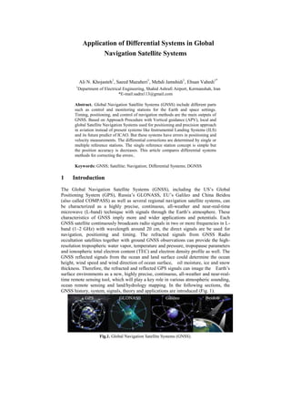
  • 1. Application of Differential Systems in Global Navigation Satellite Systems Ali N. Khojasteh1 , Saeed Mazaheri1 , Mehdi Jamshidi1 , Ehsan Vahedi1* 1 Department of Electrical Engineering, Shahid Ashrafi Airport, Kermanshah, Iran *E-mail:sadra113@gmail.com Abstract. Global Navigation Satellite Systems (GNSS) include different parts such as control and monitoring stations for the Earth and space settings. Timing, positioning, and control of navigation methods are the main outputs of GNSS. Based on Approach Procedure with Vertical guidance (APV), local and global Satellite Navigation Systems used for positioning and precision approach in aviation instead of present systems like Instrumental Landing Systems (ILS) and its future predict of ICAO. But these systems have errors in positioning and velocity measurements. The differential corrections are determined by single or multiple reference stations. The single reference station concept is simple but the position accuracy is decreases. This article compares differential systems methods for correcting the errors.. Keywords: GNSS; Satellite; Navigation; Differential Systems; DGNSS 1 Introduction The Global Navigation Satellite Systems (GNSS), including the US’s Global Positioning System (GPS), Russia’s GLONASS, EU’s Galileo and China Beidou (also called COMPASS) as well as several regional navigation satellite systems, can be characterized as a highly precise, continuous, all-weather and near-real-time microwave (L-band) technique with signals through the Earth’s atmosphere. These characteristics of GNSS imply more and wider applications and potentials. Each GNSS satellite continuously broadcasts radio signals in two or more frequencies in L- band (1–2 GHz) with wavelength around 20 cm, the direct signals are be used for navigation, positioning and timing. The refracted signals from GNSS Radio occultation satellites together with ground GNSS observations can provide the high- resolution tropospheric water vapor, temperature and pressure, tropopause parameters and ionospheric total electron content (TEC) and electron density profile as well. The GNSS reflected signals from the ocean and land surface could determine the ocean height, wind speed and wind direction of ocean surface, oil moisture, ice and snow thickness. Therefore, the refracted and reflected GPS signals can image the Earth’s surface environments as a new, highly precise, continuous, all-weather and near-real- time remote sensing tool, which will play a key role in various atmospheric sounding, ocean remote sensing and land/hydrology mapping. In the following sections, the GNSS history, system, signals, theory and applications are introduced (Fig. 1). Fig.1. Global Navigation Satellite Systems (GNSS).
  • 2. 2 GNSS Signals and Systems GNSS is consisting of a space segment having a constellation of satellites in Medium Earth Orbit (MEO) at the height of nearly 20,000 km and above, control segment having monitoring and control stations to monitor/control/update the constellation of satellites and the user segment; consisting of receivers to give position, velocity and time (PVT) of the static and mobile user all over the globe at all times using at least four satellites of the constellation in view. The Global Navigation Satellite System (GNSS) has a well-defined structure, initially designed by US and USSR and then is being followed by the systems like Galileo and Beidou. The basic segments like space, control, user and augmentation are discussed in next lines. The reference architecture is about the GPS as it is only the fully operational at this moment with maximum information too. The signal structure is also discussed briefly to understand the basic principle of navigation and finding the position and time information. 2.1 Space Segment It consists of constellation of satellites equipped with navigational payload, precise atomic clocks, navigational antennas and other subsystems like thermal, propulsion, attitude and orbit determination and control (AODC), Tracking, Telemetry and Command (TT&C) and power subsystems. The constellation is designed considering the availability of at least four satellites at all times across the globe. The satellites are arranged in different planes to provide the best geometric dilution of precision (GDOP), a parameter of satellite geometry. Medium Earth Orbits (MEO), 20,000– 30,000 km, are chosen for the constellation of satellites due to considerable launch cost and global coverage. 2.2 Control Segment It consists of master control center along with some monitoring stations and telemetry telecommand antennas spread all over the globe to perform the following main tasks. - Measures the position of each satellite and controls its attitude and orbit; - Monitors the signals broadcast by satellites - Sends information to satellites for a proper clock alignment - Sends information to satellites for the navigation message 2.3 User Segment User segment consists of mainly the GNSS receivers to process the signals received from the satellites and estimates the user’s position. The functionalities common to any kind of receiver can be summarized as identification of the satellites in view, estimation of the user-satellite distance and Triangulation. 2.3 Augmentation Segment It includes additional equipment like local elements, pseudolites or Geo-Satellites allowing new services or improved performance. Differential GPS (DGPS), Local area GPS (LGPS), Wide Area GPS (WGPS), WAAS (Wide Area Augmentation System), GDGPS (Global Differential GPS) by NASA, MSAS (Multifunction Satellite Augmentation System) by Japan and EGNOS (European Global Navigation Overlay System) by European Union are the few examples.
  • 3. 3 GNSS Signals GNSS signals are summarized in Table 1 (Hofmann-Wellenhof et al. 2008). For example, GPS satellites continuously broadcast right-hand circularly polarized signals with both the navigation message and ranging codes modulated on two L-band microwave carrier frequencies, i.e., the L1 (f1=1.57542 GHz, λ1≈19.0 cm) and L2 (f2=1.2276 GHz, λ2≈24.4 cm). Starting from 2006, as part of GPS modernization effort, two new civilian-use signals L2C (L2 frequency, C denoting civilian) and L5 (fL5=1.17645 GHz, λL5≈25.5 cm) were broadcasting on the new generation GPS satellites. Also another civilian-use frequency L1C is down the road in the near future. The navigation message includes the ephemeris data, used to calculate the position of the individual GPS satellite in orbit at the time of signal transmission, and the almanac data with the information about the time and status of the entire satellite constellation. On the other hand, the ranging code enables the user’s receiver to determine the transit (or propagation) time of the signal and thereby determine the satellite-to-user range. The satellite network uses a CDMA (code division multiple access) spread-spectrum technique where the low-bit-rate message data is encoded with a high-rate “pseudo-random noise” (PRN) sequence that is unique for each GPS satellite. The PRN is a binary signal with random noise-like properties, which is generated by mathematical algorithm or “code”, and consists of repeated pattern of 1’s and 0’s. Both L1 and L2 signals are modulated by a pseudo-random precision ranging code (P code). The L1 carrier signal is also modulated with coarse/acquisition (C/A) ranging code for civilian use. The P code can be encrypted as a so-called P(Y) which is only available to military equipment with a proper decryption key. The L1 and L2 signals received from each GPS satellite can be expressed as follows (Spilker 1980): (1) (2) where CC/A and CP1 are the received powers of the in-phase and quadrature components of the L1 signal, respectively, CP2 is the received power of L2, D(t) is an amplitude modulation for L1 and L2 containing navigation data, X(t) is a pseudorandom sequence of ±1, known as clear acquisition or C/A code-modulating the in-phase component of L1 at a rate of 1.023 MHz, and P(t) is a pseudorandom sequence of ±1, known as P-code-modulating the quadrature component of L1 and L2 at a rate of 10.23 MHz. The C/A-Code and the P-Code are examples of PRN codes. Each satellite transmits a unique C/A-Code and P-Code sequence (on the same L1 and L2 frequencies), and hence a satellite may be identified according to its “PRN number”, e.g. PRN2 or PRN14 are particular GPS satellites. The CDMA technique allows the receiver to recognize multiple satellites on the same frequency with different PRNs. A GPS receiver will detect amplitude, pseudo- range and phase measurements for each C/A, L1 P-code (P1) and L2 P-code (P2) signals. The C/A and P1 contained identical informations, however, the C/A is preferred over P1 due to its stronger power and not being encrypted. Note that the pseudo-range is an absolute measurement of differential group delay between time of transmission and reception. It is the sum of the actual range between the transmitter
  • 4. and the receiver, atmospheric and ionospheric delays and transmitter and receiver clocks offsets. Note that the early GPS included a feature called Selective Availability (SA) that adds intentional, time varying errors of up to 100 m (328 ft) to the publicly available navigation signals. This was intended to deny an unauthorized use of GPS signals. The SA service was eventually terminated in year 2000. Table1. GNSS Signals 4 GNSS Error Sources GNSS User Equivalent Errors (USER) is defined as the errors in PVT computation due to three segments of GNSS architecture. In space segment, the source of error can be satellite clock stability, satellite perturbations or selective availability (turned off in May 2001). The control segment causes the errors like ephemeris prediction and the user segment contributes the major part due to Ionospheric delay, Tropospheric delay, receiver noise, multi-path, indoor positioning or due to urban canyons. - Satellite and receiver clock errors - Satellite orbit errors - Atmospheric effects (ionosphere, troposphere) - Multipath: signal reflected from surfaces near the receiver - Antenna phase centre - Solar radiation pressure - Satellite Geometry - Relativistic Effects - Receiver noise - Signal Obstruction
  • 5. Fig.2 GNSS Refracted and reflected signals and geometry 4.1 GNSS Constellation Satellite Error GNSS constellation satellite error mainly includes inherent orbital position error of the satellite and clock error. The former is mainly caused by influences of various perturbative forces, number of monitoring station and spatial distribution, number and precision of orbital parameters, and non-real-time property of ephemeris, and the range error caused thereby is approximately within 1.5 m–7.0 m; influences on range error are tried to be weakened generally through simultaneous observation to work out the difference or method of orbit improvement to limit it within the error scope of 1 m. The latter refers to the nonsynchronous deviation between satellite clock and GNSS standard time due to frequency offset and frequency drift between clock of GNSS constellation satellite and GNSS standard time; total quantity of such deviation may reach 1 ms, and equivalent range error caused thereby may reach 300 km; the deviation may correct the clock error model through continuous measurement of the ground station to limit the equivalent range error within 6 m; if residual error of GNSS constellation satellite clock is further weakened, it may be realized through differential technology. 4.2 GNSS Signal Propagation Error GNSS signal propagation error mainly includes ionospheric refraction, tropospheric refraction, multipath error, etc. Ionospheric refraction error: Ionospheric refraction error is in direct proportion to atmospheric electron density and inversely proportional to the penetrated electromagnetic wave frequency. Atmospheric electron density varies with radiation intensity of the Sun and other celestial bodies, season, time, geographic position, etc. For GNSS constellation satellite signal, randomness of solar activity is large, so the difference of impact of ionospheric refraction on GNSS navigation and positioning error is large, and it is impossible to establish precise mathematical model for it. During GNSS navigation and positioning, methods may be generally adopted to weaken the impact of ionosphere on the precision of GNSS navigation and positioning include: (1) correction through double frequency observation; (2) correction through simultaneous observation value to work out the difference, i.e., relative positioning method.
  • 6. An effective method to reduce influence of tropospheric refraction on navigation and positioning error is to estimate the propagation delay of electromagnetic wave in the troposphere. Measures commonly taken at present mainly include: (1) working out the difference through simultaneous observation to effectively reduce or even eliminate influences on delay of troposphere; (2) improving atmospheric model of troposphere through measured data nearby the monitoring station. Besides directly receiving signals sent by GNSS constellation satellite, GNSS receiver also receives GNSS constellation satellite signals sent for once or many times by buildings surrounding the receiver antenna, i.e., during actual measurement, signals received by GNSS antenna are signals superimposed by direct and reflected wave. Phase delay may exist between reflected and direct wave since the length of path passed by the two signals is different, and multipath error is thereby caused. It is difficult to establish accurate error model due to the uncertainty of reflection coefficient of reflector and the distance between it and the receiver antenna. Measures may be taken to reduce multipath error at present mainly include: (1) trying to make GNSS receiver antenna avoid object surface with large reflection coefficient; (2) using GNSS receiver antenna with good directivity such as the choking coil antenna. 4.3 Signal Reception Error Such errors mainly include GNSS receiver measurement error, GNSS receiver clock error, antenna phase center error, etc. Among them, besides related to measurement resolution of software and hardware of GNSS receiver for constellation satellite signals, GNSS receiver measurement error is also related to installation precision of GNSS receiver antenna. GNSS receiver clock error is related to the receiver, so the clock error may be taken as an unknown parameter to estimate such error by working out the pseudo-range equation; influences of such error may also be eliminated by working out the differential treatment through observation quantity. Antenna phase center error is caused by different incident angles, and equivalent range error may reach a few millimeters or even a few centimeters according to conditions of antenna performance. 5 Differential Systems The signal of GNSSS was relayed from geosynchronous satellites to the user equipment. The user equipment responded to the signal with the geostationary satellites. Finally, the master ground station computed the user position using two- way run-time measurement, implementing either measurements from three satellites or additionally implementing height information from a barometer. The GEOSTAR systems work as a model for the Twin-Star program of China, which later became Beidou-1. The US’s company Qualcomm launched the OmniTRACS system in 1988 to provide a space-based service for position determination and data dissemination for America. EutelTRACS operated in cooperation with the European Telecommunication Satellite Organization. The systems have been developed mainly for fleet management purposes. Both systems rely on a concept similar to GEOSTAR. A ranging signal is transmitted from a ground station with geostationary satellites to the user and back again. The position is derived from run-time measurements incorporating height information of an elevation model .The subsystem for position determination is denoted as Qualcomm automatic satellite position reporting (QASPR). Meanwhile Omni-TRACS and EutelTRACS also integrate GNSS receivers in the user equipment to increase the positioning performance. The bidirectional communication link transmits the GNSS position to the service center. The degradation of the GPS point positioning accuracy by selective availability (SA) has led to the development of differential techniques. While the degradation has been deactivated but the methods still evolve to increase the
  • 7. performance parameters of GNSS. The basic concept of differential GNSS (DGNSS) relies on two or more receivers. From the known reference receiver location and the satellite position there results in a computed range, which is opposed to the measured range. A reference station or a reference network broadcasts differential corrections which are used by the roving receiver to eliminate GNSS inherent errors in the measurement (Fig. 3). Fig.3 Basic concept of differential positioning Three groups of GNSS range biases are distinguished: satellite-specific biases, signal propagation errors, and receiver-specific biases. DGNSS eliminates or reduces the satellite-specific biases and the signal propagation errors. The differential corrections are determined by a single or by multiple reference stations. The single-reference station concept is simple but the position accuracy decreases with increasing distance from the reference station. The rover receives the differential corrections from one reference station using a dedicated data link. The multiple-reference station concept relies on several spatially distributed reference stations which determine differential corrections and emit them to the user receiver. The network of reference stations guarantees a homogeneous service performance over a larger coverage area. Disadvantages of the multiple-reference station concept are the increased complexity and costs for the service provider, and an increasing latency of the correction data due to the network communication. 5.1 Differential Correction Domains Three different approaches to compute differential corrections exist. Solution-domain approach, measurement-domain approach, and state space approach. In the solution- domain approach, the coordinate difference between the measured position and the known position of the reference station is transmitted to the rover.These differences are used to correct the rover position. As long as both receivers use measurements to the same satellites and the same atmospheric models, this simple method will provide good results. Local obstructions as well as an increasing distance between reference stations and rover will result in a different satellite constellation. This concept is mainly used in conjunction with the single-reference station concept. The measurement-domain approach relies on a comparison of the measurements and the computed ranges. The difference in pseudo-ranges determines the pseudo-range corrections (PRC) and the range rate corrections (RRC). The rover uses PRC and RRC to correct its own measurements. PRC and RRC are either a weighted average of the reference station network, as mentioned by Szabo and Tubman (1994), or direct observations of one reference station. In case of DGNSS with a single reference station, the accuracy decreases as a function of distance from the reference station at a rate of approximately 1 cm per 1 km. Conventional DGNSS
  • 8. system concepts rely on raw or smoothed code pseudo-ranges. Position accuracies in the meter level are achievable using code measurements. Phase smoothed code ranges are necessary to obtain the submeter level. Precise DGNSS services, in contrast, use phase pseudo-ranges. In this way, accuracies at the subdecimeter level can be obtained in real time for ranges up to some 20 km. The compromise of higher positioning accuracy of precise DGNSS is the necessity of ambiguity resolution. Commonly the ambiguities must be resolved on-the-fly and therefore (generally) dual-frequency receivers are required. DGNSS systems implementing the measurement-domain approach are commonly denoted as extended or local-area differential (LAD) GNSS. In the state-space approach, the reference network models the various error sources and transmits the model parameters to the rover. This concept is particularly applied in augmentation systems but also in precise point positioning, where accurate ephemerides and clock parameters are estimated. The use of dual-frequency receivers simplifies the derivation of the ionospheric influence. Commonly a grid of ionospheric vertical delay corrections is modelled. The remaining calibrated residual between known range and measured range is projected onto the orbit and satellite clock error. The high number of model parameters requires a network of reference stations. The density of the network is lower compared to the measurement domain approach. Systems following the state-space approach are designated as wide-area differential (WAD) GNSS. Algorithms for the state-space approach can be found in Mueller et al. (1994) or Kee (1996). 6 Examples of Differential Systems The Fugro company introduced the commercial services OmniSTAR, SkyFix, and StarFix for differential positioning. The use of OmniSTAR is exclusively allowed to be used for onshore applications, whereas the other two have been introduced for marine applications. OmniSTAR provides three levels of services: a VBS (virtual base station) sub-meter positioning service, a better than 20 cm service, and a high- performance better than 10 cm service level. For all services, about 100 terrestrial reference stations are located around the world. In VBS mode, the reference stations track the GPS satellites and compute differential code corrections, every station individually. The differential corrections are encoded in a Radio Technical Commission for Maritime Services (RTCM) format and transmitted to the user receiver. The receiver then applies an inverse distance-weighted least-squares solution to generate corrections of a virtual reference station. The medium service relies on phase measurements and precise point positioning methods, thus integrating precise ephemerides and clock information which are estimated based on the reference station network. The ionospheric influence is eliminated by dual-frequency receivers. In the high-performance mode, phase corrections and dual-frequency methods are applied. SkyFix and StarFix are similar in concept but rely on different technologies, thus, providing two redundant systems for increased integrity. The SkyFix and StarFix technique apply the precise point positioning concept, which Fugro denotes as satellite differential GPS (SDGPS). The differential information is provided to the user via several commercial geostationary satellites which provide worldwide coverage of about 90% excluding the north and south poles. The L-band satellite signals in the frequency band 1531–1559MHz are decoded by dedicated receiver modules and the correction information is provided to the GNSS receivers. 6.1 StarFire The StarFire global space-based differential system is a commercial precise point positioning service developed by John Deere and Company. StarFire relies on 60
  • 9. globally distributed monitoring stations and two independent control centres both located in the US. The space segment consists of three Inmarsat satellites which provide global coverage except for the north and south poles. The satellites are positioned at 98ºW, 25ºE, and 109ºE longitude and transmit correction signals in the L-band. The differential corrections consist of precise orbit and clock values which are used in a dual-frequency receiver to achieve position accuracy in the sub-meter range. 6.1 GDGPS The Jet Propulsion Laboratory (JPL) of NASA developed a global differential GPS (DGPS) named GDGPS to provide high-accuracy GPS differential information in real time to support NASA science missions. Dual-frequency receivers which eliminate the ionospheric error integrate the ephemerides and clock differential corrections to achieve higher position accuracies. Correction data transmission rates of up to 1 Hz are possible. A global network of 100 stations operated by JPL and international partner organizations allows treating the ephemerides and clock corrections. At the same time the performance of the GPS satellites is monitored. Thus, any GPS satellite failure is reported to the user receiver in nearly real time. The correction information is accessible, e.g., via Internet using the Internet-based global DGPS service. The real-time differential correction message is also planned to be transmitted using S- band frequencies of the tracking and data relay satellite system (TDRSS). This service is especially designed for spacecraft which determine their position using GPS signals. 6.2 National DGNSS Numerous national, regional, and urban DGNSS services have been created which provide differential information at a service fee. Various companies, e.g., power suppliers, create their own DGNSS network for their special fields of application and requirements. National DGNSS services are exemplarily named and shortly described in the following paragraphs. The Austrian positioning service (APOS) integrates GNSS measurements of about 40 reference stations. In addition, measurements of reference stations of neighboring countries are used to increase the accuracy and homogeneity of the data. APOS provides different service levels, beside others RTK and DGPS services. The data streams are accessible via Internet or cellular networks. The satellite positioning service (SAPOS) provides DGNSS services for the German territory. Three service levels are offered providing real-time positioning service, high-precision real-time positioning, and geodetic high-precision positioning service. The data is transmitted in the VHF band or using cellular networks. The high- precision service provides position accuracies in the 1 to 5 cm range. The objective of the European position determination system (EUPOS), an initiative started in March 2002, is to establish a uniform DGNSS basis infrastructure in central and eastern Europe. EUPOS seeks to enhance the cross-border compatibility of the DGNSS systems. The goal is to integrate 870 reference stations in 14 countries in a common network. The correction information shall be useable for land, marine, and air applications but also for geodetic point positioning, i.e., providing sub-meter real-time services as well as subcentimeter in post-processing. The EUPOS data will be accessible via Internet, cellular networks, or VHF. 7 Conclution In this article at firs GNSS was introduced. Then signals and their sources and specifications was inspected. Famous satellites which used for GPS, GNSS, and navigation were listed. Different forms of GNSS and differential systems were
  • 10. studied and at last a comparison among them indicates their advantages and disadvantages. References AShuangen Jin, E. Cardellach, F. Xie. (2014). GNSS Remote Sensing, Springer. Hofmann Wellenhof, Wasle. (2007). GNSS: Global Navigation Satellite Systems, Springer. J. Dutronc & N. Colcy, (1990), Land Mobile Communications in Ku-Band Results of a Test Compaign on EUTELSAT I-F1, International Journal of Satellite Communications, Vol. 8. Bar-Sever et al, (2010), One-centimeter Orbit for Jason-1: New GPS-Based Strategies, Taylor & Francis.